
Search for another town


Free U.S. delivery 7 to 10 days after you order
Greenville, Alabama Map Art
Building by building, with labeled streets and shaded relief.
12" x 18" Archival Matte Print
A Map of Home. A Work of Art.
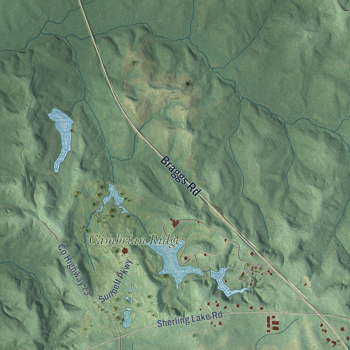
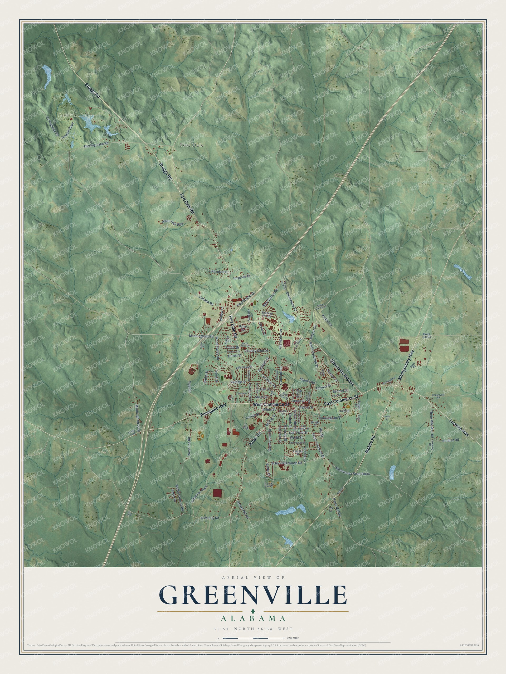
Explore Greenville, Alabama from a whole new perspective. Created using aerial imagery and detailed geographic data, this map captures Greenville building by building, with labeled streets, familiar landmarks, and shaded topographical relief that highlights the natural contours of the landscape.
Combining modern data with the timeless character of a vintage atlas, this map is just as interesting up close as it is beautiful on the wall. Whether you grew up in Greenville, spent memorable years there, or call it home today, this unique map is a great way to celebrate a place that means something to you. Zoom in on the preview to look for your street, and then order a print to put your memories on the wall.
Three ways to hang it

Unframed archival matte, a black wood frame or a white wood frame.
Up close
Geography Worth Displaying
This map was created using accurate cartographic data and authoritative geographic sources, including the U.S. Geological Survey and the Census Bureau. The map brings together terrain, waterways, roads, and building detail. The majority of the streets are labeled, houses are accurately depicted, and the topography is derived from government sources. Combining local data with carefully composed color and shading leads to this beautifully detailed Greenville artwork for your wall.
Rather than simply showing street outlines, we’ve included as many of the street names as we could reasonably fit on the map while keeping their names legible. Zoom in on the high resolution preview to see exactly what’s on the map. We truly set out to create a statement piece for anyone who loves Greenville. So whether it’s for you, or a gift for someone you love, we hope this map of Greenville brings back fond memories.
Read the story behind this map of Greenville, Alabama from 2026.

Find your street
Names on the Greenville map
Every name below is printed on this map. Look for your street, your school, the park where you played, or the pond down the road.
Places and landmarks2
- Fort Dale
- Cambrian Ridge
Streets and roads117
- East Commerce Street
- West Commerce Street
- Fort Dale Road
- Braggs Road
- Greenville Bypass
- Mobile Road
- Pineapple Highway
- Luverne Highway
- Aztec Road
- Montgomery Highway
- Airport Road
- North Conecuh Street
- Norman Road
- Montezuma Road South
- East Field Street
- Government Street
- Gamble Street
- Walnut Street
- Industrial Parkway
- County Highway 73
- South Conecuh Street
- Sherling Lake Road
- Kolb City Road
- Three Mile Well Road
- Glendale Avenue
- Hickory Street
- Walker Greene Road
- Thames Street
- Oglesby Street
- Wood Valley Road
Show all 117 streets
- New Searcy Road
- Flowers Street
- South Street
- School Highlands Road
- Cloverdale Road
- Cahaba Road
- South Park Street
- Cunningham Street
- Manningham Road
- Oak Street
- Cedar Street
- Willow Lane
- West End Road
- Paul Stabler Drive
- Bell Street
- Tiger Drive
- White Oak Way
- Manningham Loop
- Bolling Street
- Milner Street
- Country Club Drive
- Overlook Road
- Harrison Street
- Forest Drive
- World Street
- Airport Lane
- Church Street
- Gravel Hill Road
- Pinedale Drive
- Sunbelt Parkway
- Halso Mill Road
- Haygood Drive
- Boutwell Street
- Lucille Street
- Second Street
- Valley Drive
- Shanks Road
- Chalet Drive
- Aaron Drive
- Terrell Street
- Webb Street
- Fort Dale Street
- Balaclava Drive
- South Perry Street
- Shannon Hill Road
- North Pine Street
- Long Street
- Burger Street
- Norrell Drive
- Holly Hill Road
- Forest Court
- Academy Drive
- Lincoln Street
- Iris Lane
- Butler Square
- Grant Street
- Wright Street
- Olive Street
- Dunbar Park Road
- Merriweather Lane
- Butler County 45
- North Perry Street
- Honoraville Road
- East Parmer Street
- Boan Road
- Steele Circle
- East Perdue Street
- First Street
- North Chestnut Street
- Perine Street
- Stoneroad Drive
- Waters Street
- Lakeberry Road
- Herbert Street
- Corley Loop
- Tulip Road
- South Pine Street
- Logans Run
- Woodland Drive
- Manor Court
- South Cloverdale Road
- Claythorne Drive
- Searcy Cut Off Road
- Burnett Street
- Wimberly Street
- Bobwhite Lane
- Landfill Drive
Names are listed as they appear on the printed map. Zoom into the product photos to find them.
About Greenville, Alabama
Greenville is a city of 7,374 people and the seat of Butler County, in south-central Alabama. The county was created in 1819 from land the Creek Nation gave up in the Treaty of Fort Jackson. Its first seat was at Fort Dale, which Colonel Sam Dale built in 1818 as a stage stop on the Federal Road. On December 18, 1821, the legislature named a permanent seat at Buttsville, honoring Capt. Samuel Butts, who was killed in the Creek War. The settlers wanted the name of the South Carolina home many of them had left, and the legislature renamed the town Greenville on December 28, 1822.
The first courthouse, a frame building, burned in 1852 or 1853, and the fire destroyed the town's early records. In 1855 a railroad reached Greenville and tied it to Montgomery, Birmingham and Nashville in one direction and to Mobile and New Orleans in the other. New farmland opened in the southern part of the county, the Louisville and Nashville Railroad arrived late in the century, and Greenville grew into the cotton center of Butler County.
“Settlers, indignant at the fee charged by Gary, built Fort Dale five miles west of this marker.”
- Three courthousesAfter the frame courthouse burned, a second one went up. By 1871 it was decaying, so the county tore it down and built a brick courthouse in its place. The Victorian-style courthouse that serves Butler County today was built in 1904, and its dome was replaced in 1977.
- From schoolhouse to City HallThe two-story brick Greenville Public School opened in 1897. A fire in 1921 partly destroyed its upper story, and the building was remodeled into a grammar school. That school burned too and was torn down in 1928. Greenville City Hall was finished on the same spot in 1936-37, and it joined the National Register in 1986.
- A depot for six countiesFor many years farmers and merchants across six counties of south-central Alabama had no other place to ship their goods than the Greenville depot, which its marker dates to 1910. High winds damaged it, and it was rebuilt in 1924, then restored in 1991. It stands in the West Commerce Street Historic District and is one of the few brick and stucco depots left in south Alabama.
- The Camellia CityCamellias have been popular in Greenville gardens for decades, which gave the city its nickname. The campaign to replace the goldenrod with the camellia as Alabama's state flower started here, with LaMont Glass and H.B. Taylor sponsoring the bill. Each November the city also holds its Sweet Potato Festival.
- No two headstones alikeCapt. William Butler, the county's namesake, was killed in the Creek uprising of 1818 and lies in Pioneer Cemetery. The cemetery faces the First United Methodist Church of Greenville, the oldest church in Butler County. J. R. Abram designed and patented its headstones, and no two of them are the same.
Keep exploring Alabama
Greenville is one of 675 Alabama towns we've mapped. Every dot on the map is a print of its own.
The search covers every state, Alabama first.
Near Greenville
Order 2 or more town maps and save 10%. Shown in the size and finish you picked above, so they hang as a set.
- Fort Deposit 12" x 18" / Archival Matte Print $39.99
- Calhoun 12" x 18" / Archival Matte Print $39.99
- Georgiana 12" x 18" / Archival Matte Print $39.99


More maps nearby: Highland Home, Pine Apple, McKenzie, Rutledge and Gordonville.
The art of mapping a place
How This Map Was Made
Real places. Remarkable detail. Discover the layers that turn geographic data into a map of home.

The view from above
Aerial imagery reveals the character of the land: woodland, open fields, and the patterns of a place.

The shape of the land
Elevation data brings hills, valleys, and subtle changes in the landscape into view.

The details of home
Roads, waterways, and building footprints come together to make the map feel unmistakably local.

Geography becomes art
Considered color, shading, and typography bring the layers together in a map made for your wall.


Process illustrated with Mendon, Massachusetts. Aerial imagery: USDA NAIP. Terrain: USGS 3D Elevation Program. Map details and finished artwork: KNOWOL.
The Details
About This Print
Choose an archival matte print, or a black or white Ayous wood frame. The archival matte print is unframed.
Select your size and finish above to see the matching product image and price.
Materials & Craftsmanship
A contemporary map with the character of a classic atlas, printed on archival matte paper. Optional frames are made from Ayous wood.
Your printed map does not include the watermark shown in the full-map preview.
Shipping & Delivery
Free shipping within the United States. Every print is made to order in the USA.
Buying a gift? Add a note in your cart and we'll include it. We never put prices in the package.
Prints ship within 2 to 3 business days. Allow 7 to 10 days total from ordering for delivery. Timing may vary during holidays or periods of high order volume.
Read our shipping policy.
Returns and damaged prints
Each print is made to order. Change-of-mind refunds are not available after production.
If your print arrives damaged, misprinted or incorrect, contact support@knowol.com within 30 days of receiving it. Include your order number, photos and a description of the issue.
Read our full refund and replacement policy. For questions about your order, email support@knowol.com.