
Search for another town





Free U.S. delivery 7 to 10 days after you order
Greenville, Mississippi Map Art
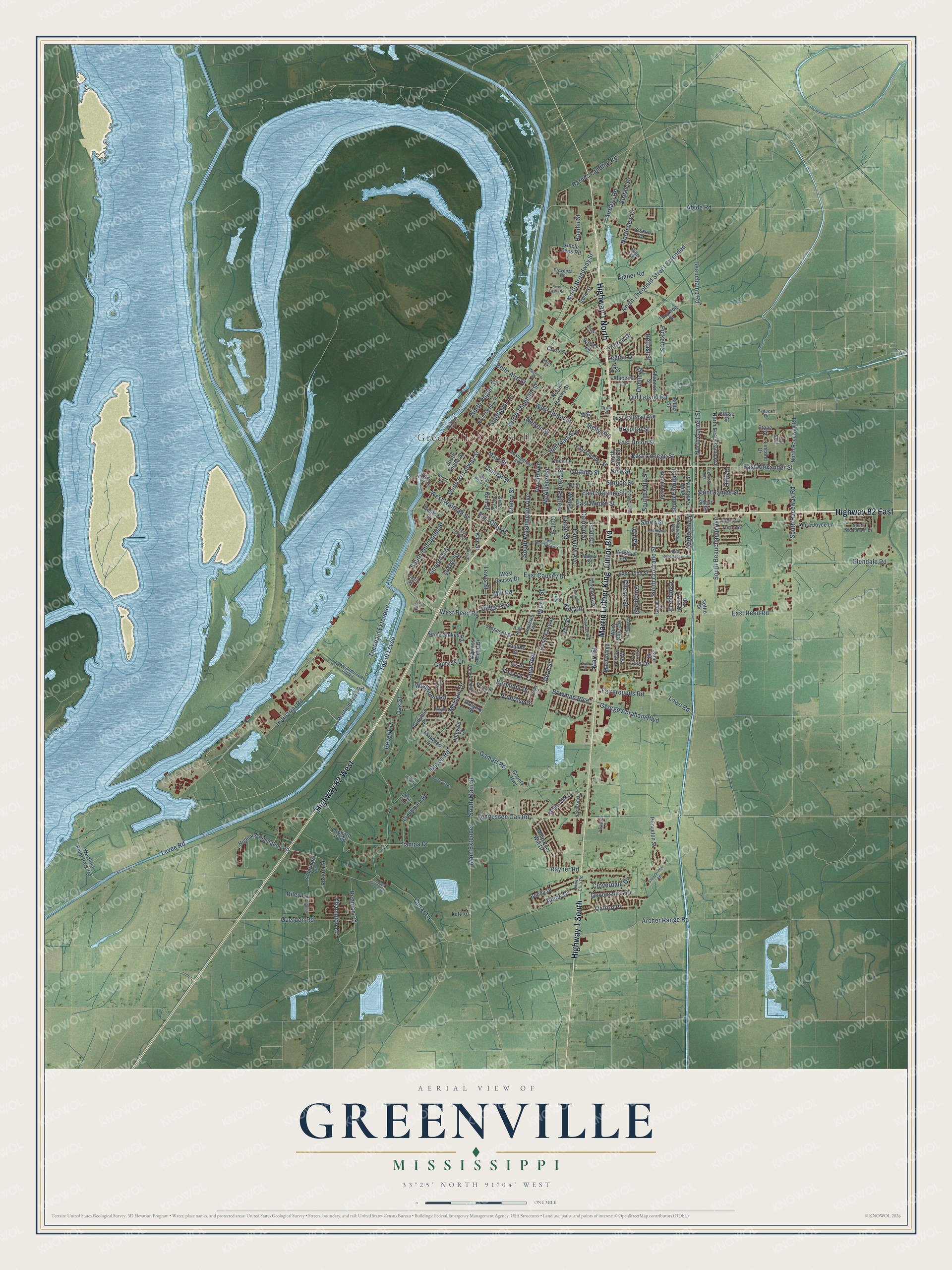
A new map of Greenville, Mississippi, made in 2026 and printed to order on thick archival matte paper.
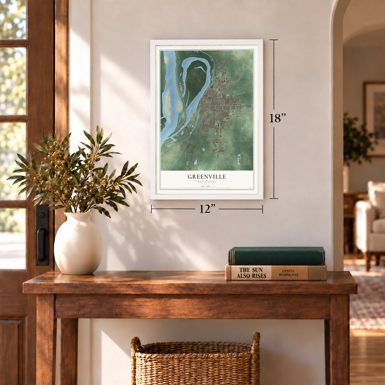
12" x 18" Archival Matte Print
A Map of Home. A Work of Art.
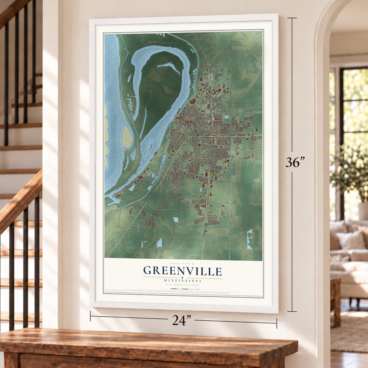
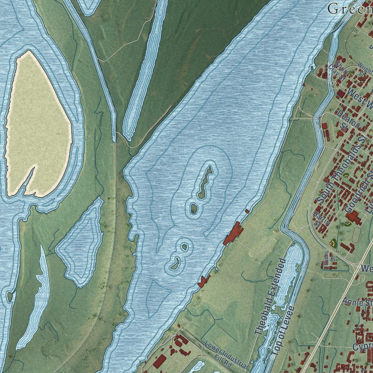
Explore Greenville, Mississippi from a whole new perspective. Created using aerial imagery and detailed geographic data, this map captures Greenville building by building, with labeled streets, familiar landmarks, and shaded topographical relief that highlights the natural contours of the landscape.
Combining modern data with the timeless character of a vintage atlas, this map is just as interesting up close as it is beautiful on the wall. Whether you grew up in Greenville, spent memorable years there, or call it home today, this unique map is a great way to celebrate a place that means something to you. Zoom in on the preview to look for your street, and then order a print to put your memories on the wall.
Three ways to hang it
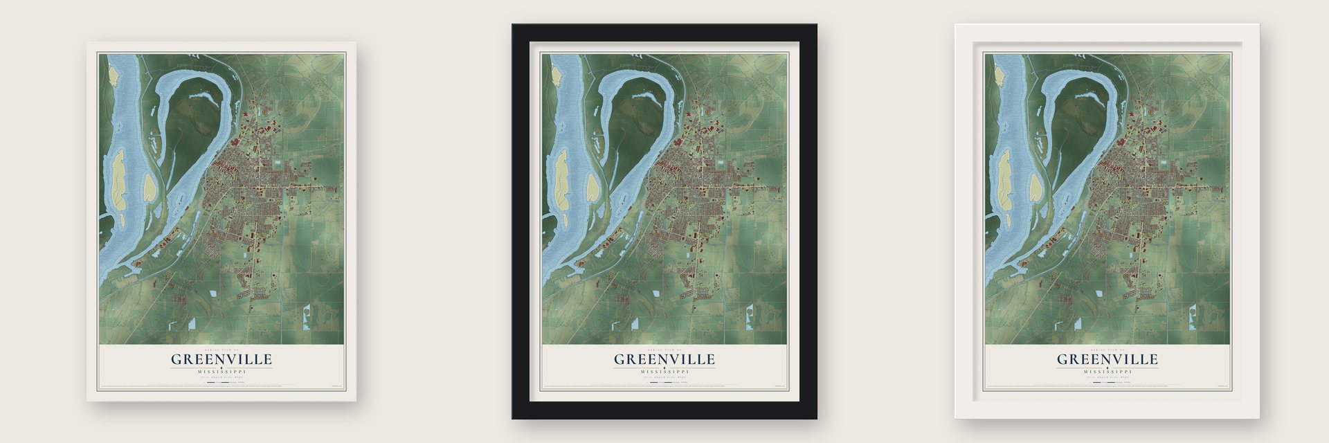
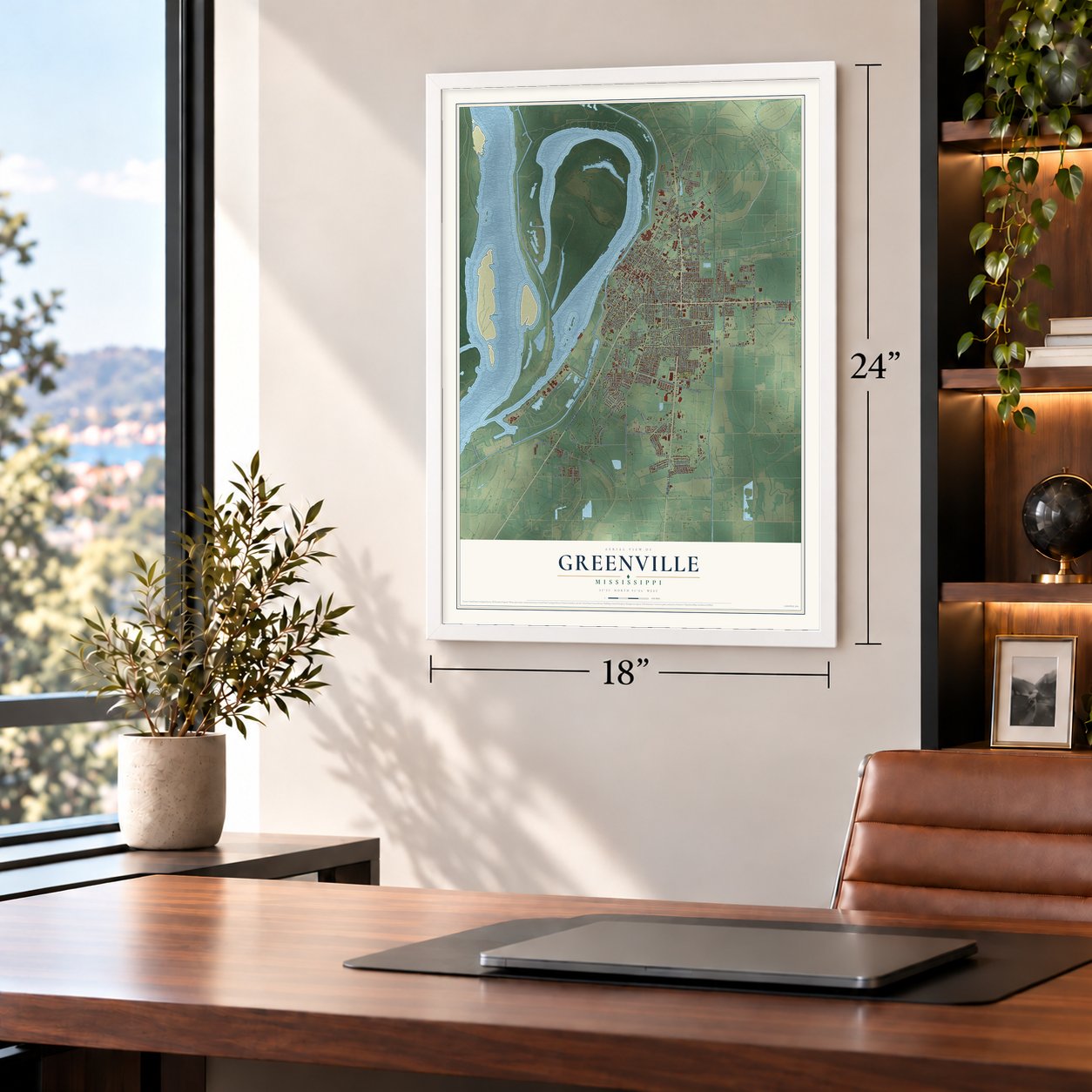
Unframed archival matte, a black wood frame or a white wood frame.
Up close
Geography Worth Displaying
This map was created using accurate cartographic data and authoritative geographic sources, including the U.S. Geological Survey and the Census Bureau. The map brings together terrain, waterways, roads, and building detail. The majority of the streets are labeled, houses are accurately depicted, and the topography is derived from government sources. Combining local data with carefully composed color and shading leads to this beautifully detailed Greenville artwork for your wall.
Rather than simply showing street outlines, we’ve included as many of the street names as we could reasonably fit on the map while keeping their names legible. Zoom in on the high resolution preview to see exactly what’s on the map. We truly set out to create a statement piece for anyone who loves Greenville. So whether it’s for you, or a gift for someone you love, we hope this map of Greenville brings back fond memories.
Read the story behind this map of Greenville, Mississippi from 2026.

About Greenville, Mississippi
Greenville is a city of 29,670 people and the county seat of Washington County, on Lake Ferguson, an oxbow lake that was once a channel of the Mississippi River. The county's earlier seats, New Mexico and Princeton, sat on the river and were washed away, so a new seat was chosen in 1844. Greenville took that role when it was founded in 1847, and its founders named it for General Nathanael Greene, a friend of George Washington.
During the siege of Vicksburg, Union troops came ashore from a gunboat, and after being fired on they burned every building in town. When the war ended, the former residents rebuilt three miles away, on the highest ground along the river between Vicksburg and Memphis. Most of the new site belonged to Harriet Blanton Theobald, who gave lots for schools, churches and public buildings, and people came to call her the "Mother of Greenville." The streets were laid out by Major Richard O'Hea, the man who had planned Vicksburg's wartime defenses.
- The railroad arrives in 1878Greenville's first railroad, a narrow gauge line to Stoneville on Deer Creek, was finished in 1878. A year later it ran 30 miles east to the Sunflower River and 30 miles south along Deer Creek, and steamboat lines on the Mississippi added to the trade. Before long the city was shipping huge amounts of cotton and running four cottonseed oil mills, two compresses and several large sawmills.
- Two businesses born in 1903Two immigrants started businesses here in 1903. Sam Stein, from Russia, opened the store that grew into the Stein Mart department store chain, and Carmel Signa, from Italy, ran a grocery that later became Doe's Eat Place. The restaurant joined the National Register in 2012.
- The flood of 1927In the Great Mississippi River Flood of 1927, a levee broke north of Greenville. Water spread over two million acres of the Delta and stayed for four months. City leaders sent white women and children to Vicksburg and Memphis, but planters who feared losing their workers would not let Black families go.
- Stranded on the leveeAbout 7,500 African Americans had to live in tents on the levee through the flood, and the men were made to work for no pay. Word of how they were treated spread across the nation, and Herbert Hoover sent investigators. The disaster helped push Black families to move to northern cities.
- Blues on Nelson StreetIn the 1940s and 1950s, crowds filled the clubs on Nelson Street to hear jazz, big band, jump blues and Delta blues, and record companies came to Greenville looking for new talent. Southern Whispers Restaurant, an early stop on the Chitlin' Circuit, became the second site marked on the Mississippi Blues Trail.
Find your street
Names on the Greenville map
Every name below is printed on this map. Look for your street, your school, the park where you played, or the pond down the road.
Places and landmarks1
- Greenville City Hall
Streets and roads237
- Highway 1 North
- Martin Luther King Junior Boulevard
- Highway 1 South
- Highway 82 East
- Highway 82 West
- Top of Levee
- East Alexander Street
- Smith Street
- South Broadway Street
- West Reed Road
- North Broadway Street
- Theobald Extended
- Railroad Avenue
- Primrose Drive
- Airbase Road
- South Eureka Street
- West Walthall Street
- East College Street
- Levee Road
- South Main Street
- Bayou Road
- East Reed Road
- Industrial Road
- South Colorado Street
- Bowman Boulevard
- Abide Road
- Main Street
- Main Extended
- Tampa Drive
- Fairview Avenue
Show all 237 streets
- North Theobald Street
- East Causey Drive
- South Theobalds Street
- Oak Street
- South Raceway Road
- South Beauchamp Avenue
- Arnold Avenue
- Gamari Road
- North Theobald Street Extended
- Old Leland Road
- Archer Range Road
- Guerdon Road
- Pickett Street
- Tennessee Gas Road
- George Abraham Boulevard
- East Moore Street
- Nelson Street
- East Starling Street
- Cypress Lane
- Wildwood Road
- Beauchamp Road
- Spruce Street
- McAllister Street
- Glendale Road
- West Union Street
- Fairgrounds Road
- Lowe Road
- South Washington Avenue
- Cloverdale Drive
- Cannon Street
- Lewis Street
- Central Street
- Cedar Street
- Barnes Landing Road
- Cedar Lane
- Sunflower Lane
- McClain Drive
- East Union Street
- North Poplar Street
- Orlando Street
- Mill Road
- Canal Avenue
- Dublin Street
- Groome Street
- Northview Drive
- Mary Street
- Oxford Place
- Airdale Drive
- Fava Drive
- Belle Aire Street
- Amber Road
- North Cornell Street
- Lisa Drive
- East Clay Street
- Goodrich Street
- Abide Drive
- Redman Road
- Kirk Circle
- Saint James Street
- Legion Drive
- South Delta Street
- South Florida Street
- Bermuda Drive
- Luster Street
- Devonshire Place
- Hamlin Street
- Ridge Avenue
- Hospital Street
- California Street
- Champion Drive
- Wilzin Street
- Cileste Street
- Belfast Street
- Cottage Drive
- Beverly Drive
- Rayner Road
- Sicily Avenue
- Patton Drive
- Irby Street
- Cherry Street
- Lotus Street
- Hart Drive
- Ohio Drive
- Pete Street
- Riley Lane
- Golf Street
- Pine Street
- East Railroad Avenue
- West Ollie Circle
- Warfield Ferry Road
- North Harvey Street
- Thornton Street
- South Shelby Street
- North Sixth Street
- County Highway
- Genie Fairway
- Annie Stokes Road
- Anita Joyce Lane
- Highland Plantation Road
- Creekmore Road
- Marilyn Avenue
- Whip Poor Will Drive
- North Beauchamp Avenue
- North Raceway Road
- Stone Street
- Warfield Point Park Road
- Bonda Drive
- Princeton Street
- Sisson Drive
- Uncle Bens Road
- East Gloster Street
- South California Street
- Mayer Street
- Orchard Pond
- Shannon Street
- Rosetta Street
- Kentucky Street
- Lincoln Drive
- Deaton Street
- West Causey Drive
- White Oak Drive
- Carver Circle
- East John Street
- Idlewild Drive
- Ohea Lane
- Irene Street
- Crescent Street
- Greenway Street
- Alderman Lane
- Jane Street
- Audubon Place
- Alabama Drive
- West Pear Lane
- Pauline Street
- Gregory Street
- Iris Street
- Turin Street
- Cypress Ridge Drive
- Gum Street
- Wells Lane
- Malwood Drive
- Bay Street
- Oak Lane Drive
- Waxhaw Drive
- Cross Street
- Short Street
- Kate Street
- Chase Street
- Lott Road
- Netho Drive
- Lela Lane
- Billija Street
- Joy Street
- Hill Drive
- Washington Avenue
- Paducah Drive
- North Shelby Street
- West Percy Lane
- Walnut Street
- Lower Industrial Fill Road
- Pinewood Drive
- Thomas Avenue
- Garden Drive
- East McCorkle Circle
- Short Clay Street
- South Woodlawn Drive
- Provenza Road
- Belmont Drive
- Casavechia Lane
- Robinson Lane
- Lance Cv
- South Percy Street
- Kirkland Drive
- Inez Street
- Holly Lane
- Highland Avenue
- Miller Drive
- Gaylo Drive
- River Club Road
- Harris Street
- High Street
- Ruth Street
- Park Street
- North Robertshaw Street
- Shields Street
- South Ninth Street
- Magnolia Street
- East Robertshaw Street
- First Street
- Stonebridge Road
- Montbury Lane
- Naples Avenue
- River Grain Road
- Sharon Lane
- Wortham Drive
- Dykes Drive
- Saint Charles Street
- Columbus Street
- Cooper Gilder Road
- Paradise Lane
- Fox Trail Road
- Wright Street
- Lacey Street
- Pear Lane
- Toni Street
- Grove Street
- Evers Drive
Names are listed as they appear on the printed map. Zoom into the product photos to find them.
The art of mapping a place
How This Map Was Made
Real places. Remarkable detail. Discover the layers that turn geographic data into a map of home.

The view from above
Aerial imagery reveals the character of the land: woodland, open fields, and the patterns of a place.

The shape of the land
Elevation data brings hills, valleys, and subtle changes in the landscape into view.

The details of home
Roads, waterways, and building footprints come together to make the map feel unmistakably local.

Geography becomes art
Considered color, shading, and typography bring the layers together in a map made for your wall.


Process illustrated with Mendon, Massachusetts. Aerial imagery: USDA NAIP. Terrain: USGS 3D Elevation Program. Map details and finished artwork: KNOWOL.
The Details
About This Print
Choose an archival matte print, or a black or white Ayous wood frame. The archival matte print is unframed.
Select your size and finish above to see the matching product image and price.
Materials & Craftsmanship
A contemporary map with the character of a classic atlas, printed on archival matte paper. Optional frames are made from Ayous wood.
Your printed map does not include the watermark shown in the full-map preview.
Shipping & Delivery
Free shipping within the United States. Every print is made to order in the USA.
Buying a gift? Add a note in your cart and we'll include it. We never put prices in the package.
Prints ship within 2 to 3 business days. Allow 7 to 10 days total from ordering for delivery. Timing may vary during holidays or periods of high order volume.
Read our shipping policy.
Returns and damaged prints
Each print is made to order. Change-of-mind refunds are not available after production.
If your print arrives damaged, misprinted or incorrect, contact support@knowol.com within 30 days of receiving it. Include your order number, photos and a description of the issue.
Read our full refund and replacement policy. For questions about your order, email support@knowol.com.
Find your town
Looking for another city?
Find a map of home in our Mississippi collection, or any town in the country.
Nearby
Maps of towns near Greenville
Know someone from one of these towns? Their map makes a great gift.
 Metcalfe
, Mississippi
From $39.99See the map
 Stoneville
, Mississippi
From $39.99See the map
 Winterville
, Mississippi
From $39.99See the map
More maps nearby: Leland, Elizabeth, Arcola, Scott and Hollandale.