


Search for another town





Free U.S. delivery 7 to 10 days after you order
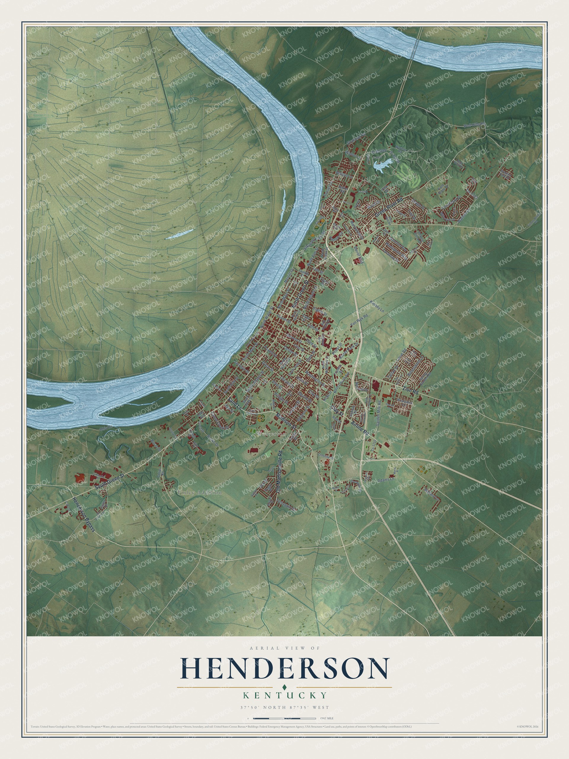
Henderson, Kentucky Map Art
Building by building, with labeled streets and shaded relief.
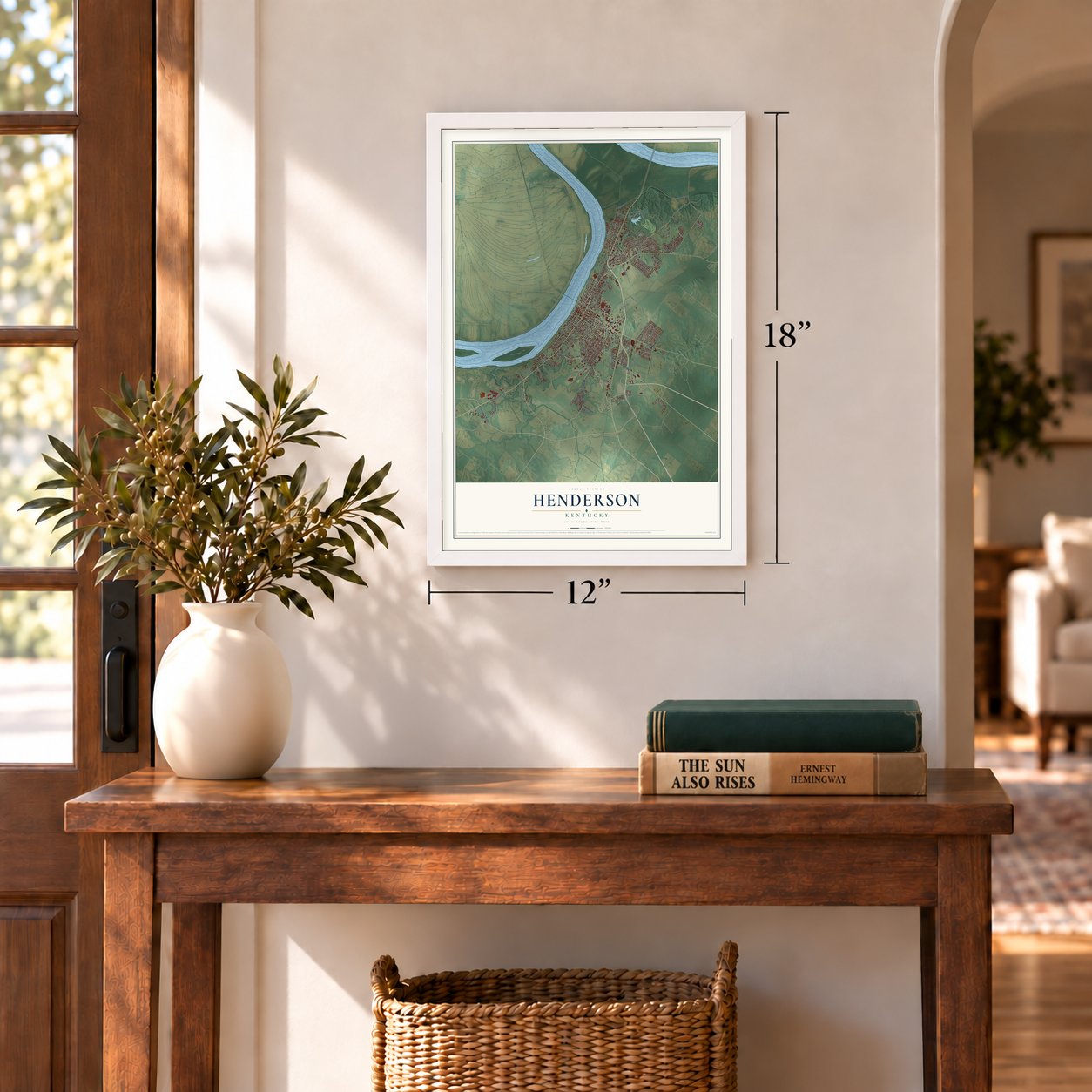
12" x 18" Archival Matte Print
A Map of Home. A Work of Art.
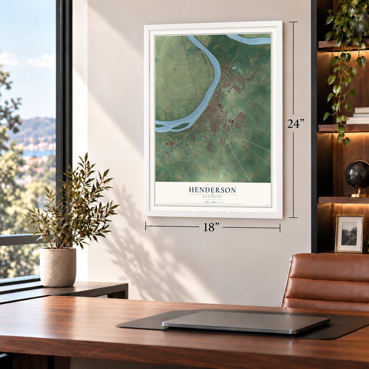
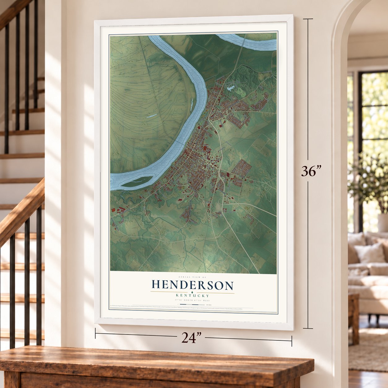
Explore Henderson, Kentucky from a whole new perspective. Created using aerial imagery and detailed geographic data, this map captures Henderson building by building, with labeled streets, familiar landmarks, and shaded topographical relief that highlights the natural contours of the landscape.
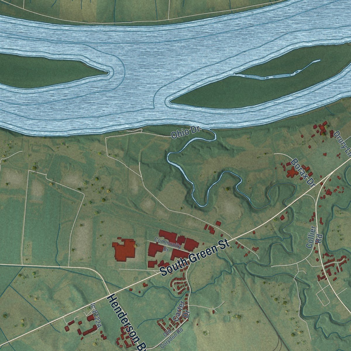
Combining modern data with the timeless character of a vintage atlas, this map is just as interesting up close as it is beautiful on the wall. Whether you grew up in Henderson, spent memorable years there, or call it home today, this unique map is a great way to celebrate a place that means something to you. Zoom in on the preview to look for your street, and then order a print to put your memories on the wall.
Three ways to hang it
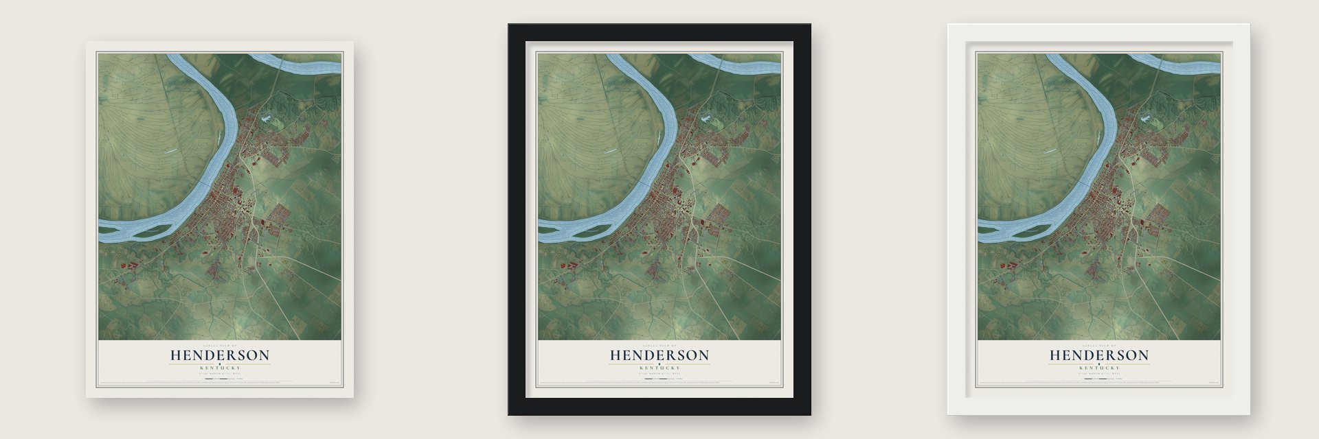
Unframed archival matte, a black wood frame or a white wood frame.
Up close
Geography Worth Displaying
This map was created using accurate cartographic data and authoritative geographic sources, including the U.S. Geological Survey and the Census Bureau. The map brings together terrain, waterways, roads, and building detail. The majority of the streets are labeled, houses are accurately depicted, and the topography is derived from government sources. Combining local data with carefully composed color and shading leads to this beautifully detailed Henderson artwork for your wall.
Rather than simply showing street outlines, we’ve included as many of the street names as we could reasonably fit on the map while keeping their names legible. Zoom in on the high resolution preview to see exactly what’s on the map. We truly set out to create a statement piece for anyone who loves Henderson. So whether it’s for you, or a gift for someone you love, we hope this map of Henderson brings back fond memories.
Read the story behind this map of Henderson, Kentucky from 2026.

Find your street
Names on the Henderson map
Every name below is printed on this map. Look for your street, your school, the park where you played, or the pond down the road.
Places and landmarks2
- Weaverton
- Finley Addition
Streets and roads152
- Sand Lane
- Clay Street
- South Green Street
- Green River Road
- Airline Road
- Henderson Bypass
- North Green Street
- Zion Road
- Old Madisonville Road
- Madison Street
- Merritt Drive
- Obyrne Street
- North Water Street
- Dixon Street
- Obryne Street
- Taransay Drive
- South Adams Street
- First Street
- Ilex Drive
- Wathen Lane
- Fifth Street
- North Elm Street
- South Main Street
- Adams Lane
- Washington Street
- Powell Street
- Wolf Hills Road
- Second Street
- North Adams Street
- Watson Lane
Show all 152 streets
- Kimsey Lane
- South Elm Street
- North Main Street
- Eighth Street
- Center Street
- Garden Mile Road
- Third Street
- Fourth Street
- Sunset Lane
- Van Wyk Road
- Atkinson Street
- Letcher Street
- Atkinson Park Road
- Larue Road
- Pringle Street
- Rocks Drive
- Marywood Drive
- Bittersweet Lane
- Vine Street
- Constanza Drive
- Cs-1383
- Priest Street
- Mallard Lane
- Canoe Creek Drive
- Huntspoint Way
- Klutey Park Drive
- Ohio Drive
- Wood Drive
- Helm Street
- Trail Drive
- Barret Boulevard
- Stratman Road
- Osage Drive
- Tartan Drive
- Turnagain Drive
- Borax Drive
- Walnut Lane
- Barrett Circle
- Jackson Street
- Clark Street
- Fair Street
- 14th Street
- Melwood Drive
- Pebble Creek Drive
- South Alves Street
- South Alvasia Street
- Sixth Street
- Spring Garden Road
- Ironwood Drive
- Twelfth Street
- Cs-1003
- Millcreek Drive
- Heilman Avenue
- North Lincoln Avenue
- Glenshiel Way
- Barker Road
- Franklin Street
- South Julia Street
- Reid Drive
- Warbler Road
- North McKinley Street
- Briarpatch Lane
- Cresline Drive
- Bob Posey Street
- Kresge Drive
- Peggy Drive
- Cs-1230
- Field Stone Drive
- Braxton Park Drive
- Taylor Drive
- Hallway Drive
- Cs-1110
- Drury Lane
- Hicks Street
- Porter Drive
- Edds Avenue
- Collier Road
- Carter Drive
- Deer Lane
- Park Drive
- South Water Street
- North Ingram Street
- Barrett Boulevard
- Dylan Circle
- Sutton Drive
- Tillman-Bethel Road
- Gregory Drive
- Irish Ivy Lane
- Belle Wood Drive
- Pond Street
- Bend Gate Road
- Village Drive
- Summit Drive
- Arbor Drive
- Rettig Road
- Marie Place
- Gum Street
- Community Drive
- Dundee Drive
- Janalee Drive
- Old Corydon Road
- Balmoral Drive
- Tenth Street
- East Fox Hollow Run
- Plum Street
- Comanche Drive
- Glover Drive
- Knoll Top Lane
- South Parkway Street
- Carriage Drive
- Oakcrest Drive
- South Arlington Drive
- Cs-1295
- Stadium Drive
- Russell Drive
- Old Orchard Lane
- Congress Avenue
- Red Bird Lane
- Cs-1117
- Locust Drive
- Bruce Street
- Market Street
Names are listed as they appear on the printed map. Zoom into the product photos to find them.
About Henderson, Kentucky
Henderson is a city of 27,981 people and the seat of Henderson County, on a high bluff above the Ohio River. It began as Red Banks, a village named for the reddish clay of those bluffs. In the early 1790s the village held a tavern and a few settler families who lived near the Cherokee, yet it had also earned a name as a hideout for outlaws heading west. In 1797 Captain Young of Mercer County led a band of regulators, called the "Exterminators," who drove the outlaws out.
That same year Samuel Hopkins and surveyor Thomas Allin laid out a new town on the site, and the Kentucky legislature made it official. They named it for Richard Henderson, the land speculator who had hoped to settle this country but died before the town took shape. Its streets were made unusually wide, reportedly so a fire could not jump from one block to the next. A census on October 29, 1799, counted 183 people, a post office opened in 1801, and the city was incorporated on January 21, 1840.
“Henderson is on the river but never in it!”
- The Transylvania PurchaseOn March 17, 1775, Richard Henderson, a North Carolina judge, met with 1,200 Cherokee at Sycamore Shoals. There his Transylvania Company bought more than 17,000,000 acres between the Ohio, Cumberland and Kentucky rivers. The Virginia General Assembly voided the sale because the land fell under Virginia's charter, but it granted his company 200,000 acres where the Green River meets the Ohio. Henderson hired Daniel Boone to survey the land and pick good sites.
- Tobacco and millionairesBy the mid-1800s Henderson County was a major tobacco grower, shipping much of it to Great Britain. People called it the world's top producer of dark tobacco, and warehouses and stemmeries filled downtown. Shortly before World War I, the city reportedly had more millionaires per capita than any other in the world. After the war a steep British tariff ended the export trade, and the Soaper on Pennell Street, the last warehouse, shut in 1984.
- Audubon's store in the 1810sThe naturalist John James Audubon lived in Henderson for several years in the 1810s. He ran a store with his partner Ferdinand Rozier before he chose to work at art full time. John James Audubon State Park carries his name, and nine cast-bronze sculptures based on his Birds of America paintings honor him downtown.
- Spared by the 1937 floodIn 1937 the Ohio River watershed took in 21 inches of precipitation over just 18 days. The flood that came next badly hurt river cities such as Louisville, Evansville and Paducah. Henderson, high on its bluff, avoided much of that damage, and its safe ground later helped the city draw new industries.
Keep exploring Kentucky
Henderson is one of 659 Kentucky towns we've mapped. Every dot on the map is a print of its own.
The search covers every state, Kentucky first.
Near Henderson
Order 2 or more town maps and save 10%. Shown in the size and finish you picked above, so they hang as a set.
- Anthoston 12" x 18" / Archival Matte Print $39.99
- Cairo 12" x 18" / Archival Matte Print $39.99
- Spottsville 12" x 18" / Archival Matte Print $39.99


More maps nearby: Niagara, Corydon, Robards, Poole and Curdsville.
The art of mapping a place
How This Map Was Made
Real places. Remarkable detail. Discover the layers that turn geographic data into a map of home.

The view from above
Aerial imagery reveals the character of the land: woodland, open fields, and the patterns of a place.

The shape of the land
Elevation data brings hills, valleys, and subtle changes in the landscape into view.

The details of home
Roads, waterways, and building footprints come together to make the map feel unmistakably local.

Geography becomes art
Considered color, shading, and typography bring the layers together in a map made for your wall.


Process illustrated with Mendon, Massachusetts. Aerial imagery: USDA NAIP. Terrain: USGS 3D Elevation Program. Map details and finished artwork: KNOWOL.
The Details
About This Print
Choose an archival matte print, or a black or white Ayous wood frame. The archival matte print is unframed.
Select your size and finish above to see the matching product image and price.
Materials & Craftsmanship
A contemporary map with the character of a classic atlas, printed on archival matte paper. Optional frames are made from Ayous wood.
Your printed map does not include the watermark shown in the full-map preview.
Shipping & Delivery
Free shipping within the United States. Every print is made to order in the USA.
Buying a gift? Add a note in your cart and we'll include it. We never put prices in the package.
Prints ship within 2 to 3 business days. Allow 7 to 10 days total from ordering for delivery. Timing may vary during holidays or periods of high order volume.
Read our shipping policy.
Returns and damaged prints
Each print is made to order. Change-of-mind refunds are not available after production.
If your print arrives damaged, misprinted or incorrect, contact support@knowol.com within 30 days of receiving it. Include your order number, photos and a description of the issue.
Read our full refund and replacement policy. For questions about your order, email support@knowol.com.