
Search for another town



Free U.S. delivery 7 to 10 days after you order
Hot Springs, Arkansas Map Art
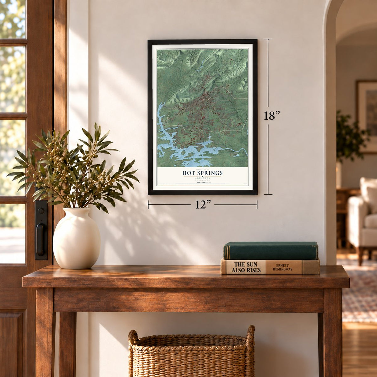
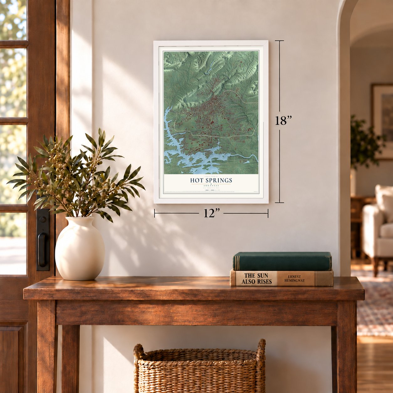
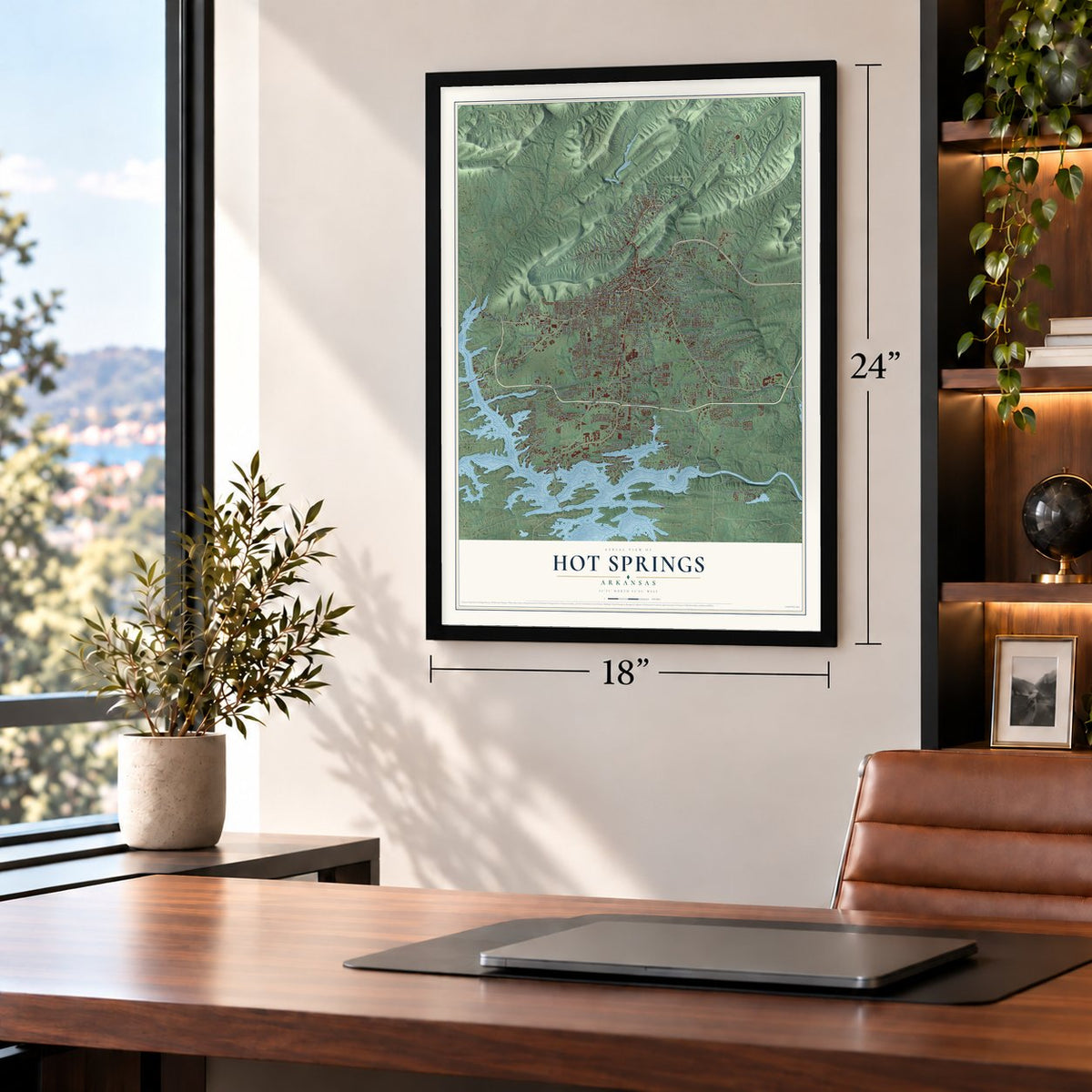
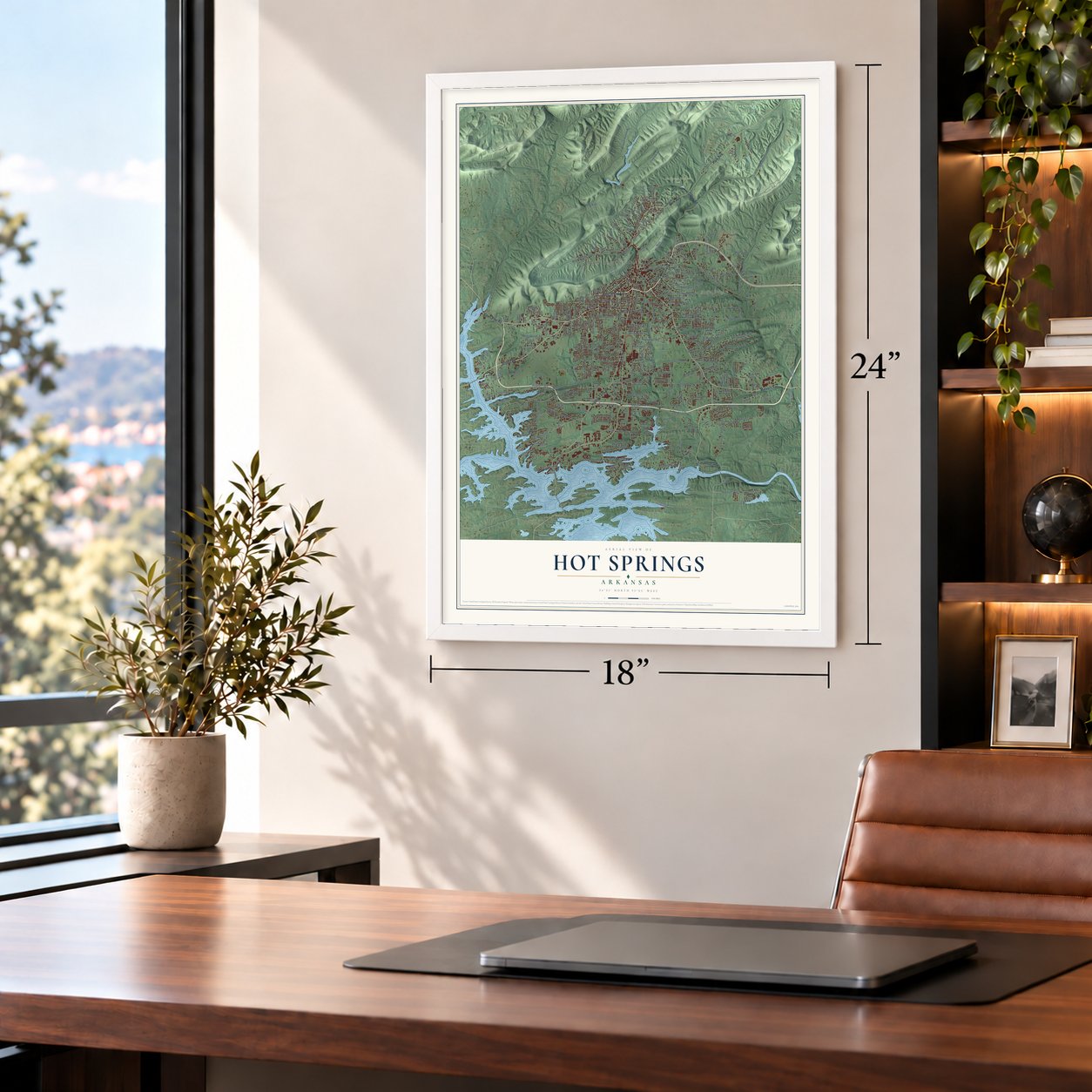
A new map of Hot Springs, Arkansas, made in 2026 and printed to order on thick archival matte paper.
12" x 18" Archival Matte Print
A Map of Home. A Work of Art.
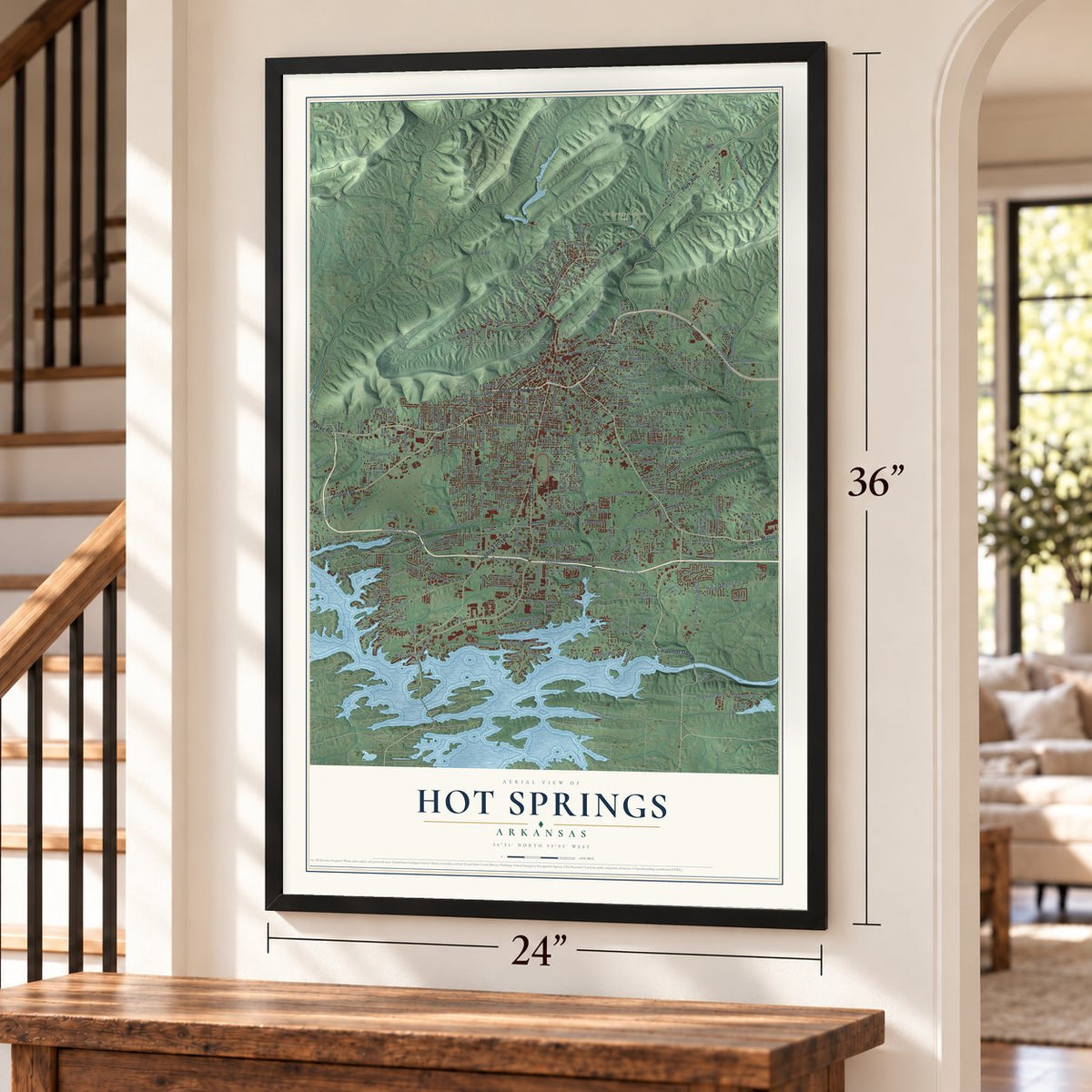
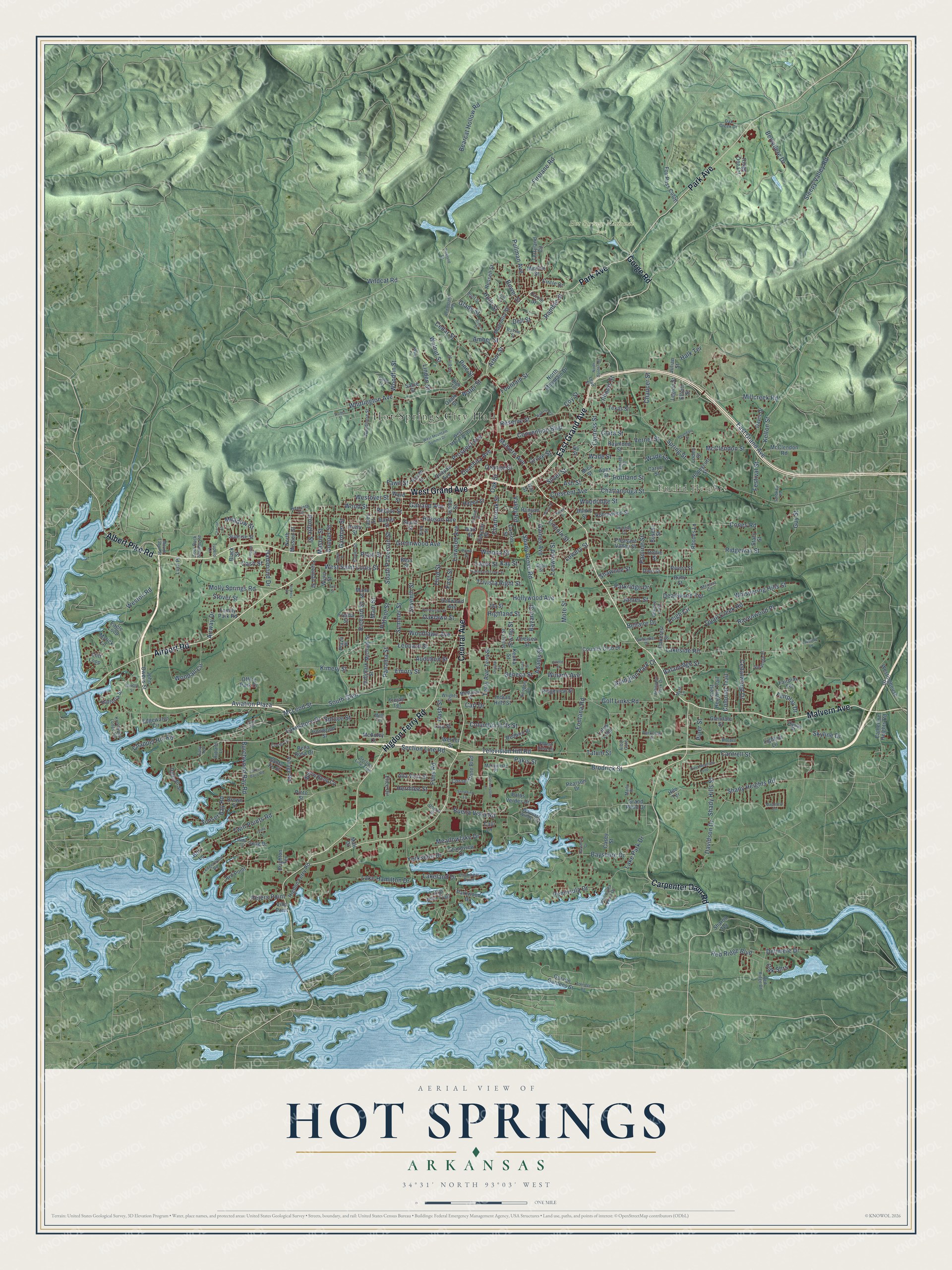
Explore Hot Springs, Arkansas from a whole new perspective. Created using aerial imagery and detailed geographic data, this map captures Hot Springs building by building, with labeled streets, familiar landmarks, and shaded topographical relief that highlights the natural contours of the landscape.
Combining modern data with the timeless character of a vintage atlas, this map is just as interesting up close as it is beautiful on the wall. Whether you grew up in Hot Springs, spent memorable years there, or call it home today, this unique map is a great way to celebrate a place that means something to you. Zoom in on the preview to look for your street, and then order a print to put your memories on the wall.
Three ways to hang it
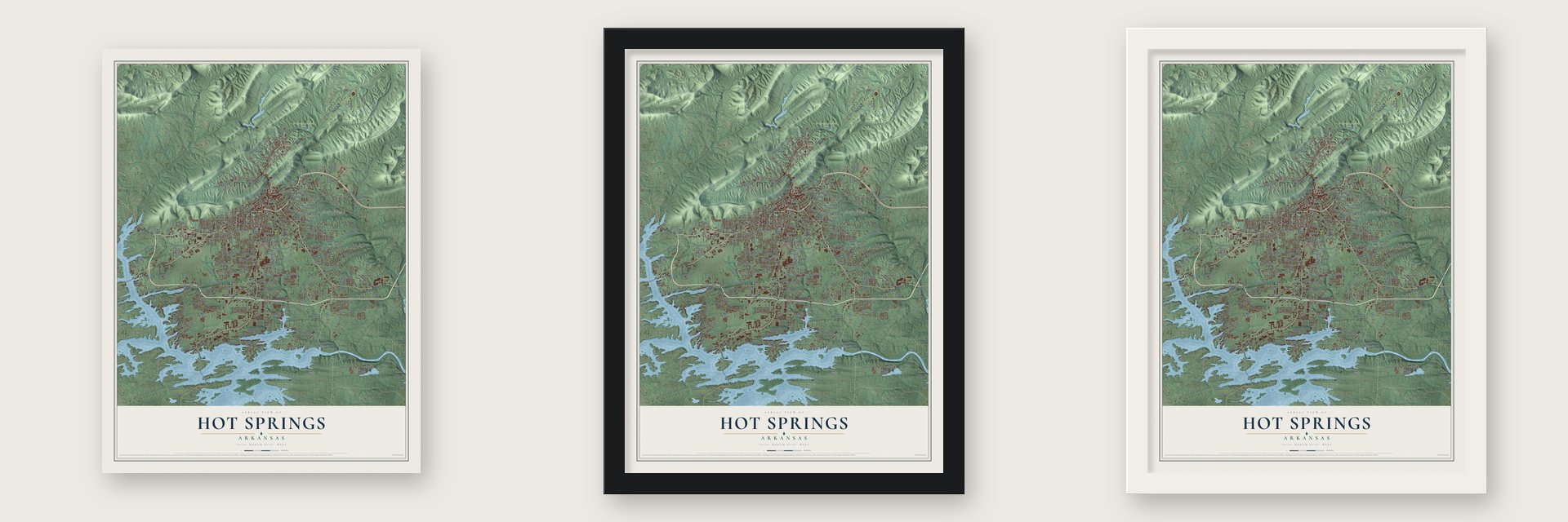
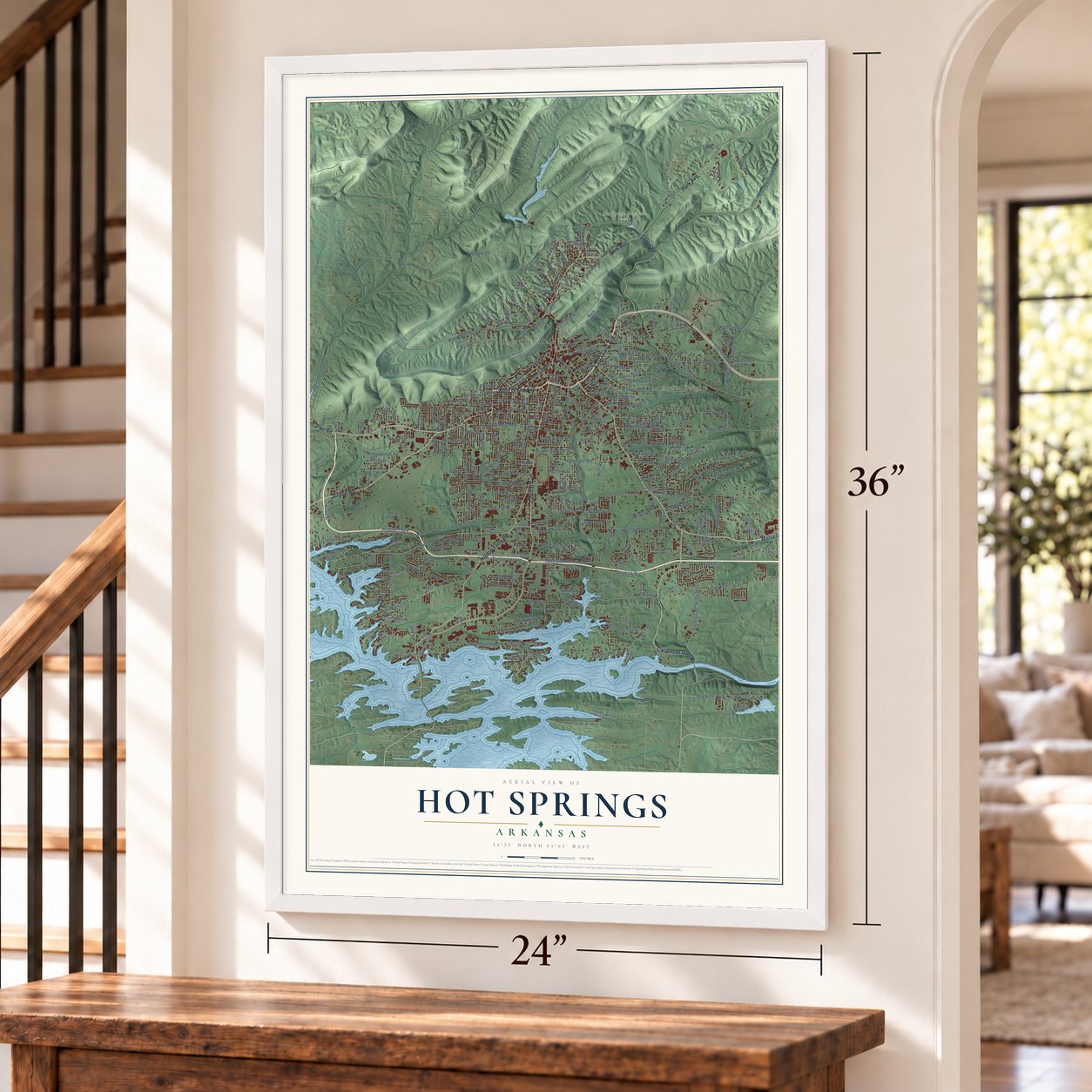
Unframed archival matte, a black wood frame or a white wood frame.
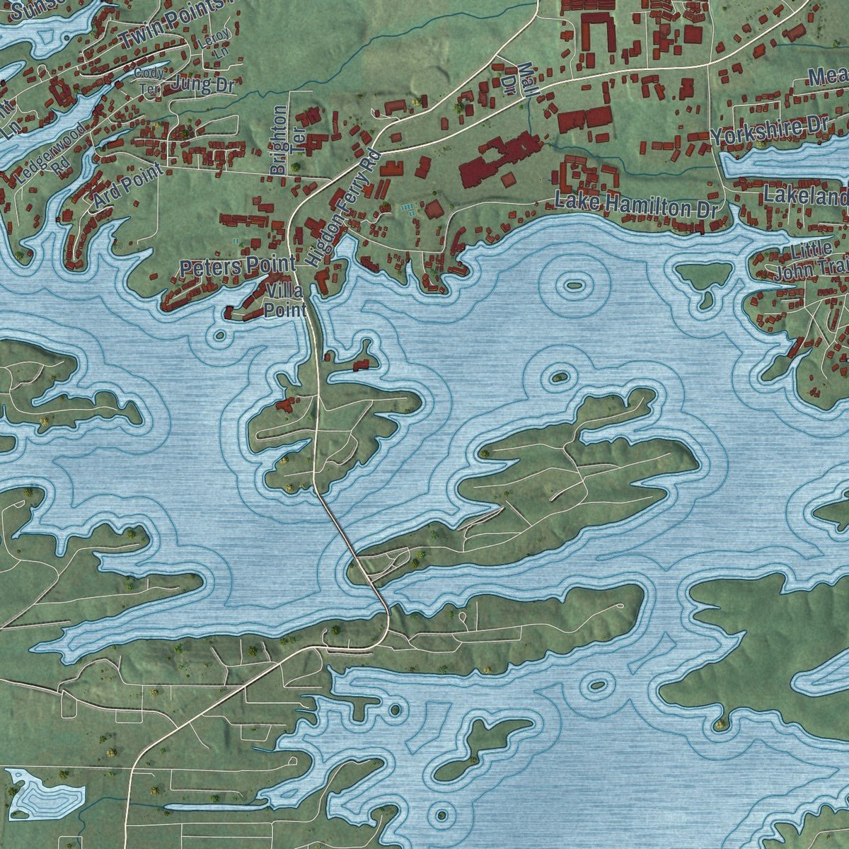
Up close
Geography Worth Displaying
This map was created using accurate cartographic data and authoritative geographic sources, including the U.S. Geological Survey and the Census Bureau. The map brings together terrain, waterways, roads, and building detail. The majority of the streets are labeled, houses are accurately depicted, and the topography is derived from government sources. Combining local data with carefully composed color and shading leads to this beautifully detailed Hot Springs artwork for your wall.
Rather than simply showing street outlines, we’ve included as many of the street names as we could reasonably fit on the map while keeping their names legible. Zoom in on the high resolution preview to see exactly what’s on the map. We truly set out to create a statement piece for anyone who loves Hot Springs. So whether it’s for you, or a gift for someone you love, we hope this map of Hot Springs brings back fond memories.
Read the story behind this map of Hot Springs, Arkansas from 2026.

About Hot Springs, Arkansas
From the CALS Encyclopedia of Arkansas: "In 1887, the Army and Navy Hospital, the first combined general hospital treating patients from both the U.S. Army and U.S. Navy, opened in downtown Hot Springs. It was the first hospital of its kind in the nation and specialized in arthritis and other ailments that were frequently treated with therapeutic baths."
From the CALS Encyclopedia of Arkansas: "The Hot Springs Country Club is home to the state’s first golf course. The Arkansas Alligator Farm was founded in 1902 and remains a popular attraction."
Find your street
Names on the Hot Springs map
Every name below is printed on this map. Look for your street, your school, the park where you played, or the pond down the road.
Places and landmarks3
- Hot Springs City Hall
- Euclid Heights
- Hot Springs National Park
Streets and roads374
- Malvern Avenue
- East Grand Avenue
- West Grand Avenue
- Central Avenue
- Park Avenue
- Albert Pike Road
- Airport Road
- Higdon Ferry Road
- Carpenter Dam Road
- Gorge Road
- Clara Street
- Pine Street
- Water Street
- Whittington Avenue
- Summer Street
- Valley Road
- Terry Avenue
- Stover Street
- Lakeshore Drive
- Shady Grove Road
- Spring Street
- Lakeside Road
- Golf Links Road
- Hobson Avenue
- Sleepy Valley Road
- Burchwood Bay Road
- Firelane Road
- Ridgeway Street
- Twin Points Road
- Seventh Street
Show all 374 streets
- Cones Road
- Belvedere Drive
- Richard Street
- Leonard Street
- Woodlawn Avenue
- Lake Park Drive
- Convention Boulevard
- Weston Road
- Lake Hamilton Drive
- Peninsula Drive
- Lakeland Drive
- Millcreek Road
- Prospect Avenue
- Quail Creek Road
- Bayshore Drive
- McLeod Street
- South Glen
- Third Street
- Hollywood Avenue
- Fountain Street
- Garland Avenue
- Greenwood Avenue
- West Saint Louis Street
- Television Hill Road
- Bearcat Hollow Road
- Files Road
- Chattanooga Street
- Panama Street
- Red Ridge Boulevard
- Bellaire Drive
- Emory Street
- Whispering Hills Street
- Main Street
- Crescent Avenue
- Buena Vista Road
- Aviation Plaza
- Ramble Street
- Brodrick Street
- Illinois Street
- Ravenwood Place
- Sunset Bay Road
- Woodall Circle
- Shady Heights Road
- Pakis Street
- Davidson Drive
- Rector Street
- Skyline Drive
- Section Line Road
- McClendon Street
- Grove Street
- Shady Hills Street
- Silver Street
- Cedar Street
- Linwood Avenue
- Glade Street
- Molly Springs Road
- Fontana Road
- Walnut Street
- Leigh Circle
- Gaines Avenue
- Oaklawn Street
- Columbia Hills Street
- Mote Street
- Ouachita Avenue
- South Patterson Street
- Kimery Street
- Wade Street
- Woodridge Street
- Cedarwood Drive
- Kelton Street
- Pullman Avenue
- Vernel Street
- Cypress Street
- Hammond Drive
- Orange Street
- Wildcat Road
- Leawood Street
- Chappel Hill Road
- Guy Street
- Plain Street
- Portland Street
- Ewing Street
- Oak Shrs
- Trivista Right Street
- Seneca Street
- Winans Avenue
- Bafanridge Street
- Meadowlake Drive
- Wood Street
- Pauline Street
- Laser Street
- Woodfin Street
- Mason Street
- Arlington Park Court
- Dellmere Drive
- Linden Street
- Bower Street
- Nash Street
- Tatum Street
- Amber Street
- Parkridge Drive
- Cantrell Street
- Bayard Street
- Highland Street
- Chaucer Street
- Holly Street
- Coy Street
- Deanwood Terrace
- Halk Terrace
- Colonial Trail
- Hermlee Street
- Pringle Street
- Charteroak Street
- Peters Point
- Festival Street
- Fairplay Drive
- James Street
- Cooper Street
- Audubon Street
- Yorkshire Drive
- Ash Street
- Meadow Street
- Winona Street
- Westover Street
- Spruce Street
- Lincoln Street
- Dell Street
- Oak Street
- Shawnee Street
- Gardner Street
- Cash Street
- Piper Street
- Reserve Street
- Adams Street
- Fawn Street
- First Street
- Patriot Street
- Wade Lane
- Lowery Street
- Airway Drive
- Arbor Street
- Carl Drive
- Kay Street
- Village Road
- Family Park Road
- Terry Street
- Westinghouse Drive
- North Mission Street
- Halteria Street
- North Mountain Drive
- Quapaw Avenue
- Lotus Loop
- Freida Street
- Ward Street
- Mineral Street
- Werner Street
- Fox Pass Cutoff
- School Street
- Little John Trail
- Country Club Drive
- South Street
- Raymond Street
- Oakwood Avenue
- Davis Drive
- Willow Bend Circle
- Ridge One Circle
- Ard Point
- Catherine Heights Road
- Ridgeview Street
- Grand Point Drive
- Edgewater Circle
- Palos Verdes Drive
- Office Park Drive
- John Owens Street
- Carver Street
- Oakcliff Street
- Terryland Circle
- Elice Circle
- Cornerstone Boulevard
- Pleasant Valley Street
- Apex Street
- Garven Gardens Street
- Magnolia Street
- Lacey Street
- Sabie Street
- Indian Hills Street
- Honeycutt Street
- Robinwood Street
- Ozark Street
- McClendon Road
- Parkwood Drive
- Wynn Street
- Alta Vista Street
- Chelsea Street
- McAuley Court
- Forest Heights Trail
- Bella Rosa Drive
- Sunrise Street
- Eagle Loop
- Glendale Street
- Grandview Drive
- Brighton Terrace
- Carson Street
- Fairplay Terrace
- Brown Street
- Russell Street
- Daffodil Street
- Freeman Street
- Michael Street
- Circle Drive
- Pearson Drive
- Hallmark Street
- Keuka Street
- Oriole Street
- Oakcrest Street
- Ironwood Street
- Redbird Place
- Avery Street
- Pecan Street
- Rhodes Lane
- Stacy Street
- Runyan Street
- Rivera Street
- Legion Street
- Villa Point
- Casey Street
- Sharon Terrace
- Hagen Street
- Texas Street
- Santa Fe Street
- Cliff Loop
- Ida Street
- Lightner Lane
- Jung Drive
- Banks Street
- Watt Street
- Dottie Street
- Myrick Lane
- Baxter Street
- Busche Street
- Lura Place
- Dino Street
- Lary Street
- Trojan Terrace
- Pinto Street
- Black Street
- Mann Street
- Loden Street
- Britt Lane
- Mall Drive
- Julian Street
- Elliott Street
- Mica Street
- Plaza Place
- Ruby Street
- Hilo Terrace
- Calli Lane
- Bess Street
- Ivy Street
- Hill Street
- Hyacinth Circle
- West Mountain Drive
- Section Line Trail
- Oak Creek Drive
- Fifth Street
- Barrett Street
- Robin Street
- Forest View Circle
- Ledgerwood Road
- Woodmere Street
- Knollwood Lodge Road
- Scott Street
- Arlington Park Drive
- Sellers Street
- Pond Street
- Sour Rock Springs Road
- Red Ridge Drive
- Wayward Winds Terrace
- Bluff Street
- Peninsula Point Drive
- Chambers Point
- Suburban Drive
- Bayles Street
- McMahan Street
- Marwinette Place
- Saratoga Street
- Wrights Street
- Melissa Circle
- Sanders Lane
- Bellaire Loop
- Skyway Street
- Mount Tabor Street
- Parkview Street
- Maily Place
- Cortez Street
- Ravine Street
- Rutland Lane
- Smokey Place
- Dorset Street
- Tupelo Lane
- Arbor Gate
- Mills Terrace
- Lead Street
- Myth Lane
- High Terrace
- Easy Terrace
- Cedarglade Road
- West Mountain Summit Drive
- Pine Meadows Loop
- Mapleleaf Circle
- Henderson Street
- Cornerstone Lane
- Daley Terrace
- East Saint Louis Street
- Arkridge Road
- Bluebell Court
- Walter Street
- Cove Street
- Lakeside Lane
- Breeze Street
- Chelle Street
- Pineland Drive
- Boundary Street
- Highrise Circle
- Henry Street
- Carter Dairy Road
- Wafer Circle
- Snowbird Lane
- Sanson Street
- North Border Terrace
- Tillayer Street
- Baber Street
- Hudgins Circle
- Blake Street
- Bayshore Cv
- Parkhill Street
- Vickers Place
- Charlon Street
- Ross Street
- Oneida Street
- Leroy Lane
- Joker Place
- Cody Terrace
- Sun Street
Names are listed as they appear on the printed map. Zoom into the product photos to find them.
The art of mapping a place
How This Map Was Made
Real places. Remarkable detail. Discover the layers that turn geographic data into a map of home.

The view from above
Aerial imagery reveals the character of the land: woodland, open fields, and the patterns of a place.

The shape of the land
Elevation data brings hills, valleys, and subtle changes in the landscape into view.

The details of home
Roads, waterways, and building footprints come together to make the map feel unmistakably local.

Geography becomes art
Considered color, shading, and typography bring the layers together in a map made for your wall.


Process illustrated with Mendon, Massachusetts. Aerial imagery: USDA NAIP. Terrain: USGS 3D Elevation Program. Map details and finished artwork: KNOWOL.
The Details
About This Print
Choose an archival matte print, or a black or white Ayous wood frame. The archival matte print is unframed.
Select your size and finish above to see the matching product image and price.
Materials & Craftsmanship
A contemporary map with the character of a classic atlas, printed on archival matte paper. Optional frames are made from Ayous wood.
Your printed map does not include the watermark shown in the full-map preview.
Shipping & Delivery
Free shipping within the United States. Every print is made to order in the USA.
Buying a gift? Add a note in your cart and we'll include it. We never put prices in the package.
Prints ship within 2 to 3 business days. Allow 7 to 10 days total from ordering for delivery. Timing may vary during holidays or periods of high order volume.
Read our shipping policy.
Returns and damaged prints
Each print is made to order. Change-of-mind refunds are not available after production.
If your print arrives damaged, misprinted or incorrect, contact support@knowol.com within 30 days of receiving it. Include your order number, photos and a description of the issue.
Read our full refund and replacement policy. For questions about your order, email support@knowol.com.
Find your town
Looking for another city?
Find a map of home in our Arkansas collection, or any town in the country.
Nearby
Maps of towns near Hot Springs
Know someone from one of these towns? Their map makes a great gift.
 Lake Hamilton
, Arkansas
From $39.99See the map
 Rockwell
, Arkansas
From $39.99See the map
 Piney
Piney, Arkansas
From $39.99See the map
More maps nearby: Diamondhead, Mountain Pine, Jones Mills, Fountain Lake and Magnet Cove.