
Search for another town




Free U.S. delivery 7 to 10 days after you order
Indianola, Mississippi Map Art
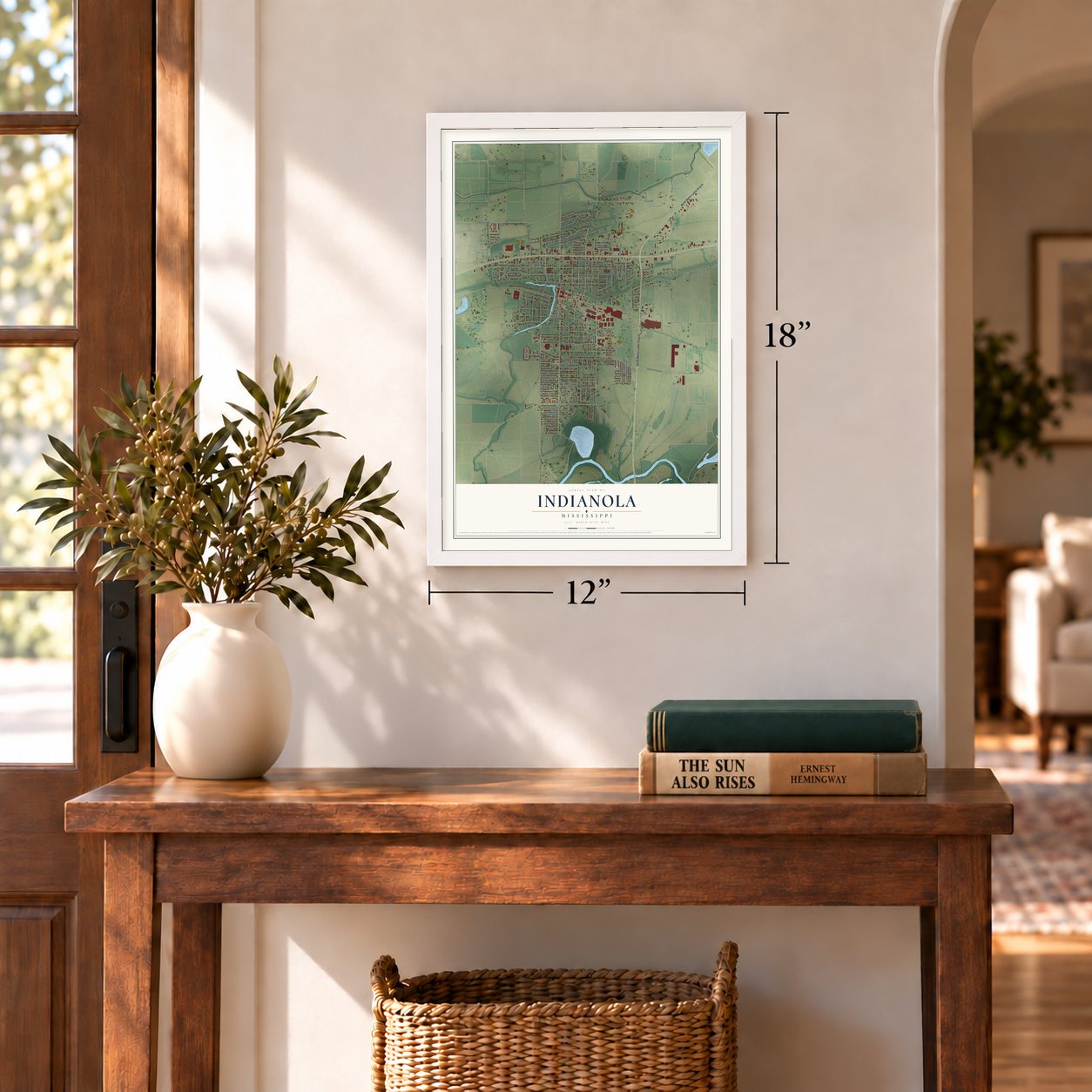
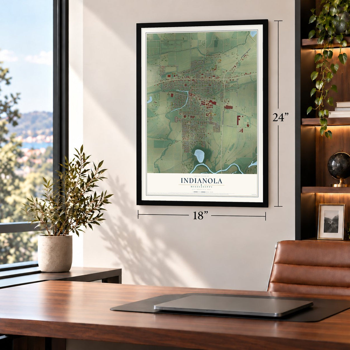
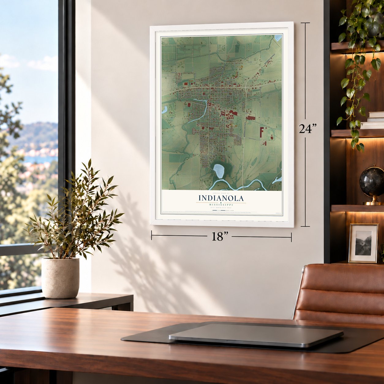
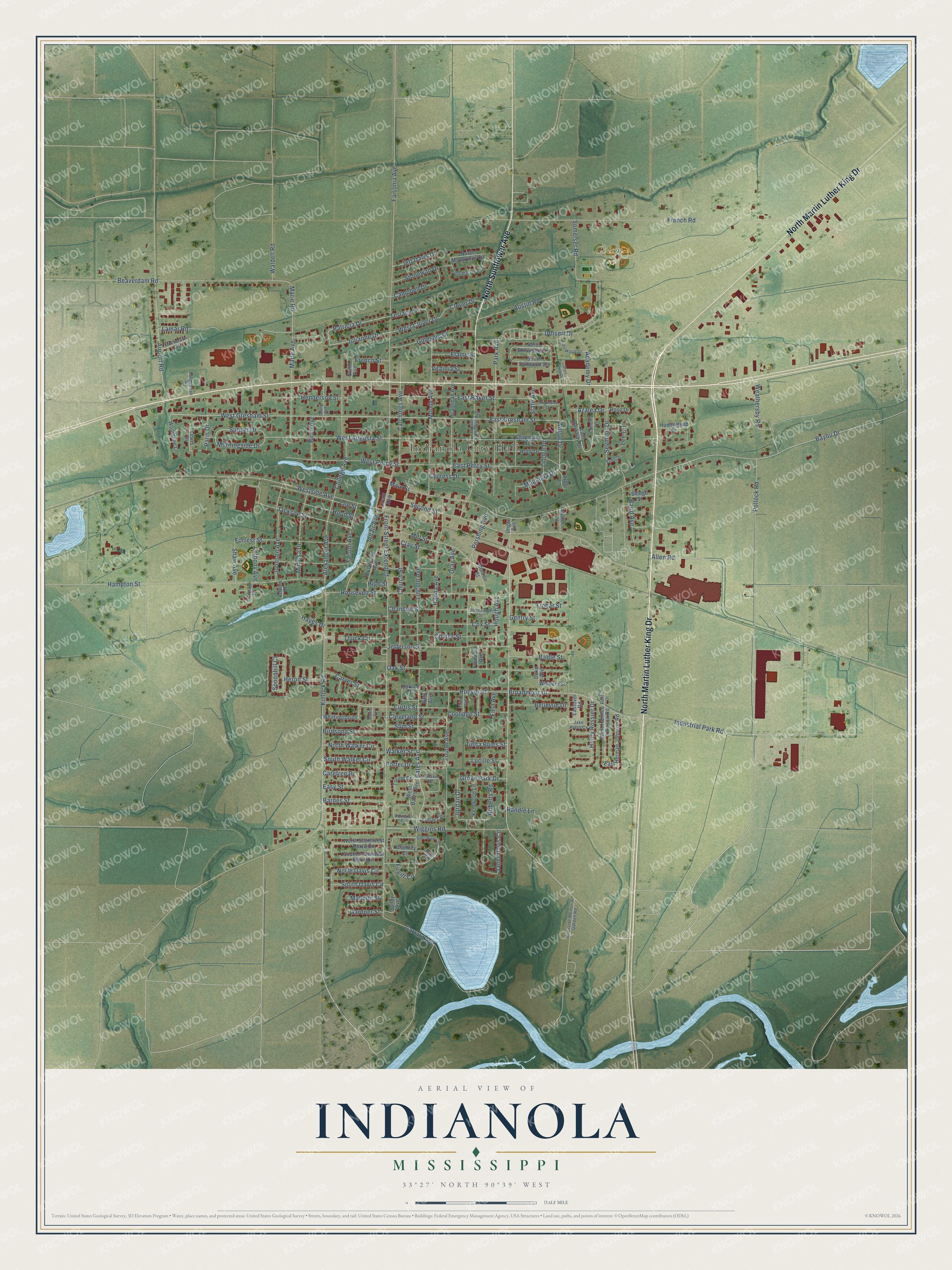
A new map of Indianola, Mississippi, made in 2026 and printed to order on thick archival matte paper.
12" x 18" Archival Matte Print
A Map of Home. A Work of Art.
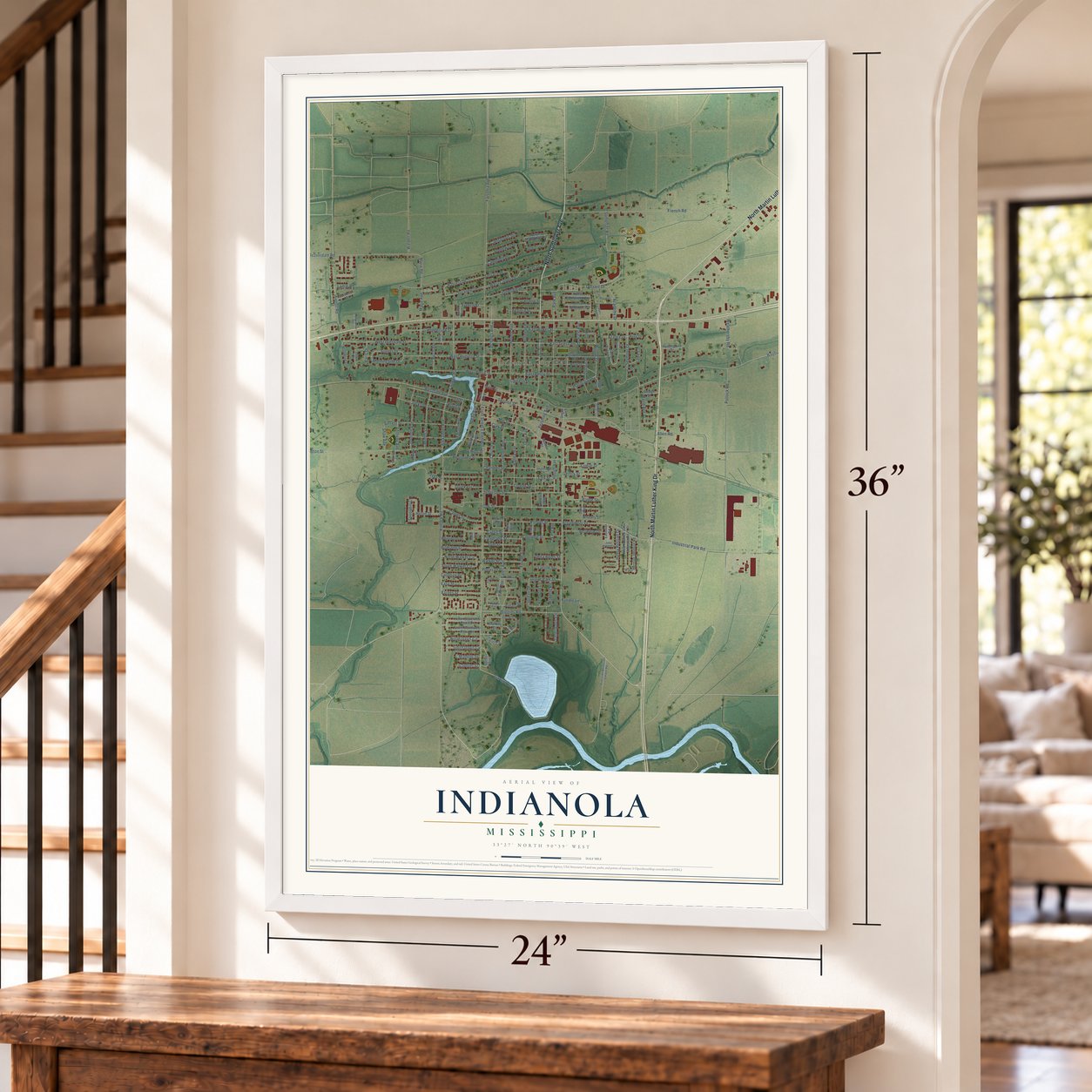
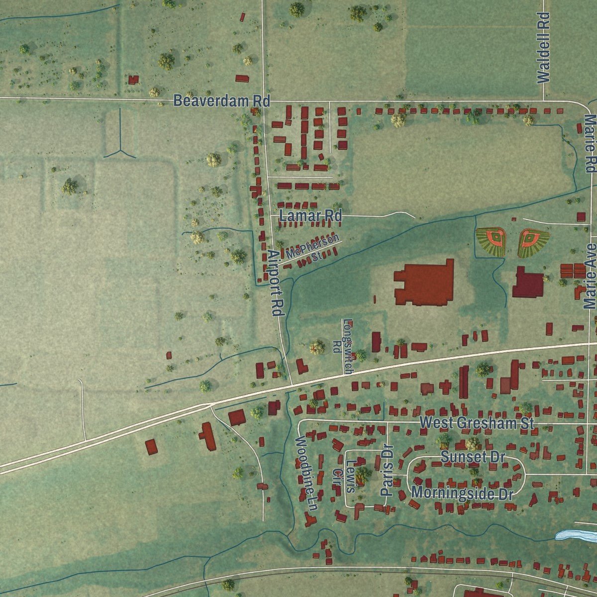
Explore Indianola, Mississippi from a whole new perspective. Created using aerial imagery and detailed geographic data, this map captures Indianola building by building, with labeled streets, familiar landmarks, and shaded topographical relief that highlights the natural contours of the landscape.
Combining modern data with the timeless character of a vintage atlas, this map is just as interesting up close as it is beautiful on the wall. Whether you grew up in Indianola, spent memorable years there, or call it home today, this unique map is a great way to celebrate a place that means something to you. Zoom in on the preview to look for your street, and then order a print to put your memories on the wall.
Three ways to hang it
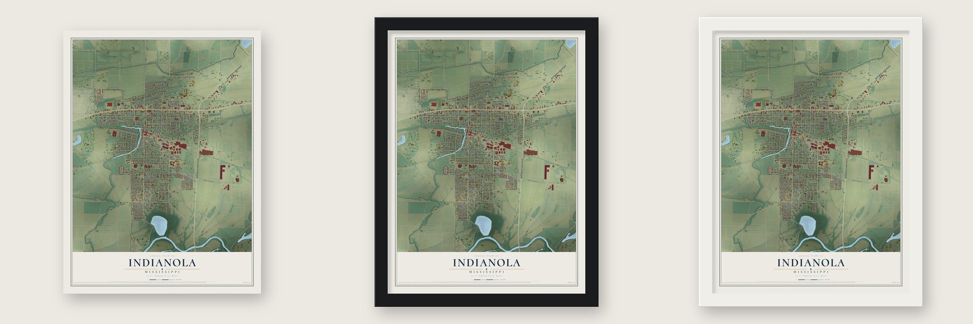
Unframed archival matte, a black wood frame or a white wood frame.
Up close
Geography Worth Displaying
This map was created using accurate cartographic data and authoritative geographic sources, including the U.S. Geological Survey and the Census Bureau. The map brings together terrain, waterways, roads, and building detail. The majority of the streets are labeled, houses are accurately depicted, and the topography is derived from government sources. Combining local data with carefully composed color and shading leads to this beautifully detailed Indianola artwork for your wall.
Rather than simply showing street outlines, we’ve included as many of the street names as we could reasonably fit on the map while keeping their names legible. Zoom in on the high resolution preview to see exactly what’s on the map. We truly set out to create a statement piece for anyone who loves Indianola. So whether it’s for you, or a gift for someone you love, we hope this map of Indianola brings back fond memories.
Read the story behind this map of Indianola, Mississippi from 2026.
About Indianola, Mississippi
Indianola is a city of 9,646 people in the Mississippi Delta and the county seat of Sunflower County. Its town site was surveyed on June 30, 1874. In 1882 the county board called an election on moving the seat of government away from the old capital at Johnsonville, and voters chose Eureka, a place later renamed Indianola. A frame courthouse costing about $3,000 went up in 1883, and a brick courthouse and jail replaced it in 1898.
Indianola was incorporated in 1886 and had 1,098 people by 1900. Cotton and corn from the surrounding farms fed two cotton seed oil mills and a large cotton compress. Two weekly papers started in town, the Sunflower Tocsin in 1886 and the Enterprise in 1896. In 1905 Black stockholders organized the Delta Penny Savings Bank with $10,000 in capital, one of four banks in town.
“Life in Indianola still moves at a pace established by its distinguishing characteristic, the picturesque and languid Indian Bayou that winds through downtown.”
- Minnie Cox, postmasterMinnie Cox became Indianola's postmaster in 1891, the first Black woman to hold the job in the United States. In 1902 white residents petitioned for her removal, and threats forced her to resign. Theodore Roosevelt refused to accept it and closed the office on January 2, 1903, routing mail to Greenville while Cox kept her salary. She left for her safety; the office reopened in February 1904. In 2008 Congress named the post office building for her.
- B.B. King's boyhood homeB.B. King spent his childhood in Indianola and came back every year for the blues festival that carries his name. He named his 1970 album Indianola Mississippi Seeds for the town. In September 2008 the B.B. King Museum, a $14 million center on King and the blues, opened in Indianola. The guitarist Albert King was born here too.
- The first Citizens' CouncilTwo months after the Supreme Court's Brown v. Board of Education ruling against school segregation, Robert B. Patterson, who managed a plantation, called like-minded people to a house in Indianola in July 1954. That meeting founded the White Citizens' Council, and its first chapter was based here.
- A record comic stripOn June 7, 2003, art students at Gentry High School painted a Lucky Cow comic strip across their school parking lot. It measured 135 feet wide and 47.8 feet high, enough to cover 35 school buses, and Guinness World Records listed it as the largest comic strip in the world.
Find your street
Names on the Indianola map
Every name below is printed on this map. Look for your street, your school, the park where you played, or the pond down the road.
Places and landmarks2
- Indianola City Hall
- Chism Park
Streets and roads185
- North Martin Luther King Drive
- North Sunflower Avenue
- West Gresham Street
- East Gresham Street
- Magnolia Drive
- Willow Drive
- Marie Road
- Patricia Drive
- Morningside Drive
- Julianne Drive
- Sunset Drive
- West Augusta Street
- Broadmoor Drive
- Alexander Avenue
- Catchings Avenue
- Hoover Street
- West Clover Drive
- Jordan Drive
- Azalea Drive
- Front Street Extended
- Quick Circle
- Main Street
- Garrard Avenue
- Kinlock Road
- Westside Avenue
- Faisonia Avenue
- French Road
- Second Street
- Hampton Street
- Bayou Drive
Show all 185 streets
- Industrial Park Road
- Wiggins Road
- Roosevelt Street
- Beaverdam Road
- Oak Street
- Airport Road
- Cox Street
- Moody Avenue
- Park Avenue
- Hanna Avenue
- Bates Avenue
- East Percy Street
- Pershing Avenue
- Dorsett Drive
- East Baker Street
- Church Street
- Curtis Street
- Birdsong Street
- Jefferson Street
- Seymour Drive
- Mill Street
- Somerset Road
- College Avenue
- West Percy Street
- Forrest Street
- Marie Avenue
- Lincoln Avenue
- Janet Davis Circle
- Johnson Avenue
- Coates Street
- Jackson Street
- Adair Avenue
- Austin Road
- Mimosa Drive
- Lee Street
- Gillespie Drive
- Spoonbill Court
- Chandler Street
- Hood Street
- Fourth Avenue
- Henderson Street
- Clay Street
- Walker Street
- Baird Avenue
- Faison Avenue
- Carver Street
- Cypress Drive
- Pollock Road
- Campbell Drive
- Easy Street
- Stonewall Drive
- Barnes Street
- Lamar Road
- Coolidge Street
- North Walker Circle
- Cleveland Street
- Slim Street
- South Walker Circle
- Porter Drive
- Linbar Street
- Gentry Street
- Bellevue Drive
- North Davis Circle
- Battle Street
- Academy Drive
- Lee Circle
- Waldell Road
- South Davis Circle
- Weathersby Road
- Hough Avenue
- Grove Park Drive
- Henry Rossier Drive
- Terrace Drive
- Gray Avenue
- Carefree Drive
- Hayes Drive
- Roberts Road
- Jeff Davis Drive
- Virginia Street
- Birch Avenue
- Elaine Street
- Shaw Avenue
- Allen Road
- Anthony Avenue
- Clover Drive
- Delta Blues Street
- Heron Street
- Lucille Street
- Fugitt Circle
- Mabelle Street
- French Street
- Linden Drive
- Randle Lane
- State Avenue
- Paris Drive
- Gardner Street
- First Avenue
- High Street
- East Parkway Drive
- West Bates Avenue
- Brantley Circle
- North Elmwood Circle
- Lewis Circle
- West Hermon Johnson Road
- Chapman Street
- Heathman Avenue
- East Herman Johnson Road
- North Macarthur Circle
- South Southwest Plaza Circle
- North Southwest Plaza Circle
- Oklahoma Avenue
- Front Avenue
- Monroe Street
- Whittington Drive
- Lunar Circle
- Torino Drive
- Sandy Avenue
- Kentwood Lane
- South Elmwood Circle
- Woodbine Lane
- Humingbird Drive
- Holly Drive
- Whinery Street
- Duke Avenue
- Eastover Road
- Sledge Street
- Modern Lane
- Fountain Avenue
- Rose Drive
- Arbor Lane
- North Avenue
- Spruce Street
- Hull Circle
- Adkins Drive
- Unger Avenue
- Fifth Avenue
- Camellia Lane
- Galaxie Road
- Aquarius Circle
- Highland Drive
- Riverside Memorial Garden Road
- Eastwood Drive
- Grand Avenue
- McPherson Street
- Choctaw Lane
- Shortridge Street
- Longswitch Road
- Jake Ayers Cv
- Third Avenue
- Ezell Drive
- Fuller Drive
- Davis Cv
- Ethel Waters Drive
- South Macarthur Circle
- Short Bayou Drive
Names are listed as they appear on the printed map. Zoom into the product photos to find them.
The art of mapping a place
How This Map Was Made
Real places. Remarkable detail. Discover the layers that turn geographic data into a map of home.

The view from above
Aerial imagery reveals the character of the land: woodland, open fields, and the patterns of a place.

The shape of the land
Elevation data brings hills, valleys, and subtle changes in the landscape into view.

The details of home
Roads, waterways, and building footprints come together to make the map feel unmistakably local.

Geography becomes art
Considered color, shading, and typography bring the layers together in a map made for your wall.


Process illustrated with Mendon, Massachusetts. Aerial imagery: USDA NAIP. Terrain: USGS 3D Elevation Program. Map details and finished artwork: KNOWOL.
The Details
About This Print
Choose an archival matte print, or a black or white Ayous wood frame. The archival matte print is unframed.
Select your size and finish above to see the matching product image and price.
Materials & Craftsmanship
A contemporary map with the character of a classic atlas, printed on archival matte paper. Optional frames are made from Ayous wood.
Your printed map does not include the watermark shown in the full-map preview.
Shipping & Delivery
Free shipping within the United States. Every print is made to order in the USA.
Buying a gift? Add a note in your cart and we'll include it. We never put prices in the package.
Prints ship within 2 to 3 business days. Allow 7 to 10 days total from ordering for delivery. Timing may vary during holidays or periods of high order volume.
Read our shipping policy.
Returns and damaged prints
Each print is made to order. Change-of-mind refunds are not available after production.
If your print arrives damaged, misprinted or incorrect, contact support@knowol.com within 30 days of receiving it. Include your order number, photos and a description of the issue.
Read our full refund and replacement policy. For questions about your order, email support@knowol.com.
Find your town
Looking for another city?
Find a map of home in our Mississippi collection, or any town in the country.
Nearby
Maps of towns near Indianola
Know someone from one of these towns? Their map makes a great gift.
 Inverness
, Mississippi
From $39.99See the map
 Moorhead
, Mississippi
From $39.99See the map
 Sunflower
, Mississippi
From $39.99See the map
More maps nearby: Shaw, Isola, Elizabeth, Leland and Stoneville.