
Search for another town





Free U.S. delivery 7 to 10 days after you order
Iola, Kansas Map Art
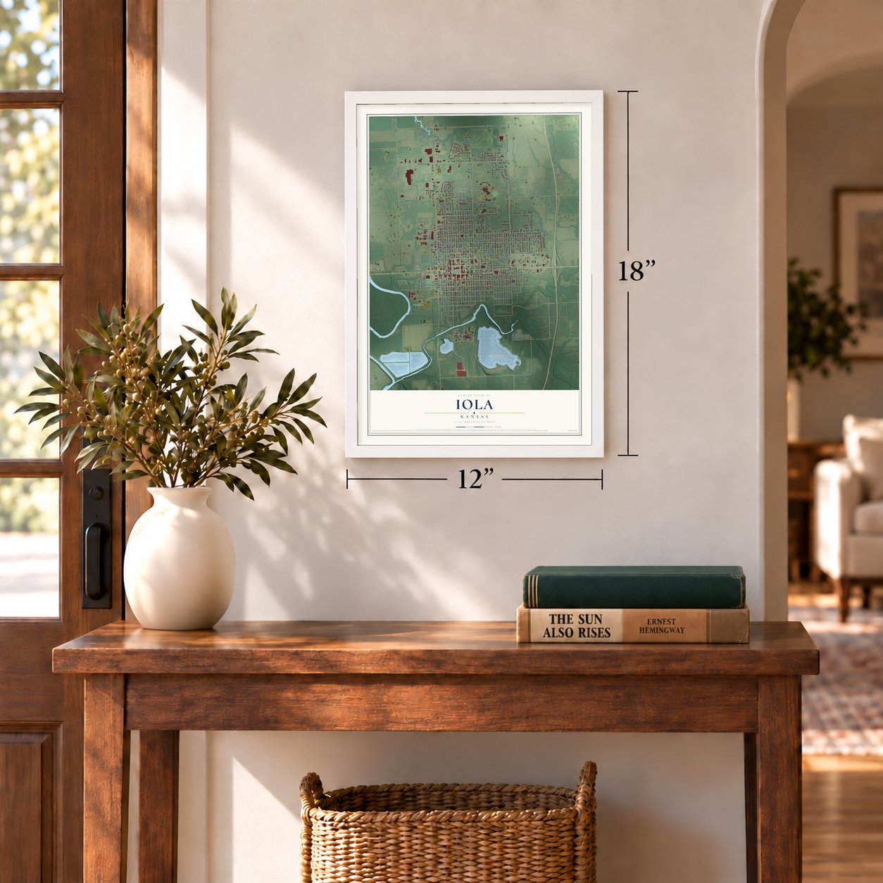
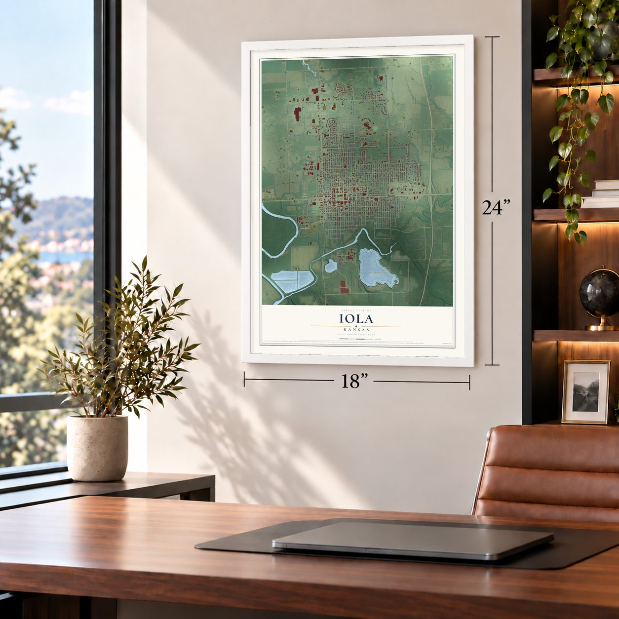
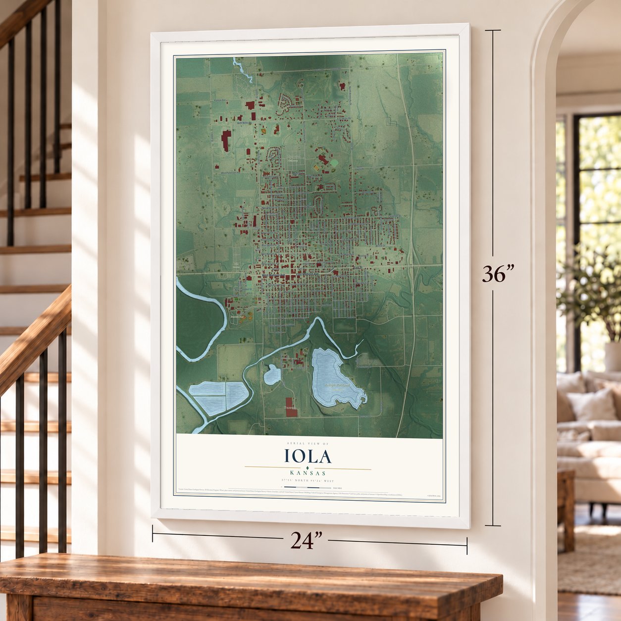
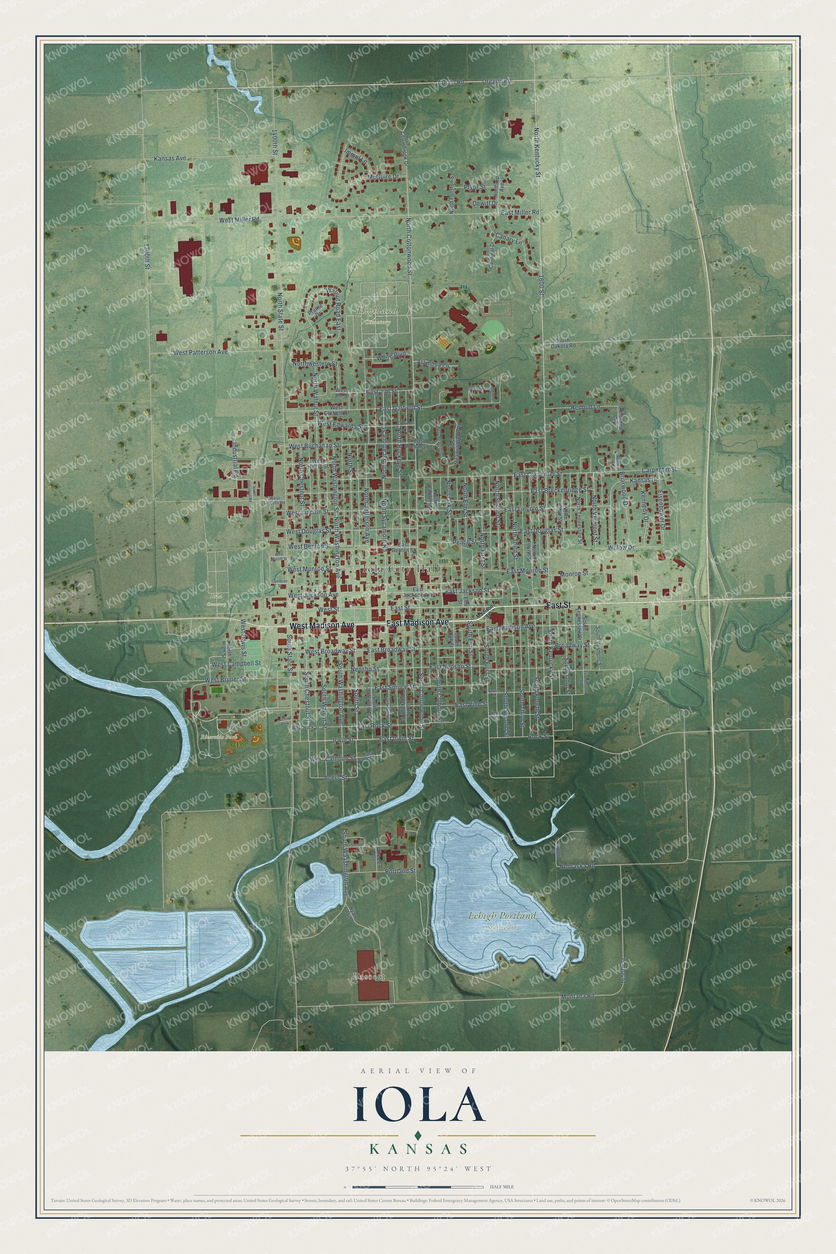
A new map of Iola, Kansas, made in 2026 and printed to order on thick archival matte paper.
12" x 18" Archival Matte Print
A Map of Home. A Work of Art.
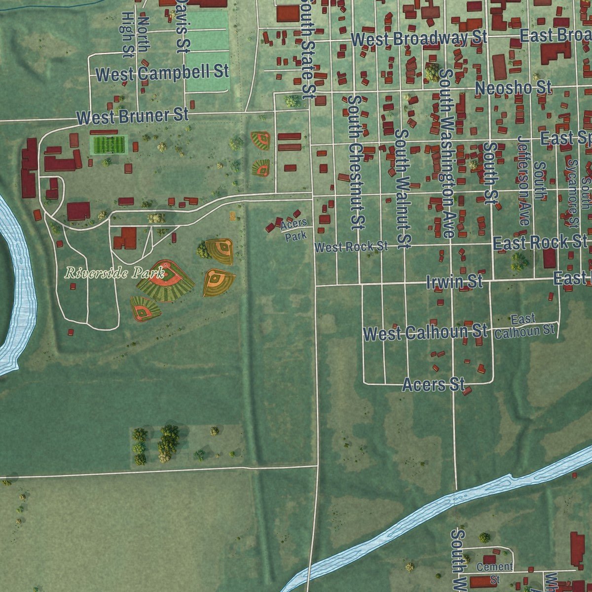
Explore Iola, Kansas from a whole new perspective. Created using aerial imagery and detailed geographic data, this map captures Iola building by building, with labeled streets, familiar landmarks, and shaded topographical relief that highlights the natural contours of the landscape.
Combining modern data with the timeless character of a vintage atlas, this map is just as interesting up close as it is beautiful on the wall. Whether you grew up in Iola, spent memorable years there, or call it home today, this unique map is a great way to celebrate a place that means something to you. Zoom in on the preview to look for your street, and then order a print to put your memories on the wall.
Three ways to hang it
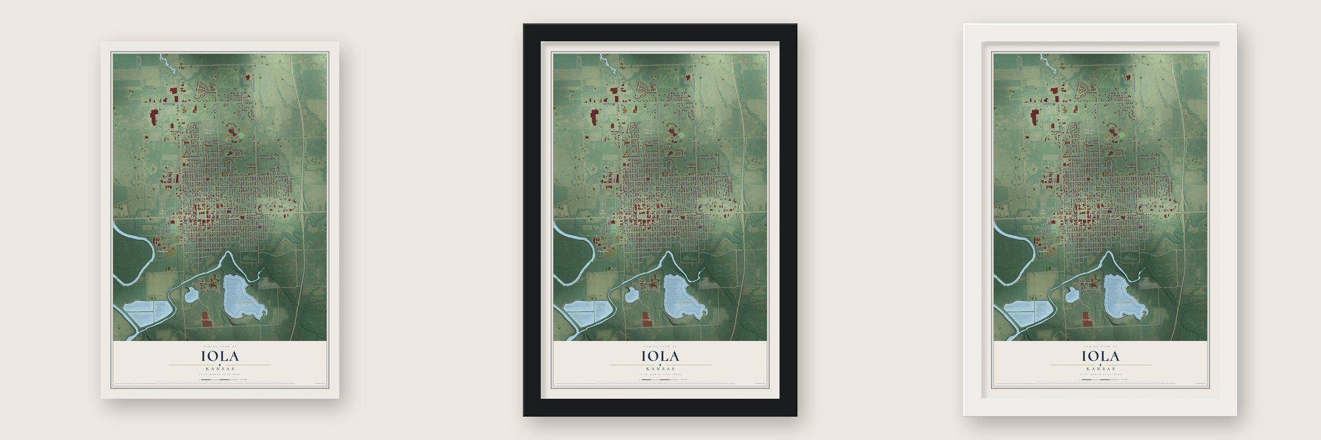
Unframed archival matte, a black wood frame or a white wood frame.
Up close
Geography Worth Displaying
This map was created using accurate cartographic data and authoritative geographic sources, including the U.S. Geological Survey and the Census Bureau. The map brings together terrain, waterways, roads, and building detail. The majority of the streets are labeled, houses are accurately depicted, and the topography is derived from government sources. Combining local data with carefully composed color and shading leads to this beautifully detailed Iola artwork for your wall.
Rather than simply showing street outlines, we’ve included as many of the street names as we could reasonably fit on the map while keeping their names legible. Zoom in on the high resolution preview to see exactly what’s on the map. We truly set out to create a statement piece for anyone who loves Iola. So whether it’s for you, or a gift for someone you love, we hope this map of Iola brings back fond memories.

About Iola, Kansas
Iola is a city of 5,396 people and the county seat of Allen County, on the Neosho River in southeast Kansas. When the legislature of 1858 put the county seat at Humboldt, settlers in the central and northern parts of the county were unhappy. On January 1, 1859, they met at the Deer Creek schoolhouse and formed a town company. Its officers picked a spot where Elm Creek meets the Neosho, and the members chose the town's name by ballot, honoring Iola Colborn, the wife of J. F. Colborn.
The first vote to move the county seat, on March 26, 1860, went to Humboldt, and a drought that year left business dull. Then almost all of the town's able-bodied men went off to the Civil War, so Iola stayed the same size until 1865. On May 19 of that year a second election finally went Iola's way, and the county records and offices moved here at once. The county seat has stayed in Iola ever since.
“The residents of Cofachique, despairing of making their town a success, joined with Iola, and most of them moved to the new site, all working together in the endeavor to secure the location of the county seat at once.”
- The first family in townJ. F. Colborn had lived on part of the townsite since 1857. Early in June 1859 he finished the first house built after the survey, and his family moved in as Iola's first settlers. A Methodist minister, Rev. Mr. Hawley, had already preached the town's first sermon in that unfinished house in May. Their daughter Luella E. Colborn, born June 29, 1859, was the first child born in Iola.
- A stone fort for the warAround 1859 the settlers put up a stone building to serve as the town's headquarters if trouble came from Indians or Bushwhackers. When the Civil War began in 1861, they fortified the building and its whole block, and it became Iola's fort, used by the local militia and Army troops until the war ended.
- A stone jail for the countyIn August 1868 the county voted $10,000 in bonds for a strong stone jail. White & Hays built it the following year on a contract of $8,400. The Allen County Jail joined the National Register in 1971.
- The bridge works that failedThe King Bridge Manufacturing Company opened its shops in Iola in 1871 and hired large numbers of men. Customers usually paid it in bonds, so when the panic of 1873 drove bond values down, the company failed and took its machinery away. Several local citizens bought its buildings and land at a sheriff's sale for $1,100.
- Gas on Christmas Day, 1893Natural gas was discovered on December 25, 1893. A boom began around 1895, bringing new industry and new residents, and by 1910 Iola had 9,032 people.
Find your street
Names on the Iola map
Every name below is printed on this map. Look for your street, your school, the park where you played, or the pond down the road.
Places and landmarks7
- Iola City Hall
- Bassett
- Highland Cemetery
- Iola Cemetery
- Lehigh Portland State Park
- Riverside Park
- Acers Park
Streets and roads144
- East Madison Avenue
- West Madison Avenue
- East Street
- South Street
- East Irwin Street
- Irwin Street
- South Chestnut Street
- South Cottonwood Street
- Austin Road
- North Kentucky Street
- South Washington Avenue
- South Kentucky Street
- North Cottonwood Street
- Neosho Street
- 1600 Street
- East Jackson Street
- East Garfield Street
- South First Street
- North Street
- North State Street
- West Broadway Street
- North Walnut Street
- South State Street
- Acers Street
- East Broadway Street
- North Second Street
- East Rock Street
- Oregon Road
- Montana Road
- East Miller Road
Show all 144 streets
- North Jefferson Avenue
- East Lincoln Street
- North Sycamore Road
- North Sycamore Street
- North Buckeye Street
- East Neosho Street
- East Carpenter Street
- 1300th Street
- Broadway Street
- Kansas Drive
- East Breckenridge Street
- East Douglas Street
- East Monroe Street
- South Walnut Street
- North Chestnut Street
- North Washington Avenue
- North Washington Street
- 1400th Street
- West Miller Road
- Kansas Avenue
- North Third Street
- East Vine Street
- East Spruce Street
- South Fourth Street
- South Third Street
- North First Street
- South Second Street
- West Bruner Street
- West Lincoln Street
- West Patterson Avenue
- McGuire Drive
- North Elm Street
- West Street
- 1650th Street
- Industrial Road
- South Ohio Street
- South Colborn Street
- Carpenter Street
- Walnut Road East
- Canary Lane
- Northwestern Street
- West Jackson Avenue
- South Waashington Avenue
- Briarwood Drive
- North Vermont Street
- South Elm Street
- Redbud Lane
- Portland Street
- Willow Drive
- West Campbell Street
- Kennedy Drive
- West Benton Street
- Eisenhower Drive
- West Douglas Street
- West Monroe Street
- North Oak Street
- West Davis Street
- West Buchanan Street
- East Jim Street
- Rock Street
- West Edwards Street
- Nebraska Road
- Pryor Street
- Monroe Street
- White Boulevard
- West Calhoun Street
- Alamosa Lane
- Immel Lane
- Dewitt Drive
- Peach Street
- East Jackson Avenue
- Wheeler Avenue
- Ryan Avenue
- North Fourth Street
- South Jefferson Avenue
- South Buckeye Street
- East Buchanan Street
- South Oak Street
- Cedarbrook Drive
- North Tennessee Street
- North Ohio Street
- South Tennessee Street
- West Garfield Street
- Vine Street
- East Benton Street
- North Colborn Street
- West Henry Street
- East Meadowbrook Road
- South Vermont Street
- North Funston Street
- North High Street
- Northrup Avenue
- Cardinal Drive
- North Dakota Road
- Elm Street
- Kenwood Circle
- 1600th Street
- Prairie Drive
- West Jim Street
- Tennessee Street
- South Sycamore Street
- West Rock Street
- Edwards Street
- East Calhoun Street
- West Lincoln Road
- Wilson Lane
- Madison Street
- North Industrial Road
- Spruce Street
- West Meadowbrook Road
- Garfield Road North
- Cement Street
- West Martin Street
- Cameron Street
Names are listed as they appear on the printed map. Zoom into the product photos to find them.
The art of mapping a place
How This Map Was Made
Real places. Remarkable detail. Discover the layers that turn geographic data into a map of home.

The view from above
Aerial imagery reveals the character of the land: woodland, open fields, and the patterns of a place.

The shape of the land
Elevation data brings hills, valleys, and subtle changes in the landscape into view.

The details of home
Roads, waterways, and building footprints come together to make the map feel unmistakably local.

Geography becomes art
Considered color, shading, and typography bring the layers together in a map made for your wall.


Process illustrated with Mendon, Massachusetts. Aerial imagery: USDA NAIP. Terrain: USGS 3D Elevation Program. Map details and finished artwork: KNOWOL.
The Details
About This Print
Choose an archival matte print, or a black or white Ayous wood frame. The archival matte print is unframed.
Select your size and finish above to see the matching product image and price.
Materials & Craftsmanship
A contemporary map with the character of a classic atlas, printed on archival matte paper. Optional frames are made from Ayous wood.
Your printed map does not include the watermark shown in the full-map preview.
Shipping & Delivery
Free shipping within the United States. Every print is made to order in the USA.
Buying a gift? Add a note in your cart and we'll include it. We never put prices in the package.
Prints ship within 2 to 3 business days. Allow 7 to 10 days total from ordering for delivery. Timing may vary during holidays or periods of high order volume.
Read our shipping policy.
Returns and damaged prints
Each print is made to order. Change-of-mind refunds are not available after production.
If your print arrives damaged, misprinted or incorrect, contact support@knowol.com within 30 days of receiving it. Include your order number, photos and a description of the issue.
Read our full refund and replacement policy. For questions about your order, email support@knowol.com.
Find your town
Looking for another city?
Find a map of home in our Kansas collection, or any town in the country.
Nearby
Maps of towns near Iola
Know someone from one of these towns? Their map makes a great gift.
 Bassett
, Kansas
From $39.99See the map
 Gas
Gas, Kansas
From $39.99See the map
 La Harpe
, Kansas
From $39.99See the map
More maps nearby: Piqua, Humboldt, Neosho Falls, Colony and Moran.