
Search for another town





Free U.S. delivery 7 to 10 days after you order
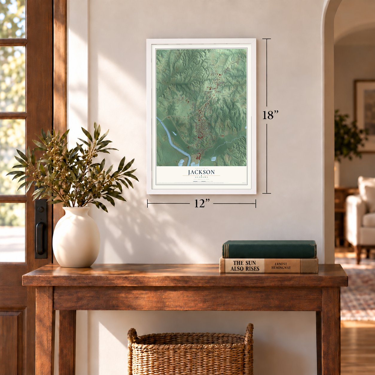
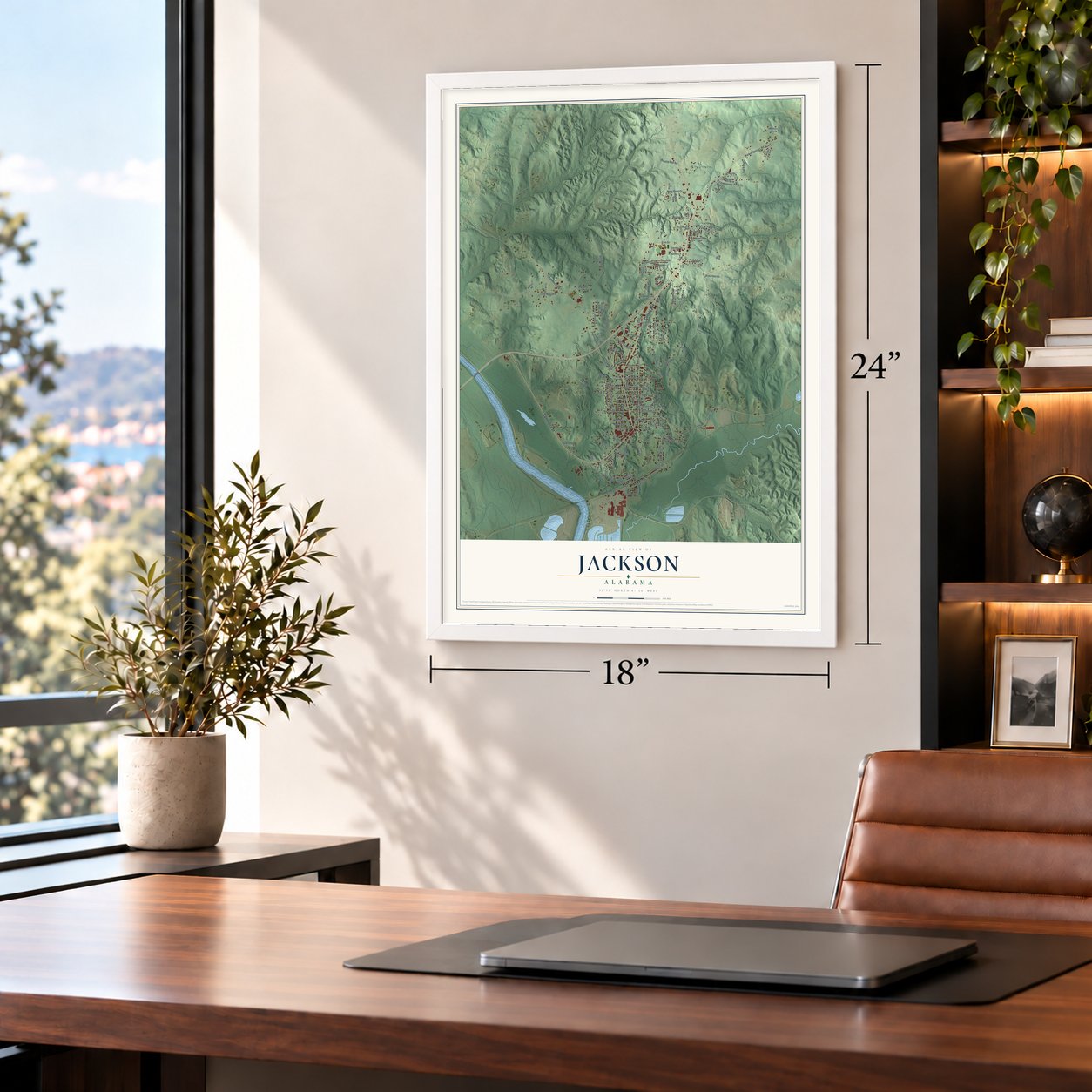
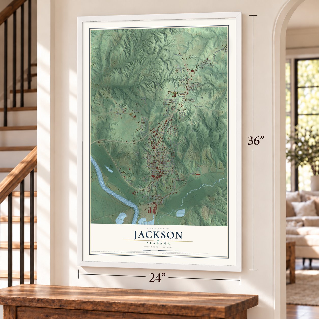
Jackson, Alabama Map Art
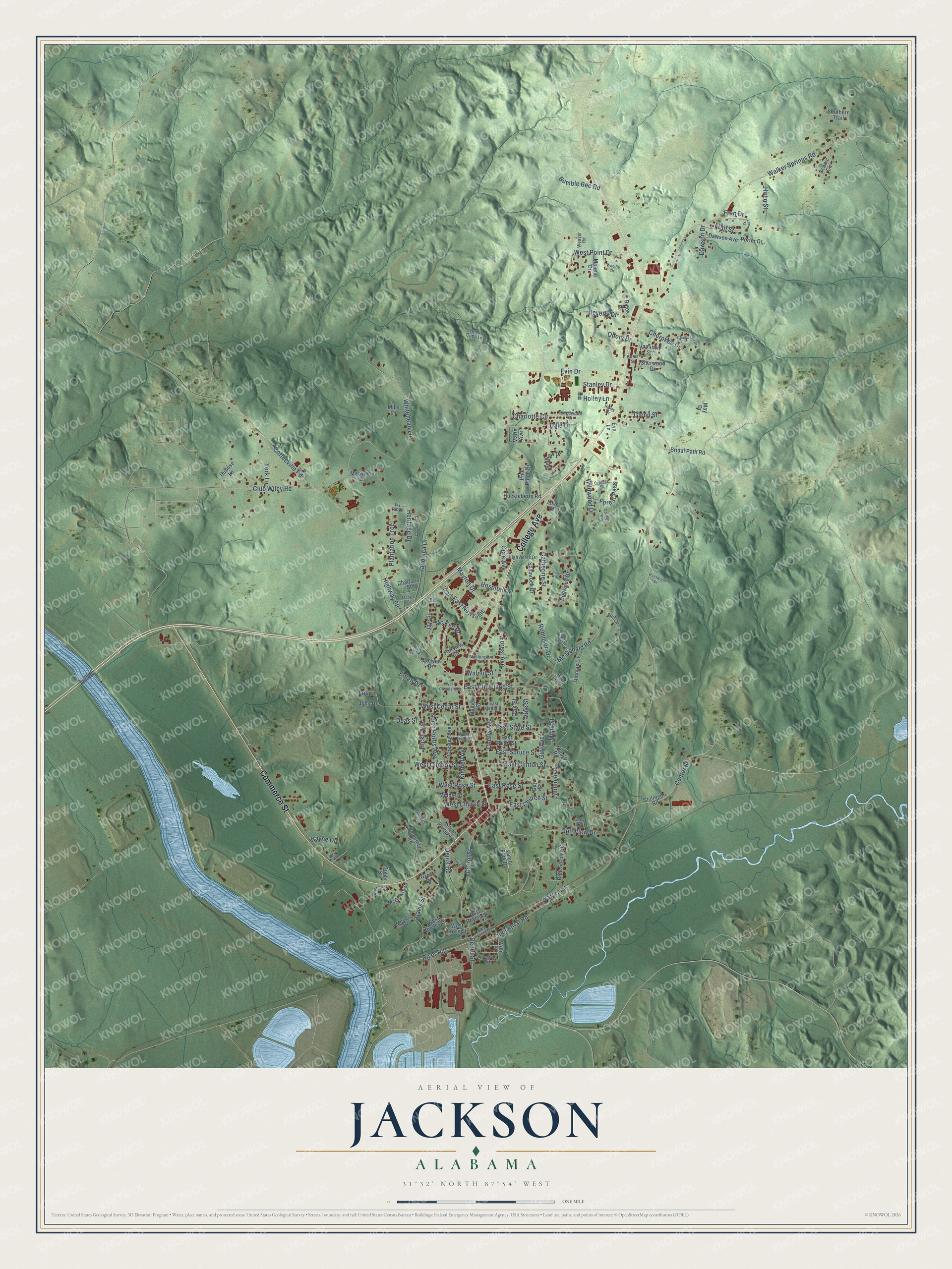
Building by building, with labeled streets and shaded relief.
12" x 18" Archival Matte Print
A Map of Home. A Work of Art.
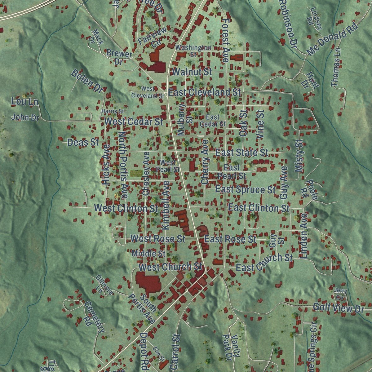
Explore Jackson, Alabama from a whole new perspective. Created using aerial imagery and detailed geographic data, this map captures Jackson building by building, with labeled streets, familiar landmarks, and shaded topographical relief that highlights the natural contours of the landscape.
Combining modern data with the timeless character of a vintage atlas, this map is just as interesting up close as it is beautiful on the wall. Whether you grew up in Jackson, spent memorable years there, or call it home today, this unique map is a great way to celebrate a place that means something to you. Zoom in on the preview to look for your street, and then order a print to put your memories on the wall.
Three ways to hang it
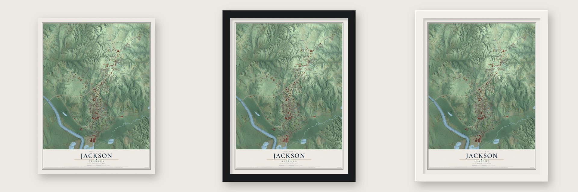
Unframed archival matte, a black wood frame or a white wood frame.
Up close
Geography Worth Displaying
This map was created using accurate cartographic data and authoritative geographic sources, including the U.S. Geological Survey and the Census Bureau. The map brings together terrain, waterways, roads, and building detail. The majority of the streets are labeled, houses are accurately depicted, and the topography is derived from government sources. Combining local data with carefully composed color and shading leads to this beautifully detailed Jackson artwork for your wall.
Rather than simply showing street outlines, we’ve included as many of the street names as we could reasonably fit on the map while keeping their names legible. Zoom in on the high resolution preview to see exactly what’s on the map. We truly set out to create a statement piece for anyone who loves Jackson. So whether it’s for you, or a gift for someone you love, we hope this map of Jackson brings back fond memories.
Read the story behind this map of Jackson, Alabama from 2026.

Find your street
Names on the Jackson map
Every name below is printed on this map. Look for your street, your school, the park where you played, or the pond down the road.
Streets and roads148
- Commerce Street
- College Avenue
- River Road
- West Rose Street
- Cherokee Drive
- Heritage Drive
- Evin Drive
- Coffeeville Road
- Depot Street
- Industrial Road
- Highway 69
- Walker Springs Road
- Whitehead Lane
- Center Street
- Forest Avenue
- East Cleveland Street
- Golf View Drive
- Stanley Drive
- Mc Donald Road
- Warren Street
- Charlotte Circle
- Carrol Street
- Oak Street
- Cherry Avenue
- Wildwood Drive
- Depot Road
- West Cedar Street
- East Church Street
- Glenn Street
- Kimbell Avenue
Show all 148 streets
- Club Wiley Road
- West Point Drive
- East Clinton Street
- Vine Street
- Robinson Drive
- West Clinton Street
- North Portis Avenue
- Japonica Drive
- Davis Street
- East State Street
- Mc Kee Drive
- Carl East Newsome
- Catherine Street
- York Lane
- East Spruce Street
- Mayton Drive
- Beverly Drive
- Dale Drive
- Plantation Trce
- Hospital Drive
- Fran Street
- Hicks Avenue
- Walnut Street
- Ocre Avenue
- Hi-Lo Street
- West Church Street
- East Rose Street
- Forest Pass
- Bolen Drive
- Bumble Bee Road
- Odom Drive
- Misty Street
- Holley Lane
- Guy Avenue
- Linden Avenue
- Dawson Drive
- Lou Lane
- Deas Street
- Wayne Drive
- Fran Drive
- Vanity Park Drive
- Dogwood Drive
- Tiggs Street
- Dubose Lane
- Brewer Drive
- Malone Drive
- Blue Springs Circle
- Cemetery Road
- East Pearl Street
- Clolinger Road
- Chesley Avenue
- Belview Drive
- Thomas Lane
- Shamrock Drive
- Dawson Avenue
- Southern Trail
- Pine Ridge Drive
- Mulberry Street
- Fairview Circle
- Scenic Circle
- Huckleberry Road
- Madylene Lane
- South Portis Avenue
- Poole Road
- Porter Drive
- Jay Circle
- Bridal Path Road
- Grove Drive
- East Boyles Street
- Willis Street
- Jamison Street
- McGowin Street
- Charlsea Street
- Sherwood Drive
- Eva Lane
- Bates Drive
- West Boyles Drive
- Middle Street
- Meggs Drive
- May Drive
- Hunt Drive
- Mills Lane
- West Ross Street
- John Drive
- Love Street
- Guy Street
- Marie Avenue
- Ivy Ridge
- Mack Drive
- Edgewood Circle
- High Acres Drive
- Washington Street
- Sullivan Lane
- Gilmore Lane
- East Cedar Street
- Hemi Cuda Lane
- Weaver Road
- Lindsey Road
- Miller Street
- East Front Street
- West Pearl Street
- High Street
- Bell Place
- Chickasaw Drive
- Camellia Court
- Lee Street
- Cypress Street
- Jerry Circle
- Harris Street
- Valentine Street
- Elm Street
- Country Place
- West Cleveland Street
- Hayswood Drive
- Madyln Street
- Parker Street
- Woodie Drive
- Holley Drive
Names are listed as they appear on the printed map. Zoom into the product photos to find them.
About Jackson, Alabama
Jackson is a city of 4,748 people in Clarke County, set on a rise above the east bank of the Tombigbee River. Its first settlement was called Republicville, and early settlers needed passports to cross Creek territory to get there. In 1815 the Pine Level Land Company platted a town it called Pine Level. On July 3, 1816, it took the name Jackson to honor Andrew Jackson, whose part in the Creek War of 1813-14 had opened the land to settlers, and its lots were sold at public auction over the first three days of July 1817.
The river made early Jackson a busy port and a place of manufacturing, with tanneries, sawmills and grist mills, and shops turning out hats, saddles and clothing. The boom was short, and for its first decades the town held only about 100 people. Growth returned after the railroad reached Jackson in 1888 on a line to Marion Junction, and land sales surged during the late 1890s. In 1900 lamps went up along the streets, new businesses opened downtown, and First National of Jackson, the town's first bank, opened in 1901.
- The Fort Carney cannonConfederate soldiers raised Fort Carney in the Civil War on Carney's Bluff, just south of Jackson along the Tombigbee River. Its cannon now sits in front of City Hall.
- German prisoners in 1945A prisoner-of-war camp on Ocre Avenue opened on April 6, 1945, and held 253 captured German soldiers, many of them from the Afrika Korps. It closed on March 12, 1946. Today a few concrete slabs, where some of its buildings stood, are all that is left of it.
- Isham Kimbell's houseIsham Kimbell was the only member of his family to survive a massacre tied to the Creek War of 1813-14. The house he built in Jackson, the Kimbell House, is now an event center run by the city.
- Schools since the 1890sJackson opened an agricultural school as its first school in the 1890s, the same decade as its first school for African Americans. In 1909 the agricultural school became the town's first graded school. A high school for African Americans went up in 1934 and one for white students in 1935. After the schools integrated in the 1960s, the former African American high school became the middle school, and the current Jackson High was built in 1982.
- Fall Festival since 1983Each November since 1983, the city has put on a Fall Festival with antique car contests, live bands, food stands, a chili cook-off and things for children to do.
Keep exploring Alabama
Jackson is one of 675 Alabama towns we've mapped. Every dot on the map is a print of its own.
The search covers every state, Alabama first.
Near Jackson
Order 2 or more town maps and save 10%. Shown in the size and finish you picked above, so they hang as a set.
- Leroy 12" x 18" / Archival Matte Print $39.99
- Rockville 12" x 18" / Archival Matte Print $39.99
- St. Stephens 12" x 18" / Archival Matte Print $39.99


More maps nearby: Carlton, Whatley, Grove Hill, Coffeeville and Fulton.
The art of mapping a place
How This Map Was Made
Real places. Remarkable detail. Discover the layers that turn geographic data into a map of home.

The view from above
Aerial imagery reveals the character of the land: woodland, open fields, and the patterns of a place.

The shape of the land
Elevation data brings hills, valleys, and subtle changes in the landscape into view.

The details of home
Roads, waterways, and building footprints come together to make the map feel unmistakably local.

Geography becomes art
Considered color, shading, and typography bring the layers together in a map made for your wall.


Process illustrated with Mendon, Massachusetts. Aerial imagery: USDA NAIP. Terrain: USGS 3D Elevation Program. Map details and finished artwork: KNOWOL.
The Details
About This Print
Choose an archival matte print, or a black or white Ayous wood frame. The archival matte print is unframed.
Select your size and finish above to see the matching product image and price.
Materials & Craftsmanship
A contemporary map with the character of a classic atlas, printed on archival matte paper. Optional frames are made from Ayous wood.
Your printed map does not include the watermark shown in the full-map preview.
Shipping & Delivery
Free shipping within the United States. Every print is made to order in the USA.
Buying a gift? Add a note in your cart and we'll include it. We never put prices in the package.
Prints ship within 2 to 3 business days. Allow 7 to 10 days total from ordering for delivery. Timing may vary during holidays or periods of high order volume.
Read our shipping policy.
Returns and damaged prints
Each print is made to order. Change-of-mind refunds are not available after production.
If your print arrives damaged, misprinted or incorrect, contact support@knowol.com within 30 days of receiving it. Include your order number, photos and a description of the issue.
Read our full refund and replacement policy. For questions about your order, email support@knowol.com.