


Search for another town


Free U.S. delivery 7 to 10 days after you order
Jeffersontown, Kentucky Map Art
Building by building, with labeled streets and shaded relief.
12" x 18" Archival Matte Print
A Map of Home. A Work of Art.
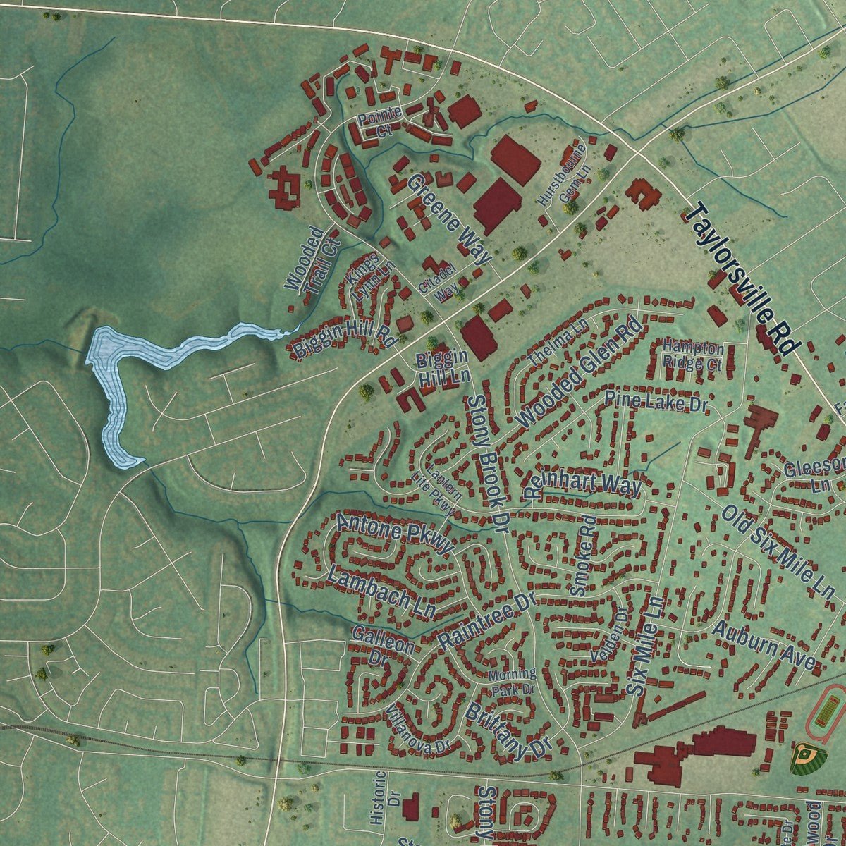
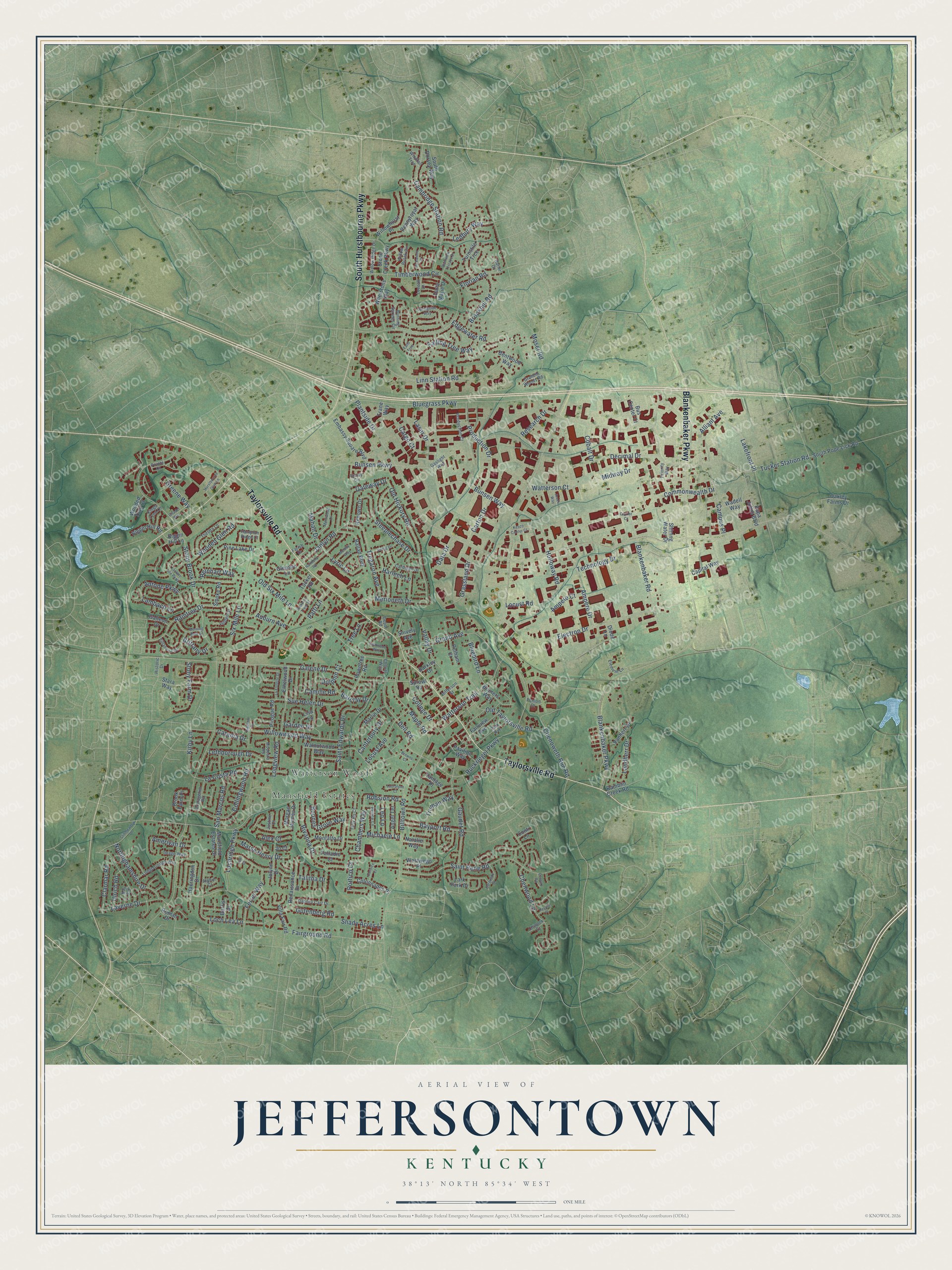
Explore Jeffersontown, Kentucky from a whole new perspective. Created using aerial imagery and detailed geographic data, this map captures Jeffersontown building by building, with labeled streets, familiar landmarks, and shaded topographical relief that highlights the natural contours of the landscape.
Combining modern data with the timeless character of a vintage atlas, this map is just as interesting up close as it is beautiful on the wall. Whether you grew up in Jeffersontown, spent memorable years there, or call it home today, this unique map is a great way to celebrate a place that means something to you. Zoom in on the preview to look for your street, and then order a print to put your memories on the wall.
Three ways to hang it

Unframed archival matte, a black wood frame or a white wood frame.
Up close
Geography Worth Displaying
This map was created using accurate cartographic data and authoritative geographic sources, including the U.S. Geological Survey and the Census Bureau. The map brings together terrain, waterways, roads, and building detail. The majority of the streets are labeled, houses are accurately depicted, and the topography is derived from government sources. Combining local data with carefully composed color and shading leads to this beautifully detailed Jeffersontown artwork for your wall.
Rather than simply showing street outlines, we’ve included as many of the street names as we could reasonably fit on the map while keeping their names legible. Zoom in on the high resolution preview to see exactly what’s on the map. We truly set out to create a statement piece for anyone who loves Jeffersontown. So whether it’s for you, or a gift for someone you love, we hope this map of Jeffersontown brings back fond memories.
Read the story behind this map of Jeffersontown, Kentucky from 2026.

Find your street
Names on the Jeffersontown map
Every name below is printed on this map. Look for your street, your school, the park where you played, or the pond down the road.
Places and landmarks2
- Mansfield Estates
- Watterson Woods
Streets and roads244
- Taylorsville Road
- South Hurstbourne Parkway
- Blankenbaker Parkway
- Watterson Trail
- Plantside Drive
- Stony Brook Drive
- Bluegrass Parkway
- Linn Station Road
- Timberwood Circle
- Six Mile Lane
- Blankenbaker Road
- Ruckriegel Parkway
- Billtown Road
- Galene Drive
- Old Six Mile Lane
- Electron Drive
- Saint Rene Road
- Gutenberg Road
- Landherr Drive
- Moser Road
- Chenwood Lane
- Loch Lea Lane
- Sue Helen Drive
- Bunsen Way
- Cambridge Station Road
- Gaudet Road
- Willowwood Way
- Old Hickory Road
- Rivanna Drive
- Wooded Glen Road
Show all 244 streets
- Ampere Drive
- Tucker Station Road
- Grand Avenue
- Raintree Drive
- Falling Tree Way
- Commonwealth Drive
- Talitha Drive
- Tregaron Avenue
- Chenoweth Run Road
- Production Drive
- Fairground Road
- Collingwood Road
- Grassland Drive
- College Drive
- Steeplechase Drive
- Janlyn Road
- Old Taylorsville Road
- Saint Edwards Drive
- Maple Road
- Holloway Road
- Decimal Drive
- San Marcos Road
- Campus Place
- Merioneth Drive
- Kirby Lane
- Antone Parkway
- Laverne Drive
- Nottinghamshire Drive
- Lethborough Drive
- Dell Road
- Carton Drive
- Shady Acres Lane
- Lakefront Place
- Gateway Drive
- Locust Avenue
- Brookhill Road
- Bayport Road
- Boones Grove Way
- Lochridge Parkway
- Ferrer Way
- Alliant Avenue
- Stony Farm Drive
- Clarmar Road
- Ledbury Way
- Technology Drive
- Midway Drive
- Florian Road
- Marse Henry Drive
- Chambers Way
- Lyric Lane
- Portico Court
- Bluebird Lane
- Brittany Drive
- La Costa Road
- Canterbury Drive
- Laser Drive
- Valley Drive
- Ulrich Road
- Bunsen Parkway
- Watterson Court
- Garden Drive
- Lambach Lane
- Barclay Drive
- Longview Road
- Greene Way
- Research Drive
- Reinhart Way
- Cargo Court
- Michaele Lane
- Amerivan Drive
- Edgewater Road
- Truman Way
- Ampere Court
- Tree Lane
- Harlech Lane
- Cobalt Drive
- Robsion Road
- Leo Lane
- Patti Lane
- Data Drive
- Catania Drive
- Dolphin Court
- Mahan Drive
- Camille Road
- Auburn Avenue
- Locust Road
- Alex Court
- Pine Lake Drive
- Gleeson Lane
- Walnutwood Way
- Ethelwood Drive
- Papa Johns Boulevard
- Morgan Jaymes Drive
- Pennyroyal Way
- Embassy Square Boulevard
- Turnstile Trce
- Whetstone Way
- Willowhurst Place
- Stone Creek Parkway
- Ballad Boulevard
- South Pope Lick Road
- Jolynn Drive
- Marlin Drive
- Renaissance Drive
- Pelham Court
- Colonnades Place
- Stara Way
- South Dorsey Way
- Bruners Way
- Vanherr Drive
- Angel Terrace
- Fairview Avenue
- Montalto Drive
- Biggin Hill Road
- Bus Center Court
- Pavilion Way
- Capital Way
- Mansfield Estates Drive
- Pirogue Road
- Shining Water Drive
- Renown Drive
- Brook Farm Place
- Villa Fair Road
- Westwego Place
- Haeringdon Drive
- Oakley Farms Drive
- Natalie Way
- Bentwood Way
- Palladio Court
- Dana Marie Drive
- Smoke Road
- Wadell Way
- Wooded Trail Court
- Lark Park Drive
- Vantage Place
- Rowntree Road
- Biggin Hill Lane
- Ramblin Creek Road
- Galleon Drive
- Snively Avenue
- Burris Drive
- Lisa Lane
- Trane Way
- Tucker Road
- Roman Drive
- Barkley Drive
- Conti Lane
- Sprowl Road
- Diode Lane
- Jo Court
- Willow Brook Circle
- Thelma Lane
- Burning Springs Circle
- Longborough Way
- Villanova Drive
- Park Avenue
- Production Court
- Tally Ho Court
- Prince Lane
- Dabney Carr Drive
- Willow Ridge Drive
- Velden Drive
- Cottagehill Road
- Cardigan Drive
- Envoy Circle
- Farish Drive
- Modesto Road
- Hampton Ridge Court
- Kings Lynn Lane
- Element Lane
- Jefferson Street
- Loveall Lane
- Grandin Woods Road
- Image Way
- Kay Avenue
- Windfall Trce
- Chinook Court
- Historic Drive
- Gaslight Way
- Priority Way
- Justine Court
- Penion Drive
- Cheval Way
- Alphin Court
- Pointe Court
- Hatler Court
- Depot Road
- Lantern Lite Parkway
- Swing Drive
- Merriwood Drive
- Harmony Road
- Lynnwood Way
- Stillmeadow Drive
- Springside Way
- Morning Park Drive
- Burgundy Drive
- Melody Way
- La Follette Drive
- Hurstbourne Gem Lane
- Bigelow Drive
- Yorkwood Place
- Stoke on Trent Street
- Cornice Court
- Plainview Terrace Drive
- Citadel Way
- Arcee Way
- Kesco Center Court
- Carrier Court
- Lauralynn Court
- Peyote Place
- Century Road
- Browns Court
- Falls Trce
- Taft Court
Names are listed as they appear on the printed map. Zoom into the product photos to find them.
About Jeffersontown, Kentucky
Jeffersontown is a city of 28,474 people in Jefferson County, a large suburb of Louisville. Bison herds once cut trails through its forests and meadows, and Native Americans and later pioneers followed those same paths. Thomas Bullitt surveyed the land in 1773, and John Floyd surveyed it a year later. Settlers heading for the Falls of the Ohio stopped here to trade, and families such as the Hites, Tylers and Oldhams farmed land granted to them for service in the Revolutionary War.
In 1794 Abraham Bruner bought 122 acres. In May 1797 the Jefferson County Fiscal Court granted his request to turn 40 of those acres into the city of Jefferson, named for the county or for Vice President Thomas Jefferson. For years people called the place Bruner's Town or Brunerstown, but Jefferson Town became its name in the end. When Louisville Metro formed in 2003, the city chose to stay independent, and locals often call it J-town.
- German churches by 1789Brunerstown's first Lutherans had come from Virginia, Maryland, Pennsylvania and North Carolina. Samuel Mau received his license to preach in Kentucky in 1789, and until 1800 he led German-speaking congregations in Jeffersontown, Nelson County and Danville.
- A national first in 1966The Bluegrass Research & Industrial Park opened on 600 acres in 1966, the first development of its kind in the United States. Now called Bluegrass Commerce Park, it covers more than 1,800 acres and holds about 850 businesses, the largest such park in Kentucky. Its 38,000 workers make Jeffersontown the state's third-largest city for jobs.
- Papa John's headquartersPapa John's Pizza ran the company from its main offices in Jeffersontown until it decided to move. The pizza chain said in late 2020 that its new global headquarters would go to Three Ballpark Center at The Battery Atlanta.
Keep exploring Kentucky
Jeffersontown is one of 659 Kentucky towns we've mapped. Every dot on the map is a print of its own.
The search covers every state, Kentucky first.
Near Jeffersontown
Order 2 or more town maps and save 10%. Shown in the size and finish you picked above, so they hang as a set.
- Forest Hills 12" x 18" / Archival Matte Print $39.99
- Hurstbourne Acres 12" x 18" / Archival Matte Print $39.99
- Douglass Hills 12" x 18" / Archival Matte Print $39.99


More maps nearby: Houston Acres, Hurstbourne, Blue Ridge Manor, Cambridge and Sycamore.
The art of mapping a place
How This Map Was Made
Real places. Remarkable detail. Discover the layers that turn geographic data into a map of home.

The view from above
Aerial imagery reveals the character of the land: woodland, open fields, and the patterns of a place.

The shape of the land
Elevation data brings hills, valleys, and subtle changes in the landscape into view.

The details of home
Roads, waterways, and building footprints come together to make the map feel unmistakably local.

Geography becomes art
Considered color, shading, and typography bring the layers together in a map made for your wall.


Process illustrated with Mendon, Massachusetts. Aerial imagery: USDA NAIP. Terrain: USGS 3D Elevation Program. Map details and finished artwork: KNOWOL.
The Details
About This Print
Choose an archival matte print, or a black or white Ayous wood frame. The archival matte print is unframed.
Select your size and finish above to see the matching product image and price.
Materials & Craftsmanship
A contemporary map with the character of a classic atlas, printed on archival matte paper. Optional frames are made from Ayous wood.
Your printed map does not include the watermark shown in the full-map preview.
Shipping & Delivery
Free shipping within the United States. Every print is made to order in the USA.
Buying a gift? Add a note in your cart and we'll include it. We never put prices in the package.
Prints ship within 2 to 3 business days. Allow 7 to 10 days total from ordering for delivery. Timing may vary during holidays or periods of high order volume.
Read our shipping policy.
Returns and damaged prints
Each print is made to order. Change-of-mind refunds are not available after production.
If your print arrives damaged, misprinted or incorrect, contact support@knowol.com within 30 days of receiving it. Include your order number, photos and a description of the issue.
Read our full refund and replacement policy. For questions about your order, email support@knowol.com.