
Search for another town





Free U.S. delivery 7 to 10 days after you order
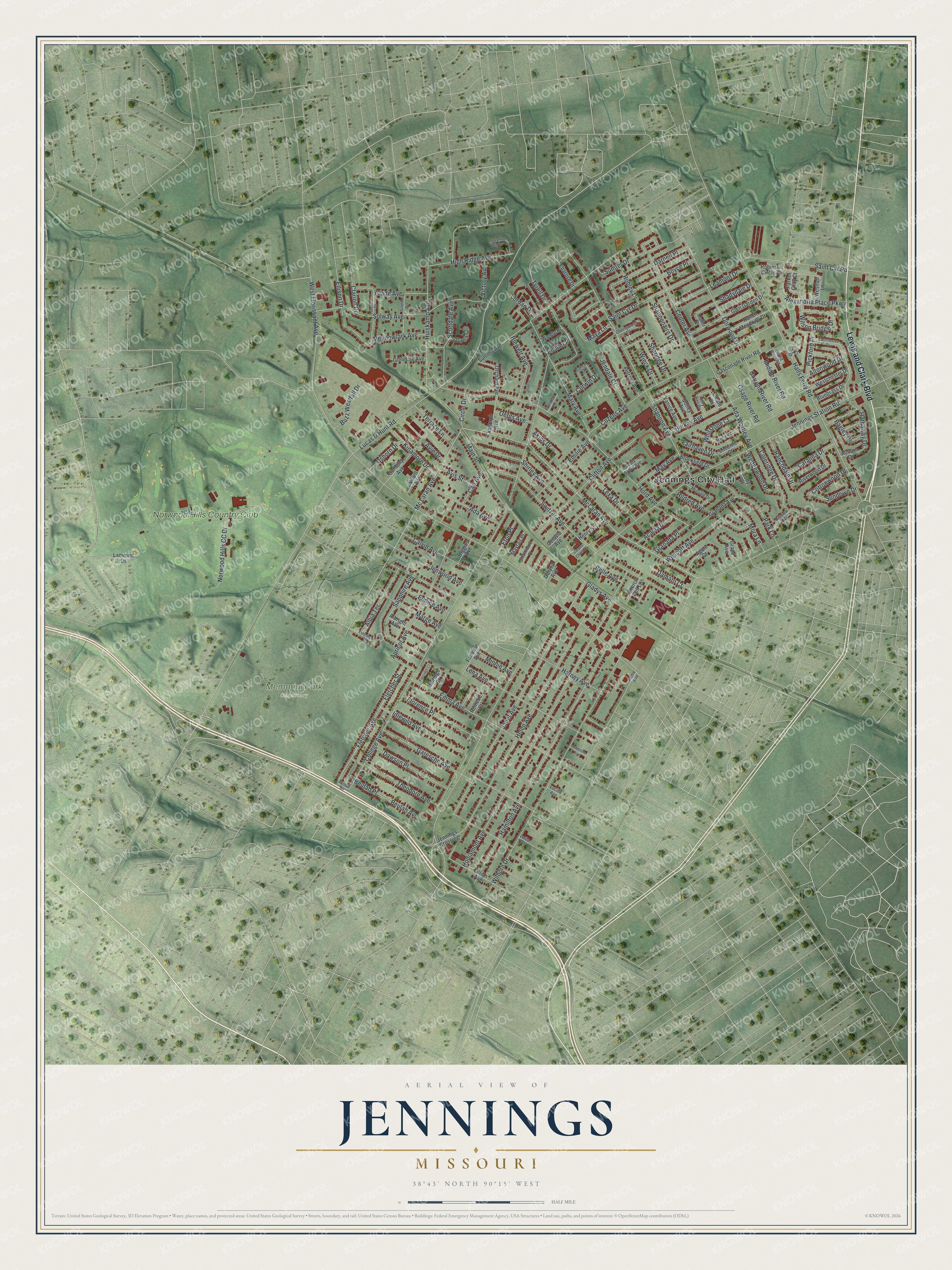
Jennings, Missouri Map Art
Building by building, with labeled streets and shaded relief.
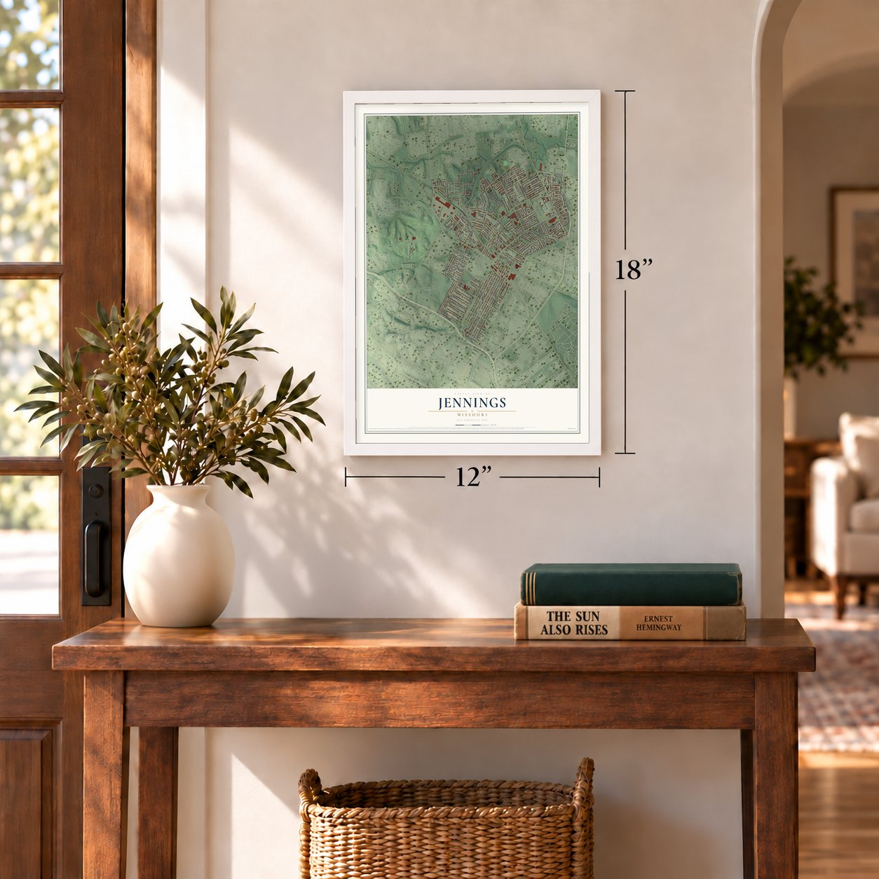
12" x 18" Archival Matte Print
A Map of Home. A Work of Art.
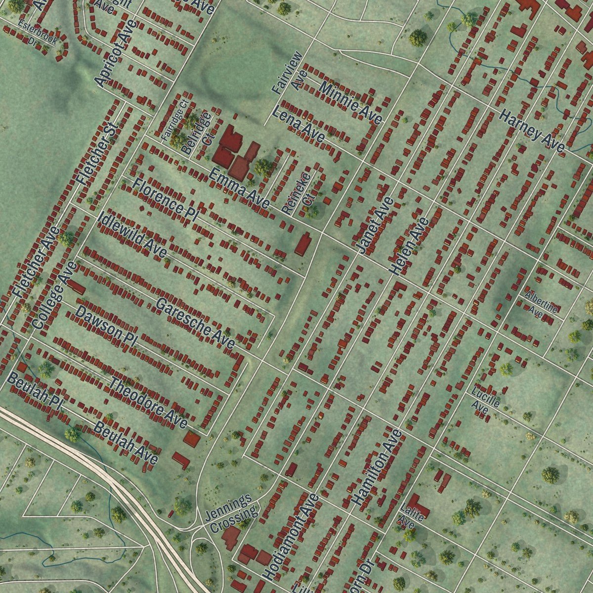
Explore Jennings, Missouri from a whole new perspective. Created using aerial imagery and detailed geographic data, this map captures Jennings building by building, with labeled streets, familiar landmarks, and shaded topographical relief that highlights the natural contours of the landscape.
Combining modern data with the timeless character of a vintage atlas, this map is just as interesting up close as it is beautiful on the wall. Whether you grew up in Jennings, spent memorable years there, or call it home today, this unique map is a great way to celebrate a place that means something to you. Zoom in on the preview to look for your street, and then order a print to put your memories on the wall.
Three ways to hang it
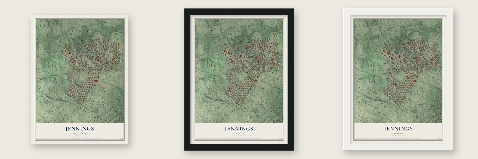
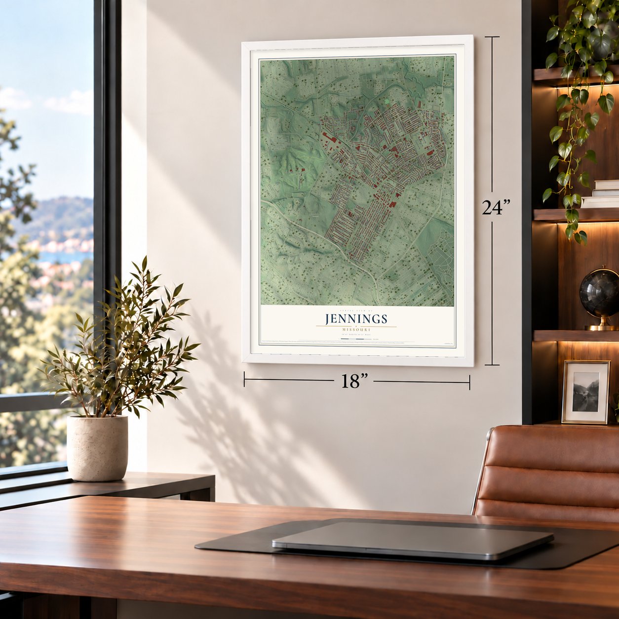
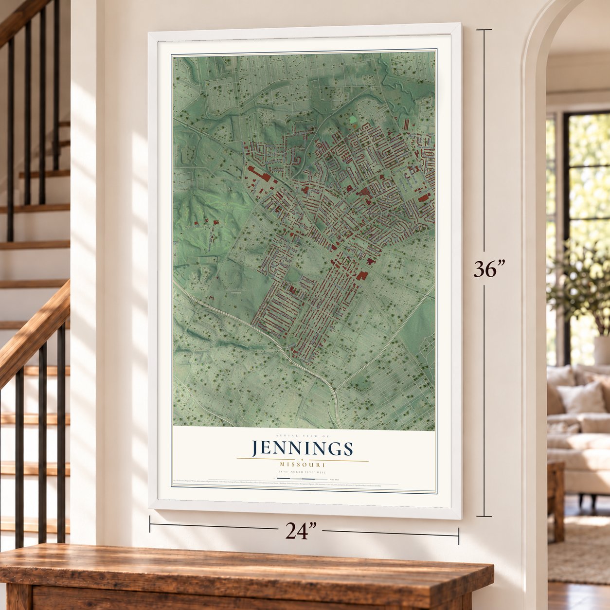
Unframed archival matte, a black wood frame or a white wood frame.
Up close
Geography Worth Displaying
This map was created using accurate cartographic data and authoritative geographic sources, including the U.S. Geological Survey and the Census Bureau. The map brings together terrain, waterways, roads, and building detail. The majority of the streets are labeled, houses are accurately depicted, and the topography is derived from government sources. Combining local data with carefully composed color and shading leads to this beautifully detailed Jennings artwork for your wall.
Rather than simply showing street outlines, we’ve included as many of the street names as we could reasonably fit on the map while keeping their names legible. Zoom in on the high resolution preview to see exactly what’s on the map. We truly set out to create a statement piece for anyone who loves Jennings. So whether it’s for you, or a gift for someone you love, we hope this map of Jennings brings back fond memories.
Read the story behind this map of Jennings, Missouri from 2026.

Find your street
Names on the Jennings map
Every name below is printed on this map. Look for your street, your school, the park where you played, or the pond down the road.
Places and landmarks3
- Jennings City Hall
- Memorial Park Cemetery
- Norwood Hills Country Club
Streets and roads180
- Lewis and Clark Boulevard
- Lucas & Hunt Road
- Granada Place
- Hathaway Drive
- Ranchdale Drive
- Jennings Station Road
- McLaran Avenue
- College Avenue
- Mc Laran Avenue
- West Florissant Avenue
- Hamilton Avenue
- Halls Ferry Road
- Helen Avenue
- Hodiamont Avenue
- Hord Avenue
- Wilborn Drive
- Janet Avenue
- Shannon Avenue
- Switzer Avenue
- Huiskamp Avenue
- Cozens Avenue
- Emma Avenue
- Garesche Avenue
- Solway Avenue
- Theodore Avenue
- Norwood Hills CC Drive
- Harney Avenue
- Lena Avenue
- Apricot Avenue
- Clifton Avenue
Show all 180 streets
- Fletcher Avenue
- Fletcher Street
- Wilson Bridge Drive
- Boyce Place
- Dorwood Drive
- Darnell Place
- Mary Avenue
- Saint Cyr Road
- Center Avenue
- Tyrell Drive
- Sapphire Avenue
- Shirley Avenue
- Alexandria Place Parkway
- Saint Cyr Drive
- Scottdale Avenue
- Coleridge Drive
- Ada Wortley Avenue
- Park Lane
- Idlewild Avenue
- Albia Terrace
- Meadowlark Avenue
- Main Street
- Florence Place
- Hildred Avenue
- High Ridge Avenue
- Dawson Place
- Leamont Drive
- Middle River Road
- Ada Avenue
- Maya Lane
- Emilie Avenue
- Glade Avenue
- Sumter Drive
- Marge Avenue
- Beulah Avenue
- Beulah Place
- Sharidge Drive
- Calvin Avenue
- Shannonaire Drive
- Berkay Avenue
- Wescott Avenue
- Blewett Avenue
- Kinamore Drive
- Shadydale Drive
- Carl Avenue
- Current River Road
- Osage River Road
- Gladys Avenue
- Minnie Avenue
- Jenwood Avenue
- Lexa Drive
- Buzz Westfall Drive
- Wedgewood Drive
- Catalina Drive
- Terrace Lane
- Robley Drive
- Mora Lane
- Jendale Court
- May Avenue
- Akins Drive
- Sundown Drive
- Altonwood Drive
- Pickford Place
- Wieck Drive
- Fairhaven Drive
- Eunice Avenue
- Whitstone Court
- Acacia Drive
- Cottonwood Drive
- Ellison Drive
- Victory Avenue
- Damato Court
- Bagley Drive
- Oepts Avenue
- Circle Drive
- Avis Street
- Lordan Drive
- Corwin Drive
- Osborn Drive
- Belle Avenue
- Clarion Drive
- Eton Place
- Avie Drive
- Eichler Place
- Agate Court
- Glen Garden Drive
- Ranch Meadows Drive
- Octavia Avenue
- Lillian Avenue
- Riverwood Drive
- Glendale Avenue
- Albright Avenue
- Sunbury Avenue
- Robinson Circle Drive
- Gasconade River Road
- Westfall Lane
- Westchester Drive
- Xograph Avenue
- Granada Avenue
- Summit Avenue
- Bluegrass Drive
- Fairview Avenue
- Brookfield Drive
- Vanice Avenue
- Willett Avenue
- Petrova Avenue
- Dotley Avenue
- Henry Street
- Orchard Avenue
- Judy Court
- Eltarose Drive
- Church Bell Lane
- Parker Gray Court
- Higgins Avenue
- Auburn Drive
- Mayfair Place
- Grape Avenue
- Lucerne Court
- Darla Court
- Jennings Crossing
- Wiedle Place
- Duryea Avenue
- Reineke Court
- Lammert Lane
- Belridge Court
- Loleate Drive
- Dever Drive
- Murvale Drive
- Lamar Drive
- Fairy Bell Drive
- Dawn Court
- Grand River Road
- Hillview Avenue
- Strathmore Place
- Cherrywood Lane
- Shady Grove Avenue
- Pohlman Lane
- Lucille Avenue
- Hallfer Drive
- Lalite Avenue
- Acme Avenue
- Gillette Avenue
- Mayfield Court
- Savannah Heights Court
- Eastchester Drive
- Fairridge Court
- Esterbrook Drive
- Albertine Avenue
- Corpus Christ Street
- Access Road
Names are listed as they appear on the printed map. Zoom into the product photos to find them.
About Jennings, Missouri
Jennings is a city of 12,895 people in St. Louis County, Missouri. It carries the name of James Jennings, a Virginia farmer and merchant who settled here in 1839, bringing his family and the people he held as slaves. In 1855 a railway was laid straight across his land, splitting the original Jennings property in two.
A post office named Jennings opened in 1876 in the northeast part of Central Township, and it served the area until 1904. The community grew fast during the boom that followed World War II, and in 1946 Jennings was incorporated as a city.
- Dry plates from 1883The Seed Dry Plate Company, founded in 1883, appears to be the first business that got its start in Jennings. Eastman Kodak later bought the company, and around 1911 its work moved away to Rochester, New York.
- The Seed Carriage HouseThe Miles A. Seed Carriage House stands behind 2456 Hord Avenue. Carriage houses like it sheltered a family's buggy and horses, and this one joined the National Register in 1987.
- New police and fire serviceIn 2011 Jennings disbanded its own police department over corruption that included missing money, and the city now contracts with the St. Louis County Police Department. Its fire department joined the Riverview Fire Protection District in 2014, and that district was renamed North County Fire & Rescue in 2019.
Keep exploring Missouri
Jennings is one of 1,207 Missouri towns we've mapped. Every dot on the map is a print of its own.
The search covers every state, Missouri first.
Near Jennings
Order 2 or more town maps and save 10%. Shown in the size and finish you picked above, so they hang as a set.
- Flordell Hills 12" x 18" / Archival Matte Print $39.99
- Country Club Hills 12" x 18" / Archival Matte Print $39.99
- North Pointe 12" x 18" / Archival Matte Print $39.99
More maps nearby: Walnut Park West, Norwood Court, Northwoods, Baden and Pasadena Hills.
The art of mapping a place
How This Map Was Made
Real places. Remarkable detail. Discover the layers that turn geographic data into a map of home.

The view from above
Aerial imagery reveals the character of the land: woodland, open fields, and the patterns of a place.

The shape of the land
Elevation data brings hills, valleys, and subtle changes in the landscape into view.

The details of home
Roads, waterways, and building footprints come together to make the map feel unmistakably local.

Geography becomes art
Considered color, shading, and typography bring the layers together in a map made for your wall.


Process illustrated with Mendon, Massachusetts. Aerial imagery: USDA NAIP. Terrain: USGS 3D Elevation Program. Map details and finished artwork: KNOWOL.
The Details
About This Print
Choose an archival matte print, or a black or white Ayous wood frame. The archival matte print is unframed.
Select your size and finish above to see the matching product image and price.
Materials & Craftsmanship
A contemporary map with the character of a classic atlas, printed on archival matte paper. Optional frames are made from Ayous wood.
Your printed map does not include the watermark shown in the full-map preview.
Shipping & Delivery
Free shipping within the United States. Every print is made to order in the USA.
Buying a gift? Add a note in your cart and we'll include it. We never put prices in the package.
Prints ship within 2 to 3 business days. Allow 7 to 10 days total from ordering for delivery. Timing may vary during holidays or periods of high order volume.
Read our shipping policy.
Returns and damaged prints
Each print is made to order. Change-of-mind refunds are not available after production.
If your print arrives damaged, misprinted or incorrect, contact support@knowol.com within 30 days of receiving it. Include your order number, photos and a description of the issue.
Read our full refund and replacement policy. For questions about your order, email support@knowol.com.