
Search for another town




Free U.S. delivery 7 to 10 days after you order
Kingman, Arizona Map Art
Building by building, with labeled streets and shaded relief.
12" x 18" Archival Matte Print
A Map of Home. A Work of Art.
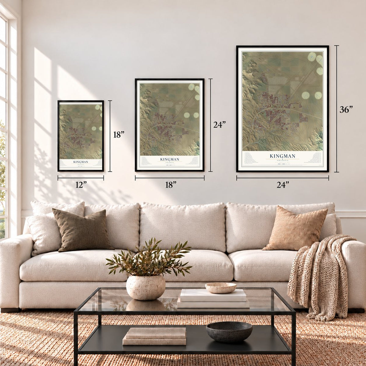
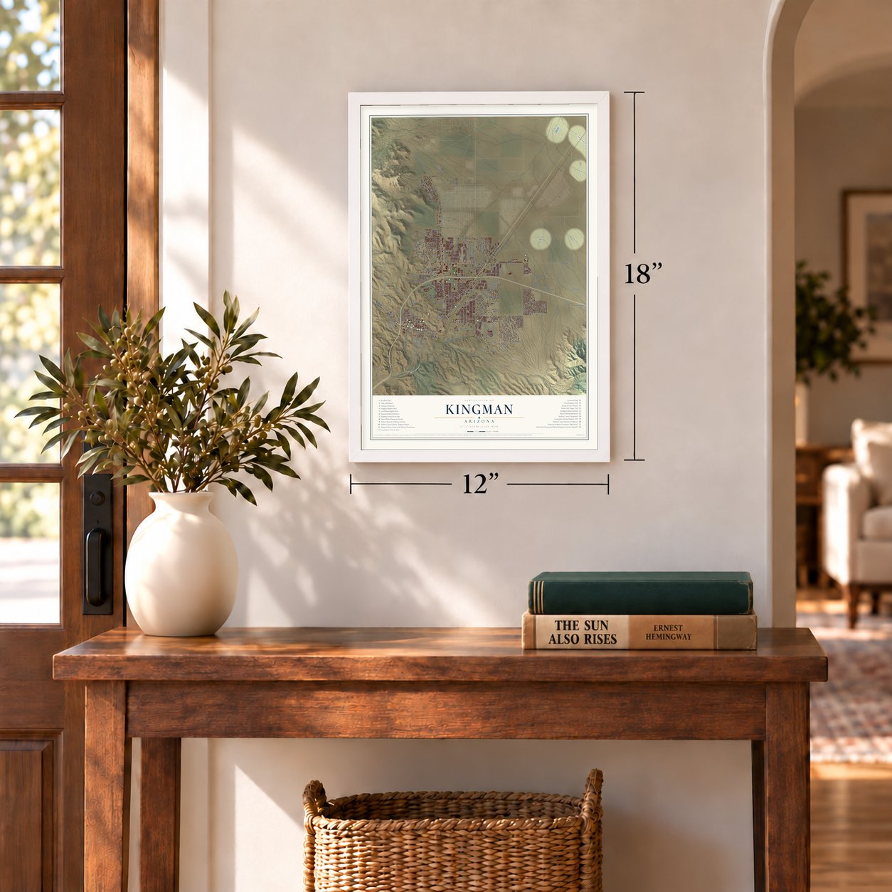
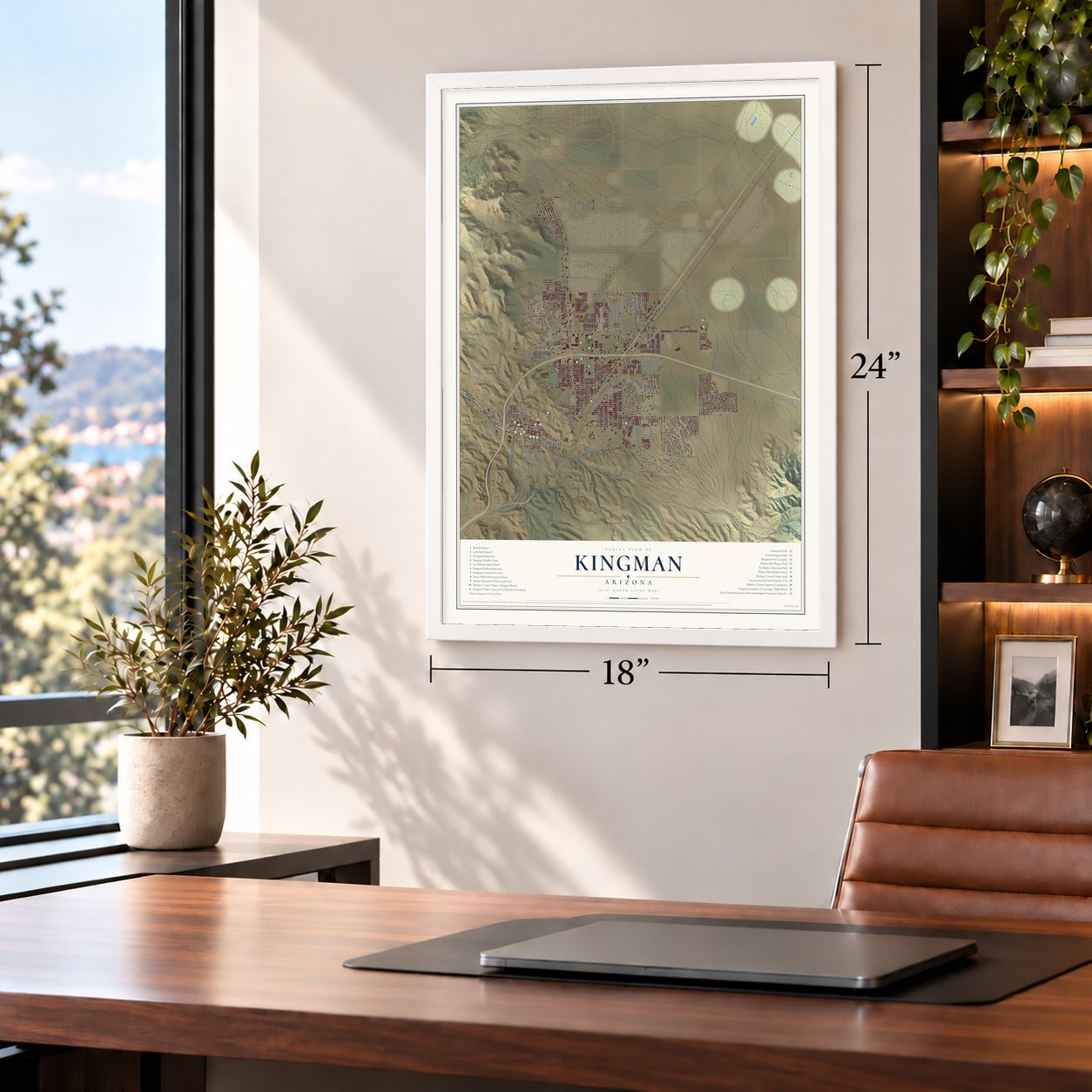
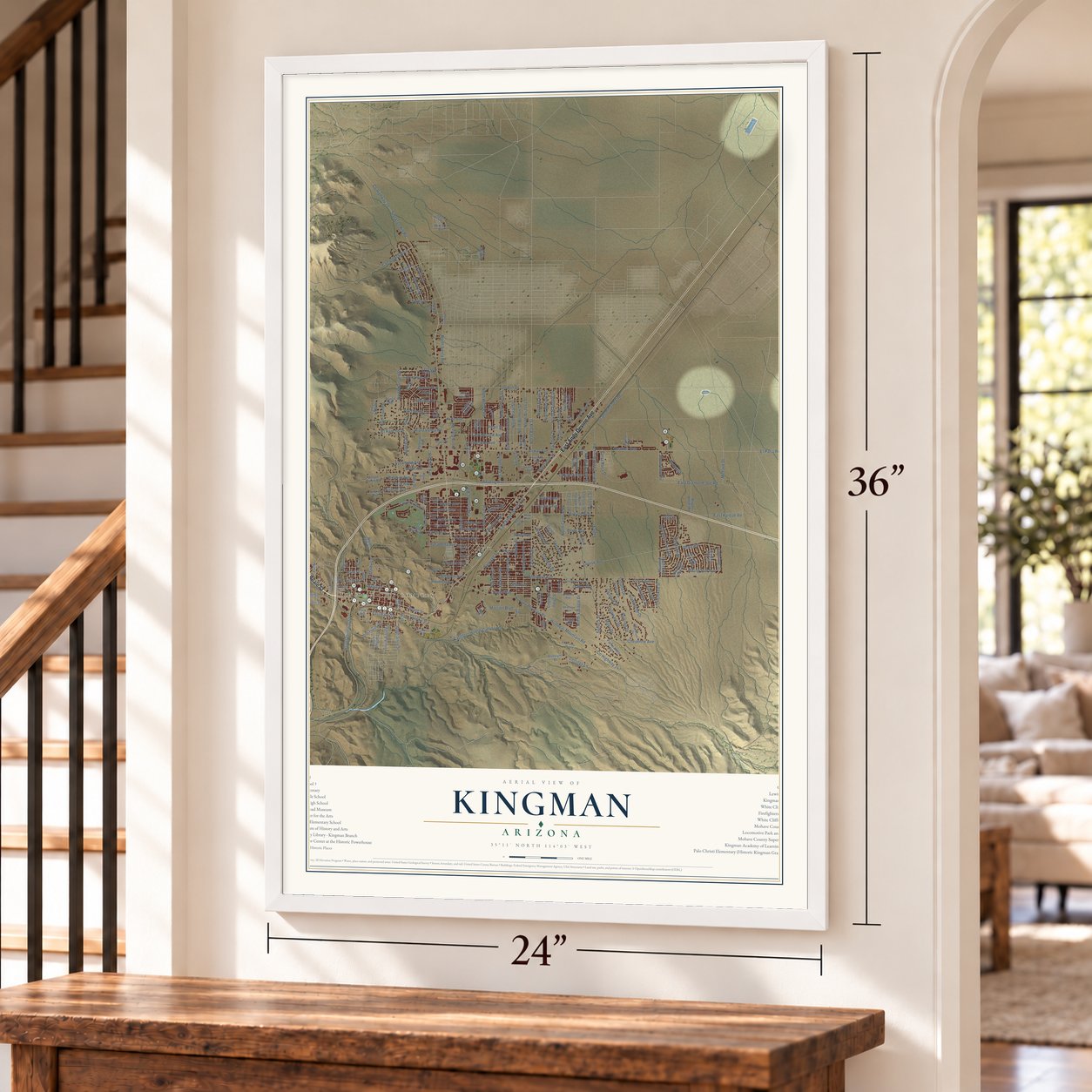
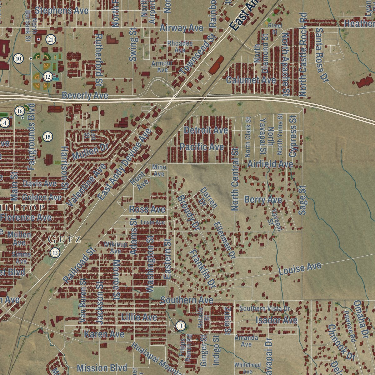
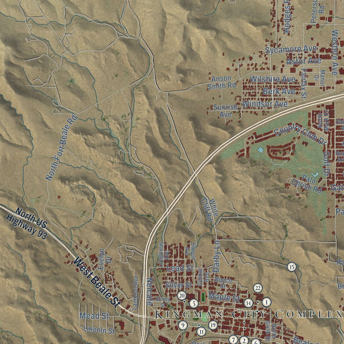
Explore Kingman, Arizona from a whole new perspective. Created using aerial imagery and detailed geographic data, this map captures Kingman building by building, with labeled streets, familiar landmarks, and shaded topographical relief that highlights the natural contours of the landscape.
Combining modern data with the timeless character of a vintage atlas, this map is just as interesting up close as it is beautiful on the wall. Whether you grew up in Kingman, spent memorable years there, or call it home today, this unique map is a great way to celebrate a place that means something to you. Zoom in on the preview to look for your street, and then order a print to put your memories on the wall.

Three ways to hang it
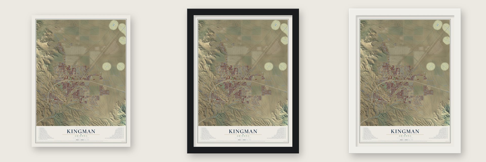
Unframed archival matte, a black wood frame or a white wood frame.
Up close
Geography Worth Displaying
This map was created using accurate cartographic data and authoritative geographic sources, including the U.S. Geological Survey (USGS) and FEMA. The map brings together terrain, waterways, roads, and building detail. The majority of the streets are labeled, houses are accurately depicted, and the topography is derived from government sources. Combining local data with carefully composed color and shading leads to this beautifully detailed Kingman artwork for your wall.
Rather than simply showing street outlines, we’ve included as many of the street names as we could reasonably fit on the map while keeping their names legible. Zoom in on the high resolution preview to see exactly what’s on the map. We truly set out to create a statement piece for anyone who loves Kingman. So whether it’s for you, or a gift for someone you love, we hope this map of Kingman brings back fond memories.
Explore the full map of Kingman, Arizona and read about the local places it shows.

Find your street
Names on the Kingman map
Every name below is printed on this map. Look for your street, your school, the park where you played, or the pond down the road.
Places and landmarks3
- Kingman City Complex
- Hilltop
- Getz
Streets and roads230
- East Andy Devine Avenue
- West Beale Street
- North Bank Street
- Mohave Drive
- Hst US Highway 66
- Gordon Drive
- Railroad Street
- El Paso Road
- East Park Street
- Airway Avenue
- East Diamond Joe Road
- Mission Boulevard
- Topeka Street
- El Camino Drive
- Sioux Avenue
- Hualapai Mountain Road
- Stockton Hill Road
- Louise Avenue
- Southern Avenue
- Kino Avenue
- Beverly Avenue
- Western Avenue
- Airfield Avenue
- Eastern Street
- Pasadena Avenue
- Detroit Avenue
- County Highway 147
- North Central Street
- North Harvard Street
- Harrison Street
Show all 230 streets
- North Roosevelt Street
- Karen Avenue
- North Castle Rock Road
- Pacific Avenue
- Windsor Avenue
- North Fort Beale Road
- Washington Street
- North Yavapai Drive
- East Morrow Avenue
- Slaughter House Canyon Road
- Fairgrounds Boulevard
- County Highway 20
- Transmission Line
- Main Street
- North Prescott Street
- North Sierra Road
- Adams Street
- Gates Avenue
- Seneca Street
- North Apache Street
- Omaha Drive
- Beale Street
- North Evans Street
- Sycamore Avenue
- Calumet Avenue
- East Kaibab Road
- Stephens Avenue
- Pawnee Drive
- Cherokee Street
- North Irving Street
- North Willow Road
- North Arizona Street
- North Benton Street
- Sage Street
- North Pinal Street
- Pearl Street
- North Rainbow Drive
- Rainbow Drive
- Riata Valley Road
- Comanche Drive
- Cheyenne Avenue
- Country Club Drive
- Rawhide Drive
- Old Trails Road
- Scotty Drive
- Miami Avenue
- North Melody Street
- Cypress Street
- Club Avenue
- Motor Avenue
- Florence Avenue
- Cerritos Lane
- Jackson Street
- Steinke Drive
- Pinto Road
- Santa Rosa Drive
- Mountain Trail Road
- Heather Avenue
- Christy Drive
- Wilshire Avenue
- Delaware Drive
- Rutherford Street
- Lillie Avenue
- Monroe Street
- North Glen Road
- Broudy Drive
- Astor Avenue
- Atlantic Avenue
- Franklin Drive
- South Fifth Street
- Isador Avenue
- Roma Road
- Maple Street
- East Siesta
- South Sixth Street
- Berk Avenue
- Rising Sun Avenue
- Valentine Avenue
- Ross Avenue
- Camelback Boulevard
- Johnson Avenue
- Townsend Street
- El Rancho Drive
- Gordon Way
- Lead Street
- Chinook Drive
- Hodges Road
- Palo Verde Drive
- Berry Avenue
- Swing Street
- Hillcrest Drive
- Seminole Drive
- Nelcafe
- Sunset Boulevard
- Selma Drive
- Maya Drive
- Golf Drive
- Darby Lane
- Mullen Drive
- Mead Street
- North US Highway 93
- Ranch Road
- Cerbat Vista Drive
- Park Street
- Win-Win Avenue
- North Eagle Rock Road
- North Diamond Street
- Sunshine Drive
- Sunrise Avenue
- North Fourth Street
- Davis Avenue
- Diamond Spur Street
- Packsaddle Road
- Golden Avenue
- North Yavapai Street
- Rosslynn Drive
- Ellerman Drive
- Lastrada Di Ricca
- Walleck Ranch Drive
- Anson Smith Road
- Broken Arrow Street
- Broadway Avenue
- Pueblo Drive
- Jagerson Avenue
- North Airport Street
- Van Buren Street
- Canyon Hills Road
- North Bond Street
- Palo Christi Road
- Running Iron Street
- South Third Street
- Wagon Wheel Road
- Silver Street
- Monte Moro Road
- Evelyn Drive
- Fairfax Street
- Mustang Springs Road
- Arnold Road
- Cty Highway 245
- Sandstone Street
- Darren Drive
- White Cliff Road
- Plaza Drive
- Pico Street
- Peterson Road
- Lyons Road
- Rex Allen Drive
- Lincoln Street
- College Trail
- Mesa Drive
- Duvall Avenue
- Ginger Street
- Indigo Street
- Mullen Avenue
- Zubia Street
- Steel Avenue
- Hunt Avenue
- Park Avenue
- Natalie Street
- Simms Avenue
- Pawnee Road
- North Yuma Street
- North Burbank Street
- Chicago Avenue
- North Sixth Street
- North Clark Street
- Hope Avenue
- Wikieup Avenue
- Rhoades Avenue
- Southern Vista Drive
- Cantle Drive
- Armour Avenue
- Lampton Avenue
- Blackfoot Drive
- Manor Drive
- Fripps Ranch Road
- North Mark Drive
- Beech Street
- Legacy Drive
- Hillside Drive
- Yavapai Street
- Amanda Avenue
- Longview Avenue
- Buchanan Street
- Quarter Circle Avenue
- Red Hill Drive
- Cerbat Avenue
- Viper Drive
- Mine Avenue
- King Avenue
- Leo Street
- Whitehead Avenue
- Spring Street
- Lovin Avenue
- Eagle View Road
- Rio Grande Avenue
- Buena Vista Drive
- North Sierra Circle
- Rimel Street
- Hibbert Avenue
Names are listed as they appear on the printed map. Zoom into the product photos to find them.
About Kingman, Arizona
Kingman is a city of 32,689 people and the seat of Mohave County, set in the Hualapai Valley with the Cerbat Mountains on one side and the Hualapai Mountains on the other. Native Americans drew water from Beale Spring, called Ha'a kumawe' in Hualapai, for centuries. In 1857 Lt. Edward Fitzgerald Beale, a Navy officer on loan to the Army's topographical engineers, mapped out a government wagon road along the 35th parallel through this valley. He came back in 1859 to build it, with orders to try out camels as pack animals.
The railroad followed Beale's route. Lewis Kingman, a civil engineer for the Atlantic and Pacific line, surveyed and built its tracks through here in 1880, and in 1882 a siding near Beale Springs became the town that carries his name. The county seat had already wandered from Mohave City, its home from 1864 to 1867, to Hardyville, to the mining town of Cerbat in 1873 and then to Mineral Park. In 1887 the county records came to Kingman to stay.
- A World War II gunnery schoolThe Kingman Army Airfield opened early in the war as a base for aerial gunnery training, and it grew into one of the Army Air Forces' largest. About 35,000 soldiers and airmen learned their trade there. After the war, rows of outdated warplanes were brought to the field to be scrapped. Mohave County took it over for civilian use in 1949, and today it is the Kingman Airport, where planes are parked for long-term storage.
- The 1907 Santa Fe depotIn 1907 the Santa Fe railway put up its Kingman depot, a Spanish Colonial Revival building with curved gables on its roofline. Before Amtrak's start in 1971, the depot had decayed badly. Workers finished restoring it top to bottom in 2010, and it now holds Amtrak's waiting room and a railroad museum. The depot anchors the Kingman Commercial Historic District, which also takes in the Beale Hotel and joined the National Register in 1986.
- Andy Devine's voiceAndy Devine grew up in Kingman and acted in more than 400 films, among them Stagecoach with John Wayne. He claimed his raspy voice came from falling with a curtain rod in his mouth at the Beale Hotel as a boy, though a biographer called that one of several stories he invented. An exhibit on him is part of the Mohave Museum of History and Arts, which dates to 1961.
- A Hollywood wedding in 1939Clark Gable and Carole Lombard took time away from the filming of Gone with the Wind to marry in Kingman in 1939. The ceremony was held in the rectory of Kingman's Saint John's Methodist Episcopal Church.
- Eleven firefighters lost in 1973On July 5, 1973, workers were moving propane from a Doxol railroad car into a storage tank on the Getz siding near Andy Devine Avenue when the car blew apart in a huge explosion and fire. The blast is remembered as the Doxol Disaster. Firefighters Memorial Park in Kingman honors the 11 firefighters who died fighting it.
Keep exploring Arizona
Kingman is one of 519 Arizona towns we've mapped. Every dot on the map is a print of its own.
The search covers every state, Arizona first.
Near Kingman
Order 2 or more town maps and save 10%. Shown in the size and finish you picked above, so they hang as a set.
- New Kingman-Butler 12" x 18" / Archival Matte Print $39.99
- Clacks Canyon 12" x 18" / Archival Matte Print $39.99
- McConnico 12" x 18" / Archival Matte Print $39.99


More maps nearby: Lazy Y U, Pinion Pines, So-Hi, Walnut Creek and Pine Lake.
The art of mapping a place
How This Map Was Made
Real places. Remarkable detail. Discover the layers that turn geographic data into a map of home.

The view from above
Aerial imagery reveals the character of the land: woodland, open fields, and the patterns of a place.

The shape of the land
Elevation data brings hills, valleys, and subtle changes in the landscape into view.

The details of home
Roads, waterways, and building footprints come together to make the map feel unmistakably local.

Geography becomes art
Considered color, shading, and typography bring the layers together in a map made for your wall.


Process illustrated with Mendon, Massachusetts. Aerial imagery: USDA NAIP. Terrain: USGS 3D Elevation Program. Map details and finished artwork: KNOWOL.
The Details
About This Print
Choose an archival matte print, or a black or white Ayous wood frame. The archival matte print is unframed.
Select your size and finish above to see the matching product image and price.
Materials & Craftsmanship
A contemporary map with the character of a classic atlas, printed on archival matte paper. Optional frames are made from Ayous wood.
Your printed map does not include the watermark shown in the full-map preview.
Shipping & Delivery
Free shipping within the United States. Every print is made to order in the USA.
Buying a gift? Add a note in your cart and we'll include it. We never put prices in the package.
Prints ship within 2 to 3 business days. Allow 7 to 10 days total from ordering for delivery. Timing may vary during holidays or periods of high order volume.
Read our shipping policy.
Returns and damaged prints
Each print is made to order. Change-of-mind refunds are not available after production.
If your print arrives damaged, misprinted or incorrect, contact support@knowol.com within 30 days of receiving it. Include your order number, photos and a description of the issue.
Read our full refund and replacement policy. For questions about your order, email support@knowol.com.