
Search for another town




Free U.S. delivery 7 to 10 days after you order
Kings Park, New York Map Art
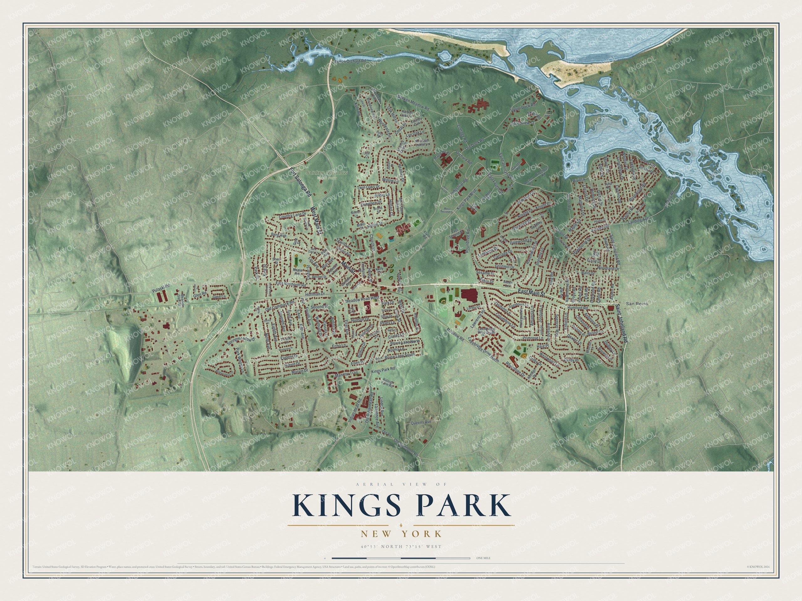
A new map of Kings Park, New York, made in 2026 and printed to order on thick archival matte paper.
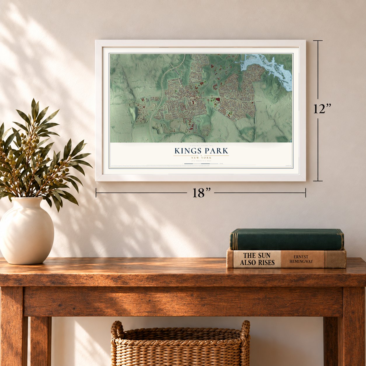
12" x 18" Archival Matte Print
A Map of Home. A Work of Art.
Bring a piece of Kings Park home. Whether it’s where you grew up, your current home, or simply a moment in your life, this Kings Park, New York map print brings those memories to your wall. Antique-inspired styling and modern geographic detail combine to create artwork that’s beautiful from across the room, with plenty to study and explore when you get up close.
Three ways to hang it
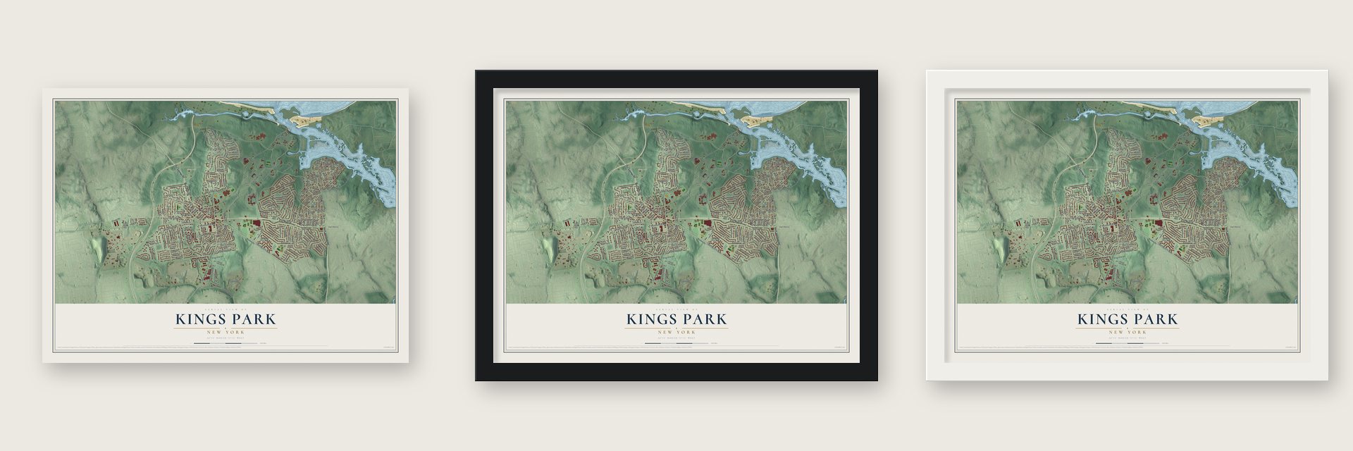
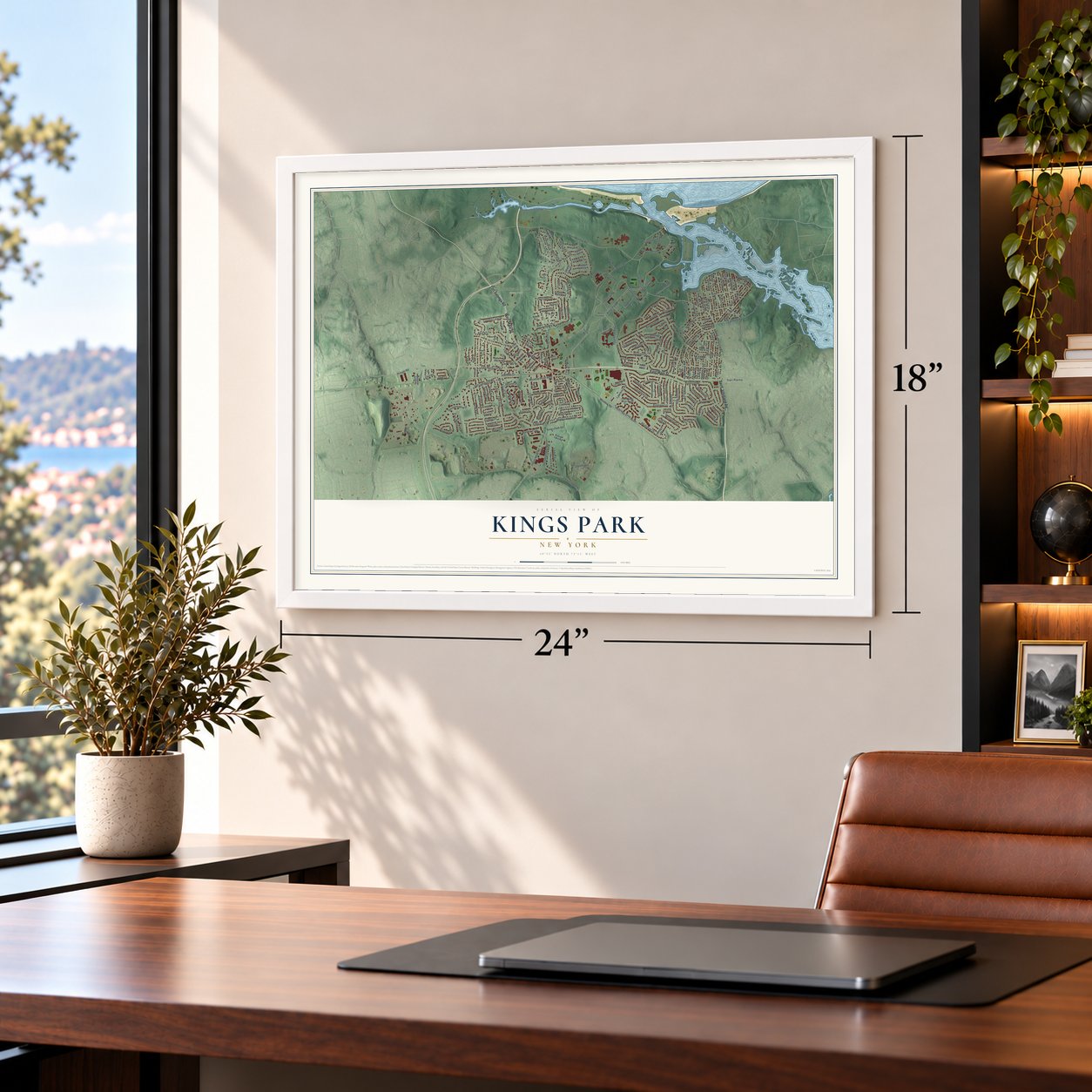
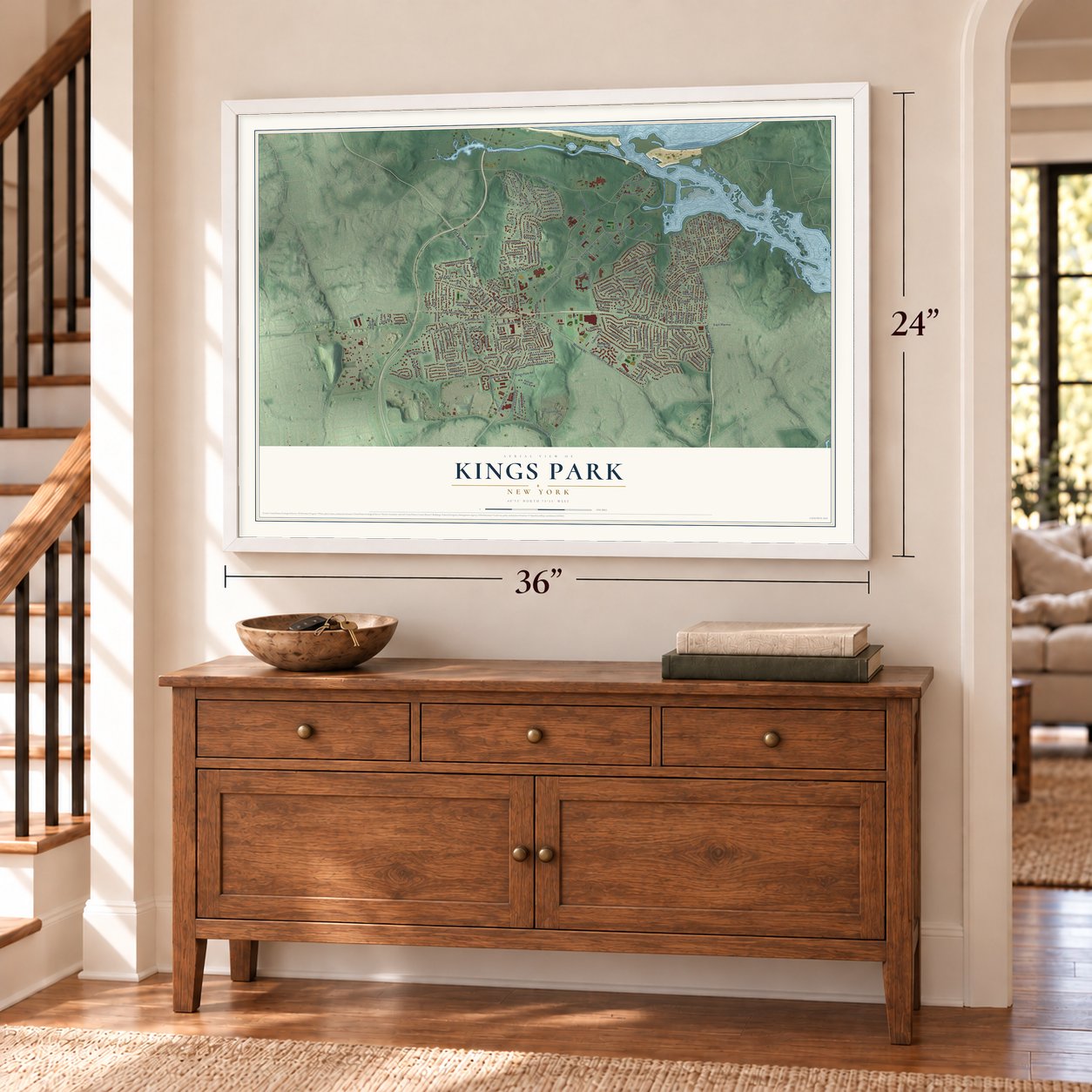
Unframed archival matte, a black wood frame or a white wood frame.
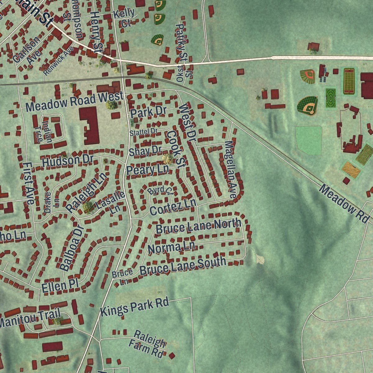
Up close
Real geography. Art worth displaying.
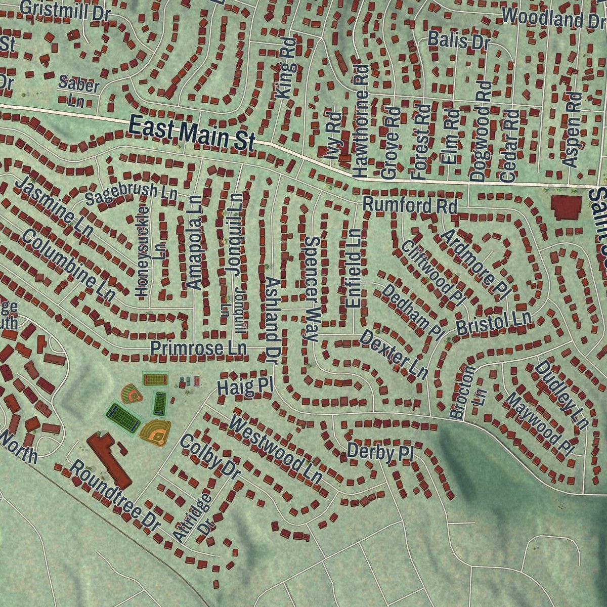
This map was created using accurate cartographic data and authoritative geographic sources, including the U.S. Geological Survey (USGS) and FEMA. The map brings together terrain, waterways, roads, and building detail. The majority of the streets are labeled, houses are accurately depicted, and the topography is derived from government sources. Combining local data with carefully composed color and shading leads to this beautifully detailed Kings Park artwork for your wall.
Rather than simply showing street outlines, we’ve included as many of the street names as we could reasonably fit on the map while keeping their names legible. Zoom in on the high resolution preview to see exactly what’s on the map. We truly set out to create a statement piece for anyone who loves Kings Park. So whether it’s for you, or a gift for someone you love, we hope this map of Kings Park brings back fond memories.
Explore the full map of Kings Park, New York and read about the local places it shows.

Find your street
Names on the Kings Park map
Every name below is printed on this map. Look for your street, your school, the park where you played, or the pond down the road.
Places and landmarks2
- Sunken Meadow State Park
- San Remo
Streets and roads233
- East Main Street
- Saint Johnland Road
- Main Street
- West Main Street
- Fort Salonga Road
- Indian Head Road
- Hilden Street
- Church Street
- Hobart Court
- Kings Park Boulevard
- Woodvale Lane
- Cedar Place
- Lawrence Road
- Lakebridge Drive North
- Old Indianhead Road
- Fifth Avenue
- Pulaski Road
- Bruce Lane North
- East Fourth Street
- Old Northport Road
- Old Dock Road
- Kohr Road
- Sunken Meadow Road
- Boxwood Drive
- Rumford Road
- Twin Oaks Drive
- Old Commack Road
- Birch Road
- Ashland Drive
- Kings Park Road
Show all 233 streets
- East Northport Road
- Riviera
- Riviera Drive
- Juniper Road
- Meadow Road
- Hawthorne Drive
- Hawthorne Road
- Marvin Drive
- First Avenue
- Landing Road
- Eugene Drive
- Lou Avenue
- Soundview Court
- Longfellow Drive
- Wartburg Drive
- Primrose Lane
- Hileen Drive
- Ravenwood Drive
- Roundtree Road
- Eighth Avenue
- Alder Drive
- Rosewood Road
- Grove Road
- Columbine Lane
- Walnut Road
- Knight Lane
- Gristmill Drive
- Bowman Lane
- Cedar Road
- Beaver Drive
- Manitou Trail
- Springmeadow Drive
- Lincoln Drive
- Ellen Place
- 5 Avenue
- Cypress Drive
- Woodland Drive
- Spencer Way
- Knight Drive
- Landing Avenue
- Aspen Road
- Orchid Drive
- Dorothy Lane
- Glen Lane
- Carriage Drive
- Ninth Avenue
- Heather Drive
- Whittier Drive
- Field 4 Orchard Road
- Park Woods Lane
- Maple Road
- Cedar Street
- Industrial Road
- Orchard Road
- Westwood Lane
- Country Lane Drive
- Roundtree Drive
- Colby Drive
- Bruce Lane South
- Haig Place
- Bristol Lane
- Balboa Drive
- King Street
- Jasmine Lane
- West Drive
- Berg Avenue
- Amapola Lane
- Linden Avenue
- Forest Road
- Jonquil Lane
- Hemlock Drive
- Lakeview Drive
- Upper Dock Road
- Lawrence Avenue
- Oak Hill Lane
- King Road
- Locust Drive
- Magnolia Drive
- Meadow Road West
- Sixth Avenue
- Derby Place
- Hudson Drive
- Fourth Avenue
- Queens Avenue
- Cook Street
- Cottage Road
- Norma Lane
- Dudley Lane
- Hoffman Drive
- Robin Lane
- Seventh Avenue
- Fireplace Drive
- Elm Road
- Landview Drive
- Dogwood Road
- Ardmore Place
- Dalewood Lane
- Enfield Lane
- Park Street
- Queen Road
- Cortez Lane
- Dexter Lane
- Lyn Oak Lane
- Raleigh Lane
- Balis Drive
- Henry Street
- Violet Road
- Daisy Drive
- Echo Lane
- Willow Lane
- Second Street
- Sesame Street
- Terrill Lane
- Saber Drive
- Peary Lane
- Ardito Avenue
- Burr Avenue
- Shore Road
- Glen Road
- Park Drive
- Ivy Road
- Woodvale Avenue
- Maple Hill Road
- East Second Street
- Lakebridge Drive South
- Tulip Road
- Broadview Avenue
- Magellan Avenue
- Student Road
- Old Road
- Brocton Lane
- Raleigh Farm Road
- Directors Road
- Cliftwood Place
- Black Gum Tree Lane
- Sagebrush Lane
- Maywood Place
- Mountain Laurel Lane
- Meadow Glen Road
- Park Avenue
- Cassata Court
- Honeysuckle Lane
- Harbor Oaks Drive
- Thistle Lane
- Country Oaks Drive
- Brand Street
- Dedham Place
- Dawson Avenue
- Collins Avenue
- Carlson Avenue
- Bennet Street
- Arbutus Drive
- Attridge Drive
- Lordly Court
- Lasalle Lane
- Thompson Street
- Maple Avenue
- Shay Drive
- Garage Road
- Patiky Street
- Geoffrey Lane
- Country Oaks
- Bralo Court
- Pine Road
- Jason Court
- Leaf Court
- Gilmer Lane
- 4 Avenue
- Flynn Road
- Short Street
- Gold Street
- Saber Lane
- Kelly Court
- Valley Road
- West Second Street
- Winnecomac Circle
- Jonquill Lane
- Indian Trce
- Acacia Road
- Bruce Lane
- Drake Lane
- Fourth Street
- Delano Lane
- Byrd Court
- East Third Street
- New Dairy Lane
- Mariner Road
- Phyllis Court
- Jenna Court
- Ann Court
- Okst Street
- West Third Street
- Renwick Avenue
- Cedar Street North
- Coach Drive
- Sea View Court
- Mapleview Place
- Johnson Avenue North
- Stattel Drive
- Cedar Drive
- Lumber Drive
- Shirley Place
- Yale Lane
Names are listed as they appear on the printed map. Zoom into the product photos to find them.
The art of mapping a place
How This Map Was Made
Real places. Remarkable detail. Discover the layers that turn geographic data into a map of home.

The view from above
Aerial imagery reveals the character of the land: woodland, open fields, and the patterns of a place.

The shape of the land
Elevation data brings hills, valleys, and subtle changes in the landscape into view.

The details of home
Roads, waterways, and building footprints come together to make the map feel unmistakably local.

Geography becomes art
Considered color, shading, and typography bring the layers together in a map made for your wall.


Process illustrated with Mendon, Massachusetts. Aerial imagery: USDA NAIP. Terrain: USGS 3D Elevation Program. Map details and finished artwork: KNOWOL.
The Details
About This Print
Choose an archival matte print, or a black or white Ayous wood frame. The archival matte print is unframed.
Select your size and finish above to see the matching product image and price.
Materials & Craftsmanship
A contemporary map with the character of a classic atlas, printed on archival matte paper. Optional frames are made from Ayous wood.
Your printed map does not include the watermark shown in the full-map preview.
Shipping & Delivery
Free shipping within the United States. Every print is made to order in the USA.
Buying a gift? Add a note in your cart and we'll include it. We never put prices in the package.
Prints ship within 2 to 3 business days. Allow 7 to 10 days total from ordering for delivery. Timing may vary during holidays or periods of high order volume.
Read our shipping policy.
Returns and damaged prints
Each print is made to order. Change-of-mind refunds are not available after production.
If your print arrives damaged, misprinted or incorrect, contact support@knowol.com within 30 days of receiving it. Include your order number, photos and a description of the issue.
Read our full refund and replacement policy. For questions about your order, email support@knowol.com.
Find your town
Looking for another city?
Find a map of home in our New York collection.
Nearby
Maps of towns near Kings Park
Know someone from one of these towns? Their map makes a great gift.
 Fort Salonga
, New York
From $39.99See the map
 Nissequogue
, New York
From $39.99See the map
 Commack
, New York
From $39.99See the map
More maps nearby: Village of the Branch, East Northport, Smithtown, Head of the Harbor and Hauppauge.