


Search for another town


Free U.S. delivery 7 to 10 days after you order
Kingsport, Tennessee Map Art
Building by building, with labeled streets and shaded relief.
12" x 18" Archival Matte Print
A Map of Home. A Work of Art.
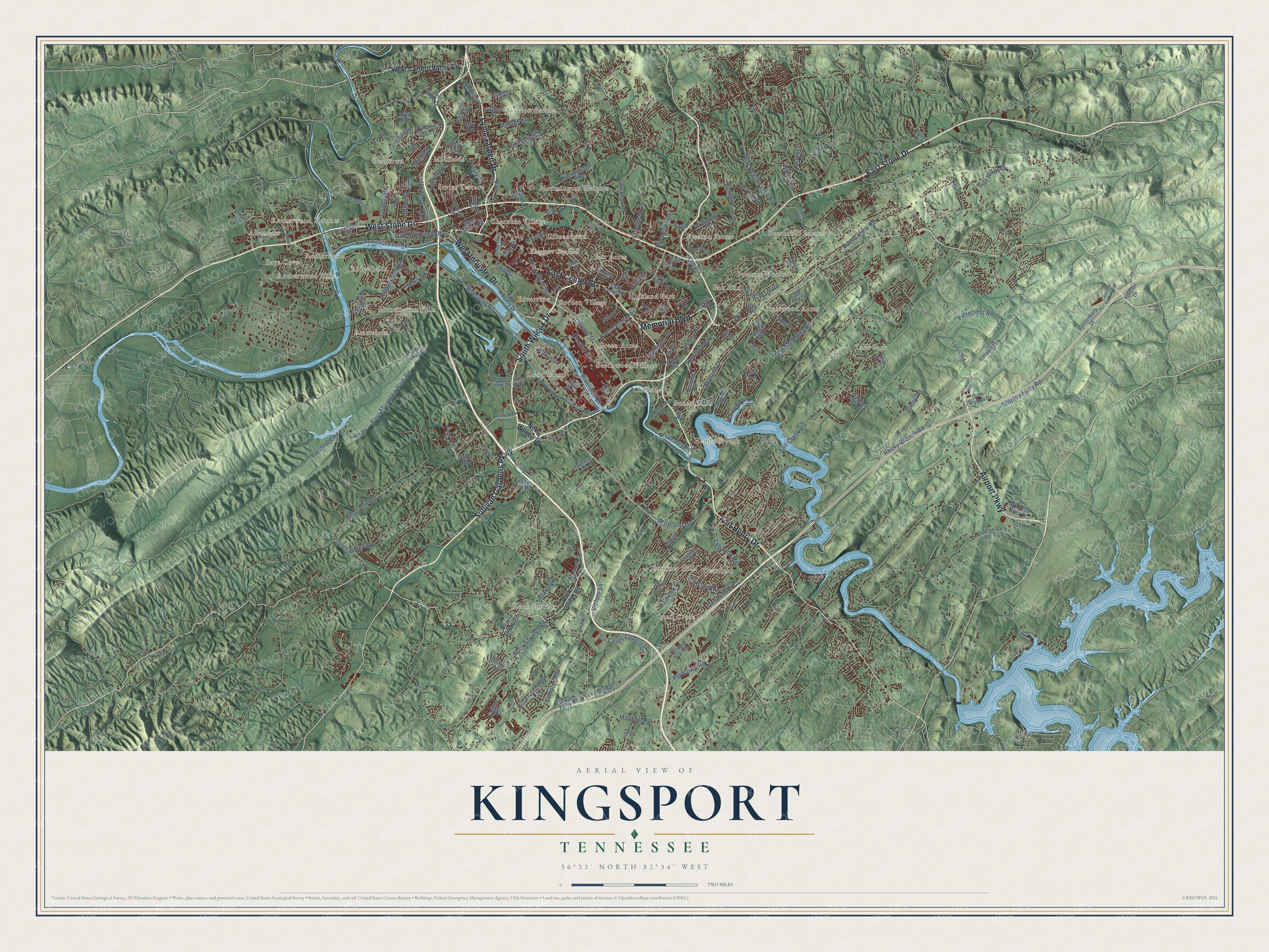
Explore Kingsport, Tennessee from a whole new perspective. Created using aerial imagery and detailed geographic data, this map captures Kingsport building by building, with labeled streets, familiar landmarks, and shaded topographical relief that highlights the natural contours of the landscape.
Combining modern data with the timeless character of a vintage atlas, this map is just as interesting up close as it is beautiful on the wall. Whether you grew up in Kingsport, spent memorable years there, or call it home today, this unique map is a great way to celebrate a place that means something to you. Zoom in on the preview to look for your street, and then order a print to put your memories on the wall.
Three ways to hang it

Unframed archival matte, a black wood frame or a white wood frame.
Up close
Geography Worth Displaying
This map was created using accurate cartographic data and authoritative geographic sources, including the U.S. Geological Survey and the Census Bureau. The map brings together terrain, waterways, roads, and building detail. The majority of the streets are labeled, houses are accurately depicted, and the topography is derived from government sources. Combining local data with carefully composed color and shading leads to this beautifully detailed Kingsport artwork for your wall.
Rather than simply showing street outlines, we’ve included as many of the street names as we could reasonably fit on the map while keeping their names legible. Zoom in on the high resolution preview to see exactly what’s on the map. We truly set out to create a statement piece for anyone who loves Kingsport. So whether it’s for you, or a gift for someone you love, we hope this map of Kingsport brings back fond memories.
Read the story behind this map of Kingsport, Tennessee from 2026.

Find your street
Names on the Kingsport map
Every name below is printed on this map. Look for your street, your school, the park where you played, or the pond down the road.
Places and landmarks37
- Kingsport City Hall
- Rock Springs
- Fox Fire
- Bays Cove
- Lake Park
- Deerfield
- Hemlock Park
- Preston Forest
- Long Island
- Beartown
- Highland Park
- Beechcliff Estates
Show all 37 places
- Bloomington Heights
- Huntington Hills
- Quail Creek
- Green Acres
- Rotherwood Heights
- Sevier Terrace
- Amersham
- Gibsontown
- Riverview
- Skyview Estates
- Preston Woods
- Cliffside
- Borden Village
- Ridgefields
- Cherokee Village
- Rotherwood
- Brairwood Acres
- Fair Acres
- Allandale
- Summer Hills
- Fox Run
- Midfields
- Beechwood Village
- Sunset Hills
- Rotherwood Hills
Streets and roads183
- West Industry Drive
- South Wilcox Drive
- Sullivan Gardens Parkway
- Fort Henry Drive
- Memorial Boulevard
- East Center Street
- East Stone Drive
- West Stone Drive
- Lynn Garden Drive
- Airport Parkway
- Rock Springs Road
- Lincoln Street
- Bays Mountain Park Road
- Cooks Valley Road
- Moreland Drive
- Riverport Road
- Rocky Branch Road
- Fordtown Road
- Granby Road
- Mitchell Road
- Fall Creek Road
- Shipley Ferry Road
- Tri-Cities Crossing
- Skyland Drive
- Lebanon Road
- Blakley Drive
- Ridgefields Road
- New Beason Well Road
- Brookside Drive
- Edens View Road
Show all 183 streets
- Golf Ridge Drive
- Riverside Drive
- Union Street
- Reservoir Road
- Circle Drive
- Lynn Road
- Pinebrook Drive
- Central Avenue
- Fort Robinson Drive
- Manor Drive
- Ashley Street
- Stratford Road
- Warpath Drive
- Barnett Drive
- Mullins Street
- Glen Alpine Road
- Gravely Road
- Oakmont Drive
- Sumpter Road
- Fieldcrest Road
- Afton Street
- Glory Road
- Echo Avenue
- Victory Lane
- Hill Street
- Lowell Drive
- Wesley Road
- Midfield
- Park Street
- Clay Street
- Earl Street
- New Wilcox Drive
- West Carters Valley Road
- Netherland Inn Road
- East Sullivan Street
- West Sullivan Street
- Fairview Avenue
- Lee Street
- Bell Ridge Drive
- North Eastman Road
- Eastern Star Road
- Bloomingdale Pike
- Cox Hollow Road
- Virgil Avenue
- Idle Hour Road
- Hidden Acres Road
- Deneen Lane
- Broad Street
- Linville Street
- Thornton Drive
- Wildwood Drive
- Rivermont Circle
- Buckingham Court
- Cleek Road
- Snapps Ferry Road
- Buchelew Drive
- Stagecoach Road
- Lakeside Drive
- Windridge Drive
- Highpoint Avenue
- Oak Street
- Westwind Drive
- Horse Creek Lane
- Gustavis Avenue
- Bays Ridge Road
- Parker Lane
- Shady View Road
- June Drive
- Truxton Drive
- Catawba Lane
- Millye Street
- Teasel Drive
- Norfolk Place
- Aurawood Drive
- Canterbury Drive
- Warrior Falls Drive
- Radio Tower Road
- Diana Road
- May Avenue
- Rustic Way
- Sam Walton Drive
- Park Drive
- Harbor Circle
- Wallace Alley Street
- Virginia Street
- Harmony Ridge Drive
- Bell Road
- Hall Street
- Lamasa Drive
- Fleenor Drive
- Dunlap Road
- Amy Avenue
- Indian Trail
- Calton Hill
- Welk Road
- Jan Way
- Kite Street
- Poplar Grove Road
- Lewis Lane
- Orebank Road
- Lamont Street
- Clinchfield Street
- Tranbarger Drive
- Chesterfield Drive
- Foothills Road
- Preston Park Drive
- Crown Circle
- Fairmont Avenue
- Suffolk Street
- East Ridge Road
- Reedy Creek Road
- Midland Drive
- Hull Drive
- Ridgeway Road
- Clearwater Drive
- Beechnut Drive
- Duke Street
- Carolina Pottery Drive
- Stapleton Drive
- Riverbend Drive
- Harris Street
- Browder Road
- Berry Street
- Seaver Road
- Clara Drive
- Iris Drive
- 14th Street
- Polk Street
- East Industry Drive
- University Boulevard
- Meadowview Parkway
- Fleetwood Drive
- Enterprise Place
- Willowbrook Trce
- Hemlock Road
- Bridwell Street
- Tidewater Court
- Shadyside Drive
- River Edge Drive
- Ashfield Drive
- Pavilion Drive
- Pickens Road
- Second Street
- Rolling Private Drive
- Virginia Avenue
- Commerce Street
- Old Mill Court
- Colonial View Road
- Bond Drive
- Union Hill Street
- Brook Street
- Cooks Point
- Faye Street
Names are listed as they appear on the printed map. Zoom into the product photos to find them.
About Kingsport, Tennessee
Kingsport is a city of 55,442 people in Sullivan County, where the Holston River's North Fork and South Fork join. In 1787 the place was called Salt Lick, after an ancient mineral lick, and pioneers bound for Kentucky on the Wilderness Road gathered here before setting out. The town was chartered in 1822 and grew into a busy river port, sending barges loaded with goods from the countryside down to Knoxville. Hard times after the Civil War cost Kingsport its charter.
The town stayed a country village until 1909, when the Carolina, Clinchfield and Ohio Railway came through the Holston Valley. George L. Carter of Hillsville, Virginia, who led the railroad, had seen the chance for an industrial city here as early as 1906. Money troubles forced him to sell around 1914 to New York investors John B. Dennis and Blair and Company. Dennis formed the Kingsport Improvement Corporation, with Carter's brother-in-law J. Fred Johnson as its chief promoter, and in 1917 the new city was chartered with one of the first city manager governments.
“Kingsport was the first economically diversified, professionally planned, and privately financed city in twentieth-century America.”
- A two-day stand in 1864In December 1864, Major General George Stoneman led over 5,500 Union troops from Knoxville to strike Virginia's salt works at Saltville, lead works at Wytheville and iron works at Marion. At Kingsport, Colonel Richard Morgan's 300 Confederates held them at the Holston River for nearly two days. Then Union Colonel Samuel Patton's cavalry crossed a ford 2.5 miles north and got behind them. Cold, outnumbered and flanked, Morgan surrendered; 18 died and 84 went to Knoxville as prisoners.
- Named for William KingThe name grew out of King's Port, after King's Boat Yard on the Holston, the head of navigation for the whole Tennessee Valley. William King built the Netherland Inn in 1802 as a boatyard for shipping salt. The Netherland family bought it in 1818 and ran it as an inn and tavern. Now a museum, it joined the National Register in 1969, and a log cabin on its grounds sheltered Daniel Boone and his family from 1773 to 1775.
- The Model City planDennis and Johnson hired John Nolen's firm of Cambridge, Massachusetts, to lay out the city, and Lola Anderson, later Mrs. John B. Dennis, to plan its landscaping and gardens. The plan gave commerce, churches, housing and industry their own districts and saved most of the riverfront for factories. It also gave Kingsport some of the first traffic circles in the United States, and its school system followed a model from Columbia University.
- The Santa Train since 1943In 1943, during World War II, a group of Kingsport businessmen teamed up with the Clinchfield Railroad to lift people's spirits. Their Santa Train still runs each year on the Saturday before Thanksgiving, now operated by CSX. It starts in Kentucky and makes its last stop in Kingsport, and volunteers give children along the way toys, backpacks and winter clothes.
- Hometown of Pal's since 1956Pal's Sudden Service opened its first restaurant in 1956 and is still based in Kingsport. In 2001 it became the first restaurant company to win the Malcolm Baldrige National Quality Award. Its owners, Pal and Sharon Barger, sponsored Pal's Roundhouse, home of the Kingsport Carousel, which 300 local volunteers finished in 2015 on a refurbished 1956 Allan Herschell frame.
Keep exploring Tennessee
Kingsport is one of 640 Tennessee towns we've mapped. Every dot on the map is a print of its own.
The search covers every state, Tennessee first.
Near Kingsport
Order 2 or more town maps and save 10%. Shown in the size and finish you picked above, so they hang as a set.
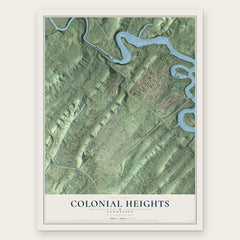
- Colonial Heights 12" x 18" / Archival Matte Print $39.99
- Sullivan Gardens 12" x 18" / Archival Matte Print $39.99
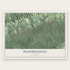
- Bloomingdale 12" x 18" / Archival Matte Print $39.99

More maps nearby: Orebank, Spurgeon, Mount Carmel, Gray and Holston.
The art of mapping a place
How This Map Was Made
Real places. Remarkable detail. Discover the layers that turn geographic data into a map of home.

The view from above
Aerial imagery reveals the character of the land: woodland, open fields, and the patterns of a place.

The shape of the land
Elevation data brings hills, valleys, and subtle changes in the landscape into view.

The details of home
Roads, waterways, and building footprints come together to make the map feel unmistakably local.

Geography becomes art
Considered color, shading, and typography bring the layers together in a map made for your wall.


Process illustrated with Mendon, Massachusetts. Aerial imagery: USDA NAIP. Terrain: USGS 3D Elevation Program. Map details and finished artwork: KNOWOL.
The Details
About This Print
Choose an archival matte print, or a black or white Ayous wood frame. The archival matte print is unframed.
Select your size and finish above to see the matching product image and price.
Materials & Craftsmanship
A contemporary map with the character of a classic atlas, printed on archival matte paper. Optional frames are made from Ayous wood.
Your printed map does not include the watermark shown in the full-map preview.
Shipping & Delivery
Free shipping within the United States. Every print is made to order in the USA.
Buying a gift? Add a note in your cart and we'll include it. We never put prices in the package.
Prints ship within 2 to 3 business days. Allow 7 to 10 days total from ordering for delivery. Timing may vary during holidays or periods of high order volume.
Read our shipping policy.
Returns and damaged prints
Each print is made to order. Change-of-mind refunds are not available after production.
If your print arrives damaged, misprinted or incorrect, contact support@knowol.com within 30 days of receiving it. Include your order number, photos and a description of the issue.
Read our full refund and replacement policy. For questions about your order, email support@knowol.com.