
Search for another town




Free U.S. delivery 7 to 10 days after you order
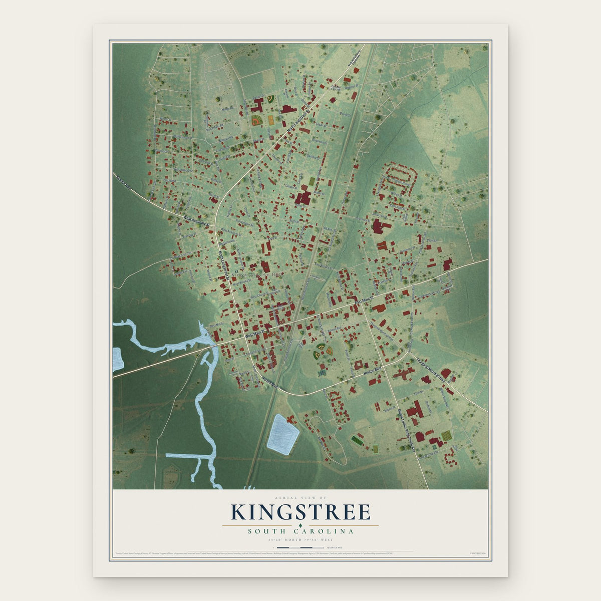
Kingstree, South Carolina Map Art
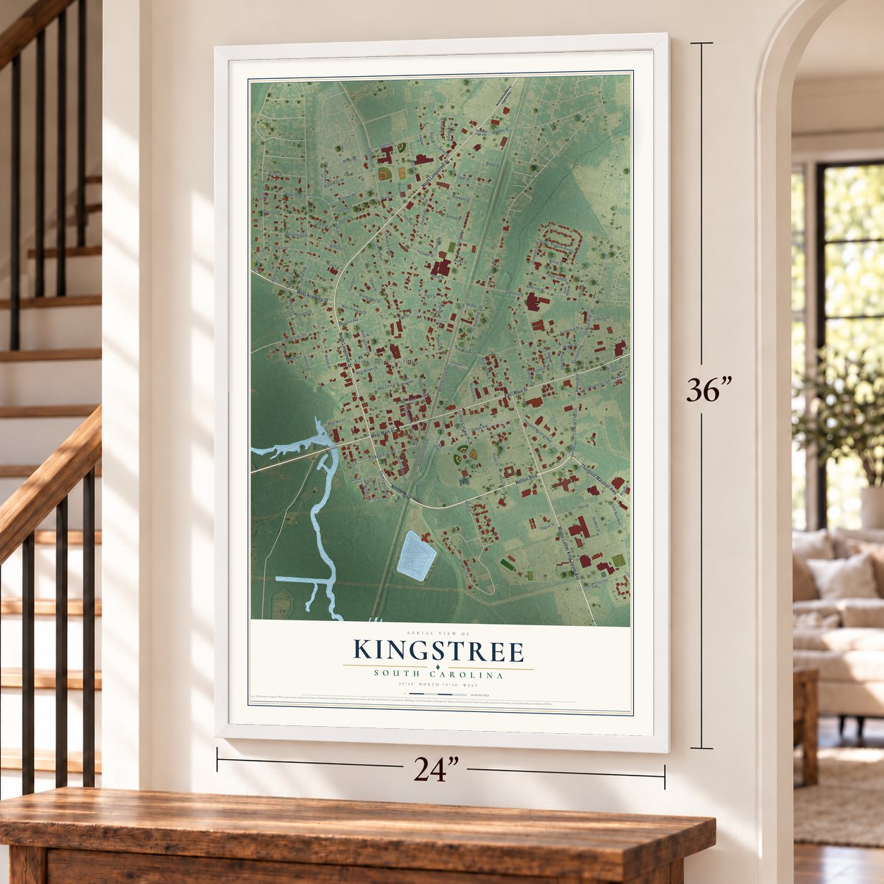
A new map of Kingstree, South Carolina, made in 2026 and printed to order on thick archival matte paper.
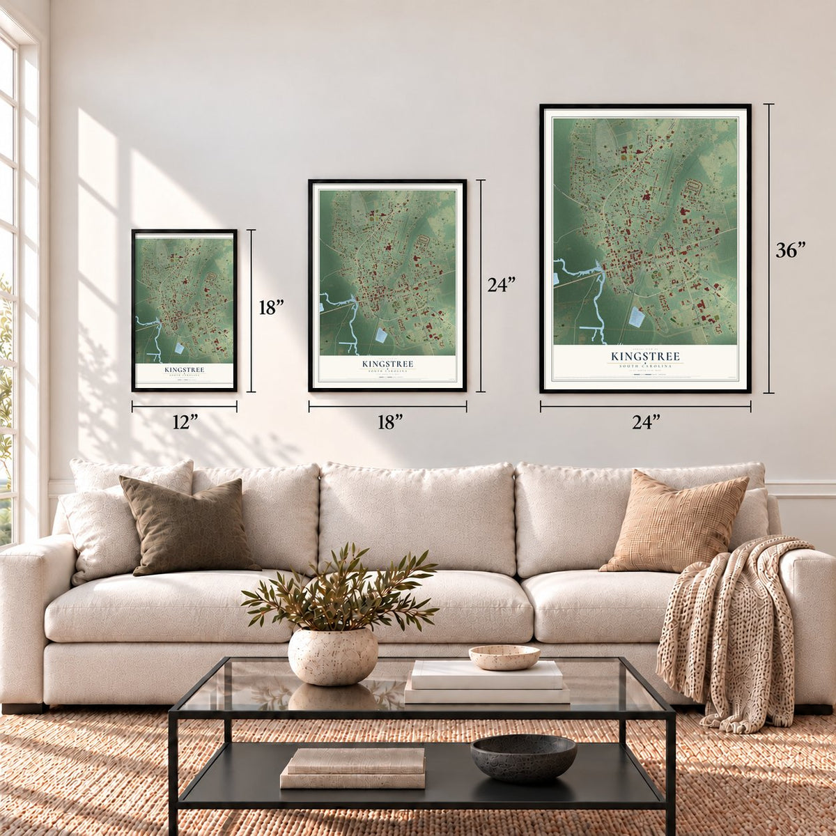
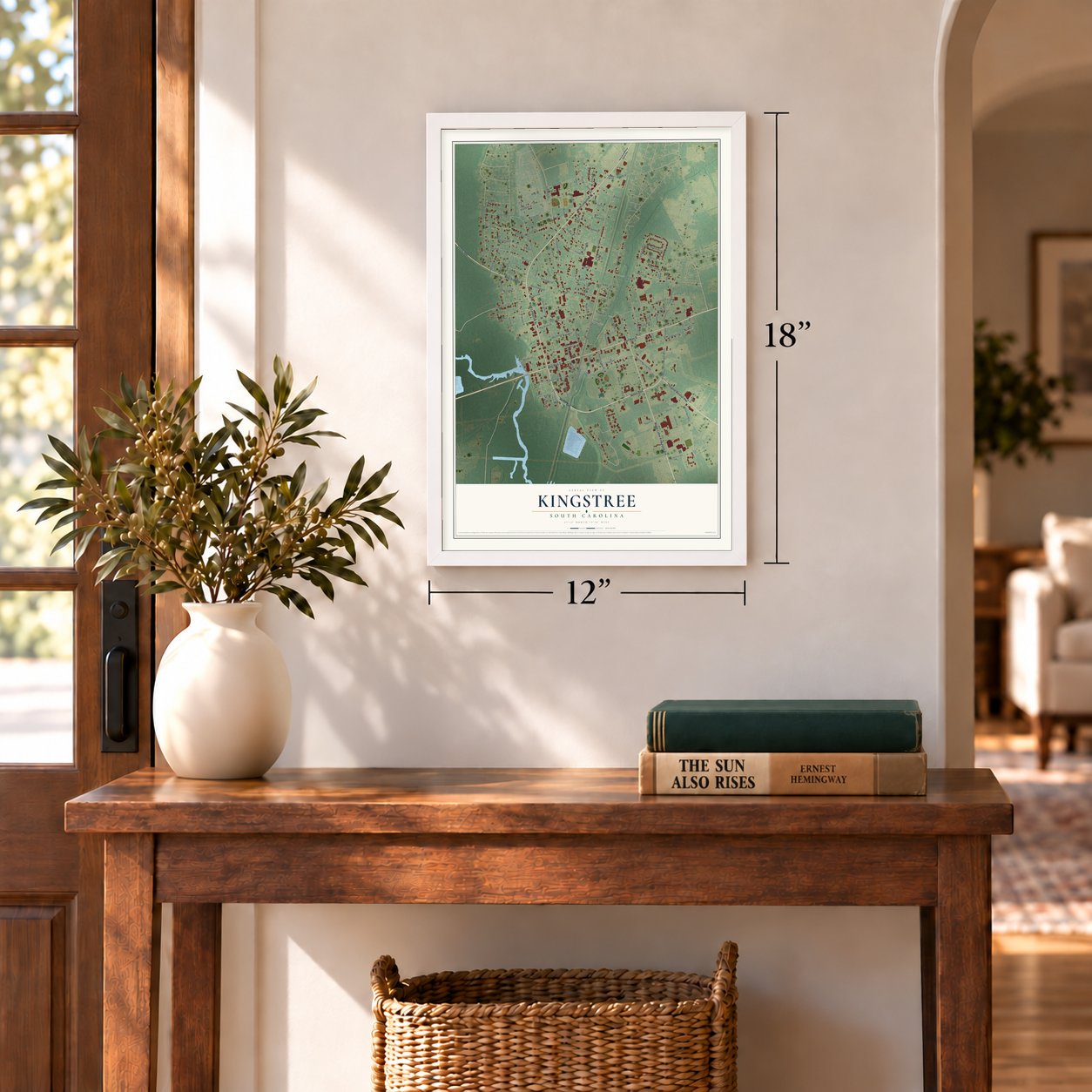
12" x 18" Archival Matte Print
A Map of Home. A Work of Art.
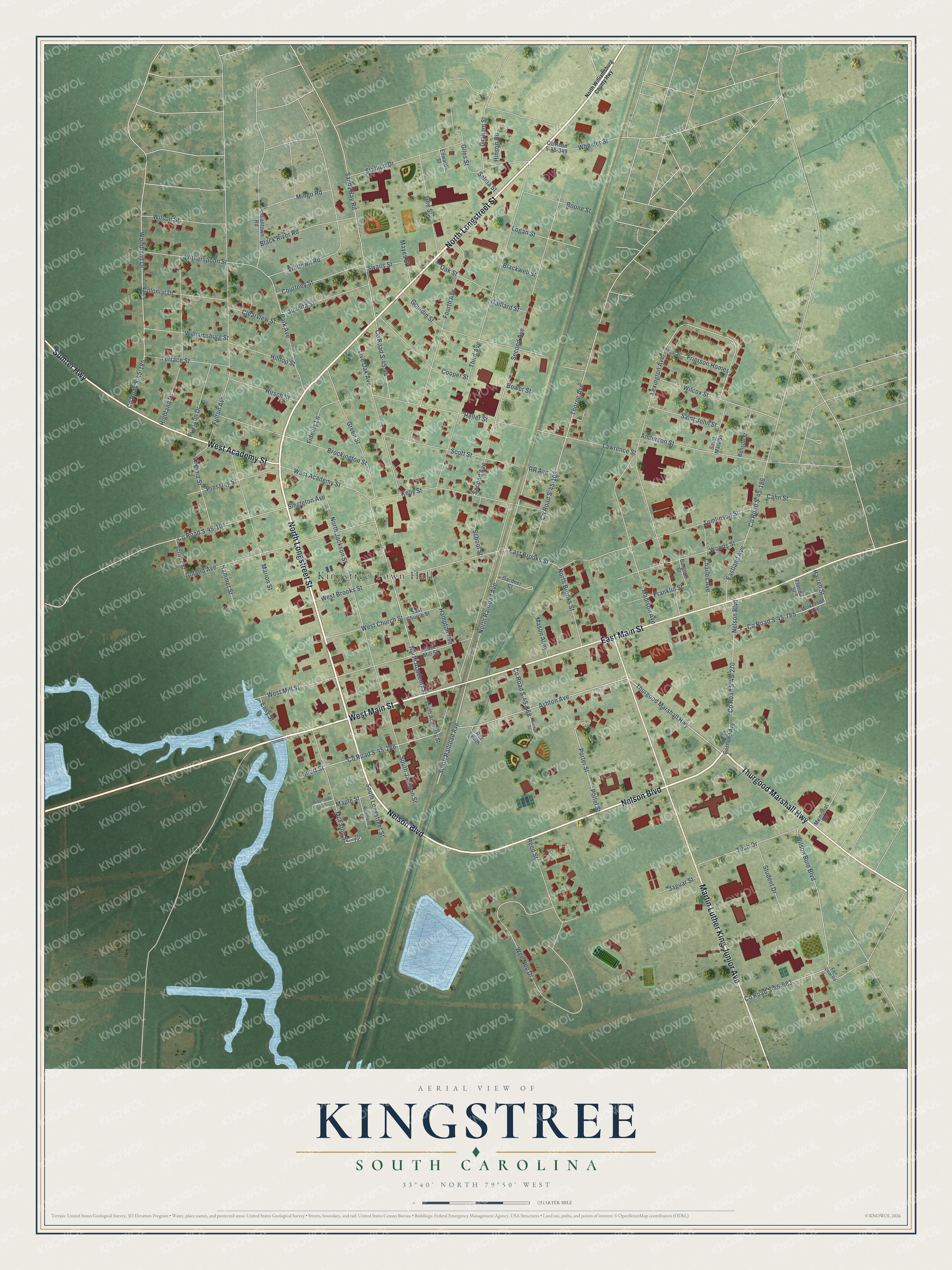
Explore Kingstree, South Carolina from a whole new perspective. Created using aerial imagery and detailed geographic data, this map captures Kingstree building by building, with labeled streets, familiar landmarks, and shaded topographical relief that highlights the natural contours of the landscape.
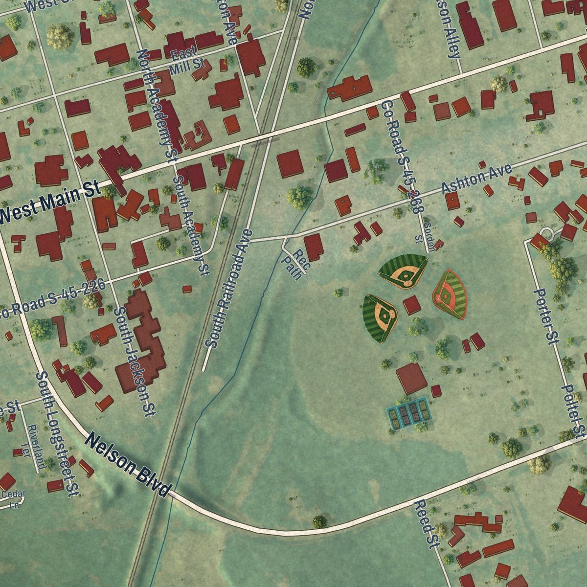
Combining modern data with the timeless character of a vintage atlas, this map is just as interesting up close as it is beautiful on the wall. Whether you grew up in Kingstree, spent memorable years there, or call it home today, this unique map is a great way to celebrate a place that means something to you. Zoom in on the preview to look for your street, and then order a print to put your memories on the wall.
Three ways to hang it
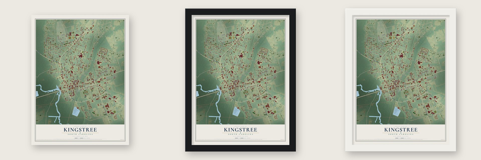
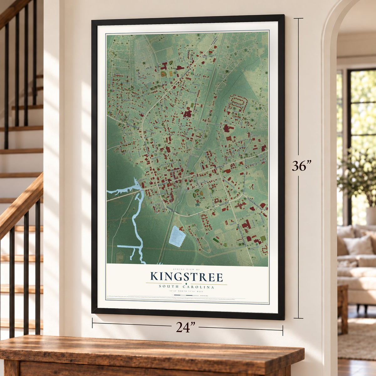
Unframed archival matte, a black wood frame or a white wood frame.
Up close
Geography Worth Displaying
This map was created using accurate cartographic data and authoritative geographic sources, including the U.S. Geological Survey and the Census Bureau. The map brings together terrain, waterways, roads, and building detail. The majority of the streets are labeled, houses are accurately depicted, and the topography is derived from government sources. Combining local data with carefully composed color and shading leads to this beautifully detailed Kingstree artwork for your wall.
Rather than simply showing street outlines, we’ve included as many of the street names as we could reasonably fit on the map while keeping their names legible. Zoom in on the high resolution preview to see exactly what’s on the map. We truly set out to create a statement piece for anyone who loves Kingstree. So whether it’s for you, or a gift for someone you love, we hope this map of Kingstree brings back fond memories.
Read the story behind this map of Kingstree, South Carolina from 2026.

About Kingstree, South Carolina
Kingstree is a town of 3,244 people and the county seat of Williamsburg County, on the Black River. In colonial times the Lords Proprietors laid out a town here called Williamsburg, but settlers found an unusually large white pine growing by the river. Tall white pines made good ship masts, so the tree was claimed for the king and carved with the broad arrow mark to keep colonists from cutting it down. The county held on to the name Williamsburg, while its seat came to be called the King's Tree.
The first settlers of Williamsburg Township came with the Roger Gordon colony. They sailed up the Black River, landed at Brown's Ferry and blazed a trail through the forest to the King's Tree, and that path has served as a road since 1732; today it is part of the Kingstree-Georgetown highway. In 1734 John Witherspoon arrived from Belfast, Ireland, with his seven children and their families, coming ashore at Potato Ferry. Kingstree held its first court in 1806 and got a post office in 1810.
- Marion's men mustered hereAfter the British took Charles Town, Captain Henry Mouzon gathered the Kingstree company in the old Williamsburg Presbyterian churchyard in July 1780. It grew into a battalion, then a brigade, fighting under Francis Marion, the Swamp Fox. Indiantown Presbyterian Church burned to the ground in the Battle of King's Tree on August 27, 1780.
- A church founded in 1736Williamsburg Presbyterian Church, founded in August 1736, raised its first building in 1738 across from the Williamsburg Cemetery and a second on that side of town in 1828. The present church on North Academy Street, with stained glass from Austria, dates from 1914. John Witherspoon (1670 to 1737) was the first person buried in its cemetery. No older church survives between the Santee and Cape Fear Rivers. It mothered 33 other Presbyterian churches and turned 275 in October 2011.
- Robert Mills's courthouseThe Williamsburg County Courthouse on Main Street stands on the old parade ground where the militia drilled during the Revolution. Robert Mills, a nationally known South Carolina architect, built it in 1823. A fire swept the second floor in 1883, but the fireproof walls were 30 inches thick, so the building was restored. Parking for horses came in 1901 and a third floor in 1954, and the courthouse joined the National Register in 1982.
- The Pig Pickin' FestivalEvery fall, Kingstree's cooks compete over Williamsburg County's vinegar-based barbecue at the Pig Pickin' Festival. In 2010 a record seventy groups entered, some traveling from North Carolina and Georgia. A golf tournament at the Swamp Fox Golf Course opens the events, followed by tennis, a car show, arts and crafts, live music and games for children.
- Horse races since 1996Horse racing in Williamsburg County began before the Revolution. The Williamsburg Hometown Chamber has backed the King's Tree trials from 1996 on, holding them on a November weekend at Deborah and Bobby McCutchen's training center in the Cedar Swamp area. Jockeys bring their horses for nine quarter races, while families and local business people share barbecue and visit.
Find your street
Names on the Kingstree map
Every name below is printed on this map. Look for your street, your school, the park where you played, or the pond down the road.
Places and landmarks1
- Kingstree Town Hall
Streets and roads136
- North Longstreet Street
- Nelson Boulevard
- West Main Street
- Thurgood Marshall Highway
- East Main Street
- Sumter Highway
- Martin Luther King Junior Avenue
- West Academy Street
- North Academy Street
- Ashton Avenue
- South Railroad Avenue
- North Railroad Avenue
- East Brooks Street
- Frierson Homes
- Wheeler Street
- Lexington Avenue
- Third Avenue
- Second Avenue
- County Road S-45-104
- Singleton Avenue
- Wee Nee Drive
- County Road S-45-44
- Sandy Bay Road
- County Road S-45-683
- Wilson Buie Boulevard
- County Road S-45-109
- Thorne Avenue
- North Jackson Street
- Fulton Avenue
- Fourth Avenue
Show all 136 streets
- Stallion Drive
- Tomlinson Street
- Gilland Avenue
- County Road S-45-185
- Woodland Drive
- Madison Avenue
- Kelly Street
- Highland Drive
- Park Avenue
- West Mill Street
- Live Oak Avenue
- Gourdin Street
- Heller Street
- Brockington Street
- County Road S-45-270
- McFarlin Street
- County Road S-45-186
- Eastland Avenue
- Marion Street
- County Road S-45-226
- Short Street
- Green Street
- Willtown Road
- Scott Street
- Woods Street
- Anderson Street
- Hampton Avenue
- Cooper Street
- Tech Drive
- Reed Street
- Lawrence Street
- Gee Street
- Porter Street
- South Jackson Street
- Black River Road
- Pressley Street
- County Road S-45-765
- Virginia Street
- Courtney Street
- Juanita Street
- Graham Street
- Poltel Street
- Colonial Drive
- Terrace Street
- Witherspoon Street
- Wilson Street
- Williamsburg Street
- Charles Avenue
- Hinson Circle
- West Brooks Street
- North Brooks Street
- West Church Street
- Student Drive
- Frierson Drive
- Mingo Road
- Saint John Street
- Wilcox Street
- Hirsch Street
- Giles Street
- Boone Street
- Logan Street
- Hilltop Street
- Oak Street
- County Road S-45-268
- Franklin Street
- School Street
- Clearview Street
- Fidelity Lane
- South Longstreet Street
- Maple Street
- Mayes Street
- Jaguar Street
- Hammet Street
- Mason Alley
- Swails Street
- Gaillard Street
- Blackwell Street
- Harrell Street
- Cahn Street
- Selma Street
- RR Avenue
- Bower Street
- Easy Street
- South Eastland Avenue
- Wilkerson Avenue
- County Road S-45-349
- East Mill Street
- Indiantown Road
- South Academy Street
- Gardner Court
- Saint Mark Street
- East Church Street
- Scriven Street
- Burgess Street
- Memorial Drive
- Benson Street
- Edwards Street
- Rec Path
- Florida Street
- Regal Street
- Riverland Terrace
- Riverside Lane
- Fair Deal Road
- North Williamsburg County Highway
- Gordon Street
- Cedar Lane
Names are listed as they appear on the printed map. Zoom into the product photos to find them.
The art of mapping a place
How This Map Was Made
Real places. Remarkable detail. Discover the layers that turn geographic data into a map of home.

The view from above
Aerial imagery reveals the character of the land: woodland, open fields, and the patterns of a place.

The shape of the land
Elevation data brings hills, valleys, and subtle changes in the landscape into view.

The details of home
Roads, waterways, and building footprints come together to make the map feel unmistakably local.

Geography becomes art
Considered color, shading, and typography bring the layers together in a map made for your wall.


Process illustrated with Mendon, Massachusetts. Aerial imagery: USDA NAIP. Terrain: USGS 3D Elevation Program. Map details and finished artwork: KNOWOL.
The Details
About This Print
Choose an archival matte print, or a black or white Ayous wood frame. The archival matte print is unframed.
Select your size and finish above to see the matching product image and price.
Materials & Craftsmanship
A contemporary map with the character of a classic atlas, printed on archival matte paper. Optional frames are made from Ayous wood.
Your printed map does not include the watermark shown in the full-map preview.
Shipping & Delivery
Free shipping within the United States. Every print is made to order in the USA.
Buying a gift? Add a note in your cart and we'll include it. We never put prices in the package.
Prints ship within 2 to 3 business days. Allow 7 to 10 days total from ordering for delivery. Timing may vary during holidays or periods of high order volume.
Read our shipping policy.
Returns and damaged prints
Each print is made to order. Change-of-mind refunds are not available after production.
If your print arrives damaged, misprinted or incorrect, contact support@knowol.com within 30 days of receiving it. Include your order number, photos and a description of the issue.
Read our full refund and replacement policy. For questions about your order, email support@knowol.com.
Find your town
Looking for another city?
Find a map of home in our South Carolina collection, or any town in the country.
Nearby
Maps of towns near Kingstree
Know someone from one of these towns? Their map makes a great gift.
 Lane
Lane, South Carolina
From $39.99See the map
 Greeleyville
, South Carolina
From $39.99See the map
 Foreston
, South Carolina
From $39.99See the map
More maps nearby: Lake City, Scranton, Stuckey, Turbeville and St. Stephen.