
Search for another town





Free U.S. delivery 7 to 10 days after you order
Kosciusko, Mississippi Map Art
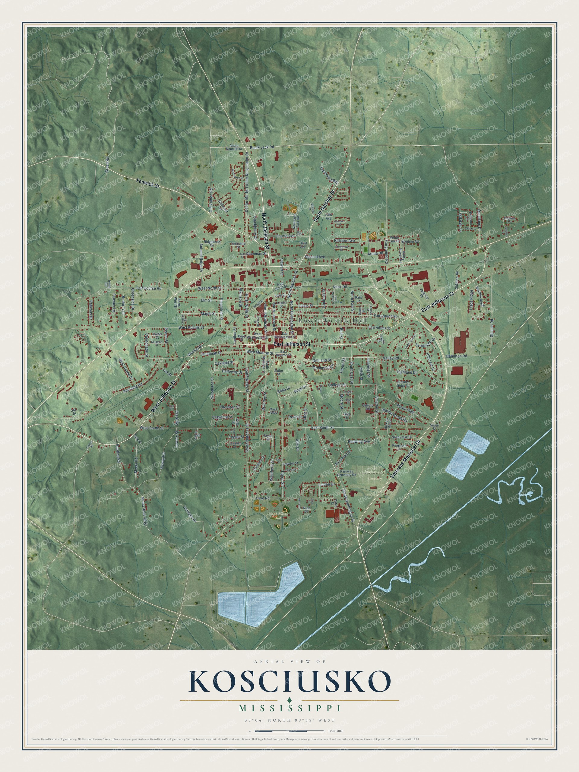
A new map of Kosciusko, Mississippi, made in 2026 and printed to order on thick archival matte paper.
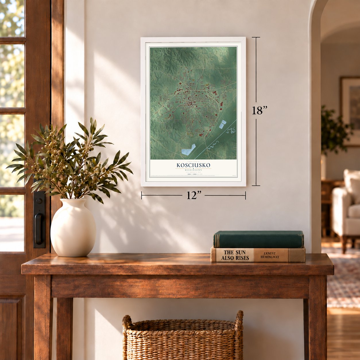
12" x 18" Archival Matte Print
A Map of Home. A Work of Art.
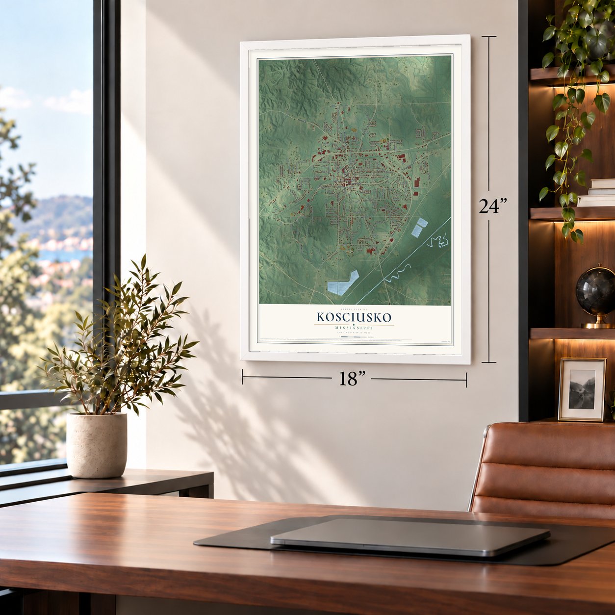
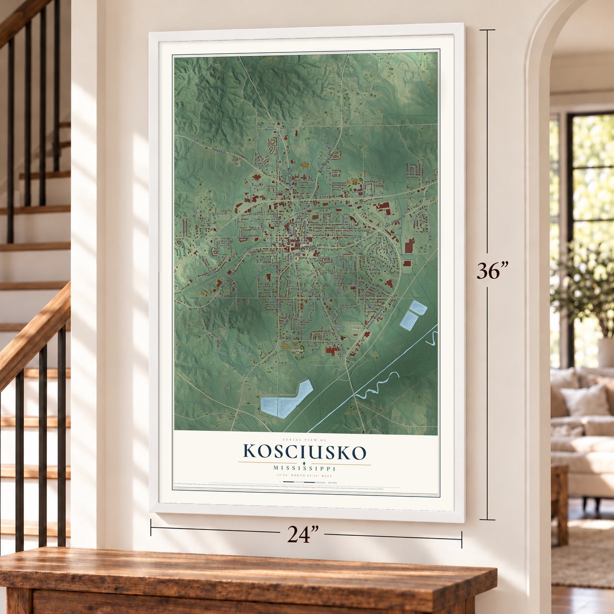
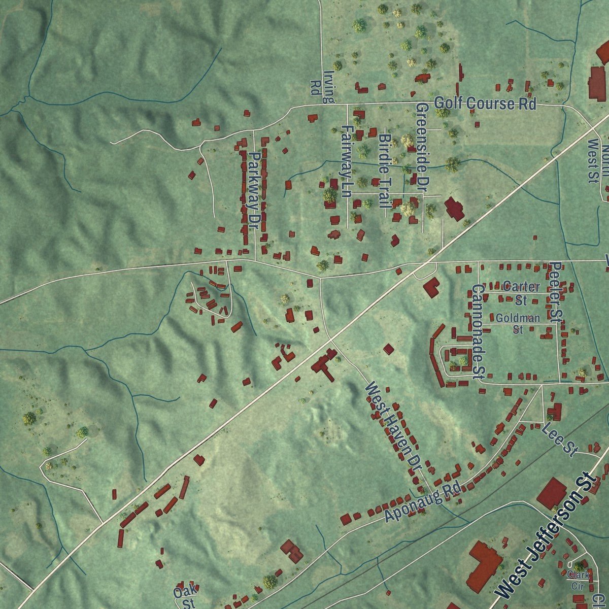
Explore Kosciusko, Mississippi from a whole new perspective. Created using aerial imagery and detailed geographic data, this map captures Kosciusko building by building, with labeled streets, familiar landmarks, and shaded topographical relief that highlights the natural contours of the landscape.
Combining modern data with the timeless character of a vintage atlas, this map is just as interesting up close as it is beautiful on the wall. Whether you grew up in Kosciusko, spent memorable years there, or call it home today, this unique map is a great way to celebrate a place that means something to you. Zoom in on the preview to look for your street, and then order a print to put your memories on the wall.
Three ways to hang it
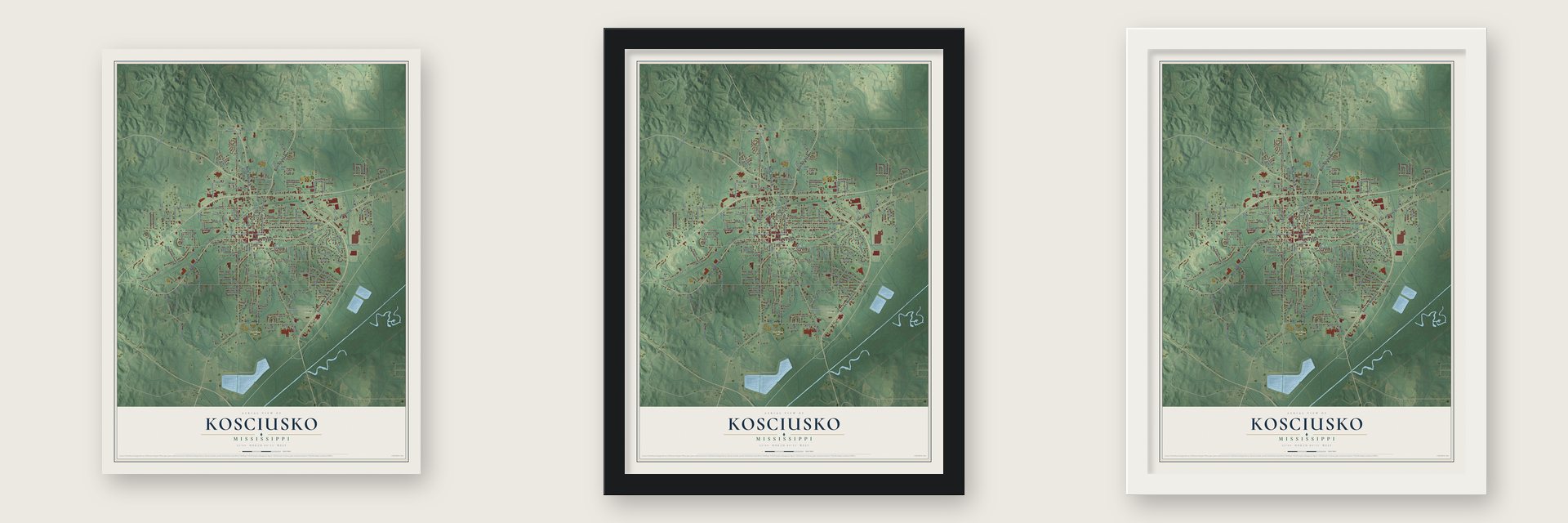
Unframed archival matte, a black wood frame or a white wood frame.
Up close
Geography Worth Displaying
This map was created using accurate cartographic data and authoritative geographic sources, including the U.S. Geological Survey and the Census Bureau. The map brings together terrain, waterways, roads, and building detail. The majority of the streets are labeled, houses are accurately depicted, and the topography is derived from government sources. Combining local data with carefully composed color and shading leads to this beautifully detailed Kosciusko artwork for your wall.
Rather than simply showing street outlines, we’ve included as many of the street names as we could reasonably fit on the map while keeping their names legible. Zoom in on the high resolution preview to see exactly what’s on the map. We truly set out to create a statement piece for anyone who loves Kosciusko. So whether it’s for you, or a gift for someone you love, we hope this map of Kosciusko brings back fond memories.
Read the story behind this map of Kosciusko, Mississippi from 2026.

About Kosciusko, Mississippi
Kosciusko is a city of 7,114 people and the county seat of Attala County, near the Yockanookany River. Shortly before the War of 1812, a French trader named David Choate and his Choctaw wife opened an inn called the Choate Stand on the Natchez Trace. They built it where the Trace crossed a path to the Creek Nation, beside a natural spring, close to where the town square is today. War journals show that Andrew Jackson got supplies there.
In 1850 the Choate family was forced out to Indian Territory under the Indian Removal Act, which Jackson had signed. The town itself was laid out in 1834 under the name Paris, and in 1839 it was renamed for Tadeusz Kosciusko, the Polish officer who helped the Continental Army in the Revolution. In 2017 the city began holding a yearly Return to Redbud Springs Festival, recalling the spring and the family who first settled beside it.
“Kosciusko is a thriving town, possessed of an industrious and energetic population, chiefly engaged in mercantile pursuits.”
- A bid for the universityBecause the town sat near the center of the state and was thought unusually healthy, it was one of seven places competing in 1841 to host the State University. On the first ballot Kosciusko drew 12 votes, then 16 on the second and 18 on the third, but the university was placed elsewhere.
- 25,000 bales a yearOnce the Aberdeen division of the Illinois Central reached town, Kosciusko became the trading center for a wide farming district that took in much of Attala, Leake and Neshoba counties. Its merchants shipped about 25,000 bales of cotton each year.
- A college opened in 1893Local Baptist associations founded Central Mississippi College in Kosciusko in 1893. It was a private school for African American students in a segregated state. Much later, from 1976 to 2008, the city was home to Magnolia Bible College.
- Where Meredith and Oprah beganJames Meredith was born in Kosciusko in 1933. In 1962 he became the first African American student at the University of Mississippi, starting its desegregation. Oprah Winfrey was born here in 1954 and lived with her grandmother in town until she was six.
- A fair for over 100 yearsKosciusko has hosted the Central Mississippi Fair for more than a century. Since 2009 the city has also been part of the Mississippi Blues Trail.
Find your street
Names on the Kosciusko map
Every name below is printed on this map. Look for your street, your school, the park where you played, or the pond down the road.
Places and landmarks3
- Kosciusko City Hall
- Hugh Ellard Park
- Parkway Cemetery
Streets and roads174
- North Jackson Street
- Veterans Memorial Drive
- West Jefferson Street
- East Jefferson Street
- Fenwick Street
- North Natchez Street
- South Huntington Street
- Smythe Street
- Black Jack Road
- South Natchez Street
- North Huntington Street
- Redwing Avenue
- Gilliland Street
- Trace Ridge
- East South Street
- Clark Road
- West Monroe Street
- West Adams Street
- Knox Road
- Tipton Street
- Aponaug Road
- Fairground Street
- Doctor Martin Luther King Junior Drive
- Byway Road
- West South Street
- Golf Course Road
- Attala Road 1011
- Burdine Road
- Love Road
- Goodman Street
Show all 174 streets
- Highland Drive
- West North Street
- Shields Road
- South East Street
- Valley Road
- North Wells Street
- Lucas Street
- College Street
- Elm Street
- Second Avenue
- Allen Street
- Fairground Road
- West Haven Drive
- Pecan Boulevard
- Autumn Ridge Drive
- Woodland Street
- Peachtree Street
- Woodland Drive
- Brantley Street
- Weatherly Street
- Myers Road
- South Wells Street
- Linden Drive
- Heritage Drive
- Hamilton Road
- North Madison Street
- Maple Street
- Fourth Avenue
- Landrum Street
- North East Street
- Walnut Grove Road
- Thornton Street
- Blackberry Drive
- Afro Drive
- Old Vaiden Road
- Galloway Drive
- Hammond Circle
- Parkway Drive
- Greenside Drive
- Hillcrest Drive
- Atkinson Street
- Boyd Street
- Fairway Lane
- Peeler Street
- Moore Street
- Cannonade Street
- Bobo Street
- Bell Street
- Stewart Street
- Turner Street
- Evergreen Drive
- Simmons Alley
- Nash Street
- Jennings Street
- Wesley Drive
- Hillview Avenue
- Oakdale Drive
- Crawford Street
- Green Road
- Birdie Trail
- Potts Street
- Bachman Street
- Poplar Street
- Oakland Street
- Arena Road
- Lowery Street
- Lee Street
- Lumber Street
- Attala Road 3034
- White Oak Drive
- Love Street
- Wren Street
- Hickory Hill Drive
- North West Street
- East Adams Street
- Parkway Cemetary Road
- Hickory Ridge Drive
- Meadow Ridge
- Thomas Circle
- Northside Park Road
- South Madison Street
- Superior Drive
- East Washington Street
- Shady Oak Drive
- West Washington Street
- Bellevue Circle
- Old Ethel Road
- Arrowhead Drive
- Bailey Nowell Road
- Wildwood Terrace
- Ridgewood Circle
- East North Street
- Pinecrest Drive
- Carter Street
- Rays Alley
- Cavalier Drive
- Glendale Drive
- Calvary Road
- Renfroe Road
- East Monroe Street
- Fifth Avenue
- Crawley Street
- Yorkshire Street
- Joplin Street
- Yates Street
- Lewis Street
- Oak Street
- Pope Street
- Tulip Street
- South Street
- Taylor Street
- West Street
- Knox Street
- Park Lane
- Third Avenue
- Sailor Street
- Cole Street
- Bryan Street
- Irving Road
- Cedar Lane Drive
- Pilsudski Street
- Heald Street
- Wellington Drive
- Mitchell Street
- Goldman Street
- Carls Lane
- Chatwin Street
- Northview Drive
- Leonard Street
- Boswell Street
- Riley Street
- Conner Road
- East Street
- Vickers Drive
- Saint Matthews Street
- Julius Street
- Mimosa Street
- Middleton Street
- Glendale Avenue
- Cedar Street
- Union Street
- Presley Street
- Clark Circle
- Rone Street
Names are listed as they appear on the printed map. Zoom into the product photos to find them.
The art of mapping a place
How This Map Was Made
Real places. Remarkable detail. Discover the layers that turn geographic data into a map of home.

The view from above
Aerial imagery reveals the character of the land: woodland, open fields, and the patterns of a place.

The shape of the land
Elevation data brings hills, valleys, and subtle changes in the landscape into view.

The details of home
Roads, waterways, and building footprints come together to make the map feel unmistakably local.

Geography becomes art
Considered color, shading, and typography bring the layers together in a map made for your wall.


Process illustrated with Mendon, Massachusetts. Aerial imagery: USDA NAIP. Terrain: USGS 3D Elevation Program. Map details and finished artwork: KNOWOL.
The Details
About This Print
Choose an archival matte print, or a black or white Ayous wood frame. The archival matte print is unframed.
Select your size and finish above to see the matching product image and price.
Materials & Craftsmanship
A contemporary map with the character of a classic atlas, printed on archival matte paper. Optional frames are made from Ayous wood.
Your printed map does not include the watermark shown in the full-map preview.
Shipping & Delivery
Free shipping within the United States. Every print is made to order in the USA.
Buying a gift? Add a note in your cart and we'll include it. We never put prices in the package.
Prints ship within 2 to 3 business days. Allow 7 to 10 days total from ordering for delivery. Timing may vary during holidays or periods of high order volume.
Read our shipping policy.
Returns and damaged prints
Each print is made to order. Change-of-mind refunds are not available after production.
If your print arrives damaged, misprinted or incorrect, contact support@knowol.com within 30 days of receiving it. Include your order number, photos and a description of the issue.
Read our full refund and replacement policy. For questions about your order, email support@knowol.com.
Find your town
Looking for another city?
Find a map of home in our Mississippi collection, or any town in the country.
Nearby
Maps of towns near Kosciusko
Know someone from one of these towns? Their map makes a great gift.
 Ethel
Ethel, Mississippi
From $39.99See the map
 Sallis
, Mississippi
From $39.99See the map
 West
West, Mississippi
From $39.99See the map
More maps nearby: Durant, McCool, Redwater, French Camp and Goodman.