
Search for another town





Free U.S. delivery 7 to 10 days after you order
LaBelle, Florida Map Art
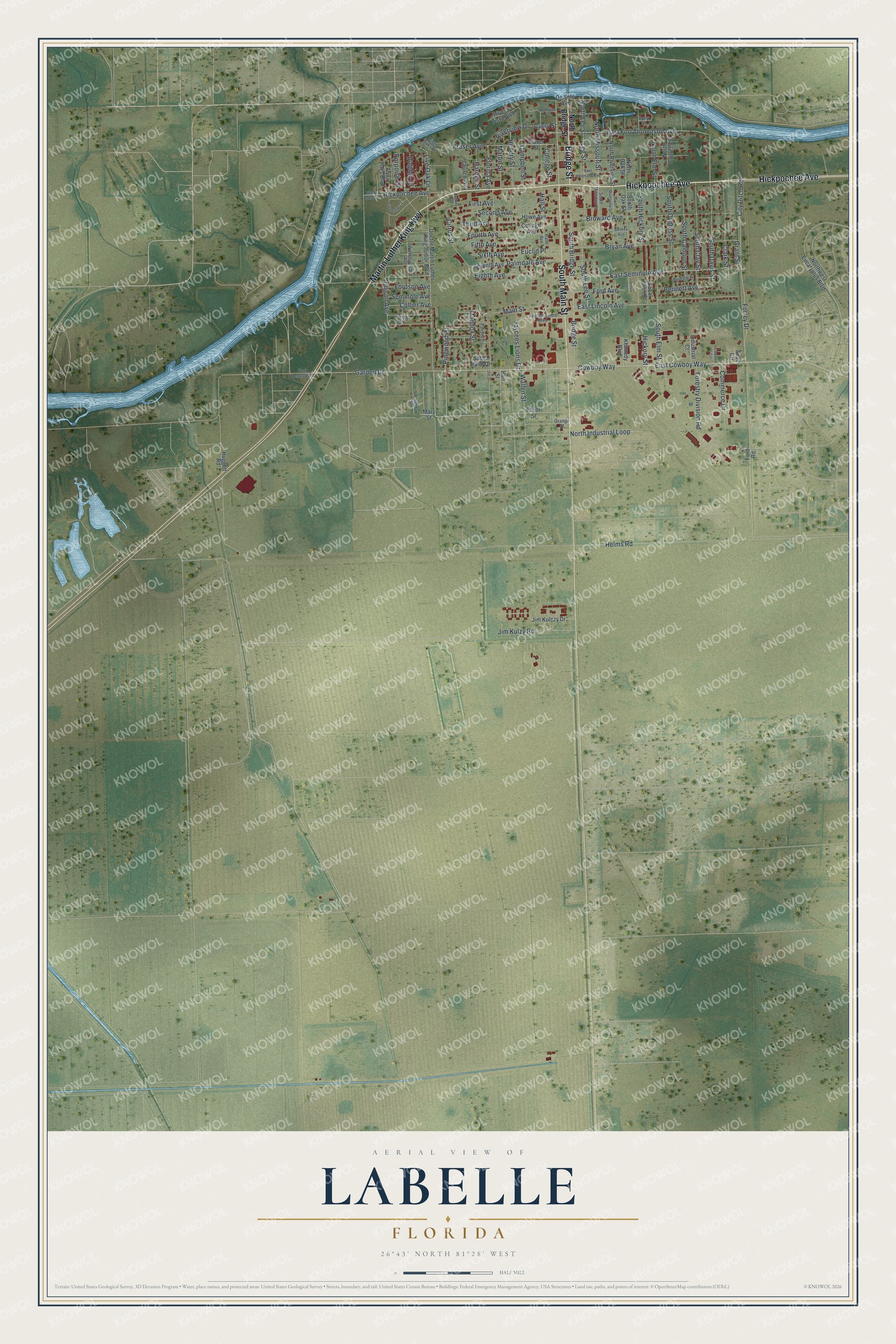
A new map of LaBelle, Florida, made in 2026 and printed to order on thick archival matte paper.
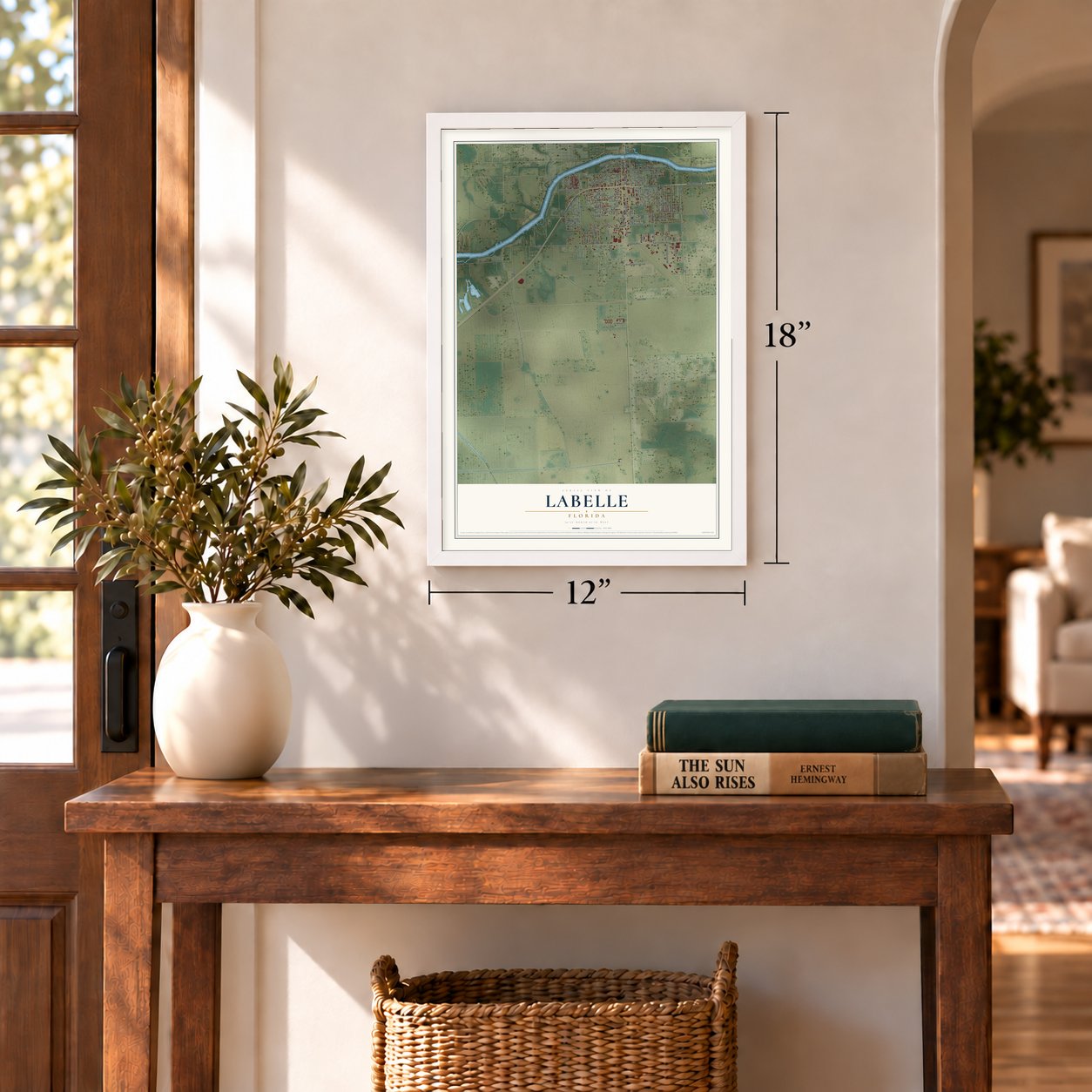
12" x 18" Archival Matte Print
A Map of Home. A Work of Art.
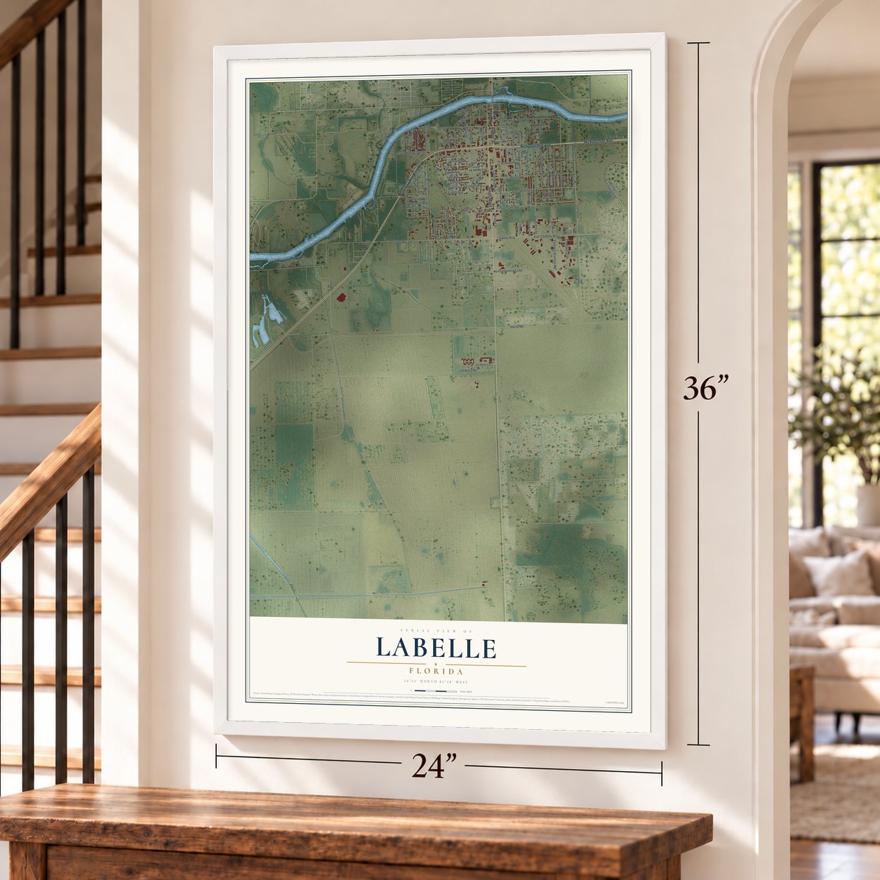
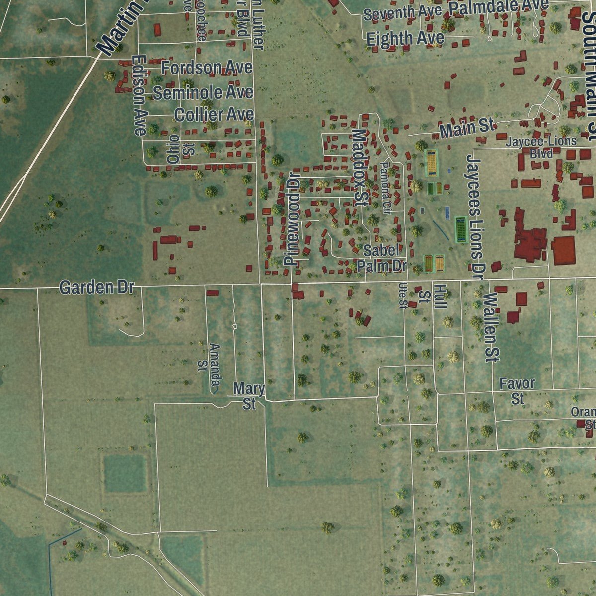
Explore LaBelle, Florida from a whole new perspective. Created using aerial imagery and detailed geographic data, this map captures LaBelle building by building, with labeled streets, familiar landmarks, and shaded topographical relief that highlights the natural contours of the landscape.
Combining modern data with the timeless character of a vintage atlas, this map is just as interesting up close as it is beautiful on the wall. Whether you grew up in LaBelle, spent memorable years there, or call it home today, this unique map is a great way to celebrate a place that means something to you. Zoom in on the preview to look for your street, and then order a print to put your memories on the wall.
Three ways to hang it

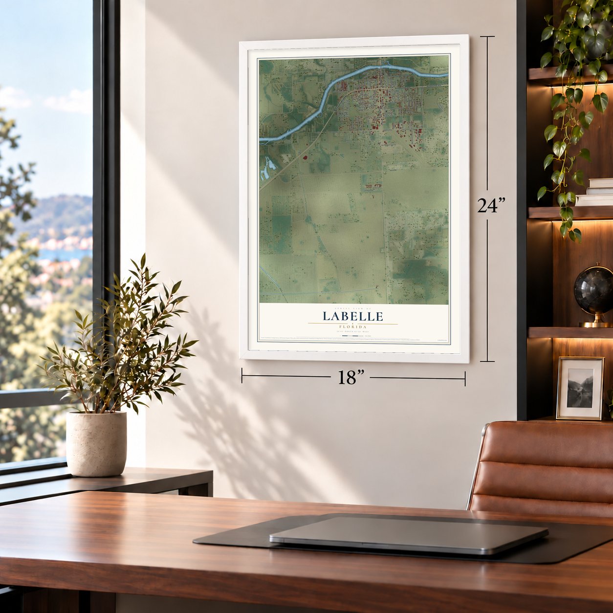
Unframed archival matte, a black wood frame or a white wood frame.
Up close
Geography Worth Displaying
This map was created using accurate cartographic data and authoritative geographic sources, including the U.S. Geological Survey (USGS) and FEMA. The map brings together terrain, waterways, roads, and building detail. The majority of the streets are labeled, houses are accurately depicted, and the topography is derived from government sources. Combining local data with carefully composed color and shading leads to this beautifully detailed LaBelle artwork for your wall.
Rather than simply showing street outlines, we’ve included as many of the street names as we could reasonably fit on the map while keeping their names legible. Zoom in on the high resolution preview to see exactly what’s on the map. We truly set out to create a statement piece for anyone who loves LaBelle. So whether it’s for you, or a gift for someone you love, we hope this map of LaBelle brings back fond memories.
Explore the full map of LaBelle, Florida and read about the local places it shows.

About LaBelle, Florida
LaBelle is a city of 4,966 people and the county seat of Hendry County, on the south bank of the Caloosahatchee River. It grew up as a river settlement while Hamilton Disston worked to drain the Everglades, at the western edge of the huge Monroe County holdings of Captain Francis A. Hendry. Its first settlers were Florida cracker cow hunters and trappers of wild game. Hendry had fenced about 25,000 acres of range by 1876 and owned some 50,000 cattle, and he platted the town in 1895.
When Hendry broke up his land for sale in 1909, Edgar Everett Goodno bought most of it, and the town grew to nearly twenty times its first size. The legislature created Hendry County in the captain's honor in 1923 and chose LaBelle as its seat. In 1925 the state chartered LaBelle as a city, replacing the old town government, and D. A. Mitchell became its first mayor.
- Named for Laura and BelleCaptain Hendry named the town for two of his daughters, Laura June Hendry and Carrie Belle Hendry, when he platted it in 1895. LaBelle carries both of their names.
- Henry Ford's 7,000 acresIn 1922 Henry Ford lent E. E. Goodno $166,986.46, with Goodno's land as security. In May 1924 Ford canceled the debt and the mortgage, paid Goodno $63,000 more, and became the owner of 7,000 acres of LaBelle land. Goodno stayed on as manager of the property, where he raised Angora goats along with Poll Angus and Brahman cattle.
- One of 18 accredited schoolsLaBelle had its first school by 1891. In 1915 the white-columned LaBelle School rose on the same ground, and by 1921 it ranked among only 18 accredited schools in Florida. Today the campus serves as Edward A. Upthegrove Elementary, which carries the name of one of the town's two original families.
- North LaBelle's round tripPart of LaBelle once lay in Glades County. In 1929 Glades County offered to settle a bond dispute with Hendry County by giving up its share of the town, and voters approved the deal. Eight years later the people of North LaBelle, who felt ignored by the Glades County government in Moore Haven, voted to join Hendry County again, and the vote reunited them with the city.
- The Swamp Cabbage FestivalOn the last full weekend of February, LaBelle celebrates the cabbage palm, Florida's state tree, with the Swamp Cabbage Festival. Events spread across town, from a 5K run and a beauty pageant to a rodeo, and the biggest crowds gather at Barron Park.
Find your street
Names on the LaBelle map
Every name below is printed on this map. Look for your street, your school, the park where you played, or the pond down the road.
Streets and roads117
- Hickpochee Avenue
- Hickpoochee Avenue
- South Main Street
- Martin Luther King Highway
- Bridge Street
- East Fort Thompson Avenue
- Main Street
- Cowboy Way
- East Cowboy Way
- North Missouri Street
- South Davis Street
- Grant Street
- Lee Street
- East Seminole Avenue
- Seminole Avenue
- Sixth Avenue
- Fraser Avenue
- Hendry Street
- Fourth Avenue
- South Bridge Street
- Forrey Drive
- South Elm Street
- Bryan Avenue
- Broward Avenue
- East Lincoln Avenue
- City Ditch Road
- Citrus Street
- Helms Road
- South Lee Street
- South Clay Street
Show all 117 streets
- Second Avenue
- Hall Street
- Jaycees Lions Drive
- Edison Avenue
- South Cypress Street
- South Calhoun Street
- Live Oak Lane
- Clark Street
- North Lee Street
- Forestry Division Road
- Hickory Street
- Jim Kulzy Road
- North Industrial Loop
- Pinewood Drive
- Maddox Street
- Garden Drive
- Commerce Drive
- Campbell Street
- Ford Avenue
- South Hickory Street
- Florida Avenue
- Palmdale Avenue
- Bennett Avenue
- Third Avenue
- North Elm Street
- Collier Avenue
- Fordson Avenue
- Fifth Avenue
- Eighth Avenue
- Riverview Drive
- Hardee Street
- Wallen Street
- Martin Street
- College Street
- Euclid Place
- First Avenue
- Porpoise Drive
- Dolphin Drive
- Curry Street
- North Bridge Street
- Hull Street
- Northwest Eucalyptus Boulevard
- North Oak Street
- Aqua Isles Boulevard
- Jim Kulczy Drive
- Doctor Martin Luther King Junior Boulevard
- North Riverview Street
- South Oak Street
- Howe Avenue
- Sabal Palm Court
- Rivera Vista Boulevard
- De Soto Avenue
- Sabel Palm Drive
- Ohio Street
- Church Way
- North Cypress Street
- Fraser Street
- Seventh Avenue
- Kennedy Boulevard
- Industrial Court
- Cottage Avenue
- Huggett Road
- Favor Street
- Ford Road
- Mary Street
- Anvil Circle
- South Missouri Street
- River Oaks Drive
- Withlacoochee Avenue
- Jaycee-Lions Boulevard
- Bridleway
- Amanda Street
- Fort Denaud Road
- Orange Street
- Holly Street
- Palm Avenue
- Hampton Avenue
- Shady Oaks Avenue
- South Riverview Street
- East Yeomans Avenue
- Friendship Circle
- Pamona Circle
- Jeniva Street
- Cowboy Circle
- Lashley Street
- Geneva Avenue
- Ute Street
Names are listed as they appear on the printed map. Zoom into the product photos to find them.
The art of mapping a place
How This Map Was Made
Real places. Remarkable detail. Discover the layers that turn geographic data into a map of home.

The view from above
Aerial imagery reveals the character of the land: woodland, open fields, and the patterns of a place.

The shape of the land
Elevation data brings hills, valleys, and subtle changes in the landscape into view.

The details of home
Roads, waterways, and building footprints come together to make the map feel unmistakably local.

Geography becomes art
Considered color, shading, and typography bring the layers together in a map made for your wall.


Process illustrated with Mendon, Massachusetts. Aerial imagery: USDA NAIP. Terrain: USGS 3D Elevation Program. Map details and finished artwork: KNOWOL.
The Details
About This Print
Choose an archival matte print, or a black or white Ayous wood frame. The archival matte print is unframed.
Select your size and finish above to see the matching product image and price.
Materials & Craftsmanship
A contemporary map with the character of a classic atlas, printed on archival matte paper. Optional frames are made from Ayous wood.
Your printed map does not include the watermark shown in the full-map preview.
Shipping & Delivery
Free shipping within the United States. Every print is made to order in the USA.
Buying a gift? Add a note in your cart and we'll include it. We never put prices in the package.
Prints ship within 2 to 3 business days. Allow 7 to 10 days total from ordering for delivery. Timing may vary during holidays or periods of high order volume.
Read our shipping policy.
Returns and damaged prints
Each print is made to order. Change-of-mind refunds are not available after production.
If your print arrives damaged, misprinted or incorrect, contact support@knowol.com within 30 days of receiving it. Include your order number, photos and a description of the issue.
Read our full refund and replacement policy. For questions about your order, email support@knowol.com.
Find your town
Looking for another city?
Find a map of home in our Florida collection, or any town in the country.
Nearby
Maps of towns near LaBelle
Know someone from one of these towns? Their map makes a great gift.
 Port LaBelle
, Florida
From $39.99See the map
 Fort Denaud
, Florida
From $39.99See the map
 Charleston Park
, Florida
From $39.99See the map
More maps nearby: Alva, Lehigh Acres, Pioneer, Olga and Verandah.