
Search for another town


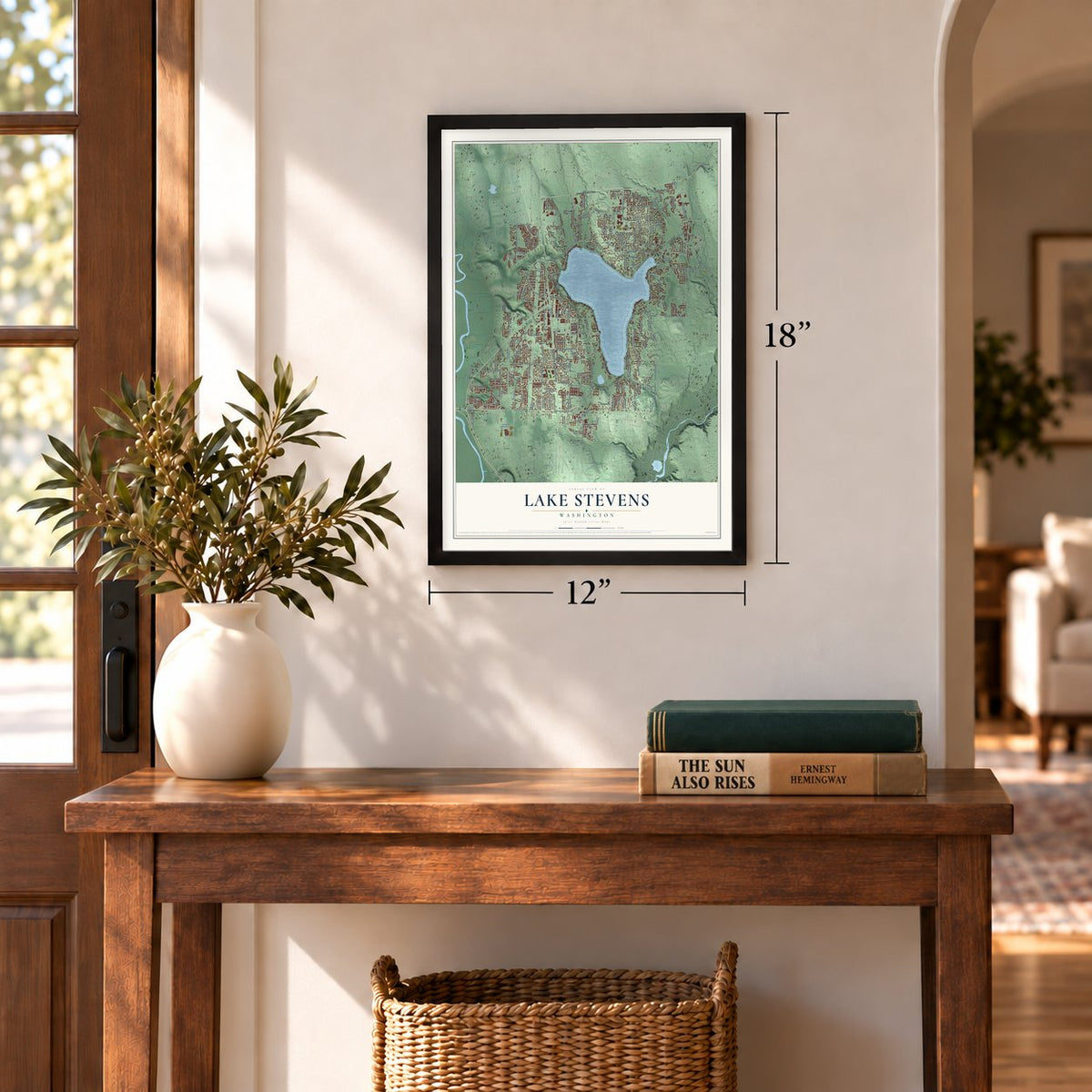
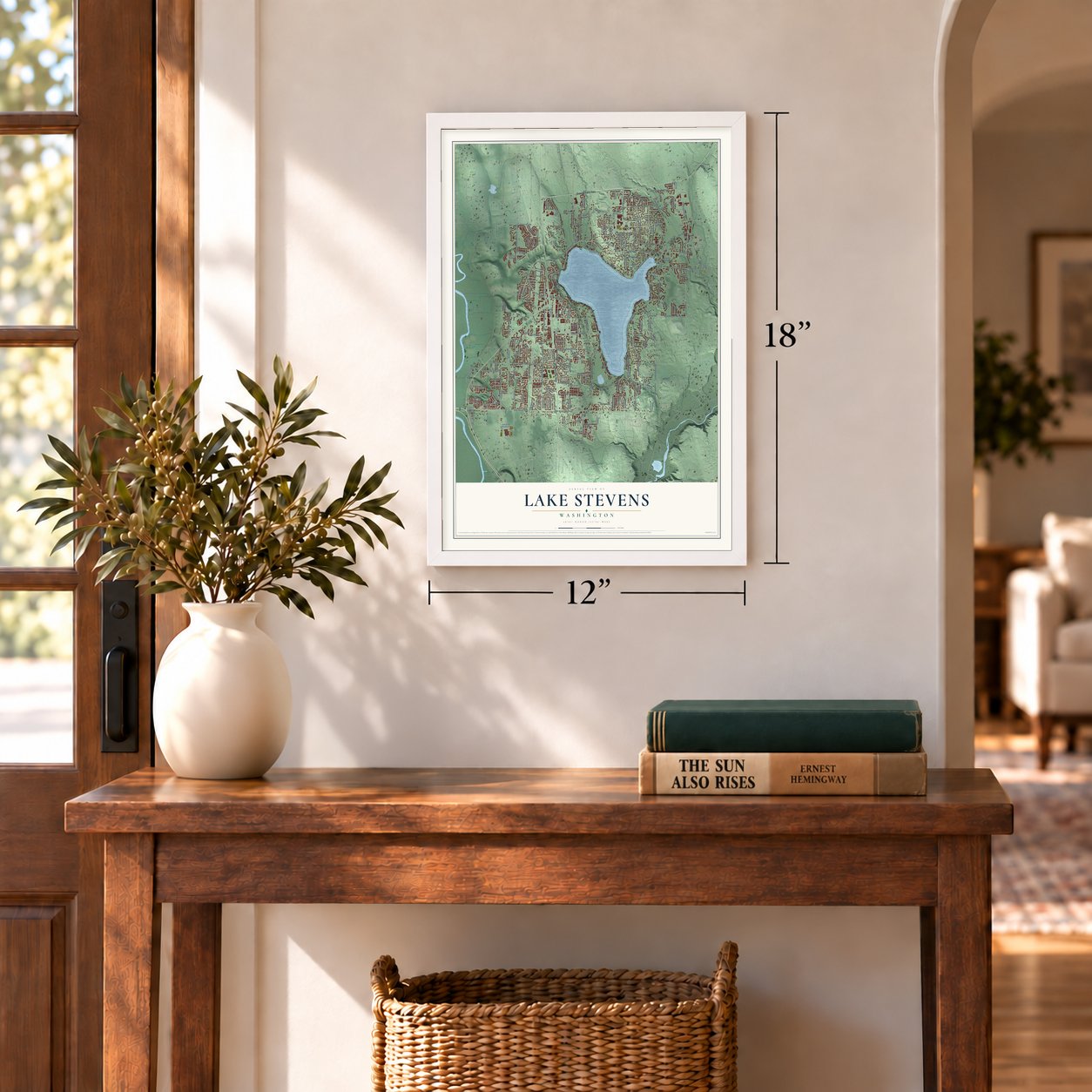

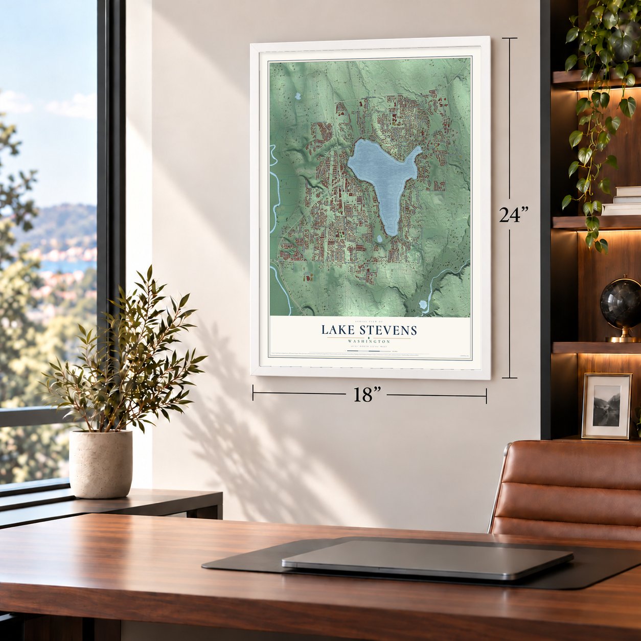
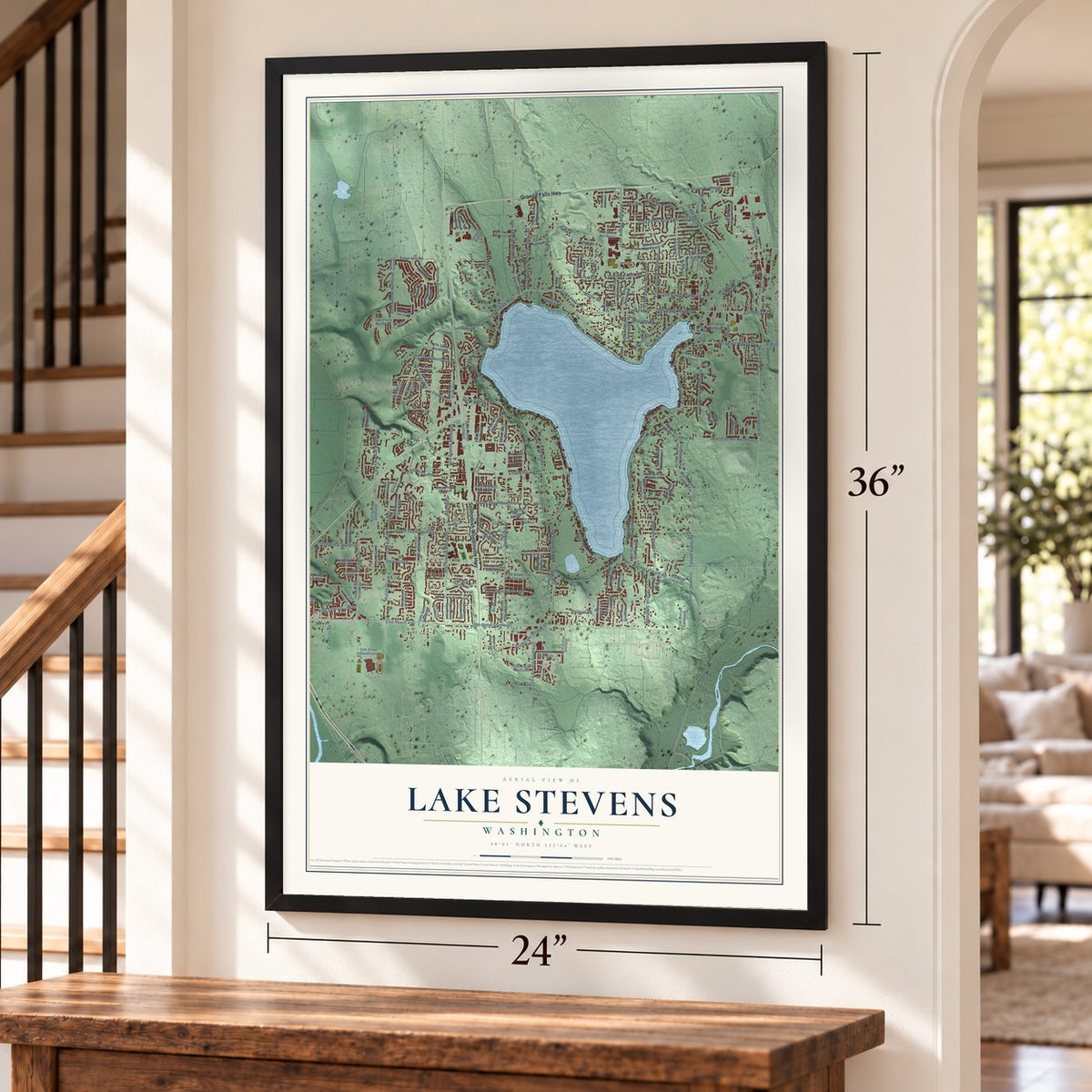
Free U.S. delivery 7 to 10 days after you order
Lake Stevens, Washington Map Art
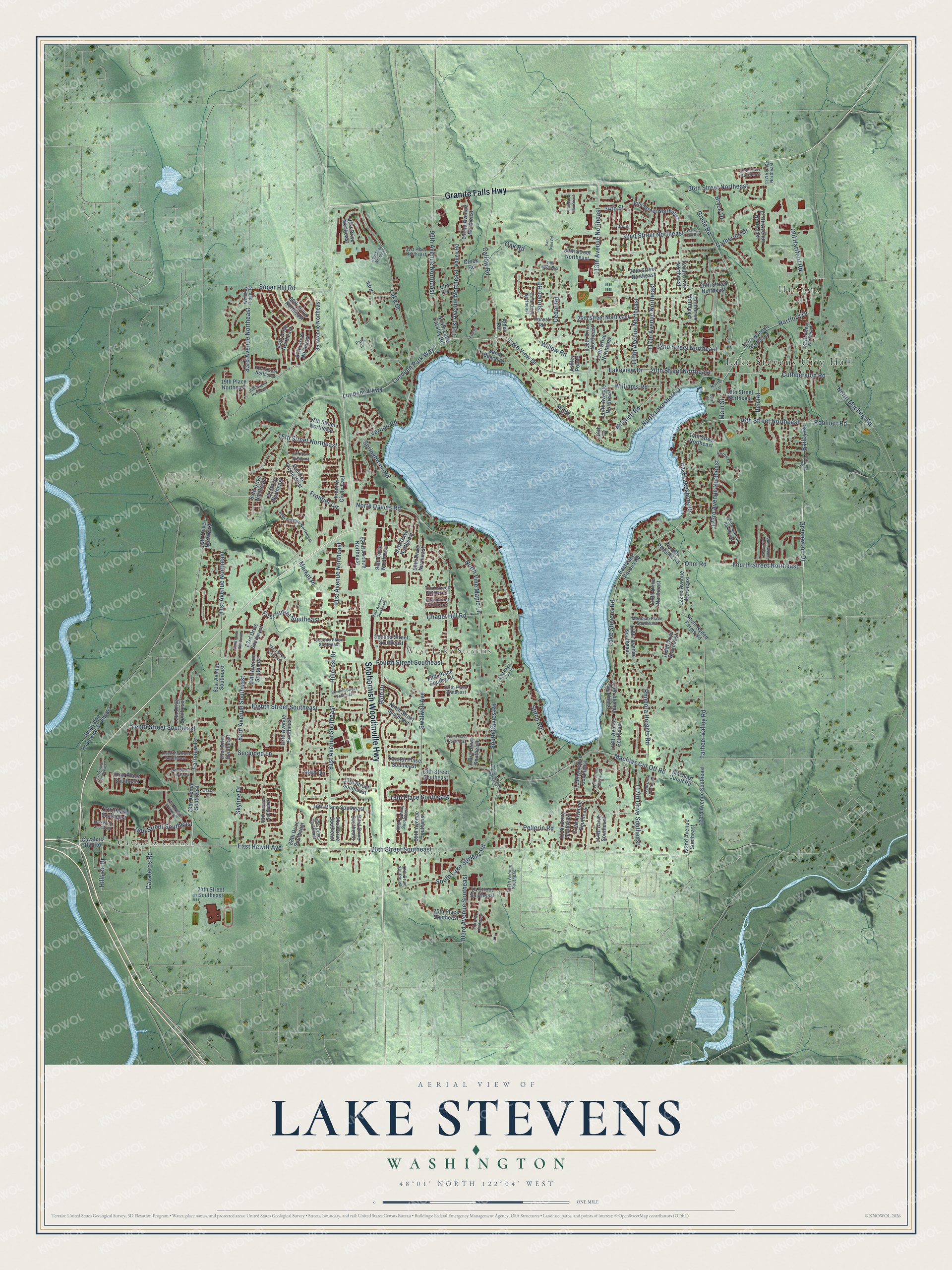
A new map of Lake Stevens, Washington, made in 2026 and printed to order on thick archival matte paper.
12" x 18" Archival Matte Print
A Map of Home. A Work of Art.
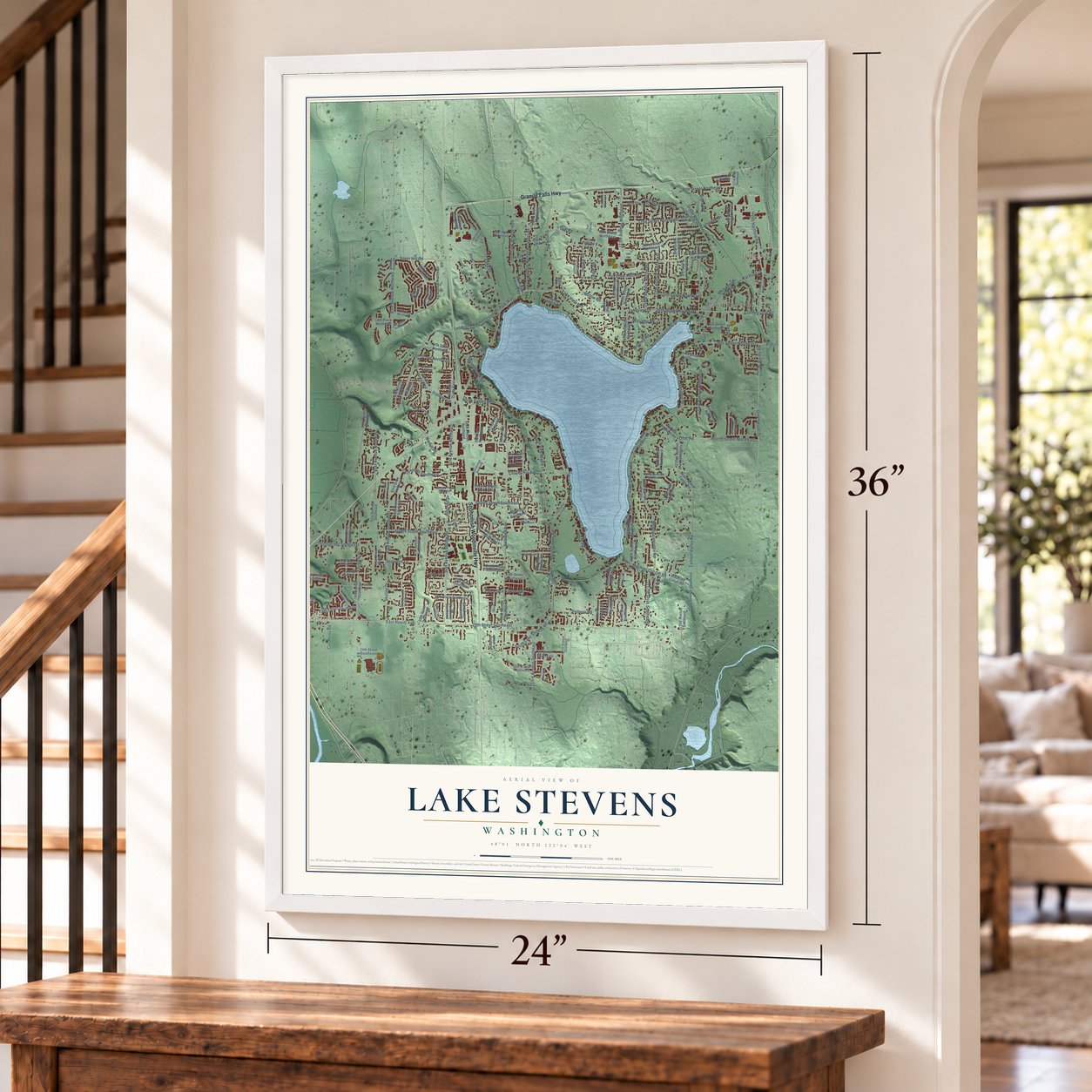
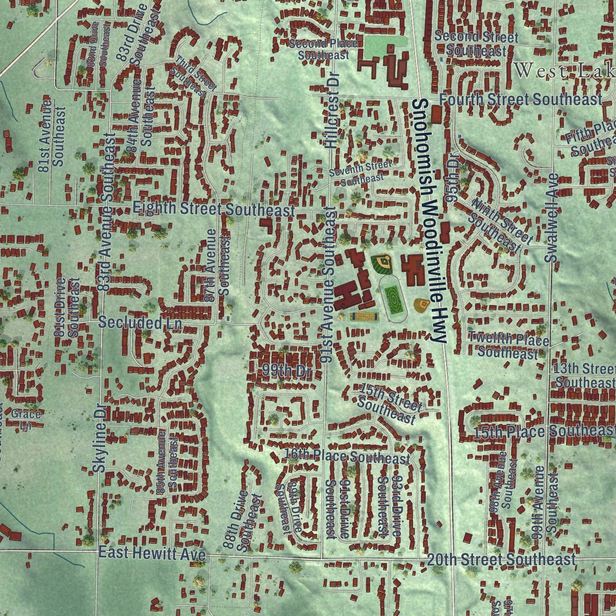
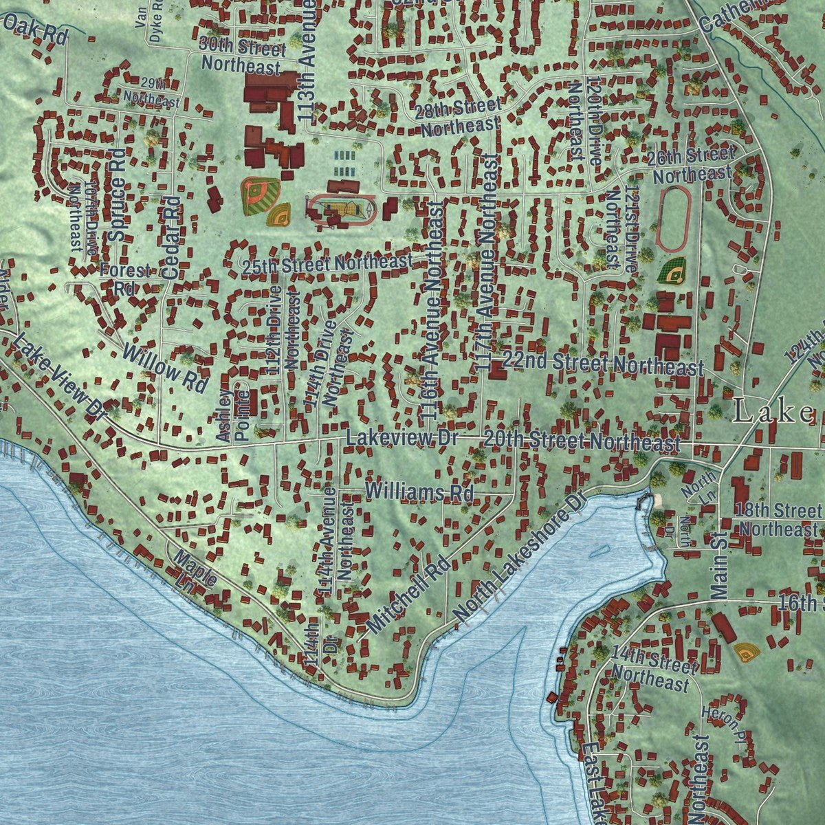
Explore Lake Stevens, Washington from a whole new perspective. Created using aerial imagery and detailed geographic data, this map captures Lake Stevens building by building, with labeled streets, familiar landmarks, and shaded topographical relief that highlights the natural contours of the landscape.
Combining modern data with the timeless character of a vintage atlas, this map is just as interesting up close as it is beautiful on the wall. Whether you grew up in Lake Stevens, spent memorable years there, or call it home today, this unique map is a great way to celebrate a place that means something to you. Zoom in on the preview to look for your street, and then order a print to put your memories on the wall.
Three ways to hang it
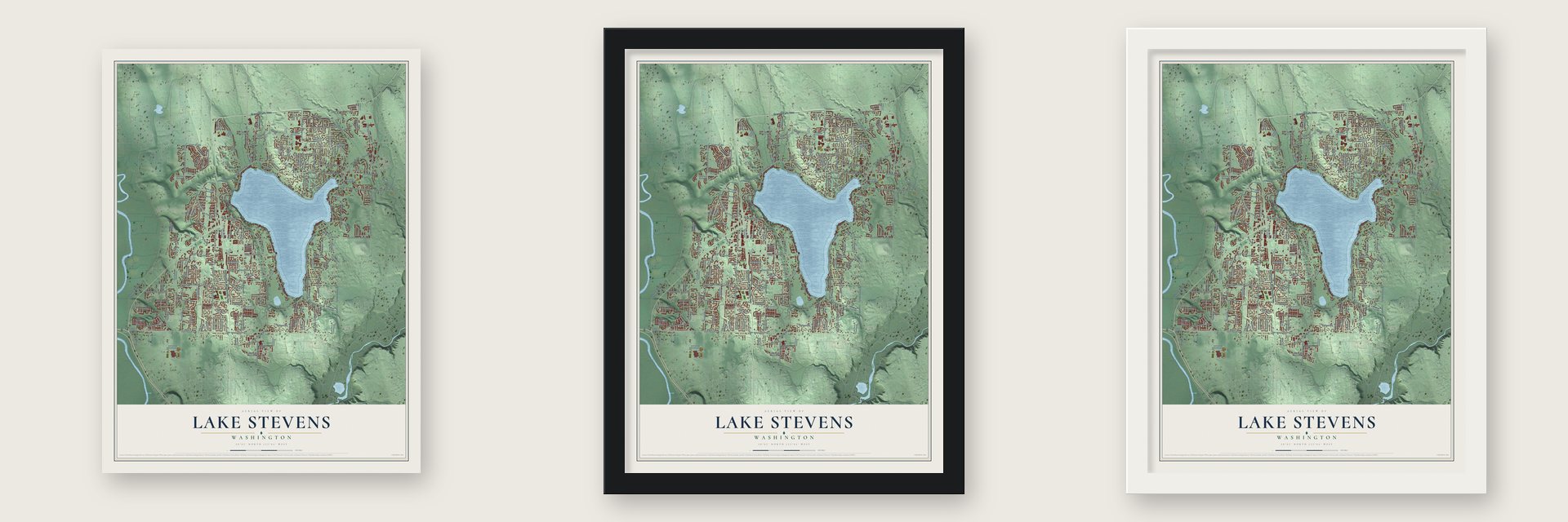
Unframed archival matte, a black wood frame or a white wood frame.
Up close
Geography Worth Displaying
This map was created using accurate cartographic data and authoritative geographic sources, including the U.S. Geological Survey and the Census Bureau. The map brings together terrain, waterways, roads, and building detail. The majority of the streets are labeled, houses are accurately depicted, and the topography is derived from government sources. Combining local data with carefully composed color and shading leads to this beautifully detailed Lake Stevens artwork for your wall.
Rather than simply showing street outlines, we’ve included as many of the street names as we could reasonably fit on the map while keeping their names legible. Zoom in on the high resolution preview to see exactly what’s on the map. We truly set out to create a statement piece for anyone who loves Lake Stevens. So whether it’s for you, or a gift for someone you love, we hope this map of Lake Stevens brings back fond memories.
Read the story behind this map of Lake Stevens, Washington from 2026.

About Lake Stevens, Washington
Lake Stevens is a city of 35,630 people in Snohomish County. It wraps around the county's largest and deepest lake, which an 1855 map named for Washington Territory Governor Isaac I. Stevens. Charles A. Missimer signed a deed for land at the north end of the lake on October 8, 1889. In 1890 he and his father-in-law, Harold W. Illman, platted a two-block townsite there called Outing. The plat was later vacated, and after several sales the land passed to the Rucker Brothers, who opened a sawmill on it in 1907.
The mill site was a swamp at the lake's natural outlet, so the town went up on pilings over a creek. The firm dug a shorter outlet to Cassidy Creek, known locally as the Ditch, and ran a railroad spur beside it to the Northern Pacific line at Hartford. By 1910 the mill employed around 250 people. It had burned once and been rebuilt, but after a fire in 1925 it never reopened, and many families left town with the Ruckers.
“our little village became a wide spot in the road”
- Lundeen Park since 1908Lundeen Park opened in 1908. A midwife known as Grandma Lundeen rowed from downtown to deliver a baby at the Johnson Farm. She fell in love with the place and asked to buy it if it was ever sold, and within a couple of years her family lived there.
- A resort for a thousand dancersPicnickers kept asking to use the Lundeens' beach, so the family started charging them and built a resort. It had a dance pavilion on pilings that held a thousand dancers, a tavern with a 60-foot bar and a ballpark. Snohomish County later bought part of the property for a public park.
- A city by vote in 1960Plans for the Frontier Village shopping center west of the lake worried downtown merchants, who proposed incorporation in 1958 to keep stores from leaving. Voters approved it 299 to 40 on November 19, 1960, creating a city of about 900 people. The new city bought an old post office for its city hall, and its jail was never used because state law changed.
- The Lake Stevens MonsterA boulder carried here by the Ice Age Floods rests in a ravine within a subdivision. It is thought to be Washington's largest erratic, at 34 feet high, 78 feet long and 210 feet around. Geologist Dave Tucker identified it as serpentinized greenstone, which matches rock found 37 miles northwest, at the northern tip of Whidbey Island.
- A fisherman's lakeDuring the 1930s, the state's Fish and Game Department put silvers, a landlocked salmon also called kokanee, into the lake. The fish thrived, and with a limit of 20, the average angler caught a full limit within an hour. Fishing resorts became the town's main source of income, but once World War II was over the state quit planting silvers.
Find your street
Names on the Lake Stevens map
Every name below is printed on this map. Look for your street, your school, the park where you played, or the pond down the road.
Places and landmarks4
- Lake Stevens City Hall
- Cavalero Corner
- Hartford
- West Lake Stevens
Streets and roads217
- Granite Falls Highway
- Snohomish Woodinville Highway
- Vernon Road
- 20th Street Southeast
- East Hewitt Avenue
- Lundeen Park Way
- Grade Road
- Fourth Street Northeast
- East Lakeshore Drive
- North Lakeshore Drive
- Callow Road
- Ohm Road
- Lundeen Parkway
- Main Street
- Greenwood Drive
- Fairview Drive
- Bailey Road
- 20th Street Northeast
- Cedar Road
- 91st Avenue Southeast
- Hartford Drive
- Lake View Drive
- Cuthberston Road
- Lakeview Drive
- Tarheel Valley Road
- 91st Avenue Northeast
- Fourth Street Southeast
- Chapel Hill Road
- Cavaleros Road
- 83rd Avenue Southeast
Show all 217 streets
- South Davies Road
- Lake Stevens Road
- South Lake Stevens Road
- North Machias Road
- Skyline Drive
- 15th Place Southeast
- Swalwell Avenue
- Hillcrest Drive
- Soper Hill Road
- North Davies Road
- 99th Avenue Northeast
- 123rd Avenue Northeast
- Eighth Street Southeast
- Lake Drive
- 36th Street Northeast
- 101st Avenue Northeast
- 117th Avenue Northeast
- Rhodora Heights Road
- 16th Street Northeast
- 18th Street Southeast
- Robinett Road
- 32nd Street Northeast
- 103rd Avenue Southeast
- Market Place
- First Street Southeast
- 81st Avenue Northeast
- 116th Avenue Northeast
- 117th Drive Southeast
- Machias Cut Off Road
- 22nd Street Northeast
- 15th Street Northeast
- 83rd Avenue Northeast
- Old Hartford Road
- 113th Avenue Northeast
- Stitch Road
- Frontier Circle
- Mitchell Road
- Tenth Street Southeast
- Catherine Drive
- Secluded Lane
- Williams Road
- North Vine Maple Lane
- Pellerin Road
- Springbrook Road
- 95th Drive
- Spruce Road
- Iten Road
- Hillside Drive
- Bryce Drive
- Oak Road
- Willow Road
- 34th Street
- 99th Drive
- 85th Drive Northeast
- Cavalero Hill Road
- 85 Drive Northeast
- Purple Pennant Road
- 122nd Avenue Northeast
- South Nyden Farms Road
- 24th Street Southeast
- East Lake Stevens Road
- 103rd Drive Southeast
- Machias Cutoff Road
- 87th Avenue Southeast
- 25th Place Southeast
- 124th Avenue Northeast
- 24 Street Southeast
- 28th Street Northeast
- 127th Avenue Northeast
- Twelfth Place Southeast
- 15th Street Southeast
- 34th Street Northeast
- 102nd Avenue Northeast
- 99th Avenue Southeast
- 79th Avenue Southeast
- 123rd Avenue Southeast
- 30th Street Northeast
- 118th Avenue Southeast
- South Lake Cassidy Road
- 118th Drive Northeast
- 14th Place Southeast
- 26th Street Northeast
- 25th Street Northeast
- 89 Avenue Northeast
- 16th Place Southeast
- 93rd Drive Southeast
- Valley Road
- Second Street Southeast
- Fifth Place Southeast
- 84th Drive Northeast
- Frontier Circle West
- 77th Drive Southeast
- 120th Drive Northeast
- 81st Avenue Southeast
- 13th Street Southeast
- 112th Drive Northeast
- 116th Avenue Southeast
- 114th Avenue Northeast
- Ninth Street Southeast
- 84th Avenue Southeast
- 83rd Drive Southeast
- 119th Drive Southeast
- 18th Street Northeast
- 17th Street Northeast
- 114th Drive Northeast
- 17th Place Southeast
- 19th Place Northeast
- Sunnyside Boulevard Southeast
- 88th Drive Southeast
- Creek Road
- 97th Drive Northeast
- 14th Street Northeast
- 92nd Avenue Northeast
- 114th Drive Southeast
- 112th Avenue Southeast
- 115th Avenue Southeast
- 94th Drive Northeast
- Frontier Circle East
- 87th Drive Northeast
- 79th Drive Northeast
- Sandy Beach Drive
- 81st Drive Southeast
- 122nd Avenue Southeast
- 98th Drive Northeast
- 91st Drive Southeast
- 86th Drive Northeast
- 113th Avenue Southeast
- 114th Drive
- 111th Drive Southeast
- 121st Drive Northeast
- Maple Lane
- Ashley Pointe
- 91st Drive Northeast
- Forest Road
- Elm Road
- Alder Road
- 93rd
- 131st Avenue Northeast
- 127th Drive Northeast
- North Lane
- 21st Street Northeast
- 87th Avenue Northeast
- Twelfth Street Southeast
- 125th Avenue Northeast
- 85th Avenue Southeast
- 31st Place Northeast
- Sixth Place Southeast
- Third Street Northeast
- Second Place Southeast
- 98th Avenue Southeast
- Whiskey Ridge Road
- First Street Northeast
- Meridian Place Southeast
- 107th Avenue Southeast
- 89th Drive Southeast
- 107th Drive Northeast
- 97th Drive Southeast
- 37th Place Northeast
- Park Drive
- Grace Lane
- Heron Place
- 33rd Street
- Nyden Farms Road
- 18th Place Southeast
- 105th Avenue Southeast
- 104 Drive Southeast
- 71st Avenue Southeast
- Walker Hill Road
- Tenth Place Southeast
- 19th Street Northeast
- 95th Avenue Southeast
- 77th Avenue Southeast
- Third Street Southeast
- 29th Street Northeast
- 13th Place Northeast
- East Davies Loop Road
- 118th Drive Southeast
- 82nd Drive Southeast
- 128th Avenue Northeast
- Seventh Street Southeast
- 14th Street Southeast
- 114th Street Southeast
- 111th Drive Northeast
- 29th Northeast
- Prdrwy
- Van Dyke Road
- North Drive
Names are listed as they appear on the printed map. Zoom into the product photos to find them.
The art of mapping a place
How This Map Was Made
Real places. Remarkable detail. Discover the layers that turn geographic data into a map of home.

The view from above
Aerial imagery reveals the character of the land: woodland, open fields, and the patterns of a place.

The shape of the land
Elevation data brings hills, valleys, and subtle changes in the landscape into view.

The details of home
Roads, waterways, and building footprints come together to make the map feel unmistakably local.

Geography becomes art
Considered color, shading, and typography bring the layers together in a map made for your wall.


Process illustrated with Mendon, Massachusetts. Aerial imagery: USDA NAIP. Terrain: USGS 3D Elevation Program. Map details and finished artwork: KNOWOL.
The Details
About This Print
Choose an archival matte print, or a black or white Ayous wood frame. The archival matte print is unframed.
Select your size and finish above to see the matching product image and price.
Materials & Craftsmanship
A contemporary map with the character of a classic atlas, printed on archival matte paper. Optional frames are made from Ayous wood.
Your printed map does not include the watermark shown in the full-map preview.
Shipping & Delivery
Free shipping within the United States. Every print is made to order in the USA.
Buying a gift? Add a note in your cart and we'll include it. We never put prices in the package.
Prints ship within 2 to 3 business days. Allow 7 to 10 days total from ordering for delivery. Timing may vary during holidays or periods of high order volume.
Read our shipping policy.
Returns and damaged prints
Each print is made to order. Change-of-mind refunds are not available after production.
If your print arrives damaged, misprinted or incorrect, contact support@knowol.com within 30 days of receiving it. Include your order number, photos and a description of the issue.
Read our full refund and replacement policy. For questions about your order, email support@knowol.com.
Find your town
Looking for another city?
Find a map of home in our Washington collection, or any town in the country.
Nearby
Maps of towns near Lake Stevens
Know someone from one of these towns? Their map makes a great gift.
 Cavalero
, Washington
From $39.99See the map
 Machias
, Washington
From $39.99See the map
 Bunk Foss
, Washington
From $39.99See the map
More maps nearby: Lake Cassidy, Lochsloy, Fobes Hill, Everett and Snohomish.