
Search for another town





Free U.S. delivery 7 to 10 days after you order
Laplace, Louisiana Map Art
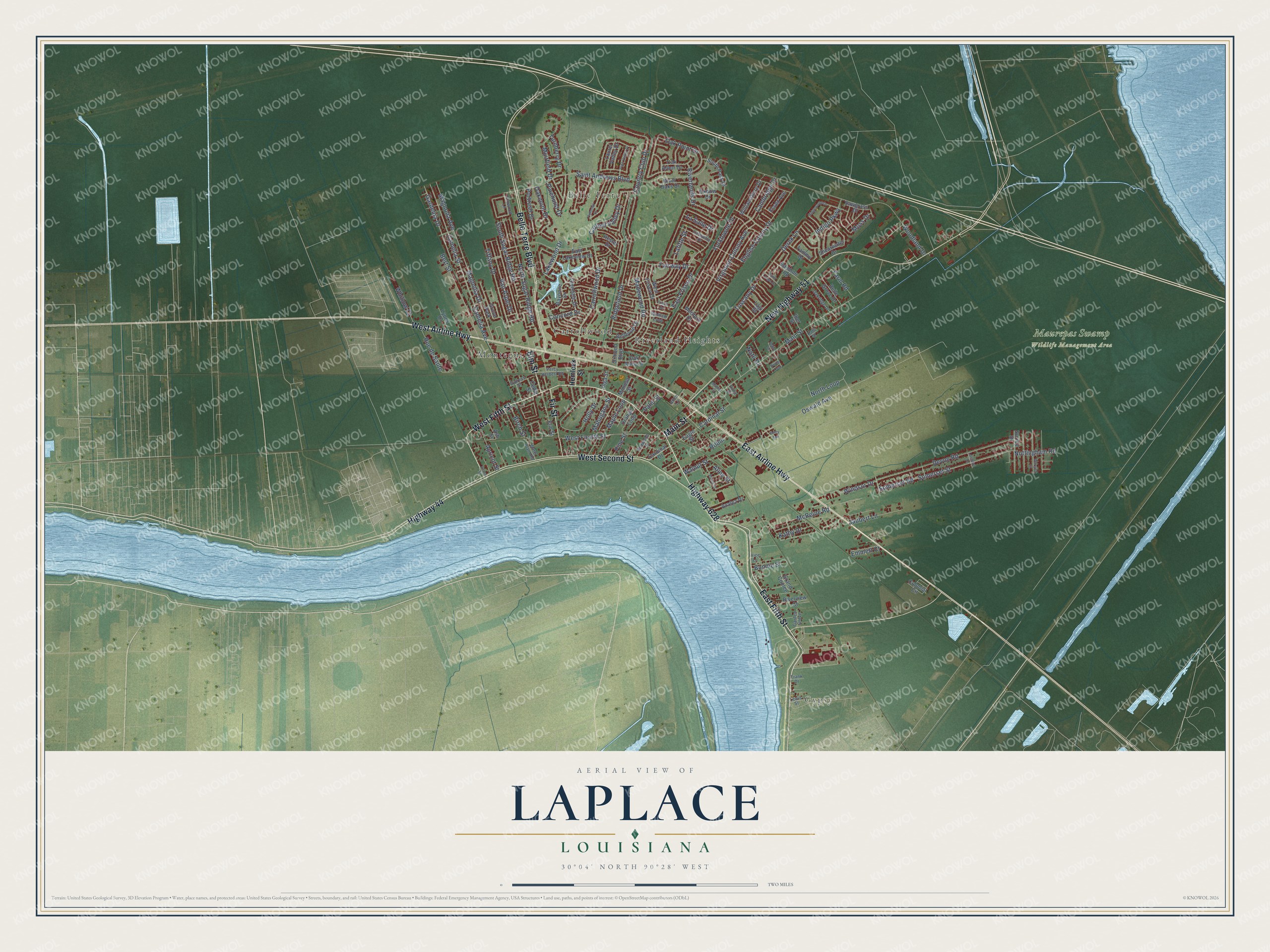
A new map of Laplace, Louisiana, made in 2026 and printed to order on thick archival matte paper.
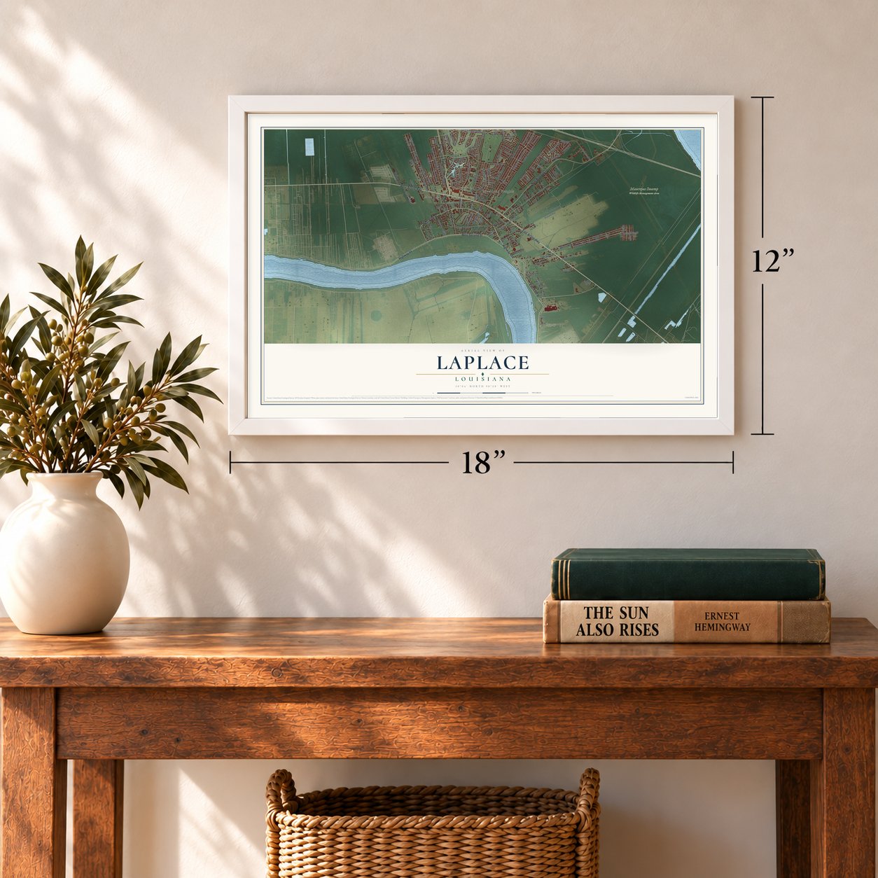
12" x 18" Archival Matte Print
A Map of Home. A Work of Art.
Explore Laplace, Louisiana from a whole new perspective. Created using aerial imagery and detailed geographic data, this map captures Laplace building by building, with labeled streets, familiar landmarks, and shaded topographical relief that highlights the natural contours of the landscape.
Combining modern data with the timeless character of a vintage atlas, this map is just as interesting up close as it is beautiful on the wall. Whether you grew up in Laplace, spent memorable years there, or call it home today, this unique map is a great way to celebrate a place that means something to you. Zoom in on the preview to look for your street, and then order a print to put your memories on the wall.
Three ways to hang it
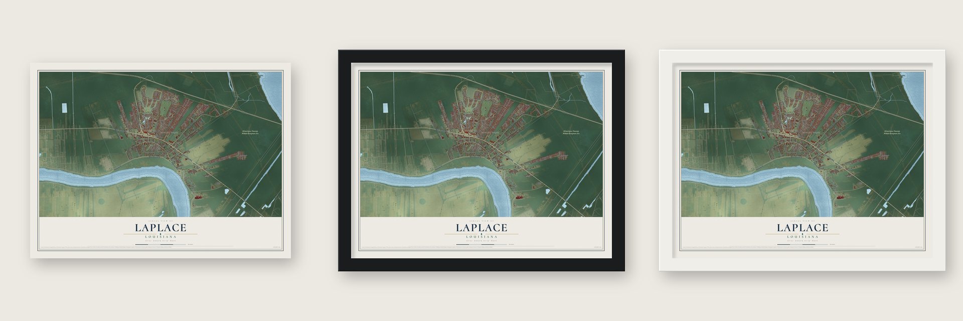
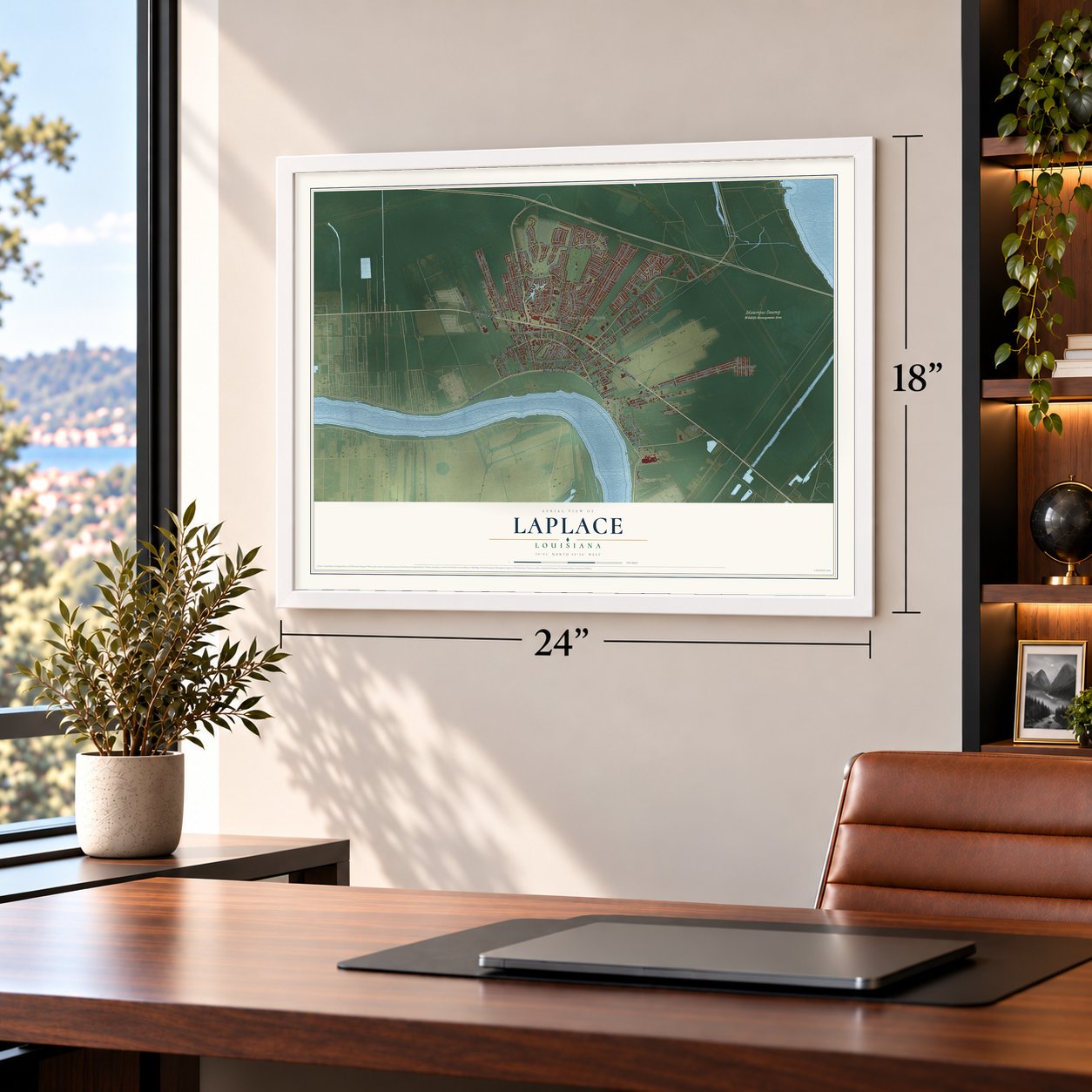
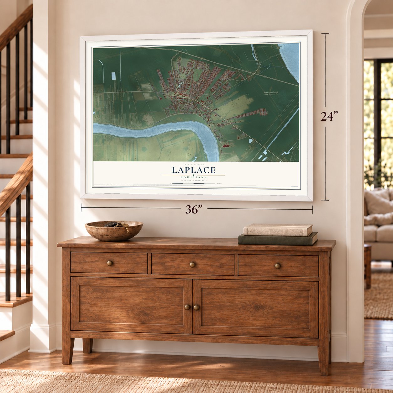
Unframed archival matte, a black wood frame or a white wood frame.
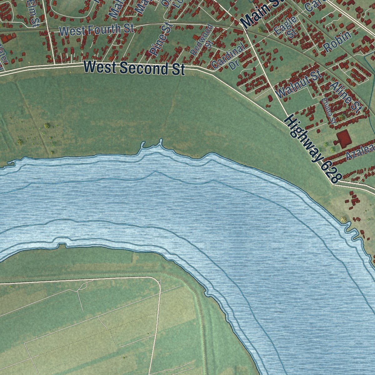
Up close
Geography Worth Displaying
This map was created using accurate cartographic data and authoritative geographic sources, including the U.S. Geological Survey and the Census Bureau. The map brings together terrain, waterways, roads, and building detail. The majority of the streets are labeled, houses are accurately depicted, and the topography is derived from government sources. Combining local data with carefully composed color and shading leads to this beautifully detailed Laplace artwork for your wall.
Rather than simply showing street outlines, we’ve included as many of the street names as we could reasonably fit on the map while keeping their names legible. Zoom in on the high resolution preview to see exactly what’s on the map. We truly set out to create a statement piece for anyone who loves Laplace. So whether it’s for you, or a gift for someone you love, we hope this map of Laplace brings back fond memories.
Read the story behind this map of Laplace, Louisiana from 2026.

About Laplace, Louisiana
LaPlace is a community of 28,841 people in St. John the Baptist Parish, on the east bank of the Mississippi River about 25 miles west of New Orleans. The Chitimacha lived here before Europeans came. German-speaking settlers arrived from 1721 as part of Karlstein, one of four settlements on the German Coast. French and Acadian families married into the German ones, and the area came to be called Bonnet Carré, French for "square bonnet," after the sharp bend the river makes nearby.
In 1879 Basile Laplace, a New Orleans pharmacist and planter who also sold patent medicines, started a large plantation in Bonnet Carré. He let the railroad cross his land, and a depot opened in 1884 that people called LaPlace Station. His name went first to the depot, then to the post office, and at last to the town. In 1971 the parish police jury ruled that the official spelling would use a capital P.
- The uprising of 1811Woodland Plantation was built by Manual Andry in 1793, and he made enslaved people work its sugarcane fields. In early January 1811 they rose up with people from nearby plantations in the German Coast Uprising. Between 200 and 500 rebels, carrying guns, axes and cane knives, marched from LaPlace toward New Orleans, seeking freedom. White militia crushed the revolt within three days, and nearly 100 rebels died in battle or were executed after quick trials run by planters.
- The Bonnet Carré CrevasseIn 1850 a flood tore a gap more than a mile wide in the east bank levee. The break made several later floods worse, including one that badly flooded New Orleans in 1871. The levee was finally closed in 1883.
- Andouille Capital of the WorldIn the 1970s Governor Edwin Edwards gave LaPlace the title of "Official Andouille Capital of the World" for its smoked pork sausage. The town has held an Andouille Festival every October since 1972, and TV chef Alton Brown came here to taste it on his show Feasting on Asphalt.
- Kid Ory's birthplaceEdward "Kid" Ory, the trombonist and bandleader, was born in an outbuilding on Woodland Plantation. He later led a successful jazz band in New Orleans. The Montegut family bought Woodland in the 1920s.
Find your street
Names on the Laplace map
Every name below is printed on this map. Look for your street, your school, the park where you played, or the pond down the road.
Places and landmarks7
- Gypsy
- Maurepas Swamp Wildlife Management Area
- Belle Terre
- Carrollwood
- Montegut
- Riverland Heights
- Grove Park
Streets and roads143
- Main Street
- East Fifth Street
- Highway 628
- East Airline Highway
- West Fifth Street
- Elm Street
- West Airline Highway
- Belle Terre Boulevard
- West Second Street
- New Highway 51
- Highway 44
- Fir Street
- Fairway Drive
- East Frisco Drive
- Somerset Street
- Ridgefield Drive
- South Sugar Ridge Road
- Cambridge Drive
- Saint Andrews Boulevard
- Devon Road
- Woodland Drive
- Oswald Avenue
- Yorktowne Drive
- English Colony Drive
- Magnolia Avenue
- Magnolia Drive
- Camelia Avenue
- Camelia Street
- Country Club Drive
- Somerset Road
Show all 143 streets
- Oak Point Drive
- Holly Drive
- Carrollwood Drive
- North Sugar Ridge Road
- Tiffany Drive
- West Fourth Street
- Cardinal Street
- Virginian Colony Avenue
- Madewood Road
- Bert Street
- McReine Road
- Tuscany Drive
- Riverlands Drive
- Derek Lane
- Carmel Valley Drive
- Gardenia Drive
- Maple Loop
- Van Arpel Drive
- Lakewood Drive
- Muirfield Drive
- Rue de Sante
- Walnut Street
- Whitlow Court
- Windsor Drive
- Lafitte Street
- Indigo Parkway
- Oakmont Drive
- North Loop
- Jaubert Lane
- Portrush Drive
- Moss Drive
- Aline Street
- Apricot Street
- Turnberry Drive
- Nottingham Road
- Mahogany Street
- Concord Drive
- Pinehurst Drive
- Farm Road
- Birch Street
- La Salle Drive
- Kathy Drive
- Bonnie Street
- Emmett Court
- Pine Street
- Robin
- Palm Street
- Natli Drive
- Hemlock Street
- Belle Grove Drive
- Williamsburg Drive
- South Pass Drive
- Shearwater Drive
- Orange Loop
- East Lakeview Drive
- Tammy Drive
- Laurel Valley Drive
- Bamboo Road
- Surrey Drive
- Bayonne Drive
- Bellevue Drive
- West Frisco Drive
- Oxbow Drive
- Glendale Drive
- Riverview Court
- Azalea Drive
- Grand Coulee
- River Oaks Drive
- Sawgrass Drive
- Ash Street
- Colonial Circle
- Oak Arbor Drive
- Ormond Boulevard
- Medford Drive
- Hester Drive
- Lyons Drive
- Oak Allee Drive
- Essex Avenue
- Iber Street
- Cardinal Drive
- Mimosa Street
- Lagi Street
- Eagle Street
- Inga Street
- Cedar Street
- Foxwood Lane
- Welham Loop
- Percy Herbert Road
- Lafayette Drive
- Cypress Street
- Oakridge Drive
- Redwood Street
- Alice Lane
- Water Plant Road
- Garden Grove
- Kate Street
- Lewis Street
- Frank Drive
- Viola Court
- Vice Lane
- Frisco Drive
- Ridgewood Drive
- Colonial Drive
- Warwick Street
- Pine Valley Drive
- Betty Avenue
- Elvina Street
- Oriole Loop
- Lancelot Drive
- Saint Loupe Drive
- Mattie Street
- Major Drive
- Acorn Street
Names are listed as they appear on the printed map. Zoom into the product photos to find them.
The art of mapping a place
How This Map Was Made
Real places. Remarkable detail. Discover the layers that turn geographic data into a map of home.

The view from above
Aerial imagery reveals the character of the land: woodland, open fields, and the patterns of a place.

The shape of the land
Elevation data brings hills, valleys, and subtle changes in the landscape into view.

The details of home
Roads, waterways, and building footprints come together to make the map feel unmistakably local.

Geography becomes art
Considered color, shading, and typography bring the layers together in a map made for your wall.


Process illustrated with Mendon, Massachusetts. Aerial imagery: USDA NAIP. Terrain: USGS 3D Elevation Program. Map details and finished artwork: KNOWOL.
The Details
About This Print
Choose an archival matte print, or a black or white Ayous wood frame. The archival matte print is unframed.
Select your size and finish above to see the matching product image and price.
Materials & Craftsmanship
A contemporary map with the character of a classic atlas, printed on archival matte paper. Optional frames are made from Ayous wood.
Your printed map does not include the watermark shown in the full-map preview.
Shipping & Delivery
Free shipping within the United States. Every print is made to order in the USA.
Buying a gift? Add a note in your cart and we'll include it. We never put prices in the package.
Prints ship within 2 to 3 business days. Allow 7 to 10 days total from ordering for delivery. Timing may vary during holidays or periods of high order volume.
Read our shipping policy.
Returns and damaged prints
Each print is made to order. Change-of-mind refunds are not available after production.
If your print arrives damaged, misprinted or incorrect, contact support@knowol.com within 30 days of receiving it. Include your order number, photos and a description of the issue.
Read our full refund and replacement policy. For questions about your order, email support@knowol.com.
Find your town
Looking for another city?
Find a map of home in our Louisiana collection, or any town in the country.
Nearby
Maps of towns near Laplace
Know someone from one of these towns? Their map makes a great gift.
 Montz
Montz, Louisiana
From $39.99See the map
 Reserve
, Louisiana
From $39.99See the map
 Edgard
, Louisiana
From $39.99See the map
More maps nearby: Killona, Taft, Norco, Hahnville and New Sarpy.