
Search for another town


Free U.S. delivery 7 to 10 days after you order
Leclaire, Illinois Map Art
Building by building, with labeled streets and shaded relief.
12" x 18" Archival Matte Print
A Map of Home. A Work of Art.
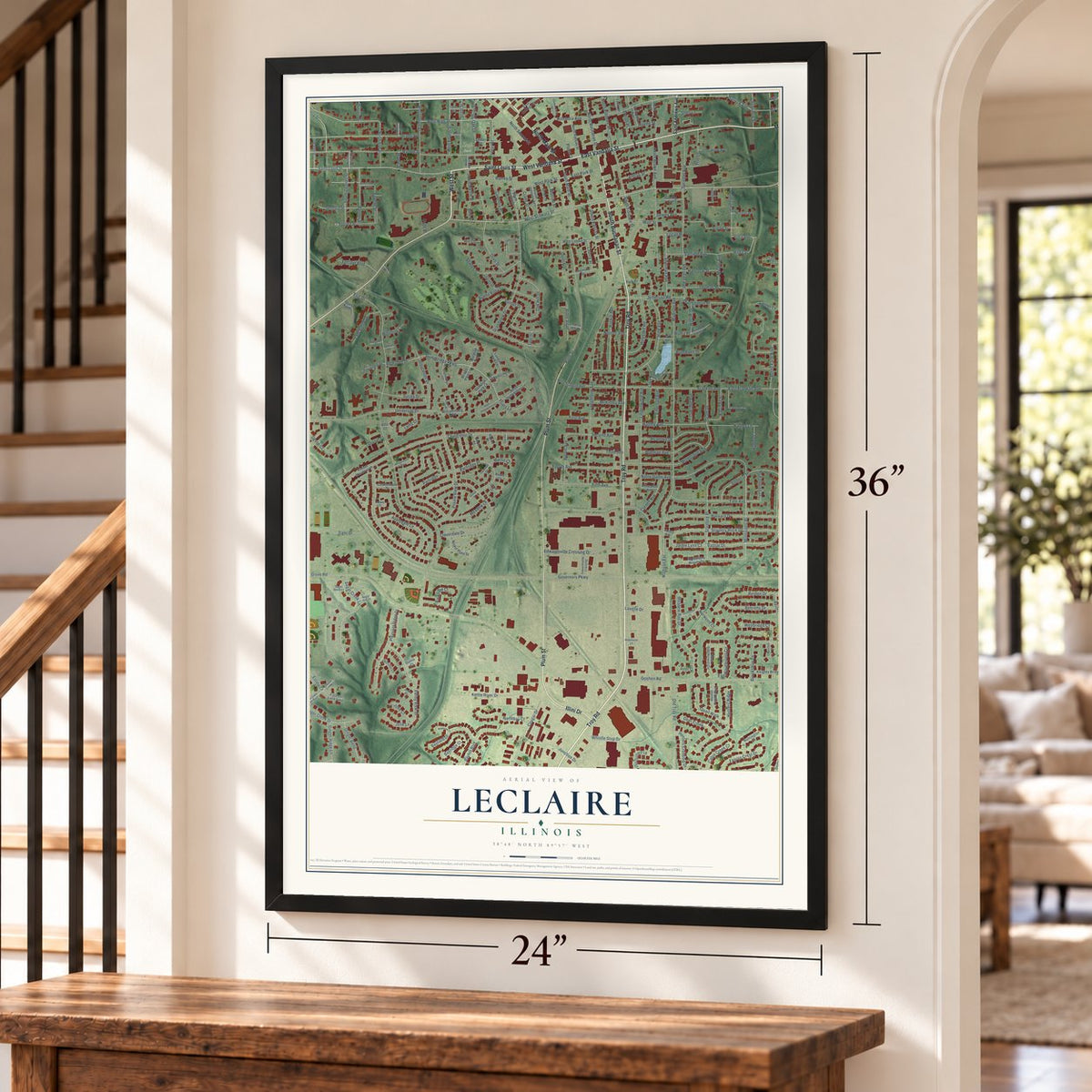
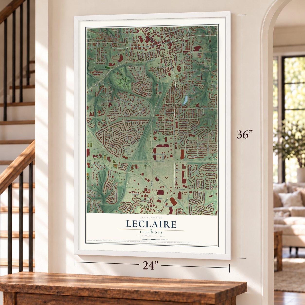
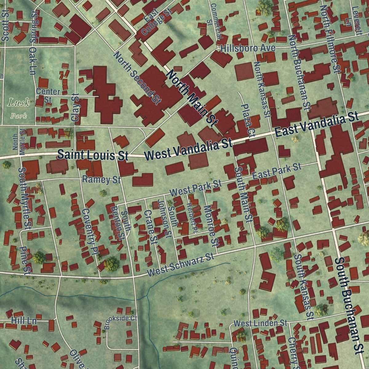
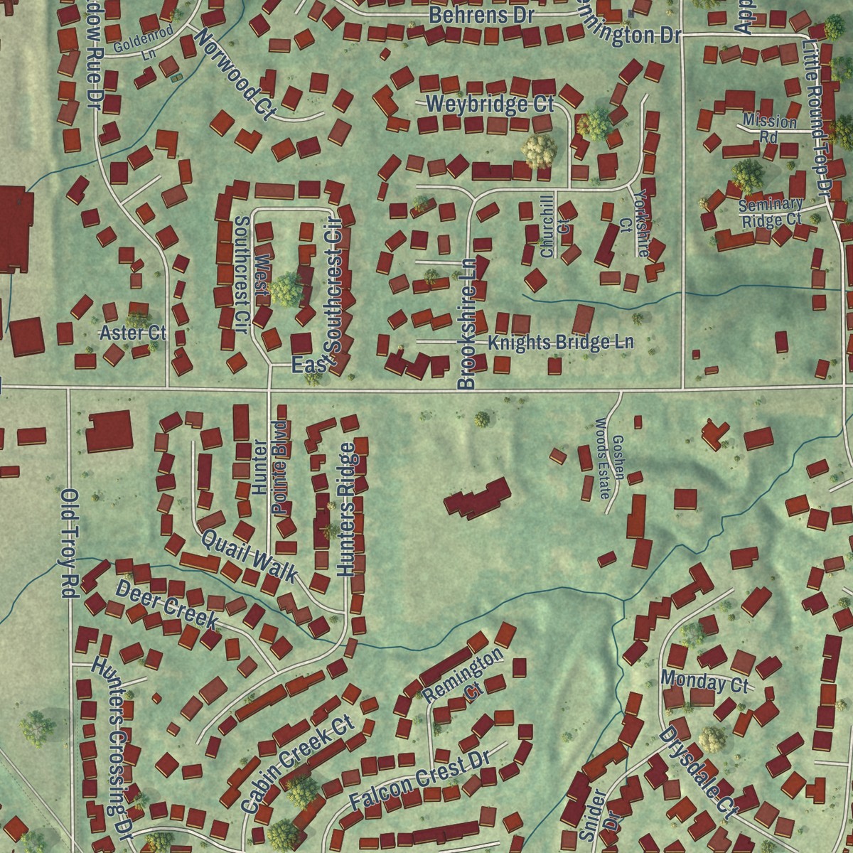
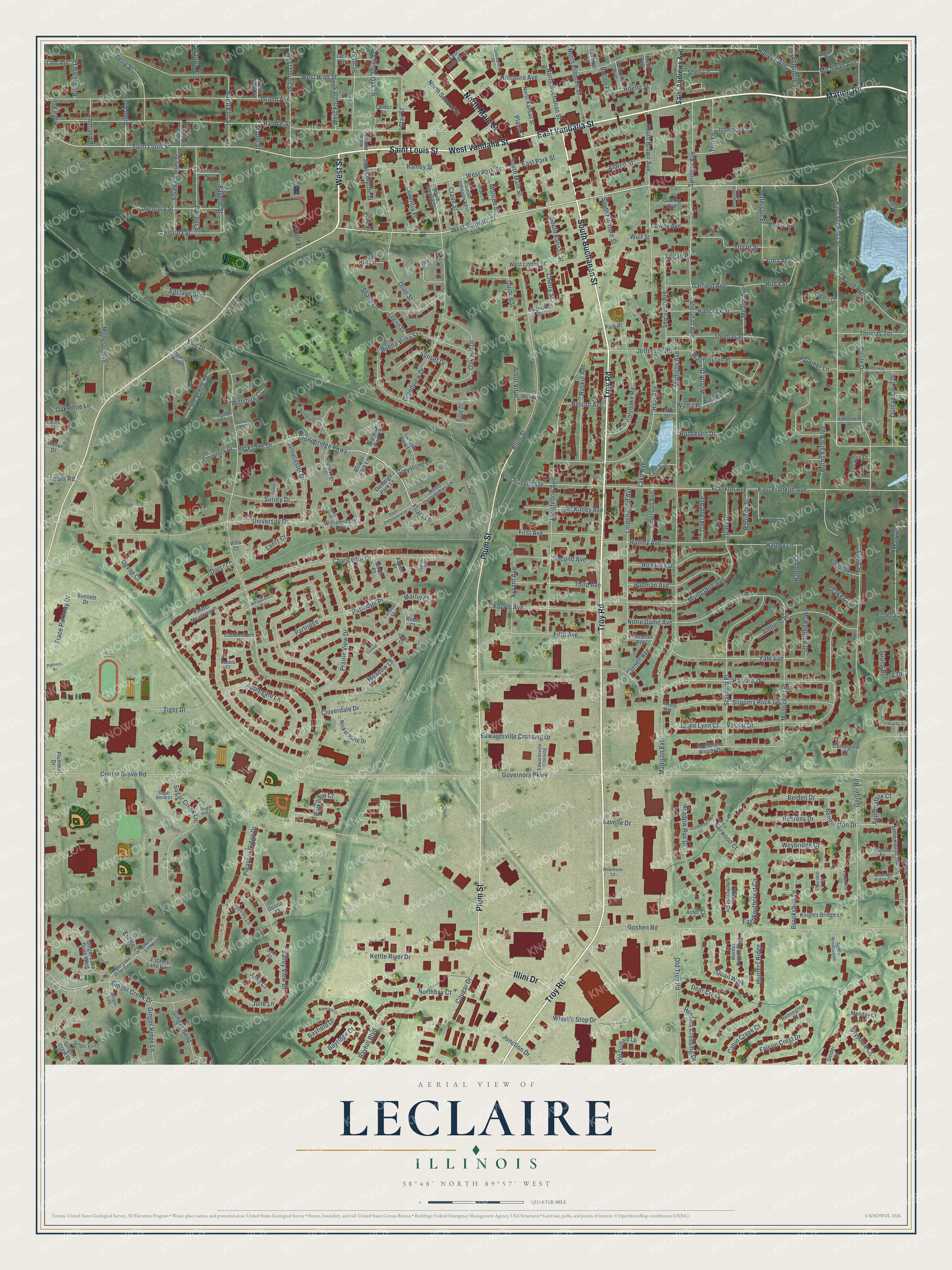
Explore Leclaire, Illinois from a whole new perspective. Created using aerial imagery and detailed geographic data, this map captures Leclaire building by building, with labeled streets, familiar landmarks, and shaded topographical relief that highlights the natural contours of the landscape.
Combining modern data with the timeless character of a vintage atlas, this map is just as interesting up close as it is beautiful on the wall. Whether you grew up in Leclaire, spent memorable years there, or call it home today, this unique map is a great way to celebrate a place that means something to you. Zoom in on the preview to look for your street, and then order a print to put your memories on the wall.
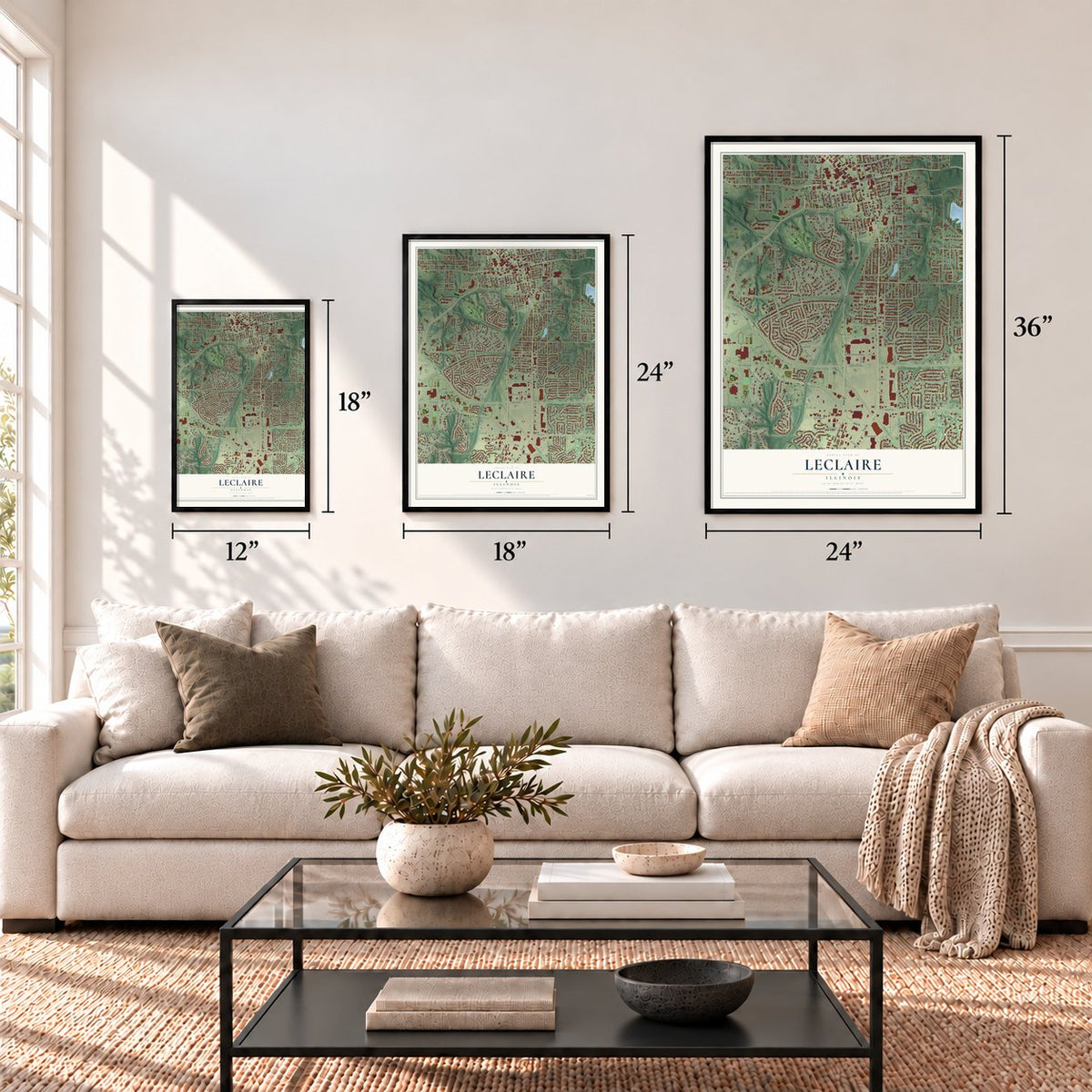
Three ways to hang it
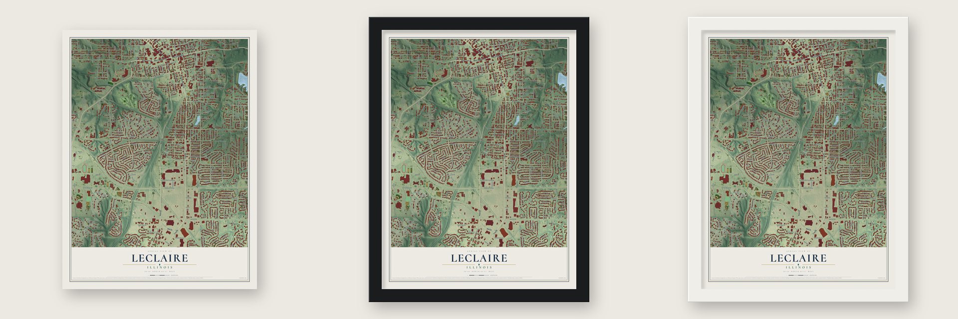
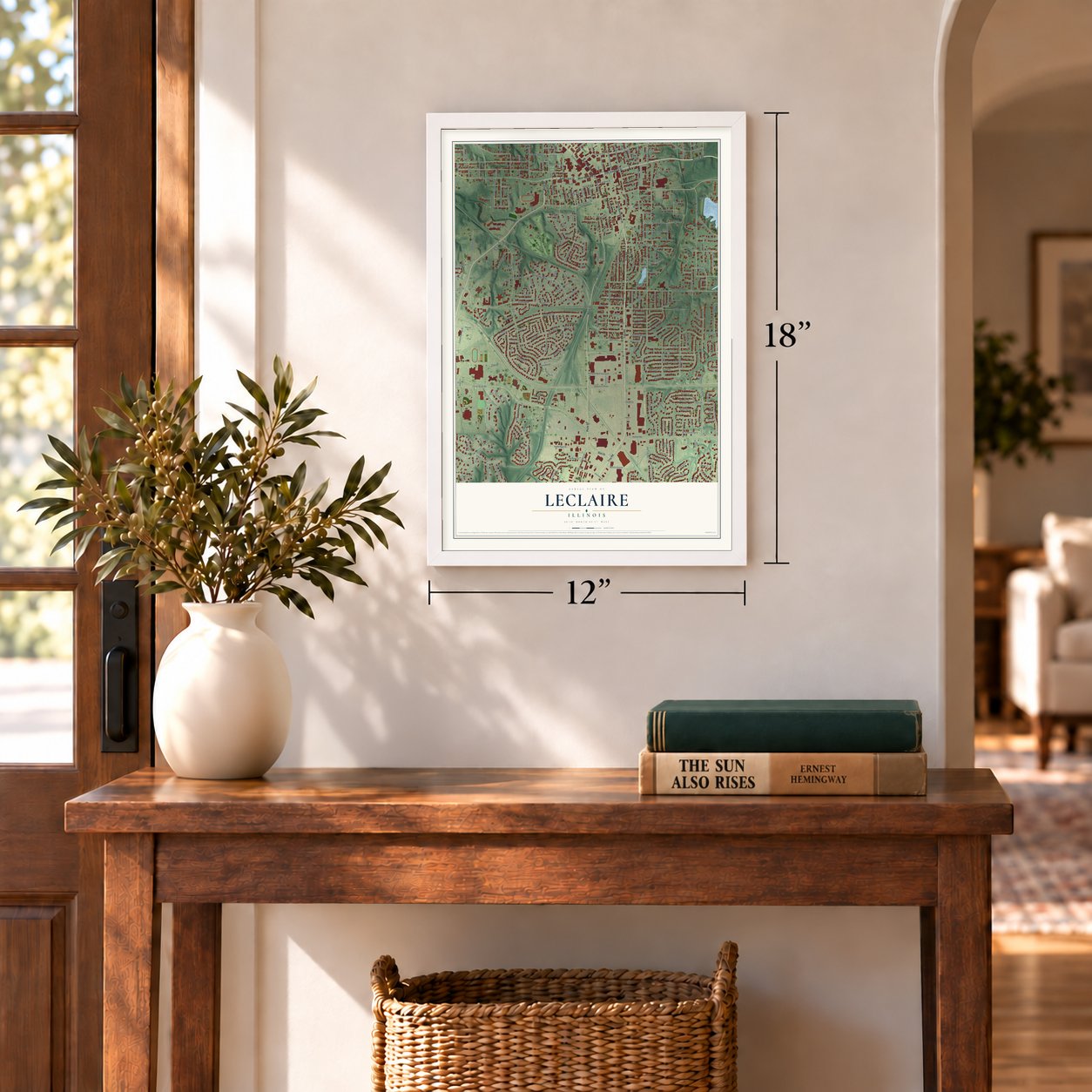
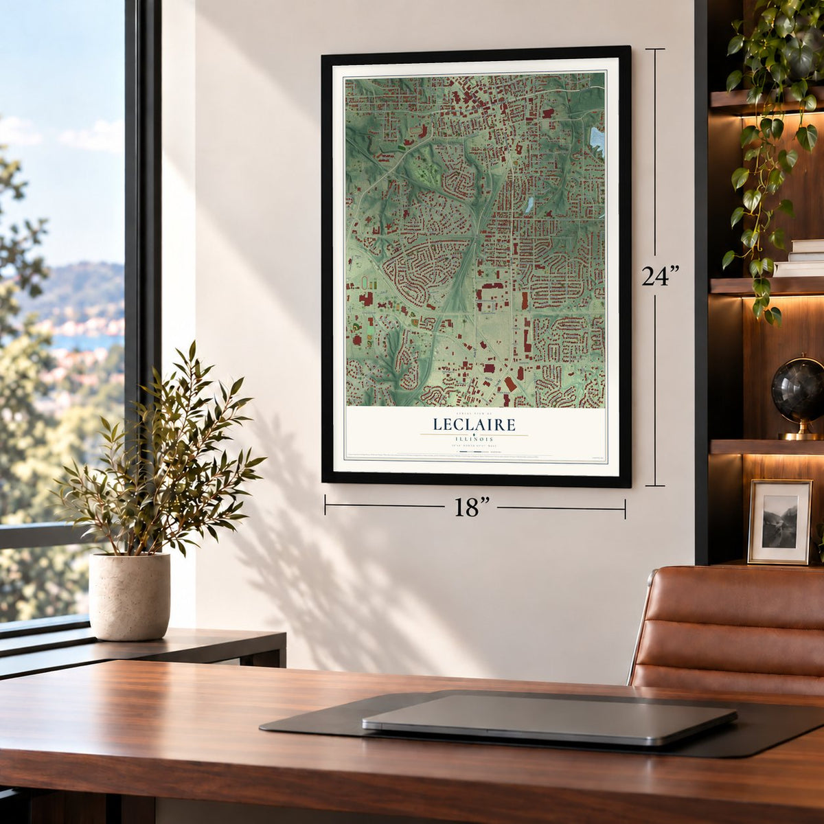
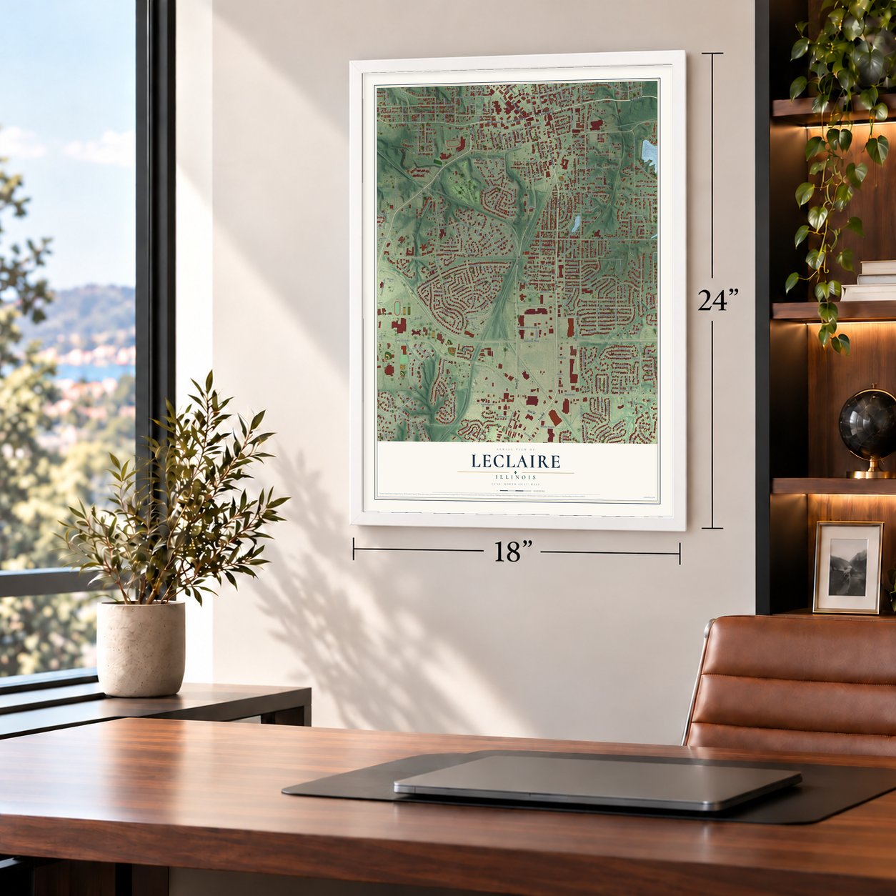
Unframed archival matte, a black wood frame or a white wood frame.
Up close
Geography Worth Displaying
This map was created using accurate cartographic data and authoritative geographic sources, including the U.S. Geological Survey and the Census Bureau. The map brings together terrain, waterways, roads, and building detail. The majority of the streets are labeled, houses are accurately depicted, and the topography is derived from government sources. Combining local data with carefully composed color and shading leads to this beautifully detailed Leclaire artwork for your wall.
Rather than simply showing street outlines, we’ve included as many of the street names as we could reasonably fit on the map while keeping their names legible. Zoom in on the high resolution preview to see exactly what’s on the map. We truly set out to create a statement piece for anyone who loves Leclaire. So whether it’s for you, or a gift for someone you love, we hope this map of Leclaire brings back fond memories.
Read the story behind this map: Detailed Map of Leclaire, Illinois.
Find your street
Names on the Leclaire map
Every name below is printed on this map. Look for your street, your school, the park where you played, or the pond down the road.
Places and landmarks2
- Township Park
- Lusk Park
Streets and roads318
- North Main Street
- Saint Louis Street
- West Street
- West Vandalia Street
- Marine Road
- Troy Road
- South Buchanan Street
- East Vandalia Street
- Plum Street
- Illini Drive
- East Schwarz Street
- West Schwarz Street
- Berkshire Drive
- Ginger Creek Drive
- North Buchanan Street
- Dewey Avenue
- Halleck Avenue
- Stonebridge Parkway
- Cherry Street
- West High Street
- West Park Street
- Franklin Avenue
- Sheridan Avenue
- University Drive
- Hadley Avenue
- Partridge Place
- Madison Extension
- Irma Avenue
- Governors Parkway
- Center Grove Road
Show all 318 streets
- Esic Drive
- Chancellor Drive
- Madison Avenue
- Randle Street
- Harvard Drive
- Longfellow Avenue
- Goshen Road
- Hale Avenue
- Meadow Lane
- Monticello Place
- Grand Avenue
- Buena Vista Street
- Gerber Road
- Cloverdale Drive
- Hillsboro Avenue
- Vassar Drive
- Valley View Drive
- South Brown Avenue
- Grandview Drive
- Prairie View Drive
- Montclaire Avenue
- Stanford Place
- Notre Dame Avenue
- Duke Street
- East Franklin Avenue
- Circle Drive
- Kettle River Drive
- Barnett Drive
- Olive Street
- Lindenwood Avenue
- Junction Drive
- Sunset Drive
- Sugar Creek Lane
- Amherst Place
- Springer Avenue
- Yale Avenue
- Pleasant Ridge Drive
- Meadow Rue Drive
- Old Troy Road
- Brookshire Lane
- South Kansas Street
- South Main Street
- Holyoake Road
- Bayhill Boulevard
- Cougar Drive
- Edwardsville Crossing Drive
- South Fillmore Street
- Washington Place
- Jaime Lynn Court
- Fourth Avenue
- West Union Street
- Hunters Ridge
- Applegate Lane
- Slippery Rock Drive
- Jefferson Road
- Drysdale Court
- Oak Hill Drive
- Roanoke Drive
- North Second Street
- Mengstrasse
- Belden Drive
- Bryant Avenue
- Bollman Avenue
- Fifth Avenue
- Shady Lane
- Thomas Street
- Ruskin Avenue
- Bayfield Drive
- East Park Street
- Partridge
- Sherman Avenue
- Terry Street
- Georgia Street
- Mary Drive
- Third Avenue
- South Charles Street
- Banner Street
- Coventry Place
- Gloucester Drive
- Scott Street
- West Fourth Street
- Northbay Court
- First Avenue
- Second Avenue
- East Southcrest Circle
- McKinley Avenue
- Behrens Drive
- North Fillmore Street
- Burns Farm Boulevard
- Garfield Avenue
- Quail Walk
- Hancock Street
- Dunlap Cove Drive
- Trace Parkway Drive
- Jefferson Street
- Clay Street
- Tiger Drive
- Surrey Drive
- Florida Street
- Devon Court
- Quince Street
- North Elm Street
- Lancashire Drive
- Thomas Terrace
- Weybridge Court
- Falcon Crest Drive
- Roosevelt Drive
- Hunters Crossing Drive
- Ramey Street
- Enclave Boulevard
- Michigan Avenue
- Wolf Street
- Harrison Street
- Whistle Stop Drive
- Ginger Ridge Lane
- Ginger Bend
- Cornell Avenue
- Arbor Vitae
- Fayette Street
- Hadley Lane
- Stolze Street
- Grant Drive
- Deer Creek
- Emerson Avenue
- Trio Lane
- Oakland Avenue
- Cabin Creek Court
- Oakstone Lane
- Oak Lane
- Norwood Court
- Friars Lane
- Burton Place
- Seminole Street
- Aldrup Street
- Bennington Drive
- South Myrtle Street
- Crane Street
- Meade Avenue
- Spring Brook Drive
- Allen Avenue
- Ammann Place
- Monroe Street
- Hilda Street
- McKendree Drive
- Timber Lane
- Broadview Drive
- Wilson Drive
- Appomattox Court
- Nelson Avenue
- Julie Lane
- Hoehn Street
- Dorset Court
- Shell Lane
- Hill Lane
- Lavelle Drive
- Julie Court
- Lantz Court
- Greystone Lane
- Logan Place
- Lake Avenue
- Parkview Court
- Wiltshire Court
- Hadley Court
- Estate Lane
- Rose Avenue
- Drake Court
- Martin Court
- Bayridge Court
- Plaza Court
- Lewis Road
- Warren Street
- Pine Street
- Dude Place
- Maple Street
- Wyma Place
- Saint Andrews Avenue
- South Benton Street
- Magnolia Street
- West Linden Street
- West Southcrest Circle
- Little Round Top Drive
- North Kansas Street
- Timber Meadows Place
- Ginger Crest Drive
- Plummer Drive
- Bennett Drive
- Ginger Lake Drive West
- Knights Bridge Lane
- Warwick Park Lane
- Williamsburg Boulevard
- Lautner Lane
- West Franklin Avenue
- North Oxfordshire Lane
- Biscayne Drive
- Hunter Pointe Boulevard
- South Johnson Street
- Remington Court
- Nickel Plate Drive
- Carrington Court
- Montclaire Woods Drive
- Center Street
- Isherwood Avenue
- Snider Drive
- Old Orchard Lane
- Pinebrook Drive
- East Avenue
- Lane Street
- Wellesly Court
- Estates Lane East
- London Park Lane
- Cobblestone Drive
- East College Street
- Morton Avenue
- Autumn Forest
- Richetta Drive
- Ladd Avenue
- Legion Drive
- Quartz Knoll
- Jennifer Lane
- Columbia Avenue
- Dunleigh Park Lane
- Monday Court
- Gueltig Avenue
- North Charles Street
- Princeton Avenue
- Leverett Lane
- Spring Street
- Lake Drive
- Bristol Park Lane
- Creek Street
- Sage Drive
- Bunn Avenue
- Terra Verde
- Aster Court
- North Oak Street
- Birch Court
- Park Place
- Robin Court
- Weber Drive
- Donna Court
- Aspen Court
- Kristy Lane
- Villa Court
- Ginger Lake Drive East
- Minnesota Street
- South Street
- Brookside Court
- Ginger Forest Court
- Kiowa Street
- Edwardsville Crossing
- Southbridge Lane
- Commercial Street
- Ginger Lea
- Herbert Place
- Chaderic Court
- Seminary Ridge Court
- Vadalabene Drive
- Mission Road
- Sugar Bend Court
- Jason Court
- Yorkshire Court
- Robinson Lane
- North Myrtle Street
- Sugar Hill Court
- Pineridge Court
- Churchill Court
- Cardinal Court
- Durham Court
- Castle Court
- Pebble Court
- Oriole Court
- Stonebrooke Drive
- Greenway Drive North
- Goldenrod Lane
- Goshen Woods Estate
- South Oxfordshire Lane
- North Shore Drive
- Northbridge Circle
- Whippoorwill Way
- North Estates Lane
- Schwarz Street Plaza
- Baywood Court
- Carters Grove
- Partners Drive
- Surrey Court
- Bramble Lane
- Cypress Court
- Orchid Court
Names are listed as they appear on the printed map. Zoom into the product photos to find them.
About Leclaire, Illinois
Factory owner N. O. Nelson founded Leclaire between 1890 and 1895 as a planned community for his workers. He shared company profits with them. That idea came from the Maison LeClaire in Paris, which gave the town its name. Edwardsville annexed Leclaire in 1933.
- Famous writers took noticeJournalist Nellie Bly wrote that Leclaire compared well with Pullman in Chicago. Ida Tarbell also wrote about the community. Its water tower, nicknamed Tin Man, went up in 1931.
Keep exploring Illinois
Leclaire is one of 1,513 Illinois towns we've mapped. Every dot on the map is a print of its own.
The search covers every state, Illinois first.
Near Leclaire
Order 2 or more town maps and save 10%. Shown in the size and finish you picked above, so they hang as a set.
- Edwardsville 12" x 18" / Archival Matte Print $39.99
- Glen Carbon 12" x 18" / Archival Matte Print $39.99
- Maryville 12" x 18" / Archival Matte Print $39.99
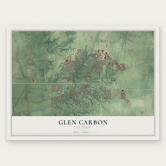
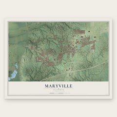
More maps nearby: Roxana, South Roxana, Troy, Mitchell and Hartford.
The art of mapping a place
How This Map Was Made
Real places. Remarkable detail. Discover the layers that turn geographic data into a map of home.

The view from above
Aerial imagery reveals the character of the land: woodland, open fields, and the patterns of a place.

The shape of the land
Elevation data brings hills, valleys, and subtle changes in the landscape into view.

The details of home
Roads, waterways, and building footprints come together to make the map feel unmistakably local.

Geography becomes art
Considered color, shading, and typography bring the layers together in a map made for your wall.


Process illustrated with Mendon, Massachusetts. Aerial imagery: USDA NAIP. Terrain: USGS 3D Elevation Program. Map details and finished artwork: KNOWOL.
The Details
About This Print
Choose an archival matte print, or a black or white Ayous wood frame. The archival matte print is unframed.
Select your size and finish above to see the matching product image and price.
Materials & Craftsmanship
A contemporary map with the character of a classic atlas, printed on archival matte paper. Optional frames are made from Ayous wood.
Your printed map does not include the watermark shown in the full-map preview.
Shipping & Delivery
Free shipping within the United States. Every print is made to order in the USA.
Buying a gift? Add a note in your cart and we'll include it. We never put prices in the package.
Prints ship within 2 to 3 business days. Allow 7 to 10 days total from ordering for delivery. Timing may vary during holidays or periods of high order volume.
Read our shipping policy.
Returns and damaged prints
Each print is made to order. Change-of-mind refunds are not available after production.
If your print arrives damaged, misprinted or incorrect, contact support@knowol.com within 30 days of receiving it. Include your order number, photos and a description of the issue.
Read our full refund and replacement policy. For questions about your order, email support@knowol.com.