
Search for another town





Free U.S. delivery 7 to 10 days after you order
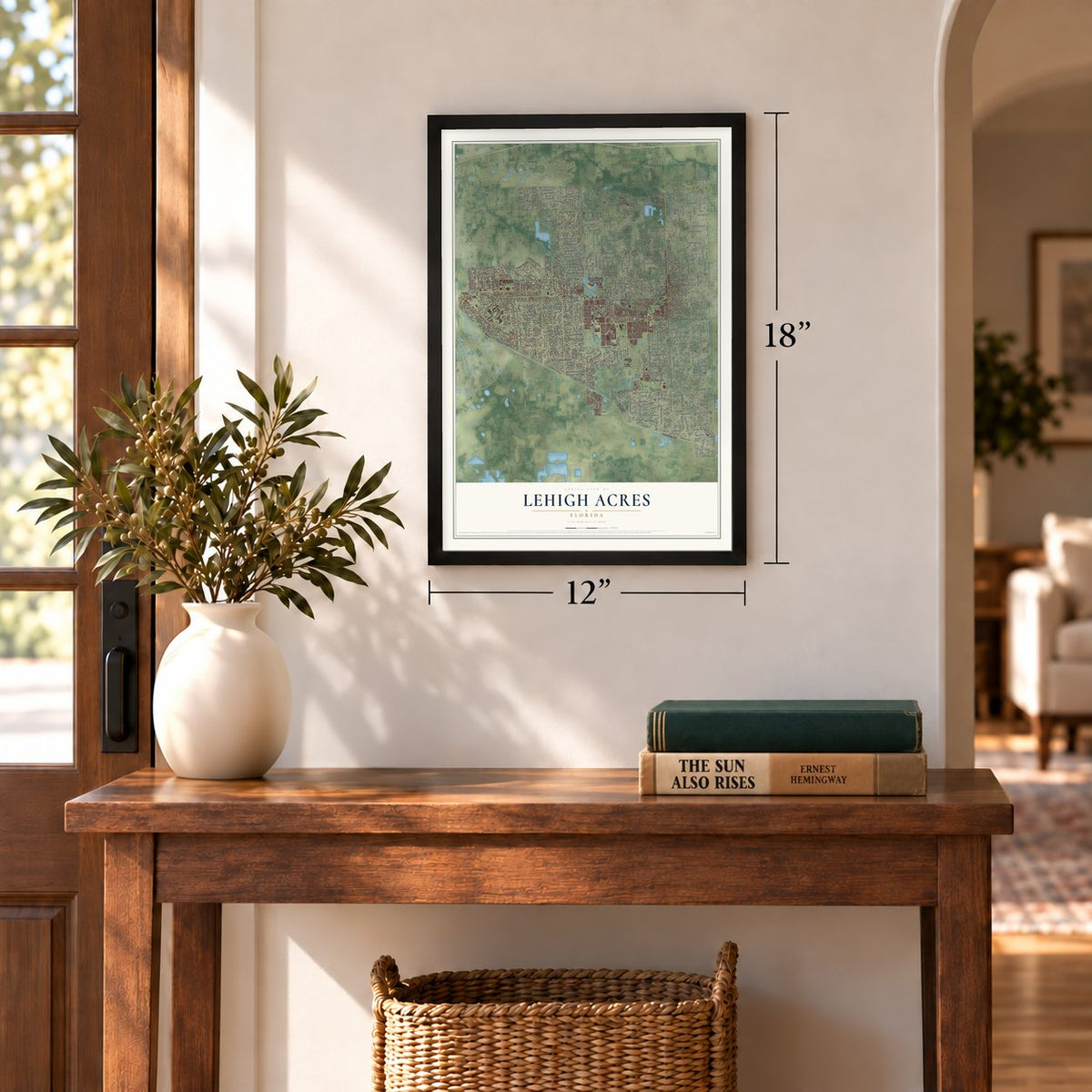
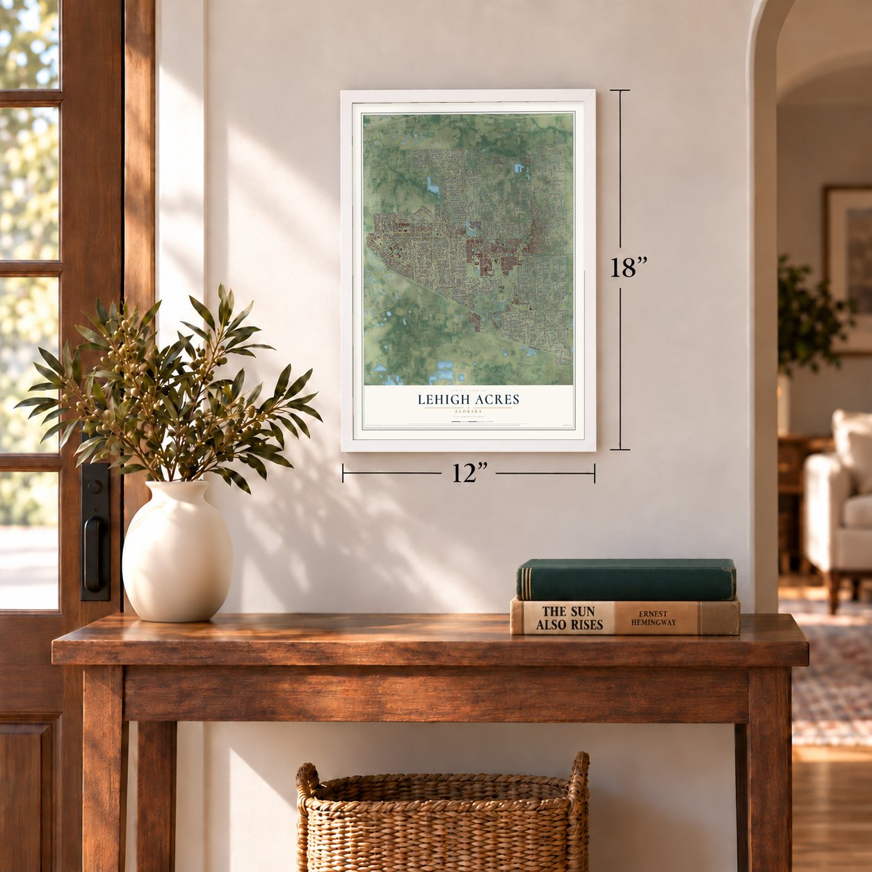
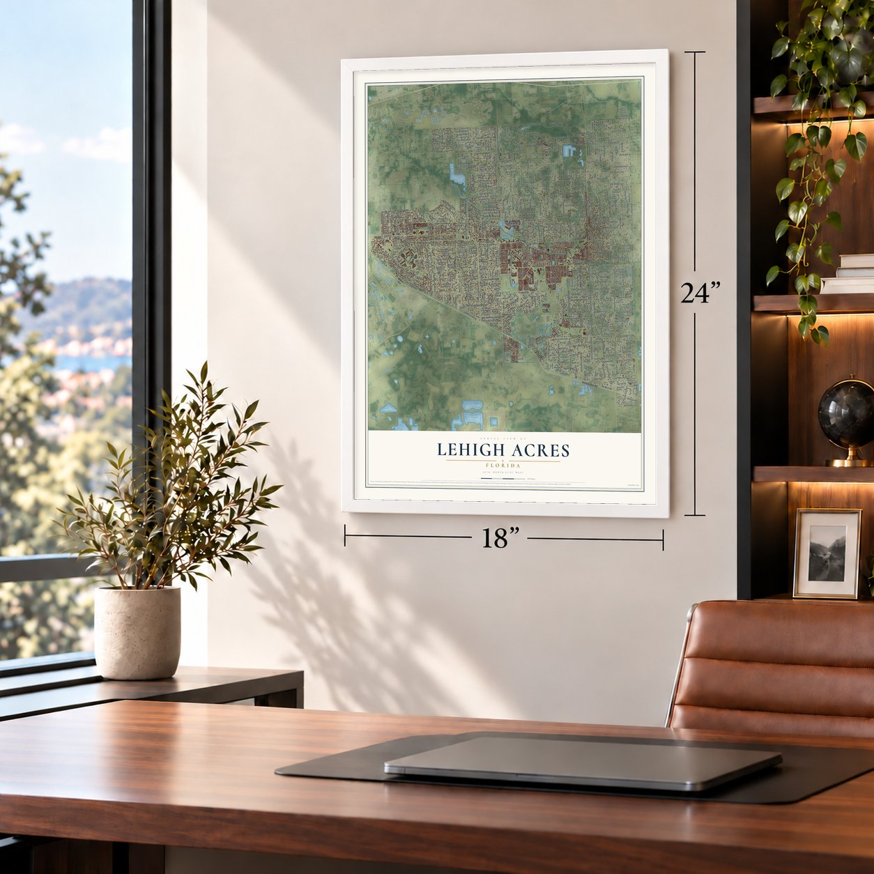
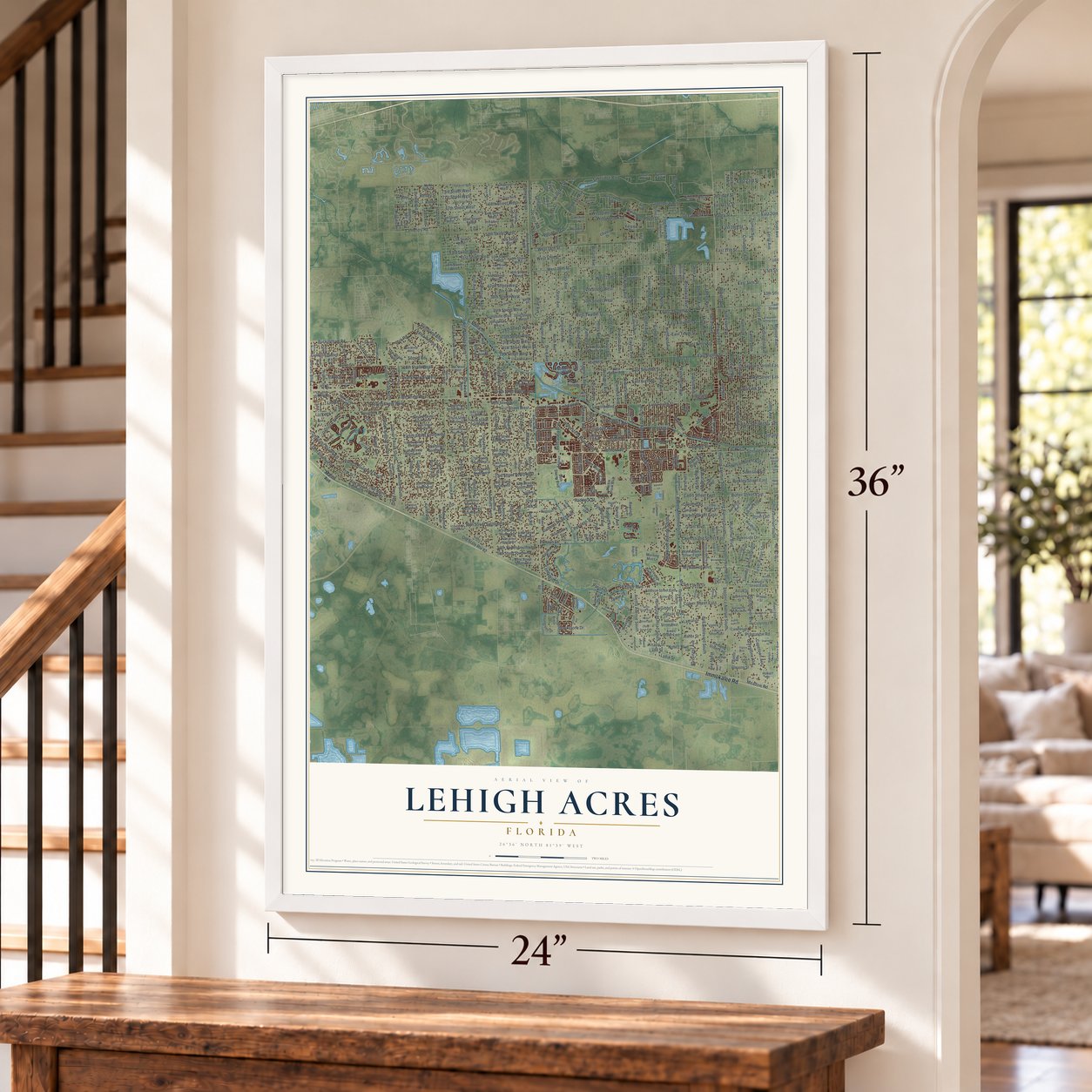
Lehigh Acres, Florida Map Art
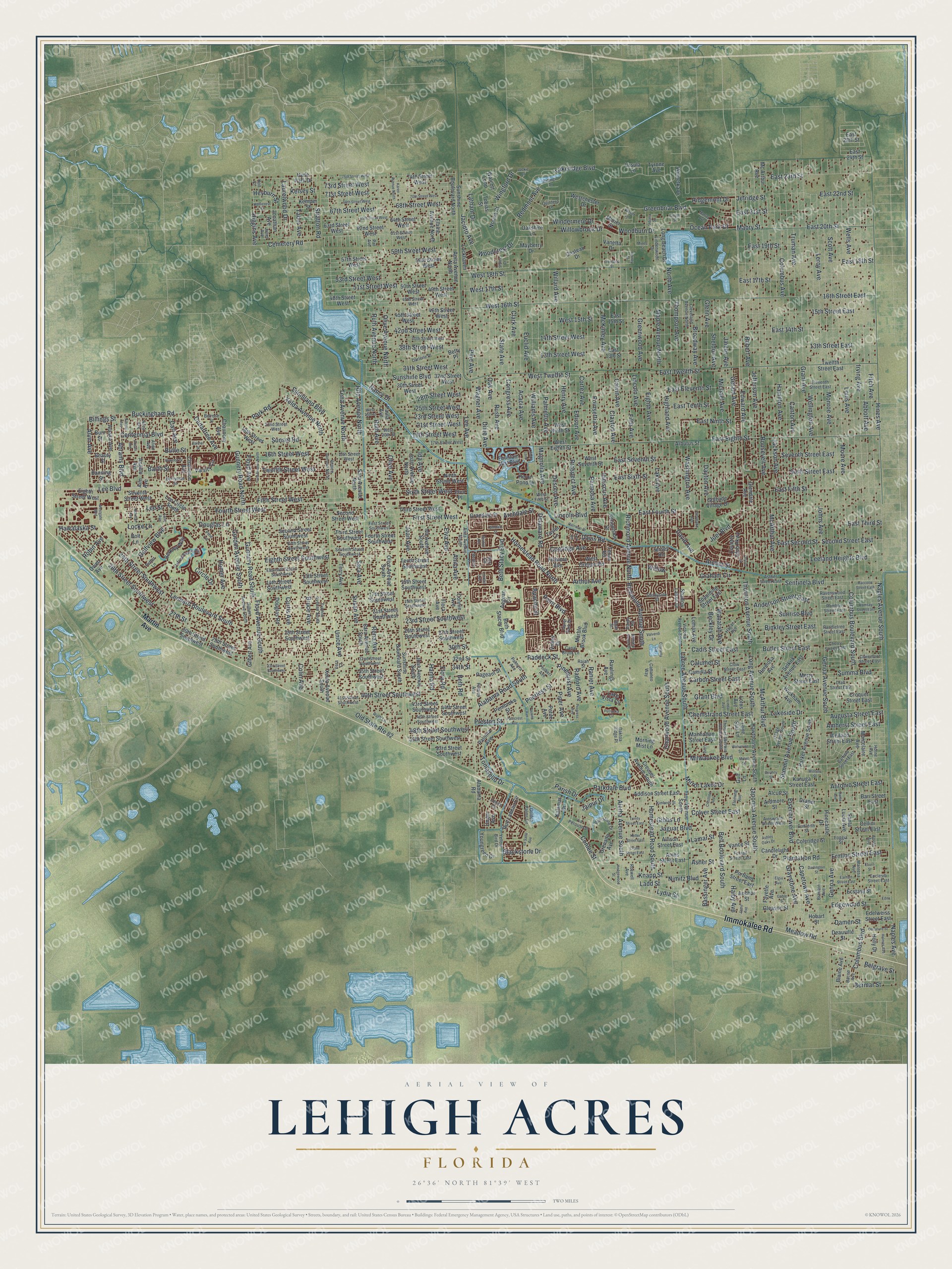
A new map of Lehigh Acres, Florida, made in 2026 and printed to order on thick archival matte paper.
24" x 36" Black Wood Frame
A Map of Home. A Work of Art.
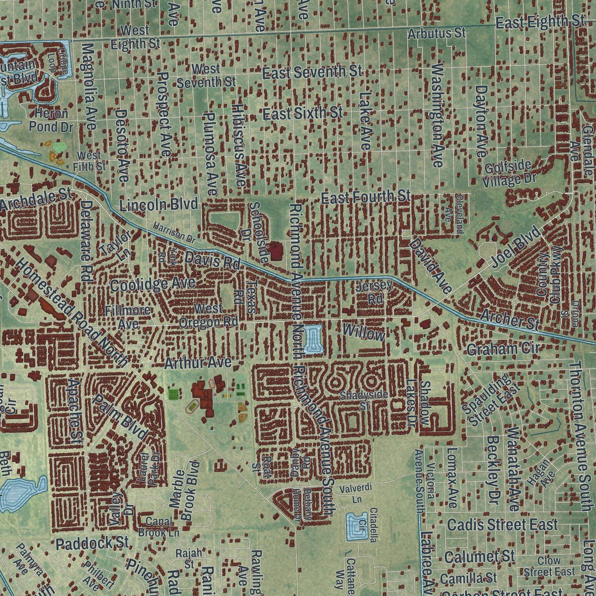
Explore Lehigh Acres, Florida from a whole new perspective. Created using aerial imagery and detailed geographic data, this map captures Lehigh Acres building by building, with labeled streets, familiar landmarks, and shaded topographical relief that highlights the natural contours of the landscape.
Combining modern data with the timeless character of a vintage atlas, this map is just as interesting up close as it is beautiful on the wall. Whether you grew up in Lehigh Acres, spent memorable years there, or call it home today, this unique map is a great way to celebrate a place that means something to you. Zoom in on the preview to look for your street, and then order a print to put your memories on the wall.
Three ways to hang it
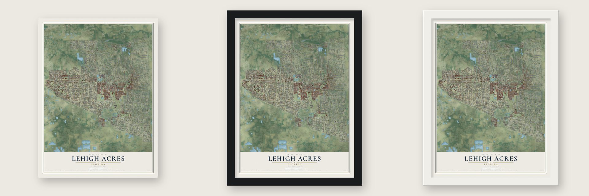
Unframed archival matte, a black wood frame or a white wood frame.
Up close
Geography Worth Displaying
This map was created using accurate cartographic data and authoritative geographic sources, including the U.S. Geological Survey (USGS) and FEMA. The map brings together terrain, waterways, roads, and building detail. The majority of the streets are labeled, houses are accurately depicted, and the topography is derived from government sources. Combining local data with carefully composed color and shading leads to this beautifully detailed Lehigh Acres artwork for your wall.
Rather than simply showing street outlines, we’ve included as many of the street names as we could reasonably fit on the map while keeping their names legible. Zoom in on the high resolution preview to see exactly what’s on the map. We truly set out to create a statement piece for anyone who loves Lehigh Acres. So whether it’s for you, or a gift for someone you love, we hope this map of Lehigh Acres brings back fond memories.
Explore the full map of Lehigh Acres, Florida and read about the local places it shows.

About Lehigh Acres, Florida
Lehigh Acres is a census-designated place of 114,287 people in eastern Lee County, reaching east from the edge of Fort Myers to the Hendry County line. Lee Ratner, a Chicago businessman who founded the d-CON rat poison company, sold his pest control business and stood to lose much of the money to a steep capital gains tax. He heard that cattle made a good shelter, so around 1951 he bought more than 18,000 acres here, along with at least 1,400 head of cattle, and named it the Lucky Lee Ranch.
In 1954, during a horseback ride across the ranch, Florida advertising man Gerald H. Gould urged Ratner to carve the land into half-acre lots and sell them. Ratner had never developed land, but he set up a company, made Gould its president and added Manuel Riskin, a Chicago CPA, and Edward Shapiro, who sold real estate in California.
- Florida's first hay exportRatner's brother-in-law, Jim Richmond, came to manage the Lucky Lee Ranch. Within a year the ranch had over 130 acres planted in vegetables and over 700 acres in alfalfa, a crop rarely seen in the area. A deal to ship the ranch's hay became the first recorded hay export from Florida.
- Elephants and heat lampsBuyers of lots soon wanted houses too, so the company offered a short list of ready-made designs and could finish a home in 90 to 120 days. To lure northerners, it posed models under heat lamps beside its model homes in midwinter and paraded elephants through the Midwest with banners that read "Fly to Florida for peanuts!"
- An airfield under the lotsBuckingham Army Air Field opened in 1942 on 7,000 drained acres of swamp, and aerial gunners trained there for World War II. While it operated, no airfield in Florida was larger. It was the first Army flexible gunnery school to receive the Waller Trainer, a simulator running five movie projectors together. After the field shut down on September 30, 1945, Edison College used its barracks until 1948, and its runways later became part of Lehigh Acres's 61,000 acres.
- 152,000 lots, nearly 90% emptyThe old pastures and broken-up runways were divided into about 152,000 lots, each a quarter or half acre, along over 1,400 miles of roads, with land set aside for shops on Homestead Road and Lee Boulevard. Most stayed empty: in 1997 nearly 90% of the lots still had no house.
- 7,500 homes in 2006Rising home prices set off a building boom from 2003 to 2007. It peaked in 2006, when more than 7,500 new homes went up, and those years brought more houses than the previous 50 combined. Then the market collapsed. The median house price around Fort Myers fell from $322,300 in late 2005 to $106,900 three years later, and area unemployment hit 14% by the summer of 2009.
Find your street
Names on the Lehigh Acres map
Every name below is printed on this map. Look for your street, your school, the park where you played, or the pond down the road.
Streets and roads607
- Immokalee Road
- Lee Boulevard
- Meadow Road
- Sunshine Boulevard
- Milwaukee Boulevard
- Grant Boulevard
- Joel Boulevard
- Fitch Avenue
- Louis Avenue
- Grant Avenue
- Canton Avenue
- Truman Avenue
- Wellington Avenue
- Columbus Avenue
- Moore Avenue
- Hamilton Avenue
- Jackson Avenue
- Roosevelt Avenue
- Abbott Avenue
- Wells Avenue
- 28th Street Southwest
- Hines Avenue
- Irving Avenue
- Monroe Avenue
- Leroy Avenue
- Scott Avenue
- Johns Avenue
- Richmond Avenue North
- Jefferson Avenue
- Robert Avenue
Show all 607 streets
- 24th Street Southwest
- Homestead Road South
- Sixth Street West
- Bell Boulevard South
- McArthur Avenue
- 14th Street West
- Fourth Street West
- Jaguar Boulevard
- 13th Street West
- Naples Avenue South
- North Avenue
- Lincoln Avenue
- Fifth Street West
- Greenwood Avenue
- Maple Avenue North
- Sunrise Boulevard
- Eighth Avenue
- Palmetto Avenue
- Eisenhower Boulevard
- Highland Avenue
- Fifth Avenue
- East Tenth Street
- Nimitz Boulevard
- Edward Avenue
- East Ninth Street
- East 14th Street
- Prospect Avenue
- Lake Avenue
- Clayton Avenue
- Poinsettia Avenue
- East Fifth Street
- McKinley Avenue
- Calvin Avenue
- 15th Street East
- 13th Street East
- 23rd Street Southwest
- East Third Street
- Plumosa Avenue
- East Eighth Street
- Magnolia Avenue
- Williams Avenue
- Greenbriar Boulevard
- Genoa Avenue South
- Cortez Avenue
- Henry Avenue
- Desoto Avenue
- Willard Avenue
- Edison Avenue
- Columbus Boulevard
- Hibiscus Avenue
- Twelfth Street West
- Alabama Road South
- Eighth Street Southwest
- 16th Street West
- Thompson Avenue
- East 17th Street
- Gerald Avenue
- 16th Street East
- Acacia Avenue
- Olive Avenue North
- Sheldon Avenue
- Washington Avenue
- Leonard Boulevard South
- Broadway Avenue
- McArthur Boulevard
- Rush Avenue
- Golfview Boulevard
- Gunnery Road South
- Ruth Avenue North
- James Avenue
- Michael Avenue
- Glenn Avenue
- Sentinela Boulevard
- Lakeridge Boulevard
- Columbus Boulevard South
- Oak Avenue
- Dixie Avenue
- Wagner Avenue
- West 18th Street
- Pine Avenue
- Clark Avenue
- Euclid Avenue
- State Avenue
- Congress Avenue
- East Sixth Street
- Lee Avenue
- Dayton Avenue
- East Eleventh Street
- 40th Street Southwest
- 21st Street West
- Blackstone Drive
- Ruth Avenue
- Genoa Avenue
- East Seventh Street
- Floyd Avenue South
- Parkdale Boulevard
- West 17th Street
- Sunniland Boulevard
- Sunset Road
- East Twelfth Street
- Seventh Street East
- West 15th Street
- West 16th Street
- East 23rd Street
- East 21st Street
- East 18th Street
- East 19th Street
- Leeland Heights Boulevard
- 68th Street West
- Buckingham Road
- Japonica Avenue South
- Windermere Drive
- 51st Street West
- 59th Street West
- 71st Street West
- 73rd Street West
- 53rd Street West
- Billings Street
- Sixth Street East
- Centennial Boulevard
- Olive Avenue
- 67th Street West
- Xelda Avenue North
- Gunnery Road North
- Rita Avenue North
- West Twelfth Street
- 19th Street West
- East Second Street
- 25th Street West
- Ida Avenue
- 23rd Street West
- Butte Street
- Lee Street
- Homestead Road North
- Charwood Avenue South
- East 20th Street
- Gordon Avenue South
- 42nd Street West
- Summa Boulevard
- Unice Avenue
- 38th Street West
- Aletha Avenue South
- Curtis Avenue
- Paddock Street
- Chemstrand Street East
- Plantation Road
- Tena Avenue North
- Second Street East
- Coolidge Avenue
- Peerless Street
- 34th Street West
- Joan Avenue
- Douglas Lane
- East 22nd Street
- Palm Boulevard
- Alvin Avenue
- Woodburn Drive
- Capetown Avenue
- Hanna Road
- East Fourth Street
- Abrams Boulevard
- Graystone Avenue
- 28th Street West
- Ocean Park Drive
- Latham Drive
- Preston Street
- Willowbrook Drive
- Richmond Avenue South
- Naples Avenue
- First Street West
- Barth Street
- Mirror Lakes Drive
- 27th Street
- Cemetery Road
- Long Avenue South
- Archer Street
- Beth Stacy Boulevard
- Cadis Street East
- Carbon Street East
- Labree Avenue South
- Colin Avenue
- 48th Street Southwest
- Summit Avenue South
- Thornton Avenue South
- Higgins Avenue
- Lamar Street
- Laurelwood Drive
- Arthur Avenue
- Colyer Street East
- Asher Street
- Stratton Road
- Anderson Street East
- Belgrave Street
- Park Road
- Parish Drive
- Woodcrest Drive
- Binkley Street East
- Butler Street East
- Bruce Avenue
- Wanatah Avenue
- Bermar Street
- Delaware Road
- Lakeside Drive
- Lincoln Boulevard
- Pinehurst Avenue
- Damen Street
- Beckley Drive
- Elva Avenue
- Edgewood Street
- Old State Route 82
- Amherst Street East
- Augusta Street East
- Carl Avenue
- Ladd Street
- Ermine Street East
- Antonio Street East
- Conlee Street
- Ridgemont Drive
- Beth Road
- Knapp Street
- Radford Avenue
- 34th Street
- Tomasello Drive
- Bassinger Avenue
- Rena Avenue
- Ranier Avenue
- Jacinto Avenue
- Cedartree Avenue
- Hawalaska Street
- Piper Avenue
- Kelsey Street
- Archdale Street
- Susan Avenue
- Redmont Avenue
- Calumet Street
- 30th Street
- Heyburn Street
- Wingford Drive
- Anita Avenue
- Halby Avenue
- Graham Circle
- Homer Avenue
- Mabry Street
- Jetridge Street
- Lydia Street
- Locke Lane
- Sara Avenue
- Floyd Avenue
- Flora Road
- Jaipur Drive
- Robin Avenue
- Davis Road
- David Avenue
- Gibbs Lane
- Apache Street
- Tabor Avenue
- Nancy Drive
- Circle Drive
- Willow
- Martin Avenue
- 29th Street Southwest
- 26th Street Southwest
- 25th Street Southwest
- Third Street West
- Seventh Street West
- 30th Street Southwest
- Second Street West
- 15th Street Southwest
- 14th Street Southwest
- 27th Street Southwest
- 21st Street Southwest
- Joan Avenue North
- 13th Street Southwest
- Third Street Southwest
- Second Street Southwest
- Fourth Street Southwest
- Ninth Street West
- Tenth Street Southwest
- 17th Street Southwest
- 35th Street Southwest
- Eighth Street West
- 18th Street West
- Joan Avenue South
- Elaine Avenue North
- West Ninth Street
- Twelfth Street East
- 64th Street West
- 63rd Street West
- 62nd Street West
- 50th Street West
- Ida Avenue South
- 74th Street West
- 57th Street West
- 56th Street West
- 49th Street West
- Sara Avenue North
- Sara Avenue South
- 48th Street West
- 32nd Street West
- Olive Avenue South
- Sunshine Boulevard South
- Douglas Road
- 45th Street West
- 46th Street West
- Xelda Avenue South
- 44th Street Southwest
- 43rd Street Southwest
- Connie Avenue
- Sunshine Boulevard North
- Beauty Street
- Country Club Parkway
- Shadow Lakes Drive
- Berkley Way
- West Seventh Street
- West Eighth Street
- Banning Street
- Varsity Circle
- Pembroke Street
- Troy Avenue South
- Alaska Avenue
- Rue Labeau Circle
- Hawthorne Avenue South
- 50th Street Southwest
- Spaulding Street East
- Candlelight Drive
- Manhattan Street East
- Hyde Park Drive
- Ames Street East
- Addison Street East
- 30th Street West
- Deauville Street
- Parker Avenue South
- Anita Avenue North
- Mc Arthur Avenue
- Edelweiss Street East
- Champion Avenue
- Kanuga Street East
- Aegean Circle
- Bari Street East
- Mayberry Drive
- Allison Street East
- Creuset Avenue South
- Winnetka Drive
- Santa Lucia Avenue
- Lake Vista Circle
- Cellini Street East
- Angelo Avenue
- Petite Avenue
- Morning Mist Lane
- East 13th Street
- Croquet Street East
- Fountain Mist Boulevard
- Walcott Loop
- Pinecastle Drive
- Schoolside Drive
- Heron Pond Drive
- Portland Street East
- 53rd Street Southwest
- Marble Brook Boulevard
- Fayette Avenue
- Youngreen Drive
- Beth Stacey Boulevard
- Valley Drive
- Ardmore Street
- Montclaire Avenue
- Merry Street East
- Grandale Street
- Selkirk Avenue East
- Owen Avenue
- Kemper Street
- Flora Avenue
- Hermosa Avenue
- Paula Avenue
- Lee Circle South
- Golfside Village Drive
- Long Beach Drive
- Westchester Drive
- Alabama Road
- Pageant Street
- Anchor Street
- Terry Avenue
- Gleason Street
- Lone Star Lane
- Chauncey Avenue
- Grenada Avenue
- Welland Street East
- Wickham Avenue
- Vance Street
- Coleridge Street
- Camilla Street
- Blaine Avenue
- Glendale Avenue
- Vanetta Drive
- Jonathan Avenue
- Lomax Avenue
- West Oregon Road
- Rawlings Avenue
- Gilbert Avenue
- Lockhaven
- Fillmore Avenue
- Alcutt Street
- Paloma Avenue
- Ecstasy Street
- East 24th Street
- Norma Court
- Chateau Drive
- Arbutus Street
- Tyrone Avenue
- Ursula Lane
- Kalamar Drive
- Taylor Lane
- Oakshire Lane
- East 28th Street
- Texas Road
- East 15th Street
- Burr Street
- Draper Street
- 32nd Street
- Tobias Street
- Holly Drive
- Elva Place
- Bolt Lane
- Lotus Avenue
- Gulf Lane
- Unger Avenue
- Hobart Street
- Jersey Road
- Betty Place
- Muriel Street
- Aim Avenue
- Seventh Street Southwest
- Eleventh Street Southwest
- 19th Street Southwest
- First Street Southwest
- Fifth Street Southwest
- 15th Street West
- 32nd Street Southwest
- 17th Street West
- 22nd Street West
- 41st Street Southwest
- Eleventh Street East
- 61st Street West
- Cleveland Avenue North
- Gilbert Avenue South
- 40th Street West
- 47th Street West
- Yvonne Avenue South
- 46th Street Southwest
- Anita Avenue South
- Oxford Ridge Circle
- Belrose Street
- West Fifth Street
- Golden Palms Circle
- Foxtail Street East
- Ravenswood Street East
- Cattaneo Way
- Randletree Street East
- Anza Avenue
- Cherry Street East
- Berryman Street
- Asther Street East
- Venice Avenue North
- Canal Brook Lane
- Palmyra Avenue
- Burrstone Drive
- Zenith Circle
- Quintero Lane
- Paisley Avenue
- Shadyside Street
- Thomas Sherwin Avenue South
- Barfield Street East
- Brenton Avenue
- Yellow Bird Drive
- Craft Street East
- Danforth Street
- Claremont Street East
- Osage Avenue South
- Darlene Place
- Lindenwood Drive
- Fleming Avenue
- Clow Street East
- West 20th Street
- Victoria Avenue South
- Rajah Street
- Foggia Street
- Ainsworth Street West
- Rambler Street East
- Bacon Avenue
- Manresa Avenue
- Ecclesia Street East
- Danby Road
- Hagan Avenue
- Alido Avenue
- Holt Court
- La Perouse Street
- Ruth Lane
- Aprile Avenue
- Laurel Park Drive
- Pine Lane
- Daktoa Ridge Place
- Victor Lane
- Roswell Avenue
- Vera Court
- Putter Lane
- Philbert Avenue
- Horne Avenue
- Kerr Circle
- Juliet Avenue
- Pat Avenue
- Roat Street
- 33rd Street Southwest
- 75th Street West
- 69th Street West
- 70th Street West
- 65th Street West
- Holmes Avenue
- Cleveland Avenue
- Paulcrest Avenue
- Westgate Boulevard
- Crane Street East
- Keller Street East
- Trinity Street East
- Kimberly Street
- Petrucka Circle
- Karen Avenue North
- Pauline Avenue
- Albany Avenue
- Progress Avenue
- Citadella Circle
- Bywood Street
- Fred Avenue North
- Liriope Loop
- Hedgewood Street
- Darlington Street
- Rollings Drive
- Wolverine Street
- Elgin Avenue
- Urbana Street
- Dante Avenue
- La Salle Avenue
- Decature Street
- Earhart Street East
- Bethany Home Drive
- Harrison Drive
- Ramsay Street East
- Balmer Street
- Ortona Street
- Medford Place
- Winters Street
- Anson Avenue
- Ashley Oaks Drive
- Jamil Avenue
- Marlay Avenue
- Raccoon Street East
- Linda Avenue
- Hollycrest Street
- Crestline Avenue
- Styles Court
- Valverdi Lane
- West 25th Street
- Tremaine Street
- Kimdale Street
- Motel Street
- York Road
- Larry Avenue
- Norman Avenue
- Jackie Court
- Gable Street
- Beverly Street
- Seaton Avenue
- Mines Street
- Singer Street
- Lorelei Avenue
- Verney Street
- Long
- Eburn Street
- Edna
Names are listed as they appear on the printed map. Zoom into the product photos to find them.
The art of mapping a place
How This Map Was Made
Real places. Remarkable detail. Discover the layers that turn geographic data into a map of home.

The view from above
Aerial imagery reveals the character of the land: woodland, open fields, and the patterns of a place.

The shape of the land
Elevation data brings hills, valleys, and subtle changes in the landscape into view.

The details of home
Roads, waterways, and building footprints come together to make the map feel unmistakably local.

Geography becomes art
Considered color, shading, and typography bring the layers together in a map made for your wall.


Process illustrated with Mendon, Massachusetts. Aerial imagery: USDA NAIP. Terrain: USGS 3D Elevation Program. Map details and finished artwork: KNOWOL.
The Details
About This Print
Choose an archival matte print, or a black or white Ayous wood frame. The archival matte print is unframed.
Select your size and finish above to see the matching product image and price.
Materials & Craftsmanship
A contemporary map with the character of a classic atlas, printed on archival matte paper. Optional frames are made from Ayous wood.
Your printed map does not include the watermark shown in the full-map preview.
Shipping & Delivery
Free shipping within the United States. Every print is made to order in the USA.
Buying a gift? Add a note in your cart and we'll include it. We never put prices in the package.
Prints ship within 2 to 3 business days. Allow 7 to 10 days total from ordering for delivery. Timing may vary during holidays or periods of high order volume.
Read our shipping policy.
Returns and damaged prints
Each print is made to order. Change-of-mind refunds are not available after production.
If your print arrives damaged, misprinted or incorrect, contact support@knowol.com within 30 days of receiving it. Include your order number, photos and a description of the issue.
Read our full refund and replacement policy. For questions about your order, email support@knowol.com.
Find your town
Looking for another city?
Find a map of home in our Florida collection, or any town in the country.
Nearby
Maps of towns near Lehigh Acres
Know someone from one of these towns? Their map makes a great gift.
 Buckingham
, Florida
From $39.99See the map
 Gateway
, Florida
From $39.99See the map
 Charleston Park
, Florida
From $39.99See the map
More maps nearby: Olga, Alva, Verandah, Fort Denaud and Fort Myers Shores.