
Search for another town





Free U.S. delivery 7 to 10 days after you order
Lexington-Fayette, Kentucky Map Art
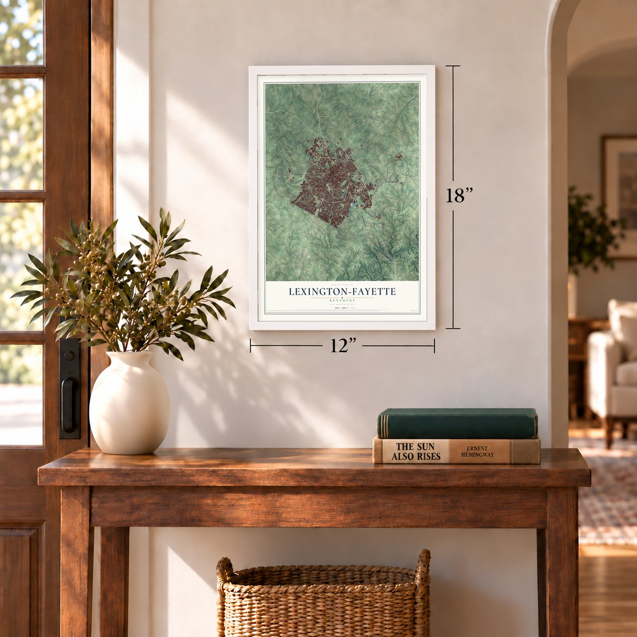
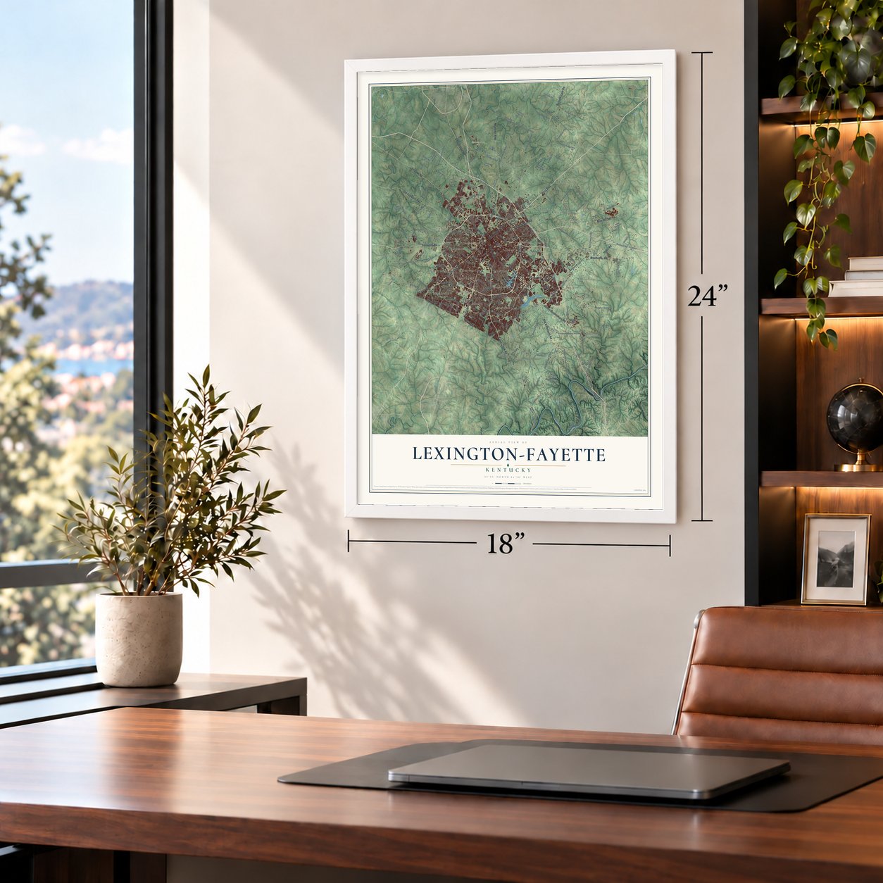
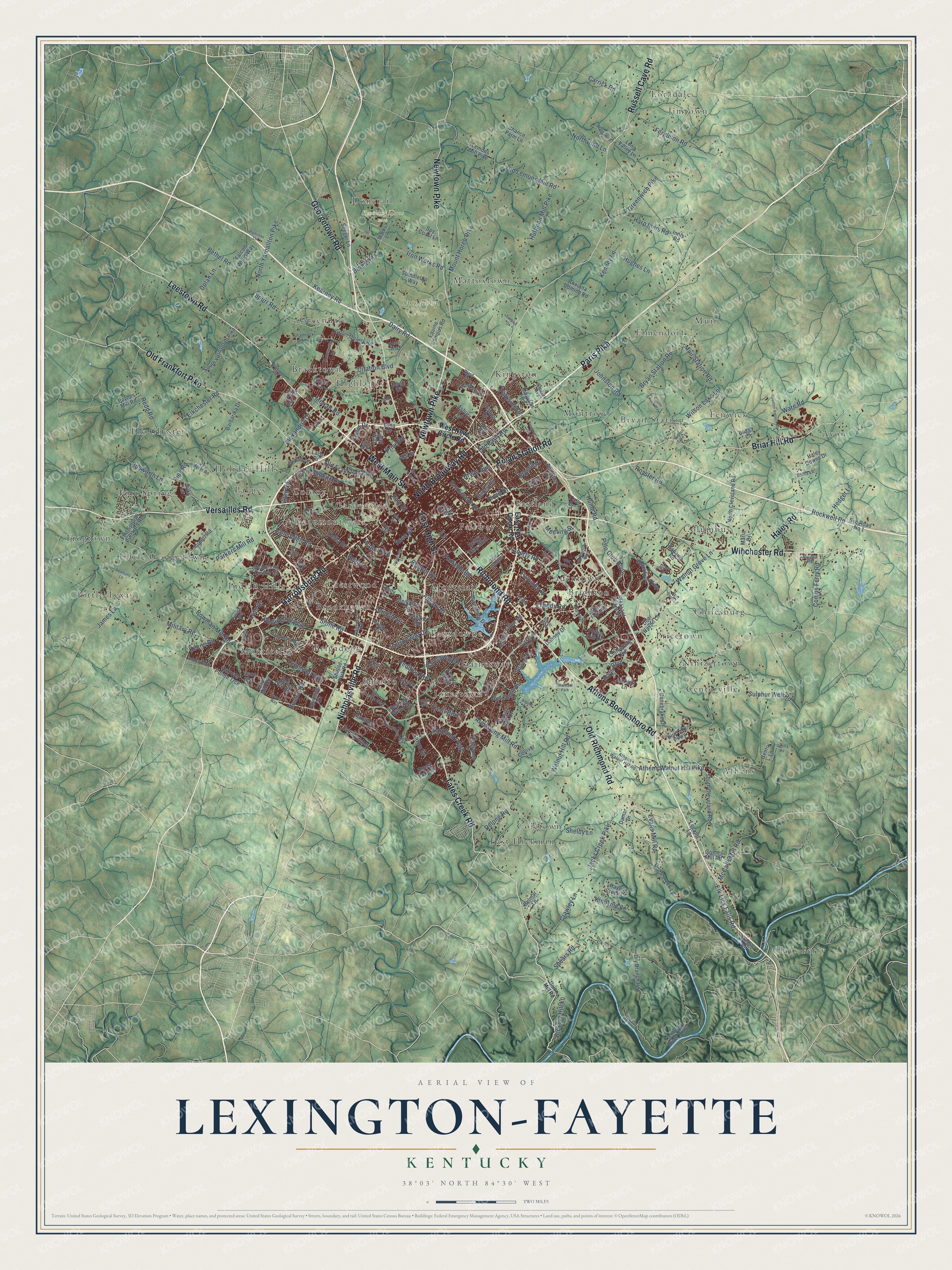
A new map of Lexington-Fayette, Kentucky, made in 2026 and printed to order on thick archival matte paper.
12" x 18" Archival Matte Print
A Map of Home. A Work of Art.
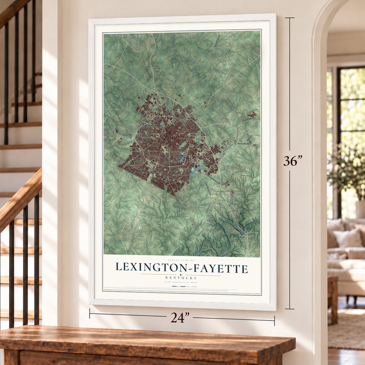
This beautifully detailed map of Lexington-Fayette, Kentucky was created in 2026 using aerial imagery combined with modern topographical, census, street and landmark data. It's a modern aerial view of Lexington-Fayette in Fayette County, Kentucky, that combines modern data with a vintage aesthetic. Zoom in on the preview and look for your block.
Three ways to hang it
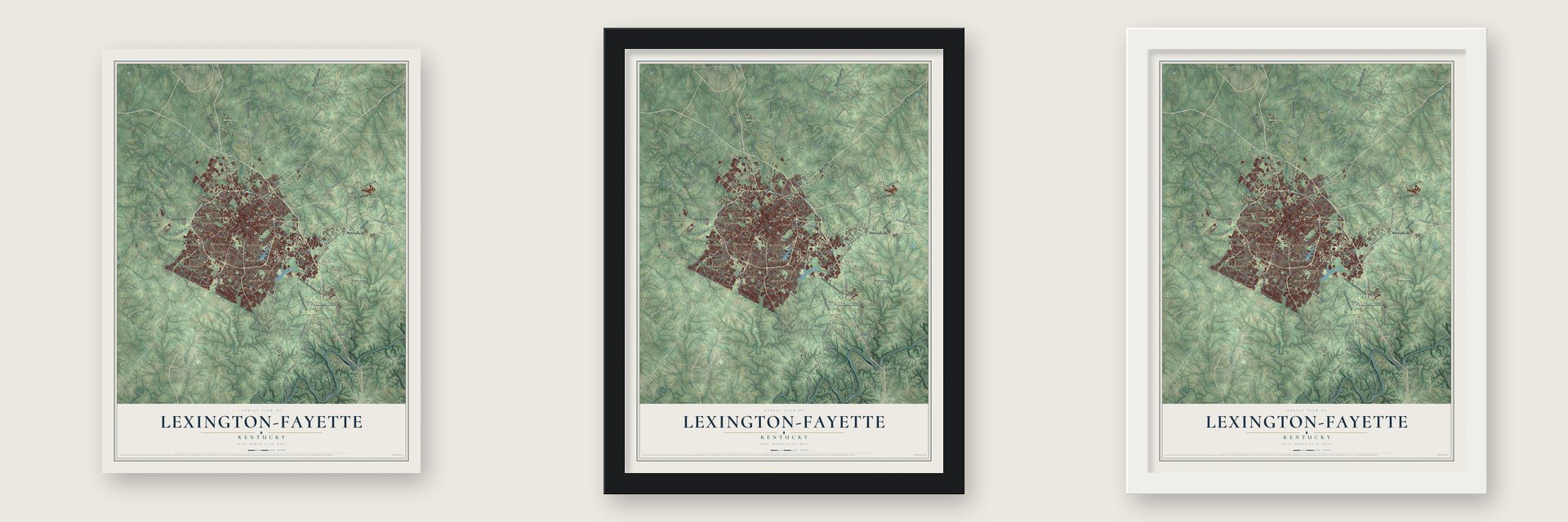
Unframed archival matte, a black wood frame or a white wood frame.
Up close
Real geography. Art worth displaying.
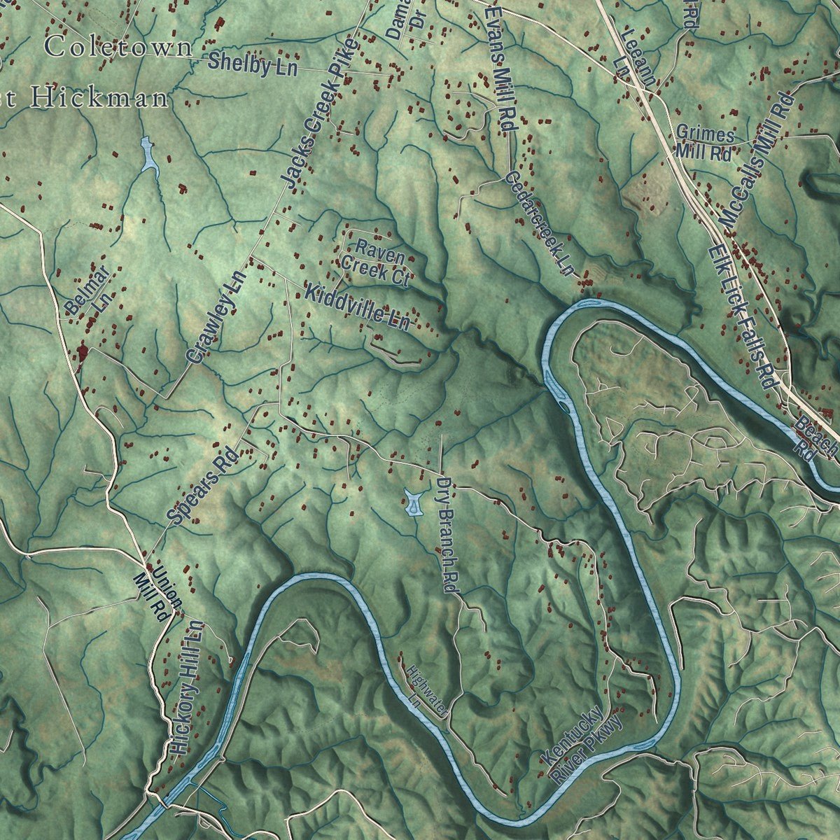
This map was created using accurate cartographic data and authoritative geographic sources, including the U.S. Geological Survey and the Census Bureau. The map brings together terrain, waterways, roads, and building detail. The majority of the streets are labeled, houses are accurately depicted, and the topography is derived from government sources. Combining local data with carefully composed color and shading leads to this beautifully detailed Lexington-Fayette artwork for your wall.
Rather than simply showing street outlines, we’ve included as many of the street names as we could reasonably fit on the map while keeping their names legible. Zoom in on the high resolution preview to see exactly what’s on the map. We truly set out to create a statement piece for anyone who loves Lexington-Fayette. So whether it’s for you, or a gift for someone you love, we hope this map of Lexington-Fayette brings back fond memories.
Read the story behind this map of Lexington-Fayette, Kentucky from 2026.

About Lexington-Fayette, Kentucky
Lexington-Fayette is a city of 322,570 people that fills all of Fayette County, and it is the county seat. In June 1775, 17 years before Kentucky became a state, William McConnell and a party of frontiersmen camped by a branch of Elkhorn Creek, at what is now McConnell Springs. News reached them of the fighting at Lexington, Massachusetts, on April 19. They named their camp Lexington, the first of many places in America named for the Massachusetts town.
On January 25, 1780, 45 settlers signed the Lexington Compact. Each share got a half-acre lot inside the walls of Fort Lexington and a 5-acre lot outside for farming. In December 1781 about 600 pioneers from Spotsylvania County, Virginia, arrived under the preacher Lewis Craig and Captain William Ellis. They were known as the Travelling Church. The Virginia General Assembly chartered the town on May 6, 1782. In the early 1800s John Wesley Hunt, a planter here, grew so rich that he is counted as the first millionaire anywhere west of the Alleghenies.
“Lexington is the largest and most wealthy town in Kentucky, or indeed west of the Allegheny Mountains; the main street of Lexington has all the appearance of Market Street in Philadelphia on a busy day”
- Kentucky's oldest Black Baptist churchAround 1790 Peter Durrett founded First African Baptist Church. He was an enslaved Baptist preacher held by Joseph Craig, and he had helped guide the Travelling Church to Kentucky. By 1850 the church was led by London Ferrill, a free Black man from Virginia. With 1,820 members, it was the largest church in the state, Black or white. It is the third-oldest Black Baptist congregation in the country.
- The cholera of 1833Cholera spread along the Mississippi and Ohio valleys in 1833. In Lexington it killed 500 of the town's 7,000 people within two months, including nearly a third of the members of Christ Church Episcopal. London Ferrill, the second preacher at First African Baptist, stayed to care for the sick.
- Henry Clay's War of 1812Henry Clay, a Lexington lawyer, was Speaker of the U.S. House in 1812 and helped lead the War Hawks, who pushed for war with Britain. Lexington sent six companies of volunteers, and James Erwin's rope-walk, on his Richmond Road farm, was their recruiting office and barracks until the war ended. Clay later helped negotiate the Treaty of Ghent in 1814. His law office is on the National Register.
- The nation's first growth boundaryLexington's nickname, the Horse Capital of the World, comes from its hundreds of horse farms, plus Keeneland, The Red Mile and the Kentucky Horse Park. To protect those farms, the city drew the nation's first urban growth boundary in 1958. New building had to stay inside an urban service area, and land outside it had to be held in tracts of at least 40 acres.
Find your street
Names on the Lexington-Fayette map
Every name below is printed on this map. Look for your street, your school, the park where you played, or the pond down the road.
Places and landmarks50
- Kentucky Horse Park
- Spindletop Farm
- Athens
- Avon
- Baralto
- Beaumont Park
- Bracktown
- Brigadoon
- Brighton
- Brookhaven
- Bryan Station
- Cadentown
Show all 50 places
- Centerville
- Chilesburg
- Clays Ferry
- Coletown
- Colony
- Columbus
- Crestwood
- Donerail
- East Hickman
- Eastland
- Elk Chester
- Elmendorf
- Fairway
- Fenwick
- Fort Spring
- Frogtown
- Gainesway
- Gardenside
- Greendale
- Highlands
- Holiday Hills
- Indian Hills
- Jimtown
- Jonestown
- Kingston
- Lansdowne
- Little Georgetown
- Little Texas
- Loradale
- Mattoxtown
- Montclair
- Monticello
- Montrose
- Muir
- Nihizertown
- Paynes
- Pricetown
- Branham Park
Streets and roads258
- Tates Creek Road
- Winchester Road
- Paris Pike
- Nicholasville Road
- Leestown Road
- Georgetown Road
- North Broadway Road
- West Main Street
- East High Street
- Versailles Road
- Old Frankfort Pike
- Newtown Pike
- Russell Cave Road
- Richmond Road
- Old Richmond Road
- Harrodsburg Road
- Briar Hill Road
- Athens Boonesboro Road
- Haley Road
- Bryan Station Road
- Old Paris Road
- Taylor Drive
- Alexandria Drive
- Liberty Road
- Waller Avenue
- Todds Road
- Saron Drive
- Citation Boulevard
- Hartland Parkway
- Dunkirk Drive
Show all 258 streets
- Jacks Creek Pike
- Iron Works Road
- Polo Club Boulevard
- Parkers Mill Road
- Alumni Drive
- Delong Road
- Mount Horeb Pike
- Muir Station Road
- Greenwich Pike
- Elkchester Road
- Walnut Hill Road
- Spurr Road
- Royster Road
- Military Road
- Hays Boulevard
- Lansdowne Drive
- Huffman Mill Pike
- North Yarnallton Pike
- Kearney Road
- Armstrong Mill Road
- Old Lemons Mill Road
- Wellington Way
- Athens Walnut Hill Pike
- Sulphur Well Road
- Bowman Mill Road
- Ferguson Road
- McCalls Mill Road
- Hume Road
- Redd Road
- Mercer Road
- Hughes Lane
- Walnut Grove Lane
- Elk Lick Falls Road
- Rockwell Road
- Crawley Lane
- Harp Innis Road
- Cooper Drive
- Kenney Lane
- Palumbo Drive
- Lane Allen Road
- Bethel Road
- Evans Mill Road
- Cromwell Way
- Combs Ferry Road
- Boston Road
- Fontaine Road
- Shelby Lane
- Spears Road
- Trent Boulevard
- Della Drive
- Rice Road
- Johnston Road
- Ware Road
- Hickory Hill Lane
- Bosworth Lane
- Zandale Drive
- Dairy Road
- Buckhorn Drive
- Lyon Drive
- Carrick Road
- Dolan Lane
- Redding Road
- Gainesway Drive
- Stone Road
- Hedger Lane
- Rose Street
- Price Road
- Berea Road
- Wilson Lake Lane
- Kiddville Lane
- Bryan Avenue
- Meeting Street
- Northwind Lane
- Keene Road
- James Lane
- Parkside Drive
- Brynell Drive
- Viley Road
- Floyd Drive
- Pine Street
- Reed Lane
- East New Circle Road
- West New Circle Road
- East Third Street
- Laredo Drive
- Southpoint Drive
- Belleau Wood Drive
- North Cleveland Road
- Clays Mill Road
- Spurr Quarry Road
- Dry Branch Road
- Spindletop Way
- Lakeshore Drive
- Fort Springs Pinckard Road
- Equine Campus Road
- Bahama Road
- Beaumont Centre Lane
- Svc Road No 1
- South Cleveland Road
- Grimes Mill Road
- Malabu Drive
- South Yarnallton Pike
- Winthrop Drive
- Innis Road
- Blackford Parkway
- Chilesburg Road
- Falcon Wood Way
- Pleasant Ridge Drive
- Anniston Drive
- Blue Sky Parkway
- Squires Road
- East Seventh Street
- Spy Coast Lane
- Forest Hill Drive
- Kentucky River Parkway
- Albany Road
- Henry Clay Boulevard
- Centre Parkway
- Shillito Park Road
- Long Valley Lane
- Lemons Mill Pike
- Mount Tabor Road
- Kingston Road
- Cedarcreek Lane
- Manitoba Lane
- Chance Farm Lane
- Deer Haven Lane
- Airport Road
- Dixiana Domino Road
- Spring Run Road
- Dabney Drive
- Canebrake Drive
- Harrods Pointe Trce
- Glendover Road
- Barbarika Drive
- Seeger Lane
- Haley Downs Drive
- Forest Lake Drive
- Winburn Drive
- Bishop Drive
- Trace Boulevard
- Asbury Lane
- Colliver Lane
- Darley Drive
- Paynes Mill Road
- Leeann Lane
- Larkhill Lane
- Raven Creek Court
- Shady Lane
- Belmar Lane
- Laco Drive
- Maria Drive
- Marks Lane
- Lima Drive
- Damar Drive
- Fister Way
- Squire Oak Drive
- Buggy Lane
- Ash Street
- Beach Road
- Gentry Lane
- Birch Drive
- Silks Lane
- Call Drive
- Lily Drive
- Clearwater Way
- Sir Barton Way
- Van Meter Road
- Athens Walnut Hill Road
- Regency Road
- Codell Drive
- Fortune Drive
- Abbeywood Road
- Swigert Avenue
- Cindy Blair Way
- Shamrock Lane
- White Oak Trce
- Mable Lane
- Waterwild Lane
- Idle Hour Drive
- Dover Road
- Andover Forest Drive
- Ward Drive
- Willia Lane
- The Lane
- Kelsey Drive
- Riviera Road
- Tartan Drive
- Union Mill Road
- West Third Street
- University Drive
- Sandersville Road
- Gentry Road
- Forsythe Drive
- Sundart Drive
- Houston Antioch Road
- Ashbrooke Drive
- Dedmans Lane
- Stonewood Lane
- Appian Way
- Palomar Boulevard
- Castle Rock Way
- Weber Way
- Hidden Lake Lane
- East Tiverton Way
- Preakness Drive
- Real Quiet Lane
- South Eagle Creek Drive
- Raleigh Road
- Waco Road
- Enterprise Drive
- Highwater Lane
- Hamilton Lane
- Bracktown Road
- Mapleleaf Drive
- Blazer Parkway
- Clay Avenue
- Virginia Avenue
- Trade Street
- Delong Lane
- Sahalee Drive
- Walcot Way
- Star Gaze Drive
- Burke Road
- Antilles Drive
- Lansill Road
- Scott Avenue
- Polk Lane
Names are listed as they appear on the printed map. Zoom into the product photos to find them.
The art of mapping a place
How This Map Was Made
Real places. Remarkable detail. Discover the layers that turn geographic data into a map of home.

The view from above
Aerial imagery reveals the character of the land: woodland, open fields, and the patterns of a place.

The shape of the land
Elevation data brings hills, valleys, and subtle changes in the landscape into view.

The details of home
Roads, waterways, and building footprints come together to make the map feel unmistakably local.

Geography becomes art
Considered color, shading, and typography bring the layers together in a map made for your wall.


Process illustrated with Mendon, Massachusetts. Aerial imagery: USDA NAIP. Terrain: USGS 3D Elevation Program. Map details and finished artwork: KNOWOL.
The Details
About This Print
Choose an archival matte print, or a black or white Ayous wood frame. The archival matte print is unframed.
Select your size and finish above to see the matching product image and price.
Materials & Craftsmanship
A contemporary map with the character of a classic atlas, printed on archival matte paper. Optional frames are made from Ayous wood.
Your printed map does not include the watermark shown in the full-map preview.
Shipping & Delivery
Free shipping within the United States. Every print is made to order in the USA.
Buying a gift? Add a note in your cart and we'll include it. We never put prices in the package.
Prints ship within 2 to 3 business days. Allow 7 to 10 days total from ordering for delivery. Timing may vary during holidays or periods of high order volume.
Read our shipping policy.
Returns and damaged prints
Each print is made to order. Change-of-mind refunds are not available after production.
If your print arrives damaged, misprinted or incorrect, contact support@knowol.com within 30 days of receiving it. Include your order number, photos and a description of the issue.
Read our full refund and replacement policy. For questions about your order, email support@knowol.com.
Find your town
Looking for another city?
Find a map of home in our Kentucky collection.
Nearby
Maps of towns near Lexington-Fayette
Know someone from one of these towns? Their map makes a great gift.
 Nicholasville
, Kentucky
From $39.99See the map
 Keene
Keene, Kentucky
From $39.99See the map
 Midway
, Kentucky
From $39.99See the map
More maps nearby: Versailles, Winchester, Paris, Georgetown and Wilmore.