
Search for another town


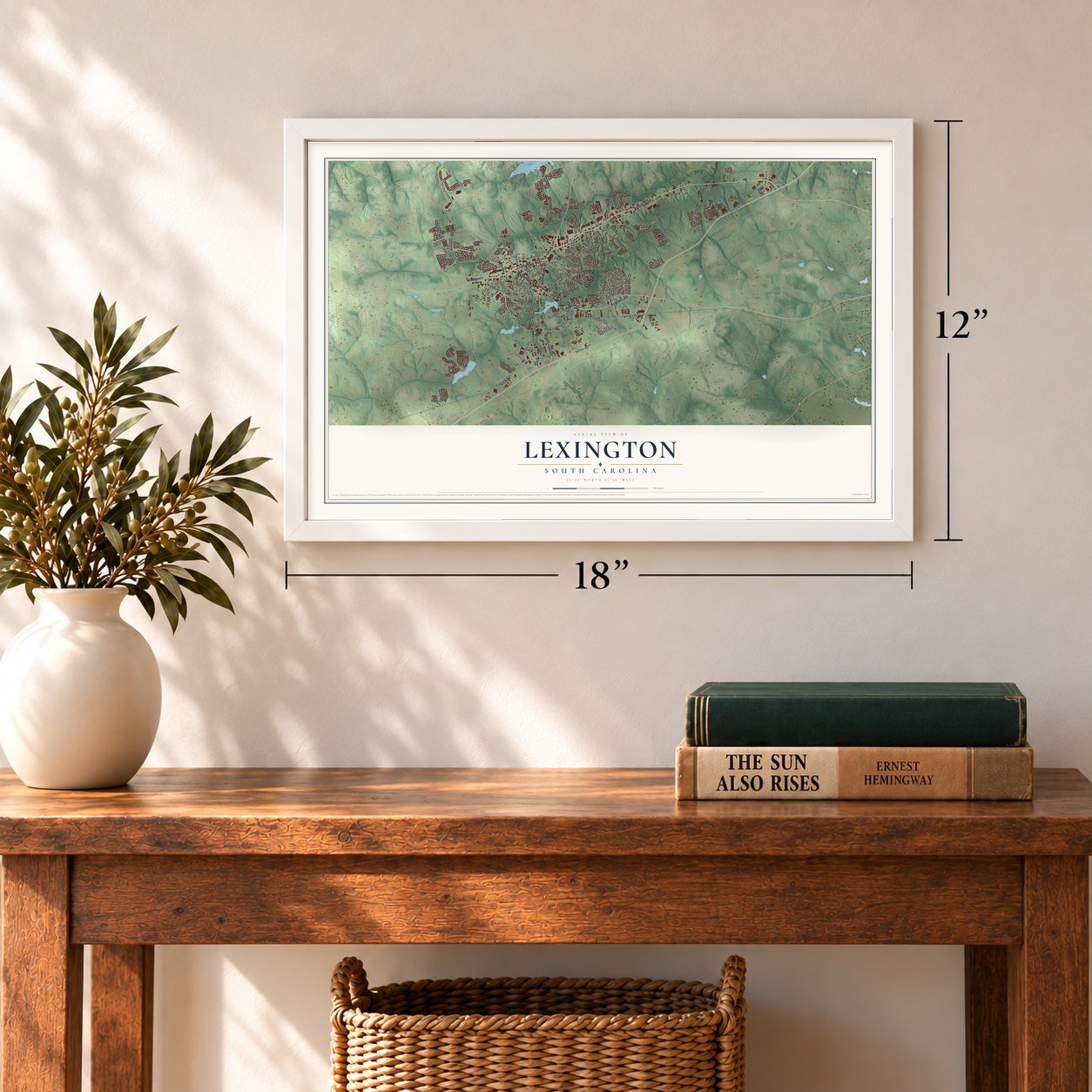

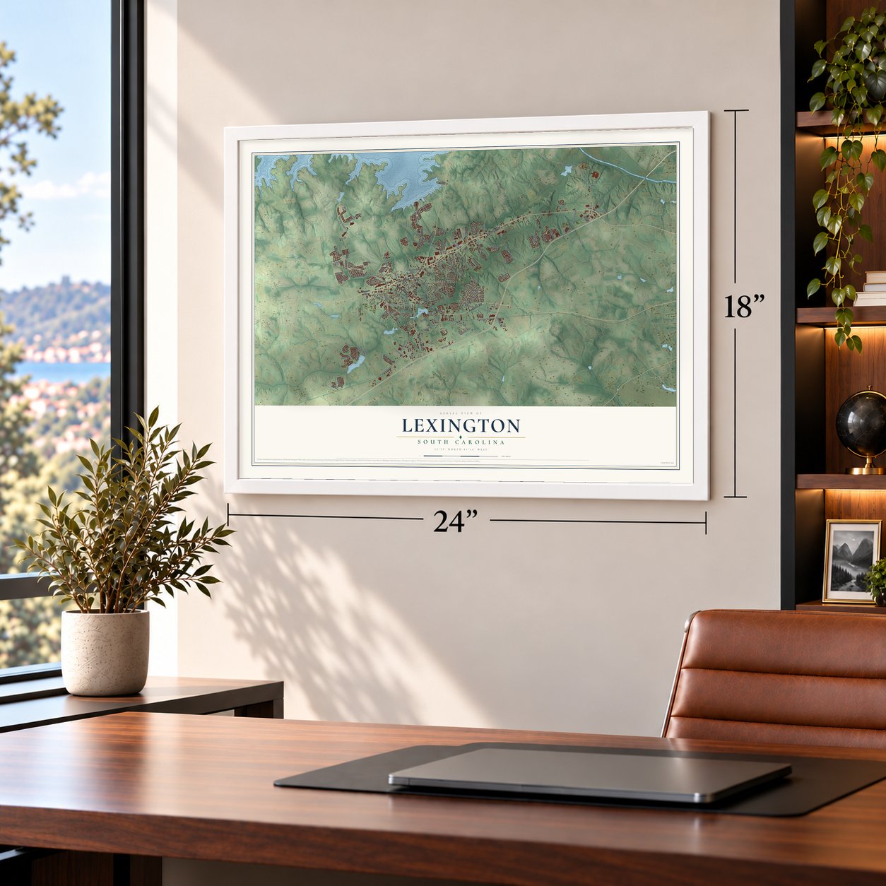

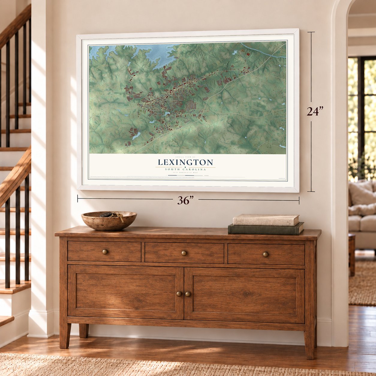
Free U.S. delivery 7 to 10 days after you order
Lexington, South Carolina Map Art
A new map of Lexington, South Carolina, made in 2026 and printed to order on thick archival matte paper.
12" x 18" Archival Matte Print
A Map of Home. A Work of Art.
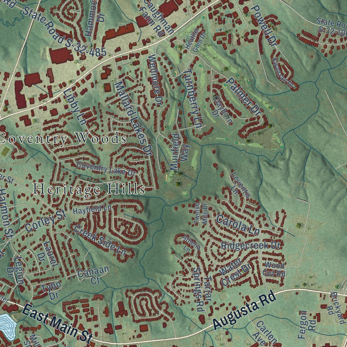
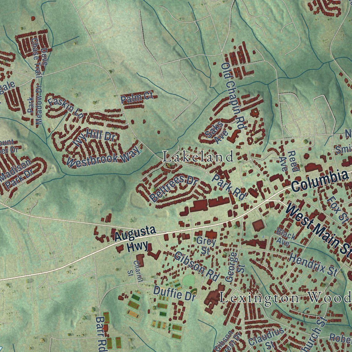
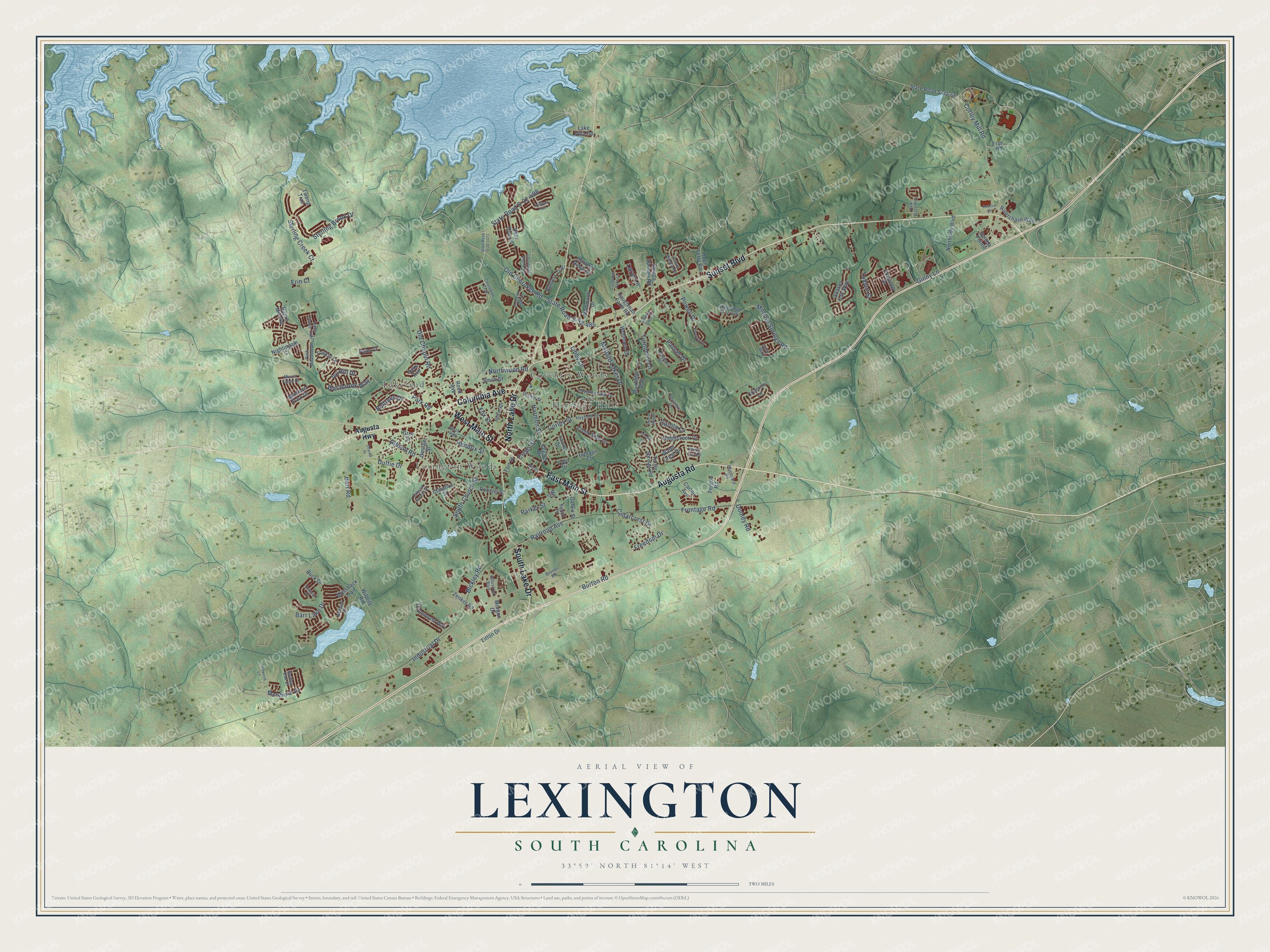
Explore Lexington, South Carolina from a whole new perspective. Created using aerial imagery and detailed geographic data, this map captures Lexington building by building, with labeled streets, familiar landmarks, and shaded topographical relief that highlights the natural contours of the landscape.
Combining modern data with the timeless character of a vintage atlas, this map is just as interesting up close as it is beautiful on the wall. Whether you grew up in Lexington, spent memorable years there, or call it home today, this unique map is a great way to celebrate a place that means something to you. Zoom in on the preview to look for your street, and then order a print to put your memories on the wall.
Three ways to hang it
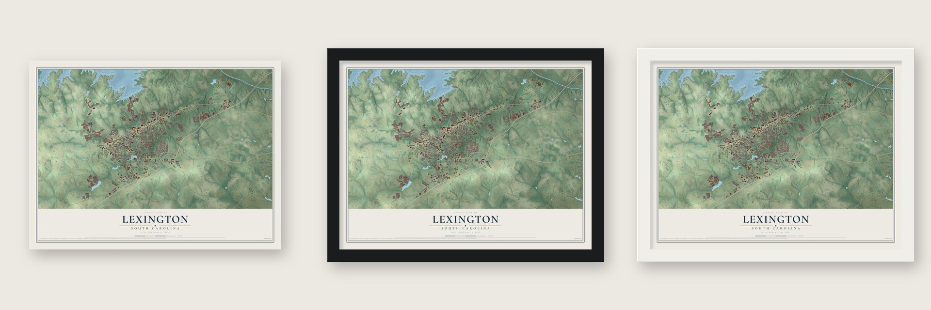
Unframed archival matte, a black wood frame or a white wood frame.
Up close
Geography Worth Displaying
This map was created using accurate cartographic data and authoritative geographic sources, including the U.S. Geological Survey and the Census Bureau. The map brings together terrain, waterways, roads, and building detail. The majority of the streets are labeled, houses are accurately depicted, and the topography is derived from government sources. Combining local data with carefully composed color and shading leads to this beautifully detailed Lexington artwork for your wall.
Rather than simply showing street outlines, we’ve included as many of the street names as we could reasonably fit on the map while keeping their names legible. Zoom in on the high resolution preview to see exactly what’s on the map. We truly set out to create a statement piece for anyone who loves Lexington. So whether it’s for you, or a gift for someone you love, we hope this map of Lexington brings back fond memories.
Read the story behind this map of Lexington, South Carolina from 2026.

About Lexington, South Carolina
Lexington is a town of 23,568 people and the seat of Lexington County, 12 miles west of Columbia. In 1735 the colonial government set up 11 backcountry townships, and one of them, Saxe Gotha, was settled mostly by German and Swiss families who grew corn, wheat, tobacco, hemp and flax. In 1785 the county was renamed Lexington to honor the first battles of the Revolution in Massachusetts.
The courthouse first stood at Granby, now Cayce, but floods kept striking it, so in 1820 the county moved it here. Locals called the new seat Lexington Courthouse, and it was incorporated as the Town of Lexington in 1861. During the Civil War, Union troops guarding Sherman's western flank on the march to Columbia burned most of the town, the courthouse included. Farms and lumber helped it recover after Reconstruction. In the 1890s a railroad linking Columbia and Augusta, along with the Lexington Textile Mill, was helping the town grow, and after Lake Murray was created in 1930, many more people moved here.
- Two battles in 1781Two Revolutionary War fights took place here in 1781. Soldiers clashed at Muddy Springs, south of today's town, and at Tarrar Springs, which lies inside the present town limits.
- Where the move over law beganOn January 28, 1994, paramedic James D. Garcia was hit and hurt while helping a driver who had slid off the road, and the South Carolina Highway Patrol blamed him. Garcia pushed for a law requiring drivers to change lanes around stopped emergency vehicles. The General Assembly passed it in 1996 and made it easier to enforce in 2002. All 50 states and the District of Columbia now have one, and Hawaii was last, in 2012.
- Rebuilt in brickSevere fires in 1894 and 1916 led to many of the brick buildings that stand in Lexington today. The Fox House joined the National Register in 1970, and the William Berly House and Lemuel Boozer House followed in 1977. The Bank of Western Carolina, Home National Bank and James Harman Building were among the places added in 1983.
- First woman mayor in 2023Hazel Livingston, who had been Mayor Pro-Tem since 2004, was sworn in on December 4, 2023, as the first woman to serve as mayor of Lexington.
Find your street
Names on the Lexington map
Every name below is printed on this map. Look for your street, your school, the park where you played, or the pond down the road.
Places and landmarks4
- Coventry Woods
- Heritage Hills
- Lakeland
- Lexington Woods
Streets and roads139
- Augusta Road
- East Main Street
- Columbia Avenue
- Sunset Boulevard
- North Lake Drive
- South Lake Drive
- West Main Street
- Railroad Avenue
- Harmon Street
- Cedarcrest Drive
- Burton Road
- Old Cherokee Road
- Gibson Road
- Industrial Drive
- Corley Mill Road
- Park Road
- Ginny Lane
- State Road S-32-485
- Hendrix Street
- State Road S-32-408
- Corley Street
- Sterling Brook Drive
- Mineral Springs Road
- Old Chapin Road
- Dooley Road
- South Church Street
- Mallard Lakes Drive
- Montrose Drive
- Barr Road
- Barr Lake Drive
Show all 139 streets
- Palmer Drive
- Bickley Road
- Frontage Road
- Parker Street
- Northwood Road
- Carola Lane
- Duffie Drive
- Sterling Creek Court
- Laryn Lane
- Powell Drive
- Westbrook Way
- Freedom Drive
- Turnberry Lane
- Libby Lane
- Fox Street
- Beltrees Drive
- Creps Street
- Ivy Hill Drive
- Tolbert Street
- Erin Court
- Augusta Highway
- State Road S-32-68
- Roberts Street
- Hunters Ridge Drive
- Madison Park Drive
- Tarrar Springs Road
- Northside Boulevard
- Reed Avenue
- Zenker Road
- Laurel Drive
- Ridgecreek Drive
- Saluda Springs Road
- Faskin Lane
- Riverchase Way
- Drummond Way
- George Street
- Mossback Trail
- Wellmore Drive
- Deer Run Lane
- Morgan Drive
- Dahlia Street
- Dupre Mill Road
- Creek Side Lane
- Fergon Road
- Hammock Drive
- Water Crest Drive
- Carlen Avenue
- Hunters Trail
- Nightingale Court
- Scarlet Oak Way
- Saluda Pointe
- Caughman Farm Road
- Hope Ferry Road
- Crismon Lane
- Wildlife Road
- Tweng Trail
- Claudius Street
- Canaan Court
- Chamfort Drive
- Muirfield Way
- Fort Street
- Smith Street
- Buck Drive
- Litton Drive
- Lake Villa Road
- Legion Drive
- Palm Court
- Tybo Drive
- Frye Road
- Saks Avenue
- Grey Street
- State Road S-32-106
- Cherokee Trail
- Dreher Street
- Coventry Lake Drive
- Gibson Forest Drive
- Swartz Road
- Hayfield Lane
- Clayborn Drive
- Black Avenue
- Cherokee Pond Court
- Park Meadow Drive
- Leventis Lane
- Industrial Boulevard
- Irene Way
- Dove Chase Trail
- Golden Oak Drive
- Brickyard Road
- Heddon Drive
- Mount Faber Drive
- Bruner Road
- Wood Cut Road
- Mill Street
- Hickory Meadow Road
- Meetze Avenue
- State Road S-32-1171
- Kwanzan Drive
- Palmetto Hall Drive
- Settlers Trail
- Chariot Street
- Park Place Trail
- Caughman Farm Lane
- Dedrick Drive
- Penwood Lane
- Athena Lane
- Heather Glen Drive
- Pawleys Drive
- Martel Drive
- Twelve Mile Drive
Names are listed as they appear on the printed map. Zoom into the product photos to find them.
The art of mapping a place
How This Map Was Made
Real places. Remarkable detail. Discover the layers that turn geographic data into a map of home.

The view from above
Aerial imagery reveals the character of the land: woodland, open fields, and the patterns of a place.

The shape of the land
Elevation data brings hills, valleys, and subtle changes in the landscape into view.

The details of home
Roads, waterways, and building footprints come together to make the map feel unmistakably local.

Geography becomes art
Considered color, shading, and typography bring the layers together in a map made for your wall.


Process illustrated with Mendon, Massachusetts. Aerial imagery: USDA NAIP. Terrain: USGS 3D Elevation Program. Map details and finished artwork: KNOWOL.
The Details
About This Print
Choose an archival matte print, or a black or white Ayous wood frame. The archival matte print is unframed.
Select your size and finish above to see the matching product image and price.
Materials & Craftsmanship
A contemporary map with the character of a classic atlas, printed on archival matte paper. Optional frames are made from Ayous wood.
Your printed map does not include the watermark shown in the full-map preview.
Shipping & Delivery
Free shipping within the United States. Every print is made to order in the USA.
Buying a gift? Add a note in your cart and we'll include it. We never put prices in the package.
Prints ship within 2 to 3 business days. Allow 7 to 10 days total from ordering for delivery. Timing may vary during holidays or periods of high order volume.
Read our shipping policy.
Returns and damaged prints
Each print is made to order. Change-of-mind refunds are not available after production.
If your print arrives damaged, misprinted or incorrect, contact support@knowol.com within 30 days of receiving it. Include your order number, photos and a description of the issue.
Read our full refund and replacement policy. For questions about your order, email support@knowol.com.
Find your town
Looking for another city?
Find a map of home in our South Carolina collection, or any town in the country.
Nearby
Maps of towns near Lexington
Know someone from one of these towns? Their map makes a great gift.
 Red Bank
, South Carolina
From $39.99See the map
 Oak Grove
, South Carolina
From $39.99See the map
 Seven Oaks
, South Carolina
From $39.99See the map
More maps nearby: Springdale, West Columbia, White Knoll, St. Andrews and South Congaree.