
Search for another town





Free U.S. delivery 7 to 10 days after you order
Lexington, Tennessee Map Art
Building by building, with labeled streets and shaded relief.
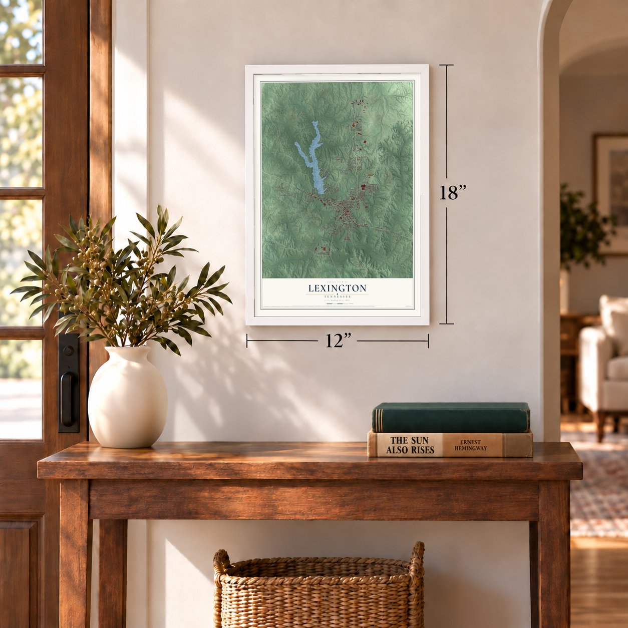
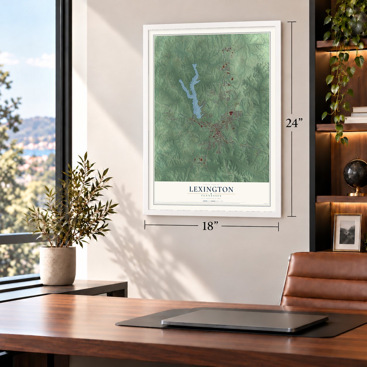
12" x 18" Archival Matte Print
A Map of Home. A Work of Art.
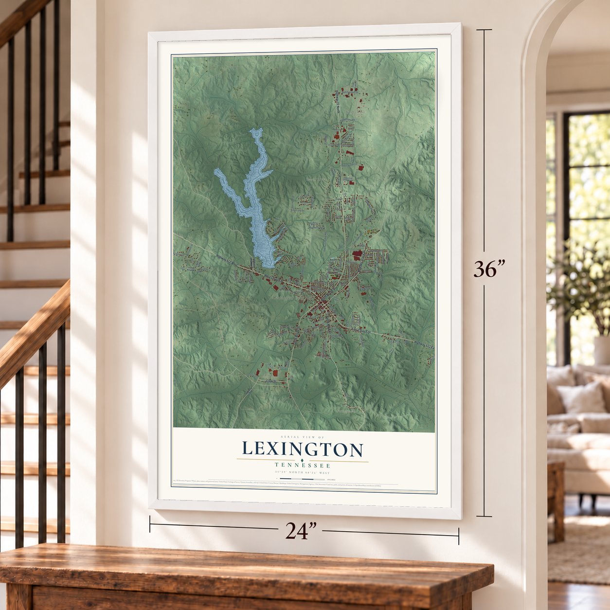
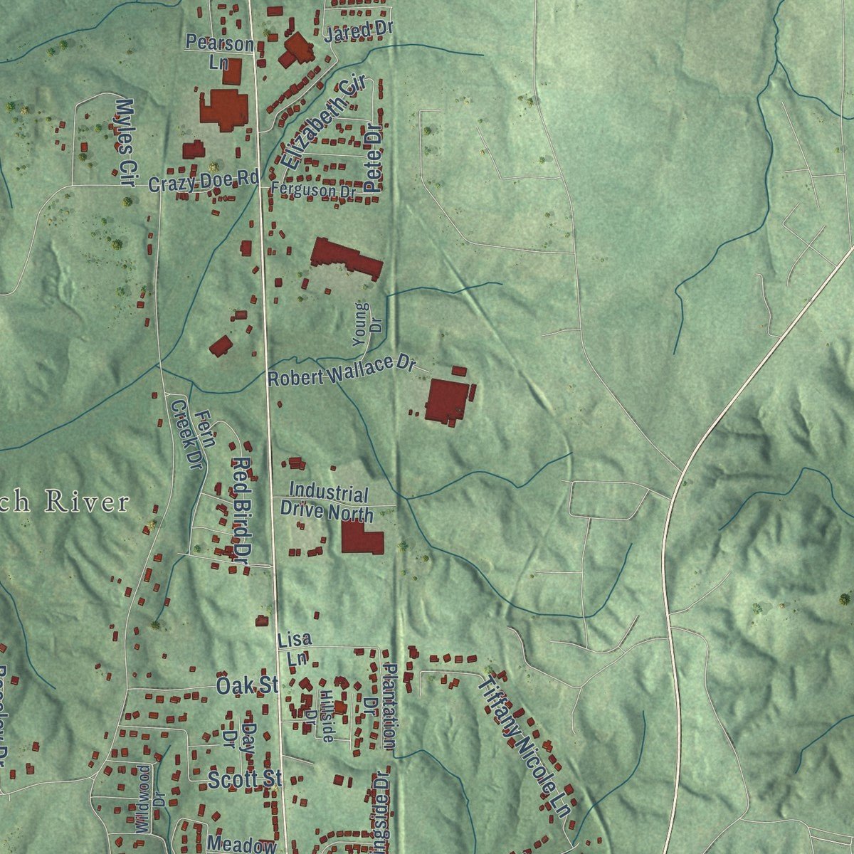
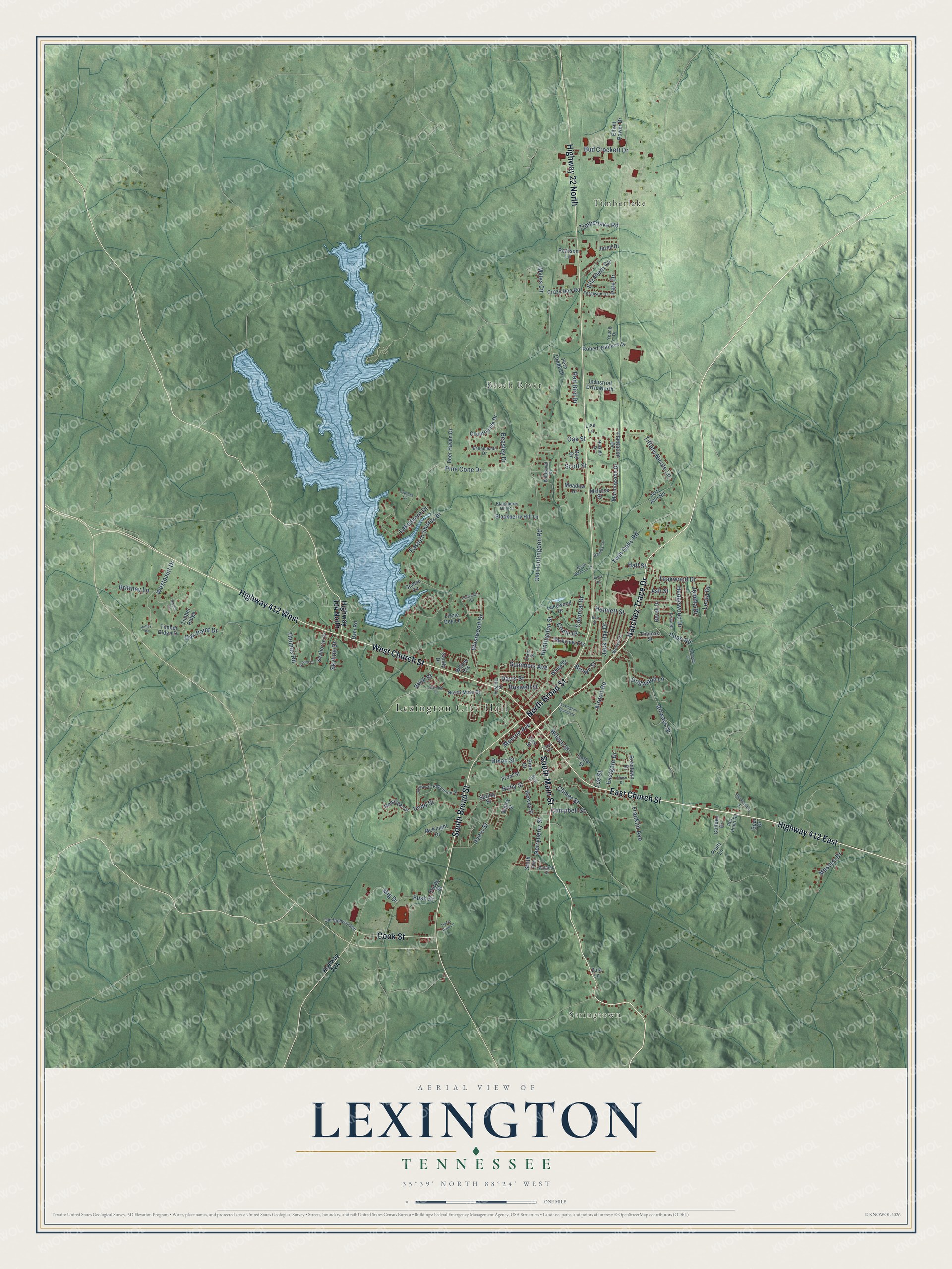
Explore Lexington, Tennessee from a whole new perspective. Created using aerial imagery and detailed geographic data, this map captures Lexington building by building, with labeled streets, familiar landmarks, and shaded topographical relief that highlights the natural contours of the landscape.
Combining modern data with the timeless character of a vintage atlas, this map is just as interesting up close as it is beautiful on the wall. Whether you grew up in Lexington, spent memorable years there, or call it home today, this unique map is a great way to celebrate a place that means something to you. Zoom in on the preview to look for your street, and then order a print to put your memories on the wall.
Three ways to hang it
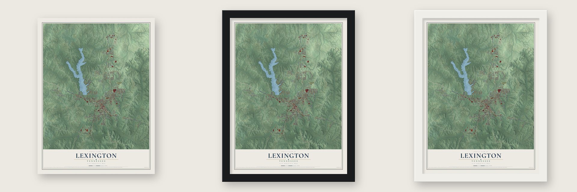
Unframed archival matte, a black wood frame or a white wood frame.
Up close
Geography Worth Displaying
This map was created using accurate cartographic data and authoritative geographic sources, including the U.S. Geological Survey and the Census Bureau. The map brings together terrain, waterways, roads, and building detail. The majority of the streets are labeled, houses are accurately depicted, and the topography is derived from government sources. Combining local data with carefully composed color and shading leads to this beautifully detailed Lexington artwork for your wall.
Rather than simply showing street outlines, we’ve included as many of the street names as we could reasonably fit on the map while keeping their names legible. Zoom in on the high resolution preview to see exactly what’s on the map. We truly set out to create a statement piece for anyone who loves Lexington. So whether it’s for you, or a gift for someone you love, we hope this map of Lexington brings back fond memories.
Read the story behind this map of Lexington, Tennessee from 2026.

Find your street
Names on the Lexington map
Every name below is printed on this map. Look for your street, your school, the park where you played, or the pond down the road.
Places and landmarks5
- Lexington City Hall
- Stringtown
- Timberlake
- Beech River
- Lexington Cemetery
Streets and roads145
- South Main Street
- East Church Street
- Natchez Trace Drive
- West Church Street
- Highway 412 East
- South Broad Street
- Highway 412 West
- North Broad Street
- Highway 22 North
- Cook Street
- Holly Street
- Oak Point Drive
- Huntingdon Street
- Climer Street
- Summers Avenue
- Old Huntingdon Road
- Eastern Shores Drive
- Airways Drive
- Franklin Avenue
- Twin Oaks Road
- Pine Cone Drive
- Westwood Drive
- Jack Hay Drive
- Derryberry Street
- Tiffany Nicole Lane
- Westpoint Drive
- Ayers Street
- Teakwood Drive
- Rush Street
- Lakeshore Drive
Show all 145 streets
- Wilson Street
- Pope Road
- Mig Drive
- Myles Circle
- Dodd Street
- Brittney Lane
- Monroe Avenue
- Scott Street
- Leota Drive
- Hedgewood Drive
- Bud Crockett Drive
- Hall Street
- Timberlake Road
- Red Bird Drive
- Beasley Drive
- Masters Drive
- Thomas Road
- Airport Road
- Davis Street
- Colonial Drive
- Elizabeth Circle
- Oak Street
- Dogwood Lane
- Boswell Street
- Hamlett Street
- Eastgate Drive
- Dixon Street
- Jemma Drive
- Skyline Drive
- Brown Street
- Campbell Street
- Pete Drive
- Circle Drive
- Ash Street
- Buck Street
- Lee Street
- Highway 104 North
- Roselawn Drive
- Jared Drive
- North Main Street
- Timber Ridge Drive
- Spring Street
- Crazy Doe Road
- Fern Creek Drive
- Red Oak Circle
- Lakewood Drive
- Smith Avenue
- Robert Wallace Drive
- Derek Drive
- Plantation Drive
- Countryside Drive
- Blackberry Hill Lane
- Bailey Street
- Deer Haven Drive
- Parkview Cts
- Morningside Drive
- Willow Cts
- McKnight Drive
- Industrial Drive North
- Thomas Street
- First Street
- Seahorse Drive
- Elliott Power Drive
- Lizzie Dee Lane
- Reeves Street
- Front Street
- Jerri Ann Road
- White Street
- Cedar Street
- Melrose Street
- Timber Ridge
- Purdy Street
- Meadow Drive
- College Drive
- Sandy Drive
- Dam Road
- Pearson Lane
- Scenic Circle
- Pruitt Lane
- Day Drive
- Pine Drive
- Zula Lane
- Lisa Lane
- Spur Drive
- Wildwood Drive
- Robertson Street
- Bellemeade Drive
- Old Highway 200
- Weaver Street
- Blackberry Hill Circle
- Ferguson Drive
- Erika Street
- Dixie Street
- Hospital Drive
- Pollock Street
- Hillside Drive
- Young Drive
- Davids Lane
- Eller Street
- Roy Pruitt Road
- Jane Lane
- Barnhill Street
- Cheyenne Circle
- Blankenship Street
- Sullivan Street
- Grissom Lane
- Arnold Drive
- North Meadow Drive
- Lewis Avenue
- Tignor Park Lane
- Chase Drive
- Cypress Cv
- Switch Cv
- Britt Street
- Valley Drive
Names are listed as they appear on the printed map. Zoom into the product photos to find them.
About Lexington, Tennessee
Lexington is a city of 7,956 people and the county seat of Henderson County, halfway between Memphis and Nashville. Henderson County was created in 1821, and soon afterward a spot near its center was picked for the county seat. The town was named for Lexington, Massachusetts, where the first battle of the American Revolution was fought.
Samuel Wilson, who held the land grant, gave the ground for the town but kept a lot on the square where his house already stood. Major John Troxell Harmon surveyed the town in 1822 and turned it crosswise to the usual layout, so the corners of the square point north, south, east and west. Workers finished the first courthouse in 1823. A year later, in 1824, the town was incorporated, and its population reached 260 by 1830.
- Forrest rides in, 1862Henderson County voted against secession, yet it sent men to both Union and Confederate regiments. On December 18, 1862, Union Colonel Robert Ingersoll ordered his troops to destroy the bridge over Beech Creek and keep the Confederates out. The bridge was left standing, and General Nathan Bedford Forrest's men pushed into Lexington, overran the Union force and captured more than 140 soldiers, Ingersoll among them, along with the artillery and supplies left behind.
- The Giants and the BeesFrom 1935 to 1938, Lexington fielded a minor league baseball team in the Kentucky-Illinois-Tennessee League. The club went by the Lexington Giants until 1938. That year it signed on as a farm team for the Boston Bees of the National League and changed its name to the Lexington Bees.
- A newspaper since 1884The Lexington Progress has covered the town since 1884. Its older history is also kept at the Beech River Heritage Museum, which holds artifacts from Lexington and Henderson County.
- Barbecue capitalLexington calls itself the barbecue capital of the country, saying it has more barbecue restaurants for its size than any other city in the United States.
- The county's big employersJohnson Controls and Leroy-Somer, the two largest employers in Henderson County, both run plants in Lexington, and together they employ more than eighteen hundred workers.
Keep exploring Tennessee
Lexington is one of 640 Tennessee towns we've mapped. Every dot on the map is a print of its own.
The search covers every state, Tennessee first.
Near Lexington
Order 2 or more town maps and save 10%. Shown in the size and finish you picked above, so they hang as a set.
- Chesterfield 12" x 18" / Archival Matte Print $39.99
- Darden 12" x 18" / Archival Matte Print $39.99
- Bargerton 12" x 18" / Archival Matte Print $39.99


More maps nearby: Wildersville, Huron, Parker's Crossroads, Scotts Hill and Luray.
The art of mapping a place
How This Map Was Made
Real places. Remarkable detail. Discover the layers that turn geographic data into a map of home.

The view from above
Aerial imagery reveals the character of the land: woodland, open fields, and the patterns of a place.

The shape of the land
Elevation data brings hills, valleys, and subtle changes in the landscape into view.

The details of home
Roads, waterways, and building footprints come together to make the map feel unmistakably local.

Geography becomes art
Considered color, shading, and typography bring the layers together in a map made for your wall.


Process illustrated with Mendon, Massachusetts. Aerial imagery: USDA NAIP. Terrain: USGS 3D Elevation Program. Map details and finished artwork: KNOWOL.
The Details
About This Print
Choose an archival matte print, or a black or white Ayous wood frame. The archival matte print is unframed.
Select your size and finish above to see the matching product image and price.
Materials & Craftsmanship
A contemporary map with the character of a classic atlas, printed on archival matte paper. Optional frames are made from Ayous wood.
Your printed map does not include the watermark shown in the full-map preview.
Shipping & Delivery
Free shipping within the United States. Every print is made to order in the USA.
Buying a gift? Add a note in your cart and we'll include it. We never put prices in the package.
Prints ship within 2 to 3 business days. Allow 7 to 10 days total from ordering for delivery. Timing may vary during holidays or periods of high order volume.
Read our shipping policy.
Returns and damaged prints
Each print is made to order. Change-of-mind refunds are not available after production.
If your print arrives damaged, misprinted or incorrect, contact support@knowol.com within 30 days of receiving it. Include your order number, photos and a description of the issue.
Read our full refund and replacement policy. For questions about your order, email support@knowol.com.