
Search for another town





Free U.S. delivery 7 to 10 days after you order
Lock Haven, Pennsylvania Map Art
Building by building, with labeled streets and shaded relief.
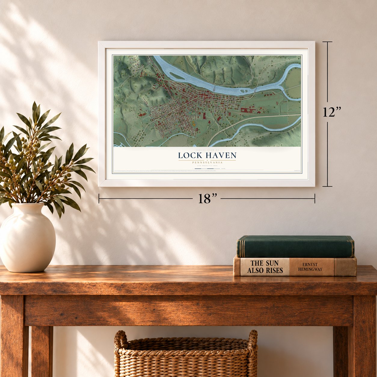
12" x 18" Archival Matte Print
A Map of Home. A Work of Art.
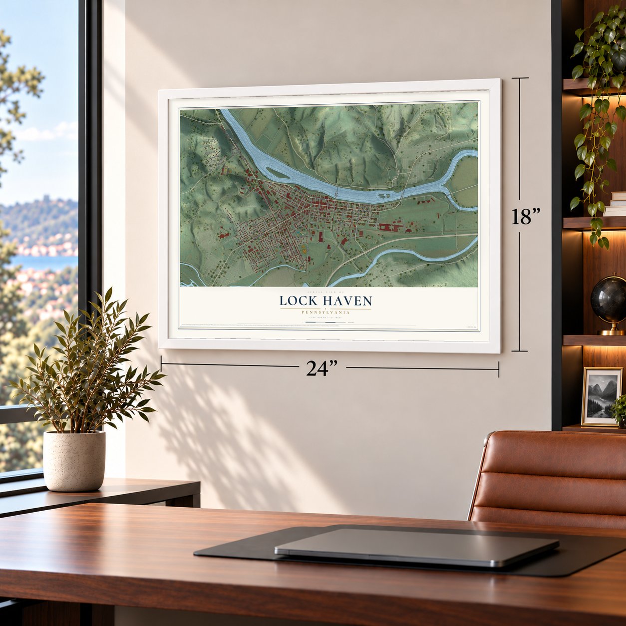
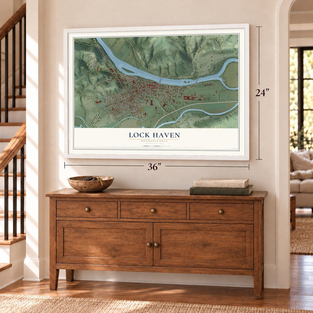
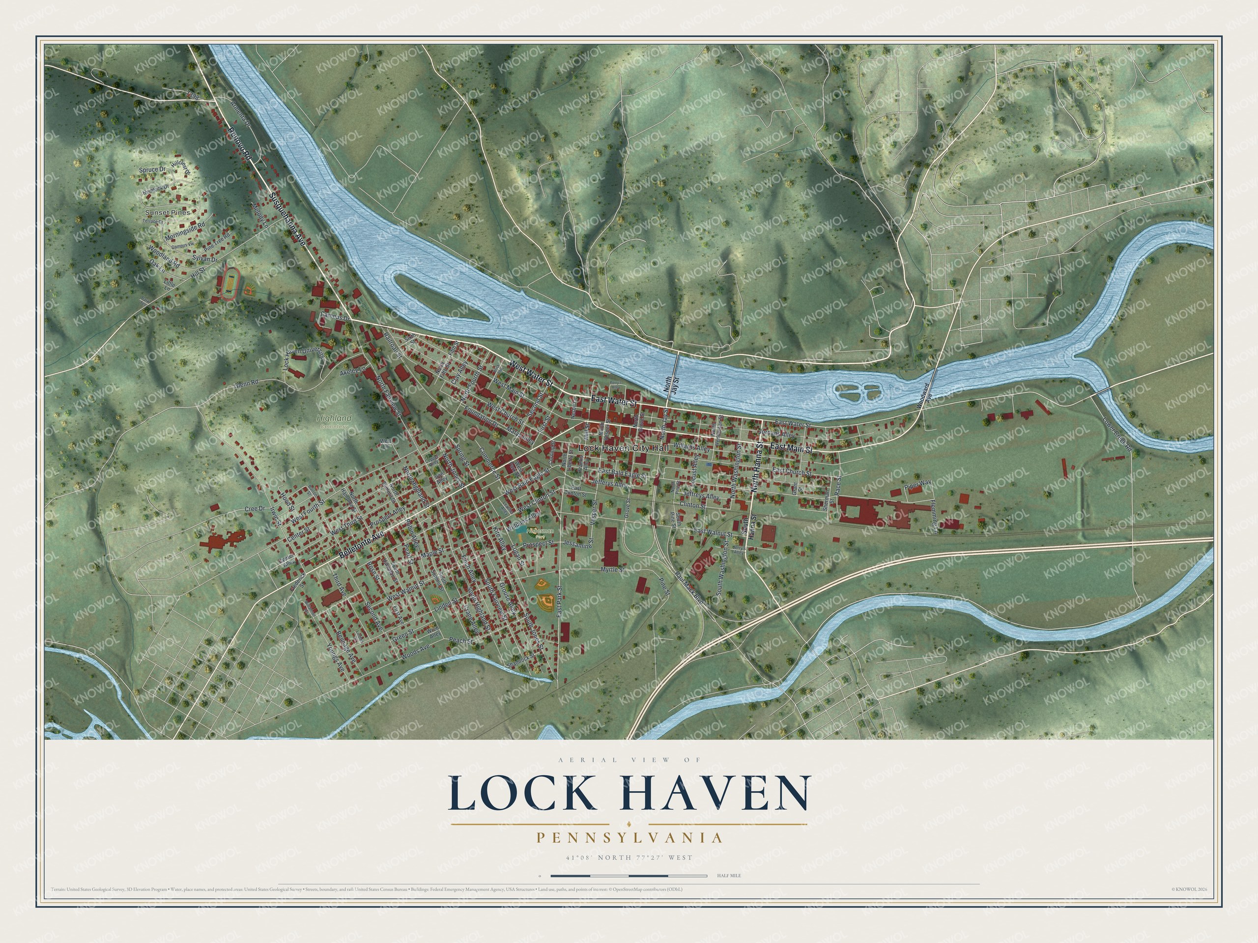
Explore Lock Haven, Pennsylvania from a whole new perspective. Created using aerial imagery and detailed geographic data, this map captures Lock Haven building by building, with labeled streets, familiar landmarks, and shaded topographical relief that highlights the natural contours of the landscape.
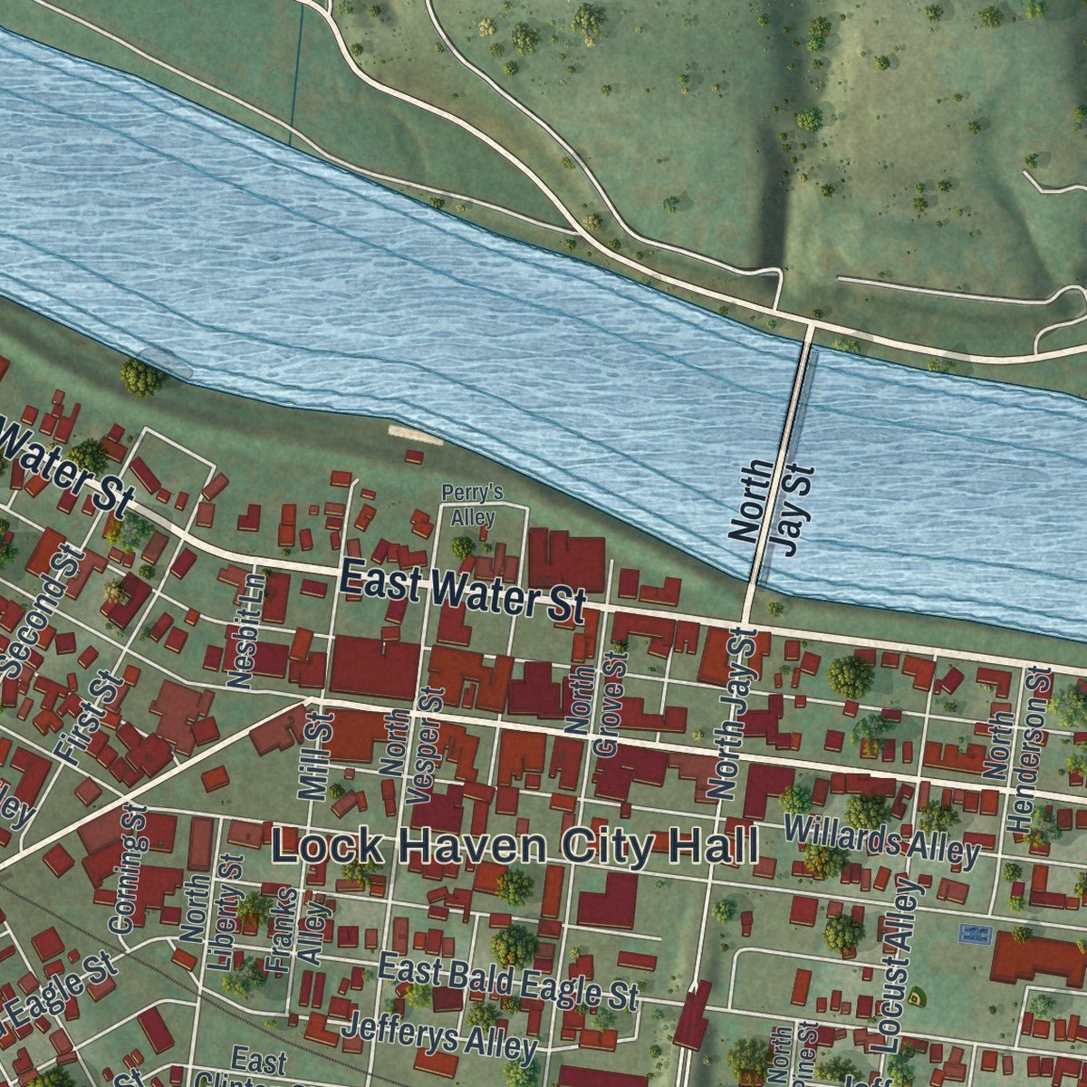
Combining modern data with the timeless character of a vintage atlas, this map is just as interesting up close as it is beautiful on the wall. Whether you grew up in Lock Haven, spent memorable years there, or call it home today, this unique map is a great way to celebrate a place that means something to you. Zoom in on the preview to look for your street, and then order a print to put your memories on the wall.
Three ways to hang it
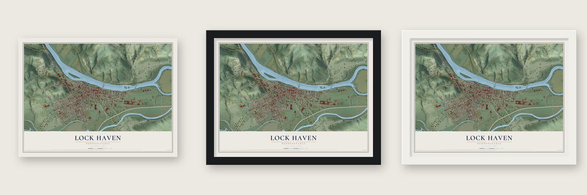
Unframed archival matte, a black wood frame or a white wood frame.
Up close
Geography Worth Displaying
This map was created using accurate cartographic data and authoritative geographic sources, including the U.S. Geological Survey and the Census Bureau. The map brings together terrain, waterways, roads, and building detail. The majority of the streets are labeled, houses are accurately depicted, and the topography is derived from government sources. Combining local data with carefully composed color and shading leads to this beautifully detailed Lock Haven artwork for your wall.
Rather than simply showing street outlines, we’ve included as many of the street names as we could reasonably fit on the map while keeping their names legible. Zoom in on the high resolution preview to see exactly what’s on the map. We truly set out to create a statement piece for anyone who loves Lock Haven. So whether it’s for you, or a gift for someone you love, we hope this map of Lock Haven brings back fond memories.
Read the story behind this map of Lock Haven, Pennsylvania from 2026.

Find your street
Names on the Lock Haven map
Every name below is printed on this map. Look for your street, your school, the park where you played, or the pond down the road.
Places and landmarks4
- Lock Haven City Hall
- Sunset Pines
- Highland Cemetery
- Hoberman Park
Streets and roads133
- East Water Street
- Renovo Road
- North Hanna Street
- West Water Street
- East Main Street
- Bellefonte Avenue
- Susquehanna Avenue
- East Park Street
- Lower Creek Road
- Jessamine Street
- Cree Drive
- Vesper Street
- East Bald Eagle Street
- Jefferys Alley
- Willards Alley
- Jordans Alley
- Marys Alley
- East Church Street
- Paul Mack Boulevard
- West Bald Eagle Street
- West Fourth Street
- South Jones Street
- West Main Street
- Irwin Street
- West Church Street
- North Fairview Street
- South Fairview Street
- Glenn Road
- Grouse Alley
- East Walnut Street
Show all 133 streets
- Linden Street
- Hill Street
- South Highland Street
- Center Street
- West Third Street
- Maple Street
- Myrtle Street
- Crane Alley
- West Walnut Street
- Prospect Alley
- Finch Alley
- Sylvan Drive
- Pearl Street
- Kite Alley
- Second Avenue
- Railroad Street
- Woods Avenue
- Jeffreys Alley
- Armenta Drive
- Locust Alley
- North Washington Street
- Lock Haven University
- Third Avenue
- West Clinton Street
- Peach Street
- Commerce Street
- Bennage Avenue
- North Fourth Street
- Youngs Avenue
- South Washington Street
- Second Street
- Pine Street
- Woodland Road
- Race Street
- First Street
- North Jay Street
- Mill Street
- Foundation Drive
- Rose Street
- Robin Alley
- Piper Way
- Prospect Street
- Morningside Road
- North Highland Street
- Logan Street
- Spring Street
- Campus Drive
- Clinton Street
- North Jones Street
- Green Street
- Oak Lane
- Hood Street
- Williams Alley
- Clay Alley
- Flemming Lane
- Akeley Lane
- Spruce Drive
- Melody Lane
- South Hanna Street
- Grove Street
- North Vesper Street
- South Summit Street
- Hemlock Drive
- North Grove Street
- West Park Street
- North Hampton Street
- South Hampton Street
- Grant Street
- North Henderson Street
- Sherman Street
- North Summit Street
- Pine Tree Road
- Hillcrest Drive
- Shamrock Street
- North Liberty Street
- Franks Alley
- Wren Alley
- East Clinton Street
- First Avenue
- Corning Street
- Frederick Street
- South Pine Street
- Fifth Street
- Sixth Street
- Nesbit Lane
- North Fifth Street
- Iron Alley
- Center Alley
- Wert Lane
- Little Lane
- Woodward Avenue
- Barton Street
- Jerry's Alley
- Campus Vw
- North Pine Street
- Leather Alley
- Terrace Drive
- Copper Alley
- Linden Circle
- Park Terrace
- Perry's Alley
- Brick Alley
- Williamson Heights
Names are listed as they appear on the printed map. Zoom into the product photos to find them.
About Lock Haven, Pennsylvania
Lock Haven is a city of 8,108 people and the county seat of Clinton County, set where Bald Eagle Creek flows into the West Branch Susquehanna River. Jeremiah Church and his brother Willard picked the site in 1833, drawn by the river, the creek and a canal that was coming through. Church called it Lock Haven because the town had a canal lock and gave shelter to loggers, boatmen and other travelers.
The West Branch Canal opened in 1834, and by 1850 the town had grown to 830 people. Lock Haven became the seat of the new Clinton County in 1839, a borough in 1840 and a city in 1870. The Sunbury and Erie Railroad arrived in 1859 and set off a building boom, while pine and hemlock cut upriver kept the town busy for the rest of the century.
- Reed's Fort and the Big RunawayCleary Campbell, the area's first European settler, built a log cabin in 1769 near today's Lock Haven University. By 1773 William Reed ringed his cabin with a stockade, and Reed's Fort became the westernmost of 11 forts along the West Branch. Indian attacks emptied it in 1778, when hundreds of settlers fled downriver to Fort Augusta, about 50 miles away; some stayed away five years. The second Treaty of Fort Stanwix gave the land to Pennsylvania in 1784.
- A boom for the logsIn 1849 the town built a log boom in the pool behind the Dunnstown Dam. Stone-weighted timber cribs stood about 150 feet apart in a line running 3 miles upriver, chained together with iron yokes and rings, and the current pushed floating logs inside. Workers known as boom rats sorted the logs, which were branded like cattle, and sent them on to their owners' sawmills. A flood wrecked the boom and the canals in 1889.
- Home of the Piper CubAfter fire destroyed the Taylor Aircraft plant in Bradford, William T. Piper Sr. moved his company here in 1937 and started building planes in an old silk mill. Piper Aircraft employed more than 2,000 people at its peak and built nearly 77,000 aircraft in Lock Haven, 20,000 of them J-3 Cubs. In World War II, thousands of modified Cubs called L-4 Grasshoppers trained pilots and flew reconnaissance.
- A museum where Cubs were builtNew owner Lear-Siegler shifted Piper's production to Vero Beach in 1984. The next year, 1985, the Clinton County Historical Society started a museum on the old factory site, named the Piper Aviation Museum.
- A teachers' school in 1877The Central State Normal School held its first classes in 1877 on ground overlooking the West Branch, training teachers for central Pennsylvania. It stayed small, with fewer than 150 students until the 1940s, and grew into Lock Haven University of Pennsylvania.
Keep exploring Pennsylvania
Lock Haven is one of 3,725 Pennsylvania towns we've mapped. Every dot on the map is a print of its own.
The search covers every state, Pennsylvania first.
Near Lock Haven
Order 2 or more town maps and save 10%. Shown in the size and finish you picked above, so they hang as a set.
- Flemington 12" x 18" / Archival Matte Print $39.99
- Allison 12" x 18" / Archival Matte Print $39.99
- Dunnstown 12" x 18" / Archival Matte Print $39.99

More maps nearby: Castanea, Mill Hall, Woodward, Salona and Dunnstable.
The art of mapping a place
How This Map Was Made
Real places. Remarkable detail. Discover the layers that turn geographic data into a map of home.

The view from above
Aerial imagery reveals the character of the land: woodland, open fields, and the patterns of a place.

The shape of the land
Elevation data brings hills, valleys, and subtle changes in the landscape into view.

The details of home
Roads, waterways, and building footprints come together to make the map feel unmistakably local.

Geography becomes art
Considered color, shading, and typography bring the layers together in a map made for your wall.


Process illustrated with Mendon, Massachusetts. Aerial imagery: USDA NAIP. Terrain: USGS 3D Elevation Program. Map details and finished artwork: KNOWOL.
The Details
About This Print
Choose an archival matte print, or a black or white Ayous wood frame. The archival matte print is unframed.
Select your size and finish above to see the matching product image and price.
Materials & Craftsmanship
A contemporary map with the character of a classic atlas, printed on archival matte paper. Optional frames are made from Ayous wood.
Your printed map does not include the watermark shown in the full-map preview.
Shipping & Delivery
Free shipping within the United States. Every print is made to order in the USA.
Buying a gift? Add a note in your cart and we'll include it. We never put prices in the package.
Prints ship within 2 to 3 business days. Allow 7 to 10 days total from ordering for delivery. Timing may vary during holidays or periods of high order volume.
Read our shipping policy.
Returns and damaged prints
Each print is made to order. Change-of-mind refunds are not available after production.
If your print arrives damaged, misprinted or incorrect, contact support@knowol.com within 30 days of receiving it. Include your order number, photos and a description of the issue.
Read our full refund and replacement policy. For questions about your order, email support@knowol.com.