
Search for another town



Free U.S. delivery 7 to 10 days after you order
Madisonville, Kentucky Map Art
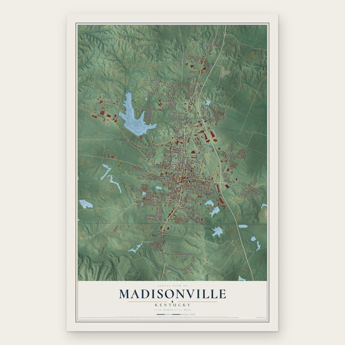
A new map of Madisonville, Kentucky, made in 2026 and printed to order on thick archival matte paper.
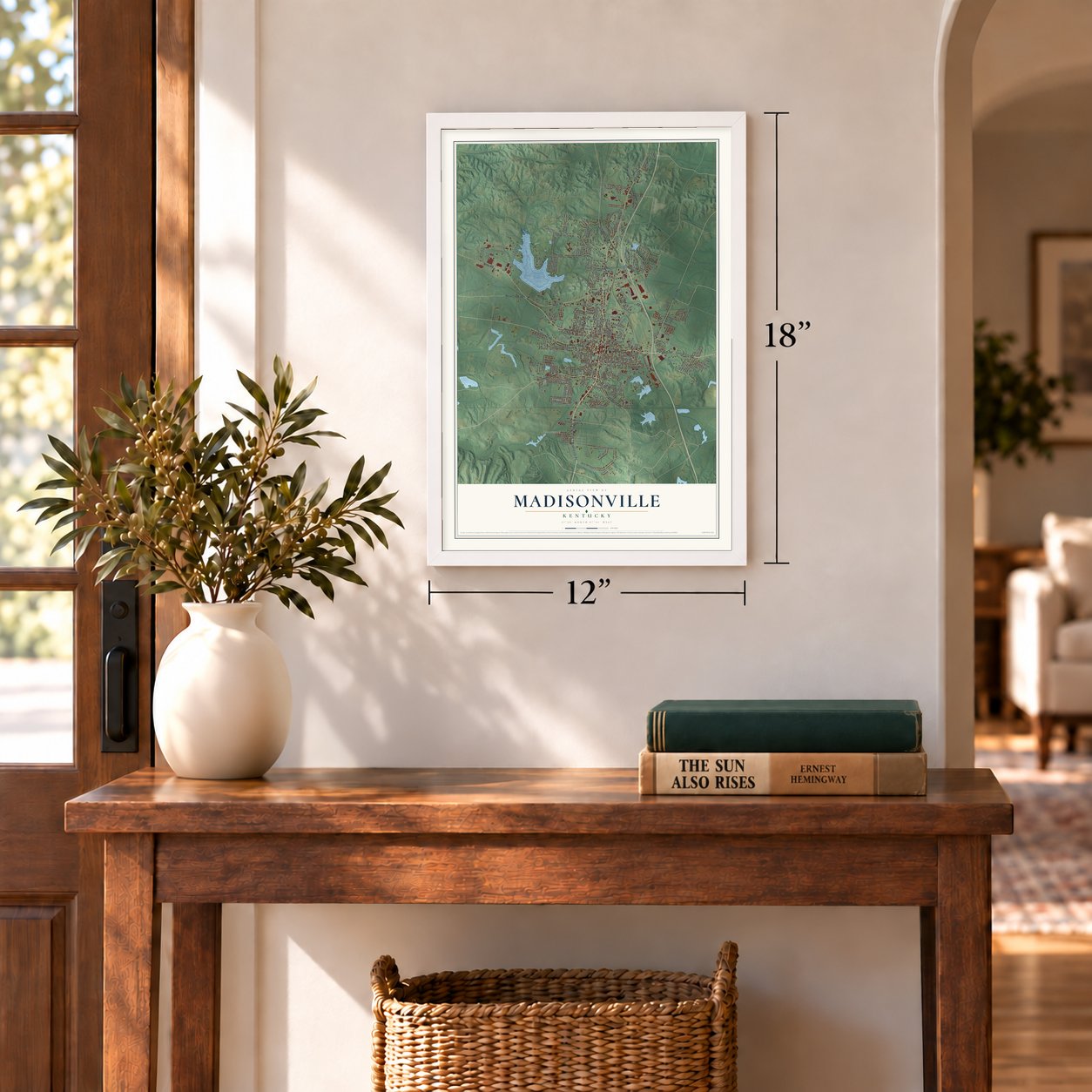
12" x 18" Archival Matte Print
A Map of Home. A Work of Art.
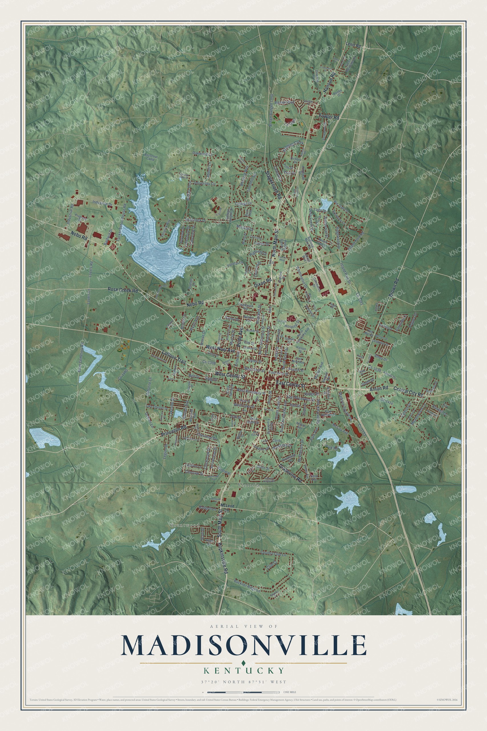
Explore Madisonville, Kentucky from a whole new perspective. Created using aerial imagery and detailed geographic data, this map captures Madisonville building by building, with labeled streets, familiar landmarks, and shaded topographical relief that highlights the natural contours of the landscape.
Combining modern data with the timeless character of a vintage atlas, this map is just as interesting up close as it is beautiful on the wall. Whether you grew up in Madisonville, spent memorable years there, or call it home today, this unique map is a great way to celebrate a place that means something to you. Zoom in on the preview to look for your street, and then order a print to put your memories on the wall.
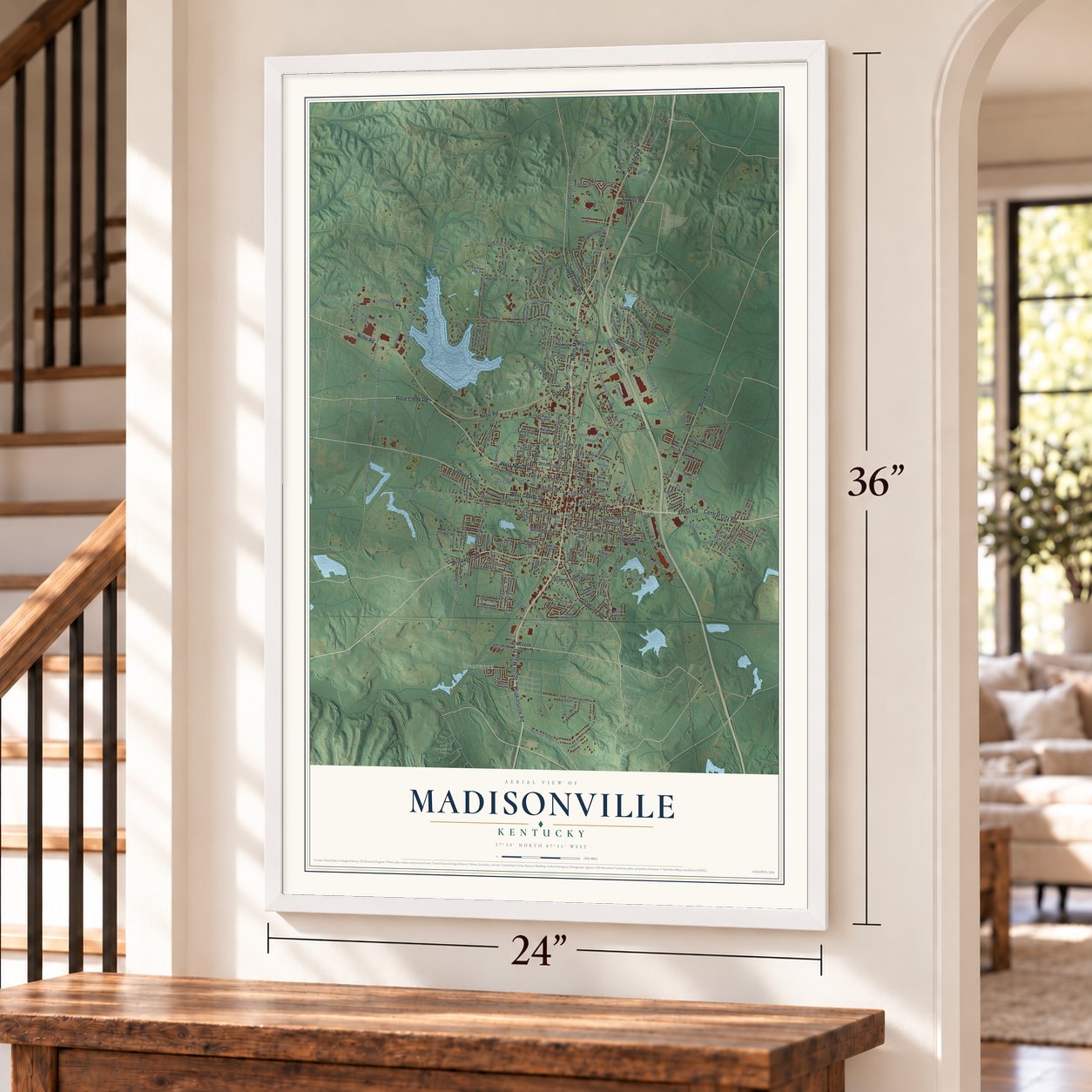
Three ways to hang it
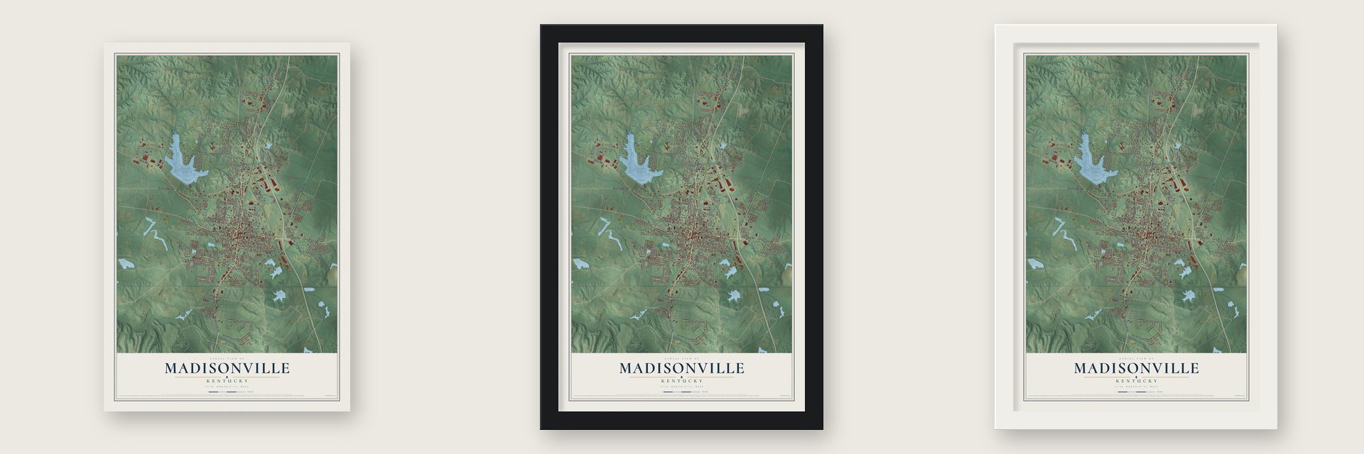
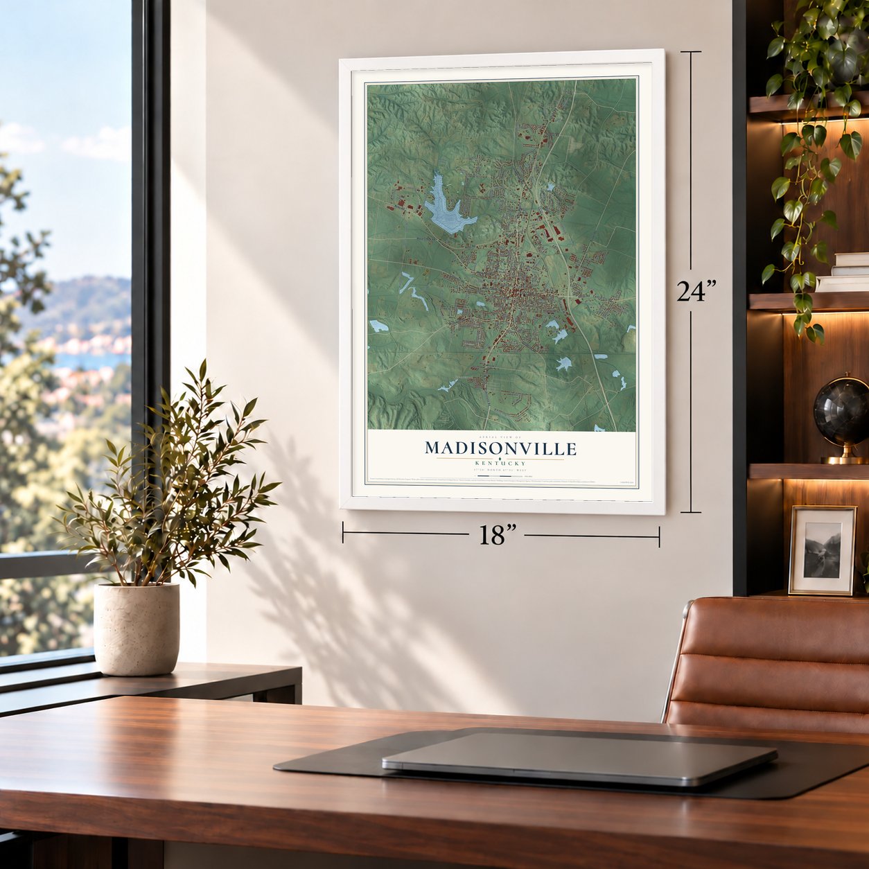
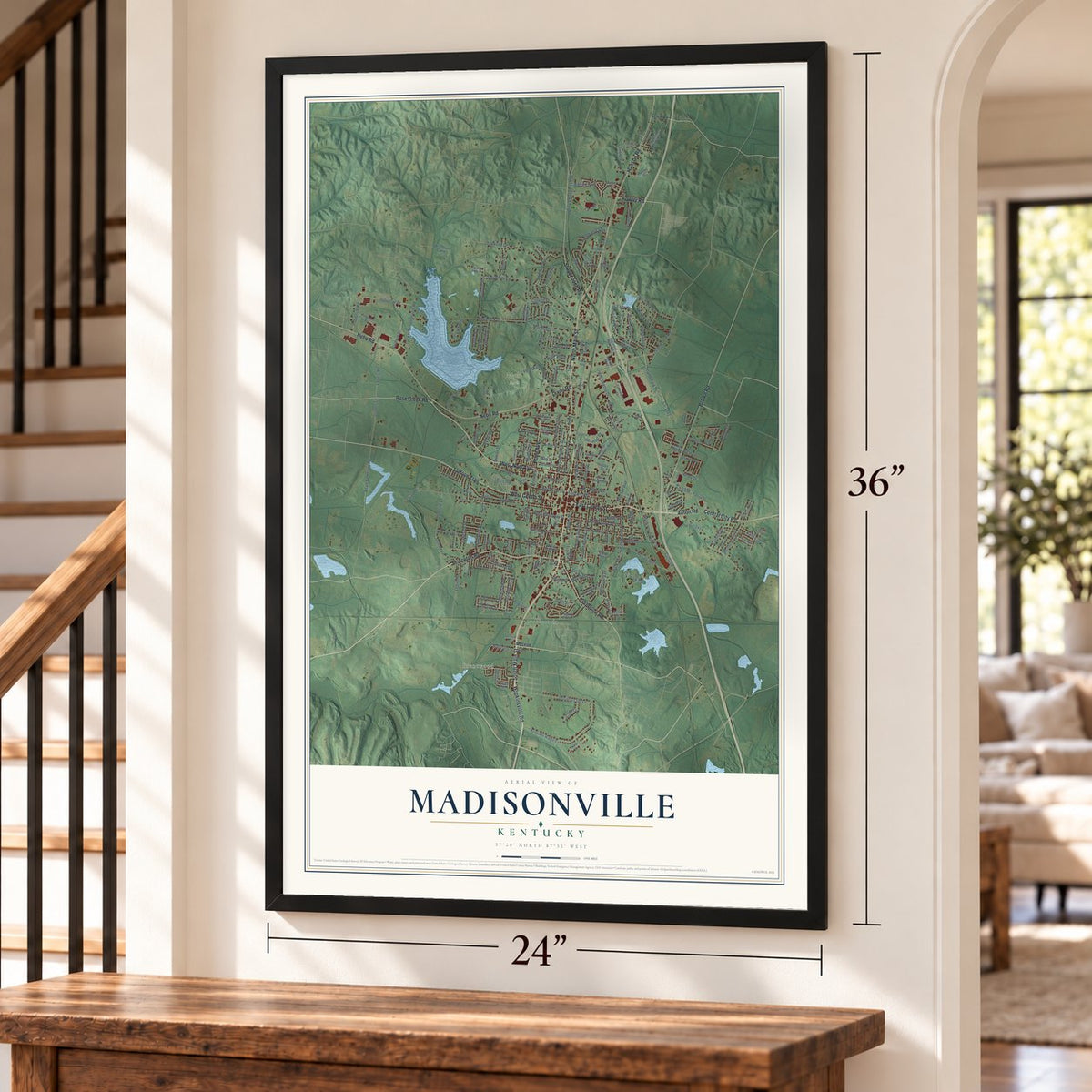
Unframed archival matte, a black wood frame or a white wood frame.
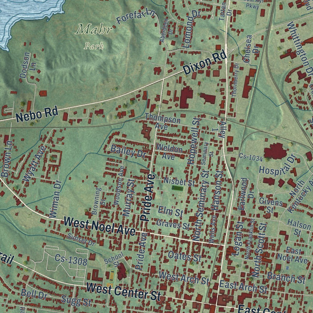
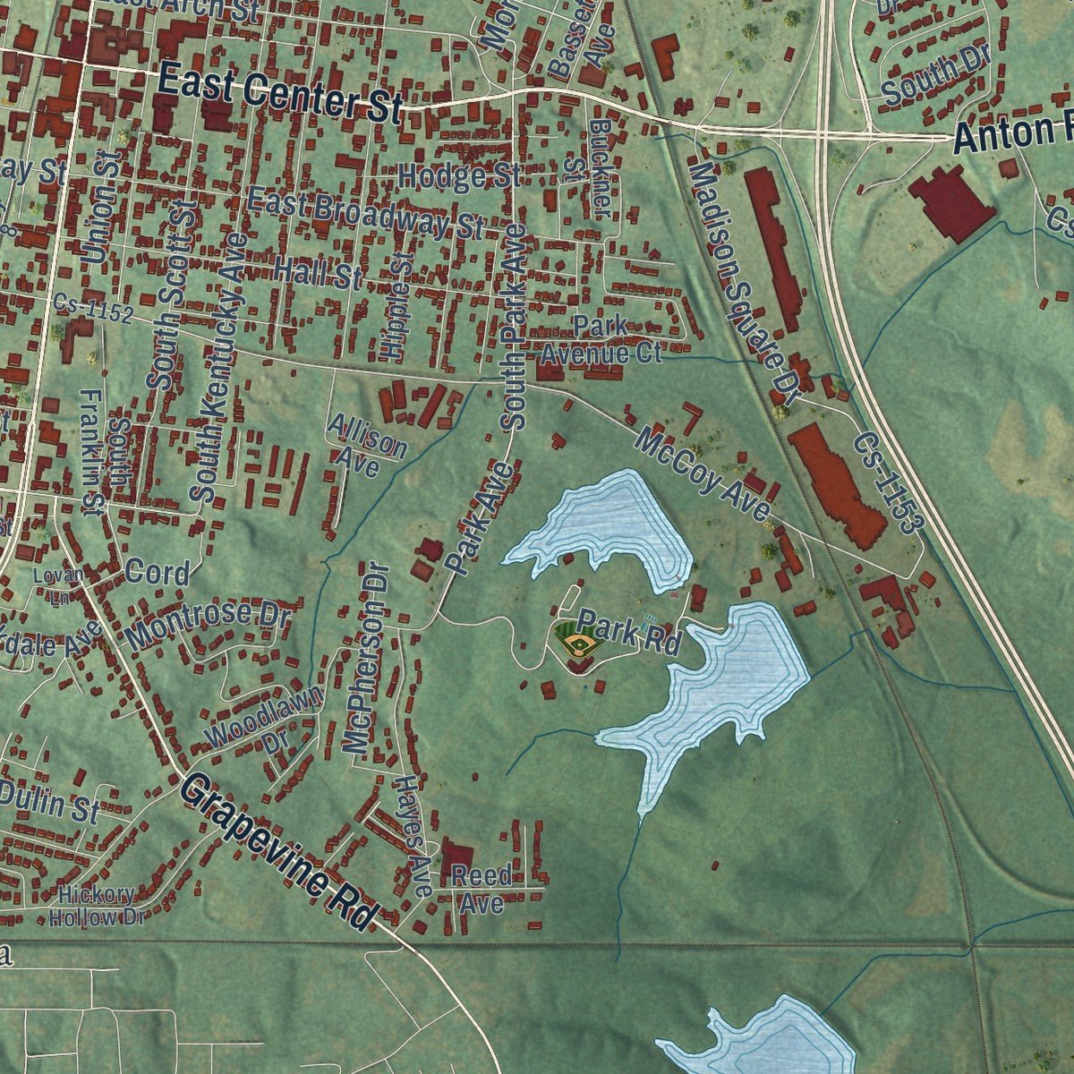
Up close
Geography Worth Displaying
This map was created using accurate cartographic data and authoritative geographic sources, including the U.S. Geological Survey and the Census Bureau. The map brings together terrain, waterways, roads, and building detail. The majority of the streets are labeled, houses are accurately depicted, and the topography is derived from government sources. Combining local data with carefully composed color and shading leads to this beautifully detailed Madisonville artwork for your wall.
Rather than simply showing street outlines, we’ve included as many of the street names as we could reasonably fit on the map while keeping their names legible. Zoom in on the high resolution preview to see exactly what’s on the map. We truly set out to create a statement piece for anyone who loves Madisonville. So whether it’s for you, or a gift for someone you love, we hope this map of Madisonville brings back fond memories.
Read the story behind this map of Madisonville, Kentucky from 2026.
About Madisonville, Kentucky
Madisonville is a city of 19,542 people and the seat of Hopkins County, in Kentucky's Western Coal Fields. It was founded in 1807 and named for James Madison, who was Secretary of State at the time. The town became the county seat a year later, in 1808, and was incorporated in 1810.
For most of the 1800s, the county lived by farming, and tobacco was its leading crop. Coal was found in an outcropping around 1837, but the first mine in the county did not open until 1869. Mining became a major industry only after 1870, when the Louisville & Nashville Railroad built its line south from Henderson through Madisonville toward Nashville. By the early 1900s the city was a rail hub and coal town with a large tobacco market, and it stayed that way until factories and service jobs came in the 1960s.
“An Old Fort, or fortification, on a high and rocky hill, about 4 miles from Madisonville, is an object of curious interest.”
- Courthouse burned in 1864The Civil War split Hopkins County. James Shackleford raised a Union regiment here, while Al Fowler signed up men for the Confederacy. On December 17, 1864, Confederate troops led by Gen. Hylan B. Lyon set fire to the Madisonville courthouse as they moved through western Kentucky.
- The 2005 tornadoOn November 15, 2005, a tornado that began forming around 3:00 PM tore through the city. The neighborhood near the Madisonville Country Club took the worst of it, and the storm wrecked the home of Frank Ramsey, the Hall of Fame basketball player who starred for the Boston Celtics. Mayor Karen Cunningham declared a state of emergency and put parts of the city under a curfew.
- The ice storm of 2009In January 2009 a severe ice storm struck Hopkins County and much of Kentucky. Power failed across Madisonville, some homes stayed dark for weeks, and the city set a curfew to keep people safe. Crews from power companies in other states came to help restore service, and clearing the fallen tree limbs took months.
- A hospital built in the 1970sDuring the 1970s the Trover Foundation built the Regional Medical Center and Trover Clinic in Madisonville. The hospital is now Baptist Health Madisonville, with 410 beds, and it offers life flight, women's health centers and a full cancer center, the kind of care people usually travel to bigger cities to find.
Find your street
Names on the Madisonville map
Every name below is printed on this map. Look for your street, your school, the park where you played, or the pond down the road.
Places and landmarks3
- Brentwood
- Mahr Park
- Victoria
Streets and roads232
- South Main Street
- North Main Street
- East Center Street
- Princeton Road
- West Noel Avenue
- Grapevine Road
- Hopkinsville Road
- Laffoon Trail
- Anton Road
- Central City Road
- Nebo Road
- West Center Street
- Dixon Road
- Hanson Road
- Brown Road
- Pride Avenue
- Rose Creek Road
- Stagecoach Road
- Fowler Road
- East Arch Street
- Park Avenue
- South Park Avenue
- West Arch Street
- McCoy Avenue
- West Lake Street
- Park Road
- Island Ford Road
- Buckner Ridge Lane
- Badgett Lane
- Hanson Street
Show all 232 streets
- Bean Cemetery Road
- West Broadway Street
- Country Club Lane
- Shamrock Drive
- Tucker Schoolhouse Road
- Industrial Drive
- Industrial Road
- Sugg Street
- East Broadway Street
- Brown Badgett Loop
- Madison Square Drive
- College Drive
- Osborn Lane
- Osborne Lane
- Buffalo Trce
- Ridgewood Drive
- Hopewell Street
- Deep Creek Drive
- University Circle
- Hall Street
- Wexford Way
- Oak Street
- South Kentucky Avenue
- Whittington Drive
- Baldwin Drive
- North Seminary Street
- Meadowlark Lane
- Pin Oak Lane
- South Scott Street
- Hospital Drive
- La-1008
- Island Park Drive
- Chickasaw Drive
- Lovers Road
- Lovers Lane
- Barnett Boulevard
- Cs-1038
- Eastside Lane
- Lakeside Drive
- Oakwood Lane
- North Scott Street
- Bartlett Avenue
- Highland Drive
- Abbott Lane
- Choctaw Street
- Celeste Lane
- Cs-1153
- Wyatt Avenue
- Lakeview Drive
- Winding Creek
- Cathlyn Drive
- Dulin Street
- Murray Street
- Thornhill Road
- Randell Drive
- Montrose Drive
- Athey Drive
- Lakeshore Drive
- Forefar Lane
- Simmental Street
- Bell Drive
- Arrowhead Drive
- Hodge Street
- Cs-1308
- Legion Drive
- Branch Street
- Cherokee Drive
- Union Street
- Bayview Drive
- Mitchell Drive
- Cs-1391
- Club Court
- McPherson Drive
- Oates Street
- Pepper Drive
- Morton Avenue
- Arnold Place
- Lomond Drive
- Brown Lane
- Comer Drive
- Wiman Drive
- Lago Drive
- Bailey Drive
- Cs-1414
- Cs-1100
- Logan Street
- South Drive
- Elm Street
- Scott Drive
- Vera Drive
- Cord
- McLeod Lane
- Lenin Road
- South Franklin Street
- Halson Street
- Wilson Street
- North Kentucky Avenue
- Rosemont Drive
- Patriot Drive
- East Noel Avenue
- National Mine Road
- Nisbet Street
- Sunrise Drive
- Earlwood Drive
- Woodlawn Drive
- Lantaff Boulevard
- Dodson Lane
- Boyscout Camp
- Downing Lane
- Commerce Drive
- Sycamore Lane
- Lake Chester Drive
- Kingsway Drive
- Scanfield Drive
- Pebble Creek Drive
- Thompson Avenue
- Chur Drive
- Graves Street
- Versnick Way
- Chelsea Drive
- Lightfoot Lane
- South Spring Street
- West Jagoe Street
- Hayes Avenue
- Green Meadows Drive
- Renfro Drive
- Park Avenue Court
- Oldham Lane
- Hickory Drive
- Castleton Drive
- Weldon Avenue
- Oakdale Avenue
- Beech Tree Lane
- Allison Avenue
- Progress Drive
- Echo Lane
- Hipple Street
- College Heights Drive
- Race Street
- Marty Drive
- Summit Street
- Westside Avenue
- Buckner Street
- Reed Avenue
- Givens Street
- Bassett Avenue
- Ken Mel Drive
- Potts Drive
- Alvey Drive
- Alley 1
- Buck Trce
- Valley Drive
- Woodson Avenue
- Cs-1034
- Devonshire Street
- Hickory Hollow Drive
- Bartlett Drive
- Jacklin Drive
- Mill Creek Court
- Lake Peewee Road
- Sunset Drive
- Carlisle Drive
- School Street
- Holiday Place
- Fernwood Drive
- Browning Street
- Belmont Drive
- Cs-1152
- Tartan Drive
- Wells Avenue
- La-1003
- Fairway View Drive
- Alley 8
- Boone Drive
- Ballard Lane
- Don Earl Street
- Angle Circle
- North Franklin Street
- Independence Drive
- Victoria Street
- Crosswinds Drive
- Mooreland Avenue
- Hillcrest Drive
- Plainview Drive
- Lovan Lane
- Thornberry Drive
- Lakemont Drive
- East Ayr Parkway
- Aberdeen Drive
- Hunters Glen
- North Russell Drive
- Baxter Avenue
- Westview Drive
- Seminary Street
- Spyglass Court
- Meadow Lane
- Polly Drive
- Clifty Street
- Whit Lane
- Buntin Lane
- Finley Drive
- Alley 4
Names are listed as they appear on the printed map. Zoom into the product photos to find them.
The art of mapping a place
How This Map Was Made
Real places. Remarkable detail. Discover the layers that turn geographic data into a map of home.

The view from above
Aerial imagery reveals the character of the land: woodland, open fields, and the patterns of a place.

The shape of the land
Elevation data brings hills, valleys, and subtle changes in the landscape into view.

The details of home
Roads, waterways, and building footprints come together to make the map feel unmistakably local.

Geography becomes art
Considered color, shading, and typography bring the layers together in a map made for your wall.


Process illustrated with Mendon, Massachusetts. Aerial imagery: USDA NAIP. Terrain: USGS 3D Elevation Program. Map details and finished artwork: KNOWOL.
The Details
About This Print
Choose an archival matte print, or a black or white Ayous wood frame. The archival matte print is unframed.
Select your size and finish above to see the matching product image and price.
Materials & Craftsmanship
A contemporary map with the character of a classic atlas, printed on archival matte paper. Optional frames are made from Ayous wood.
Your printed map does not include the watermark shown in the full-map preview.
Shipping & Delivery
Free shipping within the United States. Every print is made to order in the USA.
Buying a gift? Add a note in your cart and we'll include it. We never put prices in the package.
Prints ship within 2 to 3 business days. Allow 7 to 10 days total from ordering for delivery. Timing may vary during holidays or periods of high order volume.
Read our shipping policy.
Returns and damaged prints
Each print is made to order. Change-of-mind refunds are not available after production.
If your print arrives damaged, misprinted or incorrect, contact support@knowol.com within 30 days of receiving it. Include your order number, photos and a description of the issue.
Read our full refund and replacement policy. For questions about your order, email support@knowol.com.
Find your town
Looking for another city?
Find a map of home in our Kentucky collection, or any town in the country.
Nearby
Maps of towns near Madisonville
Know someone from one of these towns? Their map makes a great gift.
 Earlington
, Kentucky
From $39.99See the map
 Manitou
, Kentucky
From $39.99See the map
 Hanson
, Kentucky
From $39.99See the map
More maps nearby: Mortons Gap, Nebo, Slaughters, St. Charles and Nortonville.