
Search for another town





Free U.S. delivery 7 to 10 days after you order
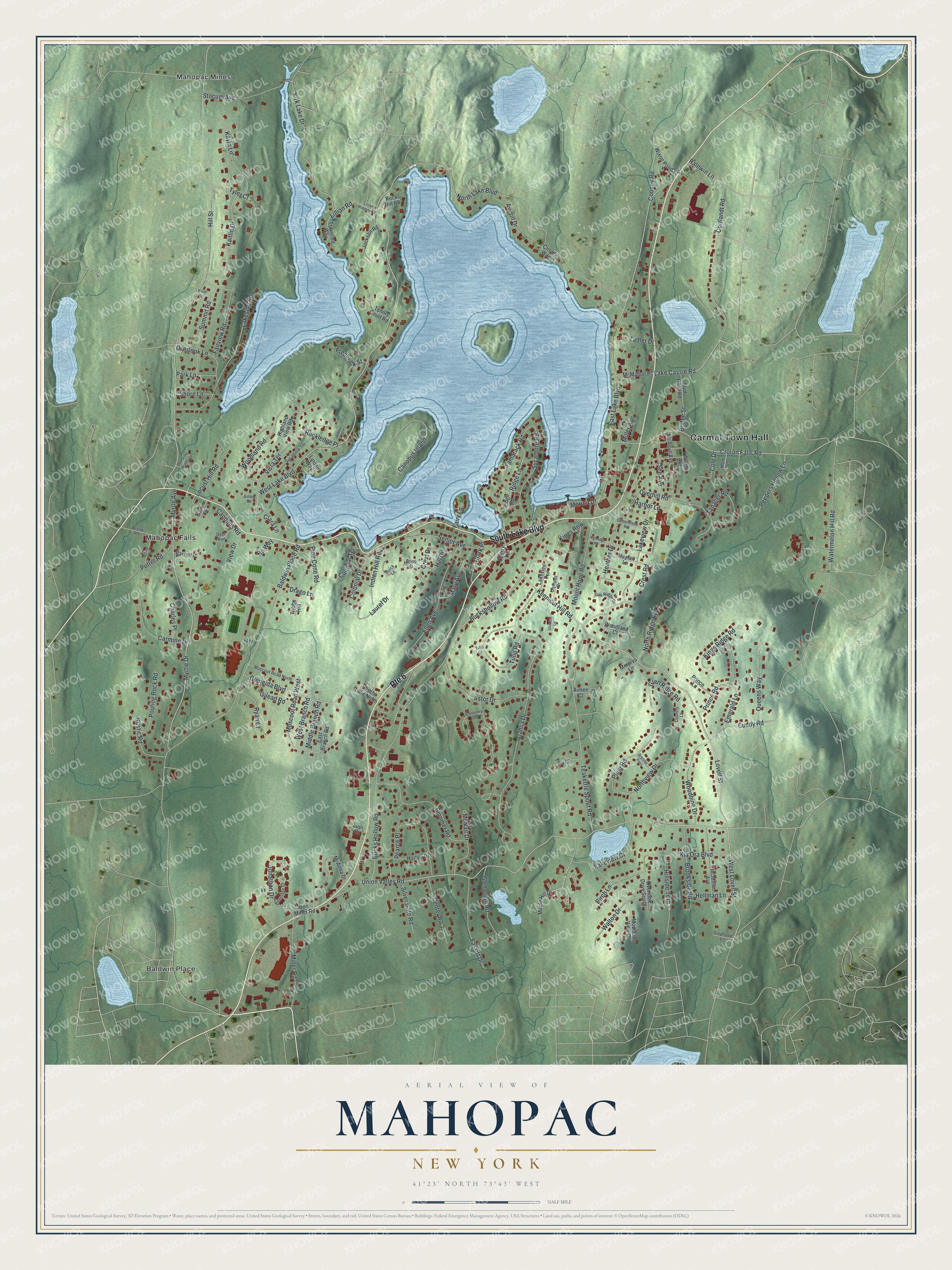
Mahopac, New York Map Art
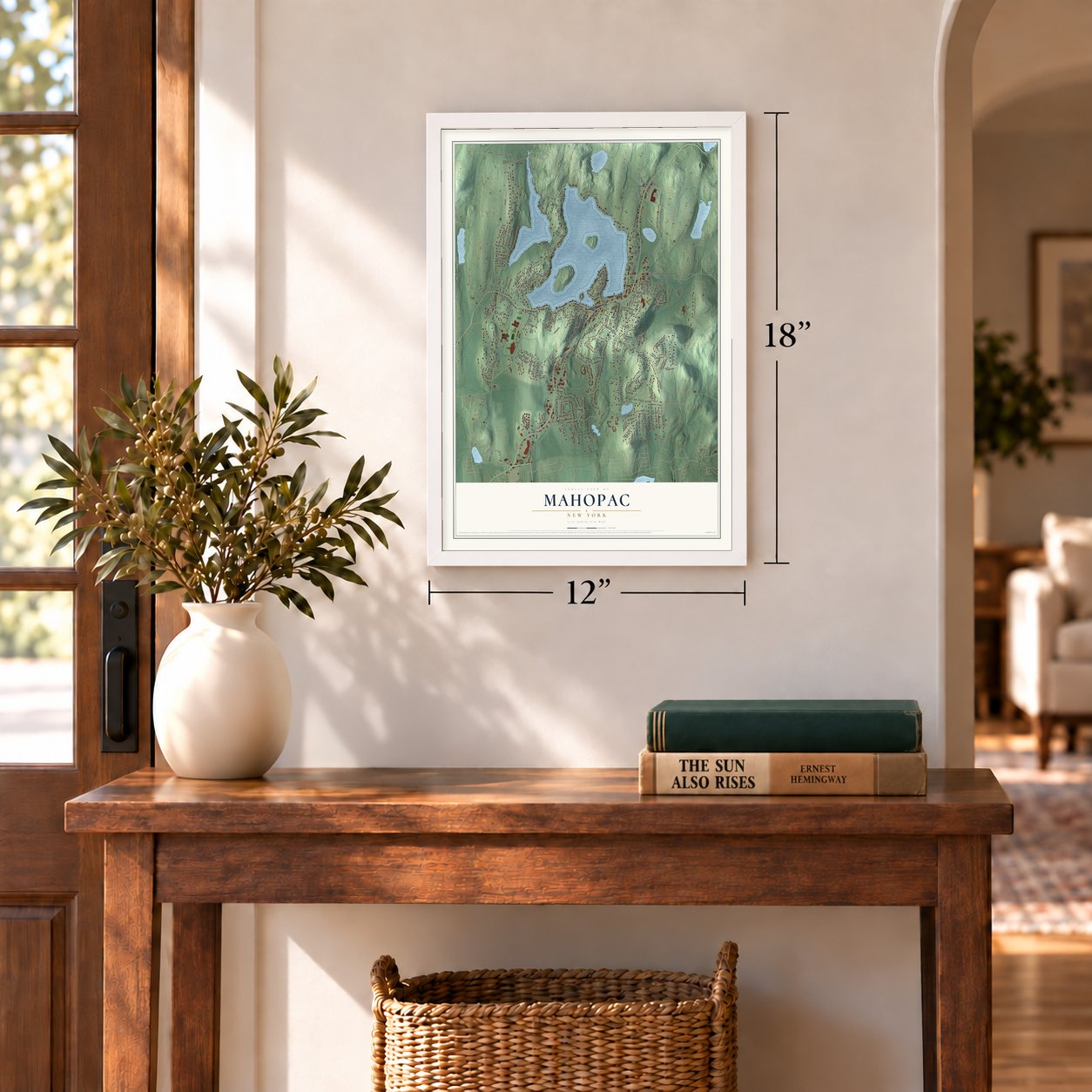
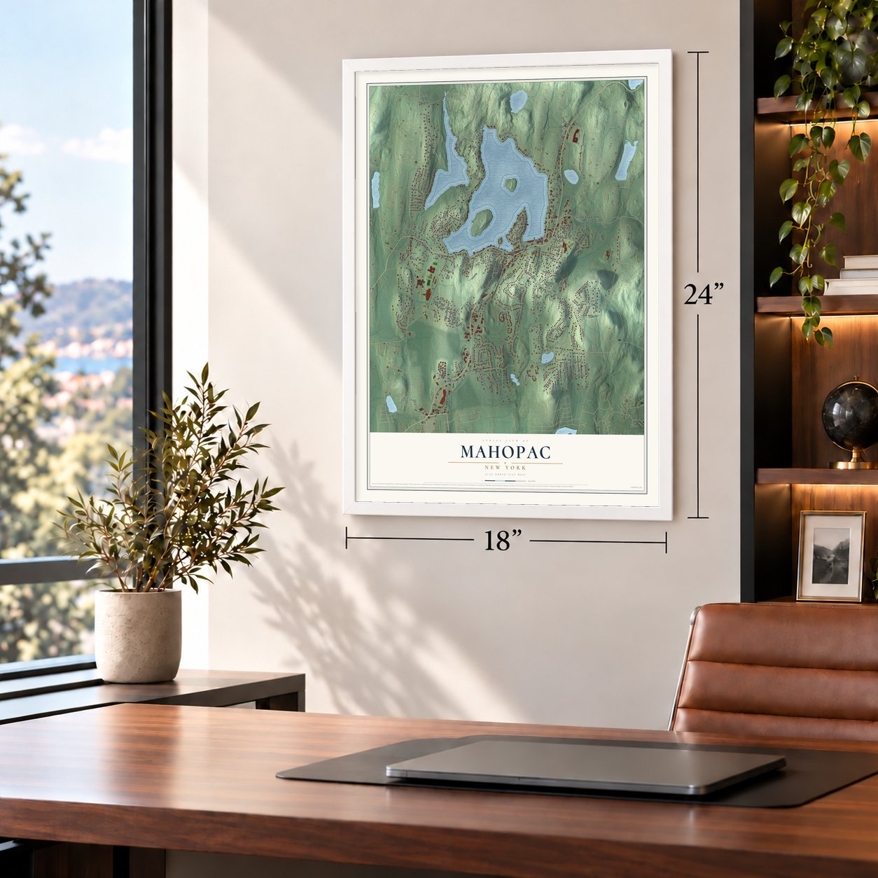
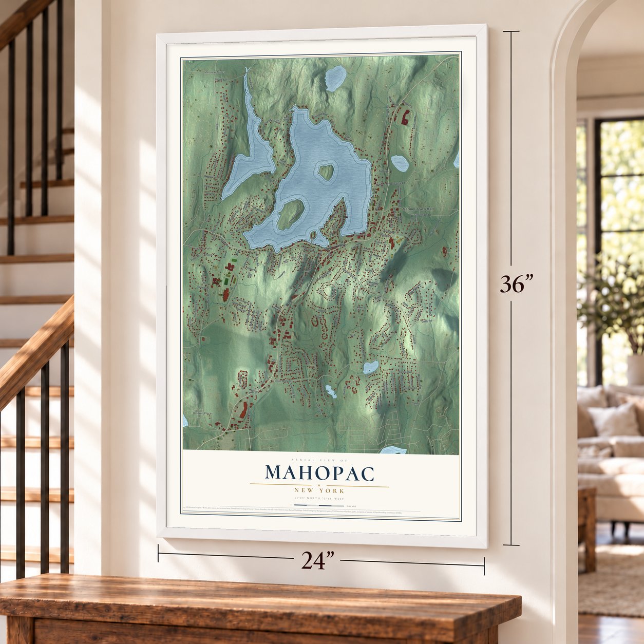
A new map of Mahopac, New York, made in 2026 and printed to order on thick archival matte paper.
12" x 18" Archival Matte Print
A Map of Home. A Work of Art.
Bring a piece of Mahopac home. Whether it’s where you grew up, your current home, or simply a moment in your life, this Mahopac, New York map print brings those memories to your wall. Antique-inspired styling and modern geographic detail combine to create artwork that’s beautiful from across the room, with plenty to study and explore when you get up close.
Three ways to hang it
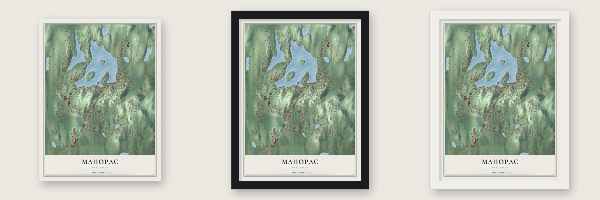
Unframed archival matte, a black wood frame or a white wood frame.
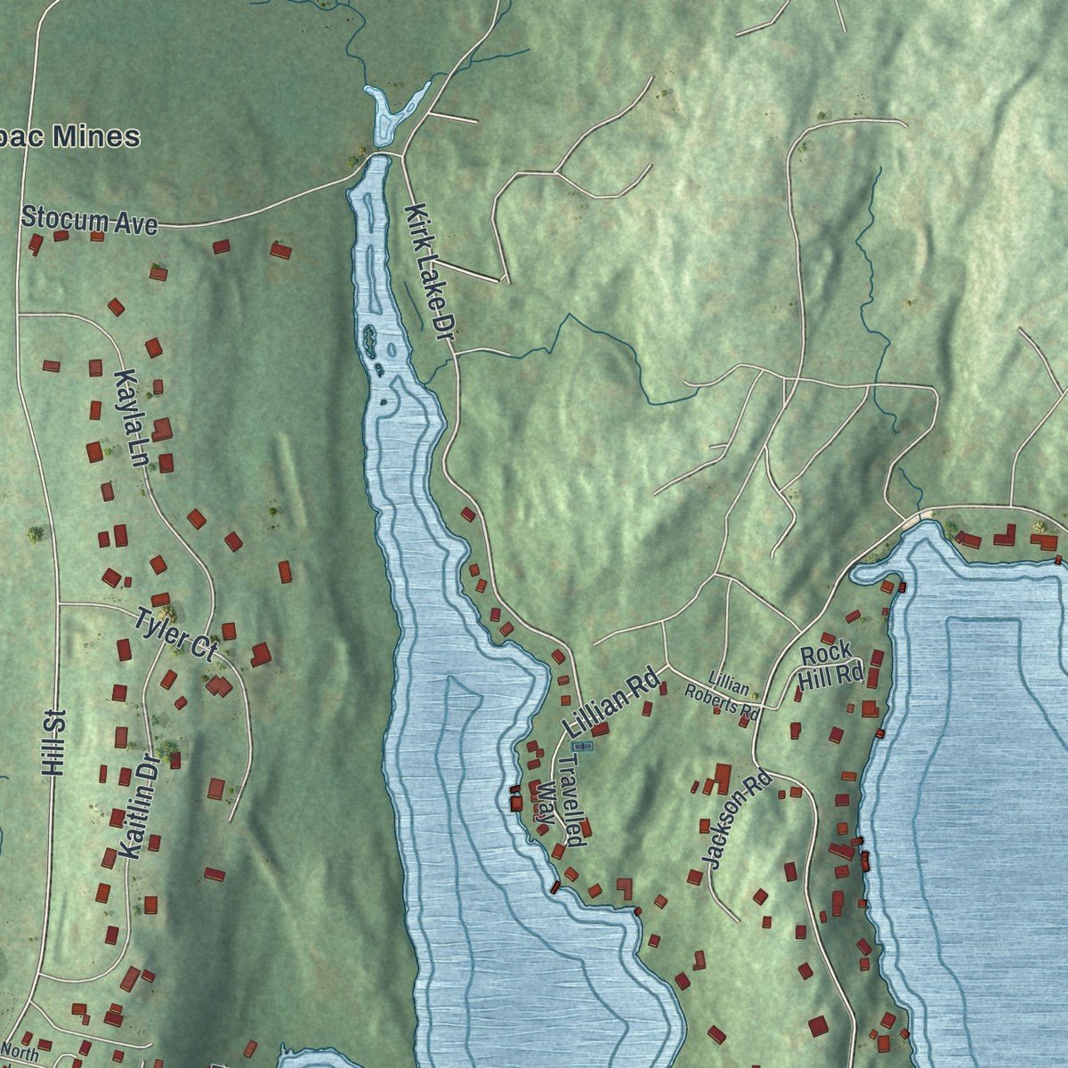
Up close
Real geography. Art worth displaying.
This map was created using accurate cartographic data and authoritative geographic sources, including the U.S. Geological Survey (USGS) and FEMA. The map brings together terrain, waterways, roads, and building detail. The majority of the streets are labeled, houses are accurately depicted, and the topography is derived from government sources. Combining local data with carefully composed color and shading leads to this beautifully detailed Mahopac artwork for your wall.
Rather than simply showing street outlines, we’ve included as many of the street names as we could reasonably fit on the map while keeping their names legible. Zoom in on the high resolution preview to see exactly what’s on the map. We truly set out to create a statement piece for anyone who loves Mahopac. So whether it’s for you, or a gift for someone you love, we hope this map of Mahopac brings back fond memories.
Explore the full map of Mahopac, New York and read about the local places it shows.

About Mahopac, New York
Mahopac ( or ) is a hamlet (and census-designated place) in the town of Carmel in Putnam County, New York, United States. As of the 2020 census, the population was 8,933.
- 8,933 peopleAs of the 2020 census, the population was 8,933.
- Incorporated in 1812After the incorporation of Putnam County in 1812 the Mahopac area grew steadily.
- A 1697 milestoneThe hamlet's land was part of a huge tract encompassing all of today's Putnam County patented in 1697 by Adolphus Philipse, son of a wealthy Anglo-Dutch gentryman, known as the Philipse.
- A 1959 milestoneWith the passing of the New York Central Putnam Division's last passenger service to Mahopac in 1959, the hamlet evolved into a year-round community, many of its residents making the commute.
- Lake countryThe world record brown bullhead (Ameiurus nebulosus), which weighed 7 pounds 6 ounces (3.3 kg), was caught in Lake Mahopac on August 1, 2009 by angler Glenn Collacuro.
Find your street
Names on the Mahopac map
Every name below is printed on this map. Look for your street, your school, the park where you played, or the pond down the road.
Places and landmarks4
- Carmel Town Hall
- Baldwin Place
- Mahopac Falls
- Mahopac Mines
Streets and roads174
- South Lake Boulevard
- Route 6
- Lake Cassie Road
- Kennicut Hill Road
- West Lovell Street
- Lovell Street
- Buckshollow Road
- Mary Avenue
- Union Valley Road
- Kirk Lake Drive
- Cooney Road
- Baldwin Place Road
- West Lake Boulevard
- Bucks Hollow Road
- Hill Street
- East Lake Boulevard
- Dahlia Drive
- Myrtle Avenue
- Myrtle Drive
- Croton Falls Road
- Watermelon Hill Road
- North Lake Boulevard
- Teakettle Spout Road
- Kia Ora Boulevard
- Lakeview Drive
- Canopus Island
- Cortlandt Road
- Lakeside Road
- Cuddy Road
- Bloomer Road
Show all 174 streets
- Woodland Road
- Jonathan Drive
- Tamarack Road
- Tulip Road
- Ellen Avenue
- Peepers Hollow Lane
- Sycamore Road
- Overhill Road
- Heather Drive
- Gleneida Boulevard
- Astor Drive
- Kayla Lane
- Mount Hope Road
- Kaitlin Drive
- Prince Road
- Plum Road
- Woodbine Drive
- Miller Road
- Fassitt Drive
- Stocum Avenue
- Brookside Road
- Northview Drive
- Pearce Place
- Glenacom Road
- Tyler Court
- Lillian Road
- Vista Terrace
- Hillside Terrace
- Senior Avenue
- Tanager Road
- Walton Drive
- McNair Drive
- Potter Road
- Carmine Drive
- Averill Drive
- Queens Way
- Kings Ridge Road
- Center Road
- Kings Row
- View Drive
- Ridge Lane
- Pouting Rock Road
- Crest Drive
- Lakeview Court
- Fairview Road
- Summit Road
- Locust Hill Road
- North Ridge Road
- Glen Ridge Road
- Overlook Lane
- Rustic Road
- Muscoot Road West
- Marina Drive
- Harbor Lane
- Indian Hill Road
- Silver Gate Road
- Laurel Drive
- West Branch Road
- Middle Branch Road
- Colonial Drive
- Tadler Drive
- Ryan Court
- See Avenue
- Pine Cone Road
- Park Lane
- Emerald Lane
- Clark Place
- Colonial Terrace
- Baldwin Lane
- Hellman Lane
- Cole Drive
- Drago Lane
- Gilead Road
- Frederick Street
- Charles Place
- Rockledge Place
- Shore Lane
- Canopus Road
- Hill Drive
- Clara Lane
- Crest Road
- Miller Avenue
- No Way
- Birch Lane
- Bridge Street
- Fairy Lane
- Maple Hill Drive
- McMahon Place
- Highland View Road
- McAlpin Avenue
- Wixon Pond Road
- Horton Drive
- Mi Anna Drive
- McMillan Avenue
- Ridge Road
- Mountain View Drive
- Tribbe Hill
- Tina Drive
- Jackson Road
- Overlook Drive South
- Woodland Court
- Aimee Court
- Mud Pond Road
- Tennis Court Road
- Rock Hill Road
- Lakeview Terrace
- Travelled Way
- East Branch Road
- Cherry Lane
- Prince Lane
- Mayfair Lane
- Veschi Lane North
- Barrett Place
- Bon Miller Road
- Wright Avenue
- Circle Way
- Minerva Lane
- Linden Way
- Lupi Court
- Hilltop Street
- Sycamore Terrace
- Muscoot Road North
- Coventry Circle
- Brook Road
- Penelope Court
- Greenfield Road
- Country Lane
- Olympus Drive
- Oak Ridge Drive
- M&m Lane
- Stephanie Lane
- Deer Run
- Maiden Lane
- Buick Lane
- Lillian Roberts Road
- Highridge Road
- October Lane
- School Street
- Out of the Woods Lane
- Brenner Pass
- Forest Drive
- Ashley Road
- North Lane
- Tulip Court
Names are listed as they appear on the printed map. Zoom into the product photos to find them.
The art of mapping a place
How This Map Was Made
Real places. Remarkable detail. Discover the layers that turn geographic data into a map of home.

The view from above
Aerial imagery reveals the character of the land: woodland, open fields, and the patterns of a place.

The shape of the land
Elevation data brings hills, valleys, and subtle changes in the landscape into view.

The details of home
Roads, waterways, and building footprints come together to make the map feel unmistakably local.

Geography becomes art
Considered color, shading, and typography bring the layers together in a map made for your wall.


Process illustrated with Mendon, Massachusetts. Aerial imagery: USDA NAIP. Terrain: USGS 3D Elevation Program. Map details and finished artwork: KNOWOL.
The Details
About This Print
Choose an archival matte print, or a black or white Ayous wood frame. The archival matte print is unframed.
Select your size and finish above to see the matching product image and price.
Materials & Craftsmanship
A contemporary map with the character of a classic atlas, printed on archival matte paper. Optional frames are made from Ayous wood.
Your printed map does not include the watermark shown in the full-map preview.
Shipping & Delivery
Free shipping within the United States. Every print is made to order in the USA.
Buying a gift? Add a note in your cart and we'll include it. We never put prices in the package.
Prints ship within 2 to 3 business days. Allow 7 to 10 days total from ordering for delivery. Timing may vary during holidays or periods of high order volume.
Read our shipping policy.
Returns and damaged prints
Each print is made to order. Change-of-mind refunds are not available after production.
If your print arrives damaged, misprinted or incorrect, contact support@knowol.com within 30 days of receiving it. Include your order number, photos and a description of the issue.
Read our full refund and replacement policy. For questions about your order, email support@knowol.com.
Find your town
Looking for another city?
Find a map of home in our New York collection.
Nearby
Maps of towns near Mahopac
Know someone from one of these towns? Their map makes a great gift.


