
Search for another town





Free U.S. delivery 7 to 10 days after you order
Manalapan, New Jersey Map Art
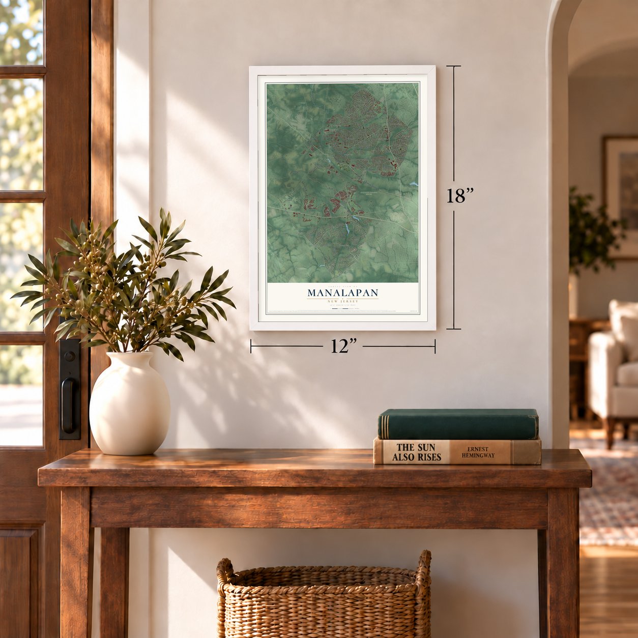
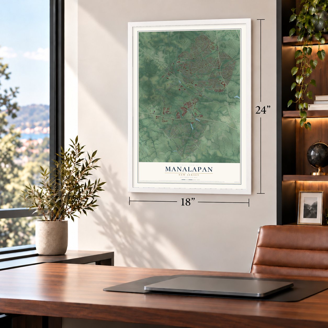
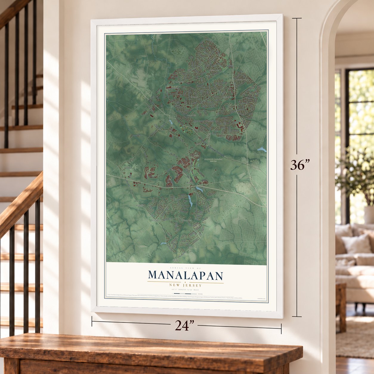
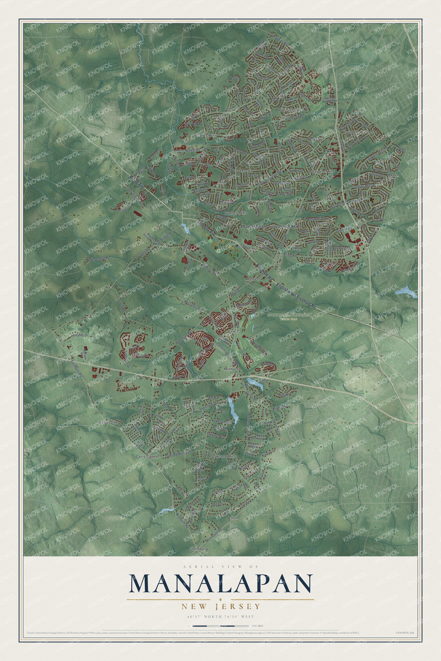
A new map of Manalapan, New Jersey, made in 2026 and printed to order on thick archival matte paper.
12" x 18" Archival Matte Print
A Map of Home. A Work of Art.
Bring a piece of Manalapan home. Whether it’s where you grew up, your current home, or simply a moment in your life, this Manalapan, New Jersey map print brings those memories to your wall. Antique-inspired styling and modern geographic detail combine to create artwork that’s beautiful from across the room, with plenty to study and explore when you get up close.
Three ways to hang it
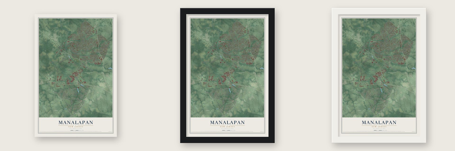
Unframed archival matte, a black wood frame or a white wood frame.
Up close
Real geography. Art worth displaying.
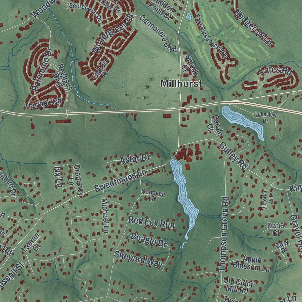
This map was created using accurate cartographic data and authoritative geographic sources, including the U.S. Geological Survey (USGS) and FEMA. The map brings together terrain, waterways, roads, and building detail. The majority of the streets are labeled, houses are accurately depicted, and the topography is derived from government sources. Combining local data with carefully composed color and shading leads to this beautifully detailed Manalapan artwork for your wall.
Rather than simply showing street outlines, we’ve included as many of the street names as we could reasonably fit on the map while keeping their names legible. Zoom in on the high resolution preview to see exactly what’s on the map. We truly set out to create a statement piece for anyone who loves Manalapan. So whether it’s for you, or a gift for someone you love, we hope this map of Manalapan brings back fond memories.
Explore the full map of Manalapan, New Jersey and read about the local places it shows.

About Manalapan, New Jersey
Manalapan is documented as a New Jersey township, and the 2020 census recorded 40,905 residents there. Its civic record reaches to March 9, 1848, when it was incorporated or formally organized, a date that remains part of the community's established local identity.
- 40,905 peopleThe United States census recorded this population in 2020.
- Organized in 1848The community was incorporated or formally organized on March 9, 1848.
Find your street
Names on the Manalapan map
Every name below is printed on this map. Look for your street, your school, the park where you played, or the pond down the road.
Places and landmarks15
- Manalapan Township Hall
- Monmouth Battlefield State Park
- Bairdsville
- Carrs Corner
- Clarks Mills
- Elton
- Gordons Corner
- Lafayette Mills
- Millhurst
- Oakland Mills
- Smithburg
- Taylors Mills
Show all 15 places
- Tennent
- Whittier Oaks
- Yorketown
Streets and roads248
- Englishtown-Freehold Road
- Wood Avenue
- Tennent Avenue
- Freehold Road
- Tracy Station Road
- Smithburg Road
- Tennent Road
- Woodville Road
- Main Street
- Wickatunk Road
- Monmouth Road
- Woodward Road
- Matawan Street
- Wilson Avenue
- Hawkins Road
- Iron Ore Road
- Taylors Mills Road
- Gordons Corner Road
- Millhurst Road
- Pinebrook Road
- Union Hill Road
- Sweetmans Lane
- Pease Road
- Thompson Grove Road
- Oakland Mills Road
- Amberly Drive
- McCaffery Road
- Daum Road
- Craig Road
- Pension Road
Show all 248 streets
- Symmes Road
- Lamb Lane
- Gulley Road
- Kinney Road
- Shira Lane
- Hedgerow Lane
- Joseph Street
- Wintergreen Drive
- Lafayette Mills Road
- Alexandria Drive
- Dey Grove Road
- Sutton Drive
- Jeanine Court
- Sandpiper Drive
- Regency Way
- Thomas Drive
- Blenheim Road
- Connor Drive
- Apache Drive
- Knox Lane
- Maxwell Lane
- Mill Road
- Franklin Lane
- Livingston Lane
- Emily Road
- Church Lane
- Shilling Road
- Ivanhoe Drive
- Smallwood Lane
- Oxford Road
- Palomino Drive
- Longstreet Road
- Village Road
- Yates Road
- Le Valley Drive
- Tarrytown Road
- Market Road
- Appaloosa Drive
- Gravel Hill Road
- Kipling Way
- Saratoga Drive
- Eliot Road
- Rifkin Court
- Beagle Drive
- Appomattox Drive
- Cornell Place
- Crystal Court
- Turnberry Drive
- Ryan Road
- Bunker Hill Drive
- Saupe Drive
- Sawgrass Drive
- High Bridge Road
- Terence Drive
- Briar Hill Drive
- Astor Drive
- Dancer Lane
- Tuppence Road
- Whittier Drive
- Timber Lane
- Mohawk Lane
- Sheffield Drive
- Randall Drive
- Stayman Court
- Shepard Way
- Jared Drive
- Red Fox Run
- Edwards Lane
- Kilmer Drive
- Hillside Road
- Manor Court
- Gold Court
- Blair Lane
- Burke Street
- Quail Court
- Ivy Lane
- Elisa Court
- West Parsonage Way
- Mount Vernon Road
- Devon Drive
- Highland Ridge Road
- Molly Pitcher Drive
- Pegasus Boulevard
- Gettysburg Drive
- Bloomfield Road
- Westbrook Way
- Yorktowne Drive
- Willow Grove Way
- Heather Drive
- Newport Drive
- Michael Lane
- Arbach Lane
- Tracy Drive
- Century Way
- Winthrop Drive
- Robertsville Road
- Country Oaks Drive
- Templar Road
- Cannonero Boulevard
- Herbert Drive
- Fallswood Lane
- Lone Star Lane
- Cooperhawk Drive
- Washingtons Advance
- Narrowbrook Court
- Manor Drive
- Iris Circle
- Ogden Lane
- Winfield Drive
- Gramercy Lane
- Kingsley Drive
- Navajo Road
- Denise Court
- Adams Court
- Rowena Road
- Bristol Road
- Wild Turkey Way
- Warwick Drive
- Apple Blossom Lane
- Crest Fruit Court
- Deer Way
- Madigan Lane
- Elkridge Way
- Forman Lane
- Belle Terre Drive
- Mercer Lane
- Lauren Court
- Summer Drive
- Covered Bridge Boulevard
- Concord Drive
- Galahad Drive
- Madison Avenue
- Hartack Road
- Hidden Pond Court
- Scott Lane
- Twin Lakes Drive
- Dana Court
- Old Cider Mill Road
- Railroad Avenue
- Towne Drive
- Vail Valley Drive
- Nature Drive
- Lenape Lane
- Equinox Lane
- Smock Court
- Alyssa Lane
- Carole Court
- Bailey Court
- Ikes Lane
- Tamar Court
- Forest Drive
- Sherri Drive
- Derek Court
- Hill Court
- East Parsonage Way
- Champions Way
- Sobecko Road
- Oak Knoll Drive
- Nottinghill Court
- Secretariat Drive
- Chamber Lane
- Woodhollow Drive
- Nottingham Road
- Lincolnshire Drive
- Heron Court
- Annapolis Drive
- Grayson Lane
- Greenleaf Drive
- Kimberly Court
- Dayton Lane
- Valley Road
- Pence Road
- Wiltshire Drive
- McBride Road
- Comtois Road
- Conmack Lane
- Hanover Drive
- Lee Road
- Glendale Drive
- Cozy Drive
- Belaire Lane
- Maple Knoll Lane
- Conover Lane
- Sugar Loaf Place
- Roxbury Lane
- Drew Court
- Robin Court
- Beena Way
- Arbor Court
- Carl Street
- Bur Court
- Old Queens Boulevard
- Shinnecock Drive
- New Beginnings Crossing
- Cornwallis Court
- Farm Tree Road
- Clinton Drive
- Tall Woods Drive
- Greenfield Road
- Arrowood Road
- Riva Ridge Road
- Chaucer Road
- Thoreau Drive
- Hancock Lane
- Lakeview Drive
- Summit Avenue
- Rockingham Court
- Monterey Lane
- Woodford Lane
- Rumford Way
- Country Lane
- Winners Circle
- Victorian Hill
- Friar Lane
- Fells Drive
- Hickory Court
- Wilfred Road
- Colby Court
Names are listed as they appear on the printed map. Zoom into the product photos to find them.
The art of mapping a place
How This Map Was Made
Real places. Remarkable detail. Discover the layers that turn geographic data into a map of home.

The view from above
Aerial imagery reveals the character of the land: woodland, open fields, and the patterns of a place.

The shape of the land
Elevation data brings hills, valleys, and subtle changes in the landscape into view.

The details of home
Roads, waterways, and building footprints come together to make the map feel unmistakably local.

Geography becomes art
Considered color, shading, and typography bring the layers together in a map made for your wall.


Process illustrated with Mendon, Massachusetts. Aerial imagery: USDA NAIP. Terrain: USGS 3D Elevation Program. Map details and finished artwork: KNOWOL.
The Details
About This Print
Choose an archival matte print, or a black or white Ayous wood frame. The archival matte print is unframed.
Select your size and finish above to see the matching product image and price.
Materials & Craftsmanship
A contemporary map with the character of a classic atlas, printed on archival matte paper. Optional frames are made from Ayous wood.
Your printed map does not include the watermark shown in the full-map preview.
Shipping & Delivery
Free shipping within the United States. Every print is made to order in the USA.
Buying a gift? Add a note in your cart and we'll include it. We never put prices in the package.
Prints ship within 2 to 3 business days. Allow 7 to 10 days total from ordering for delivery. Timing may vary during holidays or periods of high order volume.
Read our shipping policy.
Returns and damaged prints
Each print is made to order. Change-of-mind refunds are not available after production.
If your print arrives damaged, misprinted or incorrect, contact support@knowol.com within 30 days of receiving it. Include your order number, photos and a description of the issue.
Read our full refund and replacement policy. For questions about your order, email support@knowol.com.
Find your town
Looking for another city?
Find a map of home in our New Jersey collection.
Nearby
Maps of towns near Manalapan
Know someone from one of these towns? Their map makes a great gift.


