
Search for another town





Free U.S. delivery 7 to 10 days after you order
Mankato, Minnesota Map Art
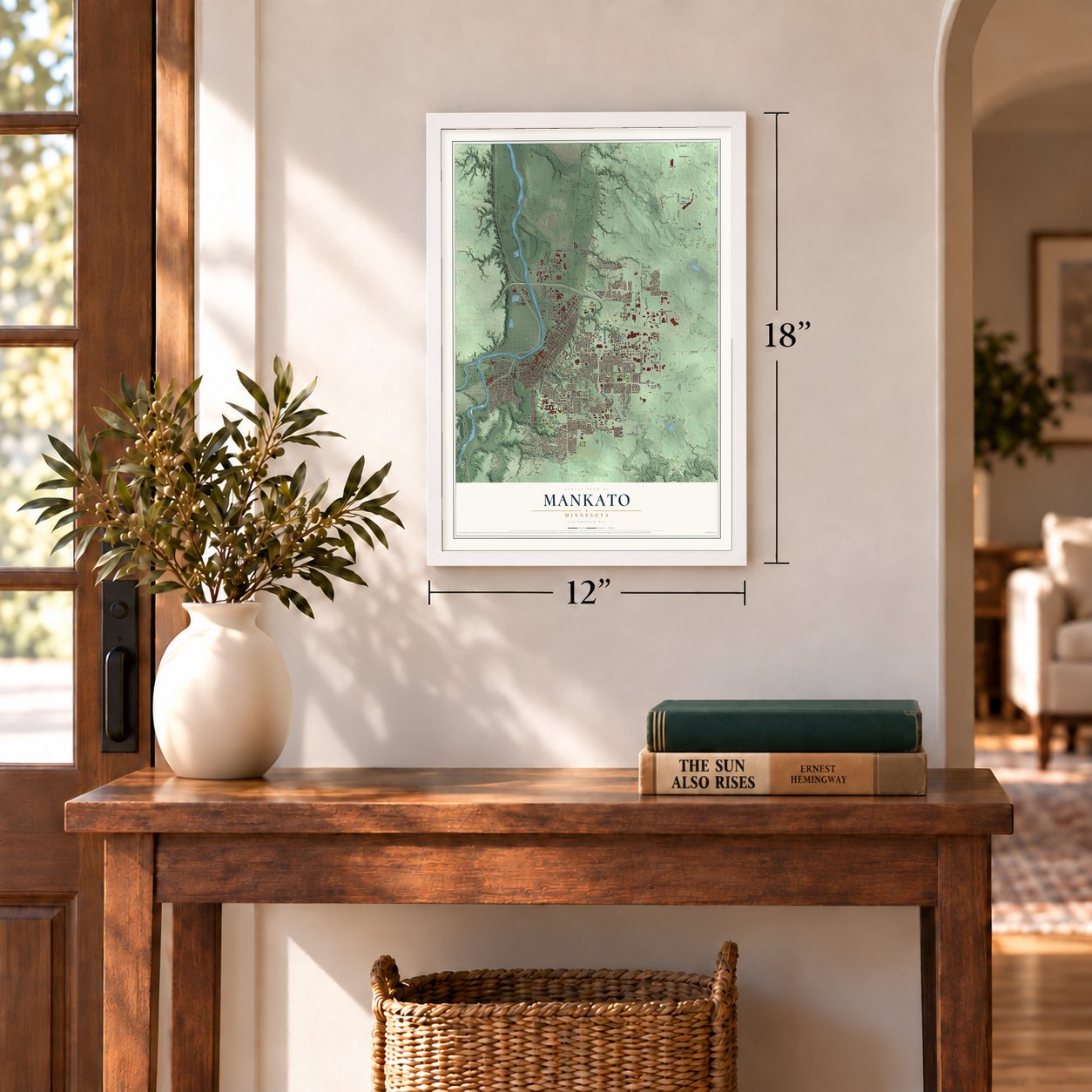
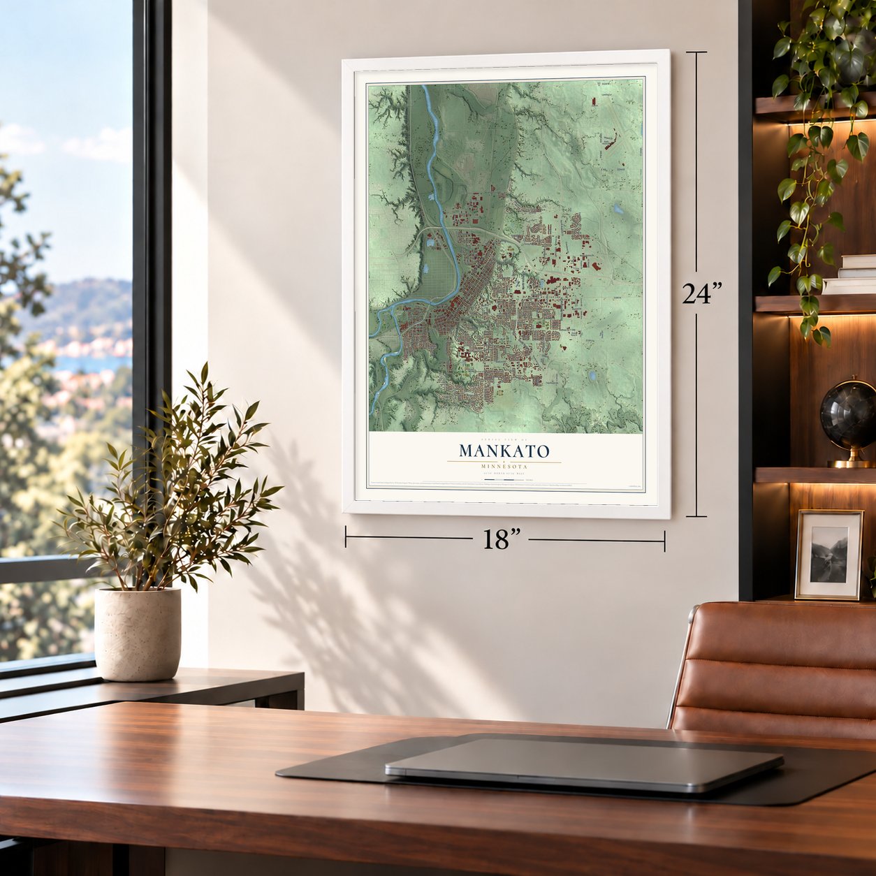
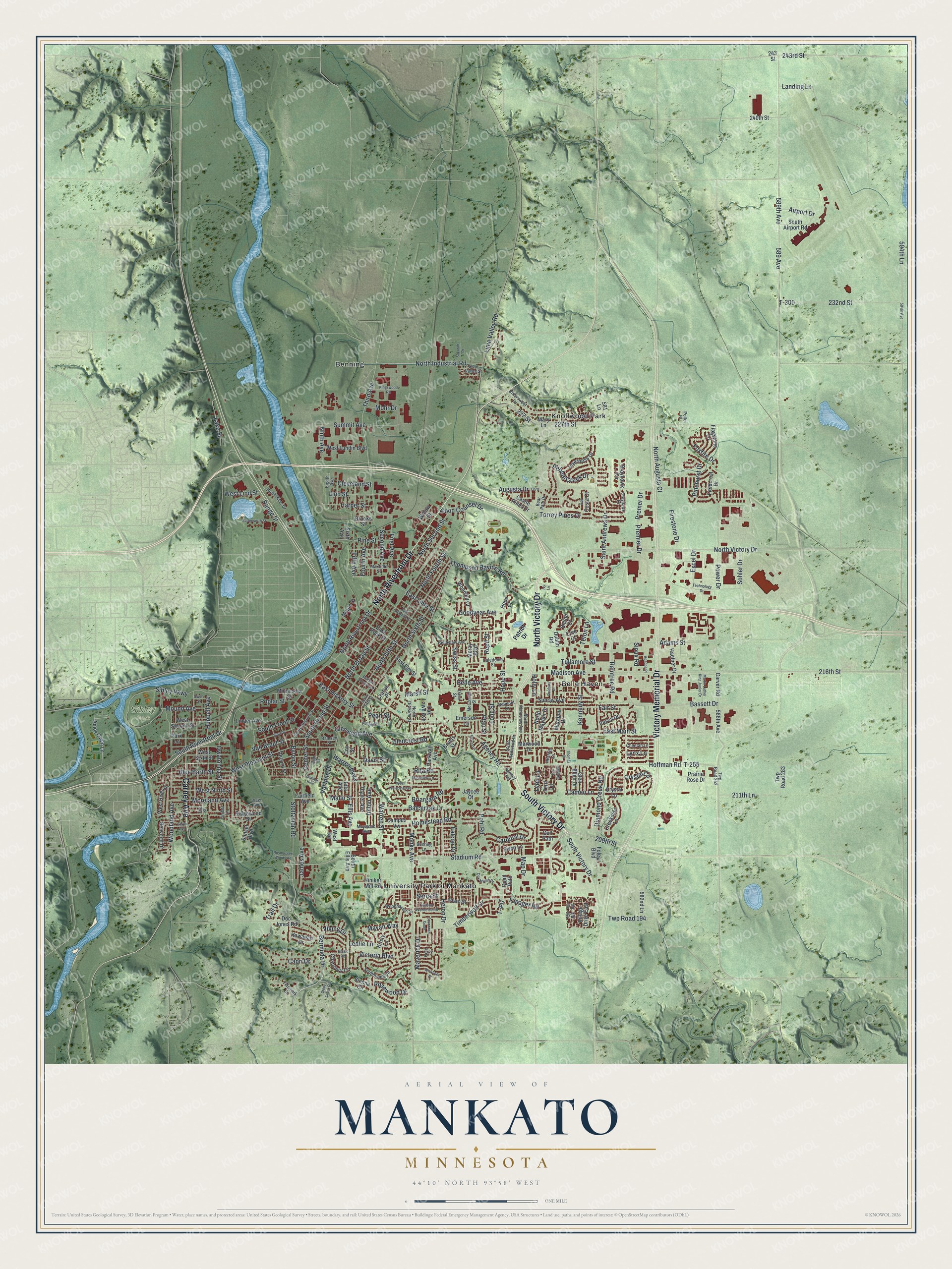
A new map of Mankato, Minnesota, made in 2026 and printed to order on thick archival matte paper.
12" x 18" Archival Matte Print
A Map of Home. A Work of Art.
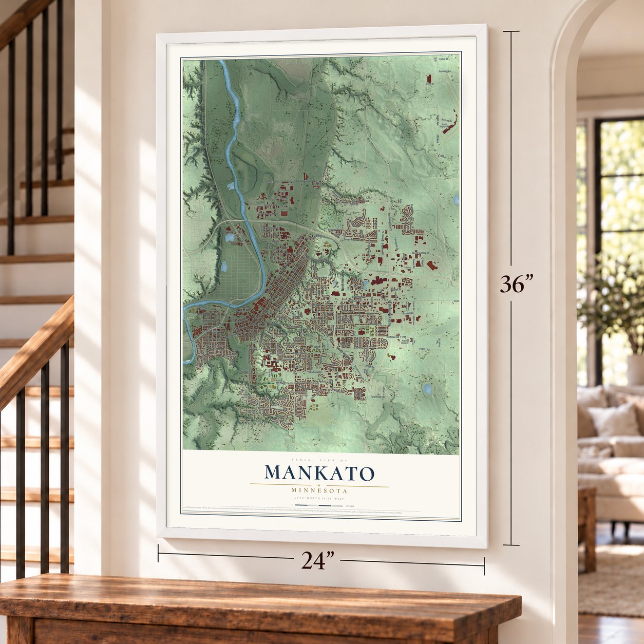
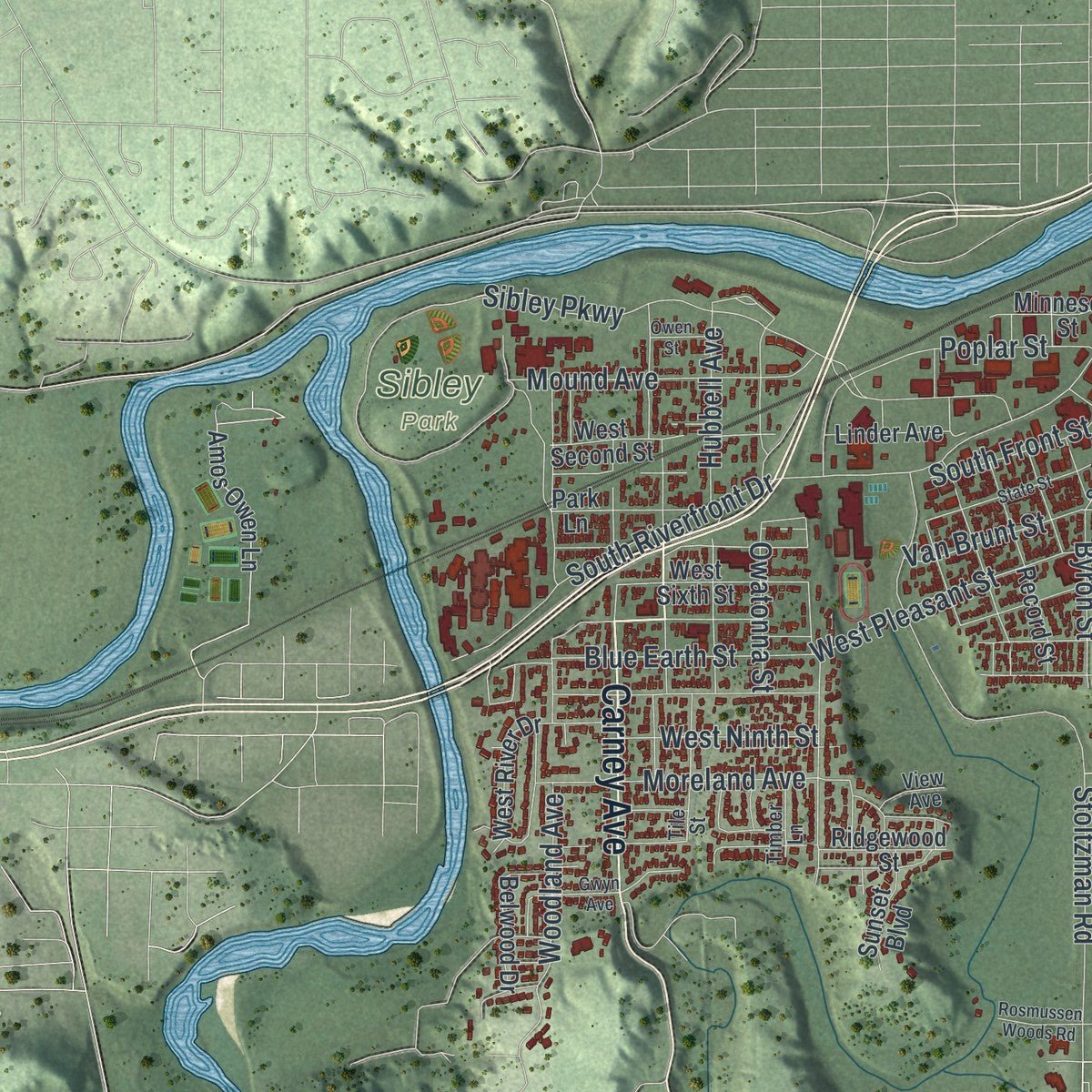
Explore Mankato, Minnesota from a whole new perspective. Created using aerial imagery and detailed geographic data, this map captures Mankato building by building, with labeled streets, familiar landmarks, and shaded topographical relief that highlights the natural contours of the landscape.
Combining modern data with the timeless character of a vintage atlas, this map is just as interesting up close as it is beautiful on the wall. Whether you grew up in Mankato, spent memorable years there, or call it home today, this unique map is a great way to celebrate a place that means something to you. Zoom in on the preview to look for your street, and then order a print to put your memories on the wall.
Three ways to hang it
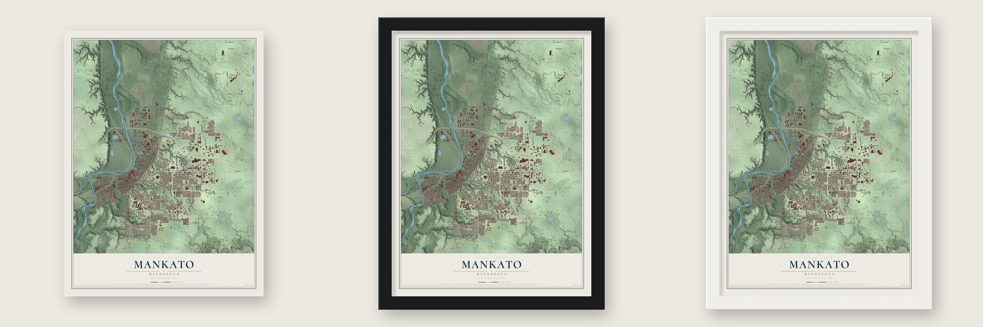
Unframed archival matte, a black wood frame or a white wood frame.
Up close
Geography Worth Displaying
This map was created using accurate cartographic data and authoritative geographic sources, including the U.S. Geological Survey and the Census Bureau. The map brings together terrain, waterways, roads, and building detail. The majority of the streets are labeled, houses are accurately depicted, and the topography is derived from government sources. Combining local data with carefully composed color and shading leads to this beautifully detailed Mankato artwork for your wall.
Rather than simply showing street outlines, we’ve included as many of the street names as we could reasonably fit on the map while keeping their names legible. Zoom in on the high resolution preview to see exactly what’s on the map. We truly set out to create a statement piece for anyone who loves Mankato. So whether it’s for you, or a gift for someone you love, we hope this map of Mankato brings back fond memories.
Read the story behind this map of Mankato, Minnesota from 2026.

About Mankato, Minnesota
Mankato spans Blue Earth, Nicollet, and Le Sueur counties and serves as the Blue Earth County seat. The city lies at a broad bend of the Minnesota River where it meets the Blue Earth River. The 2020 census recorded 44,488 residents.
- Organized in 1858Mankato was organized as a city on May 11, 1858, the same day Minnesota became a state.
- A State UniversityMinnesota State University opened in 1868 as Minnesota's second state normal school and is now the state's second largest university by enrollment.
- The 1862 ExecutionOn December 26, 1862 Volunteers hanged 38 men in Mankato, an event identified as the largest mass execution in U.S. history.
- Historic Civic BuildingsThe Blue Earth County Courthouse, First Presbyterian Church, and First National Bank of Mankato are among the city's National Register properties.
- An Early Hotdish RecipeA 1930 Mankato Lutheran church cookbook contains Mrs. C. W. Anderson's recipe titled "HOT DISH."
Find your street
Names on the Mankato map
Every name below is printed on this map. Look for your street, your school, the park where you played, or the pond down the road.
Places and landmarks5
- Sibley Park
- Belle Haven
- Benning
- Knollwood Park
- University Park of Mankato
Streets and roads276
- North Victory Drive
- South Victory Drive
- North Riverfront Drive
- Victory Memorial Drive
- Carney Avenue
- Madison Avenue
- Stadium Road
- Stoltzman Road
- Bassett Drive
- Tanager Road
- Bermuda Drive
- T-447
- Trail Drive
- Twp Road 194
- 209th Street
- 243rd Street
- Hoffman Road
- Pohl Road
- Thompson Ravine Road
- Timberwolf Drive
- East Hickory Street
- Sibley Parkway
- Crystal Circle
- 589 Avenue
- South Broad Street
- Adams Street
- East Main Street
- Monks Avenue
- Augusta Drive
- Third Avenue
Show all 276 streets
- South Riverfront Drive
- 227th Street
- Warren Street
- North Fourth Street
- Premier Drive
- Glenwood Avenue
- North Broad Street
- North Second Street
- Fair Street
- Heron Drive
- Raintree Road
- 589th Avenue
- North Fifth Street
- North Sixth Street
- Balcerzak Drive
- Marsh Street
- Summit Avenue
- Saint Andrews Drive
- Pfau Street
- 232nd Street
- T-300
- Woodland Avenue
- 216th Street
- North Industrial Road
- James Avenue
- Belle Avenue
- Cardinal Drive
- Hope Street
- Lime Valley Road
- Val Imm Drive
- Pine Street
- Power Drive
- Fifth Avenue
- Poplar Street
- Hubbell Avenue
- First Avenue
- Owatonna Street
- 227 Street
- Good Counsel Drive
- Diamond Creek Road
- South Front Street
- Mound Avenue
- Capri Drive
- Long Street
- Ellis Avenue
- Blue Earth Street
- Homestead Road
- Agency Road
- 211th Lane
- Goodyear Avenue
- Victoria Boulevard
- West Pleasant Street
- Torrey Pines Drive
- Fourth Avenue
- Moreland Avenue
- Excel Drive
- Landing Lane
- Tullamore Street
- Mayan Way
- T-265
- North Augusta Court
- 594th Lane
- Premer Drive
- Firestone Drive
- Lind Street
- Byron Street
- Ledlie Lane
- Pebble Creek Drive
- Malin Street
- Harper Street
- Range Street
- Foxfire Drive
- Lake Street
- Falcon Drive
- Pinehurst Drive
- West Ninth Street
- Second Avenue
- Cleveland Street
- Kennedy Street
- Rita Road
- Dillon Avenue
- Van Brunt Street
- Reed Street
- Rosewood Drive
- Viking Drive
- Glencrest Road
- Sohler Drive
- Teton Lane
- Airport Drive
- Cameo Lane
- Warren Parkway
- Maverick Drive
- Ninth Avenue
- Center Street
- Holly Lane
- Briargate Road
- West Lind Street
- East Lime Street
- Mohr Drive
- Swiss Street
- Pearl Street
- Lynn Lane
- Serra Street
- Sioux Road
- Davis Street
- Map Drive
- Lynx Lane
- 586th Avenue
- Carver Road
- 243 Street
- West Road
- Fieldcrest Drive
- Creekside Lane
- Amos Owen Lane
- Twp Road 283
- East Elm Street
- Emerson Lane
- Ridgewood Street
- Mary Lane
- East Rock Street
- Record Street
- Gull Path
- Meray Boulevard
- Inverness Drive
- West Sixth Street
- West Second Street
- West Lundin Boulevard
- Foley Boulevard
- Chancery Lane
- Castle Pines Drive
- Doc Jones Road
- Park Lane
- West River Drive
- Swan Lane
- Belwood Drive
- Sixth Avenue
- Marwood Drive
- Willow Street
- Flagstone Lane
- Prairie Rose Drive
- Woodhill Court
- Dublin Road
- 581 Lane
- Thayer Avenue
- Haefner Drive
- Minnesota Street
- Glen Ellen Drive
- Itasca Drive
- Cree Court
- South Airport Road
- Campus Vw
- Sunray Avenue
- Oak Lawn Avenue
- Sunset Boulevard
- La Costa Court
- Kristy Lane
- 582nd Lane
- Plato Street
- North Mayfair Drive
- Linder Avenue
- Grayhawk Circle
- Hawaiian Drive
- Terri Lane
- Sienna Circle
- Parkway Avenue
- South Ellis Avenue
- Hiniker Mill Road
- Village Drive East
- Quail Path
- Shiloh Court
- Marabou Drive
- Crystal Lane
- Maple Street
- Fairfield Avenue
- 240th Street
- Jaycee Court
- Brooks Street
- Bruels Street
- Crocus Place
- Iota Avenue
- Hope Court
- Coy Street
- Patriot Drive
- Twp Road 353
- Bittersweet Lane
- Cheetah Lane
- Southbrook Circle
- South Second Street
- Woodhaven Circle
- North River Drive
- Grayhawk Drive
- North Division Street
- Maxfield Street
- Belmont Drive
- South Redwood Drive
- Eighth Avenue
- Tile Street
- Belleview Avenue
- Maywood Avenue
- Cole Court
- Bunting Lane
- Telemark Drive
- McConnel Street
- North Plainview Avenue
- Bear Path Drive
- Meadow Lane
- Dane Street
- Heather Lane
- Lime Valley Street
- Caledonia Street
- Jaybee Lane
- Timber Lane
- Ramsey Street
- View Avenue
- Agency Trail
- Pollei Place
- 700 Blk
- South Sixth Street
- Oak Marsh Drive
- Technology Drive
- Sumner Hills
- Mulberry Street East
- State Street
- East Lafayette Street
- Butterworth Street
- Wickfield Drive
- Apache Place
- Martin Luther King Junior Drive
- Gwyn Avenue
- Clover Lane
- 594th Avenue
- Kingswood Road
- Hudson Avenue South
- Essex Road
- West Welcome Avenue
- Stony Creek Road
- Putnam Street
- Sakatah Drive
- Rosmussen Woods Road
- Savannah South
- Deldona Drive
- Thomas Drive
- Owen Street
- 500 Blk
- High Street
- Ivy Lane
Names are listed as they appear on the printed map. Zoom into the product photos to find them.
The art of mapping a place
How This Map Was Made
Real places. Remarkable detail. Discover the layers that turn geographic data into a map of home.

The view from above
Aerial imagery reveals the character of the land: woodland, open fields, and the patterns of a place.

The shape of the land
Elevation data brings hills, valleys, and subtle changes in the landscape into view.

The details of home
Roads, waterways, and building footprints come together to make the map feel unmistakably local.

Geography becomes art
Considered color, shading, and typography bring the layers together in a map made for your wall.


Process illustrated with Mendon, Massachusetts. Aerial imagery: USDA NAIP. Terrain: USGS 3D Elevation Program. Map details and finished artwork: KNOWOL.
The Details
About This Print
Choose an archival matte print, or a black or white Ayous wood frame. The archival matte print is unframed.
Select your size and finish above to see the matching product image and price.
Materials & Craftsmanship
A contemporary map with the character of a classic atlas, printed on archival matte paper. Optional frames are made from Ayous wood.
Your printed map does not include the watermark shown in the full-map preview.
Shipping & Delivery
Free shipping within the United States. Every print is made to order in the USA.
Buying a gift? Add a note in your cart and we'll include it. We never put prices in the package.
Prints ship within 2 to 3 business days. Allow 7 to 10 days total from ordering for delivery. Timing may vary during holidays or periods of high order volume.
Read our shipping policy.
Returns and damaged prints
Each print is made to order. Change-of-mind refunds are not available after production.
If your print arrives damaged, misprinted or incorrect, contact support@knowol.com within 30 days of receiving it. Include your order number, photos and a description of the issue.
Read our full refund and replacement policy. For questions about your order, email support@knowol.com.
Find your town
Looking for another city?
Find a map of home in our Minnesota collection, or any town in the country.
Nearby
Maps of towns near Mankato
Know someone from one of these towns? Their map makes a great gift.
 North Mankato
, Minnesota
From $39.99See the map
 Skyline
, Minnesota
From $39.99See the map
 Eagle Lake
, Minnesota
From $39.99See the map
More maps nearby: Madison Lake, St. Clair, Kasota, St. Peter and Good Thunder.