


Search for another town


Free U.S. delivery 7 to 10 days after you order
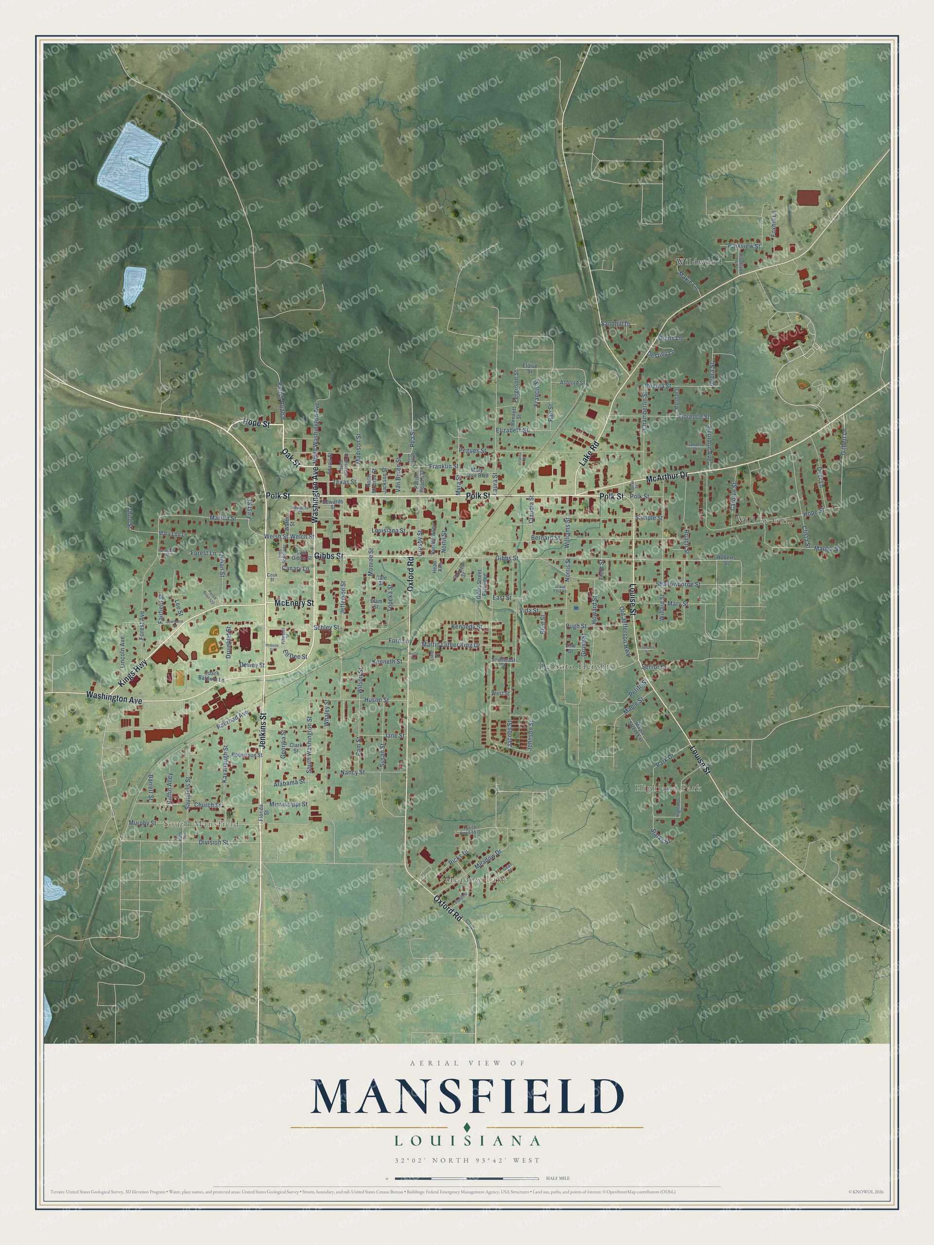
Mansfield, Louisiana Map Art
Building by building, with labeled streets and shaded relief.
12" x 18" Archival Matte Print
A Map of Home. A Work of Art.
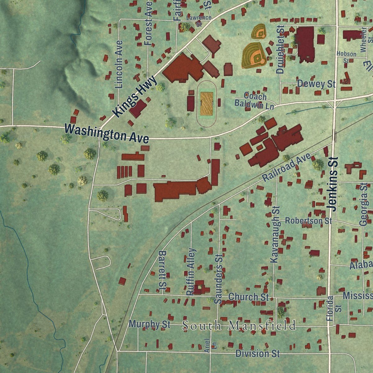
Explore Mansfield, Louisiana from a whole new perspective. Created using aerial imagery and detailed geographic data, this map captures Mansfield building by building, with labeled streets, familiar landmarks, and shaded topographical relief that highlights the natural contours of the landscape.
Combining modern data with the timeless character of a vintage atlas, this map is just as interesting up close as it is beautiful on the wall. Whether you grew up in Mansfield, spent memorable years there, or call it home today, this unique map is a great way to celebrate a place that means something to you. Zoom in on the preview to look for your street, and then order a print to put your memories on the wall.
Three ways to hang it
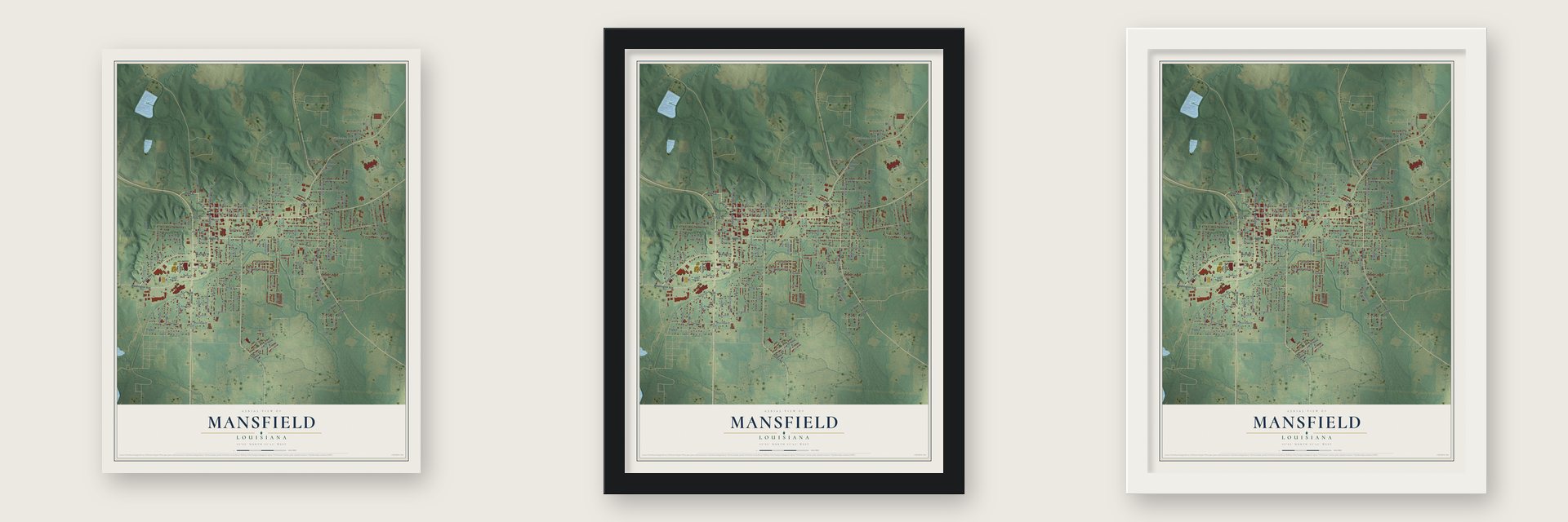
Unframed archival matte, a black wood frame or a white wood frame.
Up close
Geography Worth Displaying
This map was created using accurate cartographic data and authoritative geographic sources, including the U.S. Geological Survey and the Census Bureau. The map brings together terrain, waterways, roads, and building detail. The majority of the streets are labeled, houses are accurately depicted, and the topography is derived from government sources. Combining local data with carefully composed color and shading leads to this beautifully detailed Mansfield artwork for your wall.
Rather than simply showing street outlines, we’ve included as many of the street names as we could reasonably fit on the map while keeping their names legible. Zoom in on the high resolution preview to see exactly what’s on the map. We truly set out to create a statement piece for anyone who loves Mansfield. So whether it’s for you, or a gift for someone you love, we hope this map of Mansfield brings back fond memories.
Read the story behind this map of Mansfield, Louisiana from 2026.

Find your street
Names on the Mansfield map
Every name below is printed on this map. Look for your street, your school, the park where you played, or the pond down the road.
Places and landmarks6
- South Mansfield
- Meadow Park
- Highland Park
- De Soto Heights
- Wildwood
- Willow Glen
Streets and roads163
- Polk Street
- Jenkins Street
- McEnery Street
- Hope Street
- Gibbs Street
- McArthur Drive
- Washington Avenue
- Oxford Road
- Louise Street
- Kings Highway
- Lake Road
- Oak Street
- Division Street
- Van Buren Street
- Martha Street
- Starks Street
- Julian Street
- Gilbert Lane
- Topeka Street
- Johnson Street
- Jefferson Street
- Railroad Avenue
- Jacobs Street
- Pegues Street
- South Washington Street
- Bernard Street
- Old Jefferson Highway
- Schley Street
- Forest Avenue
- Sample Street
Show all 163 streets
- Roach Street
- Willard Street
- Franklin Street
- Monroe Street
- Murphy Street
- Laura Street
- Church Street
- Huson Street
- Whaley Street
- Elizabeth Street
- Norris Street
- Clista Street
- Kavanaugh Street
- Florence Street
- Marcia Street
- Saunders Street
- Chamberlin Street
- Shallowhorne Street
- North Washington Avenue
- Park Drive
- Georgia Street
- Martin Luther King Drive
- Meadow Drive
- Howard Street
- Texas Street
- Mary Street
- Welch Street
- Welsh Street
- Regina Street
- Deer Lane
- Pam Street
- Susan Street
- Madison Street
- Myra Street
- Nancy Street
- Field Street
- Claudia Street
- Williams Street
- Kennedy Street
- Francis Street
- Ricks Drive
- Fairfield Street
- Carolyn Street
- Crosby Street
- Lincoln Avenue
- Pugh Street
- Senior Drive
- Ferguson Street
- Lee Street
- Herndon Avenue
- Druiehlet Street
- Vida Street
- Alabama Street
- Maxie Lane
- Ruffin Alley
- Jane Street
- Louisiana Street
- Mississippi Street
- Parish Road 9
- Parkview Street
- Third Street
- Pea Street
- Debra Street
- Maple Street
- Grove Street
- Wilson Street
- First Street
- Dewey Street
- Kenneth Street
- Sandhill Drive
- Rae Street
- Forest Lane
- North Street
- Canary Lane
- Petite Street
- East Street
- Destiny Lane
- Barrett Street
- Ford Lane
- Ell Dee Street
- Foxhill Lane
- Blue Street
- Goins Lane
- Eloise Street
- Robertson Street
- Florida Street
- Clark Street
- Maple Street Extension
- North Monroe Street
- Adams Street
- Gibbs Street Extended
- Bennett Street
- Elam Street
- Mary Jane Boulevard
- Burden Alley
- Mary Lou Lane
- East Gibbs Street
- Southeast Street
- Parish Road 532
- Coach Baldwin Lane
- Jackson Street
- Edwards Street
- Ashford Street
- Farmer Street
- Roberts Street
- Water Street
- Cale Street
- West Street
- Vine Street
- Line Street
- Head Avenue
- Parish Road 1115
- North Jefferson Street
- Highland Drive
- High School Street
- Marshall Street
- Woodlawn Lane
- Edwards Court
- Gean Street
- Flanders Drive
- Wheeler Street
- Ariel Lane
- Cook Street
- Francine Street
- Lawrence Street
- North Oxford Street
- Hartsfield Street
- Parish Road 522
- Hobson Street
- Francois Street
- Grave Yard Road
- Atlantic Street
- Poole Road
Names are listed as they appear on the printed map. Zoom into the product photos to find them.
About Mansfield, Louisiana
Mansfield is a city of 4,714 people and the seat of De Soto Parish, close to the center of the parish and about 40 miles south of Shreveport. The parish had only just been created when, on June 5, 1843, this spot was picked as its seat of justice. Thomas Abington suggested the name because he admired the Scottish nobleman Lord Mansfield.
Mansfield became an incorporated town on April 15, 1847, and a state law passed on March 17, 1852, gave its mayor judicial powers. W. I. Hamilton and J. W. Parsons started the Mansfield Advertiser in 1849, the first of several newspapers printed here. Farms, timber and livestock surrounded Mansfield, and it became the place where people from the central part of the parish came for supplies.
- The Battle of Mansfield, 1864On April 8, 1864, Gen. Banks' Union army met Confederate troops led by Gen. Richard Taylor near town. The fight became the turning point of Banks' Red River campaign, since after Mansfield his army moved back instead of forward. Col. Leopold Armant was among the Confederates who died here.
- Mansfield Female College, 1854Mansfield Female College opened in 1854 and was incorporated the next year. After the battle, the Confederates turned its buildings into a hospital and kept using them that way until 1865.
- Where two railroads crossedMansfield grew where the Kansas City Southern line crossed the Texas & Pacific. Its mills ginned cotton by steam, ground grain and pressed oil from cottonseed. The Kansas City Southern Depot joined the National Register in 1989.
- Cotton bales and a race trackIn 1888 the Farmers' Union set up the Farmers' Supply Company, which kept a $20,000 stock of goods, and in 1888-9 its members controlled more than 4,000 bales. A separate group, the De Soto Live Stock Association, organized in 1890 and went on to build a fairground and a race track.
Keep exploring Louisiana
Mansfield is one of 594 Louisiana towns we've mapped. Every dot on the map is a print of its own.
The search covers every state, Louisiana first.
Near Mansfield
Order 2 or more town maps and save 10%. Shown in the size and finish you picked above, so they hang as a set.
- South Mansfield 12" x 18" / Archival Matte Print $39.99
- Grand Cane 12" x 18" / Archival Matte Print $39.99
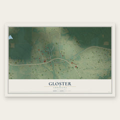
- Gloster 12" x 18" / Archival Matte Print $39.99

More maps nearby: Stanley, Frierson, Longstreet, Keachi and Stonewall.
The art of mapping a place
How This Map Was Made
Real places. Remarkable detail. Discover the layers that turn geographic data into a map of home.

The view from above
Aerial imagery reveals the character of the land: woodland, open fields, and the patterns of a place.

The shape of the land
Elevation data brings hills, valleys, and subtle changes in the landscape into view.

The details of home
Roads, waterways, and building footprints come together to make the map feel unmistakably local.

Geography becomes art
Considered color, shading, and typography bring the layers together in a map made for your wall.


Process illustrated with Mendon, Massachusetts. Aerial imagery: USDA NAIP. Terrain: USGS 3D Elevation Program. Map details and finished artwork: KNOWOL.
The Details
About This Print
Choose an archival matte print, or a black or white Ayous wood frame. The archival matte print is unframed.
Select your size and finish above to see the matching product image and price.
Materials & Craftsmanship
A contemporary map with the character of a classic atlas, printed on archival matte paper. Optional frames are made from Ayous wood.
Your printed map does not include the watermark shown in the full-map preview.
Shipping & Delivery
Free shipping within the United States. Every print is made to order in the USA.
Buying a gift? Add a note in your cart and we'll include it. We never put prices in the package.
Prints ship within 2 to 3 business days. Allow 7 to 10 days total from ordering for delivery. Timing may vary during holidays or periods of high order volume.
Read our shipping policy.
Returns and damaged prints
Each print is made to order. Change-of-mind refunds are not available after production.
If your print arrives damaged, misprinted or incorrect, contact support@knowol.com within 30 days of receiving it. Include your order number, photos and a description of the issue.
Read our full refund and replacement policy. For questions about your order, email support@knowol.com.