
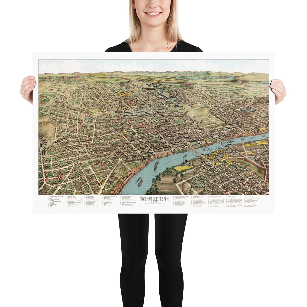
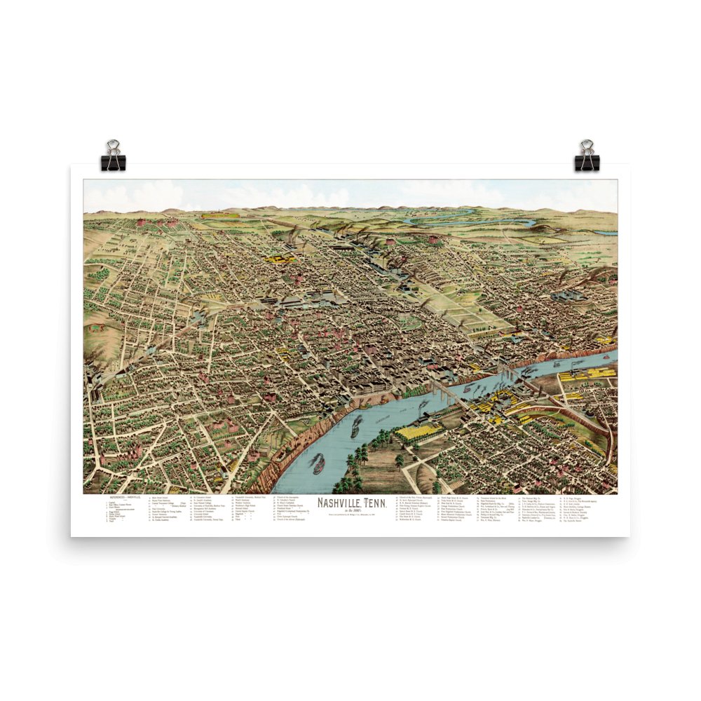
Bird's Eye View of Nashville, Tennessee 1888
Beautifully designed. Printed on archival paper for modern walls.
Archival print promise
- Free U.S. shipping: every order ships free and is backed by a 30 day replacement guarantee.
- Museum-quality paper: rich color, fine detail, and a premium feel.
- Packed for safe delivery: unframed prints ship in sturdy tubes; framed prints ship in padded boxes.
Step back in time to Nashville at the height of the Gilded Age with this stunning bird's eye view map, masterfully illustrated by renowned cartographer Henry Wellge in 1888.
In 1888 Nashville's grid of streets were bustling with commerce, its hillsides dotted with the institutions that earned Nashville its reputation as the "Athens of the South." The map captures an extraordinary moment: Vanderbilt University just over a decade old, Fisk University flourishing in the post-Reconstruction era, and the iconic Tennessee State Capitol presiding over a skyline of church steeples and factory smokestacks.
The extensive reference key at the bottom identifies nearly 100 landmarks, from Montgomery Bell Academy and the Nashville College for Young Ladies to the Tennessee School for the Blind and dozens of churches. At this size of 24" x 36" - you can actually read all the landmarks, but whether you can find them on the map depends how good you are at Nashville geography!
Whether your roots run deep in Middle Tennessee or you simply appreciate the artistry of Victorian-era cartography, this beautifully restored map offers both a window into Nashville's past and a wonderful focal point for your wall.
Each reproduction is printed on museum quality, archival paper using a restored map of Nashville from 1888.
Beautifully restored map of Nashville, Tennessee from 1888: see the history behind this piece in the KNOWOL library, with old photographs and the story of the town.
The Details
About This Print
🌲 Gallery-Quality Materials: Archival matte paper and optional solid, sustainably sourced Ayous wood frame.
✨ Shatterproof Protection: Crystal-clear Acrylite shield blocks glare and resists damage.
🛠️ Ready to Hang: Arrives at your door fully assembled and ready for the wall.
📦 Fast & Safe Shipping: Securely packaged to ensure flawless delivery.
Materials & Craftsmanship
The Unframed Print
Carefully restored from the original artwork and reproduced using gallery-quality, fade-resistant inks. Printed on heavyweight, museum-grade archival paper, this is the ideal choice if you prefer to use your own custom frame. KNOWOL reproductions are beautifully restored works of art.
The Framed Upgrade
Crafted from solid Ayous wood sourced from renewable forests, a sustainable, exotic timber that is lightweight and incredibly warp-resistant. Featuring a sleek 0.75″ profile in your choice of finish. Protected by premium Acrylite. Unlike cheap, heavy glass, our Acrylite is shatterproof, exceptionally clear, and lightweight, ensuring your vintage map is protected for decades to come. All framing components are ethically sourced from Japan and the US. Framed prints arrive fully assembled with hanging hardware included. No frame shop, no assembly, no second trips.
Shipping & Delivery
Free U.S. Shipping: All orders ship 100% free within the United States.
Unframed Prints: Carefully rolled and shipped in a heavy-duty, crush-resistant mailing tube.
Framed Prints: Shipped in custom-built protective packaging engineered specifically to keep the frame corners and Acrylite cover in flawless condition during transit.
Turnaround Time: Most orders ship within 3–5 business days and arrive at your door within 7–10 business days.
Returns & Quality Guarantee
Because every piece is custom-printed and framed to order exactly to your specifications, we are unable to accept returns or exchanges for a change of mind or sizing issues. However, we stand 100% behind our craftsmanship. If your art arrives damaged in transit or has a visible defect, email us a photo within 30 days and we will immediately expedite a flawless replacement. Quality guaranteed: the KNOWOL standard.