
Search for another town





Free U.S. delivery 7 to 10 days after you order
Maplewood, Minnesota Map Art
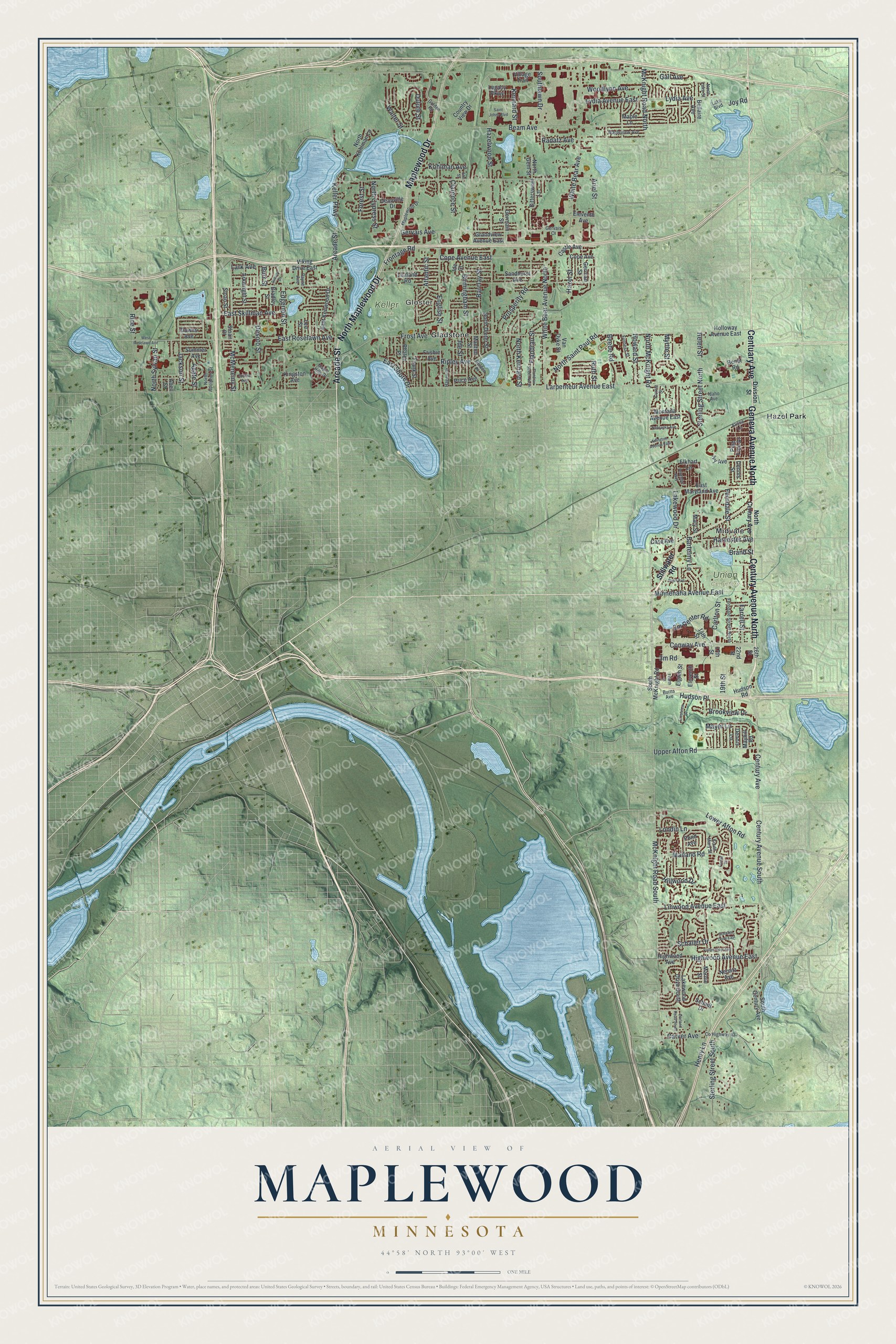
A new map of Maplewood, Minnesota, made in 2026 and printed to order on thick archival matte paper.
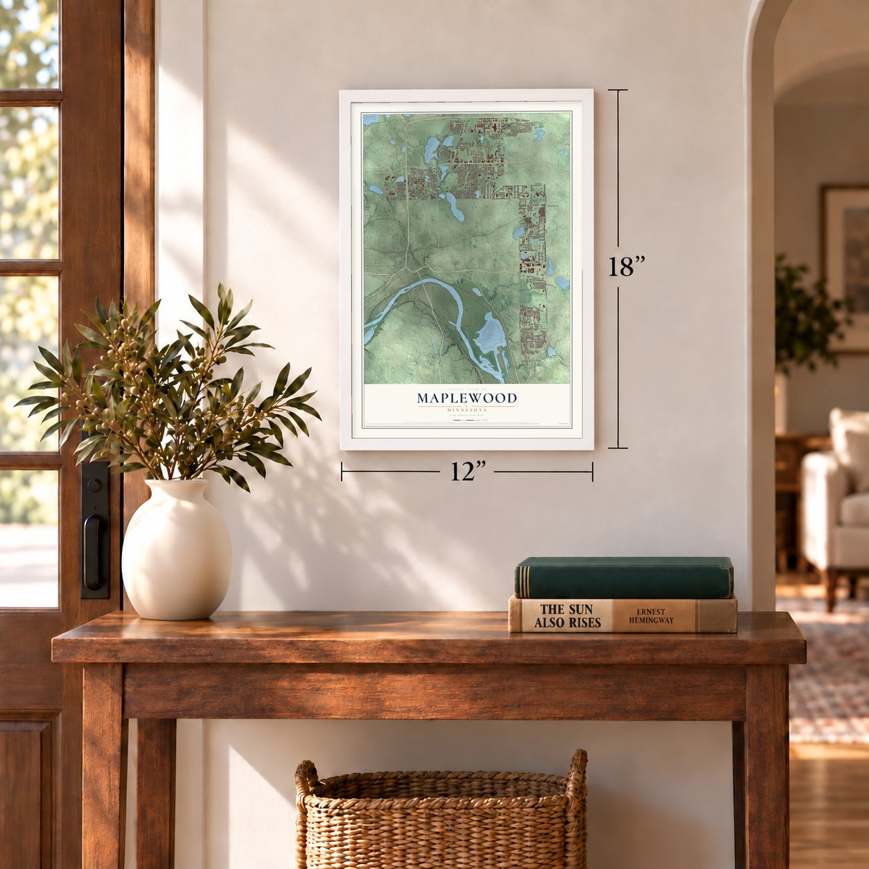
12" x 18" Archival Matte Print
A Map of Home. A Work of Art.
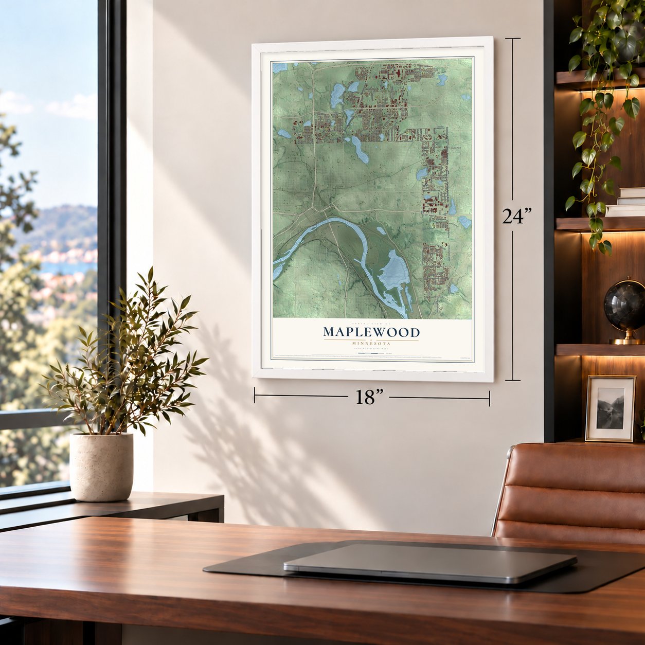
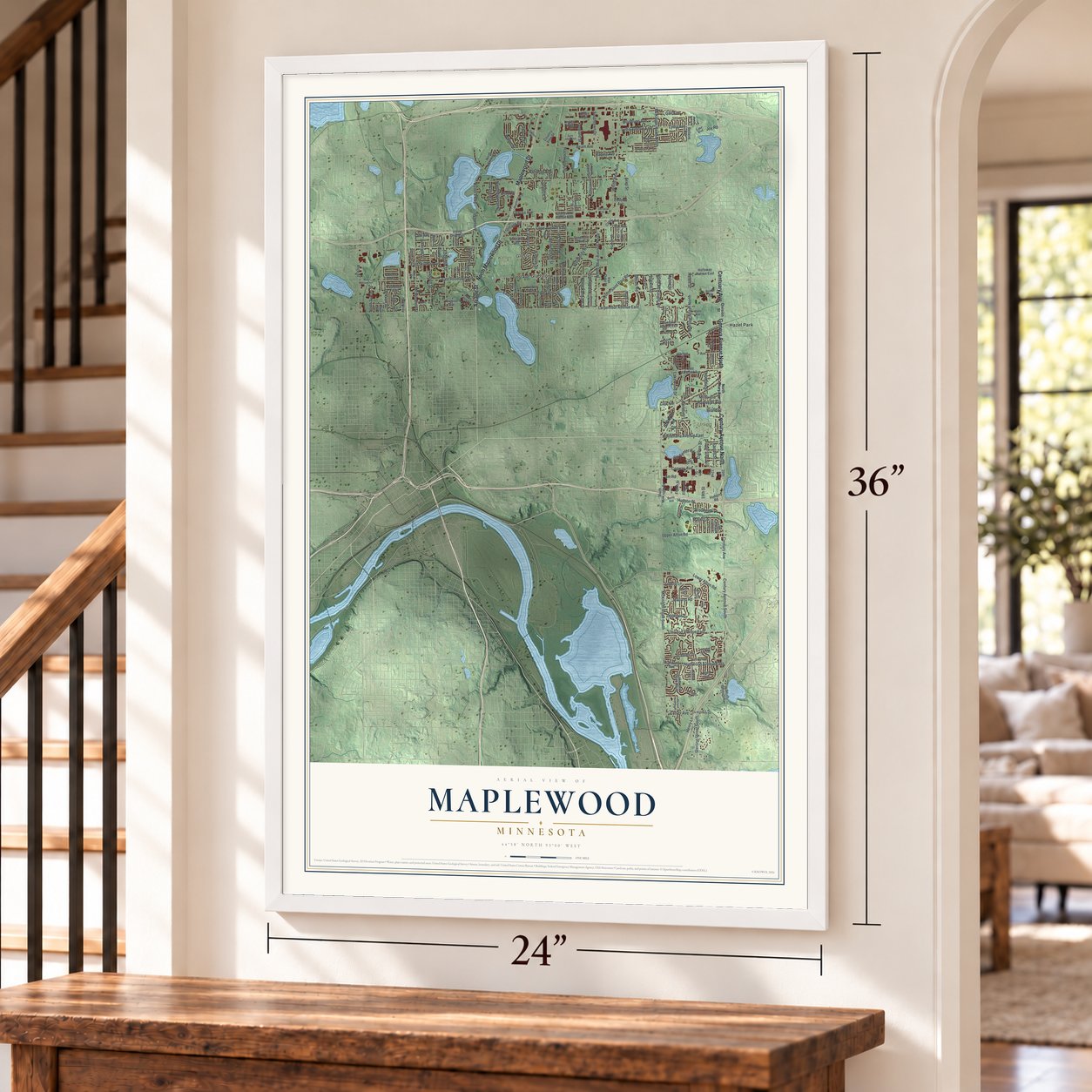
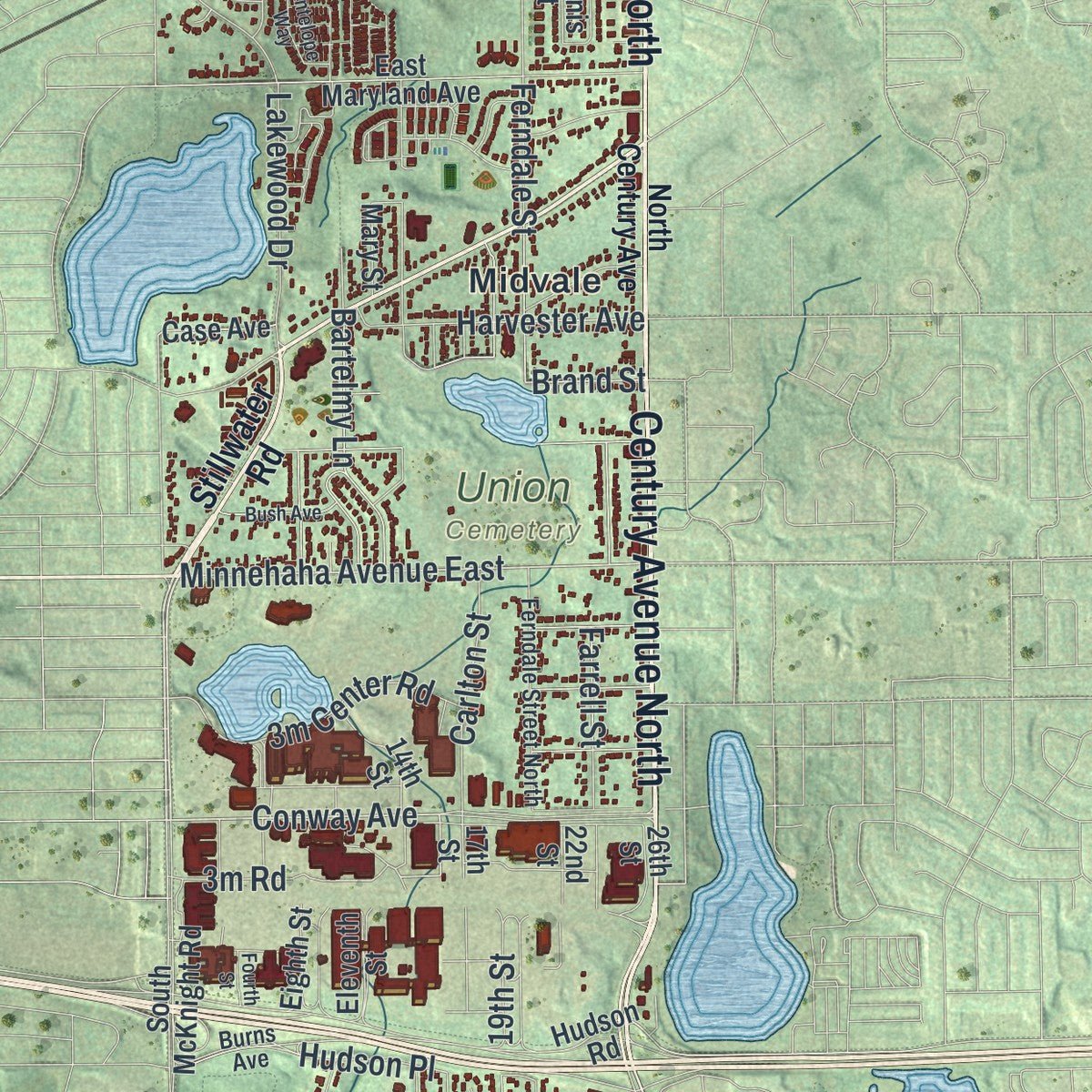
Explore Maplewood, Minnesota from a whole new perspective. Created using aerial imagery and detailed geographic data, this map captures Maplewood building by building, with labeled streets, familiar landmarks, and shaded topographical relief that highlights the natural contours of the landscape.
Combining modern data with the timeless character of a vintage atlas, this map is just as interesting up close as it is beautiful on the wall. Whether you grew up in Maplewood, spent memorable years there, or call it home today, this unique map is a great way to celebrate a place that means something to you. Zoom in on the preview to look for your street, and then order a print to put your memories on the wall.
Three ways to hang it
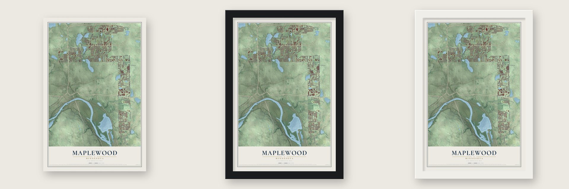
Unframed archival matte, a black wood frame or a white wood frame.
Up close
Geography Worth Displaying
This map was created using accurate cartographic data and authoritative geographic sources, including the U.S. Geological Survey and the Census Bureau. The map brings together terrain, waterways, roads, and building detail. The majority of the streets are labeled, houses are accurately depicted, and the topography is derived from government sources. Combining local data with carefully composed color and shading leads to this beautifully detailed Maplewood artwork for your wall.
Rather than simply showing street outlines, we’ve included as many of the street names as we could reasonably fit on the map while keeping their names legible. Zoom in on the high resolution preview to see exactly what’s on the map. We truly set out to create a statement piece for anyone who loves Maplewood. So whether it’s for you, or a gift for someone you love, we hope this map of Maplewood brings back fond memories.
Read the story behind this map of Maplewood, Minnesota from 2026.

About Maplewood, Minnesota
Maplewood is a Ramsey County city bordering Saint Paul on the north and east. Its landscape changed from prairie and oak savanna to farmsteads and, after the 1950s, suburban neighborhoods. Incorporated in 1957 with 14,200 residents, Maplewood recorded a population of 42,088 in the 2020 census.
- Earlier CommunitiesIndigenous peoples lived in the area before European settlement, with Dakota communities established there during the 18th century.
- Stagecoach EraA stagecoach route between Saint Paul and Duluth stopped in the Maplewood area from 1856 until 1870.
- Gladstone Town SiteGladstone was platted in 1887, prospered briefly during the 1890s, and then declined.
- 3M's Maplewood Campus3M completed its first central research laboratory buildings in Maplewood in 1955 and moved its headquarters there early in the 1960s.
- Distinctive GeographyMaplewood covers 17.99 square miles and includes a southern leg approximately 7.5 miles long and nearly one mile wide.
Find your street
Names on the Maplewood map
Every name below is printed on this map. Look for your street, your school, the park where you played, or the pond down the road.
Places and landmarks6
- Gloster
- Keller Park
- Union Cemetery
- Gladstone
- Hazel Park
- Midvale
Streets and roads189
- Geneva Avenue North
- Century Avenue North
- Centuary Avenue
- North Maplewood Drive
- Arcade Street
- Maplewood Drive
- Century Avenue South
- McKnight Road North
- White Bear Avenue North
- Lower Afton Road
- Upper Afton Road
- Century Avenue
- Lydia Avenue
- Lydia Avenue East
- Joy Road
- Conway Avenue
- Cope Avenue East
- Larpenteur Avenue East
- Highwood Avenue East
- Minnehaha Avenue East
- Atlantic Street
- East Roselawn Avenue
- Ariel Street
- Duluth Street
- Londin Lane
- East Skillman Avenue
- Jackson Street
- North McKnight Road
- Carver Avenue
- Frontage Road
Show all 189 streets
- East Shore Drive
- Frost Avenue
- Hudson Place
- Beam Avenue
- Gervais Avenue
- McKnight Road South
- Hazelwood Street
- Sterling Street South
- Ripley Avenue
- Sterling Street North
- White Bear Avenue
- Lakewood Drive
- English Street
- Barclay Street
- Flandrau Street
- Prosperity Road
- Keller Parkway
- McMenemy Street
- Clarence Street
- Edgerton Street
- Desoto Street
- Ferndale Street
- Birmingham Street
- Bartelmy Lane
- Kennard Street
- Lark Avenue
- Radatz Avenue
- Rice Street
- Linwood Avenue East
- Southlawn Drive
- Woodlynn Avenue
- Myrtle Street
- North Kennard Street
- Walter Street
- Farrell Street
- Schaller Drive
- Mailand Road
- Howard Street
- North Saint Paul Road
- Henry Lane
- 19th Street
- Harvester Avenue
- Brookview Drive
- Hillwood Drive
- Ide Street
- Beebe Road
- Hazel Street
- North Sylvan Street
- Carlton Street
- North Cypress Street
- Kohlman Avenue
- Mayer Lane
- Gall Avenue
- Forest Street
- Burr Street
- Agate Street
- Brand Street
- Ruth Street
- Helen Street
- Stillwater Road
- South Century Avenue
- Castle Avenue
- Highwood Avenue
- Dennis Street
- Cope Avenue
- Holloway Avenue East
- Van Dyke Street
- Kingston Avenue
- Hudson Road
- Mary Street
- East Maryland Avenue
- East Kenwood Drive
- Germain Street
- Lakewood Drive South
- Summer Avenue
- Frank Street
- Viking Drive East
- Marnie Street
- Sandhurst Avenue
- Eighth Street
- Montana Avenue East
- Arkwright Street
- Mayhill Road
- Legacy Parkway
- Manton Street
- Ivy Avenue
- Price Avenue
- South McKnight Road
- Maple Lane
- Bittersweet Lane
- Phalen Place
- 14th Street
- Nemitz Avenue
- Lealand Road
- Bellaire Avenue
- North Dieter Street
- North Kohlman Lane
- Pond Avenue
- Sloan Street
- Pine Tree Drive
- Bradley Street
- Grandview Avenue East
- Country View Drive
- 22nd Street
- Schadt Drive
- Eleventh Street
- Frisbie Avenue
- German Street
- North Gem Street
- Case Avenue
- Benet Road
- Deauville Drive
- Eleventh Avenue
- Sloan Place
- Dennis Lane
- Downs Avenue
- Village Trail
- Elkhart Lane
- Lee Street
- 17th Street
- Abell Street
- 26th Street
- Ide Court
- North Century Avenue
- Division Street
- North Adolphus Street
- Lake Boulevard
- County Highway 43
- Ferndale Street North
- Furness Street
- Payne Avenue
- Maple Hills Drive
- Mapleview Avenue
- Currie Street
- Hagen Drive
- Idaho Avenue
- South Mary Street
- Gulden Place
- Burns Avenue
- Gulden Road
- Gervais Court
- Alissa Lane
- North Lake Street
- West Roselawn Avenue
- Forest Drive
- Dorland Road South
- Crestview Drive
- Flandrau Street North
- Schaller Drive East
- Sophia Avenue
- Valley View Avenue
- Arlington Avenue East
- Nebraska Avenue
- Bush Avenue
- Saint Johns Boulevard
- Antelope Way
- Sunrise Drive
- Elm Street
- Fourth Street
Names are listed as they appear on the printed map. Zoom into the product photos to find them.
The art of mapping a place
How This Map Was Made
Real places. Remarkable detail. Discover the layers that turn geographic data into a map of home.

The view from above
Aerial imagery reveals the character of the land: woodland, open fields, and the patterns of a place.

The shape of the land
Elevation data brings hills, valleys, and subtle changes in the landscape into view.

The details of home
Roads, waterways, and building footprints come together to make the map feel unmistakably local.

Geography becomes art
Considered color, shading, and typography bring the layers together in a map made for your wall.


Process illustrated with Mendon, Massachusetts. Aerial imagery: USDA NAIP. Terrain: USGS 3D Elevation Program. Map details and finished artwork: KNOWOL.
The Details
About This Print
Choose an archival matte print, or a black or white Ayous wood frame. The archival matte print is unframed.
Select your size and finish above to see the matching product image and price.
Materials & Craftsmanship
A contemporary map with the character of a classic atlas, printed on archival matte paper. Optional frames are made from Ayous wood.
Your printed map does not include the watermark shown in the full-map preview.
Shipping & Delivery
Free shipping within the United States. Every print is made to order in the USA.
Buying a gift? Add a note in your cart and we'll include it. We never put prices in the package.
Prints ship within 2 to 3 business days. Allow 7 to 10 days total from ordering for delivery. Timing may vary during holidays or periods of high order volume.
Read our shipping policy.
Returns and damaged prints
Each print is made to order. Change-of-mind refunds are not available after production.
If your print arrives damaged, misprinted or incorrect, contact support@knowol.com within 30 days of receiving it. Include your order number, photos and a description of the issue.
Read our full refund and replacement policy. For questions about your order, email support@knowol.com.
Find your town
Looking for another city?
Find a map of home in our Minnesota collection, or any town in the country.
Nearby
Maps of towns near Maplewood
Know someone from one of these towns? Their map makes a great gift.
 North St. Paul
, Minnesota
From $39.99See the map
 Little Canada
, Minnesota
From $39.99See the map
 Gem Lake
, Minnesota
From $39.99See the map
More maps nearby: Vadnais Heights, White Bear Lake, Birchwood Village, Pine Springs and Oakdale.