
Search for another town





Free U.S. delivery 7 to 10 days after you order
Marion, Ohio Map Art
Building by building, with labeled streets and shaded relief.
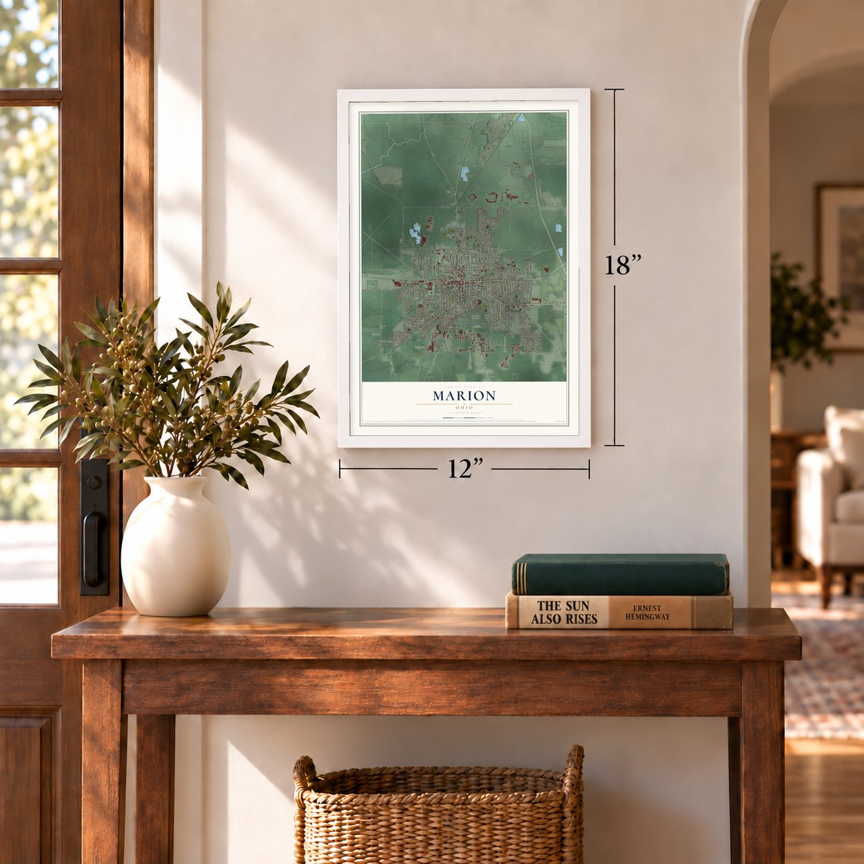
12" x 18" Archival Matte Print
A Map of Home. A Work of Art.
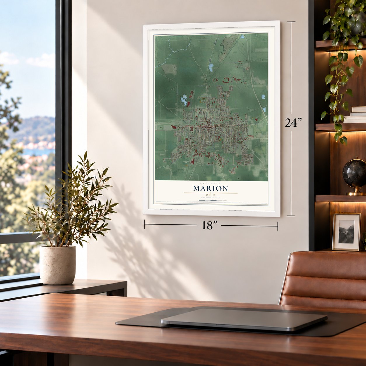
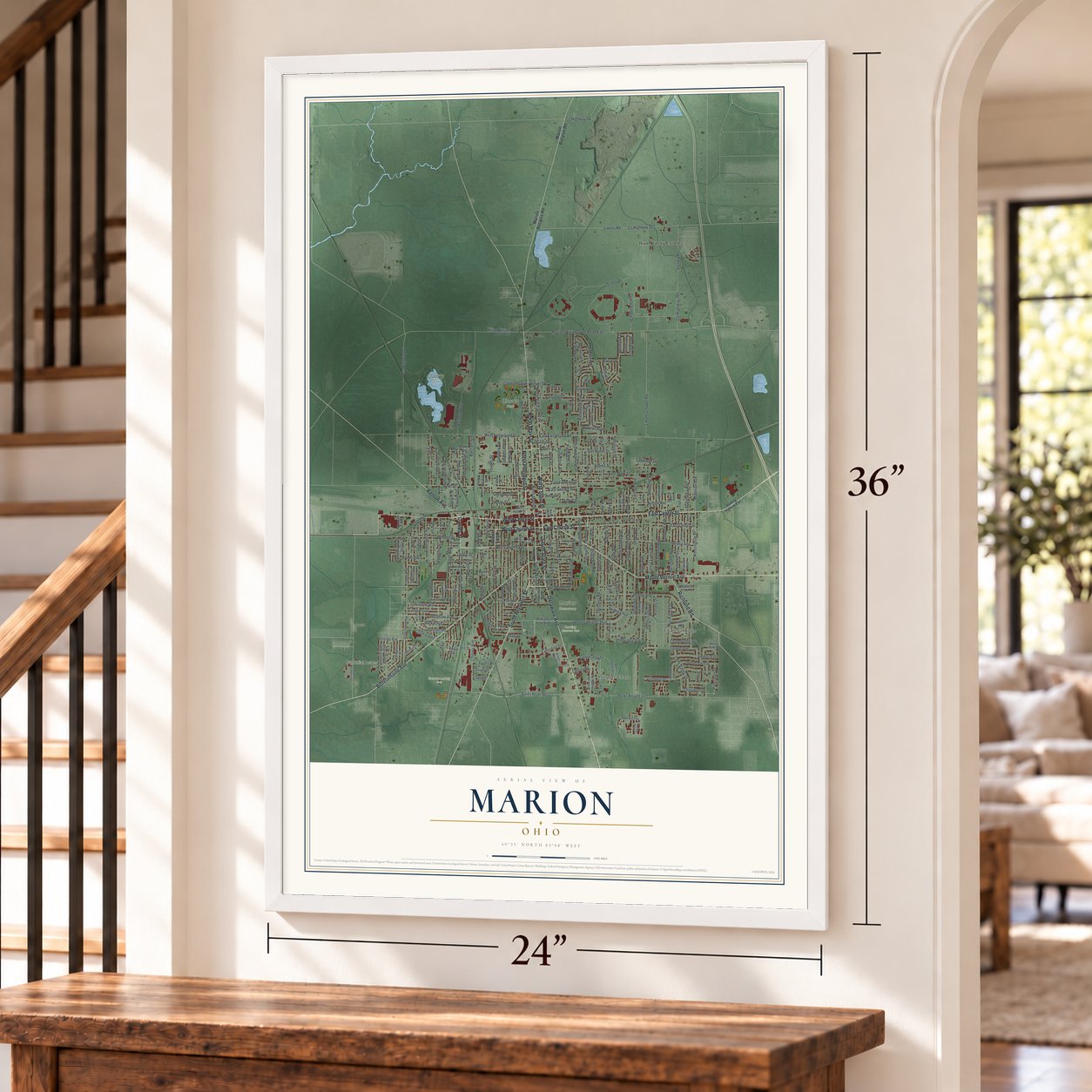
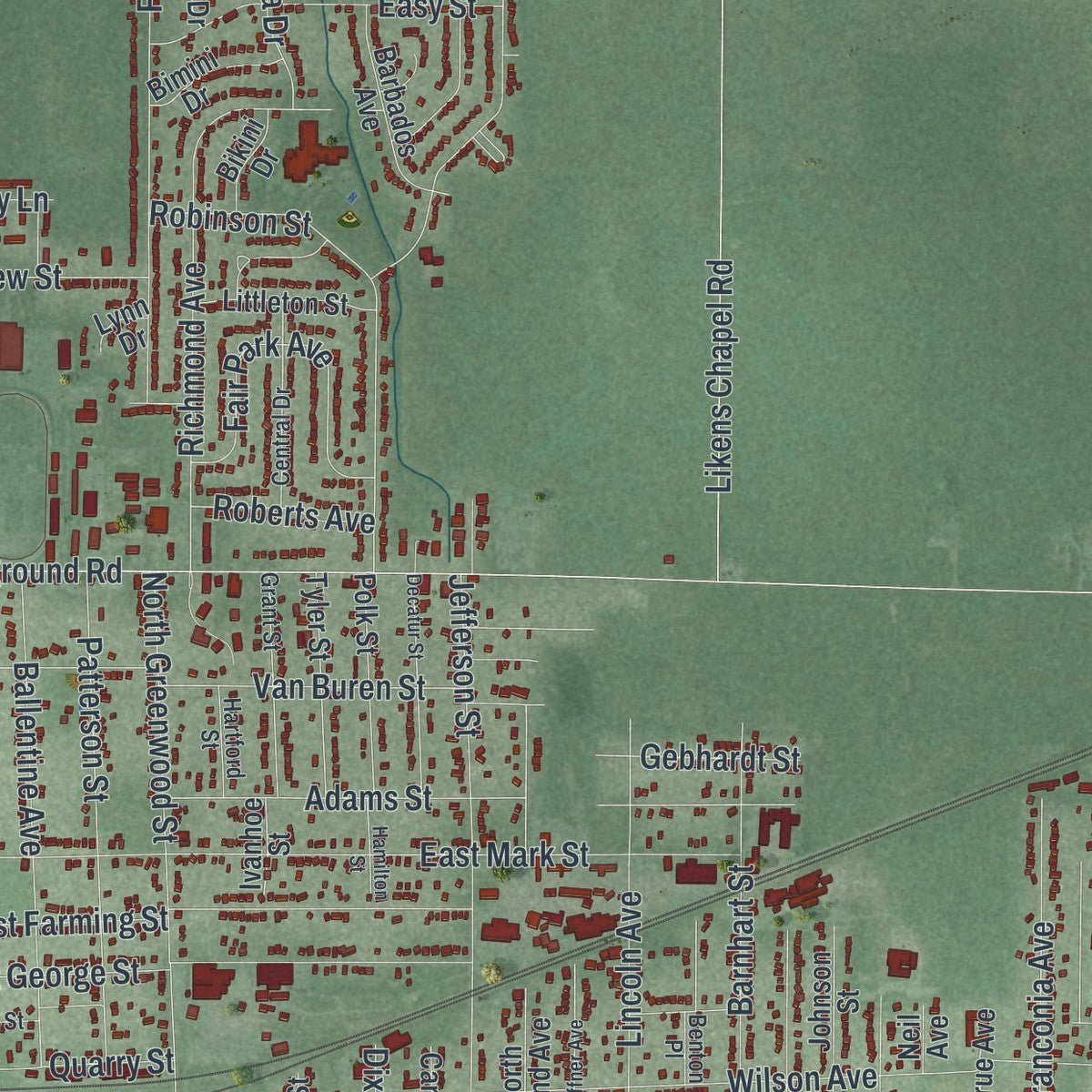
Explore Marion, Ohio from a whole new perspective. Created using aerial imagery and detailed geographic data, this map captures Marion building by building, with labeled streets, familiar landmarks, and shaded topographical relief that highlights the natural contours of the landscape.
Combining modern data with the timeless character of a vintage atlas, this map is just as interesting up close as it is beautiful on the wall. Whether you grew up in Marion, spent memorable years there, or call it home today, this unique map is a great way to celebrate a place that means something to you. Zoom in on the preview to look for your street, and then order a print to put your memories on the wall.
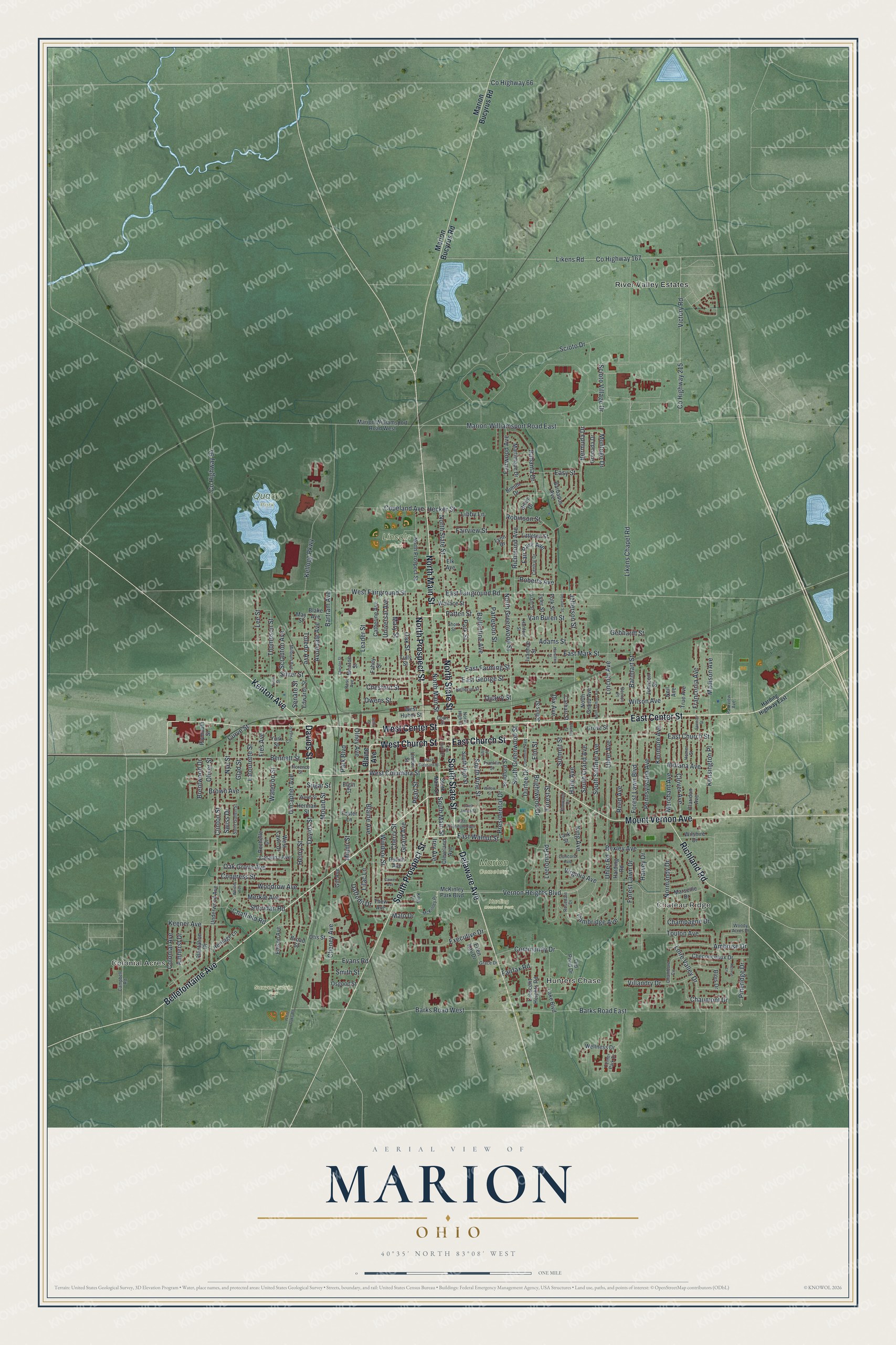
Three ways to hang it
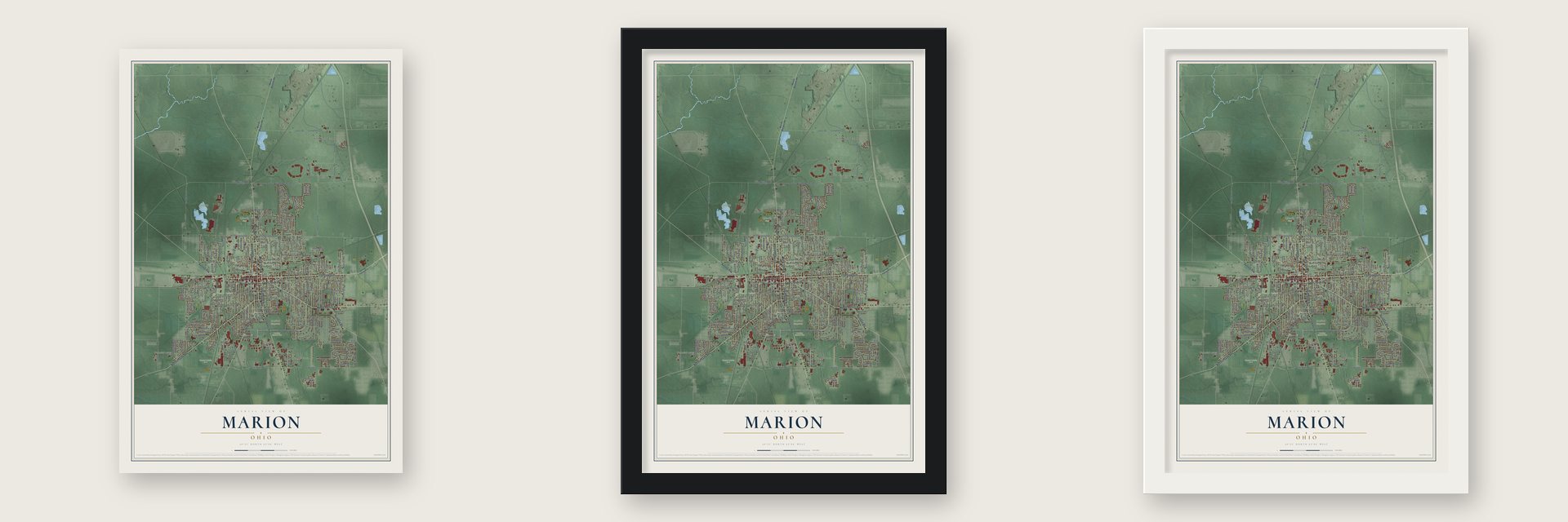
Unframed archival matte, a black wood frame or a white wood frame.
Up close
Geography Worth Displaying
This map was created using accurate cartographic data and authoritative geographic sources, including the U.S. Geological Survey and the Census Bureau. The map brings together terrain, waterways, roads, and building detail. The majority of the streets are labeled, houses are accurately depicted, and the topography is derived from government sources. Combining local data with carefully composed color and shading leads to this beautifully detailed Marion artwork for your wall.
Rather than simply showing street outlines, we’ve included as many of the street names as we could reasonably fit on the map while keeping their names legible. Zoom in on the high resolution preview to see exactly what’s on the map. We truly set out to create a statement piece for anyone who loves Marion. So whether it’s for you, or a gift for someone you love, we hope this map of Marion brings back fond memories.

Find your street
Names on the Marion map
Every name below is printed on this map. Look for your street, your school, the park where you played, or the pond down the road.
Places and landmarks9
- Colonial Acres
- Hunters Chase
- Chateau Ridge
- Harding Memorial Park
- Lincoln Park
- Marion Cemetery
- Quarry Park
- Sawyer-Ludwig Park
- River Valley Estates
Streets and roads270
- Davids Street
- Bellefontaine Avenue
- East Center Street
- Mount Vernon Avenue
- Kenton Avenue
- Delaware Avenue
- East Church Street
- North Prospect Street
- North Main Street
- West Church Street
- West Center Street
- South Prospect Street
- South State Street
- North State Street
- Richland Road
- West Columbia Street
- South Main Street
- East Walnut Street
- Barks Road West
- Blaine Avenue
- Vernon Heights Boulevard
- Marion-Williamsport Road East
- South Seffner Avenue
- Uhler Road
- Uhler Avenue
- Leetonia Road
- Pineridge Drive
- Scioto Drive
- Likens Road
- County Highway 167
Show all 270 streets
- Oak Street
- Barks Road East
- Forest Lawn Boulevard
- Uncapher Avenue
- Wilson Avenue
- East Mark Street
- East Fairground Road
- County Highway 215
- Indiana Avenue
- West Fairground Street
- Kellogg Parkway
- Silver Street
- Victory Road
- Windsor Street
- Summit Street
- Bexley Avenue
- East Farming Street
- East George Street
- Olney Avenue
- Clinton Street
- Leader Street
- Cheney Avenue
- Henry Street
- Fairwood Avenue
- North Greenwood Street
- Bennett Street
- Richmond Avenue
- Jefferson Street
- Brightwood Drive
- Forest Lawn Drive
- Adams Street
- Virginia Avenue
- Pearl Street
- Bermuda Drive
- Park Boulevard
- Robinson Street
- Forest Street
- Cambridge Avenue
- Ballentine Avenue
- Patterson Street
- Hane Avenue
- Clover Avenue
- Kensington Place
- Merchant Avenue
- Pennsylvania Avenue
- Reed Avenue
- Woodrow Avenue
- Girard Avenue
- South Vine Street
- Scioto Village Drive
- Lincoln Avenue
- Toulon Avenue
- Waterloo Street
- Barnhart Street
- Congress Street
- Fies Avenue
- Cherry Street
- Likens Chapel Road
- Madison Avenue
- Park Street
- Merkle Avenue
- Mary Street
- Lee Street
- Bartram Avenue
- Normandy Drive
- Loire Valley Drive
- South Grand Avenue
- Presidential Drive
- Fair Park Avenue
- King Avenue
- Amboise Drive
- Community Drive
- Bahama Drive
- Fairview Street
- Easy Street
- Keener Avenue
- Executive Drive
- Franconia Avenue
- Oak Grove Avenue
- Latourette Street
- South Greenwood Street
- Villandry Drive
- Colonial Avenue
- Glad Street
- Sheridan Road
- Van Buren Street
- Mound Street
- Amherst Drive
- Brown Avenue
- Thompson Street
- Quarry Street
- Toledo Avenue
- Patten Street
- Avondale Avenue
- Harvey Drive
- Chaumont Drive
- Nye Street
- Montego Drive
- Owens Street
- County Highway 66
- Kenmore Avenue
- Copeland Avenue
- Chestnut Street
- Daffodil Drive
- Universal Avenue
- County Highway 94
- Scranton Avenue
- Gebhardt Street
- Champagne Drive
- Chatfield Road
- Oliver Street
- Brentwood Drive
- Sugar Street
- Roberts Avenue
- Evans Road
- Senate Street
- Hecker Street
- Elm Street
- Smith Street
- Durfee Drive
- Libby Lane
- Fairfax Road
- Lilac Lane
- Swiss Drive
- Dix Avenue
- Irey Avenue
- Miami Street
- Malo Drive
- Curve Street
- Marion Bucyrus Road
- McKinley Park Boulevard
- West Huber Street
- Marion Williamsport Road West
- Old Pond Drive
- Plantation Drive
- North Grand Avenue
- Wellness Drive
- Chenonceaux Drive
- Lake Boulevard
- Crescent Heights Road
- South High Street
- Harding Road
- Johnson Street
- Barbados Avenue
- Tyler Street
- Polk Street
- Blois Drive
- Duluth Avenue
- Union Street
- Thew Avenue
- Catherine Avenue
- Martinique Drive
- Foster Lane
- Underwood Avenue
- Herman Street
- Littleton Street
- Edwards Street
- Marseille Drive
- York Street
- Catalina Avenue
- Bradford Street
- Wallace Street
- Bimini Drive
- Grenada Drive
- Wilshire Drive
- Heritage Lane
- Ellen Kay Drive
- True Avenue
- Claridon Avenue
- Edison Avenue
- Cleveland Avenue
- Osgood Street
- Rochelle Drive
- West Lawn Drive
- Carhart Street
- Plymouth Street
- Grove Street
- Bikini Drive
- Otis Street
- Ivanhoe Street
- Johns Street
- Tully Street
- Blake Avenue
- Monroe Street
- Fahey Street
- Gill Avenue
- Lark Street
- Broad Street
- Elgin Court
- Lynn Drive
- Neil Avenue
- Elk Avenue
- May Street
- Campbell Road
- McKinley Place
- North High Street
- Center Park Drive
- Homer Street
- Milburn Avenue
- Grant Street
- Central Drive
- Wood Street
- Bellevue Street
- Chambord Circle
- Saint Gallen Street
- Cummins Avenue
- Franklin Street
- Woody Acres Drive
- Hartford Street
- Elmwood Drive
- Parkview Avenue
- Rosedale Drive
- Concord Avenue
- Grace Drive
- Short Street
- Florence Street
- Benton Place
- Kelly Lane
- Rose Avenue
- Court Street
- Harding Highway East
- Spencer Street
- East Washington Avenue
- Decatur Street
- North Seffner Avenue
- West Pleasant Street
- Whitter Avenue
- Cayuga Street
- Willow Street
- Niles Street
- Saint James Street
- Hamilton Street
- Carner Avenue
- Ten Eyck Court
- Retreat Lane
- Chester Street
- Charles Street
- White Oaks Road
- Ellis Place
- Selby Street
Names are listed as they appear on the printed map. Zoom into the product photos to find them.
About Marion, Ohio
Marion is a city of 35,999 people and the seat of Marion County, about 50 miles north of Columbus. The town was laid out in 1822 and named for General Francis Marion. The Ohio Legislature made it a village in the session that ran from 1829 to 1830, and on March 15, 1830, voters chose Nathan Peters as the first mayor.
In 1884 Edward Huber joined Henry M. Barnhart and George W. King to found the Marion Steam Shovel Company, and its machines helped turn Marion into one of Ohio's major industrial centers. Contractors dug the Panama Canal, the Holland Tunnel and Hoover Dam with its shovels, and by 1911 Marion made 80% of the nation's steam shovels and heavy earth-moving equipment. In the 1960s NASA hired the company to build the crawlers that carried Saturn V rockets to the launch pad. "The Shovel" employed 2,500 people at its peak, until Bucyrus International, its longtime rival, bought it and shut it down in 1997.
- Bill Mitchell freed in 1839Ohioans called one Underground Railroad route the River to Lake Freedom Trail, and Marion was a stop on it. In 1839 Bill Mitchell, a Black man, was accused in Marion of being a fugitive slave, and the court case that followed set him free. Virginians who had come to claim him for his owner started a fight in the courtroom, but Marion abolitionists hurried Mitchell away, and he reached Canada.
- A front porch campaignWarren G. Harding, owner of the Marion Star, and his future wife Florence designed their Queen Anne house on Mount Vernon Avenue in 1890, then were married in it and lived there for 30 years. Running for president, Harding campaigned mostly from its wide front porch, and over 600,000 people came to hear him in three months. Reporters typed their stories in a Sears catalog house he bought for $1,000 out back. He is buried at Harding Tomb.
- Twinkling stars since 1928John Eberson designed the Palace Theatre for the Young Amusement Company, and it opened on August 30, 1928, at a cost of $500,000. Its 1,440 seats face an auditorium made to look like an outdoor palace courtyard, with a blue sky and twinkling stars overhead. Restored in 1975, it has never closed, and it is one of just 16 Eberson atmospheric theatres still running in the country.
- The Popcorn FestivalMarion grew up beside corn and popcorn fields, and Wyandot Snacks has made snacks here since the 1960s. Every September, on the weekend after Labor Day, the Marion Popcorn Festival fills downtown. The Wyandot Popcorn Museum opened in 1982, before the second festival, inside Heritage Hall, the Old U.S. Post Office built in 1910, and its antique poppers make up the largest collection of restored popcorn antiques.
Keep exploring Ohio
Marion is one of 1,389 Ohio towns we've mapped. Every dot on the map is a print of its own.
The search covers every state, Ohio first.
Near Marion
Order 2 or more town maps and save 10%. Shown in the size and finish you picked above, so they hang as a set.
- Green Camp 12" x 18" / Archival Matte Print $39.99
- Morral 12" x 18" / Archival Matte Print $39.99
- Caledonia 12" x 18" / Archival Matte Print $39.99

More maps nearby: Waldo, New Bloomington, Prospect, Harpster and La Rue.
The art of mapping a place
How This Map Was Made
Real places. Remarkable detail. Discover the layers that turn geographic data into a map of home.

The view from above
Aerial imagery reveals the character of the land: woodland, open fields, and the patterns of a place.

The shape of the land
Elevation data brings hills, valleys, and subtle changes in the landscape into view.

The details of home
Roads, waterways, and building footprints come together to make the map feel unmistakably local.

Geography becomes art
Considered color, shading, and typography bring the layers together in a map made for your wall.


Process illustrated with Mendon, Massachusetts. Aerial imagery: USDA NAIP. Terrain: USGS 3D Elevation Program. Map details and finished artwork: KNOWOL.
The Details
About This Print
Choose an archival matte print, or a black or white Ayous wood frame. The archival matte print is unframed.
Select your size and finish above to see the matching product image and price.
Materials & Craftsmanship
A contemporary map with the character of a classic atlas, printed on archival matte paper. Optional frames are made from Ayous wood.
Your printed map does not include the watermark shown in the full-map preview.
Shipping & Delivery
Free shipping within the United States. Every print is made to order in the USA.
Buying a gift? Add a note in your cart and we'll include it. We never put prices in the package.
Prints ship within 2 to 3 business days. Allow 7 to 10 days total from ordering for delivery. Timing may vary during holidays or periods of high order volume.
Read our shipping policy.
Returns and damaged prints
Each print is made to order. Change-of-mind refunds are not available after production.
If your print arrives damaged, misprinted or incorrect, contact support@knowol.com within 30 days of receiving it. Include your order number, photos and a description of the issue.
Read our full refund and replacement policy. For questions about your order, email support@knowol.com.