
Search for another town





Free U.S. delivery 7 to 10 days after you order
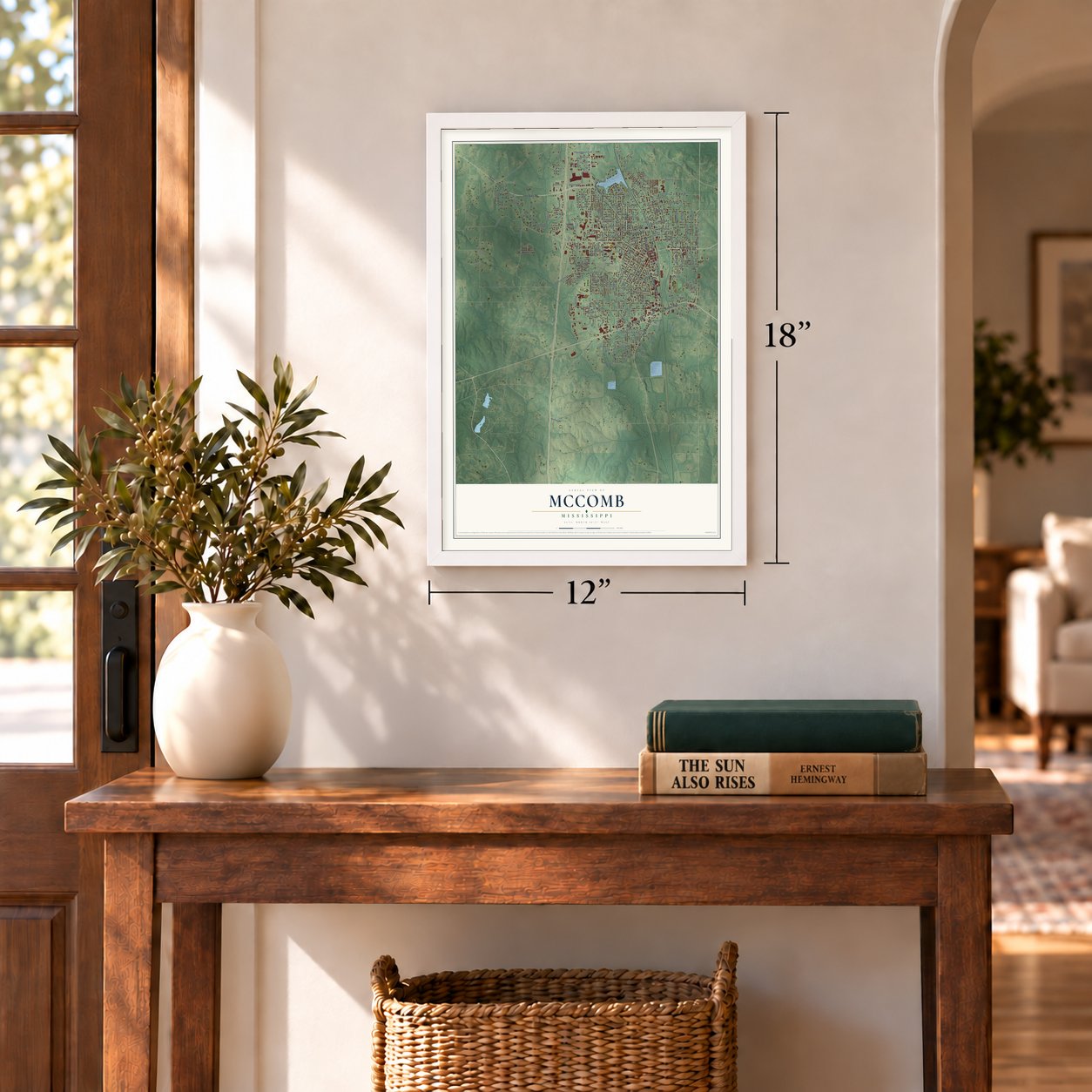
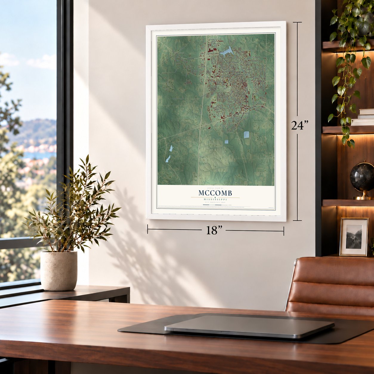
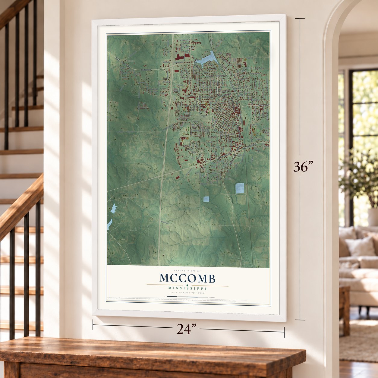
McComb, Mississippi Map Art
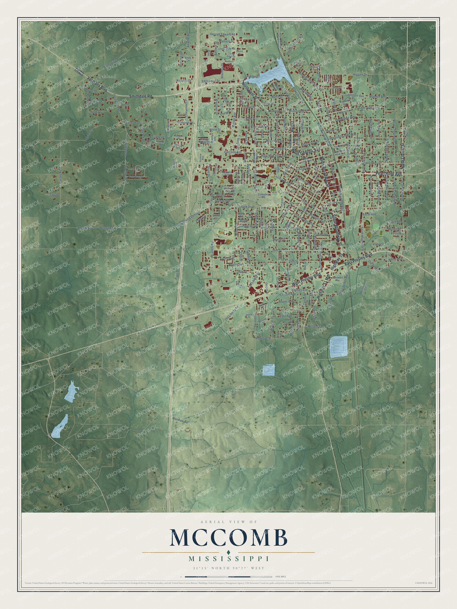
A new map of McComb, Mississippi, made in 2026 and printed to order on thick archival matte paper.
12" x 18" Archival Matte Print
A Map of Home. A Work of Art.
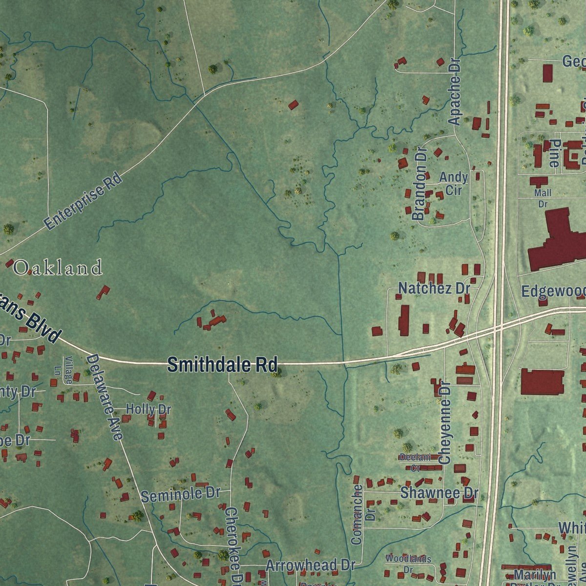
Explore McComb, Mississippi from a whole new perspective. Created using aerial imagery and detailed geographic data, this map captures McComb building by building, with labeled streets, familiar landmarks, and shaded topographical relief that highlights the natural contours of the landscape.
Combining modern data with the timeless character of a vintage atlas, this map is just as interesting up close as it is beautiful on the wall. Whether you grew up in McComb, spent memorable years there, or call it home today, this unique map is a great way to celebrate a place that means something to you. Zoom in on the preview to look for your street, and then order a print to put your memories on the wall.
Three ways to hang it
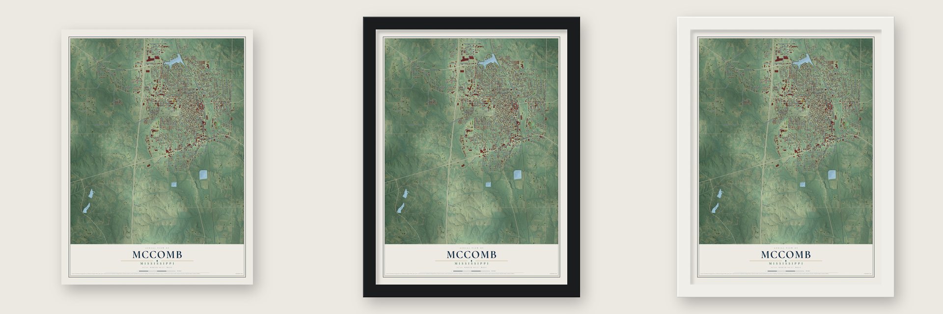
Unframed archival matte, a black wood frame or a white wood frame.
Up close
Geography Worth Displaying
This map was created using accurate cartographic data and authoritative geographic sources, including the U.S. Geological Survey and the Census Bureau. The map brings together terrain, waterways, roads, and building detail. The majority of the streets are labeled, houses are accurately depicted, and the topography is derived from government sources. Combining local data with carefully composed color and shading leads to this beautifully detailed McComb artwork for your wall.
Rather than simply showing street outlines, we’ve included as many of the street names as we could reasonably fit on the map while keeping their names legible. Zoom in on the high resolution preview to see exactly what’s on the map. We truly set out to create a statement piece for anyone who loves McComb. So whether it’s for you, or a gift for someone you love, we hope this map of McComb brings back fond memories.
Read the story behind this map of McComb, Mississippi from 2026.

About McComb, Mississippi
McComb is a city of 12,413 people in Pike County, in southern Mississippi near the Louisiana line. It began in 1872, when railroad man Henry Simpson McComb decided to move the repair shops of his New Orleans, Jackson and Great Northern Railroad out of New Orleans, hoping to keep his workers away from that city's bars. The railroad bought land in Pike County, and three nearby settlements, Elizabethtown, Burglund and Harveytown, joined together as one town named for him.
The line later became part of the Illinois Central, and the shops turned McComb into a railroad center. By the early 1900s the Illinois Central kept its biggest shops in Mississippi here, where crews built and repaired cars and locomotives. Railroad jobs drew immigrants to Pike County, especially McComb, and the town had one of the state's earliest unions of railroad workers. By 1930 McComb had grown past 10,000 people.
- The shopmen's strike of 1911When Illinois Central shop workers went on strike on September 30, 1911, McComb's rail yards became one of the worst trouble spots. Riots left many people hurt and at least three Black strikebreakers dead, and state militia were sent in to put down the violence.
- The Burglund High walkoutBrenda Travis, Robert Talbert and Ike Lewis spent 28 days in jail for a 1961 sit-in at the Greyhound station, and Travis was expelled from school. After her expulsion and the murder of farmer Herbert Lee, 115 students walked out of Burglund High on October 4, 1961. Police beat and arrested many, and the 16 seniors among them could not graduate. Travis spent six and a half months in a state juvenile facility, then was exiled from Mississippi.
- From Freedom Summer to 2006SNCC ran its first Mississippi voter registration project in McComb in 1961, but beatings and jailings drove it out early in 1962. Workers came back in mid-July 1964, and from late August through September eleven bombings targeted African Americans here. Change came slowly: in 2006 McComb elected Zach Patterson, its first African American mayor, and in 2018 voters chose Quordiniah Lockley and the city's first board with an African American majority.
- An F4 tornado in 1975On January 10, 1975, an F4 tornado tore across 38 blocks of the city, wrecking homes, businesses, cars and trees. Along its 56.5-mile path it killed 9 people and injured 210.
Find your street
Names on the McComb map
Every name below is printed on this map. Look for your street, your school, the park where you played, or the pond down the road.
Places and landmarks3
- McComb City Hall
- Oakland
- Bear Town
Streets and roads249
- Smithdale Road
- South Broadway Street
- North Broadway Street
- East Presley Boulevard
- Northwest Street
- Highway 51
- Veterans Boulevard
- Pearl River Avenue
- West Georgia Avenue
- Highway 51 Mm
- Hwy51
- North Locust Street
- West Presley Boulevard
- Delaware Avenue
- North West Street
- West Avenue South
- Mississippi Street
- Marion Avenue
- South Railroad Boulevard
- Hart Road
- North Railroad Boulevard
- Jackson Avenue
- North Street
- Summit Street
- Park Drive
- Park Drive Extended
- Pennsylvania Avenue
- Holmes Avenue
- Grant Avenue
- Warren Street
Show all 249 streets
- McComb Street
- South Chestnut Street
- 13th Court
- Caston Road
- Enterprise Road
- Holden Road
- Apache Drive
- Virginia Avenue
- 24th Street
- White Street
- Perrott Road
- 25th Street
- North Cherry Street
- Parklane Road
- North Live Oak Street
- Schmidt Road
- Schmitt Road
- North Magnolia Street
- 21st Street
- Elmwood Street
- Wardlaw Road
- South Magnolia Street
- Louisiana Avenue
- Bendat Street
- West New York Avenue
- South Locust Street
- Lakeshore Drive
- Argyle Street
- Beech Street
- Saint Augustine
- Park Street
- Wall Street
- 26th Street
- North James Avenue
- Burke Avenue
- Eleventh Street
- Aston Avenue
- Higgins Drive
- Old Liberty Road
- Martin Luther King Drive
- Minnesota Avenue
- Caston Avenue
- Howe Street
- South Sixth Street
- Harper Street
- North Chestnut Street
- Johnson Avenue
- Venable Street
- Cameron Street
- Cheyenne Drive
- Cherokee Drive
- Missouri Avenue
- High Street
- Witterman Street
- Arrowhead Drive
- Edgar Street
- Lenoir Sellers Road
- South Cherry Street
- Wilson Drive
- Oak Street
- Gay Street
- Wheelock Street
- Maddox Avenue
- Denwiddie Avenue
- Wilson Street
- Earl Street
- South Myrtle Street
- Labranch Street
- Harrison Avenue
- Twelfth Street
- Edward Lane
- White Boulevard
- Old Liberty Street
- Nelson Avenue
- Hamilton Street
- Edgewood Drive
- Brandon Drive
- Maxine Avenue
- Rawls Drive
- Howell Drive
- Eighth Street
- Ninth Street
- Natchez Drive
- Tenth Street
- George Edward Road
- Sherman Drive
- Johnny Forest Road
- 13th Street
- Baldwin Street
- Page Drive
- Kentucky Avenue
- Carver Street
- Gilbert Road
- Lincoln Avenue
- Paige Drive
- Christine Drive
- Pope Circle
- Peoples Street
- South Live Oak Street
- Bacot Avenue
- North Front Street
- Peach Avenue
- Shawnee Drive
- Pike Street
- Pine Street
- Stokes Avenue
- Gillis Circle
- Vogel Street
- Universal Street
- Herrington Street
- 14th Street
- Westover Drive
- Sedgewick Street
- Scott Drive
- Old 24 Highway
- Sinclair Street
- Hunter Street
- Shannon Drive
- Lund Street
- Marquette Avenue
- Laird Avenue
- Fox Run Drive
- Adams Avenue
- Taga Drive
- Ellen Drive
- Wallace Drive
- Gerald Drive
- Seminole Drive
- Hope Drive
- Perrett Road
- Moses Lane
- Monty Drive
- Butler Street
- Kendall Street
- Price Street
- Ball Street
- Pine
- West Street North
- Cemetery Road
- Argyle Court
- Clay Avenue
- South Fifth Street
- CC Bryant Drive
- Cedar Ridge Road
- Llewellyn Avenue
- Avenue East
- Seventh Street
- Maddock Avenue
- Michigan Avenue
- Laurel Street
- North Myrtle Street
- La Branch Street
- New York Avenue
- Marilyn Butler Drive
- Desoto Avenue
- Leggett Street
- Fox Loop
- Lynn Avenue
- Montana Avenue
- James Street
- Fourth Street
- Vermont Avenue
- Lasalle Street
- Lloyd Stille Road
- Evans Avenue
- Bardwell Avenue
- Fifth Avenue
- School Street
- Lee Street
- Scott Street
- Joliet Avenue
- Comanche Drive
- East New York Avenue
- Jordan Circle
- Berthadale Circle
- Ashley Street
- Commerce Street
- Canal Street
- Holly Drive
- Shelly Drive
- Lynn Place
- Pershing Street
- Moore Avenue
- Kelly Drive
- Avalon Avenue
- Andy Circle
- Wren Avenue
- Shelia Drive
- Ennis Drive
- Long Leaf Drive
- Main Street
- Monroe
- Saint Augustine Avenue
- Third Street
- Nebraska Avenue
- Donna Drive
- Martin Street
- Rainbow Way
- Pawnee Drive
- Laird Street
- Alford Street
- Highway 570 West
- Witterman Street Extended
- Northwest Avenue
- Lakeview Avenue
- Oliver Emmerich Drive
- Woodlands Drive
- Martin Luther King Drive Extended
- East Georgia Avenue
- Village Lane
- Woodland Ridge Drive
- Lissa Drive
- Choctaw Drive
- Mc Guiness Avenue
- Deelani Court
- North Fifth Street
- Nathan Drive
- Watts Street
- Mall Drive
Names are listed as they appear on the printed map. Zoom into the product photos to find them.
The art of mapping a place
How This Map Was Made
Real places. Remarkable detail. Discover the layers that turn geographic data into a map of home.

The view from above
Aerial imagery reveals the character of the land: woodland, open fields, and the patterns of a place.

The shape of the land
Elevation data brings hills, valleys, and subtle changes in the landscape into view.

The details of home
Roads, waterways, and building footprints come together to make the map feel unmistakably local.

Geography becomes art
Considered color, shading, and typography bring the layers together in a map made for your wall.


Process illustrated with Mendon, Massachusetts. Aerial imagery: USDA NAIP. Terrain: USGS 3D Elevation Program. Map details and finished artwork: KNOWOL.
The Details
About This Print
Choose an archival matte print, or a black or white Ayous wood frame. The archival matte print is unframed.
Select your size and finish above to see the matching product image and price.
Materials & Craftsmanship
A contemporary map with the character of a classic atlas, printed on archival matte paper. Optional frames are made from Ayous wood.
Your printed map does not include the watermark shown in the full-map preview.
Shipping & Delivery
Free shipping within the United States. Every print is made to order in the USA.
Buying a gift? Add a note in your cart and we'll include it. We never put prices in the package.
Prints ship within 2 to 3 business days. Allow 7 to 10 days total from ordering for delivery. Timing may vary during holidays or periods of high order volume.
Read our shipping policy.
Returns and damaged prints
Each print is made to order. Change-of-mind refunds are not available after production.
If your print arrives damaged, misprinted or incorrect, contact support@knowol.com within 30 days of receiving it. Include your order number, photos and a description of the issue.
Read our full refund and replacement policy. For questions about your order, email support@knowol.com.
Find your town
Looking for another city?
Find a map of home in our Mississippi collection, or any town in the country.
Nearby
Maps of towns near McComb
Know someone from one of these towns? Their map makes a great gift.
 Summit
, Mississippi
From $39.99See the map
 Fernwood
, Mississippi
From $39.99See the map
 Magnolia
, Mississippi
From $39.99See the map
More maps nearby: Bogue Chitto, Osyka, Liberty, Tylertown and Brookhaven.