
Search for another town





Free U.S. delivery 7 to 10 days after you order
Meadville, Pennsylvania Map Art
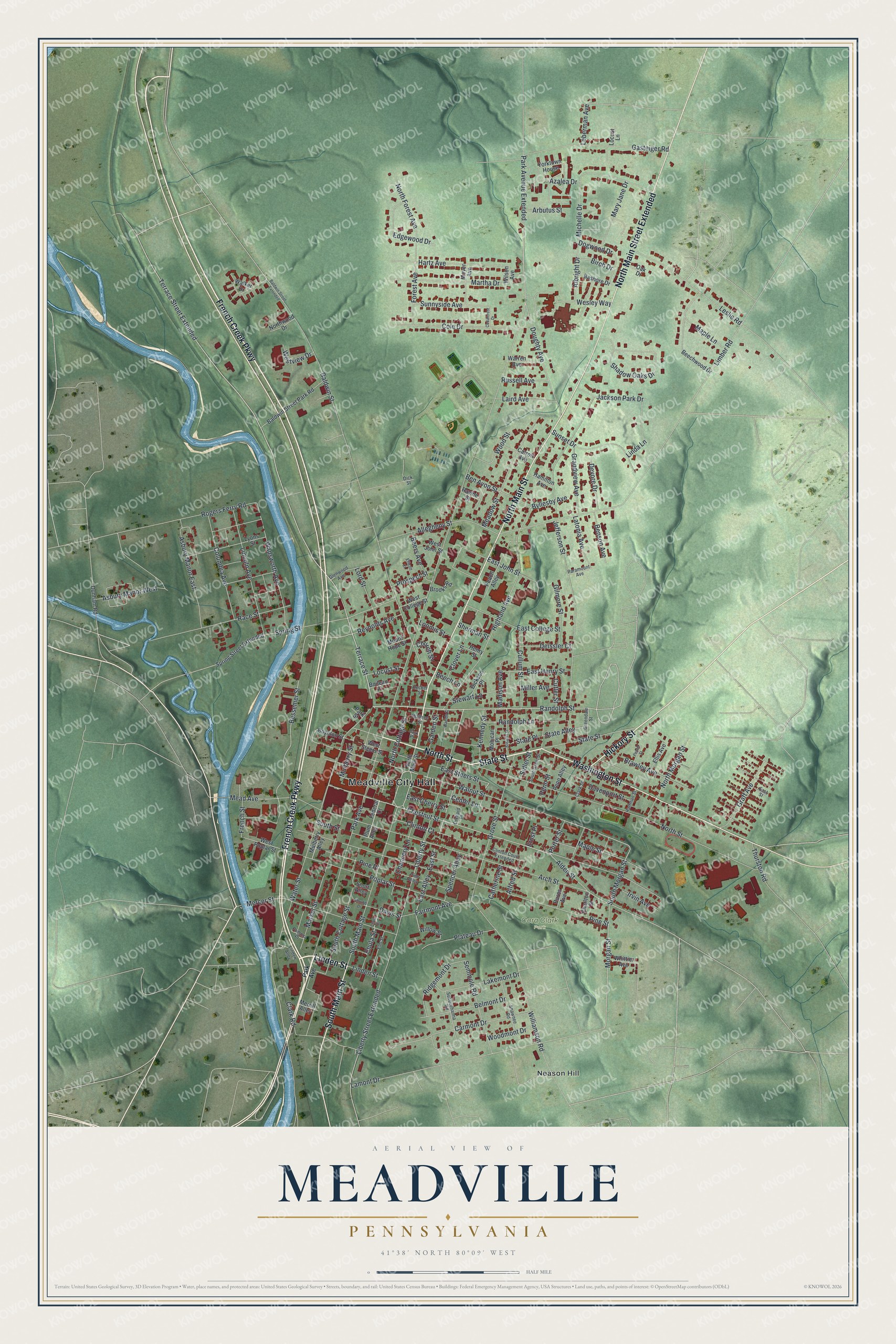
A new map of Meadville, Pennsylvania, made in 2026 and printed to order on thick archival matte paper.
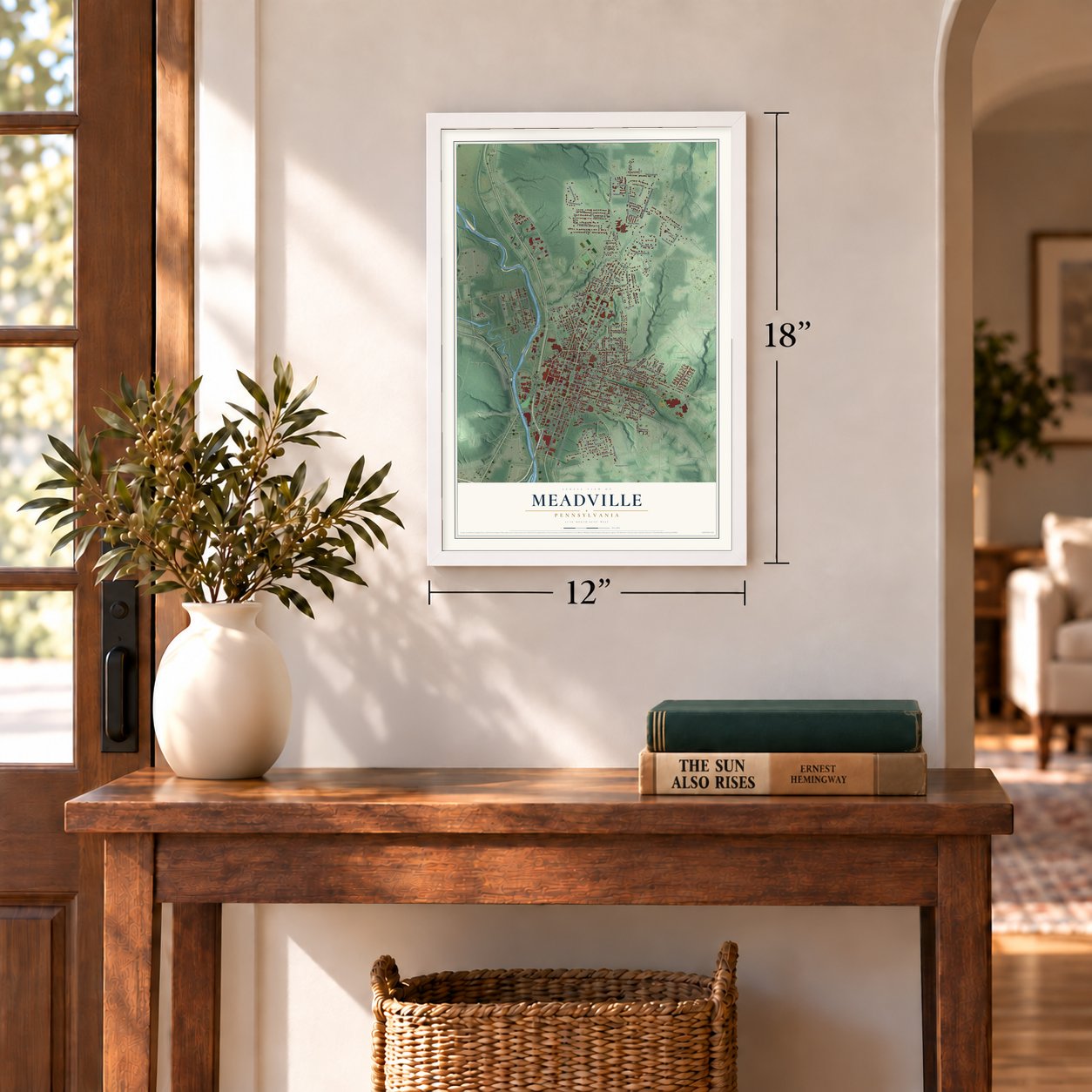
12" x 18" Archival Matte Print
A Map of Home. A Work of Art.
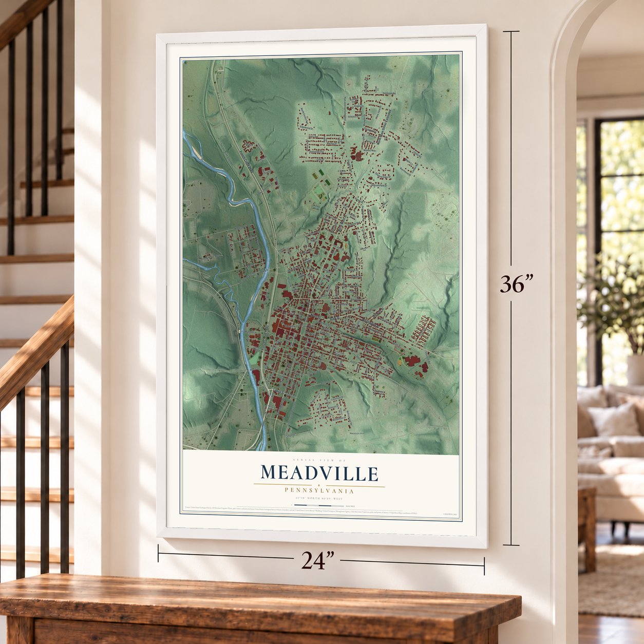
If you grew up in Meadville, went to Allegheny College, or still have family along North Main Street, this map gives you plenty to find. It's a modern aerial view of Meadville in Crawford County, Pennsylvania, drawn from modern data with a soft vintage look. Zoom in on the preview and look for your block.
Three ways to hang it
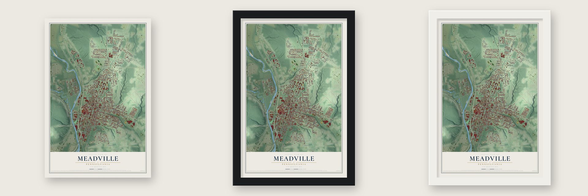
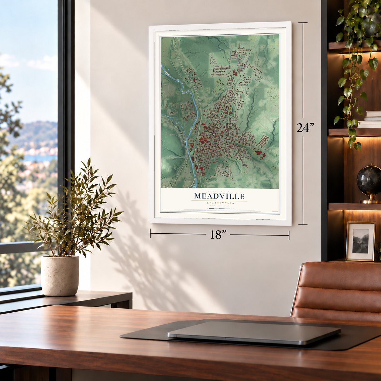
Unframed archival matte, a black wood frame or a white wood frame.
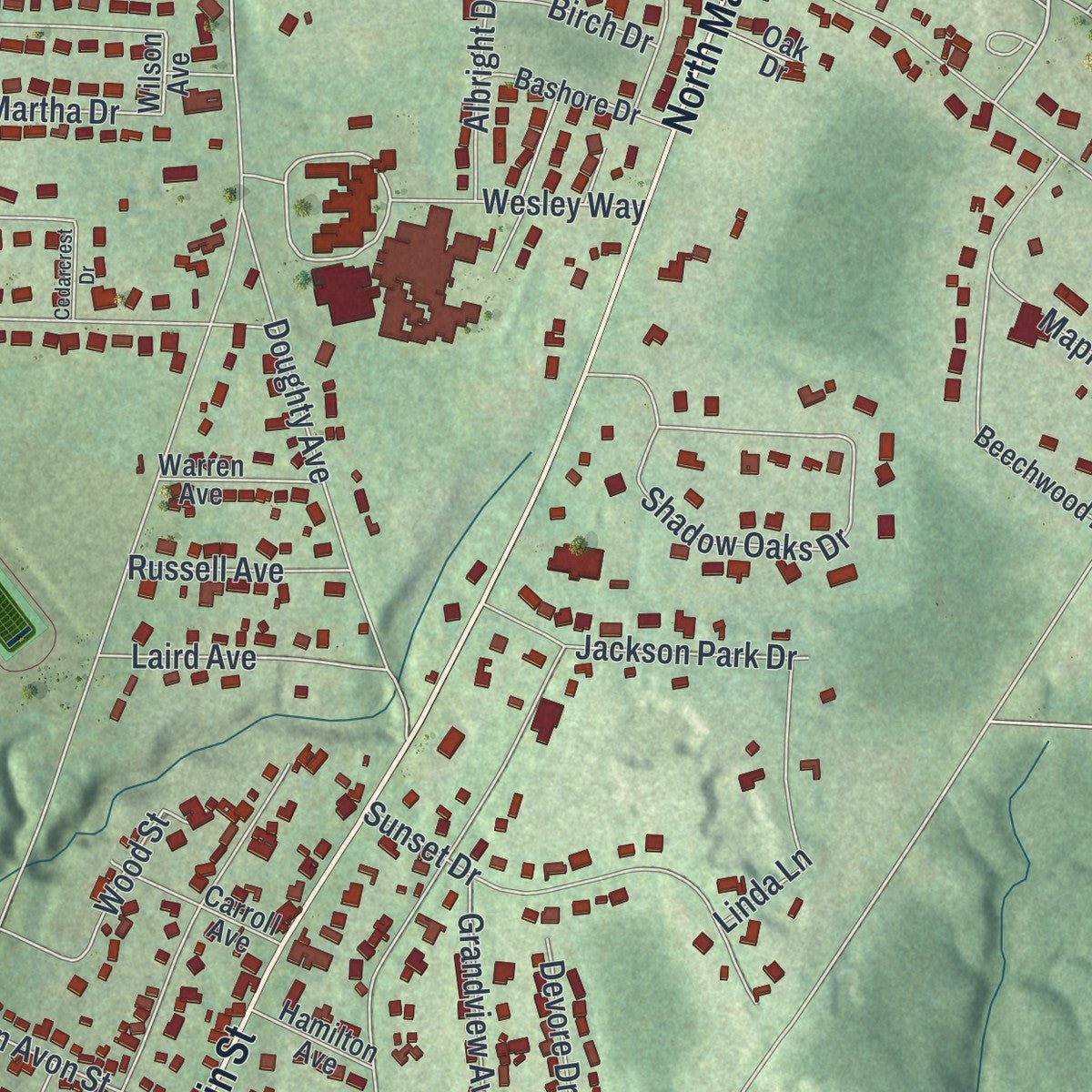
Up close
Real geography. Art worth displaying.
This map was created using accurate cartographic data and authoritative geographic sources, including the U.S. Geological Survey and the Census Bureau. The map brings together terrain, waterways, roads, and building detail. The majority of the streets are labeled, houses are accurately depicted, and the topography is derived from government sources. Combining local data with carefully composed color and shading leads to this beautifully detailed Meadville artwork for your wall.
Rather than simply showing street outlines, we’ve included as many of the street names as we could reasonably fit on the map while keeping their names legible. Zoom in on the high resolution preview to see exactly what’s on the map. We truly set out to create a statement piece for anyone who loves Meadville. So whether it’s for you, or a gift for someone you love, we hope this map of Meadville brings back fond memories.
Read the story behind this map of Meadville, Pennsylvania from 2026.

About Meadville, Pennsylvania
Meadville, the seat of Crawford County, had 13,050 residents at the 2020 census. Before the city's establishment, the area was ancestral Eriechronon land and later the site of the Lenape settlement of Cussewago. Settled by a party led by David Mead in 1788, the community's history includes Allegheny College, a longstanding public market, zipper manufacturing, and toolmaking.
- Town PlanDavid Mead laid out the town in 1793, and Meadville became the Crawford County seat when the county was formed in 1800.
- Allegheny CollegeTimothy Alden founded Allegheny College in April 1815; its first class began in 1816 with four male students.
- A Living MarketMeadville's Market House is Pennsylvania's oldest continuously operating market structure, and farmers markets are still held there on Saturdays.
- Zippers and ToolsTalon helped develop the zipper, while later tool and die shops earned Meadville the nickname Tool City.
- Diamond ParkReserved as the Diamond in the 1795 survey, today's Diamond Park has served civic and recreational purposes for more than two centuries.
Find your street
Names on the Meadville map
Every name below is printed on this map. Look for your street, your school, the park where you played, or the pond down the road.
Places and landmarks3
- Meadville City Hall
- Cora Clark Park
- Neason Hill
Streets and roads210
- French Creek Parkway
- Linden Street
- State Street
- North Street
- North Main Street
- South Main Street
- North Main Street Extended
- Washington Street
- Hickory Street
- Randolph Street
- Terrace Street Extended
- Terrace Street
- Chestnut Street
- Azalea Drive
- North Cottage Street
- Walnut Street
- Water Street
- South Cottage Street
- Reynolds Avenue
- Liberty Street
- Park Avenue
- Bessemer Street
- Alden Street
- Mead Avenue
- Limber Road
- Wesley Way
- Ridgemont Drive
- Chula Street
- Mercer Street
- Liberty Street Extended
Show all 210 streets
- Jefferson Street
- Pine Street
- Arch Street
- Baldwin Street
- Market Street
- Highland Avenue
- Lamont Drive
- Williamson Road
- Leslie Road
- East Alley
- East Street
- Poplar Street
- South Street
- Grove Street
- Park Avenue Extended
- Chancery Lane
- Shadow Oaks Drive
- Gasteiger Road
- Clinton Court
- Carmont Drive
- Rogers Ferry Road
- Asbury Manor East
- Cole Drive
- Spring Street
- Lincoln Avenue
- Race Street
- Wadsworth Avenue
- Prospect Street
- Martha Drive
- Doughty Avenue
- Hartz Avenue
- Meadow Street
- South Morgan Street
- Columbia Avenue
- Sunset Drive
- Clark Road
- North Morgan Street
- East College Street
- Allegheny Street
- Randolph Lane
- Seminole Road
- State Alley
- State Place
- Brawley Avenue
- Mulberry Street
- Belmont Drive
- Forest Avenue
- Edgewood Drive
- Graff Avenue
- Woodmont Drive
- Lord Street
- Maple Lane
- Sunnyside Avenue
- Cullum Street
- Lakemont Drive
- Clover Lane
- Stewart Lane
- Pine Place
- Fairmont Avenue
- Sidler Street
- Asbury Manor West
- East Henry Street
- Jackson Park Drive
- Mary Jane Drive
- Maple Street
- Grandview Avenue
- Dogwood Drive
- East John Street
- Linda Lane
- Wood Street
- Morgan Street
- North Forest Avenue
- Gilmore Street
- Center Lane
- Plateau Drive
- Laird Avenue
- East Steers Street
- Michelle Drive
- Albright Drive
- Byllesby Avenue
- Beers Avenue
- Latonia Avenue
- Ben Avon Street
- Kennedy Street
- Deissler Court
- Benson Avenue
- Madison Avenue
- Devore Drive
- Davenport Street
- Spencer Alley
- Irvin Avenue
- Penn Street
- Russell Avenue
- Thurston Road
- Westview Drive
- Leberman Avenue
- Alfred Street
- Garden Street
- East Cherry Street
- Catherine Street
- Locust Street
- Arbutus Street
- French Street
- Church Street
- Birch Drive
- Cutler Street
- Davis Street
- Porter Street
- Loomis Street
- Miller Avenue
- Sherman Street
- Beech Lane
- Ernst Place
- Boynton Street
- Plum Alley
- Spring Street Extended
- Wilson Avenue
- Willow Street
- Lyons Street
- West Steers Street
- Beechwood Drive
- Baldwin Street Park Road
- Walker Drive
- Yorktown House
- Mohican Place
- Bashore Drive
- Dickson Place
- Moyer Avenue
- Carroll Avenue
- West Poplar Street
- Mulberry Alley
- Henry Street
- Warren Avenue
- Penn Alley
- Ellis Avenue
- Whittier Avenue
- West College Street
- Dunham Road
- Hamilton Avenue
- West John Street
- Northwood Drive
- Brooks Road
- Federal Court
- Charlton Street
- Burns Avenue
- Peach Alley
- Mount Hope Street
- Oak Drive
- Boileau Place
- Merrill Alley
- Locust Lane
- Ravine Street
- Short Alley
- Park Street
- Pine Alley
- Susquehanna Road
- Shawnee Road
- Glenwood Avenue
- South Grant Street
- Elm Street
- Clinton Court Extended
- Clark Street
- Greendale Street
- Orchard Place
- Wallace Street
- Hartman Street
- Paramount Avenue
- Linden Alley
- Pomona Place
- Park Place
- Hecker Street
- Dick Street
- Baldwin Street Extended
- Chula Court
- Stewart Street
- Cedarcrest Drive
- Ellicott Court
- Waelde Court
- Peach Street
- Shrubb Drive
Names are listed as they appear on the printed map. Zoom into the product photos to find them.
The art of mapping a place
How This Map Was Made
Real places. Remarkable detail. Discover the layers that turn geographic data into a map of home.

The view from above
Aerial imagery reveals the character of the land: woodland, open fields, and the patterns of a place.

The shape of the land
Elevation data brings hills, valleys, and subtle changes in the landscape into view.

The details of home
Roads, waterways, and building footprints come together to make the map feel unmistakably local.

Geography becomes art
Considered color, shading, and typography bring the layers together in a map made for your wall.


Process illustrated with Mendon, Massachusetts. Aerial imagery: USDA NAIP. Terrain: USGS 3D Elevation Program. Map details and finished artwork: KNOWOL.
The Details
About This Print
Choose an archival matte print, or a black or white Ayous wood frame. The archival matte print is unframed.
Select your size and finish above to see the matching product image and price.
Materials & Craftsmanship
A contemporary map with the character of a classic atlas, printed on archival matte paper. Optional frames are made from Ayous wood.
Your printed map does not include the watermark shown in the full-map preview.
Shipping & Delivery
Free shipping within the United States. Every print is made to order in the USA.
Buying a gift? Add a note in your cart and we'll include it. We never put prices in the package.
Prints ship within 2 to 3 business days. Allow 7 to 10 days total from ordering for delivery. Timing may vary during holidays or periods of high order volume.
Read our shipping policy.
Returns and damaged prints
Each print is made to order. Change-of-mind refunds are not available after production.
If your print arrives damaged, misprinted or incorrect, contact support@knowol.com within 30 days of receiving it. Include your order number, photos and a description of the issue.
Read our full refund and replacement policy. For questions about your order, email support@knowol.com.
Find your town
Looking for another city?
Find a map of home in our Pennsylvania collection.
Nearby
Maps of towns near Meadville
Know someone from one of these towns? Their map makes a great gift.
 Fredericksburg
, Crawford County, Pennsylvania
From $39.99See the map
 West Mead
, Pennsylvania
From $39.99See the map
 Kerrtown
, Pennsylvania
From $39.99See the map
More maps nearby: Vernon, Saegertown, East Mead, Woodcock and Hayfield.