
Search for another town





Free U.S. delivery 7 to 10 days after you order
Milan, Tennessee Map Art
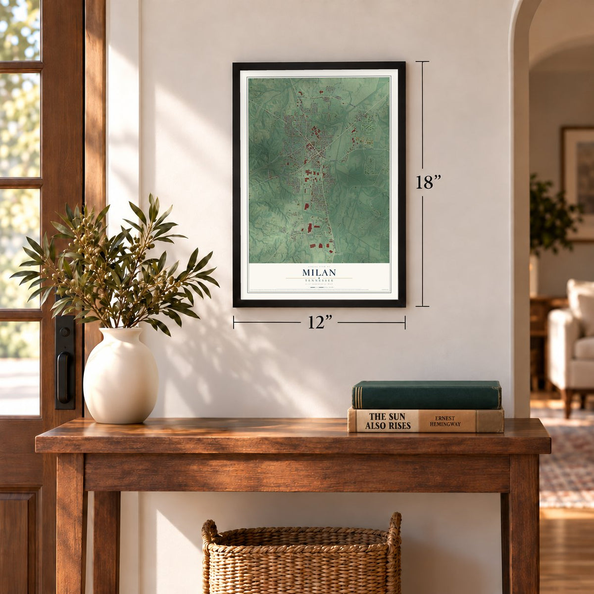
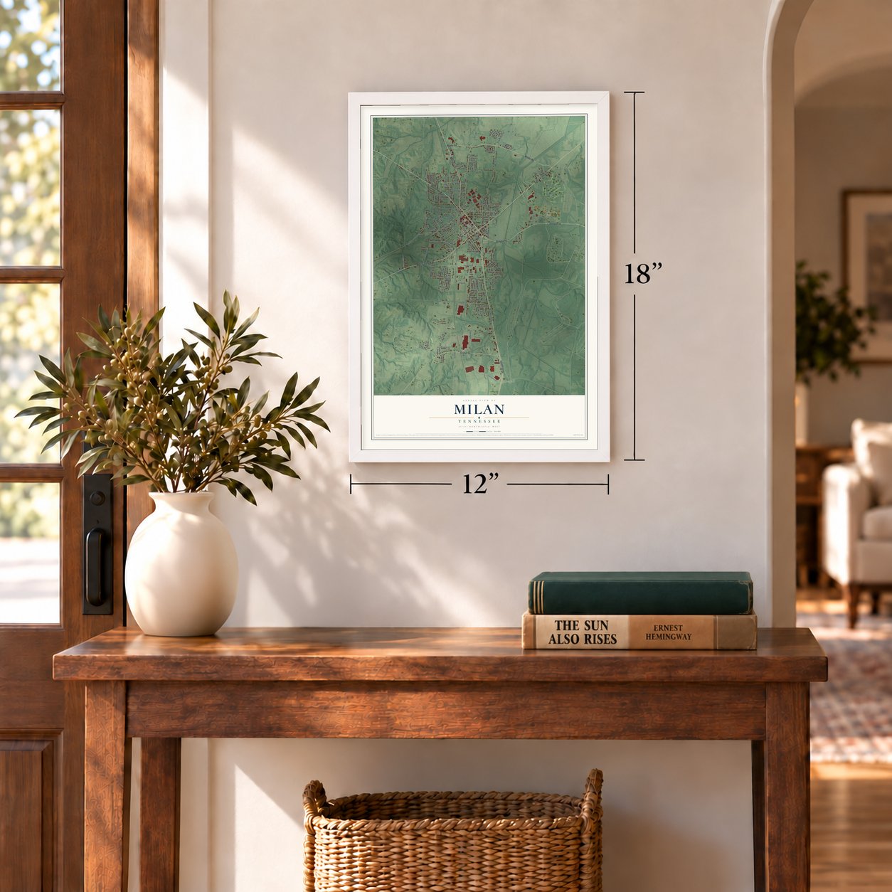
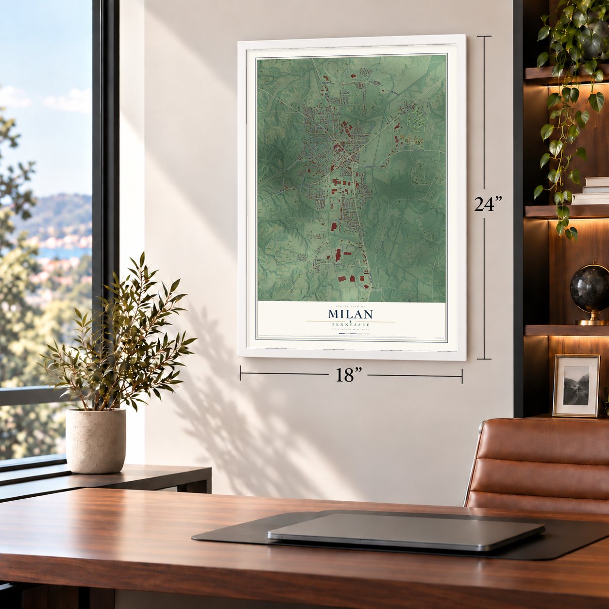
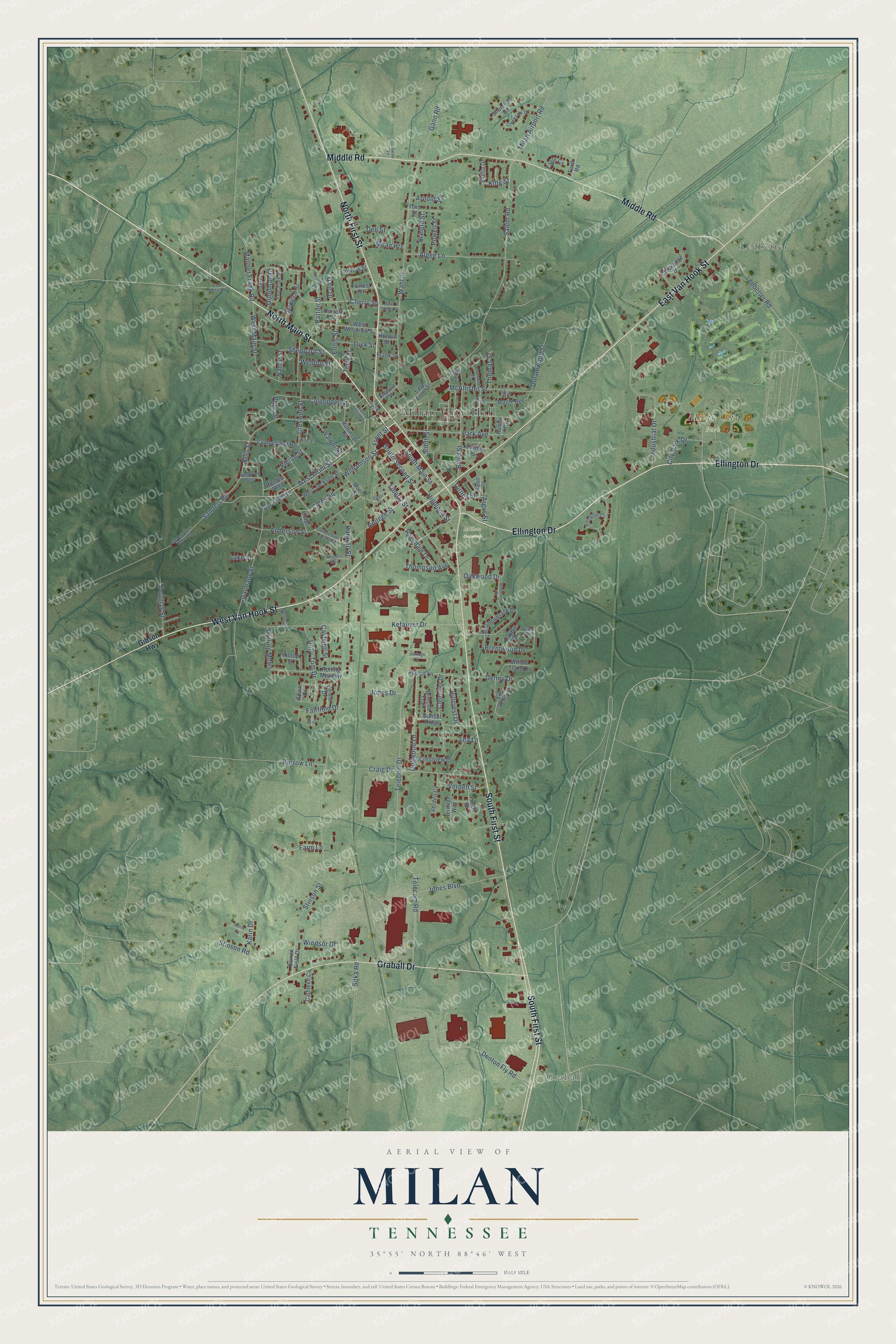
A new map of Milan, Tennessee, made in 2026 and printed to order on thick archival matte paper.
12" x 18" Archival Matte Print
A Map of Home. A Work of Art.
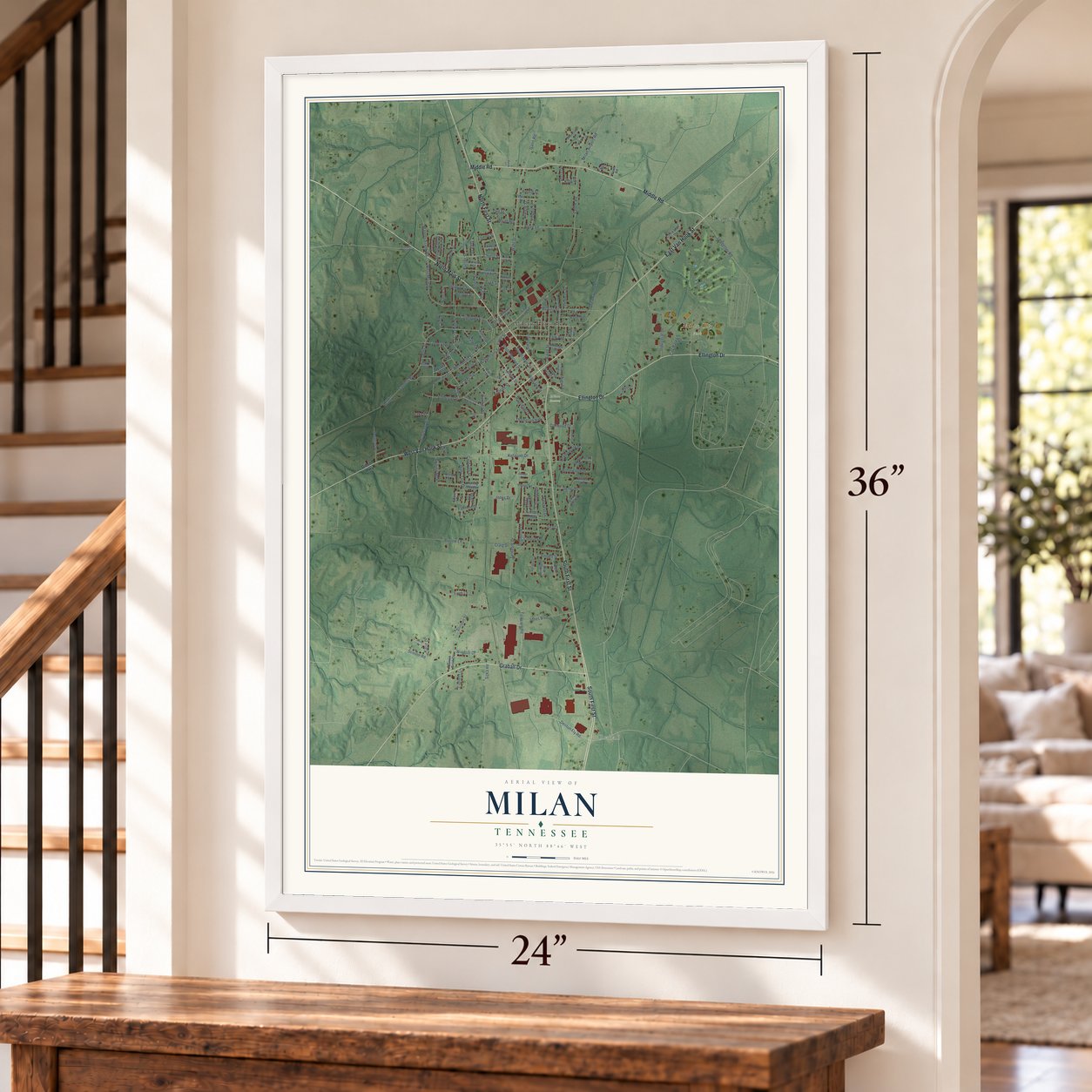
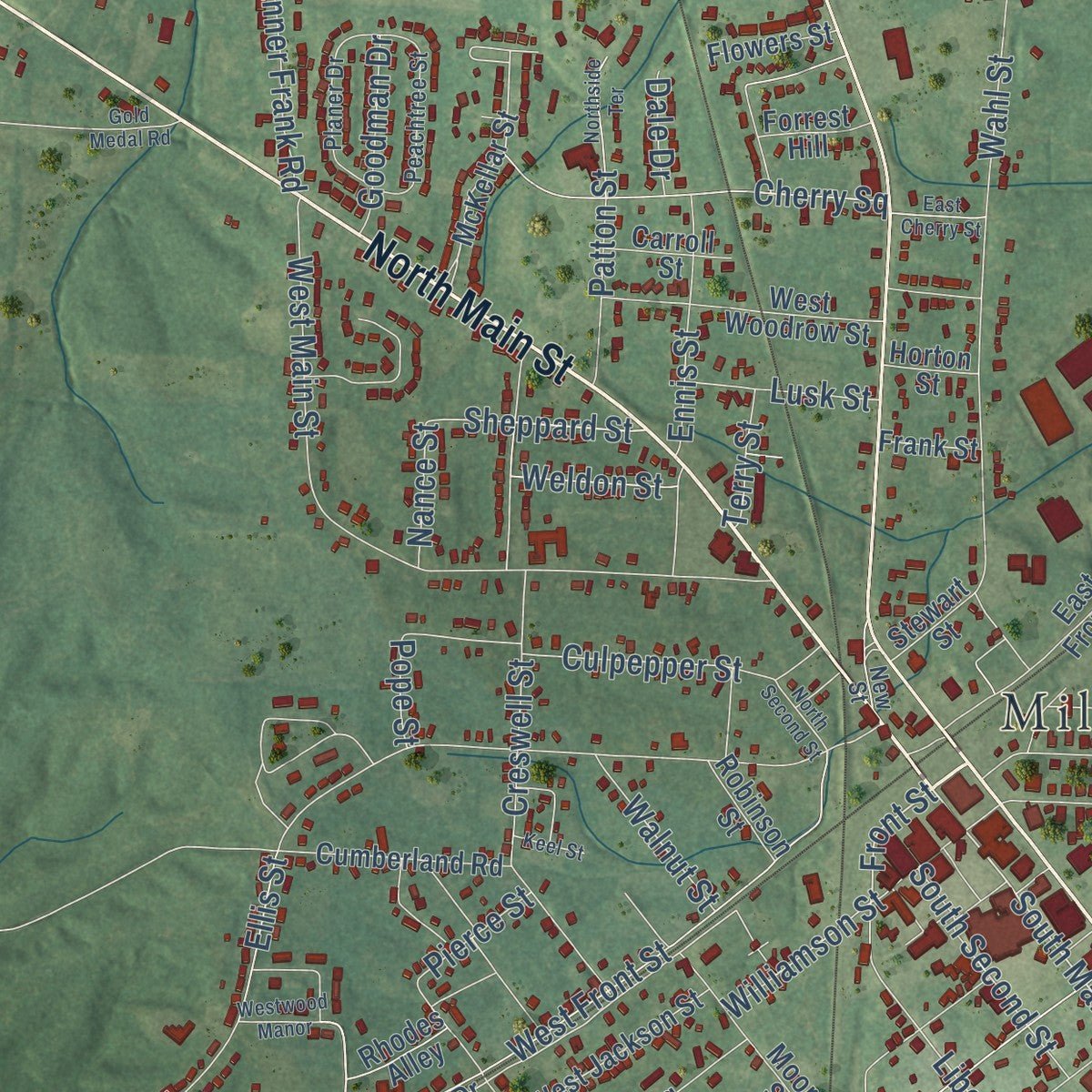
Explore Milan, Tennessee from a whole new perspective. Created using aerial imagery and detailed geographic data, this map captures Milan building by building, with labeled streets, familiar landmarks, and shaded topographical relief that highlights the natural contours of the landscape.
Combining modern data with the timeless character of a vintage atlas, this map is just as interesting up close as it is beautiful on the wall. Whether you grew up in Milan, spent memorable years there, or call it home today, this unique map is a great way to celebrate a place that means something to you. Zoom in on the preview to look for your street, and then order a print to put your memories on the wall.
Three ways to hang it
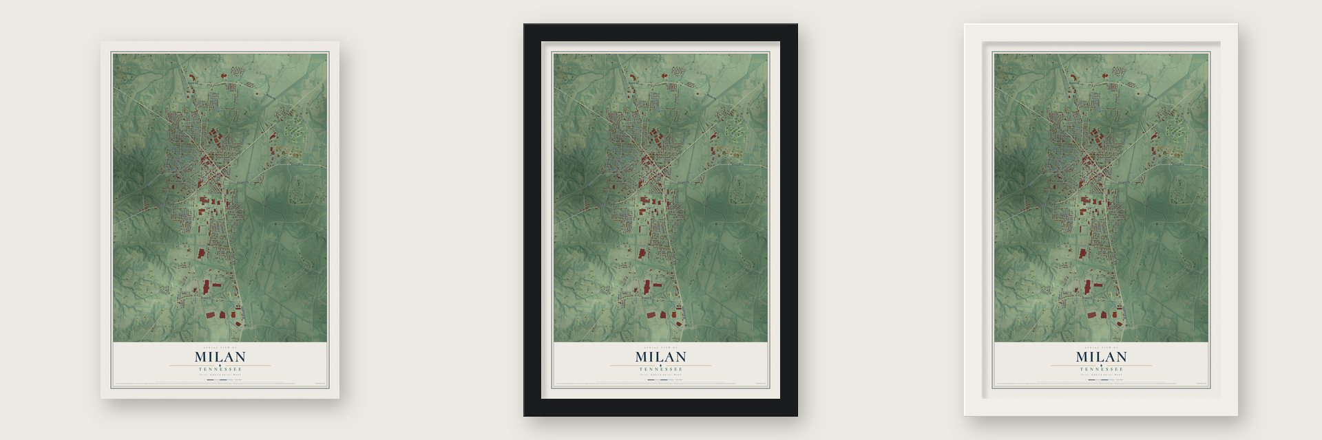
Unframed archival matte, a black wood frame or a white wood frame.
Up close
Geography Worth Displaying
This map was created using accurate cartographic data and authoritative geographic sources, including the U.S. Geological Survey and the Census Bureau. The map brings together terrain, waterways, roads, and building detail. The majority of the streets are labeled, houses are accurately depicted, and the topography is derived from government sources. Combining local data with carefully composed color and shading leads to this beautifully detailed Milan artwork for your wall.
Rather than simply showing street outlines, we’ve included as many of the street names as we could reasonably fit on the map while keeping their names legible. Zoom in on the high resolution preview to see exactly what’s on the map. We truly set out to create a statement piece for anyone who loves Milan. So whether it’s for you, or a gift for someone you love, we hope this map of Milan brings back fond memories.
Read the story behind this map of Milan, Tennessee from 2026.
About Milan, Tennessee
Milan is a city of 8,171 people and the largest in Gibson County. It began in 1858 on land owned by B. A. Williamson and John Sanford, where John G. Shepherd put up a small house and opened a grocery. Local tradition says the name came from Williamson himself: when a railroad surveyor asked him whose land this was, he answered that it was his, and "my land" became Milan.
A year after the founding, the post office at Shady Grove moved to the new town, and its first two doctors, W. R. Rooks and J. B. Hinson, came in 1860. The Tennessee Legislature incorporated Milan in 1866, and Shepherd served as its first mayor. When the Illinois Central Railroad was finished in 1873, Milan grew into a trading center, and the Grand Pacific Hotel opened beside the railroad junction in 1878.
- Bullet TownWork began in 1941 on an ordnance plant at Wolf Creek and a depot at Milan, and in 1945 the two became the Milan Arsenal, later the Milan Army Ammunition Plant. Over 10,000 people worked there in World War II.
- Fluoride first, in 1951Dr. Robert P. Denney led the effort that made Milan the first city in Tennessee, and the second in the Southeast, to add fluoride to its drinking water.
- Where no-till farming startedNo-till farming in Tennessee began in 1981 at the University of Tennessee's agricultural experiment station in Milan. Every even-numbered year the station still holds the Milan No-Till Field Day, set for July's fourth Thursday, and its West Tennessee Agricultural Museum holds more than 2,600 artifacts and farm tools.
- Firsts for the youngThe mid-South's first Little League team was formed in Milan in 1949. Forty years later, in 1989, the town set up the Milan Endowment for Growth in Academics, the first private community endowment for public schools in Tennessee, which spends only its income so the fund keeps paying out.
- The Main Street post officeThe contractor Algernon Blair built Milan's post office at 382 S. Main St., near city hall. The building joined the National Register in 1987.
Find your street
Names on the Milan map
Every name below is printed on this map. Look for your street, your school, the park where you played, or the pond down the road.
Places and landmarks5
- Milan City Hall
- Graball
- Milan Cemetery
- Milan City Park
- Ledbetter
Streets and roads161
- North Main Street
- Ellington Drive
- West Van Hook Street
- South First Street
- East Van Hook Street
- North First Street
- Middle Road
- Graball Drive
- South Main Street
- City Park Drive
- Front Street
- West Front Street
- Liberty Street
- Sheppard Street
- Salem Road
- Creswell Street
- Ledbetter Road
- Turner Street
- Stinson Street
- Wahl Street
- Telecom Drive
- Denton Fly Road
- Kefauver Drive
- Ellis Street
- West Main Street
- Industrial Drive
- College Street
- Anderson Street
- Garmany Street
- Craig Drive
Show all 161 streets
- Telecom Road
- Baird Street
- Park Avenue
- McAllister Street
- Sanders Road
- Cherry Square
- Clemmer Drive
- Algee Lane
- Dogwood Lane
- Jones Boulevard
- Dreamwood Street
- Brentwood Drive
- Stinson Road
- Sitka Road
- Ennis Street
- Dolly Tom Drive
- Manner Frank Road
- Burrow Lane
- Williamson Street
- Windsor Drive
- Cantrell Street
- South Second Street
- Culpepper Street
- Smith Street
- Highland Street
- Rolling Mdws
- Oakwood Drive
- Douglas Street
- Cates Square
- Farm Lane
- Patton Street
- Gann Road
- Caldwell Street
- Verdell Street
- Milan Airport Road
- Hillcrest Drive
- Ragsdale Drive
- Dell Street
- Fairfield Drive
- Denny Drive
- Thompson Avenue
- Milan Heights
- Powell Street
- Bringle Street
- Goodman Drive
- Walnut Street
- Lusk Street
- Jones Drive
- Thomas Street
- Weldon Street
- Lea Lane
- Pierce Street
- Arnold Street
- Argus Street
- Karin Drive
- Nance Street
- Terry Street
- King Street
- Dale Drive
- Lake Street
- Pope Street
- Gibson Highway
- McKellar Street
- Hartsfield Drive
- Meadowbrook Drive
- East Front Street
- Crestview Drive
- West Woodrow Street
- Phelps Lane
- Sunset Ridge
- Cumberland Road
- Moore Street
- Maple Avenue
- Rolling Meadow
- Chickadee Drive
- West Jackson Street
- East Denny Drive
- Robinson Street
- Willow Trace Drive
- Belew Drive
- Mimosa Trail
- Fields Drive
- Oakhill Drive
- Barren Field Drive
- Cathleen Cv
- Heritage Way
- Ford Street
- Spain Drive
- Barham Street
- Verdell Cv
- Flowers Street
- Carroll Street
- Shelia Drive
- Shoreline Drive
- Forrest Hill
- Rhodes Alley
- Eagle Cv
- Stewart Street
- Hays Street
- Frank Street
- Horton Street
- Hilltop Street
- Ford Road
- Hunter Heights
- Ratliff Street
- Ellington Cv
- Peachtree Street
- Hill Street
- Planer Drive
- Creekside Drive
- New Street
- Acorn Drive
- Molar Drive
- East Broad Street
- Cedar Square
- Westwood Manor
- College Street Extended
- Brookwood Drive
- Northside Terrace
- Sanders Store Milan Road
- Oaklawn Street
- Reasons Boulevard
- East Cherry Street
- Gold Medal Road
- Scotts Cv
- North Second Street
- Heritage Drive
- Keel Street
- Earl Cv
- Elm Street
- Randy Lane
Names are listed as they appear on the printed map. Zoom into the product photos to find them.
The art of mapping a place
How This Map Was Made
Real places. Remarkable detail. Discover the layers that turn geographic data into a map of home.

The view from above
Aerial imagery reveals the character of the land: woodland, open fields, and the patterns of a place.

The shape of the land
Elevation data brings hills, valleys, and subtle changes in the landscape into view.

The details of home
Roads, waterways, and building footprints come together to make the map feel unmistakably local.

Geography becomes art
Considered color, shading, and typography bring the layers together in a map made for your wall.


Process illustrated with Mendon, Massachusetts. Aerial imagery: USDA NAIP. Terrain: USGS 3D Elevation Program. Map details and finished artwork: KNOWOL.
The Details
About This Print
Choose an archival matte print, or a black or white Ayous wood frame. The archival matte print is unframed.
Select your size and finish above to see the matching product image and price.
Materials & Craftsmanship
A contemporary map with the character of a classic atlas, printed on archival matte paper. Optional frames are made from Ayous wood.
Your printed map does not include the watermark shown in the full-map preview.
Shipping & Delivery
Free shipping within the United States. Every print is made to order in the USA.
Buying a gift? Add a note in your cart and we'll include it. We never put prices in the package.
Prints ship within 2 to 3 business days. Allow 7 to 10 days total from ordering for delivery. Timing may vary during holidays or periods of high order volume.
Read our shipping policy.
Returns and damaged prints
Each print is made to order. Change-of-mind refunds are not available after production.
If your print arrives damaged, misprinted or incorrect, contact support@knowol.com within 30 days of receiving it. Include your order number, photos and a description of the issue.
Read our full refund and replacement policy. For questions about your order, email support@knowol.com.
Find your town
Looking for another city?
Find a map of home in our Tennessee collection, or any town in the country.
Nearby
Maps of towns near Milan
Know someone from one of these towns? Their map makes a great gift.
 Gibson
, Tennessee
From $39.99See the map
 Atwood
, Tennessee
From $39.99See the map
 Medina
, Tennessee
From $39.99See the map
More maps nearby: Lavinia, Trezevant, Humboldt, McLemoresville and Three Way.