
Search for another town



Free U.S. delivery 7 to 10 days after you order
Milledgeville, Georgia Map Art
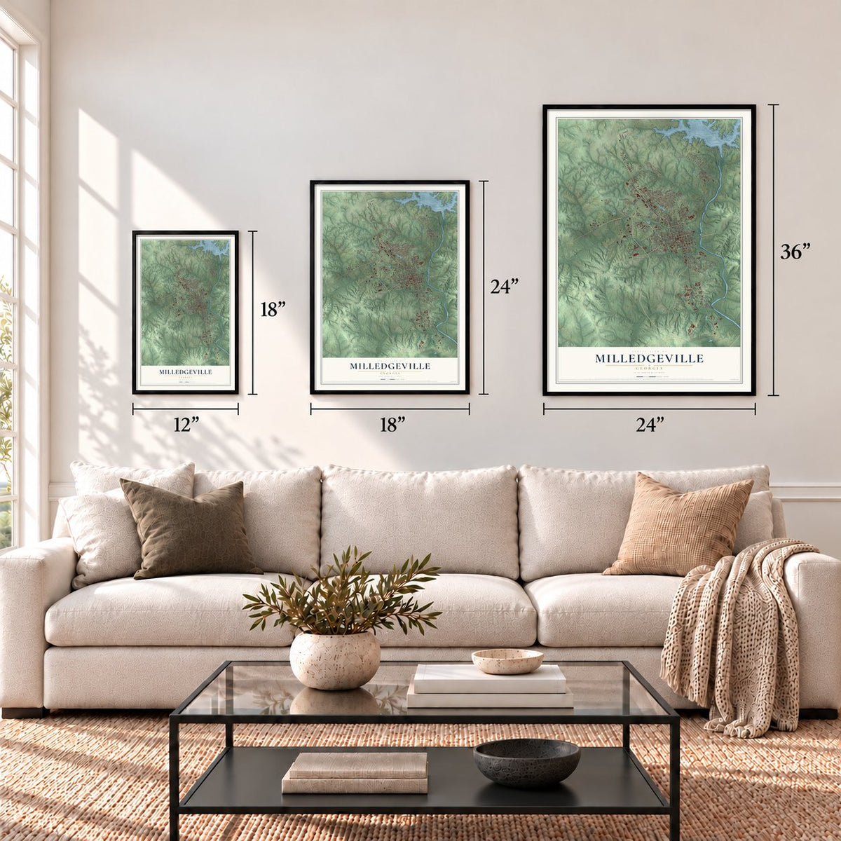
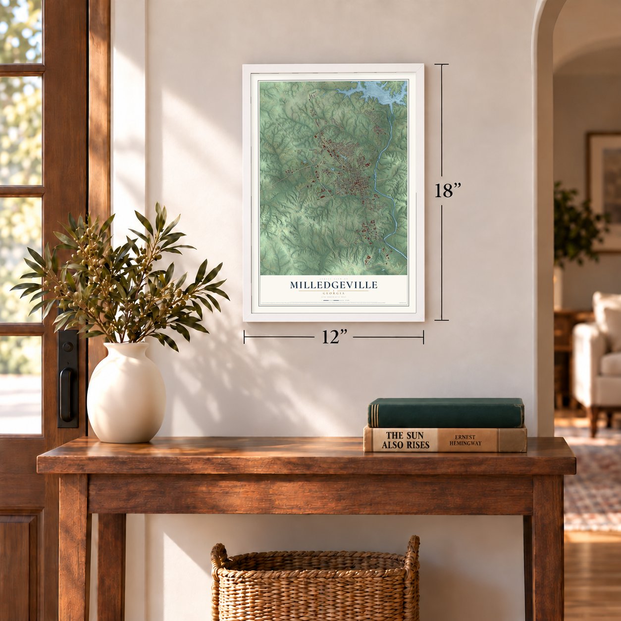
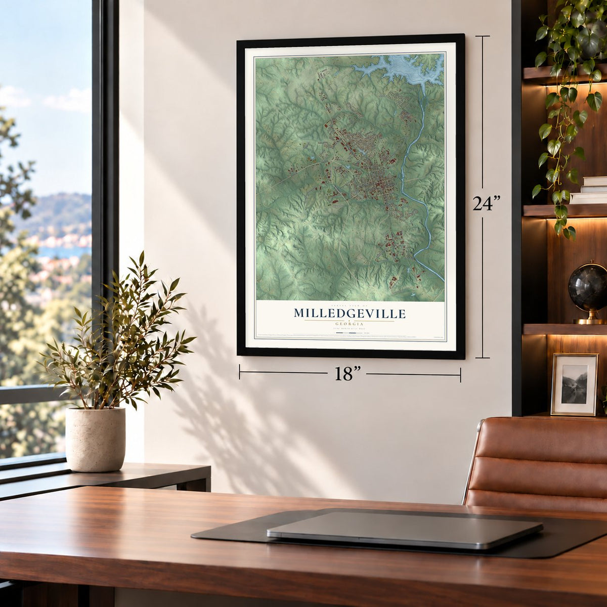
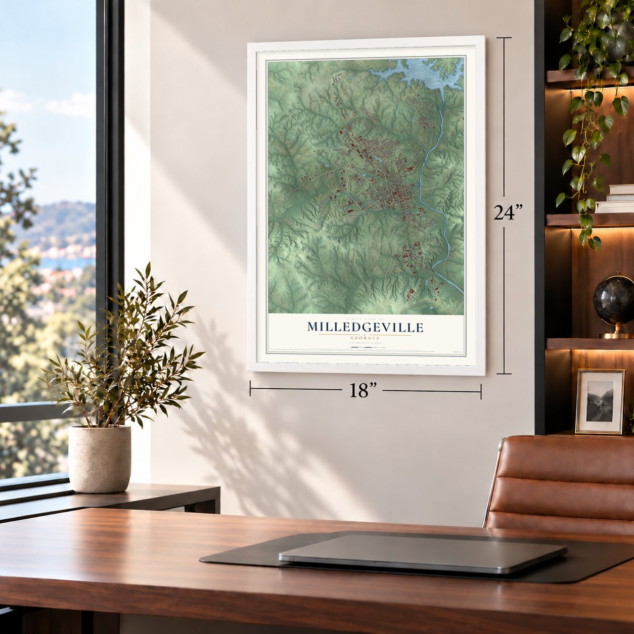
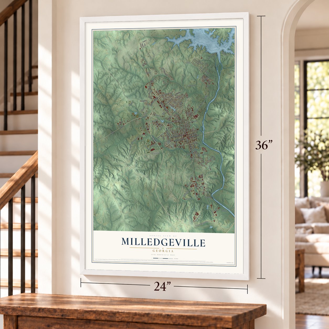
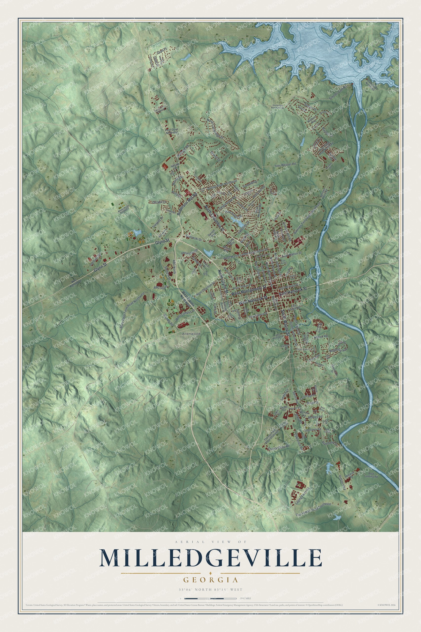
A new map of Milledgeville, Georgia, made in 2026 and printed to order on thick archival matte paper.
12" x 18" Archival Matte Print
A Map of Home. A Work of Art.
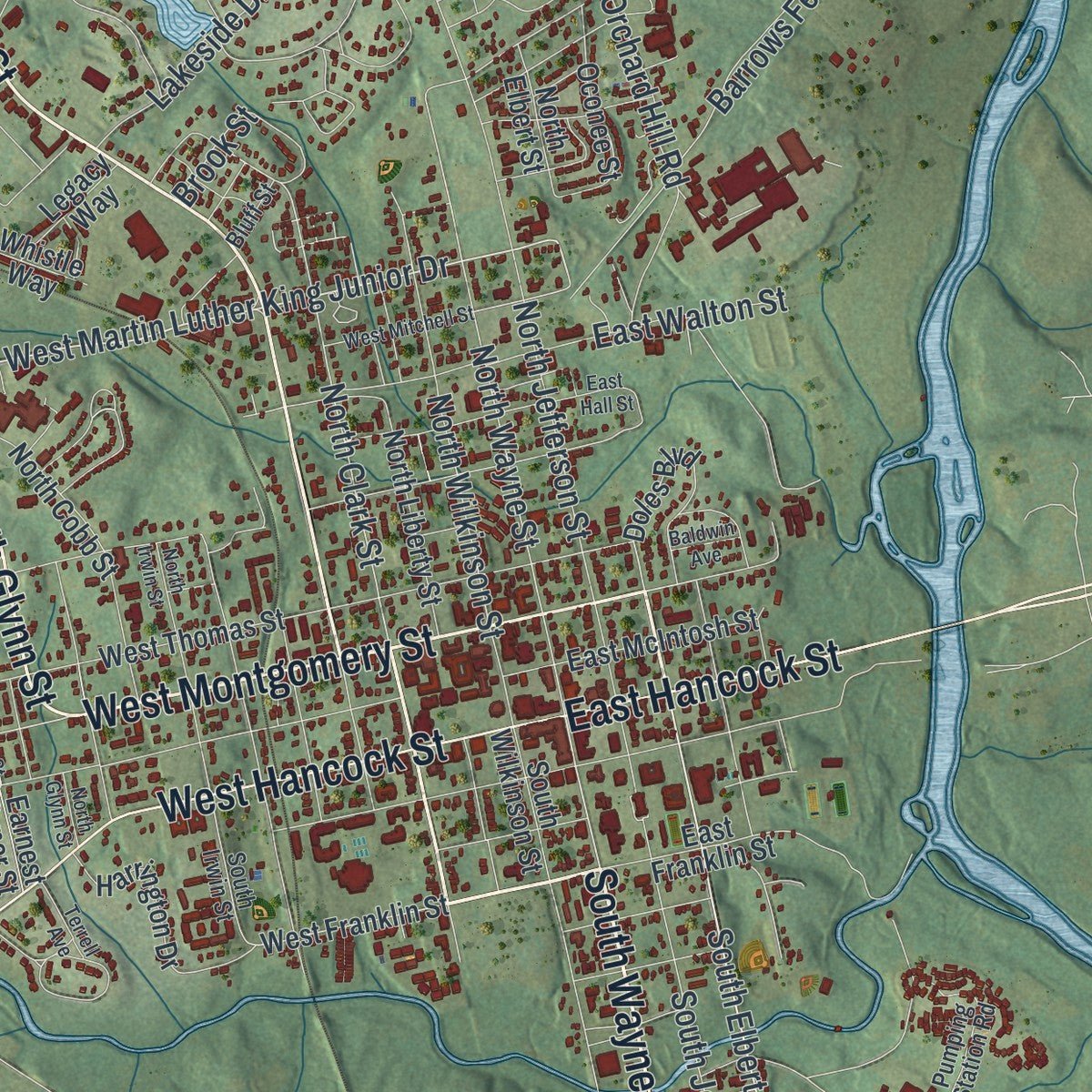
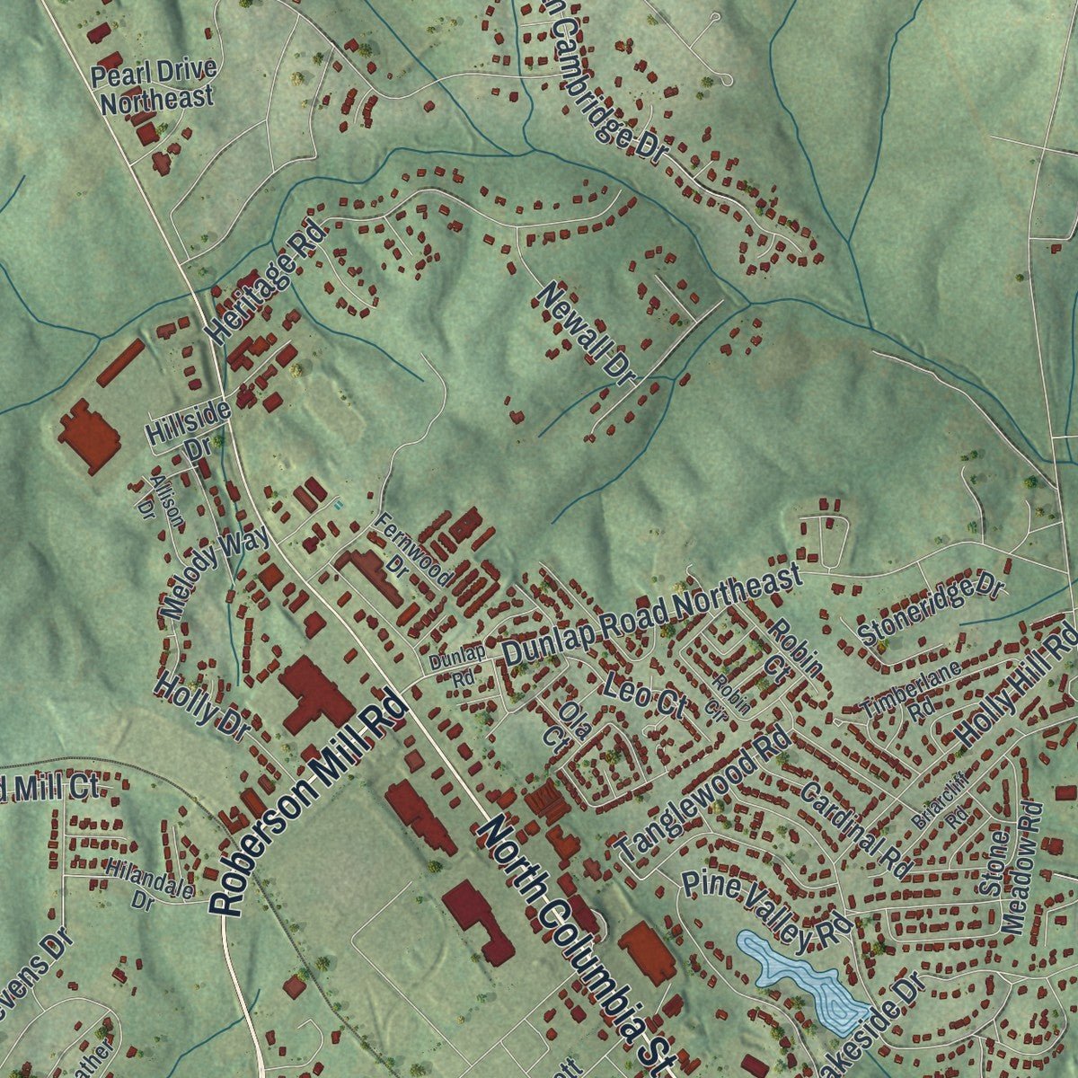
Explore Milledgeville, Georgia from a whole new perspective. Created using aerial imagery and detailed geographic data, this map captures Milledgeville building by building, with labeled streets, familiar landmarks, and shaded topographical relief that highlights the natural contours of the landscape.
Combining modern data with the timeless character of a vintage atlas, this map is just as interesting up close as it is beautiful on the wall. Whether you grew up in Milledgeville, spent memorable years there, or call it home today, this unique map is a great way to celebrate a place that means something to you. Zoom in on the preview to look for your street, and then order a print to put your memories on the wall.
Three ways to hang it
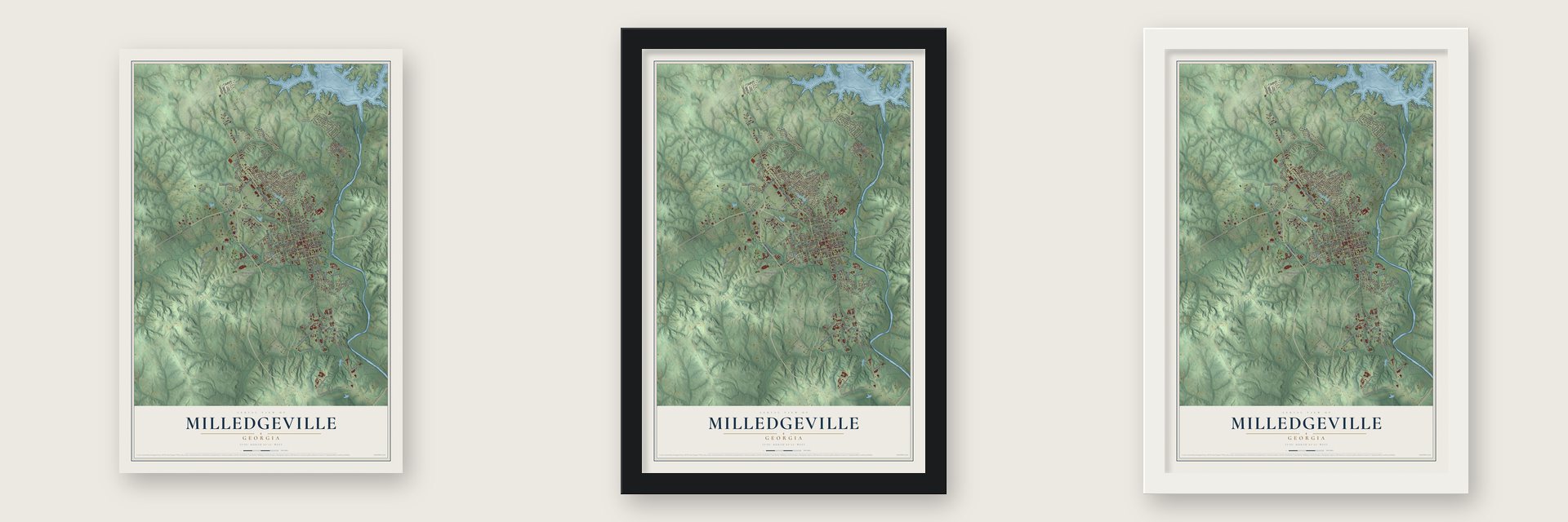
Unframed archival matte, a black wood frame or a white wood frame.
Up close
Geography Worth Displaying
This map was created using accurate cartographic data and authoritative geographic sources, including the U.S. Geological Survey (USGS) and FEMA. The map brings together terrain, waterways, roads, and building detail. The majority of the streets are labeled, houses are accurately depicted, and the topography is derived from government sources. Combining local data with carefully composed color and shading leads to this beautifully detailed Milledgeville artwork for your wall.
Rather than simply showing street outlines, we’ve included as many of the street names as we could reasonably fit on the map while keeping their names legible. Zoom in on the high resolution preview to see exactly what’s on the map. We truly set out to create a statement piece for anyone who loves Milledgeville. So whether it’s for you, or a gift for someone you love, we hope this map of Milledgeville brings back fond memories.
Explore the full map of Milledgeville, Georgia and read about the local places it shows.

About Milledgeville, Georgia
Milledgeville is a city of 17,070 people on the Oconee River. It is the county seat of Baldwin County. In the 1802 Treaty of Fort Wilkinson, the Muscogee (Creek) Nation gave up its land west of the Oconee. Georgia then chose this spot for a new capital near the middle of the state. The city was founded in 1803 and named for Governor John Milledge. Its streets were laid out on a grid, like Savannah and Washington, D.C.
Milledgeville was the capital from 1804 to 1868. In those years the state built the statehouse now called the Old State Capitol. It also built the Executive Mansion, now the Old Governor's Mansion. Cotton trade, banks, hotels and newspapers grew up around them. In 1868 the General Assembly moved the capital to Atlanta, and the town lost people. Schools helped it recover. Middle Georgia Military and Agricultural College opened on the old capitol grounds in 1879. Georgia Normal and Industrial College opened on the old prison grounds in 1889.
- Secession vote in 1861Abraham Lincoln won the election of 1860. Soon after, Georgia's secession convention met in Milledgeville on January 16, 1861, with about 300 voting delegates. On January 19 they passed the Ordinance of Secession, 208 to 80. Georgia became the fifth state to leave the Union.
- Sherman's army in 1864In November 1864, Union General William T. Sherman marched into Milledgeville with 30,000 troops. They were on the March to the Sea, from Atlanta to Savannah. The town escaped heavy damage. Still, soldiers wrecked military sites, took grain and livestock and looted homes. When the war ended in 1865, Confederate money was worthless, and many people traded goods to get what they needed.
- A hospital of 12,000 patientsWhile Milledgeville was the capital, the state opened the Georgia State Lunatic, Idiot, and Epileptic Asylum here. It was renamed Georgia State Sanitarium in 1897. Later it became Central State Hospital. By the 1960s it held more than 12,000 patients, one of the largest mental hospitals in the country. The asylum's Central Building and its Storehouse are both on the National Register.
- Lake Sinclair, 1953The Georgia Power Company dammed the Oconee River in 1953. The dam made Lake Sinclair, a lake of 15,300 acres just north of the city. The lake brought boaters and other visitors. Later, restoration work downtown in the 1980s and 1990s drew people who came to see the old buildings.
Find your street
Names on the Milledgeville map
Every name below is printed on this map. Look for your street, your school, the park where you played, or the pond down the road.
Places and landmarks2
- Hardwick
- Allenwood
Streets and roads152
- Roberson Mill Road
- West Montgomery Street
- South Wayne Street
- North Glynn Street
- Glynn Street
- North Columbia Street
- West Hancock Street
- East Hancock Street
- Vinson Highway
- South Elbert Street
- Broad Street
- Badowski Drive
- West Martin Luther King Junior Drive
- Swint Avenue
- Magnolia Avenue
- North Wayne Street
- North Clark Street
- North Jefferson Street
- Blandly Road
- Sussex Drive
- Perimeter Road
- Barrows Ferry Road Northeast
- Laying Farm Road
- West Charlton Street
- Sinclair Dam Road
- South Jefferson Street
- Ivey Weaver Road
- ABC North
- Lawrence Road
- Carl Vinson Road Southeast
Show all 152 streets
- North Wilkinson Street
- Pine Valley Road
- State Dairy Farm Road Northwest
- Heritage Road
- Dunlap Road Northeast
- North Cambridge Drive
- Ind Park Road
- Lakeside Drive
- Tanglewood Road
- Central Shop Road
- Orchard Hill Road
- Leo Court
- Nelson Road
- Holly Hill Road
- East Walton Street
- West Campus Drive
- Stevens Drive
- Linda Drive
- Shop Road
- Stadium Drive
- Riverbend Drive
- Brook Street
- Newall Drive
- Pine Avenue
- Linden Court
- Old Mill Court
- Holly Drive
- Quail Place
- Mayfair Court
- Lake Drive
- ABC South
- Ouail Place
- Mobley Road
- Center Street
- West Bypass Northwest
- Lewis Court
- West Franklin Street
- North Elbert Street
- Southside Drive
- Depot Circle
- Garrett Way
- Earnest Byner Street
- West Thomas Street
- South Wilkinson Street
- South Warren Street
- North Cobb Street
- Thomas Field Road Southeast
- East Franklin Street
- Pearl Drive Northeast
- River Ridge Road Northeast
- Stone Meadow Road
- North Liberty Street
- Barrows Ferry Road
- Harrington Drive
- Cardinal Road
- Doles Boulevard
- Oconee Street
- East McIntosh Street
- Melody Way
- Dam Road Northeast
- Yarborough Drive
- Boat Landing Road
- Laboratory Road
- Stoneridge Drive
- Brantley Way
- Hurst Drive
- Abbatoir Road
- Legacy Way
- Whistle Way
- Robin Court
- By Pass Road
- Windsor Way
- Hillside Drive
- Boone Circle
- Cox Circle
- Ola Court
- West Andrews Street
- South Irwin Street
- Oak Avenue
- Pumping Station Road
- Meriweather Circle
- Long Leaf Trail
- Hilandale Drive
- Timberlane Road
- Meeks Road Northwest
- Hillview Drive
- Oakdale Road
- Fountain Street
- Turkey Run
- Karen Circle
- Dundee Road
- Thomas Field Road
- Peacock Street
- Sussex Court
- Fernwood Drive
- Bluff Street
- Twin Drive
- Pine Street
- West Highway 22
- Dunlap Road
- Longino Road
- Briarcliff Road
- Grandview Drive Northeast
- North Irwin Street
- Robin Circle
- Ernest Byner Street
- Sinclair Dam Road Northeast
- Pennington Road
- East Hall Street
- West Mitchell Street
- Perry Drive
- Bostick Road
- Marshall Road Northeast
- Garrard Drive
- Sussex Way
- Allison Drive
- Effingham Road
- West Thomas Court
- Pine Knoll Drive
- Terrell Avenue
- Baldwin Avenue
- Rock Hill Road
Names are listed as they appear on the printed map. Zoom into the product photos to find them.
The art of mapping a place
How This Map Was Made
Real places. Remarkable detail. Discover the layers that turn geographic data into a map of home.

The view from above
Aerial imagery reveals the character of the land: woodland, open fields, and the patterns of a place.

The shape of the land
Elevation data brings hills, valleys, and subtle changes in the landscape into view.

The details of home
Roads, waterways, and building footprints come together to make the map feel unmistakably local.

Geography becomes art
Considered color, shading, and typography bring the layers together in a map made for your wall.


Process illustrated with Mendon, Massachusetts. Aerial imagery: USDA NAIP. Terrain: USGS 3D Elevation Program. Map details and finished artwork: KNOWOL.
The Details
About This Print
Choose an archival matte print, or a black or white Ayous wood frame. The archival matte print is unframed.
Select your size and finish above to see the matching product image and price.
Materials & Craftsmanship
A contemporary map with the character of a classic atlas, printed on archival matte paper. Optional frames are made from Ayous wood.
Your printed map does not include the watermark shown in the full-map preview.
Shipping & Delivery
Free shipping within the United States. Every print is made to order in the USA.
Buying a gift? Add a note in your cart and we'll include it. We never put prices in the package.
Prints ship within 2 to 3 business days. Allow 7 to 10 days total from ordering for delivery. Timing may vary during holidays or periods of high order volume.
Read our shipping policy.
Returns and damaged prints
Each print is made to order. Change-of-mind refunds are not available after production.
If your print arrives damaged, misprinted or incorrect, contact support@knowol.com within 30 days of receiving it. Include your order number, photos and a description of the issue.
Read our full refund and replacement policy. For questions about your order, email support@knowol.com.
Find your town
Looking for another city?
Find a map of home in our Georgia collection, or any town in the country.
Nearby
Maps of towns near Milledgeville
Know someone from one of these towns? Their map makes a great gift.
 Hardwick
, Georgia
From $39.99See the map
 Crooked Creek
, Georgia
From $39.99See the map
 Ivey
Ivey, Georgia
From $39.99See the map
More maps nearby: Gordon, Deepstep, McIntyre, Gray and Eatonton.