
Search for another town





Free U.S. delivery 7 to 10 days after you order
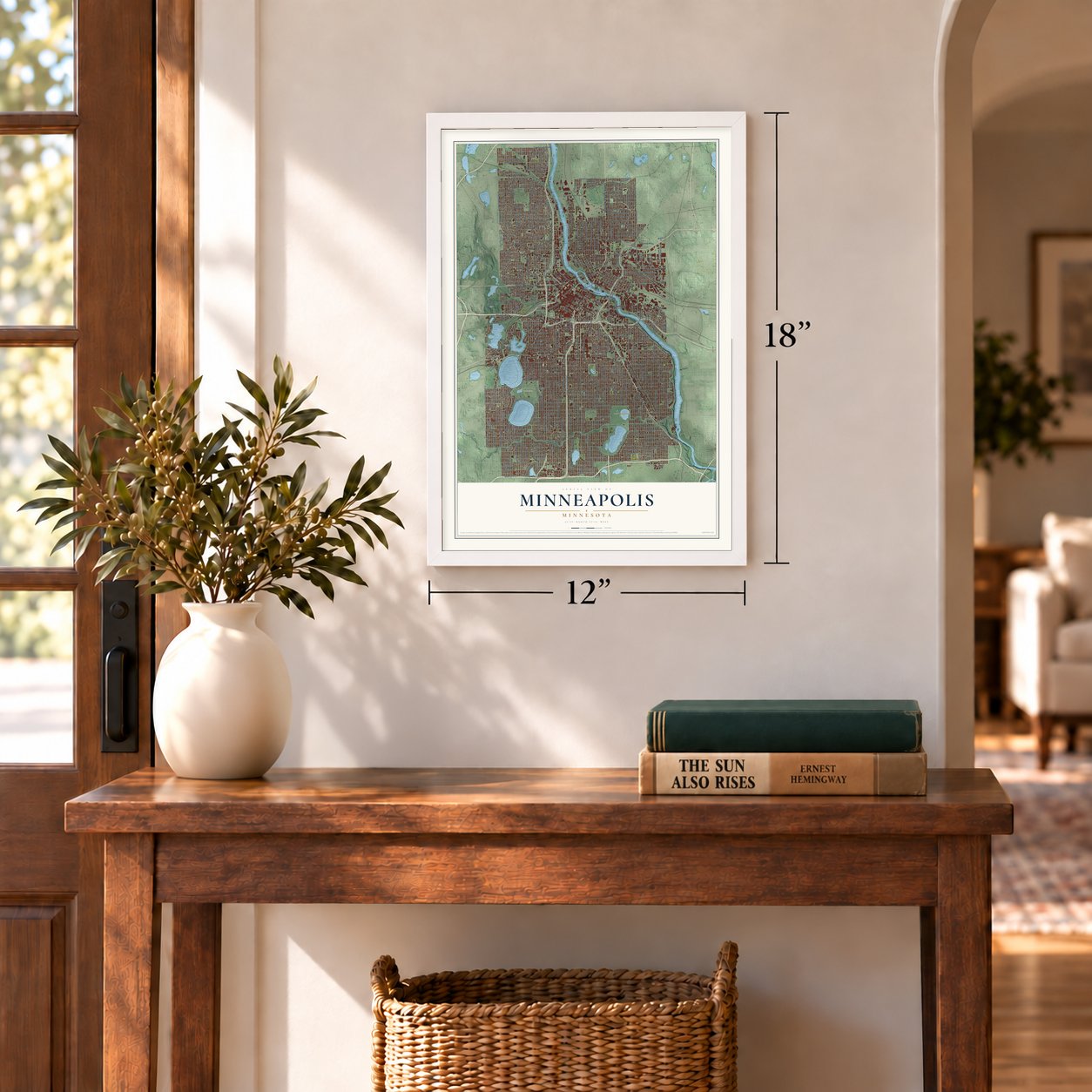
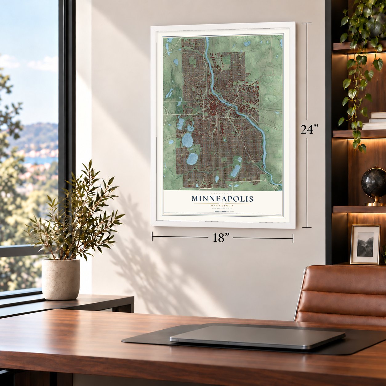
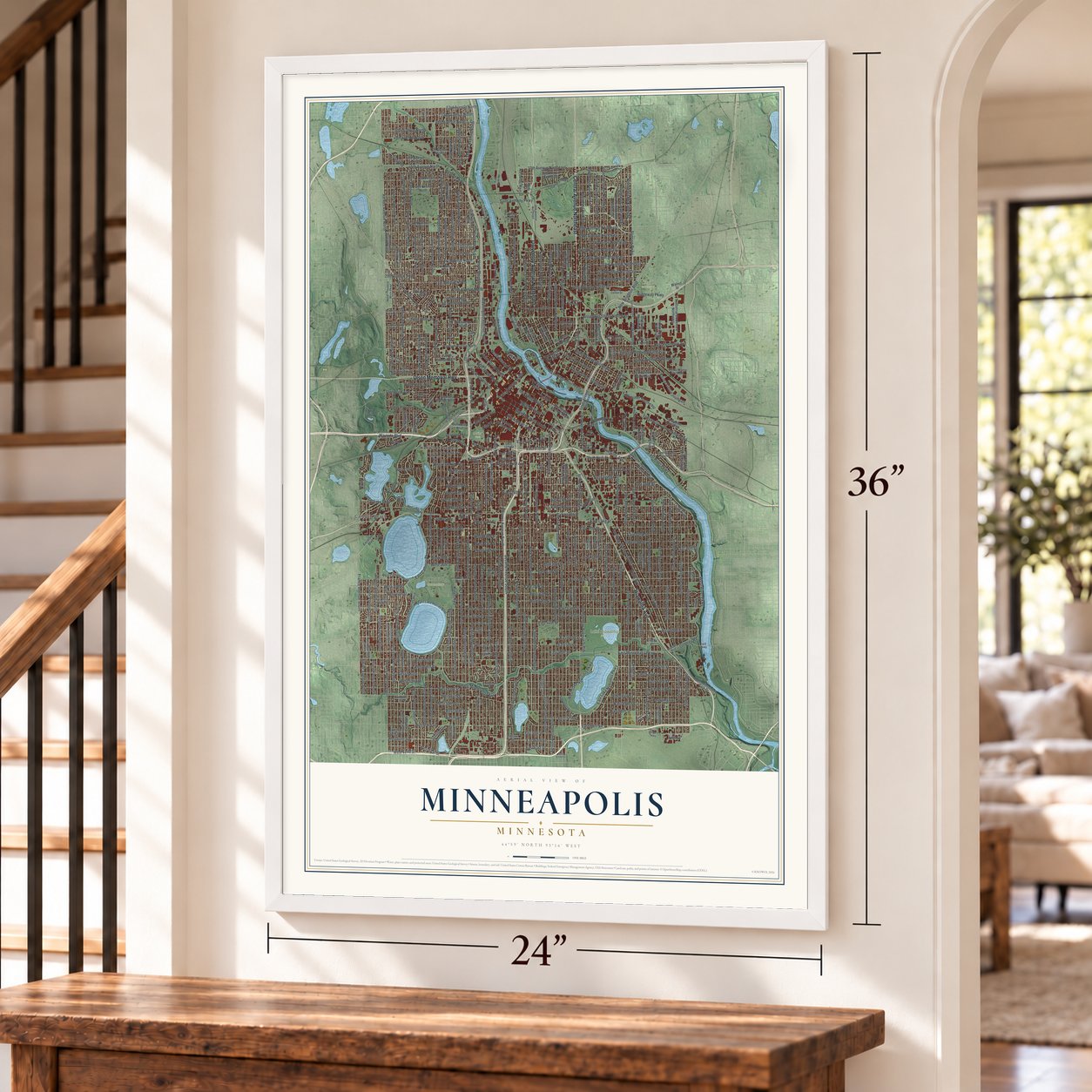
Minneapolis, Minnesota Map Art
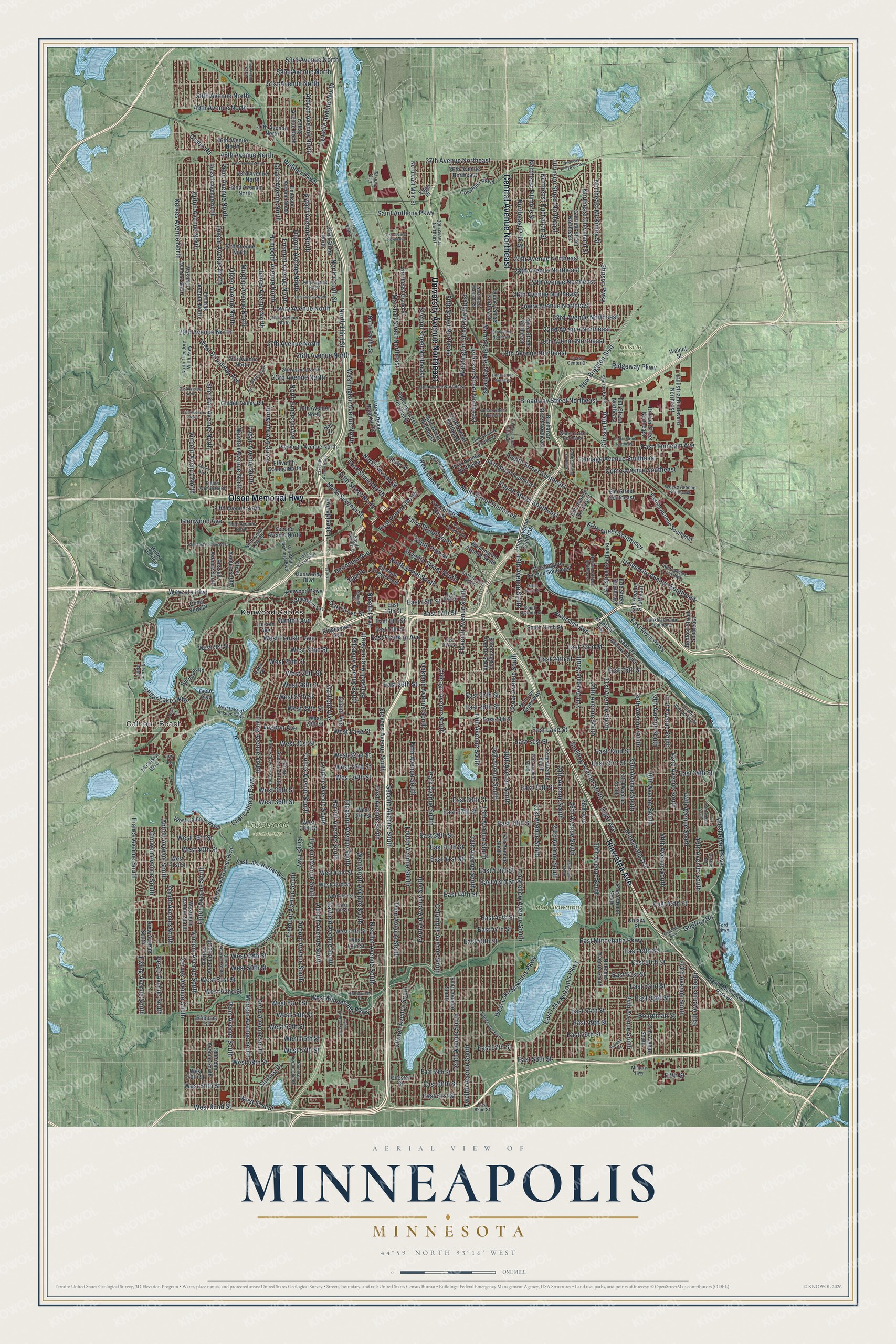
A new map of Minneapolis, Minnesota, made in 2026 and printed to order on thick archival matte paper.
12" x 18" Archival Matte Print
A Map of Home. A Work of Art.
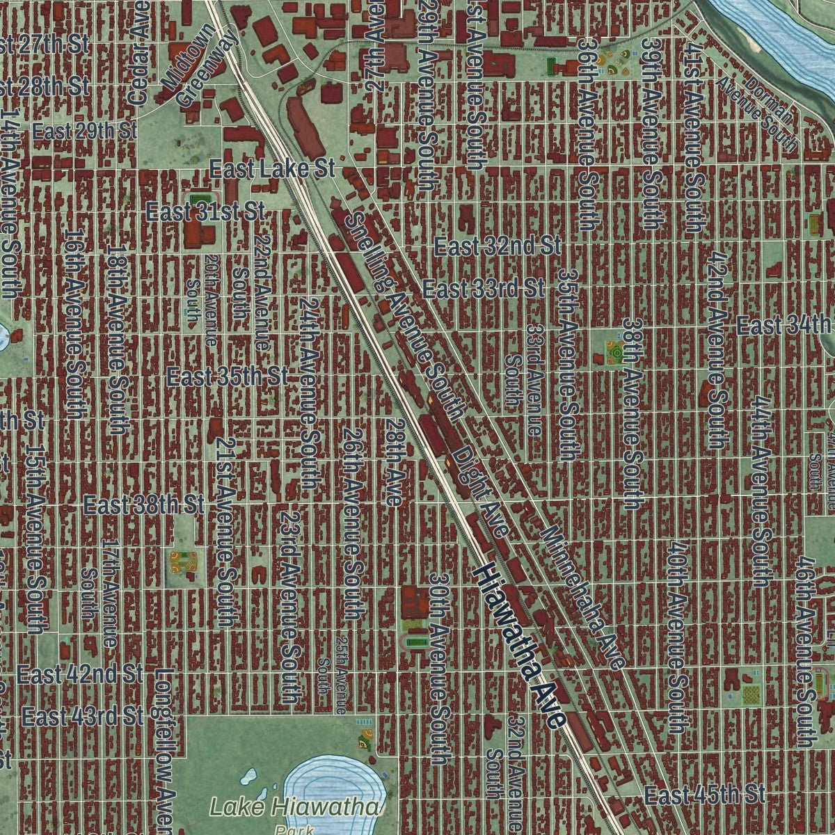
Explore Minneapolis, Minnesota from a whole new perspective. Created using aerial imagery and detailed geographic data, this map captures Minneapolis building by building, with labeled streets, familiar landmarks, and shaded topographical relief that highlights the natural contours of the landscape.
Combining modern data with the timeless character of a vintage atlas, this map is just as interesting up close as it is beautiful on the wall. Whether you grew up in Minneapolis, spent memorable years there, or call it home today, this unique map is a great way to celebrate a place that means something to you. Zoom in on the preview to look for your street, and then order a print to put your memories on the wall.
Three ways to hang it
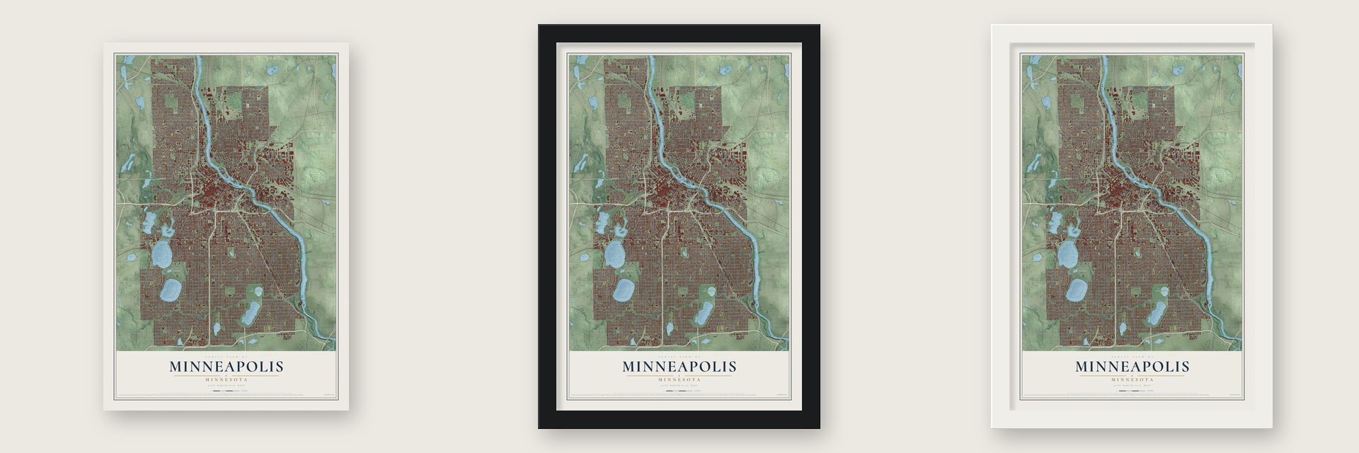
Unframed archival matte, a black wood frame or a white wood frame.
Up close
Geography Worth Displaying
This map was created using accurate cartographic data and authoritative geographic sources, including the U.S. Geological Survey and the Census Bureau. The map brings together terrain, waterways, roads, and building detail. The majority of the streets are labeled, houses are accurately depicted, and the topography is derived from government sources. Combining local data with carefully composed color and shading leads to this beautifully detailed Minneapolis artwork for your wall.
Rather than simply showing street outlines, we’ve included as many of the street names as we could reasonably fit on the map while keeping their names legible. Zoom in on the high resolution preview to see exactly what’s on the map. We truly set out to create a statement piece for anyone who loves Minneapolis. So whether it’s for you, or a gift for someone you love, we hope this map of Minneapolis brings back fond memories.
Read the story behind this map of Minneapolis, Minnesota from 2026.

About Minneapolis, Minnesota
Minneapolis spans both banks of the Upper Mississippi River in Hennepin County and adjoins Saint Paul. Dakota people inhabited the area before European settlement, and their name for the city means "Many Lakes Town." The 2020 census recorded 429,954 residents, making Minneapolis Minnesota's most populous city.
- Name From Two LanguagesCharles Hoag proposed combining the Dakota word "mni," meaning water, with the Greek word "polis," meaning city, to form Minneapolis.
- City Joined St. AnthonyAn 1866 act incorporated Minneapolis, and legislation united it with the former city of St. Anthony in 1872.
- Falls Powered MillsSaint Anthony Falls supplied energy to flour and lumber mills, helping Minneapolis earn the name "Mill City."
- Thirteen LakesMinneapolis has thirteen lakes, along with wetlands, creeks, waterfalls, and the Mississippi River.
- Arts and EducationMajor institutions include the Minneapolis Institute of Art, Walker Art Center, Minnesota Orchestra, Guthrie Theater, and the University of Minnesota's main campus.
Find your street
Names on the Minneapolis map
Every name below is printed on this map. Look for your street, your school, the park where you played, or the pond down the road.
Places and landmarks6
- Calhoun Beach
- Hillside Cemetery
- Lake Hiawatha Park
- Lakewood Cemetery
- Loring Park
- Kenwood Gables
Streets and roads430
- Hiawatha Avenue
- Central Avenue Northeast
- University Avenue Northeast
- Olson Memorial Highway
- West River Parkway
- East Minnehaha Parkway
- Park Avenue South
- 13th Avenue South
- Fifth Avenue South
- East Lake Street
- West Minnehaha Parkway
- West 50th Street
- East 50th Street
- North Seventh Street
- Seventh Street South
- East 17th Street
- Godfrey Road
- Ninth Street South
- James Avenue North
- 29th Avenue North
- Lowry Avenue North
- Xerxes Avenue North
- West Lake Street
- West Broadway Avenue
- Minnehaha Avenue
- Fourth Avenue South
- First Avenue North
- West 60th Street
- East 27th Street
- 38th Avenue South
Show all 430 streets
- East 46th Street
- Cedar Lake Parkway
- Lakeside Avenue
- South Fifth Street
- East 15th Street
- 35th Avenue South
- East 44th Street
- 27th Avenue South
- East 26th Street
- Fremont Avenue North
- Second Avenue South
- Bryant Avenue North
- Third Street South
- East 28th Street
- Stinson Boulevard
- West 24th Street
- Broadway Street Northeast
- East 60th Street
- Sunrise Drive
- East 42nd Street
- Irving Avenue North
- Lyndale Avenue South
- Lyndale Avenue North
- 14th Avenue South
- Oliver Avenue North
- 26th Avenue North
- West 58th Street
- 37th Avenue Northeast
- West 25th Street
- Stinson Pwky
- Fifth Street
- East 58th Street
- Washington Avenue North
- East 25th Street
- New Brighton Boulevard
- Abbott Avenue South
- Fifth Street Southeast
- 51st Avenue North
- East Calhoun Parkway
- Yale Place
- Cedar Avenue South
- 15th Avenue South
- First Avenue South
- 30th Avenue South
- East 40th Street
- 39th Avenue South
- 21st Avenue South
- Ewing Avenue South
- Fifth Street Northeast
- West 55th Street
- 53rd Avenue North
- East Lake Nokomis Parkway
- West 31st Street
- Garfield Avenue
- Portland Avenue South
- Chicago Avenue South
- Third Avenue South
- Tenth Avenue South
- Bryant Avenue South
- Eleventh Avenue South
- Penn Avenue North
- Colfax Avenue South
- Harriet Avenue South
- Aldrich Avenue South
- Twelfth Avenue South
- Vincent Avenue North
- Stevens Avenue South
- Columbus Avenue South
- Sheridan Avenue North
- Queen Avenue North
- Pleasant Avenue South
- Upton Avenue North
- Aldrich Avenue North
- 16th Avenue South
- Clinton Avenue South
- Dupont Avenue South
- Oakland Avenue South
- Dupont Avenue North
- Pillsbury Avenue South
- Nicollet Avenue South
- Blaisdell Avenue South
- Humboldt Avenue North
- Girard Avenue North
- Fremont Avenue South
- 28th Avenue
- Morgan Avenue North
- 31st Avenue South
- France Avenue South
- Johnson Street Northeast
- 40th Avenue South
- 34th Avenue South
- East 38th Street
- Upton Avenue South
- 42nd Avenue South
- Newton Avenue North
- Saint Anthony Parkway
- 29th Avenue South
- East 35th Street
- Xerxes Avenue South
- Logan Avenue North
- 18th Avenue South
- East 37th Street
- East 36th Street
- 36th Avenue South
- East 32nd Street
- East 43rd Street
- 43rd Avenue South
- East 33rd Street
- 44th Avenue South
- Irving Avenue South
- 41st Avenue South
- East 31st Street
- Grand Avenue
- 26th Avenue South
- East 39th Street
- 46th Avenue South
- Garfield Avenue South
- 45th Avenue South
- Vincent Avenue South
- East 34th Street
- East 41st Street
- East 54th Street
- Marshall Street Northeast
- Northeast Fillmore Street
- North Second Street
- East Hennepin Avenue
- East Franklin Avenue
- Penn Avenue South
- East 53rd Street
- University Avenue Southeast
- 19th Avenue South
- Zenith Avenue South
- East 56th Street
- Second Street Northeast
- 23rd Avenue South
- East 24th Street
- East River Parkway
- East 57th Street
- Lowry Avenue Northeast
- North Fourth Street
- 24th Avenue South
- East 51st Street
- West 49th Street
- Longfellow Avenue South
- East 45th Street
- Fourth Street Southeast
- East 52nd Street
- 22nd Avenue Northeast
- 23rd Avenue Northeast
- Morgan Avenue South
- Chowen Avenue South
- Nicollet Avenue
- East 49th Street
- East 55th Street
- Knox Avenue South
- East 22nd Street
- Snelling Avenue South
- Wentworth Avenue South
- 27th Avenue Northeast
- West 54th Street
- 19th Avenue Northeast
- 26th Avenue Northeast
- West 51st Street
- Northeast McKinley Street
- Glenwood Avenue
- West 56th Street
- Northeast Cleveland Street
- West 28th Street
- West 53rd Street
- East 47th Street
- West 57th Street
- Beard Avenue South
- 27th Avenue North
- West Franklin Avenue
- 49th Avenue North
- West 61st Street
- West 52nd Street
- West 32nd Street
- Monroe Street Northeast
- West 40th Street
- 18th Avenue Northeast
- Hennepin Avenue
- 52nd Avenue North
- 23rd Avenue North
- Washington Street Northeast
- West 22nd Street
- 45th Avenue North
- West 39th Street
- Como Avenue Southeast
- West 36th Street
- Jefferson Street Northeast
- 50th Avenue North
- West 26th Street
- West 34th Street
- West 33rd Street
- East 48th Street
- Dight Avenue
- Eighth Street Southeast
- Kings Highway
- Talmage Avenue Southeast
- 29th Avenue Northeast
- West 35th Street
- 28th Avenue Northeast
- North Third Street
- West Lake Nokomis Parkway
- West 27th Street
- Fifth Street North
- East 61st Street
- Wayzata Boulevard
- Northeast Polk Street
- Third Street North
- Riverside Avenue
- West 62nd Street
- North Emerson Avenue
- Northeast Buchanan Street
- Main Street Southeast
- Ridgeway Parkway
- Osseo Road
- Summit Avenue
- Lagoon Avenue
- Boardman Street
- Webber Parkway
- Oak Grove Street
- Second Avenue North
- Eleventh Street South
- Dunwoody Boulevard
- Washington Avenue Southeast
- Excelsior Boulevard
- Dean Boulevard
- Oliver Avenue South
- West Calhoun Parkway
- Sixth Street Southeast
- Washington Avenue South
- Russell Avenue South
- First Street South
- East Lake Harriet Boulevard
- West 29th Street
- Northeast Main Street
- Elliot Avenue South
- Bloomington Avenue South
- Russell Avenue North
- Thomas Avenue North
- 17th Avenue South
- Washburn Avenue North
- Washburn Avenue South
- Emerson Avenue North
- 32nd Avenue South
- Girard Avenue South
- 37th Avenue South
- Sheridan Avenue South
- Thomas Avenue South
- 33rd Avenue South
- Colfax Avenue North
- Drew Avenue South
- 22nd Avenue South
- East 29th Street
- Sixth Street North
- Plymouth Avenue North
- Nokomis Avenue South
- Kenwood Parkway
- West 47th Street
- West 42nd Street
- Fourth Street Northeast
- 42nd Avenue North
- West 48th Street
- 36th Avenue Northeast
- Buchanan Street Northeast
- West 59th Street
- Northeast Grand Street
- West 43rd Street
- West 41st Street
- West 38th Street
- Quincy Street Northeast
- 37th Avenue North
- Tenth Avenue Southeast
- 43rd Avenue North
- Taylor Street Northeast
- Main Street Northeast
- East 59th Street
- 25th Avenue North
- Fifth Avenue North
- East 18th Street
- South Minnehaha Park Drive
- 27th Avenue Southeast
- East 19th Street
- East 16th Street
- 18th Avenue North
- 15th Avenue Southeast
- Golden Valley Road
- 47th Avenue North
- 46th Avenue North
- Garfield Street Northeast
- Midtown Greenway
- Industrial Boulevard Northeast
- West 37th Street
- Seabury Avenue South
- West River Road North
- Oak Street Southeast
- Columbia Parkway
- Kasota Avenue Southeast
- Bedford Street Southeast
- Eleventh Avenue North
- First Avenue Northeast
- Hoover Street Northeast
- Lincoln Avenue
- Ramsey Street Northeast
- West Lake Harriet Boulevard
- West 21st Street
- Elm Street Southeast
- South Ninth Street
- Taft Street Northeast
- Burnham Road
- West Island Avenue
- Groveland Terrace
- Butler Garden
- North Pacific Street
- River Street
- Ridgewood Avenue
- Erie Street Southeast
- Cedar View Drive
- Chester Street
- Franklin Terrace
- Lake Place
- Robbins Street
- Walnut Street
- Edge Place
- Crosby Place
- Hall Lane
- Ivy Lane
- North Theodore Wirth Parkway
- South Twelfth Street
- Queen Avenue South
- Stinson Parkway
- Van White Memorial Boulevard
- Sixth Street South
- Ford Parkway
- Emerson Avenue South
- 20th Avenue South
- 30th Avenue North
- 30th Avenue Northeast
- West 44th Street
- West Lake of the Isles Parkway
- 34th Avenue North
- West 45th Street
- Eighth Avenue North
- 13th Avenue Northeast
- 24th Avenue North
- East Lake Harriet Parkway
- Third Avenue North
- East 62nd Street
- Intercampus Transitway
- Third Avenue Northeast
- Franklin Avenue Southeast
- Winter Street Northeast
- Weeks Avenue Southeast
- Holmes Avenue South
- East 14th Street
- Dorman Avenue South
- East 21st Street
- Edgewater Boulevard
- Northeast Madison Street
- South Seventh Street
- North Cedar Lake Road
- East Island Avenue
- Quarry Center Drive
- Harvard Street Southeast
- Spruce Place
- East River Road
- Military Highway
- Cedar Shore Drive
- Valleyview Place
- Burton Lane
- 17th Avenue North
- Linden Avenue West
- First Street North
- Knox Avenue North
- 25th Avenue South
- 33rd Avenue North
- 21st Avenue North
- 47th Avenue South
- Summer Street Northeast
- 44th Avenue North
- 31st Avenue Northeast
- 14th Avenue Northeast
- 20th Avenue Northeast
- Grand Avenue South
- Twelfth Avenue Southeast
- Lakeside Avenue North
- Chestnut Avenue West
- Second Street South
- Nawadaha Boulevard
- Ilion Avenue North
- Traffic Street Northeast
- Northeast Hollywood Avenue
- South Fourth Street
- Farwell Avenue
- Harrison Street Northeast
- Dean Court
- Bossen Terrace
- 17th Street
Names are listed as they appear on the printed map. Zoom into the product photos to find them.
The art of mapping a place
How This Map Was Made
Real places. Remarkable detail. Discover the layers that turn geographic data into a map of home.

The view from above
Aerial imagery reveals the character of the land: woodland, open fields, and the patterns of a place.

The shape of the land
Elevation data brings hills, valleys, and subtle changes in the landscape into view.

The details of home
Roads, waterways, and building footprints come together to make the map feel unmistakably local.

Geography becomes art
Considered color, shading, and typography bring the layers together in a map made for your wall.


Process illustrated with Mendon, Massachusetts. Aerial imagery: USDA NAIP. Terrain: USGS 3D Elevation Program. Map details and finished artwork: KNOWOL.
The Details
About This Print
Choose an archival matte print, or a black or white Ayous wood frame. The archival matte print is unframed.
Select your size and finish above to see the matching product image and price.
Materials & Craftsmanship
A contemporary map with the character of a classic atlas, printed on archival matte paper. Optional frames are made from Ayous wood.
Your printed map does not include the watermark shown in the full-map preview.
Shipping & Delivery
Free shipping within the United States. Every print is made to order in the USA.
Buying a gift? Add a note in your cart and we'll include it. We never put prices in the package.
Prints ship within 2 to 3 business days. Allow 7 to 10 days total from ordering for delivery. Timing may vary during holidays or periods of high order volume.
Read our shipping policy.
Returns and damaged prints
Each print is made to order. Change-of-mind refunds are not available after production.
If your print arrives damaged, misprinted or incorrect, contact support@knowol.com within 30 days of receiving it. Include your order number, photos and a description of the issue.
Read our full refund and replacement policy. For questions about your order, email support@knowol.com.
Find your town
Looking for another city?
Find a map of home in our Minnesota collection, or any town in the country.
Nearby
Maps of towns near Minneapolis
Know someone from one of these towns? Their map makes a great gift.
 Ventura Village
, Minnesota
From $39.99See the map
 Stevens Square-Loring Heights
, Minnesota
From $39.99See the map
 Phillips West
, Minnesota
From $39.99See the map
More maps nearby: Elliot Park, Loring Park, Whittier, Midtown Phillips and Downtown West.