
Search for another town





Free U.S. delivery 7 to 10 days after you order
Mira Mesa, California Map Art
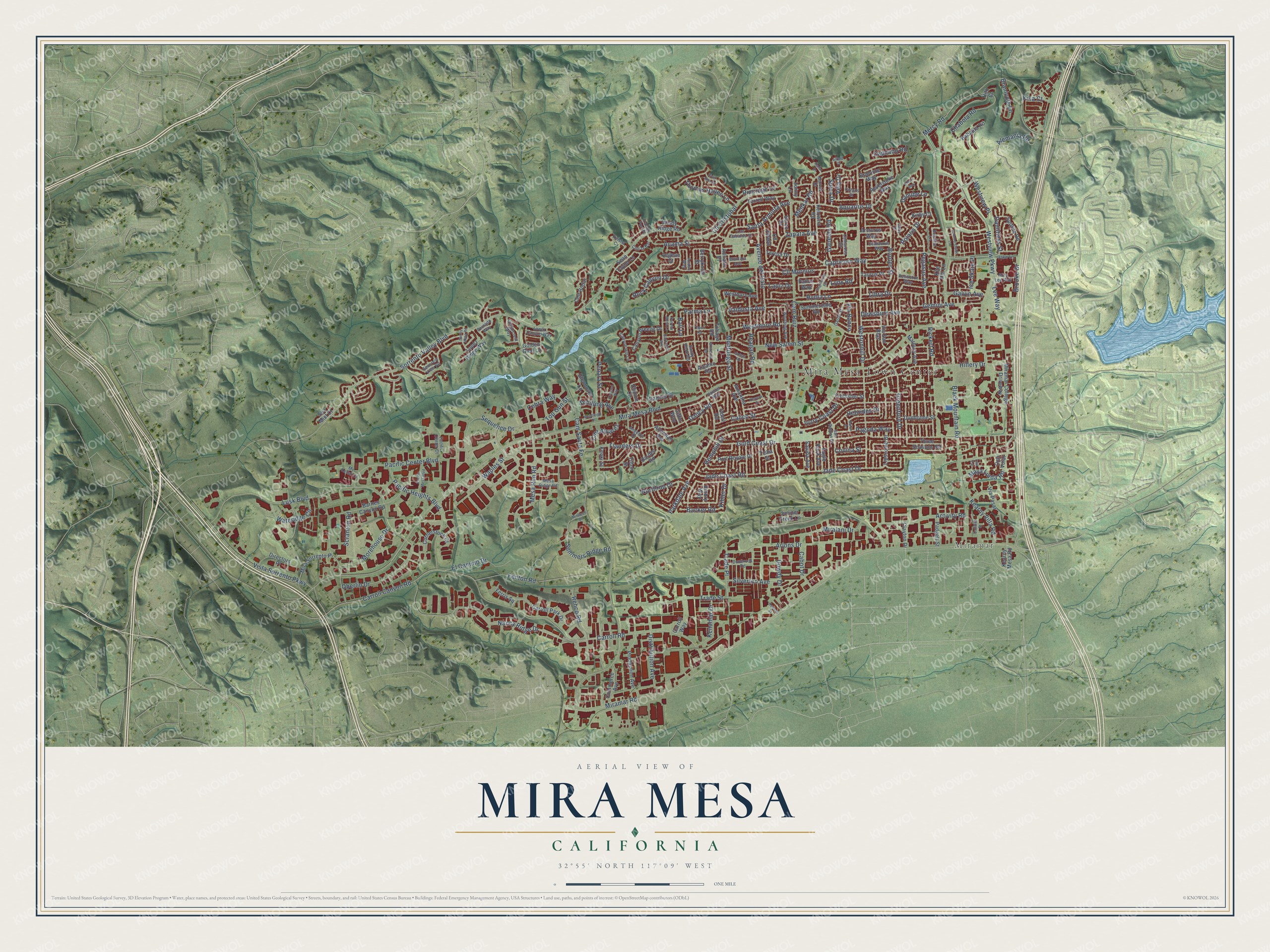
A new map of Mira Mesa, California, made in 2026 and printed to order on thick archival matte paper.
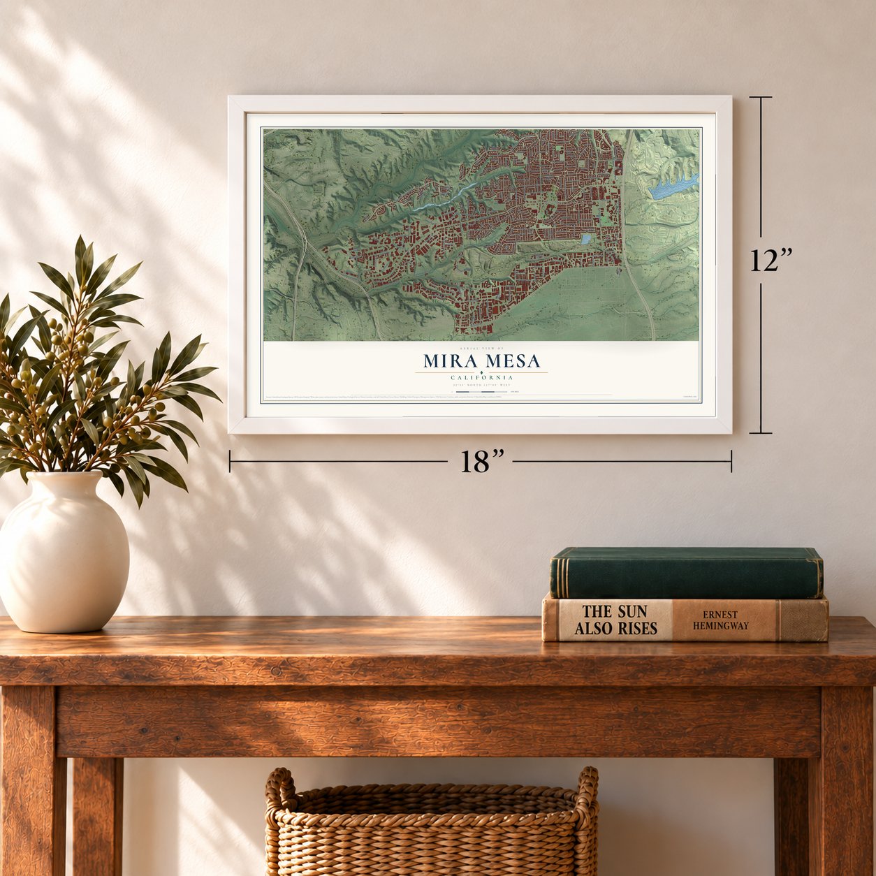
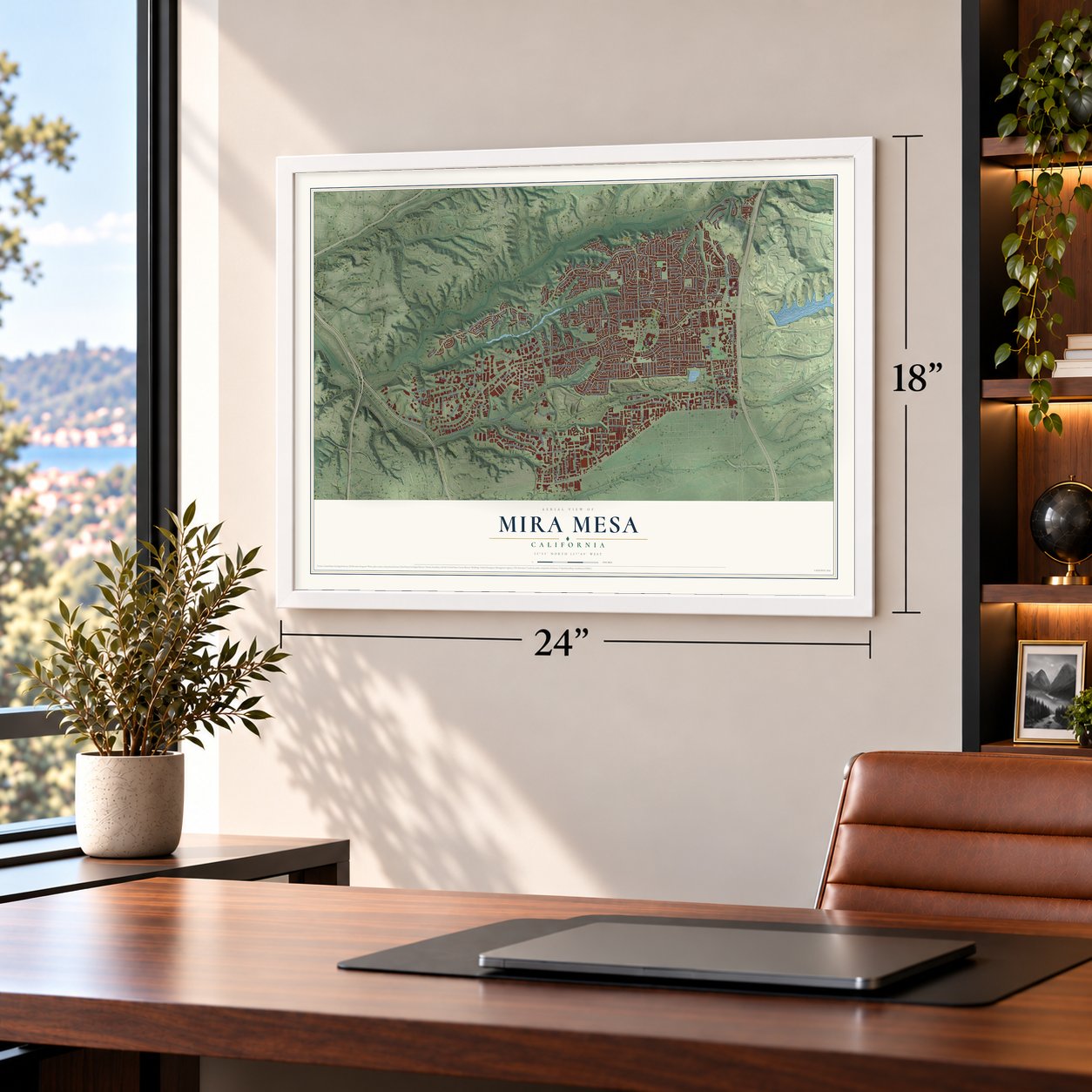
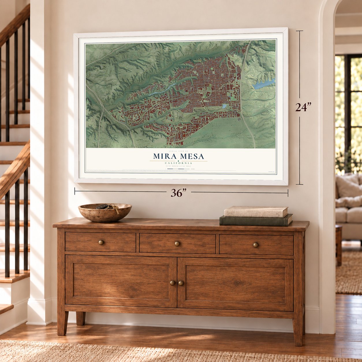
12" x 18" Archival Matte Print
A Map of Home. A Work of Art.
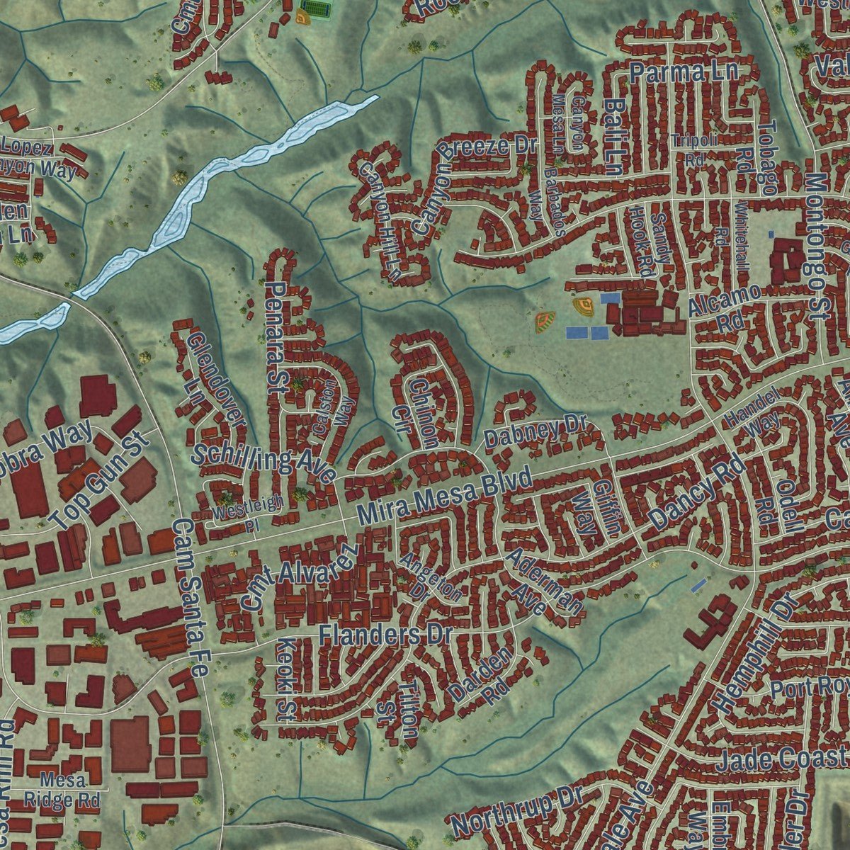
Explore Mira Mesa, California from a whole new perspective. Created using aerial imagery and detailed geographic data, this map captures Mira Mesa building by building, with labeled streets, familiar landmarks, and shaded topographical relief that highlights the natural contours of the landscape.
Combining modern data with the timeless character of a vintage atlas, this map is just as interesting up close as it is beautiful on the wall. Whether you grew up in Mira Mesa, spent memorable years there, or call it home today, this unique map is a great way to celebrate a place that means something to you. Zoom in on the preview to look for your street, and then order a print to put your memories on the wall.
Three ways to hang it
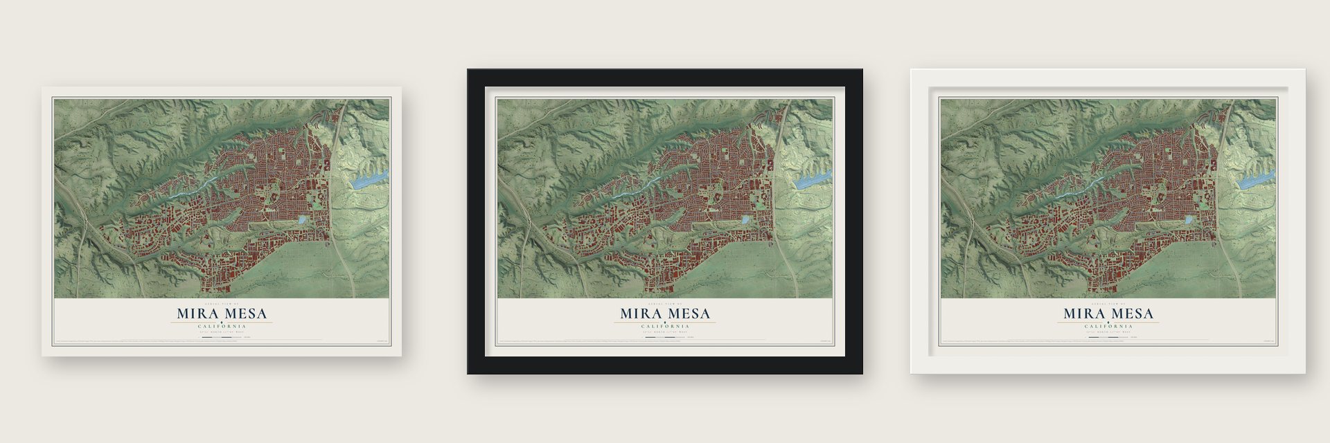
Unframed archival matte, a black wood frame or a white wood frame.
Up close
Geography Worth Displaying
This map was created using accurate cartographic data and authoritative geographic sources, including the U.S. Geological Survey and the Census Bureau. The map brings together terrain, waterways, roads, and building detail. The majority of the streets are labeled, houses are accurately depicted, and the topography is derived from government sources. Combining local data with carefully composed color and shading leads to this beautifully detailed Mira Mesa artwork for your wall.
Rather than simply showing street outlines, we’ve included as many of the street names as we could reasonably fit on the map while keeping their names legible. Zoom in on the high resolution preview to see exactly what’s on the map. We truly set out to create a statement piece for anyone who loves Mira Mesa. So whether it’s for you, or a gift for someone you love, we hope this map of Mira Mesa brings back fond memories.
Read the story behind this map of Mira Mesa, California from 2026.

About Mira Mesa, California
From the City of San Diego: "From early 1971 to the third quarter of 1972, Mira Mesa led construction activity within the City."
From the City of San Diego: "Little development occurred in the planning area until mid-1969, when the demand for moderate priced housing brought several major developers into eastern Mira Mesa. From early 1971 to the third quarter of 1972, Mira Mesa led construction activity within the City."
Find your street
Names on the Mira Mesa map
Every name below is printed on this map. Look for your street, your school, the park where you played, or the pond down the road.
Places and landmarks2
- Mira Mesa Town Center
- Miramar
Streets and roads224
- Hemphill Drive
- Valdosta Avenue
- Mira Mesa Boulevard
- Flanders Drive
- Cam Santa Fe
- Black Mountain Road
- Cam Ruiz
- Cll Cristobal
- Gold Coast Drive
- Carroll Canyon Road
- Westonhill Drive
- Sorrento Valley Boulevard
- Carroll Road
- Westview Parkway
- Lusk Boulevard
- Parkdale Avenue
- New Salem Street
- Reagan Road
- Capricorn Way
- Nancy Ridge Drive
- Mercy Road
- Westmore Road
- Hillery Drive
- Polaris Drive
- Menkar Road
- Dancy Road
- Scranton Road
- Montongo Street
- Avenue del Gato
- Vista Sorrento Parkway
Show all 224 streets
- Alemania Road
- Pacific Heights Boulevard
- Bootes Street
- Pegasus Avenue
- Trade Street
- Miramar Road
- Zapata Avenue
- Maya Linda Road
- Sequence Drive
- Fenton Road
- Greenford Drive
- Jade Coast Road
- Arjons Drive
- Aquarius Drive
- Pacific Center Boulevard
- Oberlin Drive
- Hydra Lane
- Activity Road
- Covina Street
- Jade Coast Drive
- Waples Street
- Chabola Road
- Summers Ridge Road
- Santa Arminta Avenue
- Miralani Drive
- Distribution Avenue
- Gemini Avenue
- El Camino Drive
- Rehco Road
- Acama Street
- Dewsbury Avenue
- Mesa Rim Road
- Wateridge Circle
- Morehouse Drive
- Libra Drive
- Cll Morelos
- Dowdy Drive
- Calico Street
- Kearny Villa Road
- Thomas Hayes Lane
- Pagoda Way
- Brooke Drive
- Branicole Lane
- Kenamar Drive
- Lee Way
- Northrup Drive
- Rock Canyon Drive
- Top Gun Street
- Silverton Avenue
- Hebrides Drive
- Kibler Drive
- Capcano Road
- Cmt Alvarez
- Penara Street
- Cabot Drive
- Ivory Coast Drive
- Ice Skate Place
- Westview Place
- Ganesta Road
- Schilling Avenue
- Trade Place
- Dauntless Street
- Rimridge Lane
- Cobra Way
- Galvin Avenue
- Backer Road
- Rickert Road
- Danube Lane
- Vela Drive
- Spica Drive
- Parma Lane
- Via Banco
- Lapiz Drive
- Lynx Road
- Kika Court
- Bali Lane
- Kite Hill Lane
- Miramar College Driveway
- Aderman Avenue
- Babauta Road
- Barnes Canyon Road
- Production Avenue
- Dabney Drive
- Summerdale Road
- Hito Court
- Kelowna Road
- Spitfire Road
- Torrell Way
- Port Royale Drive
- Revelstoke Way
- Mira Sorrento Place
- Lopez Ridge Way
- Canyon Breeze Drive
- Juniper Creek Lane
- Carroll Park Drive
- Cornerstone Court
- Commerce Avenue
- Amantha Avenue
- Via San Blas
- Surco Drive
- Westbury Avenue
- Kearny Mesa Road
- Directors Place
- Cmt Rodar
- Dunholme Street
- Carroll Way
- Cll Jalapa
- Three Seasons Road
- Marbury Avenue
- Lipscomb Drive
- Sean Taylor Lane
- Alcamo Road
- Bralorne Way
- Arcturus Way
- Padgett Street
- Glendover Lane
- Taurus Place
- Eagle Rock Avenue
- Saluda Avenue
- Darden Road
- Frobisher Street
- Odell Road
- Jonny Lane
- Chinon Circle
- Teresa Drive
- Clayton Drive
- Berryknoll Street
- Adriatic Place
- Via Pasar
- Pallux Way
- Ferris Square
- Tobago Road
- Kirby Court
- Windy Ridge Road
- Keoki Street
- Aegean Court
- Embry Way
- Golden Glen Lane
- Sea Mist Court
- Giffin Way
- Tilton Street
- Cmt Volar
- Tisha Street
- San Ramon Drive
- Seacrest View Road
- Dunbrook Road
- Worthing Avenue
- Camarosa Circle
- Canyon Hill Lane
- Los Sabalos Street
- Cmt la Bar
- Lopez Canyon Way
- Markab Drive
- Penticton Way
- Mesa Ridge Road
- Cedarcrest Way
- Pacific Center Court
- Centaurus Way
- Octans Street
- Garde Street
- Mira Lee Way
- Mc Kellar Court
- Acaso Way
- Belshire Lane
- Sandy Hook Road
- Angeton Drive
- Peinado Way
- Montara Avenue
- Handel Way
- Frames Port Place
- Keisha Cv
- Jake Lane
- Candida Street
- Pacific Mesa Boulevard
- River Rim Road
- Barbados Way
- Calston Way
- Sagittarius Road
- Dalby Place
- Summershade Lane
- Whitehall Road
- Elbert Way
- Sunny Mesa Road
- Kenova Street
- Tripoli Road
- Goleta Road
- Canyon Mesa Lane
- Alkaid Drive
- Westleigh Place
- Baron Drive
- Miratech Drive
- Keenan Street
- Hadar Drive
- Cmt Zar
Names are listed as they appear on the printed map. Zoom into the product photos to find them.
The art of mapping a place
How This Map Was Made
Real places. Remarkable detail. Discover the layers that turn geographic data into a map of home.

The view from above
Aerial imagery reveals the character of the land: woodland, open fields, and the patterns of a place.

The shape of the land
Elevation data brings hills, valleys, and subtle changes in the landscape into view.

The details of home
Roads, waterways, and building footprints come together to make the map feel unmistakably local.

Geography becomes art
Considered color, shading, and typography bring the layers together in a map made for your wall.


Process illustrated with Mendon, Massachusetts. Aerial imagery: USDA NAIP. Terrain: USGS 3D Elevation Program. Map details and finished artwork: KNOWOL.
The Details
About This Print
Choose an archival matte print, or a black or white Ayous wood frame. The archival matte print is unframed.
Select your size and finish above to see the matching product image and price.
Materials & Craftsmanship
A contemporary map with the character of a classic atlas, printed on archival matte paper. Optional frames are made from Ayous wood.
Your printed map does not include the watermark shown in the full-map preview.
Shipping & Delivery
Free shipping within the United States. Every print is made to order in the USA.
Buying a gift? Add a note in your cart and we'll include it. We never put prices in the package.
Prints ship within 2 to 3 business days. Allow 7 to 10 days total from ordering for delivery. Timing may vary during holidays or periods of high order volume.
Read our shipping policy.
Returns and damaged prints
Each print is made to order. Change-of-mind refunds are not available after production.
If your print arrives damaged, misprinted or incorrect, contact support@knowol.com within 30 days of receiving it. Include your order number, photos and a description of the issue.
Read our full refund and replacement policy. For questions about your order, email support@knowol.com.
Find your town
Looking for another city?
Find a map of home in our California collection, or any town in the country.
Nearby
Maps of towns near Mira Mesa
Know someone from one of these towns? Their map makes a great gift.
 Sorrento Valley
, California
From $39.99See the map
 Del Mar Mesa
, California
From $39.99See the map
 Torrey Hills
, California
From $39.99See the map
More maps nearby: University City, Torrey Highlands, Carmel Valley, Pacific Highlands Ranch and Torrey Pines.