
Search for another town



Free U.S. delivery 7 to 10 days after you order
Monroe, Louisiana Map Art
A new map of Monroe, Louisiana, made in 2026 and printed to order on thick archival matte paper.
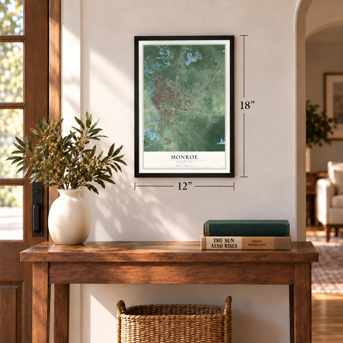
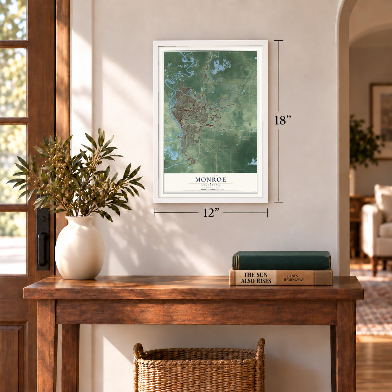
12" x 18" Archival Matte Print
A Map of Home. A Work of Art.
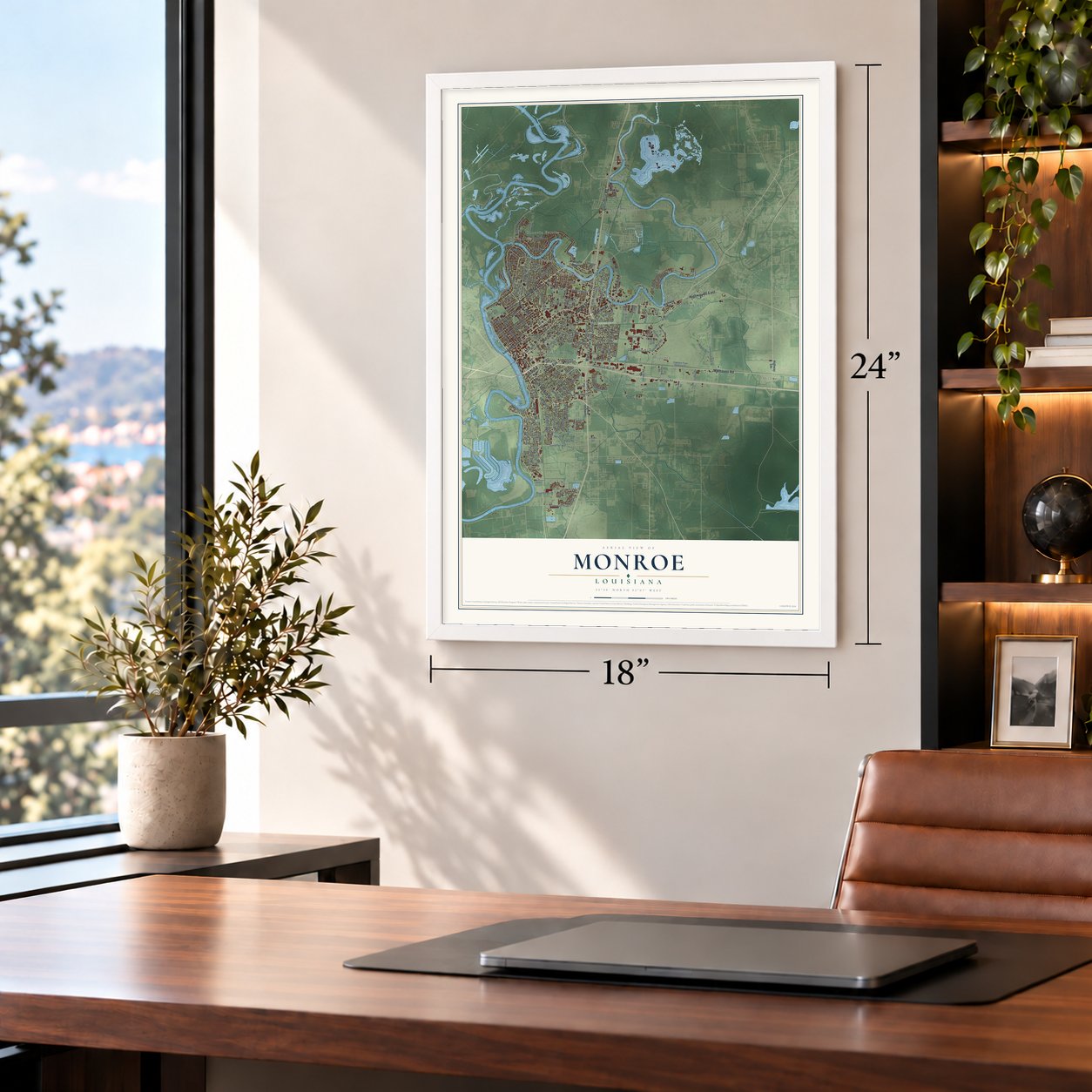
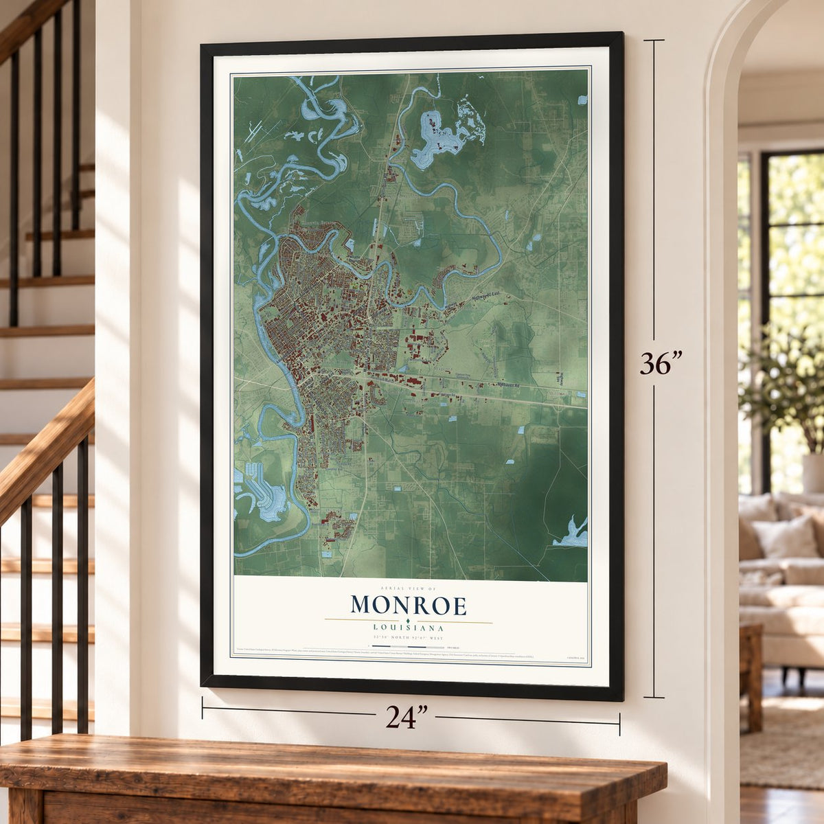
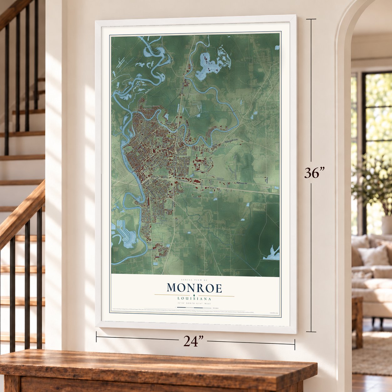
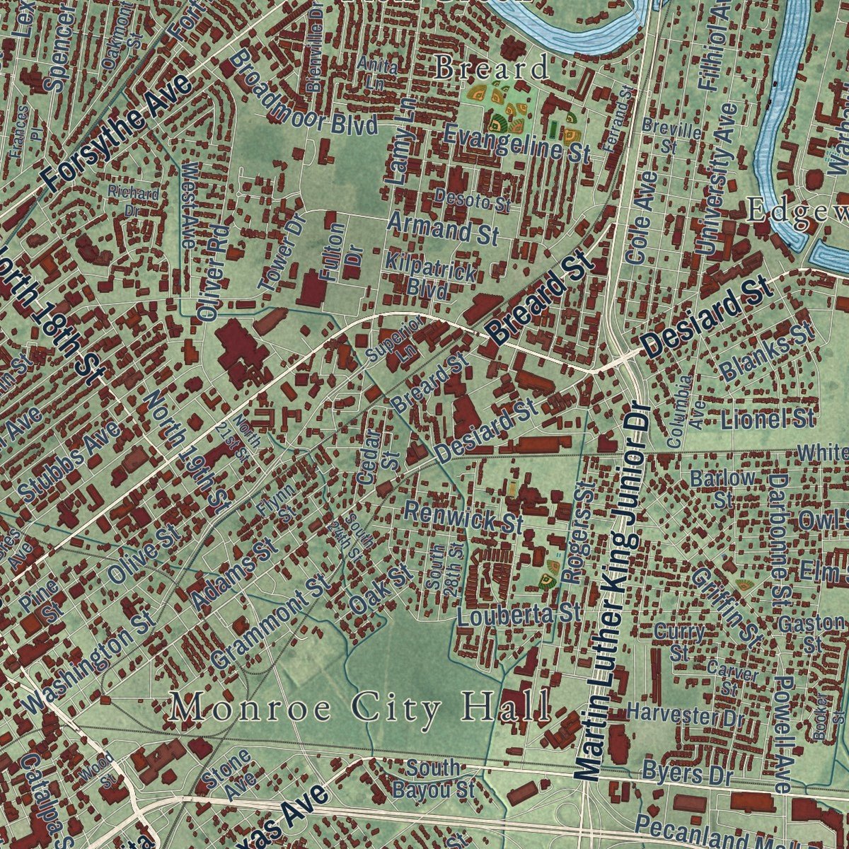
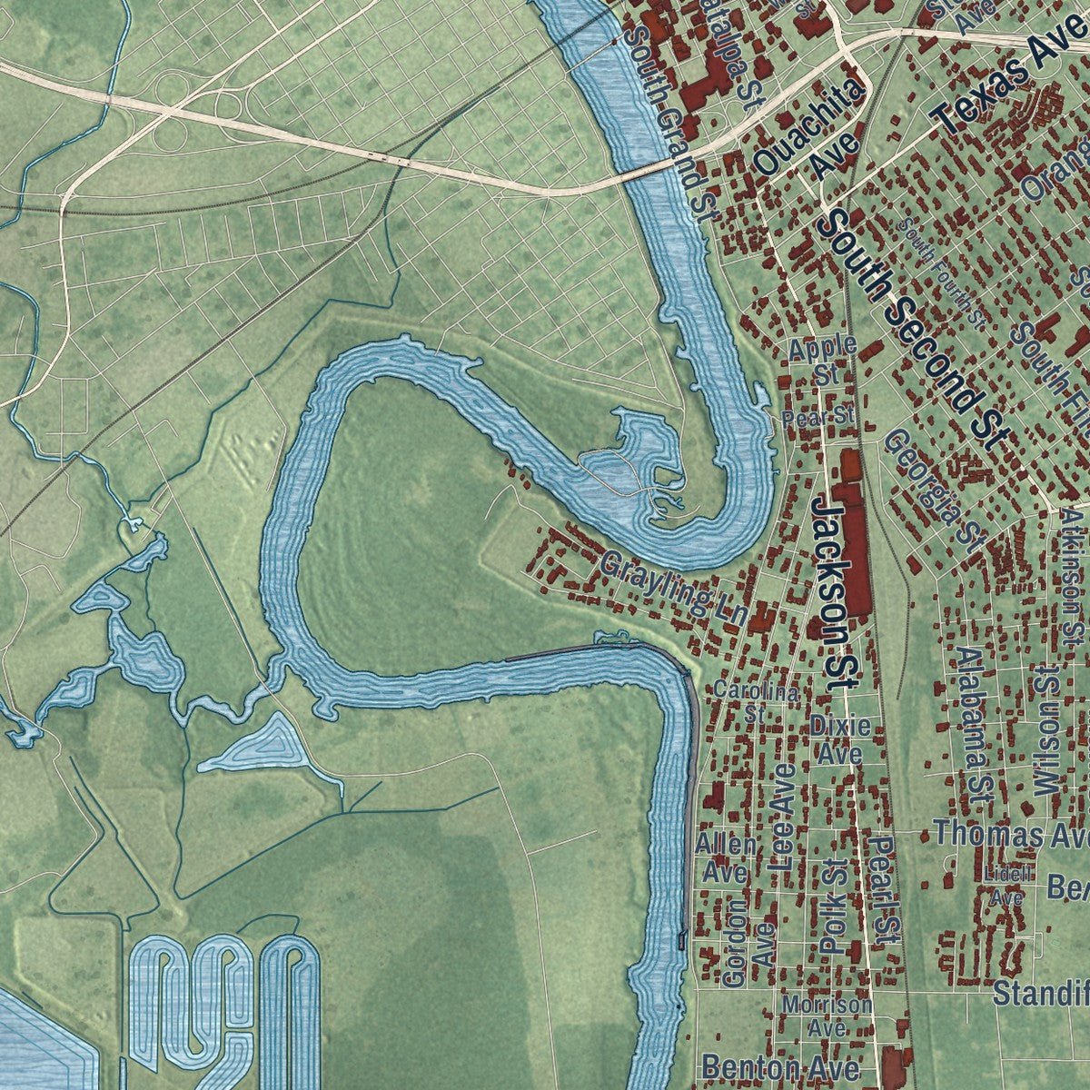
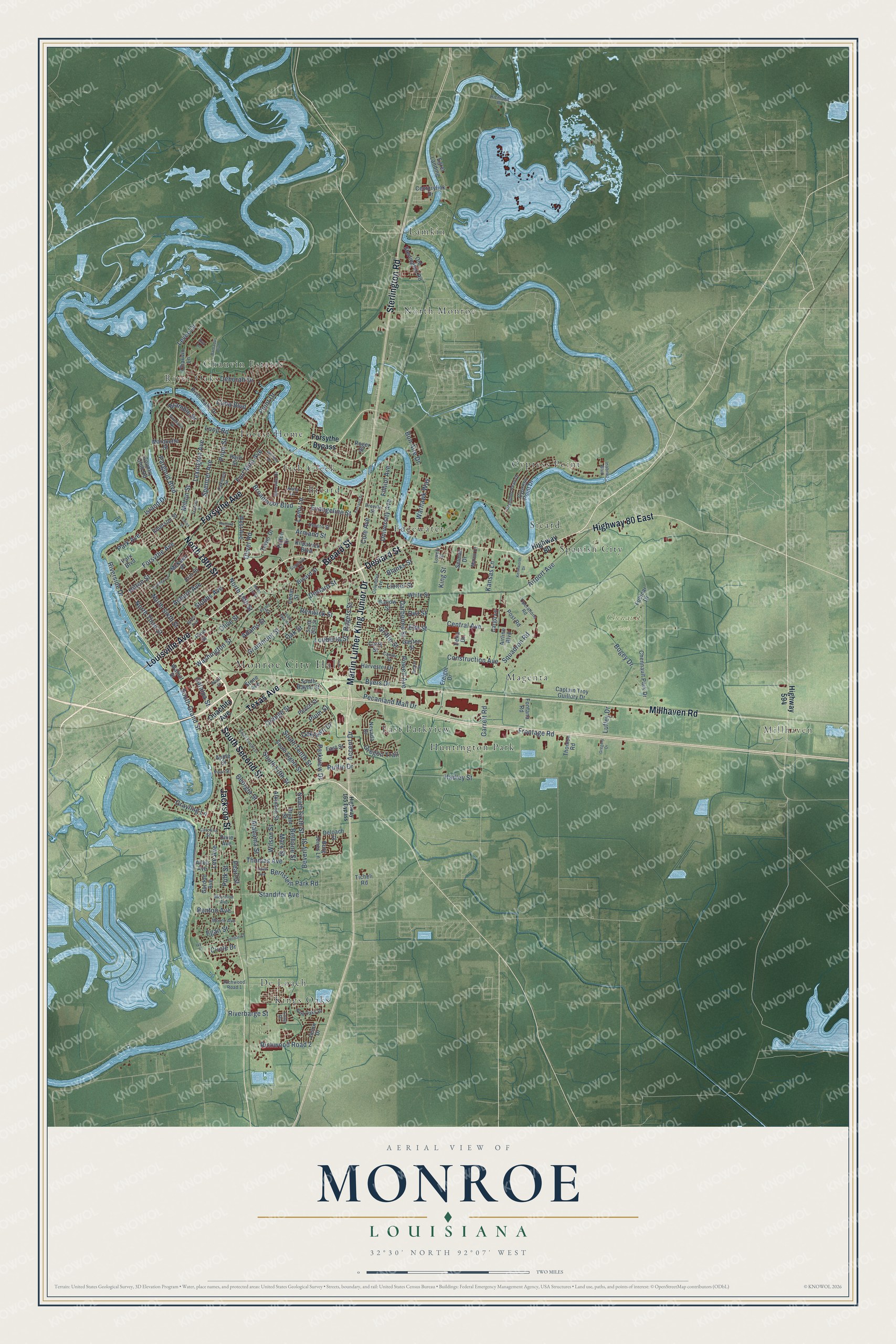
Explore Monroe, Louisiana from a whole new perspective. Created using aerial imagery and detailed geographic data, this map captures Monroe building by building, with labeled streets, familiar landmarks, and shaded topographical relief that highlights the natural contours of the landscape.
Combining modern data with the timeless character of a vintage atlas, this map is just as interesting up close as it is beautiful on the wall. Whether you grew up in Monroe, spent memorable years there, or call it home today, this unique map is a great way to celebrate a place that means something to you. Zoom in on the preview to look for your street, and then order a print to put your memories on the wall.
Three ways to hang it
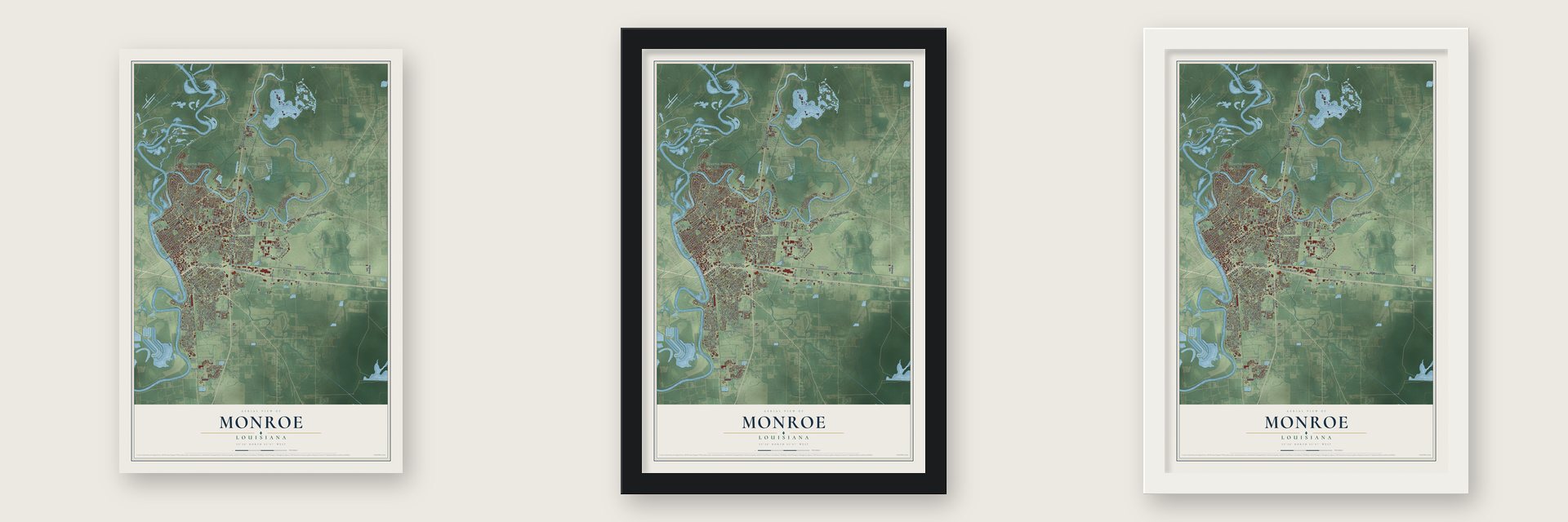
Unframed archival matte, a black wood frame or a white wood frame.
Up close
Geography Worth Displaying
This map was created using accurate cartographic data and authoritative geographic sources, including the U.S. Geological Survey and the Census Bureau. The map brings together terrain, waterways, roads, and building detail. The majority of the streets are labeled, houses are accurately depicted, and the topography is derived from government sources. Combining local data with carefully composed color and shading leads to this beautifully detailed Monroe artwork for your wall.
Rather than simply showing street outlines, we’ve included as many of the street names as we could reasonably fit on the map while keeping their names legible. Zoom in on the high resolution preview to see exactly what’s on the map. We truly set out to create a statement piece for anyone who loves Monroe. So whether it’s for you, or a gift for someone you love, we hope this map of Monroe brings back fond memories.
Read the story behind this map of Monroe, Louisiana from 2026.

About Monroe, Louisiana
Monroe is a city of 47,702 people and the seat of Ouachita Parish, on the Ouachita River. Under Spanish rule, Jean Baptiste Filhiol came north from South Louisiana in 1781 to oversee the Poste du Ouachita. In 1785 he made Prairie des Canots, the site of today's Monroe, its seat of government. The settlers asked for protection, so in 1791 a fort went up and took the name Fort Miro, after the Spanish governor Esteban Miró.
Filhiol kept command of the square palisade until the United States bought Louisiana in 1803. When Ouachita became a parish in 1807, the fort was chosen as its seat of justice. On Sept. 5, 1811, Filhiol gave the parish judge the land for the courthouse square and filed a plan for the town of Miro. The legislature incorporated it on March 11, 1820. The parish built its fourth courthouse there in 1883.
- Named for a steamboatLocal memory ties the name to the steamboat James Monroe, which first reached the town in the spring of 1820. Residents saw its arrival as the moment the old outpost became a real town. The boat carried the name of President James Monroe, and a mural of it is painted inside the Ouachita Parish Public Library's main branch.
- Coca-Cola and Delta Air LinesJoseph A. Biedenharn, the first man to bottle Coca-Cola, moved here from Vicksburg in 1913. He and his son Malcolm helped found Delta Air Lines, which began as Delta Dusters, spraying cotton fields to fight the boll weevil. Collett E. Woolman, the parish agent, started the world's first crop-dusting service. Monroe was Delta's founding city in the 1920s before the airline moved to Atlanta. Biedenharn's home is now a museum and gardens.
- Sawmills and cotton balesAn early twentieth-century account said Monroe had never been a boom town but had grown steadily, reaching 10,209 people. Over 800,000 tons of freight moved in and out each year by rail and river. Five yellow pine sawmills could cut 325,000 feet of lumber a day, and two compresses handled about 80,000 bales of cotton a year.
- City-owned transit since 1906Monroe started a four-line street railroad in 1906, and it grew into the oldest transit system owned by a city anywhere in the nation. Today the Monroe Transit System runs 13 fixed bus routes across most of the city.
Find your street
Names on the Monroe map
Every name below is printed on this map. Look for your street, your school, the park where you played, or the pond down the road.
Places and landmarks19
- Monroe City Hall
- Millhaven
- Chenault Park
- Breard
- Chauvin Estates
- Cypress Point
- De Loach
- East Parkview
- Edgewater
- Fish Creek
- Forest Home
- Huntington Park
Show all 19 places
- Kings Oaks
- Lamkin
- Magenta
- North Monroe
- River Oaks
- Sicard
- Spanish City
Streets and roads202
- Millhaven Road
- Louisville Avenue
- Desiard Street
- South Second Street
- Texas Avenue
- Martin Luther King Junior Drive
- Jackson Street
- North 18th Street
- Sterlington Road
- Forsythe Avenue
- Highway 80 East
- Breard Street
- North Sixth Street
- Catalpa Street
- Levee Drive
- Washington Street
- Central Avenue
- Pecanland Mall Drive
- Elm Street
- South Tenth Street
- South Grand Street
- Deborah Drive
- Bon Aire Drive
- Park Avenue
- Loop Road
- Grammont Street
- Pargoud Boulevard
- Oliver Road
- Spencer Avenue
- Lee Avenue
Show all 202 streets
- Kansas Lane
- Frontage Road
- South Sixth Street
- Powell Avenue
- Olive Street
- Plum Street
- Orange Street
- Riverside Drive
- Auburn Avenue
- Accent Drive
- Stubbs Avenue
- North Third Street
- North 19th Street
- Airport Avenue
- South Fifth Street
- Island Drive
- Armand Street
- Thomas Avenue
- Louberta Street
- Alabama Street
- Filhiol Avenue
- Adams Street
- Lexington Avenue
- Evangeline Street
- Wilson Street
- University Avenue
- Standifer Avenue
- Lamy Lane
- Renwick Street
- Georgia Street
- Cole Avenue
- Milton Street
- Darbonne Street
- Blanks Street
- Oregon Trail
- Point Drive
- Garrett Road
- Polk Street
- Cuba Boulevard
- Owl Street
- Warhawk Way
- Squadron Road
- Marx Street
- Hilton Street
- Construction Avenue
- Grayling Lane
- Oak Street
- Richwood Road 2
- Parkview Drive
- Pope Street
- Rogers Street
- Bernstein Park Road
- Broadmoor Boulevard
- Circle Drive
- Griffin Street
- Hadley Street
- Fort Miro Avenue
- Ruffin Drive
- Egan Street
- Pearl Street
- King Street
- Byers Drive
- Riverbarge Street
- Bogey Drive
- Bramble Drive
- Benton Avenue
- Oaklawn Drive
- Lionel Street
- Beverly Street
- Bethune Street
- Luffey Drive
- Ouachita Avenue
- Highway 80
- Highway 594
- Forsythe Bypass
- Park Boulevard
- Airline Boulevard
- Stone Avenue
- Pine Street
- South Eighth Street
- Cypress Point Drive
- Captain Troy Guillory Drive
- Emerson Street
- Chennault Park Drive
- Gordon Avenue
- Peach Street
- Tower Drive
- White Street
- Barlow Street
- Old Sterlington Road
- Atkinson Street
- Harvester Drive
- Chauvin Lane
- Fudicar Drive
- River Oaks Drive
- Bryant Street
- Country Club Road
- Delta Drive
- Curry Street
- Centurylink Drive
- Walnut Street
- Marquette Street
- Post Road
- Nevada Drive
- Burg Jones Lane
- Fontana Road
- Allen Avenue
- McKeen Place
- West Avenue
- East Street
- Egret Landing
- Harn Street
- Dixie Avenue
- Apple Street
- Jason Drive
- Freight Drive
- Cedar Street
- Selman Drive
- Kilpatrick Boulevard
- Cargo Lane
- South Bayou Street
- Deloach Street
- Ticheli Road
- Thomco Road
- Erin Street
- Gaston Street
- Fulton Drive
- Roger Street
- Inabnet Boulevard
- Bienville Drive
- Operations Road
- Bres Avenue
- Columbia Avenue
- Desoto Street
- Richwood Road 1
- Diamond Head Drive
- Oakmont Street
- Flynn Street
- Moore Avenue
- Breville Street
- South 28th Street
- King Oaks Drive
- Anita Lane
- Carver Street
- Superior Lane
- Carolina Street
- Martin Court
- Morrison Avenue
- Richland Place
- Lowery Street
- Pear Street
- Long Drive
- Ava Lane
- Highway 165 Bypass
- North 21st Street
- Wood Street
- South Fourth Street
- Barbados Boulevard
- Lidell Avenue
- Ferrand Street
- Downey Lane
- Vernon Street
- Richard Drive
- South 24th Street
- Frances Place
- Kenilworth Drive
- Whitney Drive
- Pinehurst Drive
- Booker Street
- Gregory Drive
- Essex Street
- Ivy Place
Names are listed as they appear on the printed map. Zoom into the product photos to find them.
The art of mapping a place
How This Map Was Made
Real places. Remarkable detail. Discover the layers that turn geographic data into a map of home.

The view from above
Aerial imagery reveals the character of the land: woodland, open fields, and the patterns of a place.

The shape of the land
Elevation data brings hills, valleys, and subtle changes in the landscape into view.

The details of home
Roads, waterways, and building footprints come together to make the map feel unmistakably local.

Geography becomes art
Considered color, shading, and typography bring the layers together in a map made for your wall.


Process illustrated with Mendon, Massachusetts. Aerial imagery: USDA NAIP. Terrain: USGS 3D Elevation Program. Map details and finished artwork: KNOWOL.
The Details
About This Print
Choose an archival matte print, or a black or white Ayous wood frame. The archival matte print is unframed.
Select your size and finish above to see the matching product image and price.
Materials & Craftsmanship
A contemporary map with the character of a classic atlas, printed on archival matte paper. Optional frames are made from Ayous wood.
Your printed map does not include the watermark shown in the full-map preview.
Shipping & Delivery
Free shipping within the United States. Every print is made to order in the USA.
Buying a gift? Add a note in your cart and we'll include it. We never put prices in the package.
Prints ship within 2 to 3 business days. Allow 7 to 10 days total from ordering for delivery. Timing may vary during holidays or periods of high order volume.
Read our shipping policy.
Returns and damaged prints
Each print is made to order. Change-of-mind refunds are not available after production.
If your print arrives damaged, misprinted or incorrect, contact support@knowol.com within 30 days of receiving it. Include your order number, photos and a description of the issue.
Read our full refund and replacement policy. For questions about your order, email support@knowol.com.
Find your town
Looking for another city?
Find a map of home in our Louisiana collection, or any town in the country.
Nearby
Maps of towns near Monroe
Know someone from one of these towns? Their map makes a great gift.
 Lakeshore
, Louisiana
From $39.99See the map
 West Monroe
, Louisiana
From $39.99See the map
 Richwood
, Louisiana
From $39.99See the map
More maps nearby: Brownsville, Bawcomville, Swartz, Claiborne and Sterlington.