
Search for another town





Free U.S. delivery 7 to 10 days after you order
Monroe, Washington Map Art
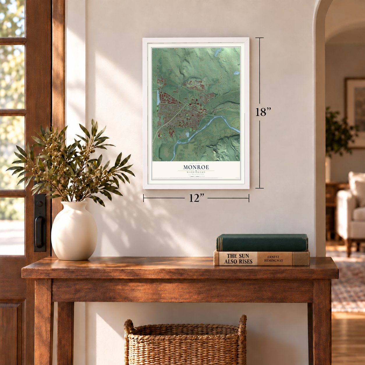
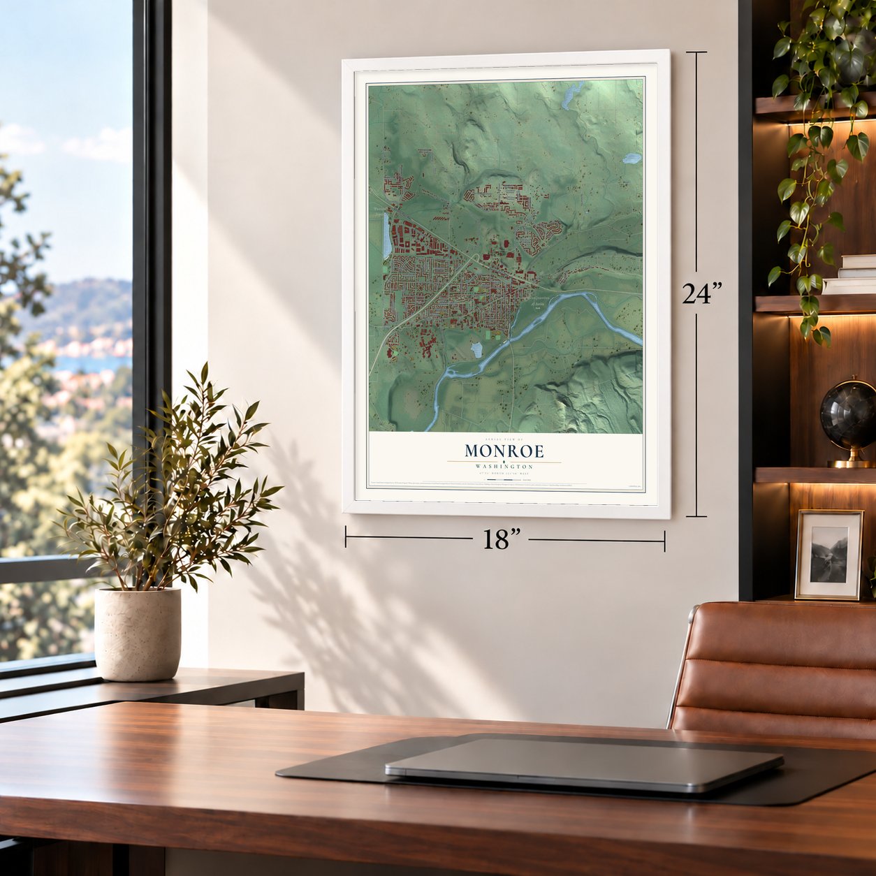
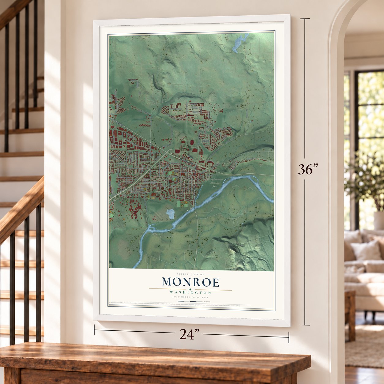
A new map of Monroe, Washington, made in 2026 and printed to order on thick archival matte paper.
12" x 18" Archival Matte Print
A Map of Home. A Work of Art.
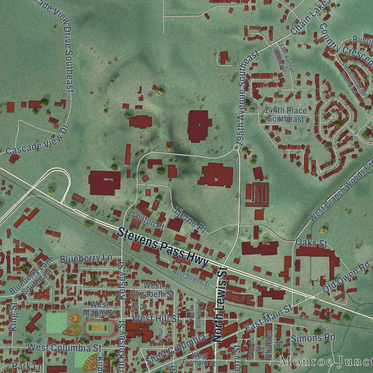
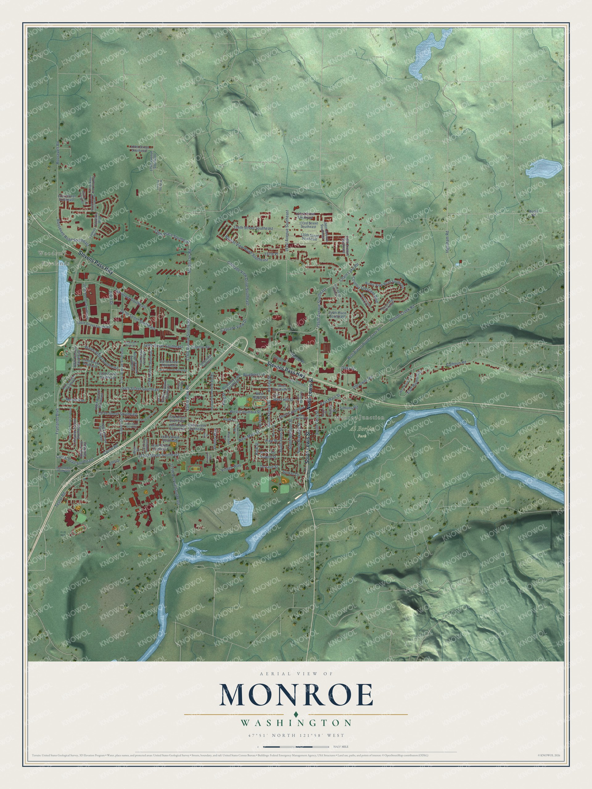
Explore Monroe, Washington from a whole new perspective. Created using aerial imagery and detailed geographic data, this map captures Monroe building by building, with labeled streets, familiar landmarks, and shaded topographical relief that highlights the natural contours of the landscape.
Combining modern data with the timeless character of a vintage atlas, this map is just as interesting up close as it is beautiful on the wall. Whether you grew up in Monroe, spent memorable years there, or call it home today, this unique map is a great way to celebrate a place that means something to you. Zoom in on the preview to look for your street, and then order a print to put your memories on the wall.
Three ways to hang it
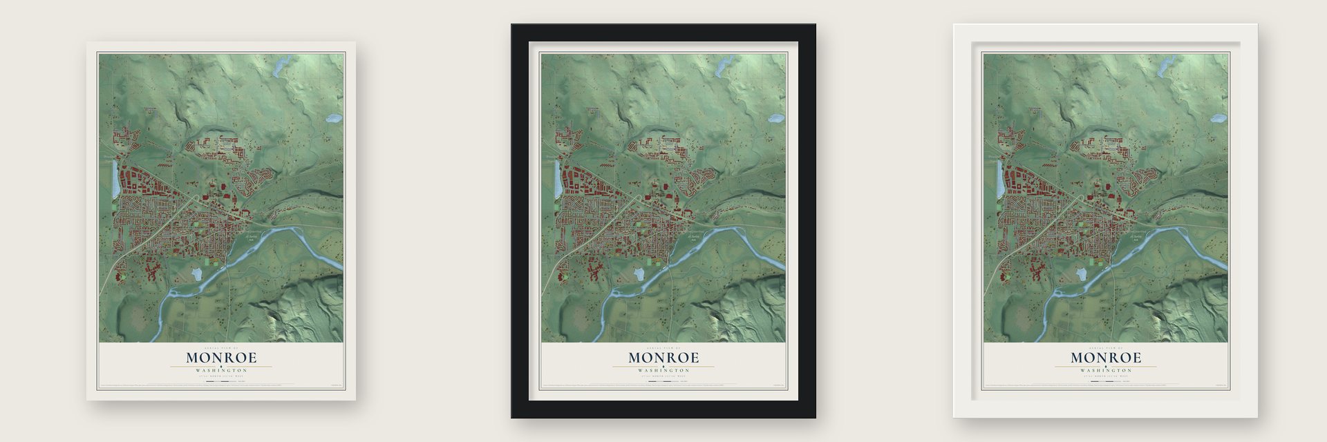
Unframed archival matte, a black wood frame or a white wood frame.
Up close
Geography Worth Displaying
This map was created using accurate cartographic data and authoritative geographic sources, including the U.S. Geological Survey and the Census Bureau. The map brings together terrain, waterways, roads, and building detail. The majority of the streets are labeled, houses are accurately depicted, and the topography is derived from government sources. Combining local data with carefully composed color and shading leads to this beautifully detailed Monroe artwork for your wall.
Rather than simply showing street outlines, we’ve included as many of the street names as we could reasonably fit on the map while keeping their names legible. Zoom in on the high resolution preview to see exactly what’s on the map. We truly set out to create a statement piece for anyone who loves Monroe. So whether it’s for you, or a gift for someone you love, we hope this map of Monroe brings back fond memories.
Read the story behind this map of Monroe, Washington from 2026.

About Monroe, Washington
Monroe is a city of 19,699 people in Snohomish County, at the spot where the Skykomish and Snoqualmie join as the Snohomish River. Henry McClurg settled here in 1860, and in 1864 he founded Park Place, about a mile west of today's downtown. When storekeeper John Vanasdlen asked for a post office, he learned that it needed a one-word name. McClurg chose Monroe, for President James Monroe, and the office was granted on March 19, 1890.
The Great Northern Railway's final survey put its tracks a mile northeast of Park Place. In late 1892 and early 1893, merchants hauled their buildings to the new line with oxen, horses and a steam thresher. Vanasdlen moved his store and the post office too, and the settlement by the tracks took the name Monroe. Trains ran through the valley by January 1893, and the town was incorporated on December 20, 1902.
“The Company does more business at Monroe than any other point on the line, outside of larger towns.”
- The fire of 1901On September 16, 1901, a fire that began at the Odd Fellows hall burned the only full block of businesses in Monroe, doing about $8,100 in damage. The owners rebuilt, and in 1903 the town set up its own fire department, with a hose cart that held 500 feet of hose.
- Carnation milk from 1908The Pacific Coast Condensed Milk Company opened its condensery on August 29, 1908, and 2,000 visitors came for Condenser Day. It became the largest maker of Carnation condensed milk, turning out 250,000 pounds a day within a year, and it helped the population reach 2,500 within two years. The plant closed in 1928 and burned on March 23, 1944.
- The state reformatoryIn 1907 the state picked Monroe over Arlington and Sultan for its second reformatory. The first inmate arrived in August 1908. The permanent building, finished in 1910 for $1.5 million, is now part of the Monroe Correctional Complex.
- Corsages for every ladyThe Great Northern Railway grew flowers in Monroe greenhouses from 1926. Each Christmas workers made two thousand corsages, so every woman boarding a train that day got one, and every year they potted 70,000 geraniums for summer. The greenhouses were taken down in 1962.
- Evergreen State FairLocal granges held the first Cavalcade of the Valleys in 1941, and the Snohomish County Fair came to the old poor farm grounds in 1946. In 1949 the fair took the name Evergreen State Fair, and Monroe has hosted it every year since.
Find your street
Names on the Monroe map
Every name below is printed on this map. Look for your street, your school, the park where you played, or the pond down the road.
Places and landmarks4
- Monroe Junction
- Woodruff
- Fryelands
- Al Borlin Park
Streets and roads137
- North Lewis Street
- South Lewis Street
- Stevens Pass Highway
- Chain Lake Road
- West Main Street
- 195th Avenue Southeast
- 162nd Street Southeast
- North Kelsey Street
- East Main Street
- South Sams Street
- Valley View Road
- 179th Avenue Southeast
- Mc Allister Road
- Roosevelt Road Southeast
- Terrace Street
- Fryelands Boulevard
- Old Owen Road
- Park Street
- Tester Road
- 154th Street Southeast
- 134th Street Southeast
- Country Crescent Boulevard
- Currie Street
- 157th Street Southeast
- 136th Place Southeast
- Rainier View Road Southeast
- Woods Creek Road
- Calhoun Road
- 177th Avenue Southeast
- Kelsey Street
Show all 137 streets
- Tye Street Southeast
- 147th Street Southeast
- Roosevelt Road
- 191st Avenue Southeast
- Currie Road
- Currie Road Southeast
- West Columbia Street
- 149th Street Southeast
- Wales Street Southeast
- Blueberry Lane
- South Blakeley Street
- Cascade View Drive Southeast
- East Rivmont Drive
- Village Way
- Tjerne Place
- Powell Street
- West Hill Street
- Cascade View Drive
- Short Columbia
- Park Lane
- South Madison Street
- 169th Drive
- South Ferry Street
- Ingraham Road
- Pike Street
- 137th Place
- Oaks Street
- Simons Road
- Sumac Drive
- Dennis Way
- King Street
- Heintz Avenue
- Foothills Boulevard
- Esther Avenue Southeast
- 165th Avenue Southeast
- 171st Avenue Southeast
- Lakeview Avenue Southeast
- Blueberry Lane Southeast
- 167th Avenue Southeast
- West Branch Woods Creek Road
- 132nd Street Southeast
- 175th Avenue Southeast
- Rustic View Road Southeast
- West Elizabeth Street
- 174th Avenue Southeast
- 133rd Street Southeast
- 135th Street Southeast
- 182nd Avenue Southeast
- 152nd Street Southeast
- 146th Street Southeast
- 199th Avenue Southeast
- 157th Place Southeast
- 153rd Street Southeast
- 158th Place Southeast
- 169th Avenue Southeast
- 160th Street Southeast
- 161st Street Southeast
- 144th Place Southeast
- 168th Avenue Southeast
- 196th Avenue Southeast
- 131st Street Southeast
- Ladd Street Southeast
- 125th Street Southeast
- Austin Avenue Southeast
- Kingman Road
- Lenton Place
- 166th Drive Southeast
- Kirby Drive
- 159th Street Southeast
- 170th Drive
- Pearson Lane
- Charles Street
- West Maple Street
- Wren Street
- Modill Road
- 164th Street Southeast
- Woods Street
- 173rd Avenue Southeast
- 150th Street Southeast
- Horizon Way Southeast
- West Rivmont Drive
- Dickinson Road
- Heintz Avenue Southeast
- Monroe Avenue
- Foothills Road
- 174th Drive Southeast
- Morris Street
- Plain View Place
- West Fremont Street
- Lin Avenue
- Orr Street
- 197th Avenue Southeast
- Lords Lake Avenue Southeast
- Mountain View Road Southeast
- West Stretch Street
- 166th Avenue Southeast
- Stanton Street Southeast
- Deerfield Drive Southeast
- Arthur Lane
- Bear Mountain Road Southeast
- North Blakeley Street
- 158th Street Southeast
- Phillips Ridge Road Southeast
- 149th Place Southeast
- 175 Drive Southeast
- Alder Street
- Academy Way
Names are listed as they appear on the printed map. Zoom into the product photos to find them.
The art of mapping a place
How This Map Was Made
Real places. Remarkable detail. Discover the layers that turn geographic data into a map of home.

The view from above
Aerial imagery reveals the character of the land: woodland, open fields, and the patterns of a place.

The shape of the land
Elevation data brings hills, valleys, and subtle changes in the landscape into view.

The details of home
Roads, waterways, and building footprints come together to make the map feel unmistakably local.

Geography becomes art
Considered color, shading, and typography bring the layers together in a map made for your wall.


Process illustrated with Mendon, Massachusetts. Aerial imagery: USDA NAIP. Terrain: USGS 3D Elevation Program. Map details and finished artwork: KNOWOL.
The Details
About This Print
Choose an archival matte print, or a black or white Ayous wood frame. The archival matte print is unframed.
Select your size and finish above to see the matching product image and price.
Materials & Craftsmanship
A contemporary map with the character of a classic atlas, printed on archival matte paper. Optional frames are made from Ayous wood.
Your printed map does not include the watermark shown in the full-map preview.
Shipping & Delivery
Free shipping within the United States. Every print is made to order in the USA.
Buying a gift? Add a note in your cart and we'll include it. We never put prices in the package.
Prints ship within 2 to 3 business days. Allow 7 to 10 days total from ordering for delivery. Timing may vary during holidays or periods of high order volume.
Read our shipping policy.
Returns and damaged prints
Each print is made to order. Change-of-mind refunds are not available after production.
If your print arrives damaged, misprinted or incorrect, contact support@knowol.com within 30 days of receiving it. Include your order number, photos and a description of the issue.
Read our full refund and replacement policy. For questions about your order, email support@knowol.com.
Find your town
Looking for another city?
Find a map of home in our Washington collection, or any town in the country.
Nearby
Maps of towns near Monroe
Know someone from one of these towns? Their map makes a great gift.
 Monroe North
, Washington
From $39.99See the map
 Chain Lake
, Washington
From $39.99See the map
 Woods Creek
, Washington
From $39.99See the map
More maps nearby: High Bridge, Cathcart, Three Lakes, Maltby and Snohomish.