
Search for another town




Free U.S. delivery 7 to 10 days after you order
Monroeville, Alabama Map Art
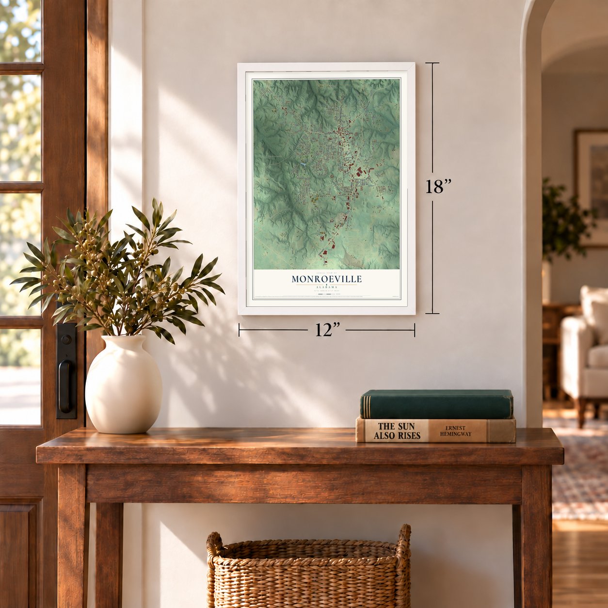
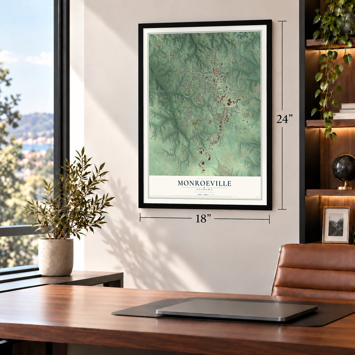
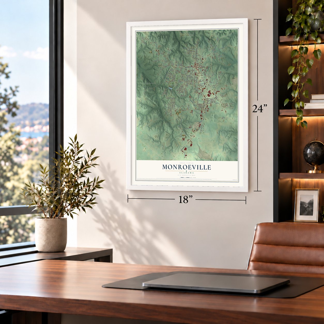
A new map of Monroeville, Alabama, made in 2026 and printed to order on thick archival matte paper.
12" x 18" Archival Matte Print
A Map of Home. A Work of Art.
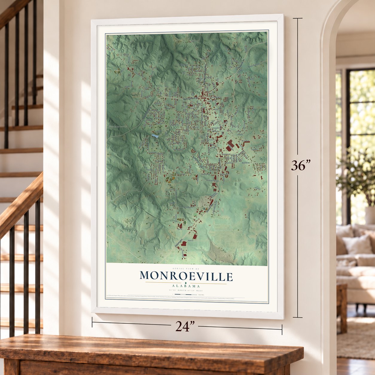
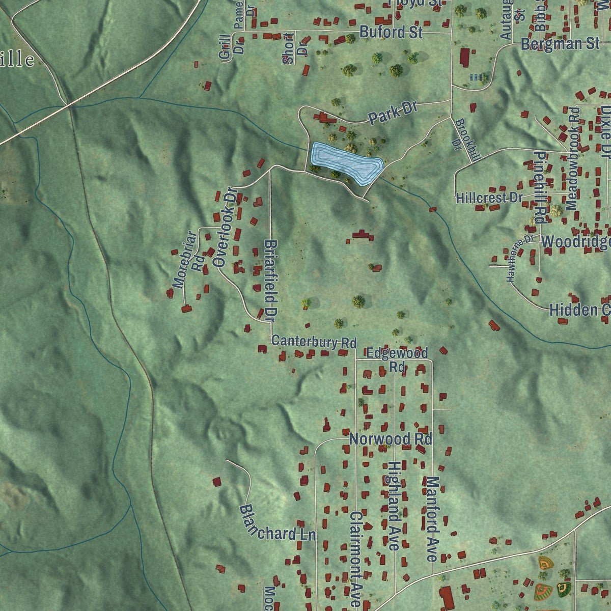
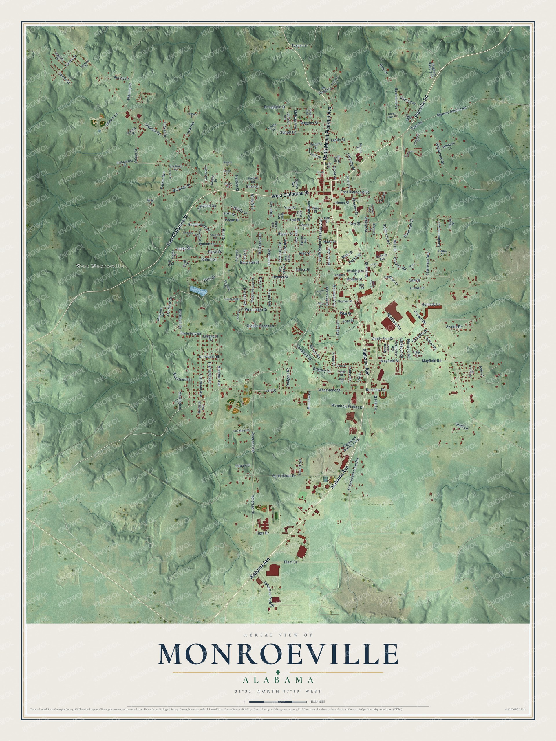
Explore Monroeville, Alabama from a whole new perspective. Created using aerial imagery and detailed geographic data, this map captures Monroeville building by building, with labeled streets, familiar landmarks, and shaded topographical relief that highlights the natural contours of the landscape.
Combining modern data with the timeless character of a vintage atlas, this map is just as interesting up close as it is beautiful on the wall. Whether you grew up in Monroeville, spent memorable years there, or call it home today, this unique map is a great way to celebrate a place that means something to you. Zoom in on the preview to look for your street, and then order a print to put your memories on the wall.
Three ways to hang it
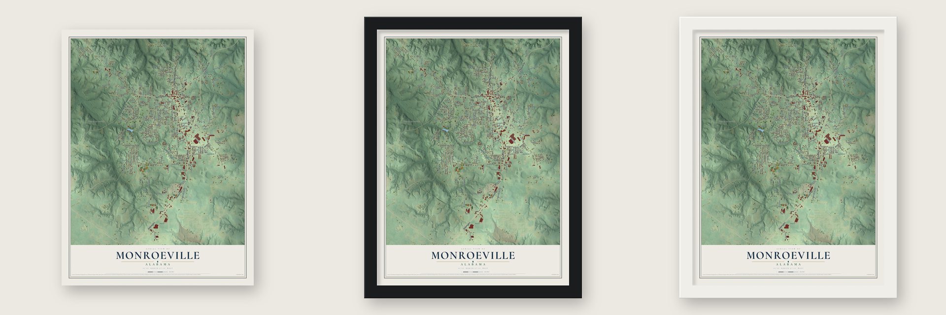
Unframed archival matte, a black wood frame or a white wood frame.
Up close
Geography Worth Displaying
This map was created using accurate cartographic data and authoritative geographic sources, including the U.S. Geological Survey and the Census Bureau. The map brings together terrain, waterways, roads, and building detail. The majority of the streets are labeled, houses are accurately depicted, and the topography is derived from government sources. Combining local data with carefully composed color and shading leads to this beautifully detailed Monroeville artwork for your wall.
Rather than simply showing street outlines, we’ve included as many of the street names as we could reasonably fit on the map while keeping their names legible. Zoom in on the high resolution preview to see exactly what’s on the map. We truly set out to create a statement piece for anyone who loves Monroeville. So whether it’s for you, or a gift for someone you love, we hope this map of Monroeville brings back fond memories.
Read the story behind this map of Monroeville, Alabama from 2026.
About Monroeville, Alabama
Monroeville is a city of 5,951 people and the seat of Monroe County, in south Alabama between Montgomery and Mobile. While this was the Mississippi Territory it was called Burnt Corn Springs, and later Walker's Mill and Store, after Major Walker, who settled nearby in 1815 and opened a store, a tavern and a grist mill. In 1831 Probate Judge Henry W. Taylor received 80 acres from the U.S. government, and the town grew from that grant.
In 1832 the county seat moved here from Claiborne, on the Alabama River, which had held it for 22 years. The town went briefly by Centerville, for its spot in the middle of the county, then took the name Monroeville, for President James Monroe, once the legal papers had come over from Claiborne. The first courthouse burned in 1833 with all its records, and enslaved laborers built the next one in the 1850s from bricks made here. Monroeville was finally incorporated on April 15, 1899.
“I won't be here forever, Buddy. Nor will you ....The Lord willing, you'll be here long after I've gone. And as long as you remember me, then we'll always be together.”
- A courtroom made famousArchitect Andrew Bryan designed the Old Monroe County Courthouse, and Louisville contractor M. T. Lewman built it in 1903 and 1904, in a Romanesque style with Georgian touches. It held most county offices and court cases until a new courthouse opened in 1963. Its courtroom was the model for the one in the film of To Kill a Mockingbird. The building joined the National Register in 1973 and now houses the Monroe County Heritage Museum.
- Harper Lee's MaycombHarper Lee was born and raised here, and the town became the model for Maycomb in To Kill a Mockingbird, her 1960 novel that won the 1961 Pulitzer Prize for Fiction. In 1997 the Alabama Legislature named the city and county the Literary Capital of Alabama.
- Truman Capote's boyhood homeTruman Capote lived with his Faulk relatives from 1927 to about 1933, then came back for several summers. Two Faulk sisters ran a successful hat shop on the town square. A third, called Sook, inspired characters in A Christmas Memory, The Grass Harp and The Thanksgiving Visitor. Capote grew up next door to Harper Lee, stayed her close friend and became the model for Dill. The house burned in 1940, and its replacement was torn down in 1988.
- Vanity Fair arrives in 1937When the L&N Railroad was built from Pensacola to Selma, river towns like Claiborne lost trade, and many people moved inland to Monroeville. City water and electric power arrived in 1923, the streets were paved in 1934, and the first traffic lights went up in 1938. In 1937 Vanity Fair opened the area's first sewing plant, which became the town's first major industry, and a Georgia-Pacific plant followed in 1977.
Find your street
Names on the Monroeville map
Every name below is printed on this map. Look for your street, your school, the park where you played, or the pond down the road.
Places and landmarks2
- Clausell Park
- West Monroeville
Streets and roads213
- Pineville Road
- West Claiborne Street
- Alabama Avenue
- East Claiborne Street
- North Mount Pleasant Avenue
- South Mount Pleasant Avenue
- Wilcox Street
- Overlook Drive
- Walker Street
- Hammond Drive
- Clairmont Avenue
- Mayfield Road
- Autrey Drive
- Bamboo Road
- Kress Street
- Drewry Road
- Clausell Road
- Veterans Avenue
- Ivey Street
- Golf Drive
- Marengo Street
- Agricultural Drive
- Whetstone Street
- Westbrook Drive
- Experiment Farm Road
- Pike Street
- Bergman Street
- Mayfield Street
- Park Drive
- Monroe Station Road
Show all 213 streets
- Hornady Drive
- Hybart Drive
- Camellia Drive
- Johnson Avenue
- Tate Road
- Norwood Road
- Pecan Drive
- Bigger Street
- Legion Drive
- Industrial Park Drive
- Vanity Fair Drive
- Dennis Street
- Azalea Drive
- Broughton Street
- Lauderdale Avenue
- Pine Street
- Jones Avenue
- Wiggins Street
- Highland Avenue
- Longleaf Circle
- Veterans Drive
- Hidden Creek Lane
- Manford Avenue
- Langham Street
- Buford Street
- Sunset Drive
- Rumbley Road
- Poplar Street
- Odom Street
- Macon Street
- James Avenue
- Woodrow Eddins Drive
- Tower Road
- Woodridge Drive
- Sheffield Road
- York Street
- Carole Street
- Tiger Drive
- Beechwood Drive
- Briarfield Drive
- Floyd Street
- Blanchard Lane
- Lloyd Street
- Fore Avenue
- Michaels Avenue
- Grey Drive
- Plant Drive
- Winston Street
- Parker Avenue
- Ghee's Lane
- Lazenby Street
- Hines Street
- Whiting Drive
- Randolph Street
- Daniel Drive
- Williams Avenue
- Loblolly Lane
- Stephens Road
- Pinehill Road
- Andress Avenue
- Quail Lane
- Lett Street
- Gaylord Place
- Marigold Road
- Dixie Drive
- Taylor Lane
- Melvin Road
- Hudson Avenue
- Millsap Avenue
- Saw Street
- Walnut Street
- Lawrence Avenue
- Louise Street
- Monvil Avenue
- Larkspur Road
- Rodgers Road
- Gregory Lane
- Leslie Street
- Frye Street
- Forest Avenue
- Mobile Street
- Ash Lane
- Lucky Street
- Meadow Lane
- Main Street
- Stacey Street
- Tucker Drive
- Teen Trail
- Mills Street
- Hardee Street
- Crook Street
- Rose Street
- Canterbury Road
- Pickens Avenue
- Edgewood Road
- Lynda Lane
- Bush Avenue
- Rowell Road
- Shagbark Hickory Road
- Mason Loop
- Todd Street
- Fox Run Road
- Hillcrest Drive
- Sellers Street
- Lumber Street
- Morebriar Road
- Meadowbrook Road
- West Avenue
- Liberty Street
- Engelwood Nursing Home
- Crestview Avenue
- Washington Street
- Fountain Drive
- Richardson Drive
- Daffodil Road
- Feagin Avenue
- Whitetail Lane
- Ratcliffe Street
- Mockingbird Lane
- Pineleaf Drive
- Coliseum Drive
- Marion Street
- Roberts Drive
- Thames Street
- Lamar Avenue
- Maple Street
- Slash Road
- Sumter Avenue
- Cherry Street
- Jenkins Avenue
- Duvall Avenue
- Mc Donald Street
- Locklin Avenue
- Cardinal Road
- Ingram Street
- Billy Lane
- Autauga Street
- Murdock Avenue
- Bibb Street
- Mims Street
- Perry Avenue
- Bartley Avenue
- Cecil Lane
- Syretta Street
- Tulip Drive
- Lula Street
- Oak Street
- Felix Drive
- East Avenue
- Golden Drive
- Grill Drive
- Faye Street
- Henry Street
- Gaye Avenue
- Ruby Street
- Short Drive
- Brookhill Drive
- Sycamore Drive
- Michelle Drive
- Saint Clair Street
- Daisy Street
- Hale Avenue
- Glenwood Street
- Jeanine Street
- Dickson Loop
- Green Oaks Drive
- Madison Street
- Pamela Drive
- Bray Street
- Abney Drive
- Rockwood Lane
- Hawthorne Drive
- McDonald Street
- Milton Street
- Woodland Street
- Chestnut Street
- Parker Street
- Jennifer Street
- Greenbriair Terrace
- Thrush Street
- Bernard Street
- Russell Street
- Snyder Street
Names are listed as they appear on the printed map. Zoom into the product photos to find them.
The art of mapping a place
How This Map Was Made
Real places. Remarkable detail. Discover the layers that turn geographic data into a map of home.

The view from above
Aerial imagery reveals the character of the land: woodland, open fields, and the patterns of a place.

The shape of the land
Elevation data brings hills, valleys, and subtle changes in the landscape into view.

The details of home
Roads, waterways, and building footprints come together to make the map feel unmistakably local.

Geography becomes art
Considered color, shading, and typography bring the layers together in a map made for your wall.


Process illustrated with Mendon, Massachusetts. Aerial imagery: USDA NAIP. Terrain: USGS 3D Elevation Program. Map details and finished artwork: KNOWOL.
The Details
About This Print
Choose an archival matte print, or a black or white Ayous wood frame. The archival matte print is unframed.
Select your size and finish above to see the matching product image and price.
Materials & Craftsmanship
A contemporary map with the character of a classic atlas, printed on archival matte paper. Optional frames are made from Ayous wood.
Your printed map does not include the watermark shown in the full-map preview.
Shipping & Delivery
Free shipping within the United States. Every print is made to order in the USA.
Buying a gift? Add a note in your cart and we'll include it. We never put prices in the package.
Prints ship within 2 to 3 business days. Allow 7 to 10 days total from ordering for delivery. Timing may vary during holidays or periods of high order volume.
Read our shipping policy.
Returns and damaged prints
Each print is made to order. Change-of-mind refunds are not available after production.
If your print arrives damaged, misprinted or incorrect, contact support@knowol.com within 30 days of receiving it. Include your order number, photos and a description of the issue.
Read our full refund and replacement policy. For questions about your order, email support@knowol.com.
Find your town
Looking for another city?
Find a map of home in our Alabama collection, or any town in the country.
Nearby
Maps of towns near Monroeville
Know someone from one of these towns? Their map makes a great gift.
 Peterman
, Alabama
From $39.99See the map
 Excel
Excel, Alabama
From $39.99See the map
 Frisco City
, Alabama
From $39.99See the map
More maps nearby: Repton, Megargel, Beatrice, Uriah and Vredenburgh.