
Search for another town





Free U.S. delivery 7 to 10 days after you order
Mount Olive, Stokes County, North Carolina Map Art
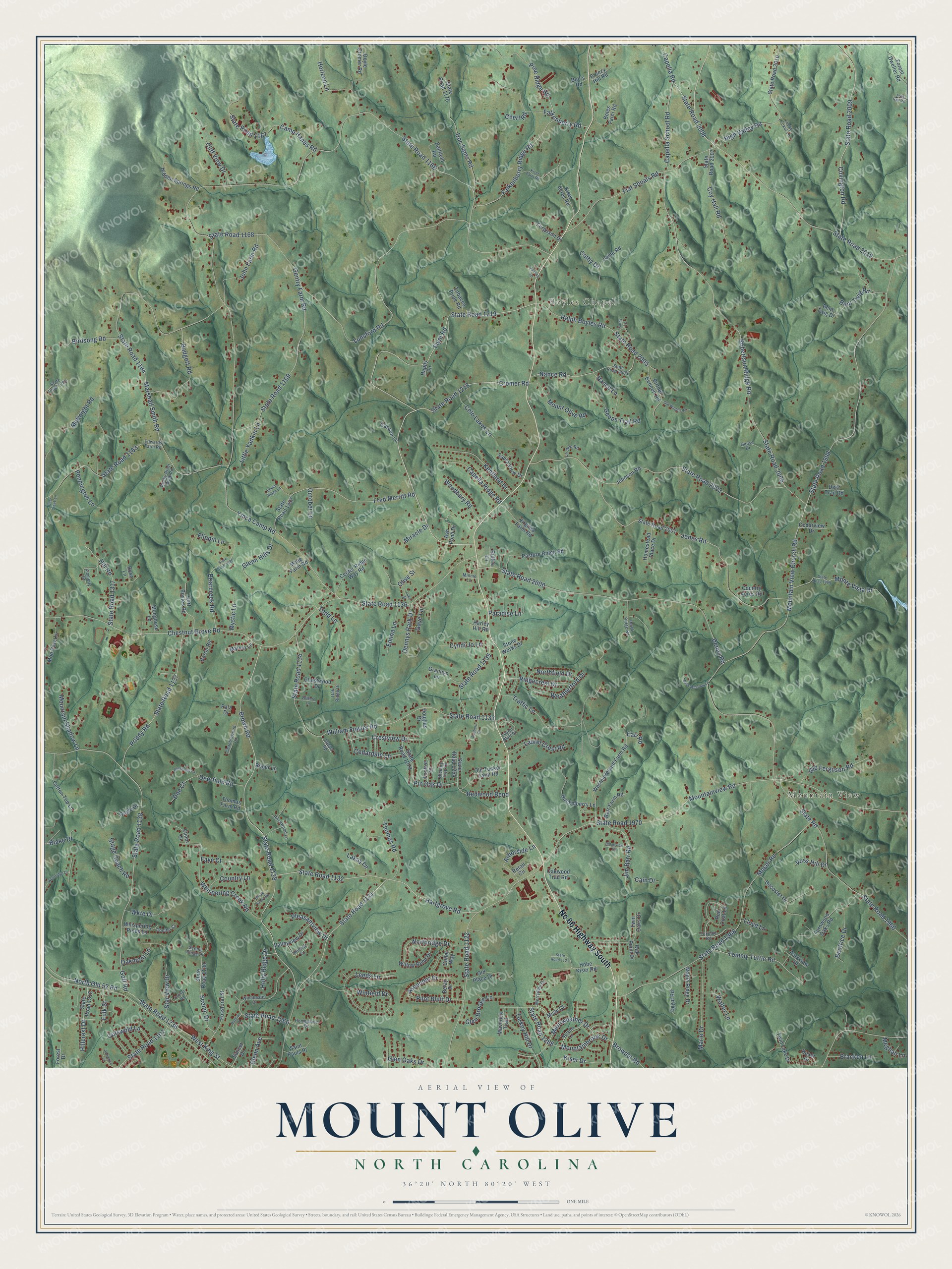
A new map of Mount Olive, Stokes County, North Carolina, made in 2026 and printed to order on thick archival matte paper.
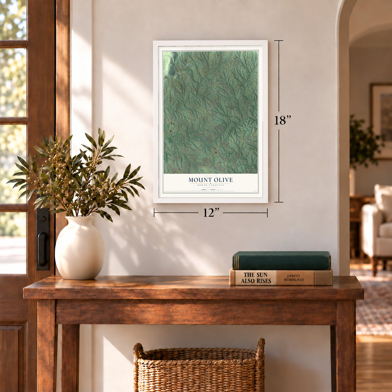
12" x 18" Archival Matte Print
A Map of Home. A Work of Art.
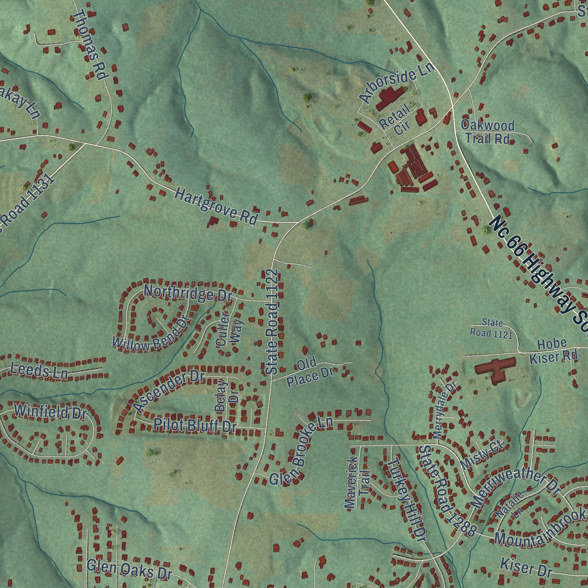
Explore Mount Olive, North Carolina from a whole new perspective. Created using aerial imagery and detailed geographic data, this map captures Mount Olive building by building, with labeled streets, familiar landmarks, and shaded topographical relief that highlights the natural contours of the landscape.
Combining modern data with the timeless character of a vintage atlas, this map is just as interesting up close as it is beautiful on the wall. Whether you grew up in Mount Olive, spent memorable years there, or call it home today, this unique map is a great way to celebrate a place that means something to you. Zoom in on the preview to look for your street, and then order a print to put your memories on the wall.
Three ways to hang it
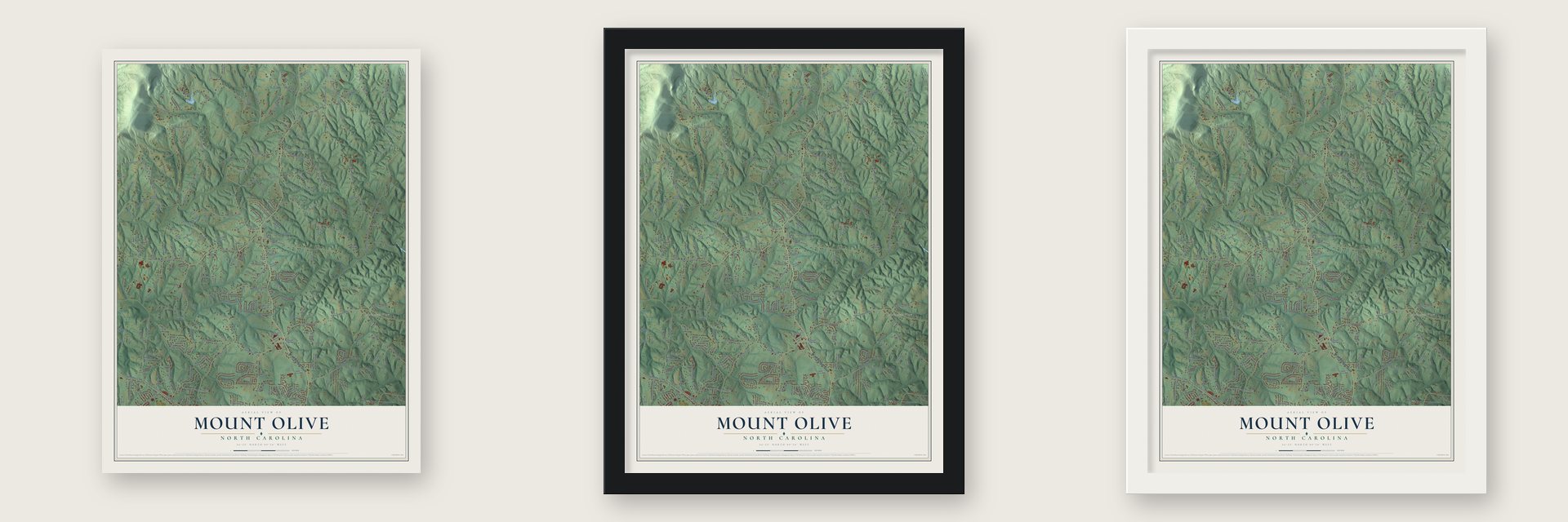
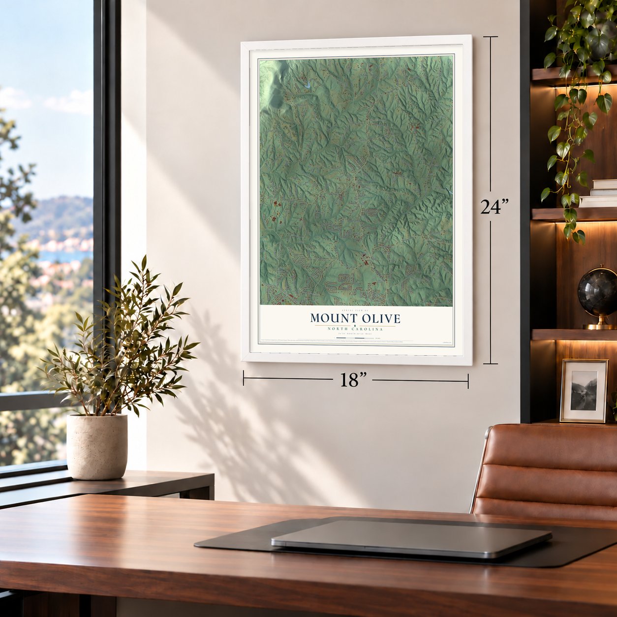
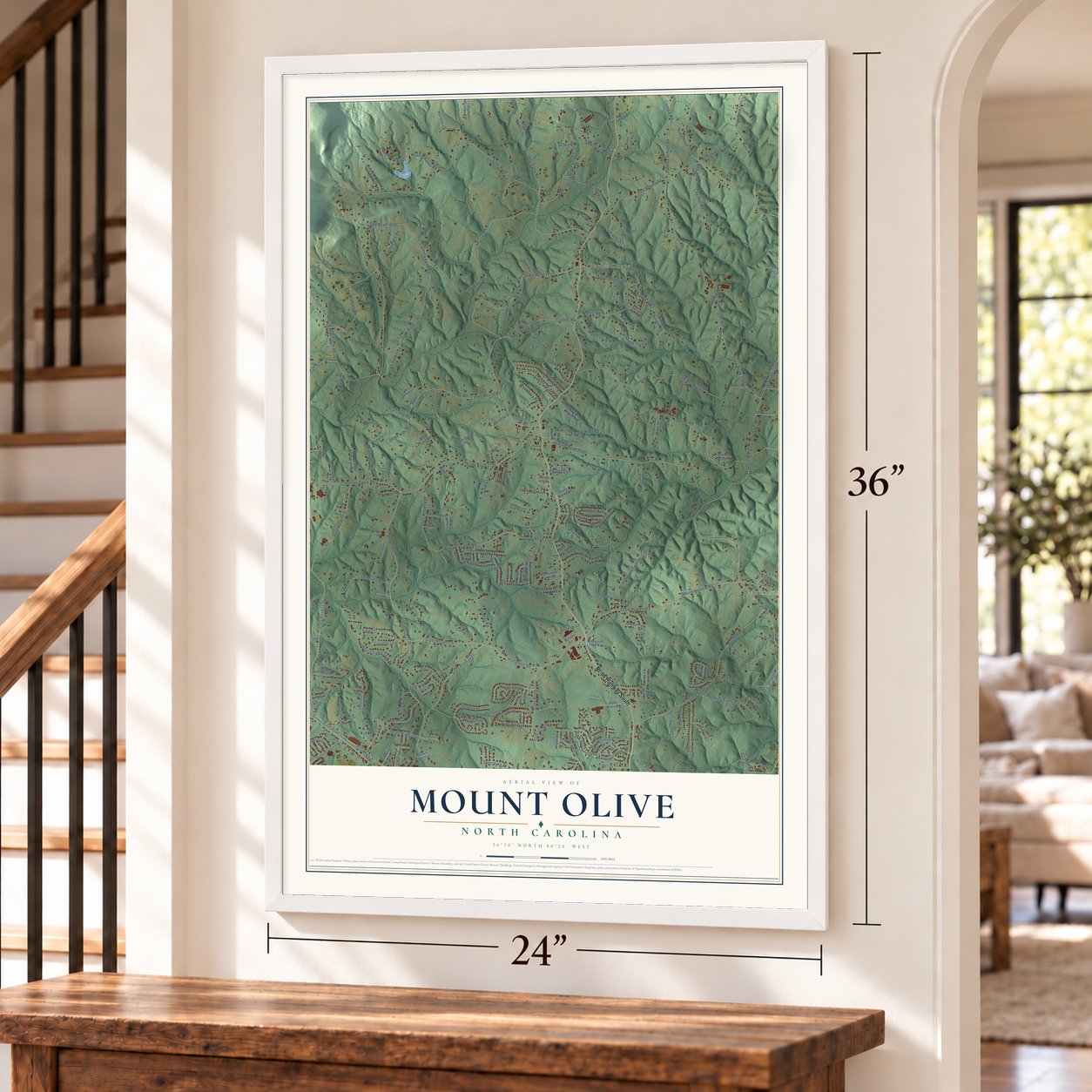
Unframed archival matte, a black wood frame or a white wood frame.
Up close
Geography Worth Displaying
This map was created using accurate cartographic data and authoritative geographic sources, including the U.S. Geological Survey and the Census Bureau. The map brings together terrain, waterways, roads, and building detail. The majority of the streets are labeled, houses are accurately depicted, and the topography is derived from government sources. Combining local data with carefully composed color and shading leads to this beautifully detailed Mount Olive artwork for your wall.
Rather than simply showing street outlines, we’ve included as many of the street names as we could reasonably fit on the map while keeping their names legible. Zoom in on the high resolution preview to see exactly what’s on the map. We truly set out to create a statement piece for anyone who loves Mount Olive. So whether it’s for you, or a gift for someone you love, we hope this map of Mount Olive brings back fond memories.
Read the story behind this map: Detailed Map of Mount Olive, Stokes County, North Carolina.

Find your street
Names on the Mount Olive map
Every name below is printed on this map. Look for your street, your school, the park where you played, or the pond down the road.
Places and landmarks2
- Mountain View
- Boyles Chapel
Streets and roads285
- Nc 66 Highway South
- State Road 1219
- Brown Road
- Covington Road
- Cromer Road
- State Road 1131
- Doe Court
- State Road 2009
- Hartgrove Road
- State Road 2008
- Capella Road
- State Road 1166
- Ymca Camp Road
- Mountainview Road
- Mountain View Church Road
- State Road 1998
- State Road 1168
- State Road 2006
- Chestnut Grove Road
- State Road 1136
- State Road 1128
- Flat Shoals Road
- State Road 2019
- State Road 1970
- Marshall Smith Road
- Robertson Ridge Road
- Jones Road
- Slate Road
- State Road 1966
- Goff Road
Show all 285 streets
- State Road 1138
- Gentry Farm Road
- State Road 1132
- William Fowler Road
- State Road 1164
- Lunsford Road
- State Road 2002
- Denny Road
- State Road 2000
- Flynt Road
- Moser Road
- State Road 1968
- State Road 1163
- North Old 52 Road
- State Road 1236
- West King Street
- Traffic Lane
- State Road 1133
- State Road 1169
- Fred Merritt Road
- State Road 1122
- Priddy Road
- State Road 1137
- High Valley Road
- Winfield Drive
- Ralph Boyles Road
- State Road 2005
- Whispering Creek Road
- Camp Hanes Road
- State Road 1167
- McKnight Road
- Scenic Drive
- Falkenberry Ridge Road
- State Road 1266
- Doc Sams Road
- State Road 1218
- Falkenberry Road
- Nance Road
- State Road 1134
- Mountainbrook Drive
- State Road 1288
- Monte Vista Drive
- Thomas Road
- Badgett Road
- Merriweather Drive
- Pine Ridge Road
- Briarcreek Road
- Tommy Tuttle Road
- Coy Hall Road
- State Road 1135
- Kentland Drive
- Marie Drive
- Hill Road
- State Road 1317
- Capella School Road
- John Farm Road
- Redwood Bend
- Weatherford Drive
- Northridge Drive
- Geeps Trail Road
- Cathy Drive
- Capella Ridge Road
- Cliff View Drive
- Gib Ferguson Road
- Cedardale Lane
- Wkte Drive
- Horizon Lane
- Mount Olive Road
- Jim Barr Road
- Crestview Drive
- Dennys Park Drive
- Glenn Hills Drive
- Ridgecrest Drive
- Glen Brooke Lane
- Turkey Hill Drive
- Hillcrest Drive
- Beatrice Drive
- State Road 1107
- Todd Lane
- Laurel Crest Road
- Birdsong Road
- Bent Twig Road
- Leeds Lane
- Celo Lakes Lane
- Mountain Shadow Lane
- Ascender Drive
- Nance Lane
- Woodbury Road
- Pilot Bluff Drive
- Northfield Drive
- Star View Drive
- Cyndi Jo Lane
- Cotswold Lane
- Paradise Lane
- Pleasantview Drive
- Emma Lane
- Little Yadkin Lane
- Bracken Lane
- Deerfield Road
- Glen Oaks Drive
- Stage Coach Road
- Pennington Lane
- Kiser Drive
- Country Lane
- Glenn Avenue
- Olive Street
- Faye Court
- Flippin Lane
- Pin Oak Drive
- Walter Lane
- Holly Ridge Drive
- Arborside Lane
- Browder Road
- Mystic Lane
- Oakmont Lane
- Blake Drive
- Fulk Street
- Cain Drive
- Miracle Drive
- Voss Hill Drive
- Lakay Lane
- Meghan Lane
- October Lane
- Lloyd Lane
- Cherl Road
- Gaye Lane
- Earl Road
- State Road 2001
- Johnson Road
- State Road 1337
- State Road 2010
- Westmoreland Farm Road
- State Road 1170
- State Road 2007
- Decoster Drive
- State Road 1130
- Hobe Kiser Road
- State Road 1254
- Doyle Cromer Road
- Pasture Ridge Road
- Fernwood Oaks Road
- Twin Oaks Drive
- Twin Lake Drive
- Huckelberry Lane
- State Road 1313
- Cotton Top Lane
- Kiser Acres Road
- Gayle Drive
- Birthel Bennett Road
- Hidden Springs Road
- Curt Boyles Road
- Moo Cow Lane
- Forest Dweller Road
- Happy Lane
- Center Ridge Way Road
- Willow Bend Drive
- State Road 1278
- Ballfield Road
- Valleyview Drive
- Virginia Farm Road
- Fosstoral Street
- Egypt Road
- Boles Farm Road
- Laine Road
- Barr Farm Road
- Bent Twig Drive
- Maple Ridge Drive
- Whispering Pines Lane
- Homestead Place Drive
- Chestwood Drive
- Grannys Lane
- Saura View Drive
- Ash Pond Drive
- Old Place Drive
- Baron Road
- Old Tucker Farm Road
- Oakwood Trail Road
- Mabe Farm Road
- Ferguson Drive
- Retail Circle
- Douglas Drive
- Deer Trail Road
- Saint Pauls Place
- Country Acres Road
- Mongoose Lane
- Tobacco Pride Road
- Cedarview Drive
- Parkview Drive
- Maverick Trail
- Harley Hill Road
- Breezy Hill Road
- Marvin Lane
- Ganson Lane
- Sunset Drive
- Roger Lane
- Thomas Farm Road
- Foxtrot Court
- Stone Works Drive
- Forest Drive
- Elinor Court
- Culler Way
- Boxer Drive
- Belay Drive
- Ruth's Lane
- Misty Court
- Oak Point Drive
- Pala Drive
- Red Coat Lane
- Bud's Road
- Rose Lane
- Edwards Farm Road
- Winchester Drive
- State Road 2003
- Hawk Ridge Road
- Chandlewood Lane
- Kimberly Drive
- Hickory Tree Lane
- Foxdale Road
- Laurel Bluff Drive
- Natalie Lane
- Hillside Court
- Rosewood Lane
- Gause Drive
- Merrydale Drive
- Homeplace Drive
- Rocky River Walk Road
- State Road 1162
- Oak Ridge Drive
- Conifer Court
- Le-Ann Road
- Lucky Locket Lane
- Fowler Road
- Scenic Ridge Place
- Minnie Lane
- State Road 1338
- State Road 1121
- State Road 1999
- Deer Creek Lane
- Buck Meadow Lane
- Cricket Road
- Ashburn Drive
- Old Wagon Road
- Beechtree Lane
- Beech Ridge Lane
- Westridge Drive
- Brook Valley Road
- Kiser Farm Road
- Ridgeview Drive
- Provence Court
- Wilburn Lane
- Luke Street
- Cathy Lane
- Barlow Court
- Jean Hall Road
- Vanhoy Road
Names are listed as they appear on the printed map. Zoom into the product photos to find them.
The art of mapping a place
How This Map Was Made
Real places. Remarkable detail. Discover the layers that turn geographic data into a map of home.

The view from above
Aerial imagery reveals the character of the land: woodland, open fields, and the patterns of a place.

The shape of the land
Elevation data brings hills, valleys, and subtle changes in the landscape into view.

The details of home
Roads, waterways, and building footprints come together to make the map feel unmistakably local.

Geography becomes art
Considered color, shading, and typography bring the layers together in a map made for your wall.


Process illustrated with Mendon, Massachusetts. Aerial imagery: USDA NAIP. Terrain: USGS 3D Elevation Program. Map details and finished artwork: KNOWOL.
The Details
About This Print
Choose an archival matte print, or a black or white Ayous wood frame. The archival matte print is unframed.
Select your size and finish above to see the matching product image and price.
Materials & Craftsmanship
A contemporary map with the character of a classic atlas, printed on archival matte paper. Optional frames are made from Ayous wood.
Your printed map does not include the watermark shown in the full-map preview.
Shipping & Delivery
Free shipping within the United States. Every print is made to order in the USA.
Buying a gift? Add a note in your cart and we'll include it. We never put prices in the package.
Prints ship within 2 to 3 business days. Allow 7 to 10 days total from ordering for delivery. Timing may vary during holidays or periods of high order volume.
Read our shipping policy.
Returns and damaged prints
Each print is made to order. Change-of-mind refunds are not available after production.
If your print arrives damaged, misprinted or incorrect, contact support@knowol.com within 30 days of receiving it. Include your order number, photos and a description of the issue.
Read our full refund and replacement policy. For questions about your order, email support@knowol.com.
Find your town
Looking for another city?
Find a map of home in our North Carolina collection, or any town in the country.
Nearby
Maps of towns near Mount Olive
Know someone from one of these towns? Their map makes a great gift.
 Poplar Springs
, North Carolina
From $39.99See the map
 Chestnut Grove
, North Carolina
From $39.99See the map
 King
King, North Carolina
From $39.99See the map
More maps nearby: Pinnacle, Tobaccoville, Rural Hall, Germanton and Pilot Mountain.