
Search for another town





Free U.S. delivery 7 to 10 days after you order
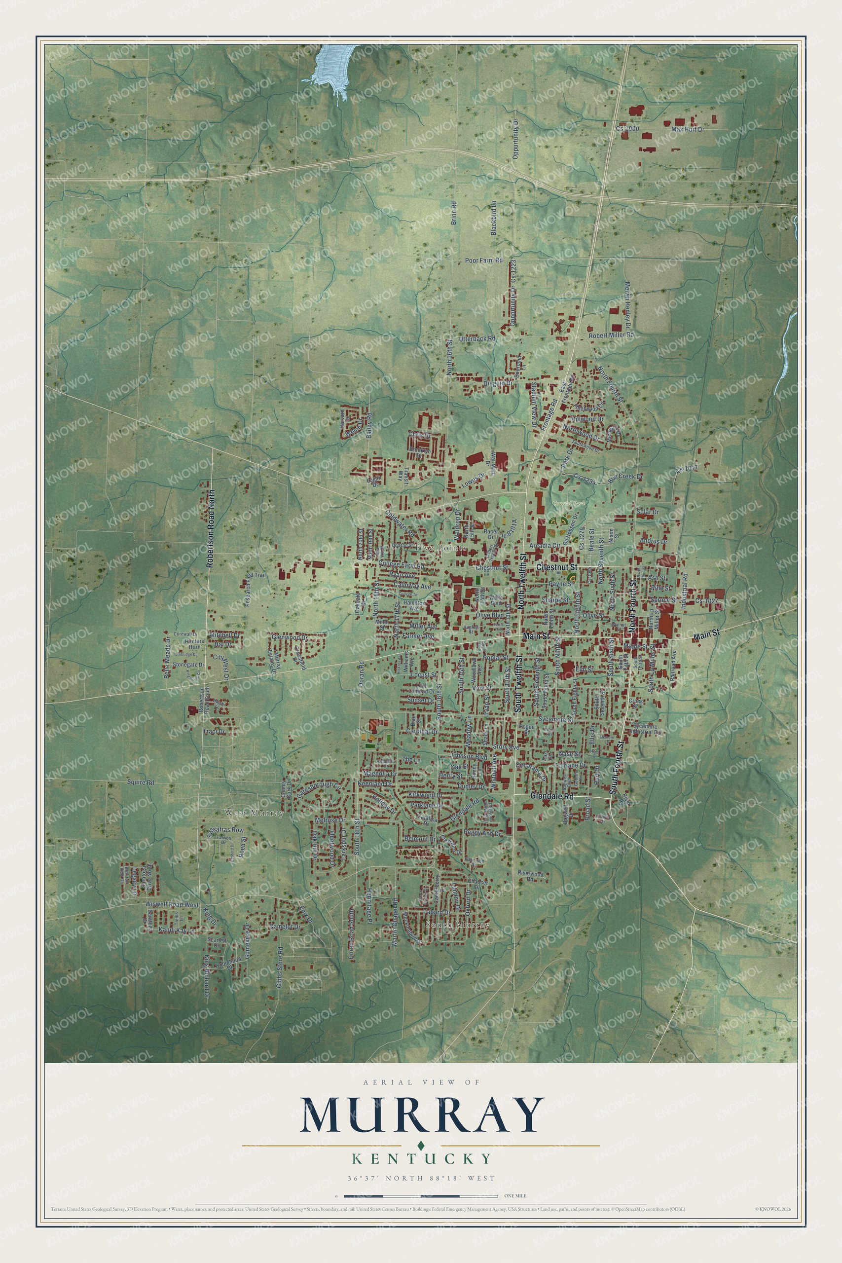
Murray, Kentucky Map Art
A new map of Murray, Kentucky, made in 2026 and printed to order on thick archival matte paper.
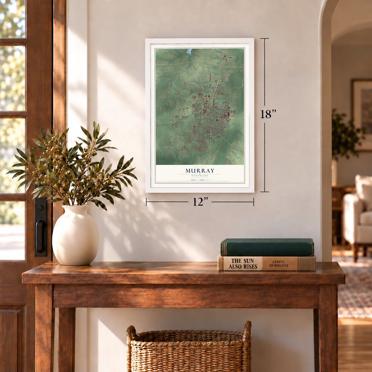
12" x 18" Archival Matte Print
A Map of Home. A Work of Art.
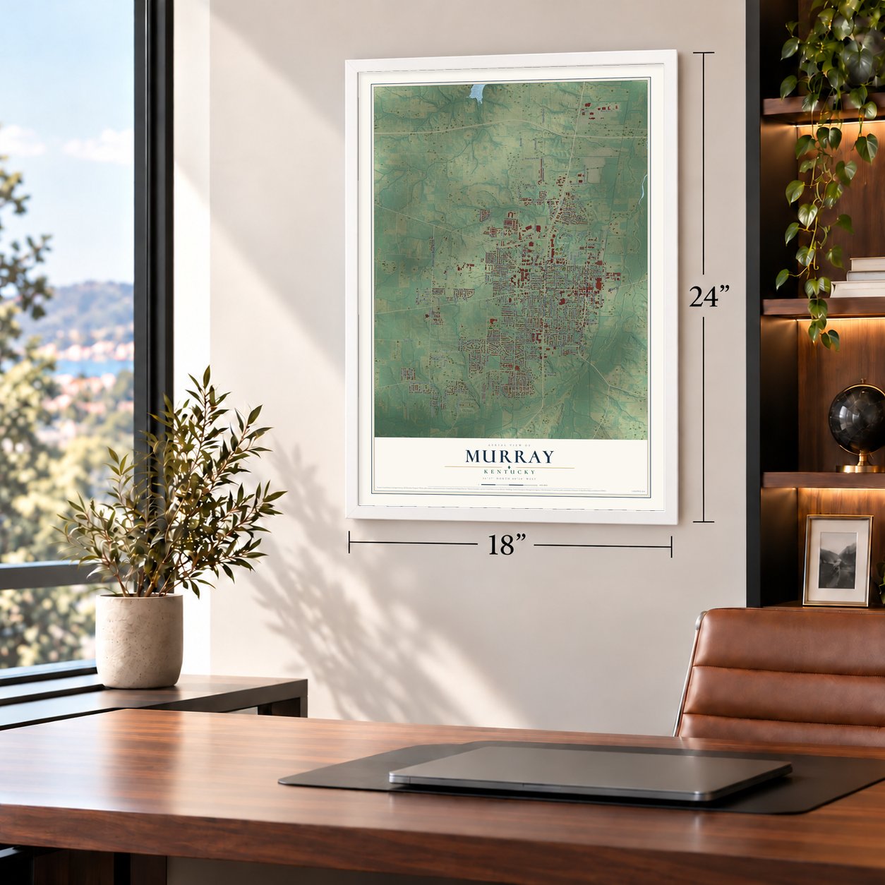
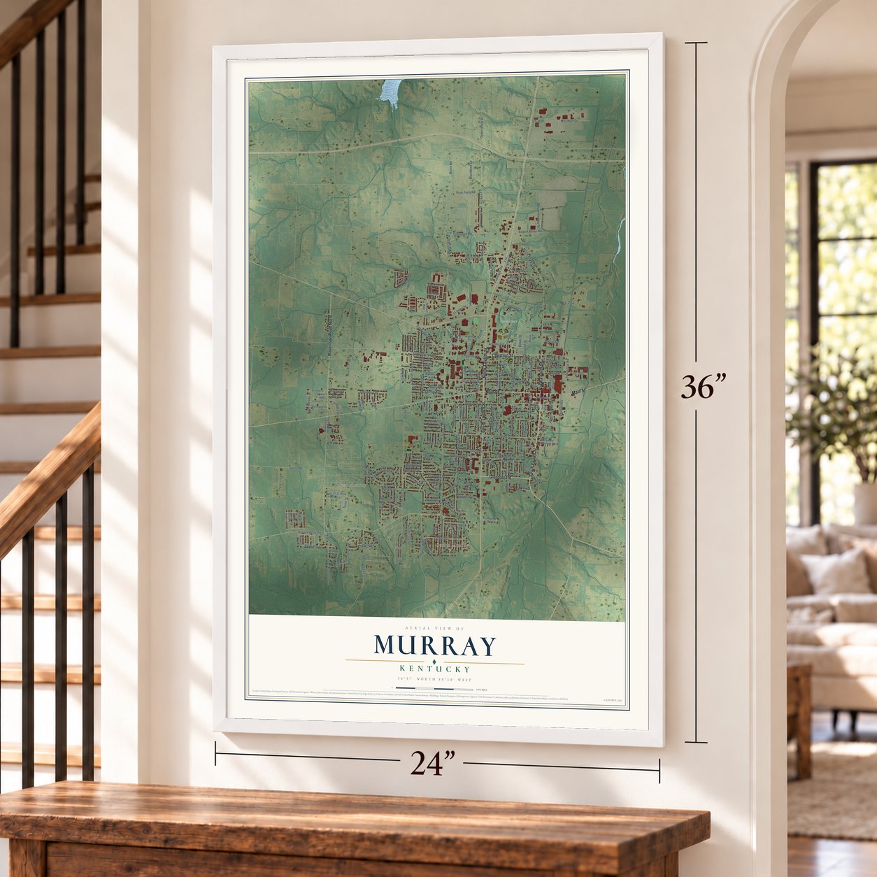
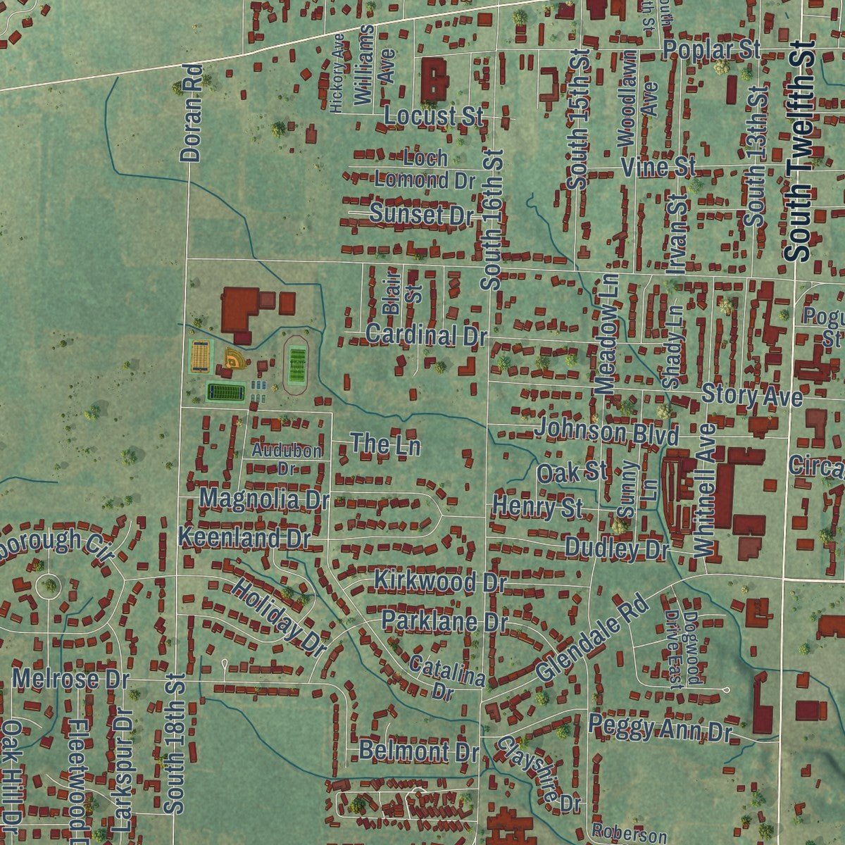
Explore Murray, Kentucky from a whole new perspective. Created using aerial imagery and detailed geographic data, this map captures Murray building by building, with labeled streets, familiar landmarks, and shaded topographical relief that highlights the natural contours of the landscape.
Combining modern data with the timeless character of a vintage atlas, this map is just as interesting up close as it is beautiful on the wall. Whether you grew up in Murray, spent memorable years there, or call it home today, this unique map is a great way to celebrate a place that means something to you. Zoom in on the preview to look for your street, and then order a print to put your memories on the wall.
Three ways to hang it
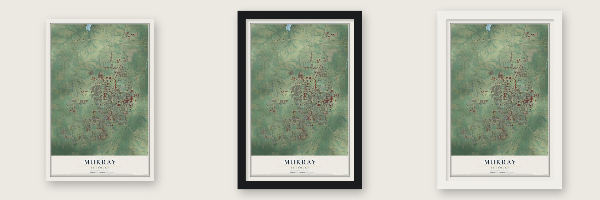
Unframed archival matte, a black wood frame or a white wood frame.
Up close
Geography Worth Displaying
This map was created using accurate cartographic data and authoritative geographic sources, including the U.S. Geological Survey and the Census Bureau. The map brings together terrain, waterways, roads, and building detail. The majority of the streets are labeled, houses are accurately depicted, and the topography is derived from government sources. Combining local data with carefully composed color and shading leads to this beautifully detailed Murray artwork for your wall.
Rather than simply showing street outlines, we’ve included as many of the street names as we could reasonably fit on the map while keeping their names legible. Zoom in on the high resolution preview to see exactly what’s on the map. We truly set out to create a statement piece for anyone who loves Murray. So whether it’s for you, or a gift for someone you love, we hope this map of Murray brings back fond memories.
Read the story behind this map of Murray, Kentucky from 2026.

About Murray, Kentucky
Murray is a city of 17,307 people and the seat of Calloway County. It started in the early 1820s as a post office and trading post called Williston, after the early settler James Willis. The name later changed to Pooltown, for the merchant Robert Pool, and then to Pleasant Springs. When the town was incorporated on January 17, 1844, it became Murray, in honor of Rep. John Murray.
The first county seat had been Wadesboro, back when Calloway County covered far more ground. In 1842 the legislature split off part of the county to form Marshall County, and leaders wanted a seat closer to the middle. They chose Murray because it sat at the county's geographic center. A courthouse and a jail went up, and the town was laid out on 80 acres, cut into 137 business and home lots along eight streets.
- Burned in the Civil WarKentucky declared itself neutral, but Murray and Calloway County sided strongly with the Confederacy. About 800 local men joined its army, while about 200 fought for the Union. Union troops burned parts of the town more than once. Josh Ellison of Murray wrote in his diary that one night in the winter of 1864-65, soldiers from Paducah set fire to all the buildings along the square's east side, and three days later they burned the ones to its north.
- A normal school in 1922Murray State University opened in 1922 as the Murray Normal School and now enrolls over 10,000 students. The Old Normal School Building joined the National Register in 1975. In 1932 the school's football team beat the University of Louisville 105-0.
- A stage in an old depotPlayhouse in the Park, among Kentucky's oldest community theatres, puts on plays and musicals all year inside a train and freight depot built in 1907, which now stands in Central Park. On May 16, 2008, former President Bill Clinton spoke there while campaigning for Hillary Clinton.
- Douglass School reunionsDouglass Graded and High School sent off its last high school class in 1962, and its elementary grades closed in 1967. Its alumni have gathered for a reunion every year since 1969, and the Kentucky Historical Society placed a marker for the school in 2023.
Find your street
Names on the Murray map
Every name below is printed on this map. Look for your street, your school, the park where you played, or the pond down the road.
Places and landmarks4
- South Murray
- West Murray
- Five Points
- Central Park
Streets and roads215
- Chestnut Street
- South Fourth Street
- North Fourth Street
- North Twelfth Street
- Main Street
- South Twelfth Street
- Robertson Road North
- Glendale Road
- South Ninth Street
- King Drive
- Industrial Road
- Arcadia Circle
- Guinevere Drive
- Sassafras Row
- Welch Drive
- Reed Street
- North 16th Street
- Wiswell Road West
- Sycamore Street
- Poplar Street
- College Farm Road
- South 16th Street
- Doran Road
- South 18th Street
- Olive Street
- Vine Street
- Oppurtunity Drive
- North 18th Street
- Lowes Drive
- Gibbs Store Road
Show all 215 streets
- Story Avenue
- North Seventh Street
- Broad Street
- Payne Street
- Utterback Road
- Gatesborough Circle
- Oxford Drive
- Tabard Drive
- Kirkwood Drive
- Johnson Boulevard
- Diuguid Drive
- Cs-1000
- Max Hurt Drive
- South 13th Street
- North 17th Street
- South Eleventh Street
- Melrose Drive
- Cs-1234
- Park Drive
- Poor Farm Road
- Spruce Street
- Northwood Drive
- Fairlane Drive
- Elm Street
- North Eighth Street
- Doran Road South
- Larkspur Drive
- Olive Boulevard
- Maple Street
- Cardinal Drive
- South Sixth Street
- Frontage Road
- Meadow Lane
- Coldwater Road
- Cs-1223
- Opportunity Drive
- Fleetwood Drive
- Martin Chapel Road
- Whitnell Avenue
- Parklane Drive
- Bailey Road
- Melvin Henley Drive
- Sunset Drive
- King Richard Drive
- South 15th Street
- North Sixth Street
- Keenland Drive
- Magnolia Drive
- Camelot Drive
- London Drive
- Waldrop Drive
- Farmer Avenue
- Miller Avenue
- Calloway Avenue
- Ryan Avenue
- Beale Street
- Oak Hill Drive
- Belmont Drive
- Stadium View Drive
- Blackbird Lane
- Kandi Kay Lane
- South Lp Miller Street
- Irvan Street
- Glenwood Drive
- Hermitage Place
- Bee Creek Drive
- Sharpe Street
- Dudley Drive
- Pine Street
- Belle Meade Drive
- Hillwood Drive
- Brinn Road
- Circarama Drive
- Peggy Ann Drive
- Robert Miller Road
- Locust Street
- Cs-1027
- Ash Street
- Holiday Drive
- Chris Drive
- City West Drive
- Traci Drive
- Ellis Drive
- Enix Drive
- Squire Road
- Henry Street
- Mitchell Drive
- Cs-1017
- Andrus Drive
- Hal Drive
- Legacy Lane
- Hurt Drive
- Nash Street
- Cs-1279
- Oak Street
- The Lane
- Solar Drive
- Robertson Road South
- Fleetwood Circle
- Research Field Trail
- North Tenth Street
- South Eighth Street
- North 13th Street
- East Frontage Road
- Canterberry Drive
- Mockingbird Drive
- South Seventh Street
- Gil Hobson Drive
- North Lp Miller Street
- North 15th Street
- Catalina Drive
- Woodlawn Avenue
- South Tenth Street
- North 14th Street
- Wells Boulevard
- Chaucer Drive
- Wal-Mart Drive
- South Fifth Street
- Railroad Avenue
- Saratoga Drive North
- Robinhood Drive
- Stonegate Drive
- Sycamore Industrial Road
- Sunny Lane
- Crossfield Drive
- Loch Lomond Drive
- Murray Estates Drive
- Hunters Horn
- Michelle Drive
- River Road
- County Cork Drive
- North 19th Street
- North 20th Street
- Riverwood Road
- Nixon Street
- Clayshire Drive
- Saratoga Drive
- Hamilton Avenue
- Blair Street
- Bagwell Drive
- Bourland Lane
- Transit Way
- Harvard Drive
- Shady Lane
- Oakdale Drive
- Williams Avenue
- Brooklyn Drive
- Miller Street
- Scarlett Drive
- Pogue Street
- Logan Drive
- Racer Drive
- Cross Street
- Earl Court
- Bagwell Boulevard
- Southwood Drive
- Walnut Street
- Falwell Drive
- South Third Street
- Guthrie Drive
- Gilbert Graves Drive
- Blissfull View Drive
- Dodson Street
- Trents Lane
- Cornwall Drive
- Roberson Street
- Dogwood Drive East
- Audubon Drive
- Sha Wa Court
- Bambi Lane
- Cs-1085
- Hughes Street
- Coach Estates Drive
- North Third Street
- Kingsbury Circle
- Turnbridge Drive
- Memory Lane
- Hickory Avenue
- College Terrace
- Bedford Drive
- Riley Court
- Chantilly Drive
- South 14th Street
- Farris Avenue
- Pogue Avenue
Names are listed as they appear on the printed map. Zoom into the product photos to find them.
The art of mapping a place
How This Map Was Made
Real places. Remarkable detail. Discover the layers that turn geographic data into a map of home.

The view from above
Aerial imagery reveals the character of the land: woodland, open fields, and the patterns of a place.

The shape of the land
Elevation data brings hills, valleys, and subtle changes in the landscape into view.

The details of home
Roads, waterways, and building footprints come together to make the map feel unmistakably local.

Geography becomes art
Considered color, shading, and typography bring the layers together in a map made for your wall.


Process illustrated with Mendon, Massachusetts. Aerial imagery: USDA NAIP. Terrain: USGS 3D Elevation Program. Map details and finished artwork: KNOWOL.
The Details
About This Print
Choose an archival matte print, or a black or white Ayous wood frame. The archival matte print is unframed.
Select your size and finish above to see the matching product image and price.
Materials & Craftsmanship
A contemporary map with the character of a classic atlas, printed on archival matte paper. Optional frames are made from Ayous wood.
Your printed map does not include the watermark shown in the full-map preview.
Shipping & Delivery
Free shipping within the United States. Every print is made to order in the USA.
Buying a gift? Add a note in your cart and we'll include it. We never put prices in the package.
Prints ship within 2 to 3 business days. Allow 7 to 10 days total from ordering for delivery. Timing may vary during holidays or periods of high order volume.
Read our shipping policy.
Returns and damaged prints
Each print is made to order. Change-of-mind refunds are not available after production.
If your print arrives damaged, misprinted or incorrect, contact support@knowol.com within 30 days of receiving it. Include your order number, photos and a description of the issue.
Read our full refund and replacement policy. For questions about your order, email support@knowol.com.
Find your town
Looking for another city?
Find a map of home in our Kentucky collection, or any town in the country.
Nearby
Maps of towns near Murray
Know someone from one of these towns? Their map makes a great gift.
 Hazel
Hazel, Kentucky
From $39.99See the map
 Dexter
, Kentucky
From $39.99See the map
 Hardin
, Kentucky
From $39.99See the map
More maps nearby: Farmington, Sedalia, Benton, Mayfield and Pryorsburg.