
Search for another town





Free U.S. delivery 7 to 10 days after you order
Natchitoches, Louisiana Map Art
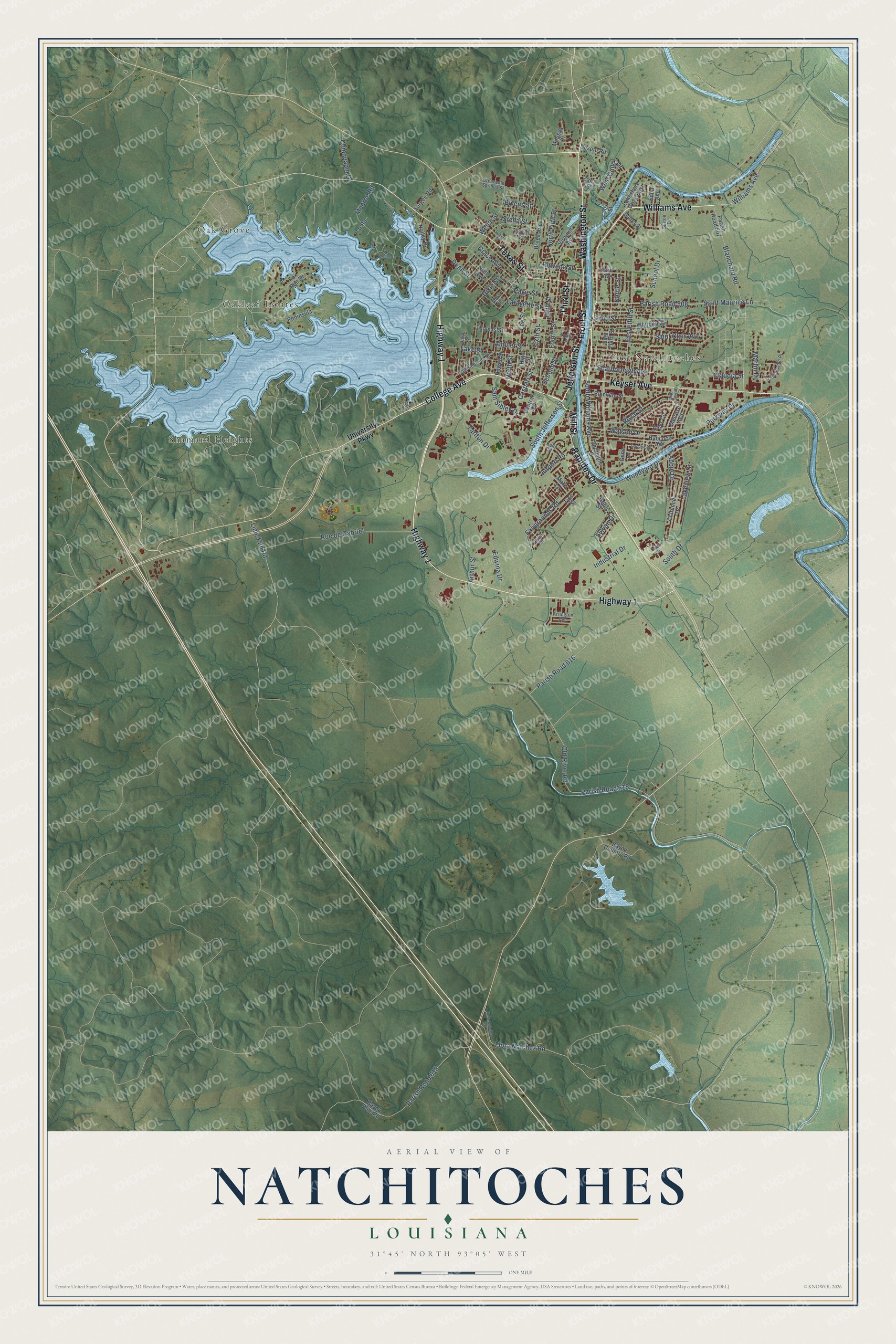
A new map of Natchitoches, Louisiana, made in 2026 and printed to order on thick archival matte paper.
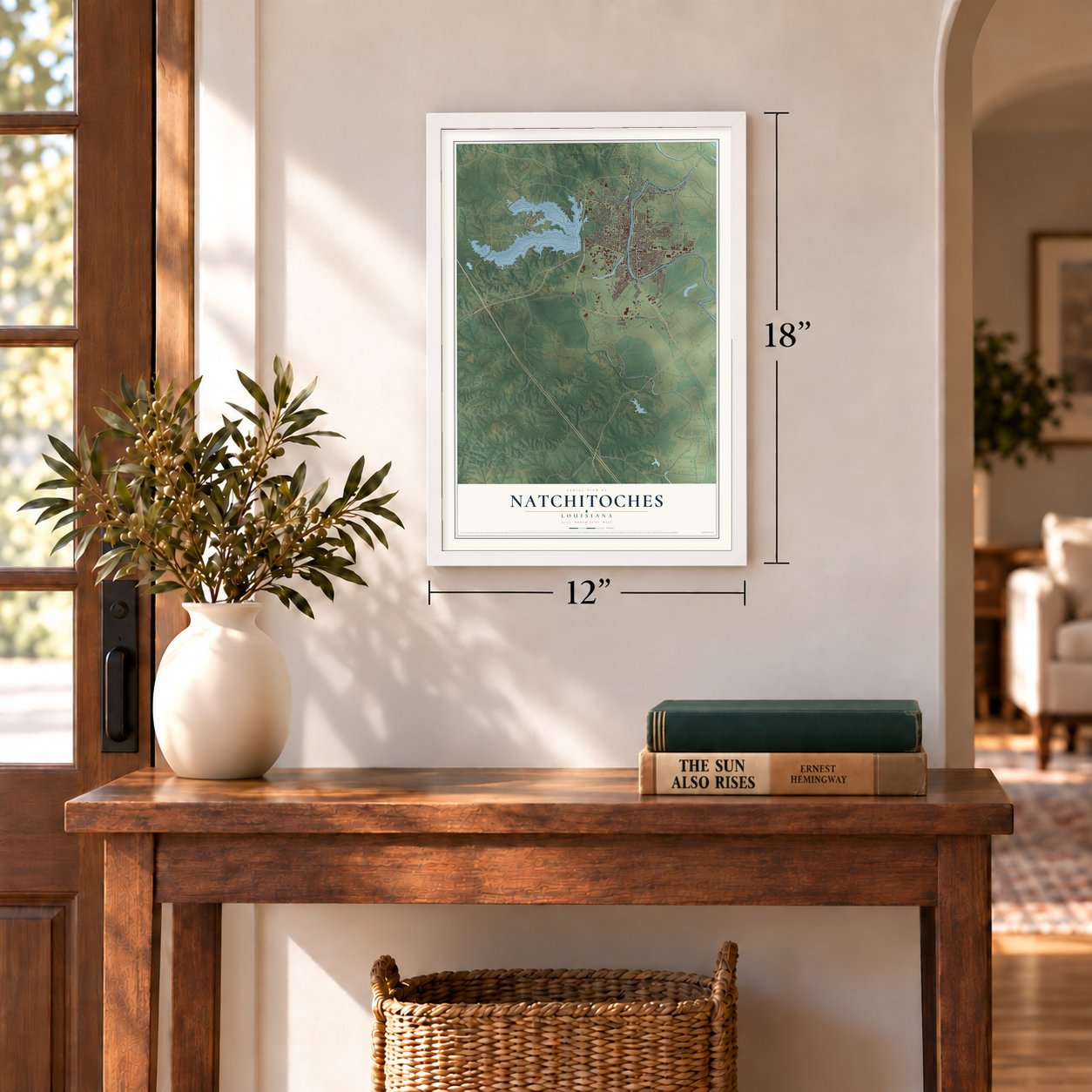
12" x 18" Archival Matte Print
A Map of Home. A Work of Art.
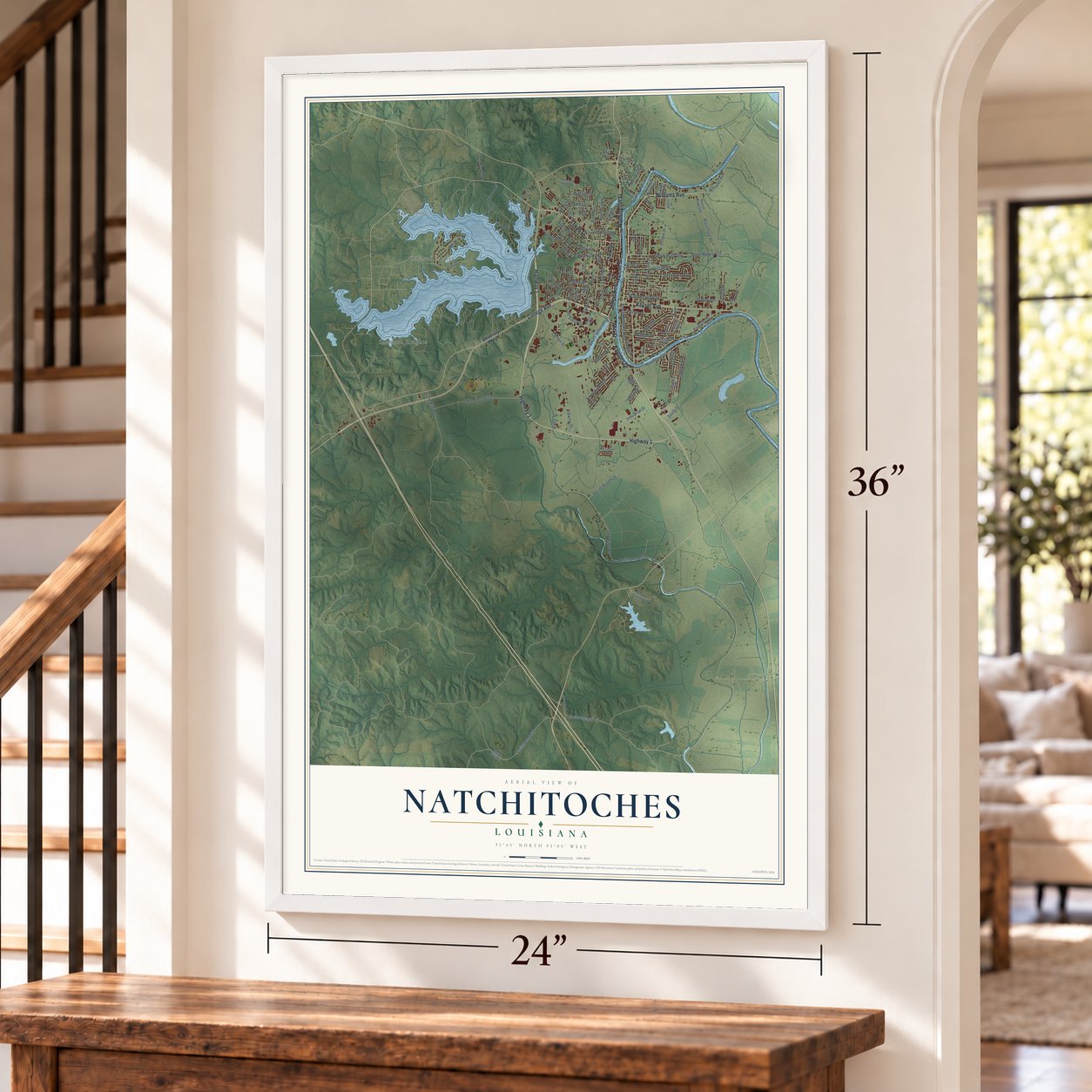
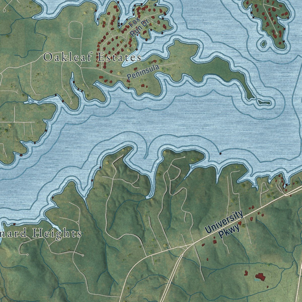
Explore Natchitoches, Louisiana from a whole new perspective. Created using aerial imagery and detailed geographic data, this map captures Natchitoches building by building, with labeled streets, familiar landmarks, and shaded topographical relief that highlights the natural contours of the landscape.
Combining modern data with the timeless character of a vintage atlas, this map is just as interesting up close as it is beautiful on the wall. Whether you grew up in Natchitoches, spent memorable years there, or call it home today, this unique map is a great way to celebrate a place that means something to you. Zoom in on the preview to look for your street, and then order a print to put your memories on the wall.
Three ways to hang it
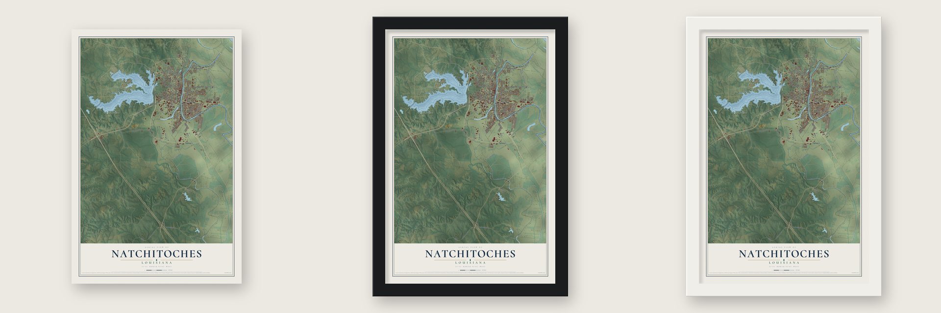
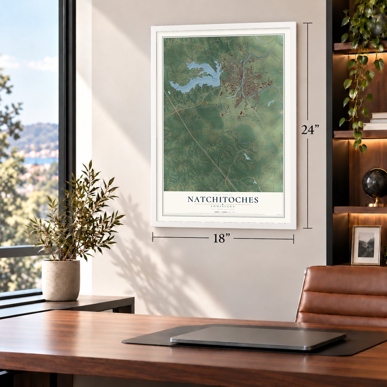
Unframed archival matte, a black wood frame or a white wood frame.
Up close
Geography Worth Displaying
This map was created using accurate cartographic data and authoritative geographic sources, including the U.S. Geological Survey and the Census Bureau. The map brings together terrain, waterways, roads, and building detail. The majority of the streets are labeled, houses are accurately depicted, and the topography is derived from government sources. Combining local data with carefully composed color and shading leads to this beautifully detailed Natchitoches artwork for your wall.
Rather than simply showing street outlines, we’ve included as many of the street names as we could reasonably fit on the map while keeping their names legible. Zoom in on the high resolution preview to see exactly what’s on the map. We truly set out to create a statement piece for anyone who loves Natchitoches. So whether it’s for you, or a gift for someone you love, we hope this map of Natchitoches brings back fond memories.
Read the story behind this map of Natchitoches, Louisiana from 2026.

About Natchitoches, Louisiana
Natchitoches is a city of 18,039 people and the seat of Natchitoches Parish. The French explorer Louis Juchereau de St. Denis founded it in 1714, which makes it the oldest town in present-day Louisiana started by Europeans. Governor Cadillac had ordered St. Denis to open a trade route with the Spanish in Texas and with the tribes to the west. St. Denis asked the Natchitoches people, who were then living on the Pearl River, whether they would go home to the Red River and help build a trading post, and they agreed.
When they reached their old site, they found the Doustionis living there. St. Denis talked the two tribes into sharing the land. They then helped him build Fort St. Jean Baptiste des Natchitoches on an island in the Red River, with quarters for the French and warehouses for trade goods. The town kept the Natchitoches name and was incorporated on February 5, 1819.
- The river moved awayIn the 1820s and early 1830s, cotton from east Texas came overland across the Sabine River to Natchitoches. Boats then carried it down the Red River all the way to New Orleans. Then the Red River changed course and bypassed the town, which cut off its valuable link to the Mississippi. The old channel became a 33-mile oxbow lake, now called Cane River Lake, and the downtown still faces it.
- Saved from the flamesDuring the Civil War, Union soldiers retreated through Natchitoches after their failed attempt to take Shreveport, and they set the town on fire as they went. Confederate cavalry chasing them got there in time to help put out the fire, so the town survived. Union troops destroyed Alexandria in 1864.
- A downtown brought backFarm jobs disappeared through the mid-20th century, and by the early 1970s 65% of the commercial district stood empty. In the mid-1970s, Mayor Bobby DeBlieux joined other preservationists in betting on tourism. He worked with landowners to create a historic district downtown. The Cane River Creole National Historical Park was authorized in 1994, and the city won the Great American Main Street Award in 2006. Vacancy downtown fell to about 1%.
- Brick by brick on Front StreetFront Street, above the river walk, is still paved with one of the city's original brick streets, and the historical society guards it against change. When the city repaired the street, workers lifted out every brick and numbered and cleaned each one. They fixed the utilities, drainage and foundation underneath, then set each brick back in place.
- Meat pies since 1826Missionary Timothy Flint mentioned the Natchitoches meat pie in a travel journal published in 1826. For generations, big orders meant tracking down a local pie maker, until butcher James Lasyone opened his restaurant at 622 Second Street in 1967. A House Beautiful story in February 1974 led Craig Claiborne and Calvin Trillin to write about the pies. In 2003 the meat pie became an official state food, and a festival celebrates it each September.
Find your street
Names on the Natchitoches map
Every name below is printed on this map. Look for your street, your school, the park where you played, or the pond down the road.
Places and landmarks4
- East Natchitoches
- Oak Grove
- Oakleaf Estates
- Shamard Heights
Streets and roads121
- Williams Avenue
- College Avenue
- Jefferson Street
- Mill Street
- Washington Street
- Rapides Drive
- Highway 1
- Third Street
- Texas Street
- Keyser Avenue
- Front Street
- South Drive
- Woodyard Drive
- South Williams Avenue
- Sam Sibley Drive
- East Fifth Street
- Royal Street
- Lakeview Drive
- West Court Drive
- Old River Road
- Parkway Drive
- Parish Road 615
- Parish Road 618
- Parish Road 508
- Saint Maurice Lane
- South Jefferson Street
- Fairgrounds Road
- Dixie Street
- Second Street
- Blanchard Road
Show all 121 streets
- Saint Clair Avenue
- Amulet Street
- Tarlton Drive
- Fifth Street
- Lee Street
- Caspari Street
- Monroe Road
- Lake Street
- Pavie Street
- Watson Drive
- Fourth Street
- Sixth Street
- Dean Street
- Rue de Gabriel
- Lafayette Street
- Industrial Drive
- Parish Road 616
- Welch Street
- Scarborough Avenue
- Flora Natchez Road
- North Fifth Street
- Airport Road
- Rowena Street
- Abbie Drive
- North Street
- Grace Avenue
- School Drive
- Stella Street
- Chinquapin Drive
- Martin Drive
- Lime Kiln Road
- Edwina Drive
- Sirod Street
- Arthur Street
- Bivens Street
- Claudia Street
- Sylvan Drive
- Nettie Street
- University Parkway
- Virginia Avenue
- Whitfield Drive
- Bayou Blue Road
- Parish Road 507
- Hancock Avenue
- Fox Run Drive
- East Third Street
- Central Avenue
- Howell Street
- Bayou Country Road
- Hill Avenue
- Clarence Drive
- Breda Avenue
- Peninsula
- Melrose Avenue
- Thomas Street
- Desoto Road
- Nolley Road
- Bienville Street
- Melissa Place
- High Street
- Lakeshore Drive East
- Aloys Circle
- Flora Street
- Shoreline Drive
- Bird Avenue
- Sorgee Road
- Par Road
- Tjoe Street
- Maria Lane
- Salter Street
- Gene Lane
- Edna Avenue
- Genti Street
- Joy Street
- Old Robeline Road
- Chinquapin Place
- Breazeale Springs Street
- Anita Street
- Julia Street
- Phillips Street
- Sutton Drive
- Arrington Avenue
- Kelly Street
- David Street
- Sabine Street
- Touline Street
- Garland Road
- Flora-Natchez Road
- Von Orange Lane
- Beaufort Boulevard
- Saida Street
Names are listed as they appear on the printed map. Zoom into the product photos to find them.
The art of mapping a place
How This Map Was Made
Real places. Remarkable detail. Discover the layers that turn geographic data into a map of home.

The view from above
Aerial imagery reveals the character of the land: woodland, open fields, and the patterns of a place.

The shape of the land
Elevation data brings hills, valleys, and subtle changes in the landscape into view.

The details of home
Roads, waterways, and building footprints come together to make the map feel unmistakably local.

Geography becomes art
Considered color, shading, and typography bring the layers together in a map made for your wall.


Process illustrated with Mendon, Massachusetts. Aerial imagery: USDA NAIP. Terrain: USGS 3D Elevation Program. Map details and finished artwork: KNOWOL.
The Details
About This Print
Choose an archival matte print, or a black or white Ayous wood frame. The archival matte print is unframed.
Select your size and finish above to see the matching product image and price.
Materials & Craftsmanship
A contemporary map with the character of a classic atlas, printed on archival matte paper. Optional frames are made from Ayous wood.
Your printed map does not include the watermark shown in the full-map preview.
Shipping & Delivery
Free shipping within the United States. Every print is made to order in the USA.
Buying a gift? Add a note in your cart and we'll include it. We never put prices in the package.
Prints ship within 2 to 3 business days. Allow 7 to 10 days total from ordering for delivery. Timing may vary during holidays or periods of high order volume.
Read our shipping policy.
Returns and damaged prints
Each print is made to order. Change-of-mind refunds are not available after production.
If your print arrives damaged, misprinted or incorrect, contact support@knowol.com within 30 days of receiving it. Include your order number, photos and a description of the issue.
Read our full refund and replacement policy. For questions about your order, email support@knowol.com.
Find your town
Looking for another city?
Find a map of home in our Louisiana collection, or any town in the country.
Nearby
Maps of towns near Natchitoches
Know someone from one of these towns? Their map makes a great gift.
 Vienna Bend
, Louisiana
From $39.99See the map
 Natchez
, Louisiana
From $39.99See the map
 Point Place
, Louisiana
From $39.99See the map
More maps nearby: Clarence, Provencal, St. Maurice, Campti and Powhatan.