
Search for another town





Free U.S. delivery 7 to 10 days after you order
Navajo, California Map Art
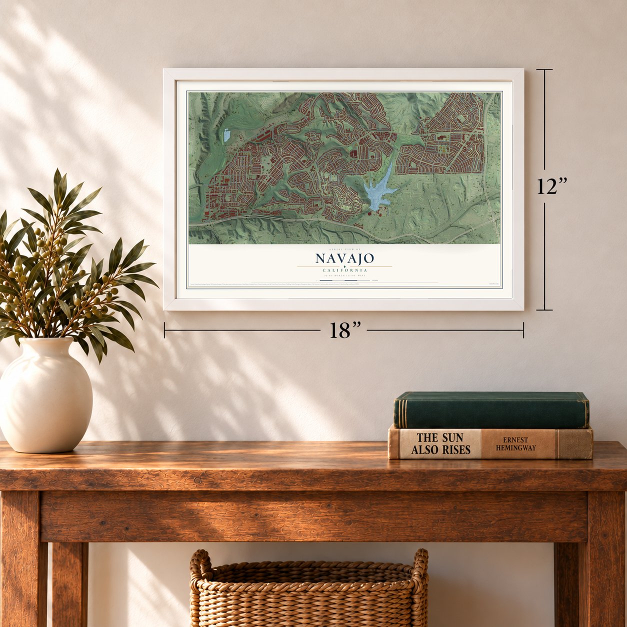
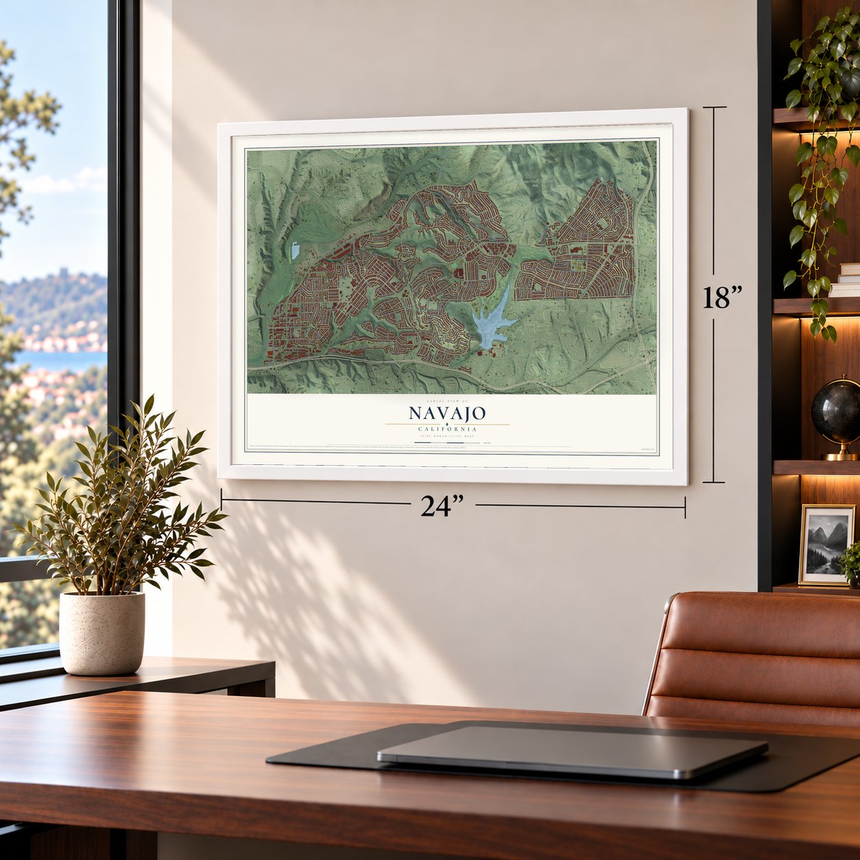
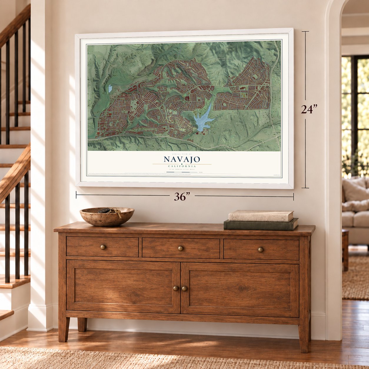
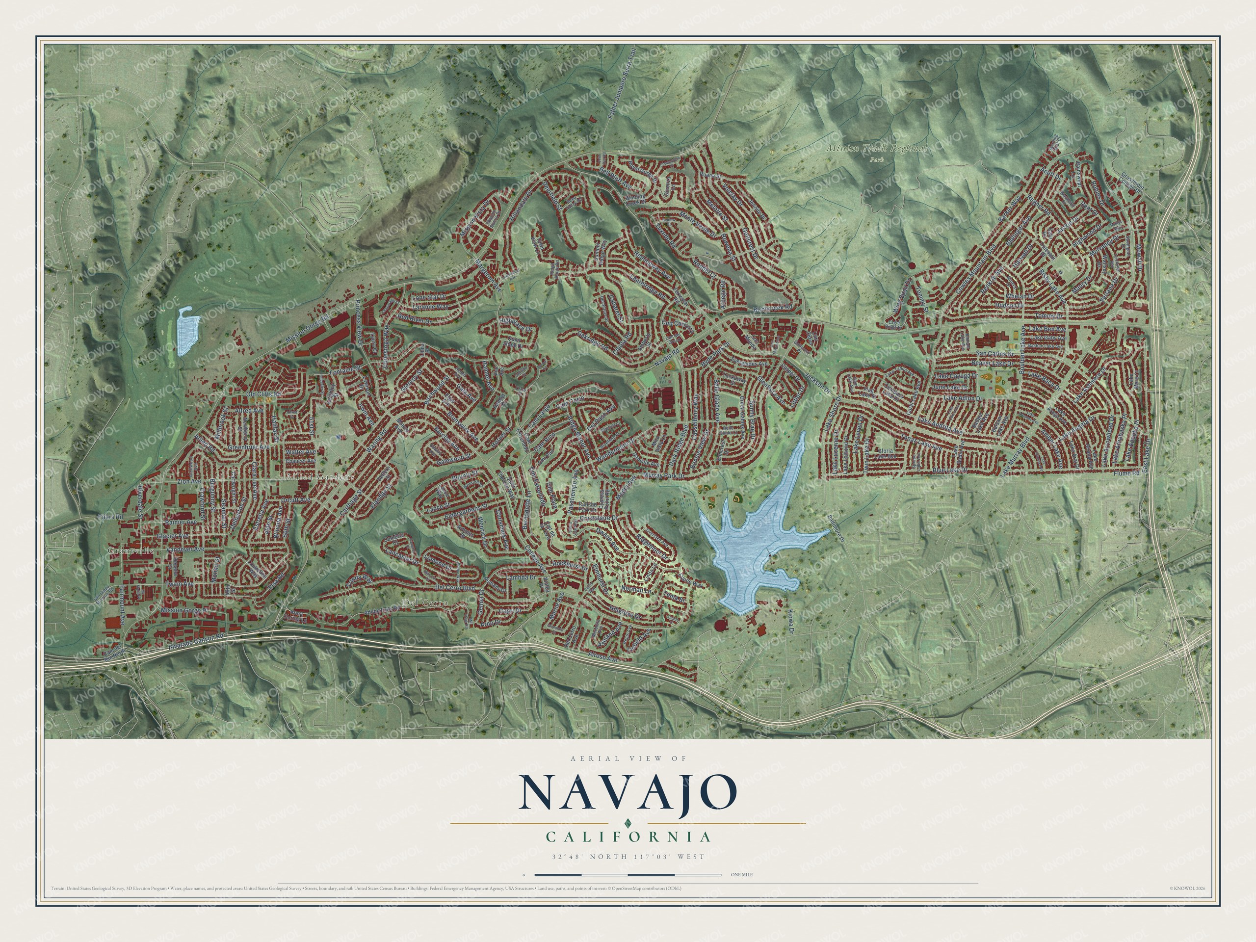
A new map of Navajo, California, made in 2026 and printed to order on thick archival matte paper.
12" x 18" Archival Matte Print
A Map of Home. A Work of Art.
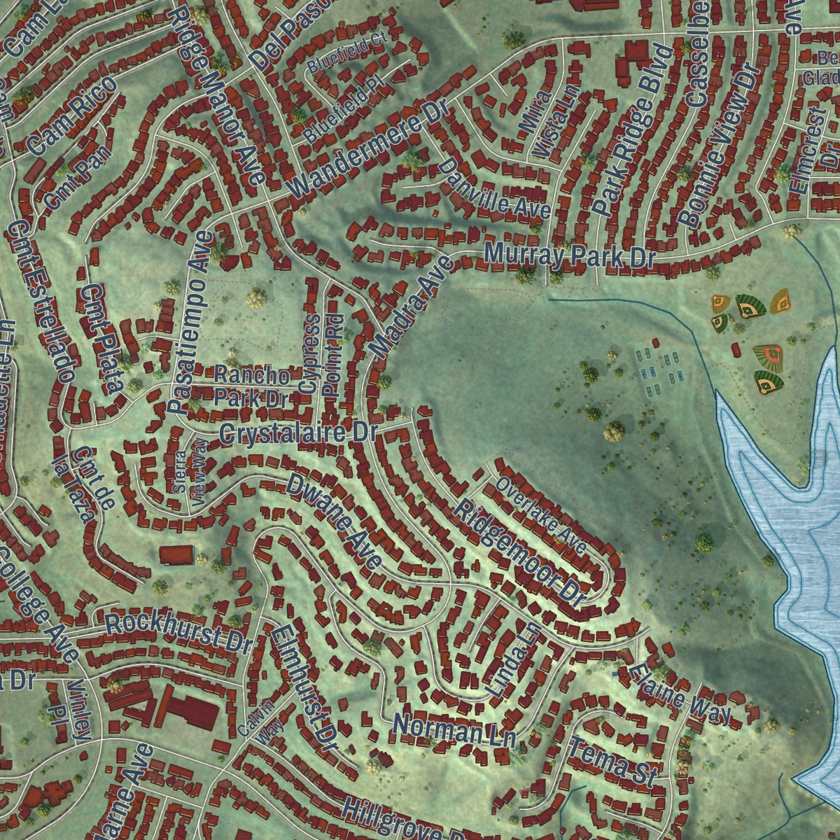
Explore Navajo, California from a whole new perspective. Created using aerial imagery and detailed geographic data, this map captures Navajo building by building, with labeled streets, familiar landmarks, and shaded topographical relief that highlights the natural contours of the landscape.
Combining modern data with the timeless character of a vintage atlas, this map is just as interesting up close as it is beautiful on the wall. Whether you grew up in Navajo, spent memorable years there, or call it home today, this unique map is a great way to celebrate a place that means something to you. Zoom in on the preview to look for your street, and then order a print to put your memories on the wall.
Three ways to hang it
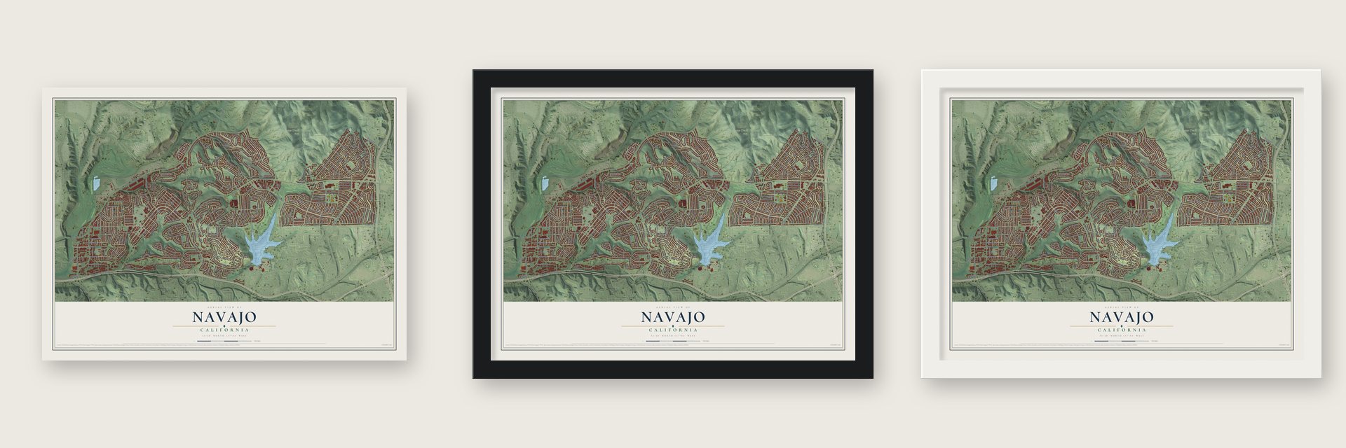
Unframed archival matte, a black wood frame or a white wood frame.
Up close
Geography Worth Displaying
This map was created using accurate cartographic data and authoritative geographic sources, including the U.S. Geological Survey and the Census Bureau. The map brings together terrain, waterways, roads, and building detail. The majority of the streets are labeled, houses are accurately depicted, and the topography is derived from government sources. Combining local data with carefully composed color and shading leads to this beautifully detailed Navajo artwork for your wall.
Rather than simply showing street outlines, we’ve included as many of the street names as we could reasonably fit on the map while keeping their names legible. Zoom in on the high resolution preview to see exactly what’s on the map. We truly set out to create a statement piece for anyone who loves Navajo. So whether it’s for you, or a gift for someone you love, we hope this map of Navajo brings back fond memories.
Read the story behind this map: Detailed Map of Navajo, California.

Find your street
Names on the Navajo map
Every name below is printed on this map. Look for your street, your school, the park where you played, or the pond down the road.
Places and landmarks4
- Grantville
- Allied Gardens
- Del Cerro
- Mission Trails Regional Park
Streets and roads287
- Alvarado Canyon Road
- Twain Avenue
- Littler Drive
- Highwood Drive
- Lancaster Drive
- Glenflora Avenue
- Pasatiempo Avenue
- Mohler Street
- Blue Lake Drive
- Mission Gorge Road
- Navajo Road
- Jackson Drive
- Del Cerro Boulevard
- Cowles Mountain Boulevard
- Golfcrest Drive
- Lake Murray Boulevard
- Waring Road
- Madra Avenue
- Zion Avenue
- Boulder Lake Avenue
- Margerum Avenue
- Tommy Drive
- College Avenue
- Park Ridge Boulevard
- Greenbrier Avenue
- Glenroy Street
- Lake Adlon Drive
- Fontaine Street
- Wandermere Drive
- Estrella Avenue
Show all 287 streets
- Ballinger Avenue
- Melotte Street
- Hillandale Drive
- Tuxedo Road
- Rockhurst Drive
- Birchwood Street
- Carthage Street
- Dwane Avenue
- Fairmount Avenue
- San Carlos Drive
- Cibola Road
- Clara Lee Avenue
- Crawford Street
- Vandever Avenue
- Beaver Lake Drive
- Eldridge Street
- Airoso Avenue
- Whelan Drive
- Orcutt Avenue
- Hudson Drive
- East Lake Drive
- Princess View Drive
- Murray Park Drive
- Lake Andrita Avenue
- Laurelridge Road
- Oakridge Road
- Wenrich Drive
- Lake Arrowhead Drive
- Belle Glade Avenue
- Glacier Avenue
- Jackie Drive
- Topaz Lake Avenue
- Birchcreek Road
- Sunny Brae Drive
- Bisby Lake Avenue
- Ridge Manor Avenue
- Father Junipero Serra Trail
- Lake Shore Drive
- Barker Way
- Lake Apopka Place
- Bonnie View Drive
- Casselberry Way
- Twin Lake Drive
- Lake Angela Drive
- Brunswick Avenue
- Elsa Road
- Volclay Drive
- Mission Vista Drive
- 51st Street
- Monte Verde Drive
- Cam Largo
- Lake Athabaska Place
- Laramie Way
- Del Paso Avenue
- Bounty Street
- Norman Lane
- Rowena Street
- Cam Rico
- Conestoga Way
- Lake Ashmere Drive
- Old Cliffs Road
- Winona Avenue
- Lambda Drive
- Mewall Drive
- 50th Street
- Mission Gorge Place
- Renkrib Avenue
- Regner Road
- Burgundy Street
- Cmt Estrellado
- Wing Span Drive
- Bernadette Lane
- Delbarton Street
- Eldergardens Street
- Lance Street
- Deerfield Street
- Galewood Street
- Red River Drive
- Barclay Avenue
- Bell Bluff Avenue
- Seaman Street
- Cabaret Street
- June Lake Drive
- Harwell Drive
- Maury Drive
- Ridgemoor Drive
- Rondel Court
- Hemingway Avenue
- Riverdale Street
- Verlane Drive
- Friars Road
- Allied Road
- Cam Corto
- Lomond Drive
- Hillgrove Drive
- Lake Lucerne Drive
- Mulvaney Drive
- Rainier Avenue
- Capri Drive
- Lone Star Drive
- Gala Avenue
- Robles Drive
- Lake Leven Drive
- Hyde Park Drive
- Highplace Drive
- Crystalaire Drive
- Amber Lake Avenue
- Chrismark Avenue
- Arno Drive
- Lake Cayuga Drive
- Elmhurst Drive
- Horner Street
- Hamlet Avenue
- Ashland Avenue
- Lake Ben Avenue
- Lake Baca Drive
- Genoa Drive
- 49th Street
- Flume Road
- Alfred Avenue
- Tommy Street
- Cmt Plata
- Marne Avenue
- Halifax Street
- Irwin Avenue
- Cmt Carlotta
- Millbrook Street
- Trinity Way
- Linfield Avenue
- Dent Drive
- Walter Avenue
- Acuff Drive
- Arpege Road
- Kiowa Drive
- Tema Street
- Grossmont College Drive
- Cmt Curva
- Cambria Court
- Adobe Falls Road
- Lake Badin Avenue
- Forrestal Road
- Saint Therese Way
- Amberly Street
- Lake Ariana Avenue
- Lake Arago Avenue
- Cartwright Street
- Green Gables Avenue
- Lake Aral Drive
- Coleshill Drive
- Arboles Street
- Lake Lomond Drive
- Elgin Avenue
- Delfern Street
- Everglades Avenue
- Keighley Street
- Linda Lane
- Jennite Drive
- Ruane Street
- Royal Gorge Drive
- Cmt de la Taza
- Rainswept Lane
- Lake Gaby Avenue
- Rancho Park Drive
- Gloria Lake Avenue
- Danville Avenue
- Balsam Lake Avenue
- Viar Avenue
- Del Cerro Avenue
- Coral Lake Avenue
- Badger Lake Avenue
- Cmt Pan
- Winding Creek Drive
- Cypress Point Road
- Compass Lake Drive
- Baltimore Drive
- Newberry Street
- Lake Mere Court
- Decena Drive
- Wallsey Drive
- Summit Ridge Way
- Elaine Way
- Cam del Rio North
- Lewison Drive
- Chaucer Avenue
- Mira Vista Lane
- Casper Drive
- Quiet Slope Drive
- Town View Lane
- Tuckaway Street
- Romany Drive
- Cam Estrellado
- Laura Court
- Cmt Mundo
- Elmcrest Drive
- Loukelton Way
- Flag Lake Street
- Gain Drive
- Kona Spring Lane
- Dicenza Lane
- Mound Avenue
- Lance Way
- Hamlet Court
- Vinley Place
- Linna Place
- 48th Street
- San Diego Mission Road
- Decanture Street
- Hamill Avenue
- Bashan Lake Avenue
- Overlake Avenue
- Lake Tahoe Avenue
- Bluefield Place
- Cmt del Greco
- Mission Bonita Drive
- Mineral Drive
- Meredith Avenue
- Spruce Lake Avenue
- Wenrich Place
- Archwood Avenue
- Deep Valley Road
- Eagle Ridge Drive
- Belle Glade Lane
- Morning Mist Court
- Regis Avenue
- Warmwell Drive
- Southgate Drive
- Delano Avenue
- Golfcrest Place
- Bantam Lake Avenue
- Ridge Route Road
- Gem Lake Avenue
- Crow Court
- Malvern Court
- Turnbridge Way
- Lake Alturas Avenue
- El Banquero Place
- Bluefield Court
- Lake Como Avenue
- Larchwood Avenue
- Chaparajos Court
- Hampton Court
- Breton Way
- Lake Artemus Avenue
- Robles Way
- Leicester Street
- Bedlow Court
- Cmt Montanoso
- Sierra View Way
- Sallisaw Court
- Calvin Way
- Ponca Court
- Glenmont Street
- Echo Dell Road
- Mc Mahar Place
- Mill Peak Road
- Cavite Court
- Alfred Court
Names are listed as they appear on the printed map. Zoom into the product photos to find them.
The art of mapping a place
How This Map Was Made
Real places. Remarkable detail. Discover the layers that turn geographic data into a map of home.

The view from above
Aerial imagery reveals the character of the land: woodland, open fields, and the patterns of a place.

The shape of the land
Elevation data brings hills, valleys, and subtle changes in the landscape into view.

The details of home
Roads, waterways, and building footprints come together to make the map feel unmistakably local.

Geography becomes art
Considered color, shading, and typography bring the layers together in a map made for your wall.


Process illustrated with Mendon, Massachusetts. Aerial imagery: USDA NAIP. Terrain: USGS 3D Elevation Program. Map details and finished artwork: KNOWOL.
The Details
About This Print
Choose an archival matte print, or a black or white Ayous wood frame. The archival matte print is unframed.
Select your size and finish above to see the matching product image and price.
Materials & Craftsmanship
A contemporary map with the character of a classic atlas, printed on archival matte paper. Optional frames are made from Ayous wood.
Your printed map does not include the watermark shown in the full-map preview.
Shipping & Delivery
Free shipping within the United States. Every print is made to order in the USA.
Buying a gift? Add a note in your cart and we'll include it. We never put prices in the package.
Prints ship within 2 to 3 business days. Allow 7 to 10 days total from ordering for delivery. Timing may vary during holidays or periods of high order volume.
Read our shipping policy.
Returns and damaged prints
Each print is made to order. Change-of-mind refunds are not available after production.
If your print arrives damaged, misprinted or incorrect, contact support@knowol.com within 30 days of receiving it. Include your order number, photos and a description of the issue.
Read our full refund and replacement policy. For questions about your order, email support@knowol.com.
Find your town
Looking for another city?
Find a map of home in our California collection, or any town in the country.
Nearby
Maps of towns near Navajo
Know someone from one of these towns? Their map makes a great gift.
 Tierrasanta
, California
From $39.99See the map
 Del Cerro
, California
From $39.99See the map
 Allied Gardens
, California
From $39.99See the map
More maps nearby: Grantville, College Area, Rolando, La Mesa and Talmadge.