
Search for another town


Free U.S. delivery 7 to 10 days after you order
New Castle, New York Map Art
Building by building, with labeled streets and shaded relief.
12" x 18" Archival Matte Print
A Map of Home. A Work of Art.
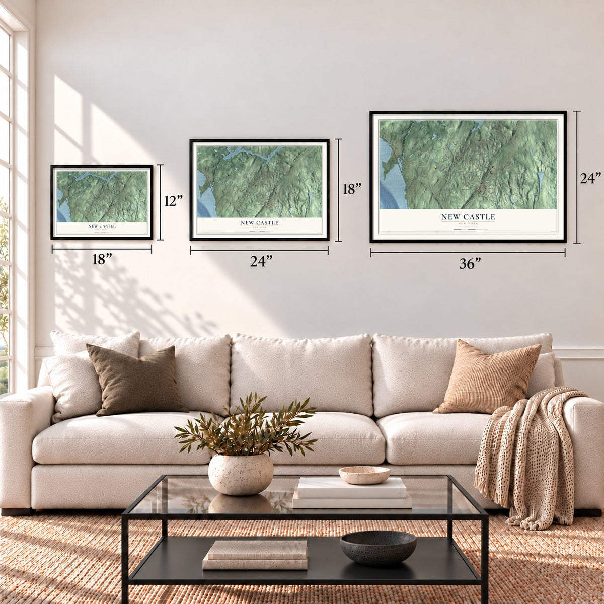
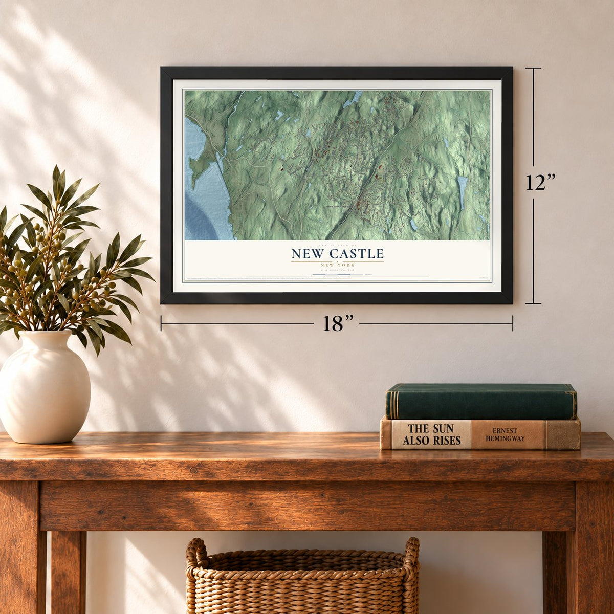
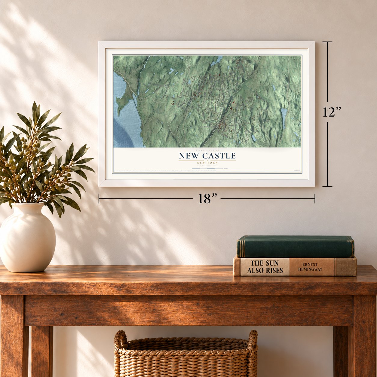
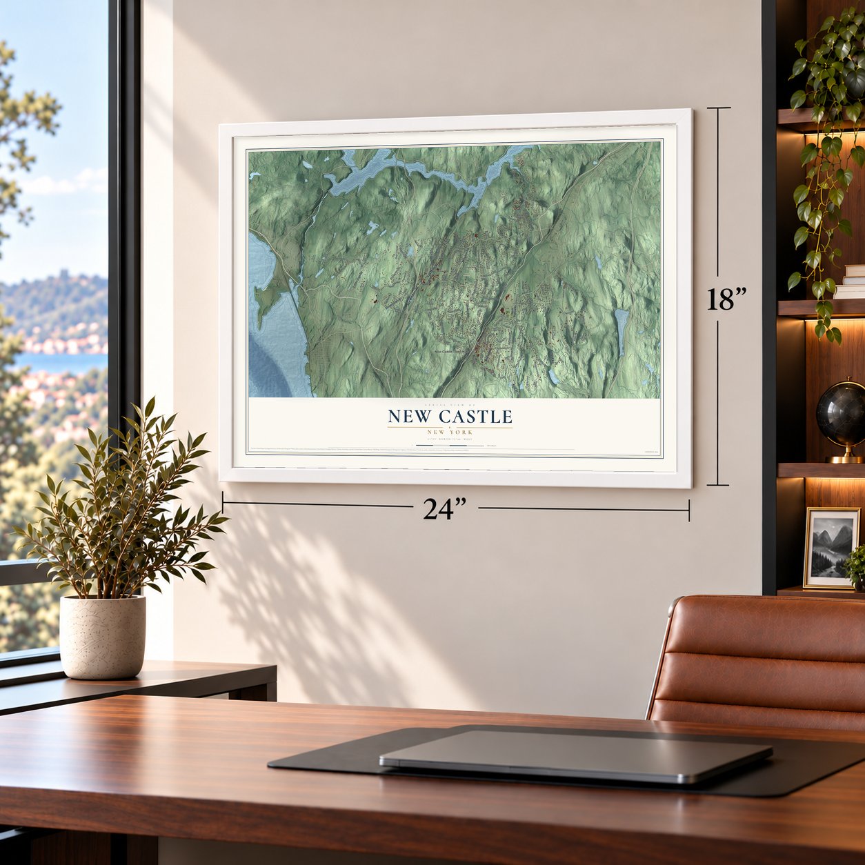
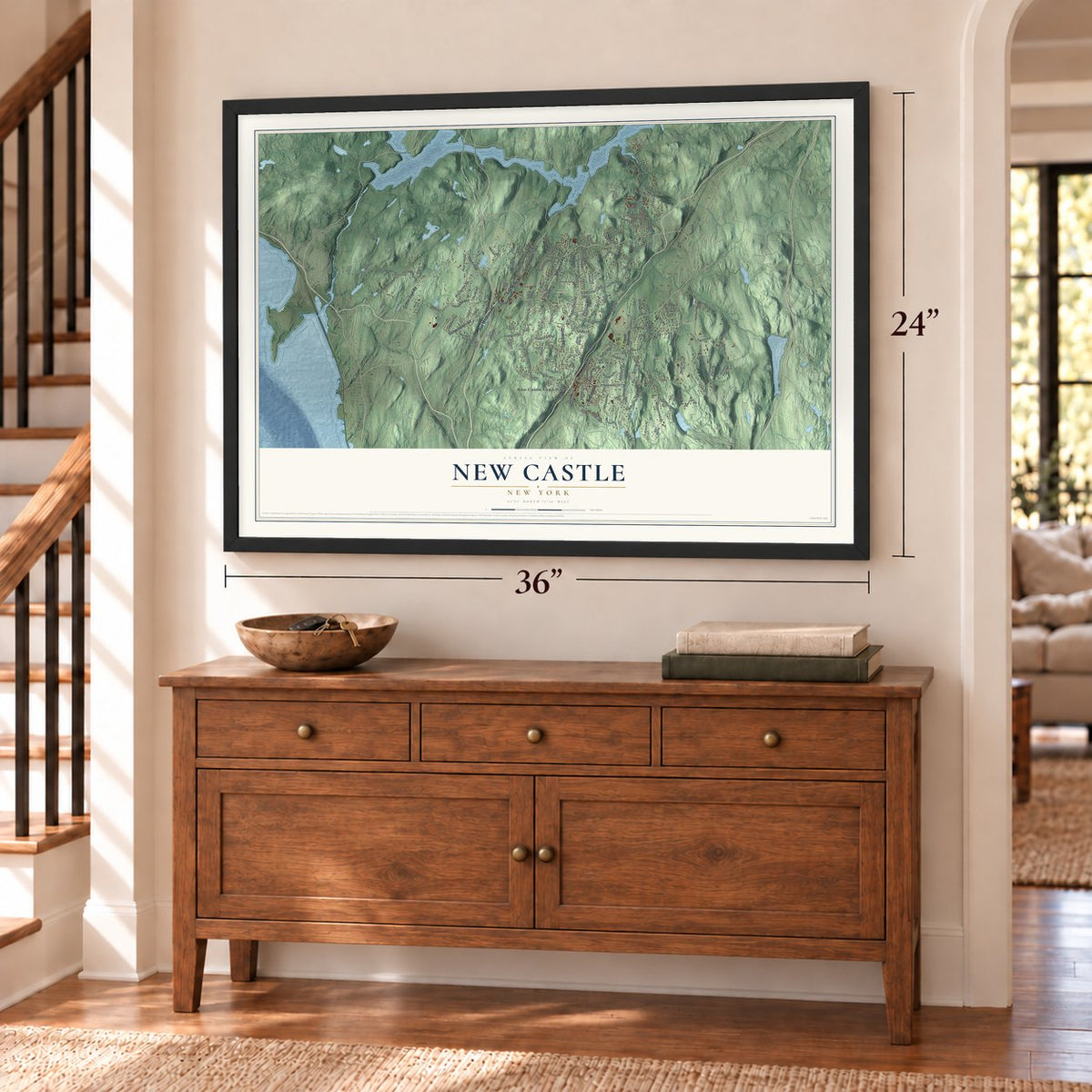
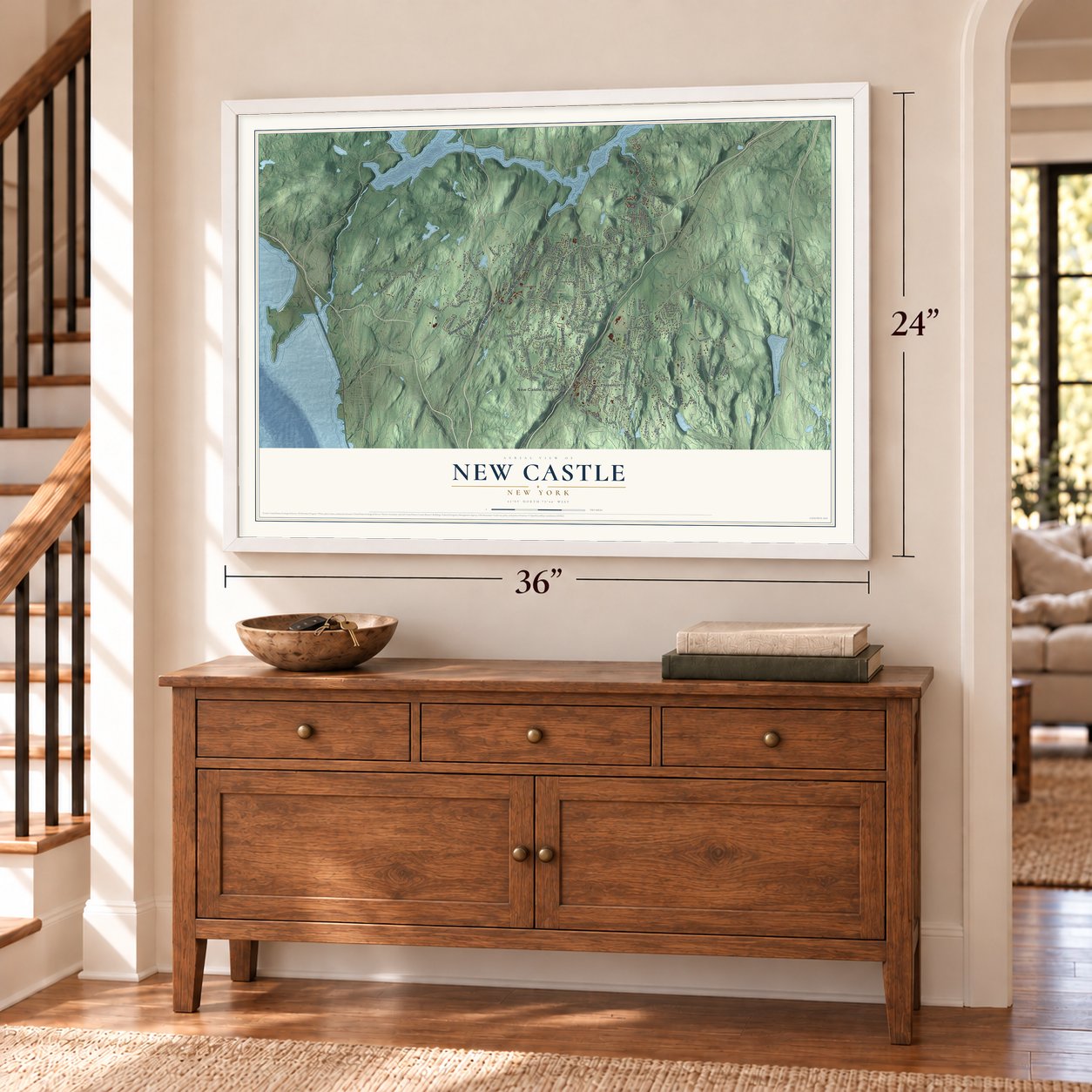
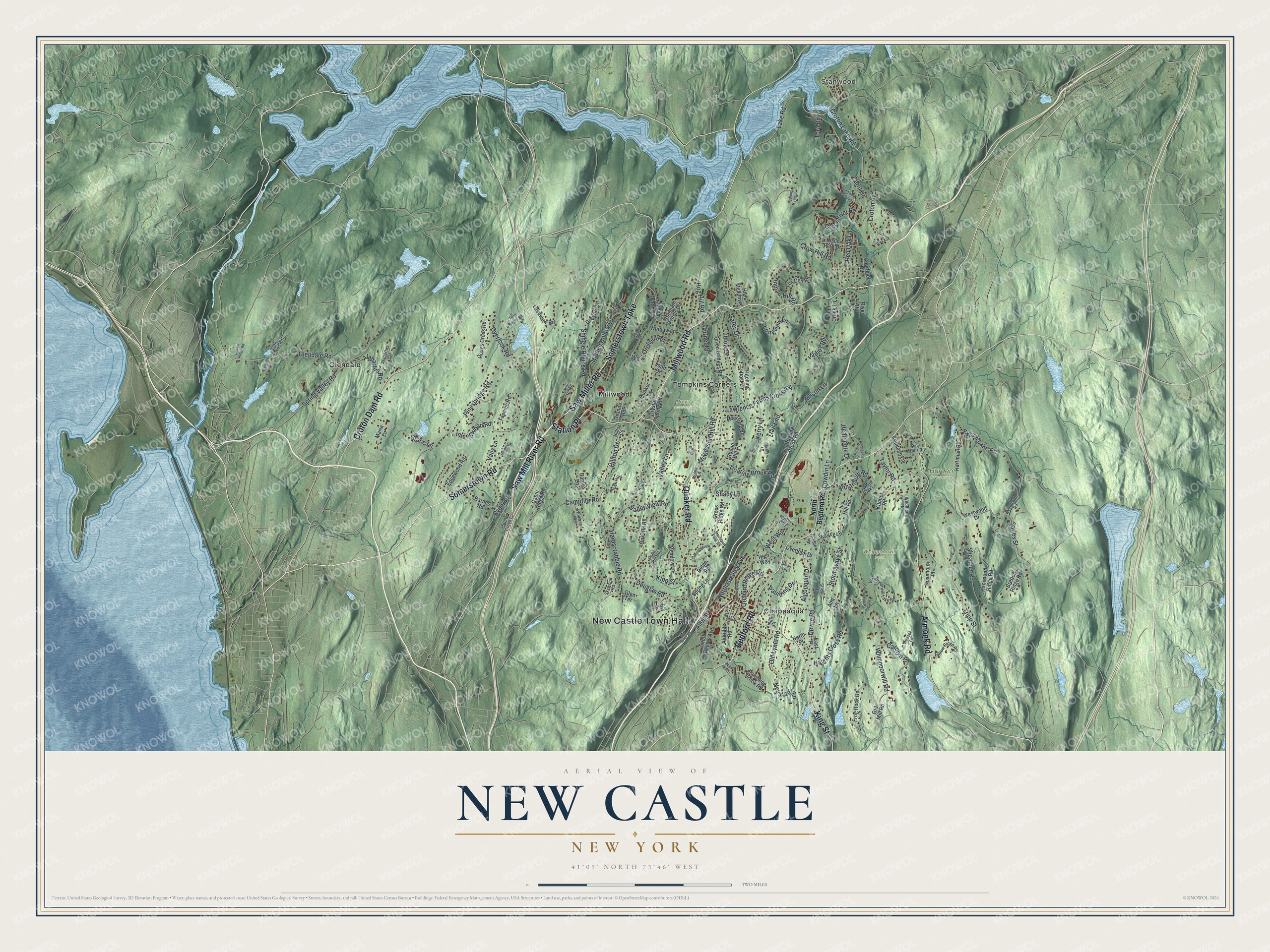
Explore New Castle, New York from a whole new perspective. Created using aerial imagery and detailed geographic data, this map captures New Castle building by building, with labeled streets, familiar landmarks, and shaded topographical relief that highlights the natural contours of the landscape.
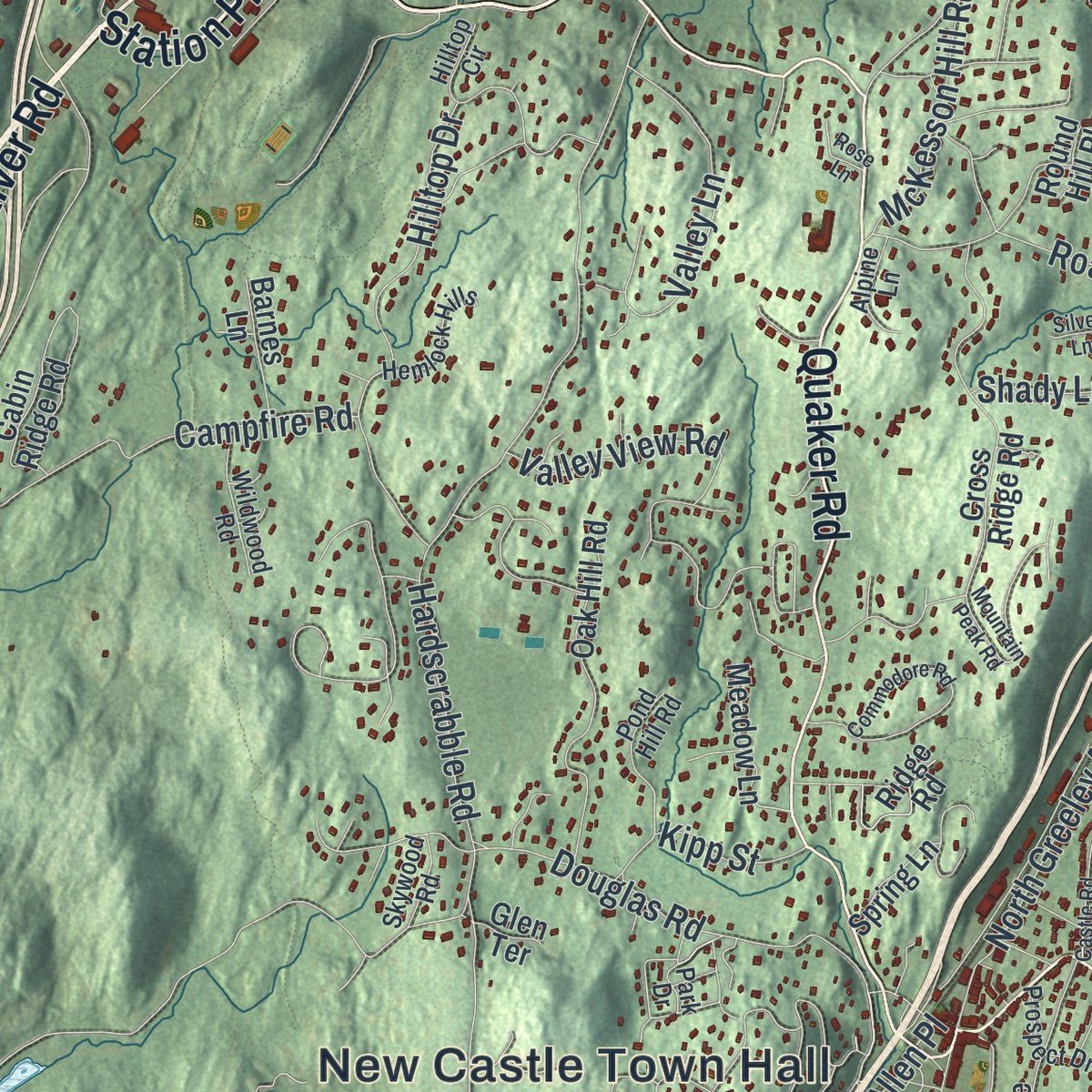
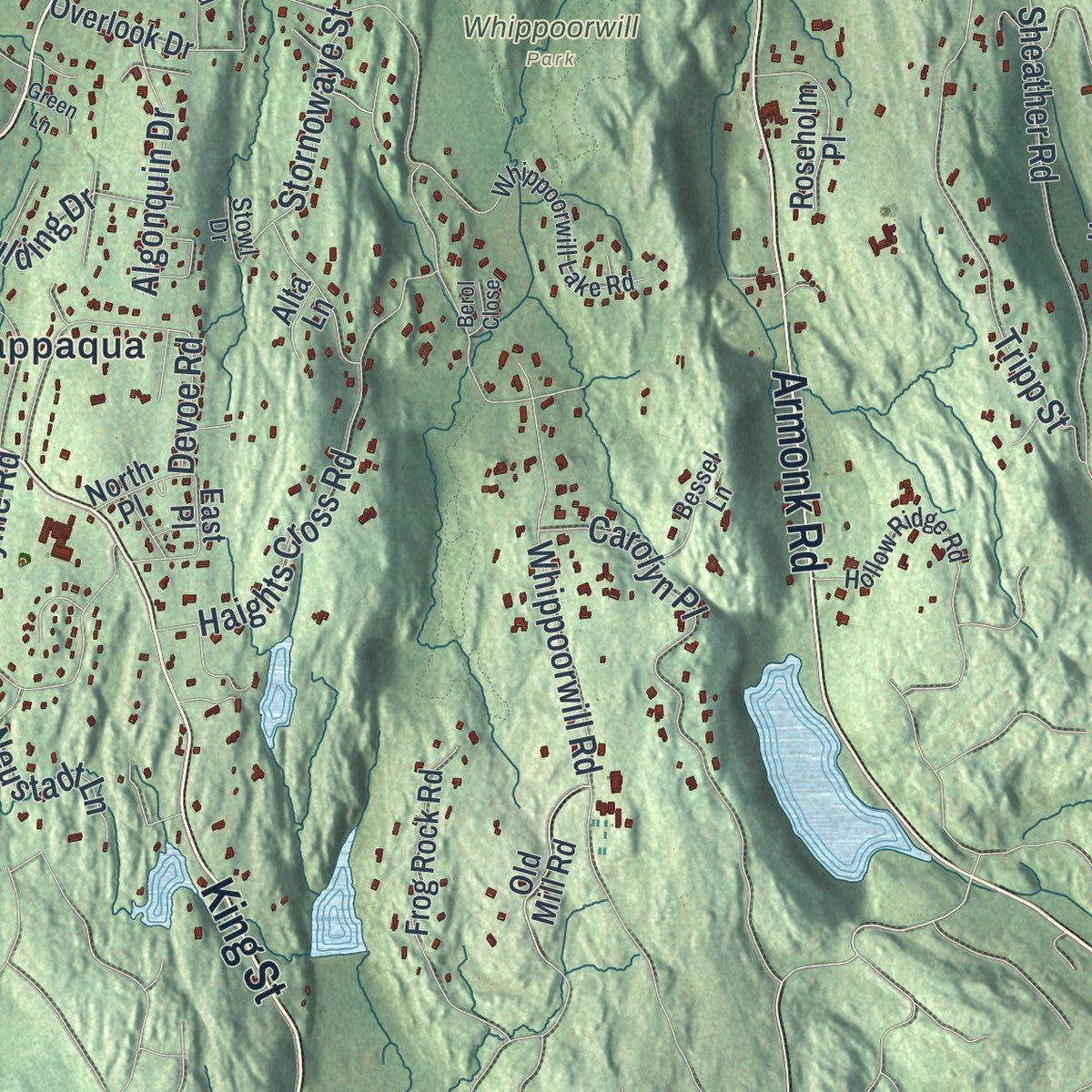
Combining modern data with the timeless character of a vintage atlas, this map is just as interesting up close as it is beautiful on the wall. Whether you grew up in New Castle, spent memorable years there, or call it home today, this unique map is a great way to celebrate a place that means something to you. Zoom in on the preview to look for your street, and then order a print to put your memories on the wall.
Three ways to hang it
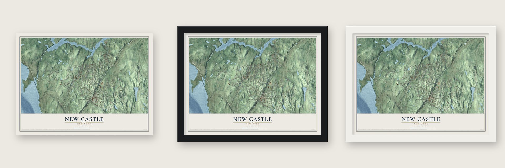
Unframed archival matte, a black wood frame or a white wood frame.
Up close
Geography Worth Displaying
This map was created using accurate cartographic data and authoritative geographic sources, including the U.S. Geological Survey (USGS) and FEMA. The map brings together terrain, waterways, roads, and building detail. The majority of the streets are labeled, houses are accurately depicted, and the topography is derived from government sources. Combining local data with carefully composed color and shading leads to this beautifully detailed New Castle artwork for your wall.
Rather than simply showing street outlines, we’ve included as many of the street names as we could reasonably fit on the map while keeping their names legible. Zoom in on the high resolution preview to see exactly what’s on the map. We truly set out to create a statement piece for anyone who loves New Castle. So whether it’s for you, or a gift for someone you love, we hope this map of New Castle brings back fond memories.
Explore the full map of New Castle, New York and read about the local places it shows.
Find your street
Names on the New Castle map
Every name below is printed on this map. Look for your street, your school, the park where you played, or the pond down the road.
Places and landmarks10
- New Castle Town Hall
- Stanwood
- Burden Preserve
- Pruyn Sanctuary
- Warburg Park
- Whippoorwill Park
- Chappaqua
- Glendale
- Millwood
- Tompkins Corners
Streets and roads169
- Somerstown Turnpike
- Saw Miller Road
- Millwood Road
- Station Place
- Saw Mill River Road
- King Street
- Bedford Road
- Quaker Road
- Armonk Road
- Croton Dam Road
- Somerstown Road
- Lake Road
- Crow Hill Road
- Taylor Road
- Allen Place
- Ryder Road
- Pinesbridge Road
- Whippoorwill Road
- Hardscrabble Road
- Campfire Road
- Sheather Road
- Roaring Brook Road
- Douglas Road
- Tripp Street
- Byram Lake Road
- Sarles Street
- Glendale Road
- Haights Cross Road
- Spring Valley Road
- Inningwood Road
Show all 169 streets
- Cross River Road
- Croton Lake Road
- Shingle House Road
- Hilltop Drive
- Indian Hill Road
- Old Lyme Road
- Hidden Hollow Lane
- Annandale Road
- Lawrence Farms Crossway
- Devoe Road
- Grace Lane
- West Orchard Road
- Kerry Lane
- Carolyn Place
- North Greeley Avenue
- Croton Avenue
- Valley View Road
- Longview Lane
- Garey Drive
- Valley Lane
- Orchard Ridge Road
- Cowdin Lane
- Red Oak Lane
- Ludlow Drive
- Alapartus Road
- Stornowaye Street
- Paulding Drive
- Overlook Road
- McKesson Hill Road
- Algonquin Drive
- Hog Hill Road
- Neustadt Lane
- Vails Lane
- Turner Drive
- Kipp Street
- James Road
- Allison Lane
- Heathcote Drive
- Trail End
- West Way
- Shady Lane
- Tora Road
- Carol Drive
- North Bedford Road
- Old Roaring Brook Road
- Seven Bridges Road
- Random Farms Drive
- Hammond Ridge Road
- Edgewood Road
- Harriman Road
- Taconic Road
- Cross Ridge Road
- Cabin Ridge Road
- Ridge Road
- Random Farms Circle
- Oak Hill Road
- Hoags Cross Road
- Fox Den Road
- Whitlaw Lane
- Spring Lane
- Westwood Drive
- Kathleen Lane
- Frog Rock Road
- South Greeley Avenue
- Kisco Park Drive
- Kitchel Road
- High Way
- Barnes Road
- Old Mill Road
- Bretton Ridge Road
- Roseholm Place
- Hitching Post Lane
- Meadow Lane
- Granite Road
- Courtmel Road
- Jeffrey Lane
- Deerfield Road
- Rambling Brook Road
- Joan Drive
- Lakeview Road
- Quaker Lane
- Gregory Lane
- Ivy Hill Road
- Overlook Drive
- Deer Creek Lane
- Barnes Lane
- Aldridge Road
- High Meadows
- Crystal Spring Road
- River Road
- Maria Lane
- North Place
- East Place
- Cerf Lane
- Round Hill Place
- Alta Lane
- Glen Terrace
- Whippoorwill Lake Road
- North Way
- Fawn Ridge
- Woodside Road
- Hollow Ridge Road
- Woodland Road
- Hemlock Hills
- Stone Creek Lane
- Prospect Drive
- White Oak Lane
- Pond Hill Road
- Alapartus Circle
- Wildwood Road
- Daly Cross Road
- Bessel Lane
- Alpine Lane
- Upland Drive
- Kings Court
- Little Lakes Road
- Skywood Road
- Park Drive
- Hilltop Circle
- Stowl Drive
- Mill River Road
- Old Town Crossing
- Commodore Road
- Twin Ridges Road
- Mountain Peak Road
- Castle Road
- Petersville Road
- Derby Lane
- Quaker Ridge Road
- Spring Hill Lane
- Dawning Lane
- Deer Ridge
- Rose Lane
- Walden Hill
- Apple Hill Lane
- Green Lane
- Berol Close
- Danny Lane
- Silver Lane
Names are listed as they appear on the printed map. Zoom into the product photos to find them.
About New Castle, New York
New Castle is a town of 18,311 people in Westchester County, and its hamlets include Chappaqua and Millwood. The Siwanoy, a band of the Wappinger people, lived on this land before Europeans bought it piece by piece. Nathaniel Turner bought part of it in 1640 from Ponas Sagamore, the Siwanoy chief, and in 1661 John Richbell bought a larger tract that took in the whole of today's town.
Caleb Heathcote bought that tract from Richbell's widow in 1696. In 1736 the land became part of the town of North Castle, which people jokingly called "the two saddlebags." The New Castle half split away and became a town of its own in 1791.
- Quakers arrived in 1753The first European settlers were Quakers, who came to what is now Chappaqua in 1753. They built a meeting house there, and it still stands on Quaker Street.
- Horace Greeley's farmHorace Greeley, the newspaper editor who ran for president, made his home in New Castle. Two buildings from his farm are on the National Register. The Greeley House is now the headquarters of the New Castle Historical Society, and Rehoboth was the first concrete barn in the country. The town's high school, Horace Greeley High School, carries his name.
- 18,311 people in 2020The 2020 census counted 18,311 people in New Castle, up from 17,569 in 2010.
Keep exploring New York
New Castle is one of 2,165 New York towns we've mapped. Every dot on the map is a print of its own.
The search covers every state, New York first.
Near New Castle
Order 2 or more town maps and save 10%. Shown in the size and finish you picked above, so they hang as a set.
- Millwood 12" x 18" / Archival Matte Print $39.99
- Chappaqua 12" x 18" / Archival Matte Print $39.99
- Mount Kisco 12" x 18" / Archival Matte Print $39.99

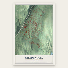

More maps nearby: Pleasantville, Armonk, Thornwood, Town of Ossining and Briarcliff Manor.
The art of mapping a place
How This Map Was Made
Real places. Remarkable detail. Discover the layers that turn geographic data into a map of home.

The view from above
Aerial imagery reveals the character of the land: woodland, open fields, and the patterns of a place.

The shape of the land
Elevation data brings hills, valleys, and subtle changes in the landscape into view.

The details of home
Roads, waterways, and building footprints come together to make the map feel unmistakably local.

Geography becomes art
Considered color, shading, and typography bring the layers together in a map made for your wall.


Process illustrated with Mendon, Massachusetts. Aerial imagery: USDA NAIP. Terrain: USGS 3D Elevation Program. Map details and finished artwork: KNOWOL.
The Details
About This Print
Choose an archival matte print, or a black or white Ayous wood frame. The archival matte print is unframed.
Select your size and finish above to see the matching product image and price.
Materials & Craftsmanship
A contemporary map with the character of a classic atlas, printed on archival matte paper. Optional frames are made from Ayous wood.
Your printed map does not include the watermark shown in the full-map preview.
Shipping & Delivery
Free shipping within the United States. Every print is made to order in the USA.
Buying a gift? Add a note in your cart and we'll include it. We never put prices in the package.
Prints ship within 2 to 3 business days. Allow 7 to 10 days total from ordering for delivery. Timing may vary during holidays or periods of high order volume.
Read our shipping policy.
Returns and damaged prints
Each print is made to order. Change-of-mind refunds are not available after production.
If your print arrives damaged, misprinted or incorrect, contact support@knowol.com within 30 days of receiving it. Include your order number, photos and a description of the issue.
Read our full refund and replacement policy. For questions about your order, email support@knowol.com.