
Search for another town





Free U.S. delivery 7 to 10 days after you order
Nogales, Arizona Map Art
Building by building, with labeled streets and shaded relief.
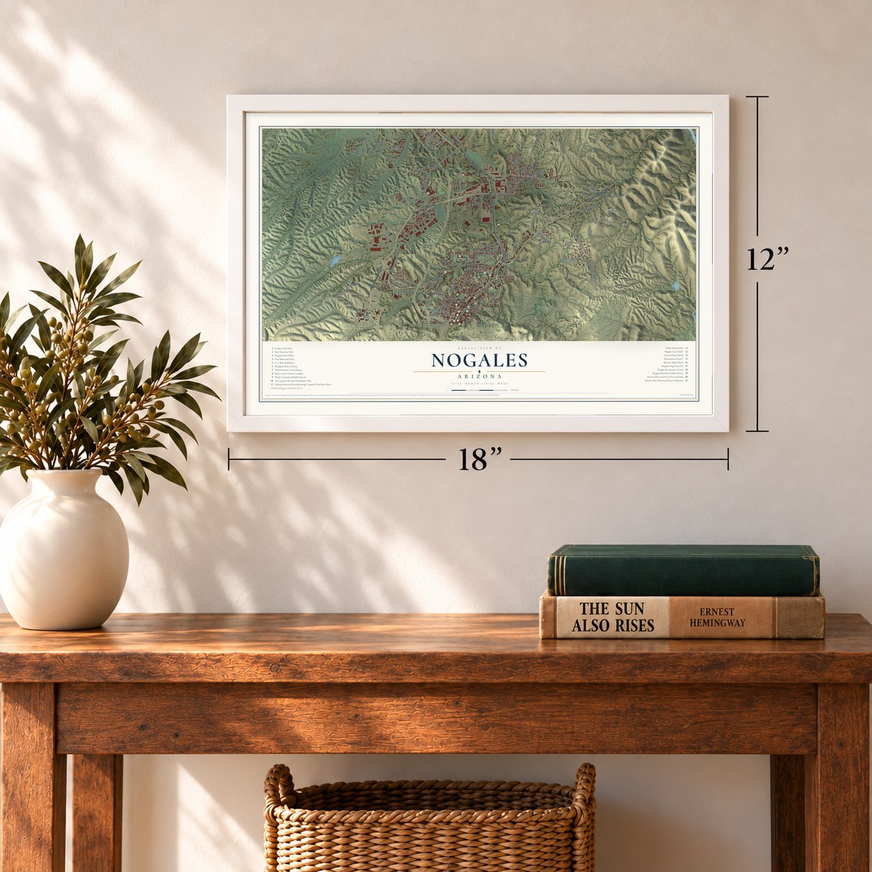
12" x 18" Archival Matte Print
A Map of Home. A Work of Art.
Explore Nogales, Arizona from a whole new perspective. Created using aerial imagery and detailed geographic data, this map captures Nogales building by building, with labeled streets, familiar landmarks, and shaded topographical relief that highlights the natural contours of the landscape.
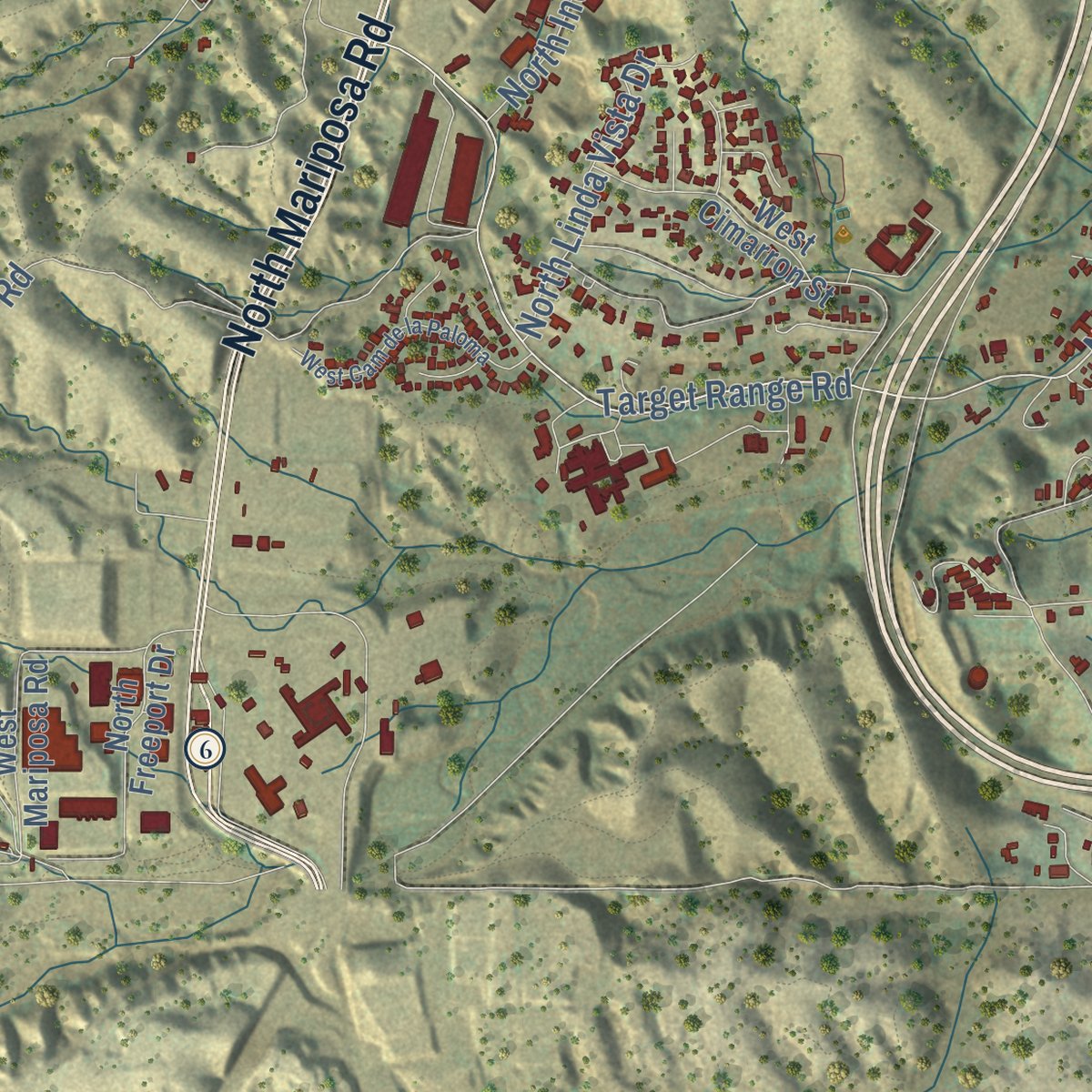
Combining modern data with the timeless character of a vintage atlas, this map is just as interesting up close as it is beautiful on the wall. Whether you grew up in Nogales, spent memorable years there, or call it home today, this unique map is a great way to celebrate a place that means something to you. Zoom in on the preview to look for your street, and then order a print to put your memories on the wall.

Three ways to hang it
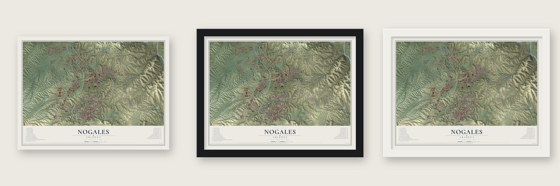
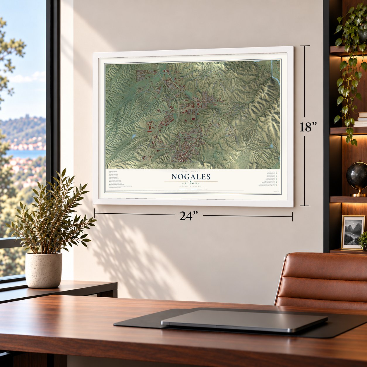
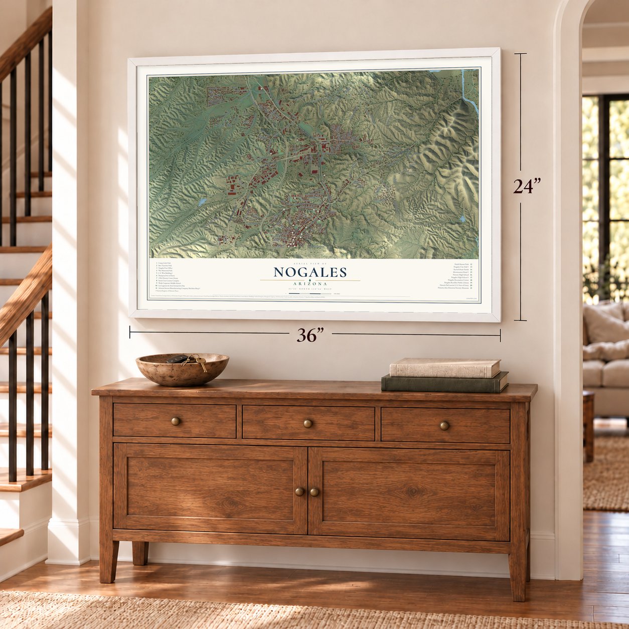
Unframed archival matte, a black wood frame or a white wood frame.
Up close
Geography Worth Displaying
This map was created using accurate cartographic data and authoritative geographic sources, including the U.S. Geological Survey (USGS) and FEMA. The map brings together terrain, waterways, roads, and building detail. The majority of the streets are labeled, houses are accurately depicted, and the topography is derived from government sources. Combining local data with carefully composed color and shading leads to this beautifully detailed Nogales artwork for your wall.
Rather than simply showing street outlines, we’ve included as many of the street names as we could reasonably fit on the map while keeping their names legible. Zoom in on the high resolution preview to see exactly what’s on the map. We truly set out to create a statement piece for anyone who loves Nogales. So whether it’s for you, or a gift for someone you love, we hope this map of Nogales brings back fond memories.
Explore the full map of Nogales, Arizona and read about the local places it shows.

Find your street
Names on the Nogales map
Every name below is printed on this map. Look for your street, your school, the park where you played, or the pond down the road.
Streets and roads140
- West Mariposa Road
- East Patagonia Highway
- Tucson-Nogales Highway
- North Grand Avenue
- North Mariposa Road
- North Country Club Drive
- North Apache Boulevard
- North Frank Reed Road
- East Baffert Drive
- East Cam Vista del Cielo
- West Gold Hill Road
- North Western Avenue
- East Cll Sonora
- Target Range Road
- North Industrial Park Drive
- Aurora Loop
- North Cam Vista del Cielo
- North Target Range Road
- North West Street
- West First Street
- North Al Harrison Road
- North Morley Avenue
- Lobo Lane Drive
- North Royal Road
- North Macnab Drive
- West Cam Campestre
- West Meadow Hills Drive
- North Industrial Park Avenue
- West Potrero Drive
- West Kino Street
Show all 140 streets
- North Sonoita Avenue
- North Hohokam Drive
- North Cinco Millas Road
- North Silver Lode Trail
- West Western Avenue
- West Fairway Drive
- East International Street
- West Anza Drive
- West Noon Street
- West Artley Drive
- North Linda Vista Drive
- Amura Lane
- West Martinez Street
- East Live Oak Drive
- East Beck Street
- East Bristol Drive
- North Ciardulli Place
- Old Tucson Road
- North Potrero Avenue
- West Hughes Street
- North Perkins Avenue
- West Mesquite Lane
- West Third Street
- West Sunset Drive
- Manzanita Lane
- East East Street
- North Arroyo Boulevard
- Frank Reed Road
- West Mariposa Ranch Road
- West Country Club Drive
- West Mesa Verde Drive
- North Aurora Drive
- East Roper Road
- North Congress Drive
- North Silver Reef Drive
- West International Street
- North David Drive
- North Canon del Oro Drive
- West La Quinta Road
- North Cebarel Lane
- West Crawford Street
- West Frontage Road
- North Freeport Drive
- North Cll Chihuahua
- West Walnut Street
- North Smokey Lane
- West Elm Street
- North Cll Trinidad
- North Silver Hill Drive
- East Mayra Drive
- North Old Mine Road
- West Ellis Street
- West Cimarron Street
- West Mariposa Hills Drive
- North Cll Santa Ana
- North Iron Gates Drive
- East Cam del Monte
- North Bankerd Avenue
- North Cherokee Avenue
- North Cll Empalme
- West Curtis Street
- North Mastick Way
- North Highland Drive
- North Cll Cananea
- North Cam Bajo
- West Manilla Drive
- East Beatus Drive
- North Kelsey Avenue
- West Bell Road
- North Sue Drive
- North Edith Place
- North Donna Avenue
- East Edward Street
- North Bitache Drive
- East Skyline Drive
- North San Simon Drive
- Dorada Court
- East Cll Mayer
- West Cam Alto
- East Rancho Grande Drive
- North Valle Verde Drive
- North Adams Street
- East Montparnasse Way
- North Mariposa Ranch Road
- North Yucca Drive
- East Burdon Place
- North Tyler Street
- East Terminal Produce Drive
- North Cll Guadalupe
- East Maya Street
- North Cll Culiacan
- North Iron Gate Road
- Parkway Drive
- West Macarthur Drive
- West Industrial Park Drive
- North Old Patagonia Road
- North Victorio Drive
- East Hudgins Street
- West Cam de la Paloma
- West Paul Bond Drive
- West Kolver Street
- Mesquite Place
- East Price Hill Road
- East Adams Street
- North Wayside Drive
- East Thelma Street
- East Cll Caborca
- North Bejarano Street
- North Mesa Drive
- North Cll Zapata
Names are listed as they appear on the printed map. Zoom into the product photos to find them.
About Nogales, Arizona
Nogales is a city of 19,770 people and the seat of Santa Cruz County, set in a mountain pass on the Mexican border. Its name is the Spanish word for walnut trees, after the black walnuts that once filled that pass. In 1841 the Mexican government gave the land to the Elías family as a grant, creating Los Nogales de Elías, and the Gadsden Purchase of 1853 made it part of the United States.
Two Russian-Jewish brothers, Isaac and Jacob Isaacson, homesteaded a trading post here in 1880 and gave it their own name. The post office opened as Isaacson, but in 1883 it was renamed Nogales. A twin city, Nogales, Sonora, grew up across the line. In 1915 Sonora's governor, Jose M. Maytorena, had an 11-wire fence built between the two towns, but it was taken down four months later.
- Where Anza's trail beginsThe 1775-1776 expedition of Juan Bautista de Anza crossed from New Spain into what is now the United States at Nogales, bound for San Francisco Bay. The route it followed, 1,210 miles long between Nogales and San Francisco, is now a national historic trail named for Anza, and the 1904 courthouse keeps a small second-floor room in honor of the expedition.
- The border wall of 1918The Mexican Revolution brought a decade of trouble to the border, with fighting at Nogales in 1913 and 1915. On August 27, 1918, U.S. Army troops fought a Mexican militia made up mostly of civilians. As a result, the open boundary along International Street got its first permanent wall dividing the two cities.
- Buffalo Soldiers at Camp LittleDuring World War I, troops of the 10th Cavalry, the famous Buffalo Soldiers, were stationed at Camp Stephen Little, which stood just north of Nogales. The site is remembered today in the name of Camp Little Park.
- A Lady Justice without a blindfoldThe Santa Cruz County Courthouse, from 1904, was designed in the Classical Revival style by Trost & Rust, an El Paso firm. A statue of Lady Justice stands on top of the building, and unlike most, the Nogales figure has no blindfold over her eyes.
- Built in 1917 and 1926William Redding & Son designed the Nogales High School building of 1917, where the school later held its centennial celebration. In 1926 the Montezuma Hotel went up as the biggest hotel in town, built in Spanish Colonial Revival style, and it joined the National Register in 1985.
Keep exploring Arizona
Nogales is one of 528 Arizona towns we've mapped. Every dot on the map is a print of its own.
The search covers every state, Arizona first.
Near Nogales
Order 2 or more town maps and save 10%. Shown in the size and finish you picked above, so they hang as a set.
- Beyerville 12" x 18" / Archival Matte Print $39.99
- Kino Springs 12" x 18" / Archival Matte Print $39.99
- Rio Rico 12" x 18" / Archival Matte Print $39.99

More maps nearby: Tumacacori-Carmen, Patagonia, Tubac, Amado and Arivaca.
The art of mapping a place
How This Map Was Made
Real places. Remarkable detail. Discover the layers that turn geographic data into a map of home.

The view from above
Aerial imagery reveals the character of the land: woodland, open fields, and the patterns of a place.

The shape of the land
Elevation data brings hills, valleys, and subtle changes in the landscape into view.

The details of home
Roads, waterways, and building footprints come together to make the map feel unmistakably local.

Geography becomes art
Considered color, shading, and typography bring the layers together in a map made for your wall.


Process illustrated with Mendon, Massachusetts. Aerial imagery: USDA NAIP. Terrain: USGS 3D Elevation Program. Map details and finished artwork: KNOWOL.
The Details
About This Print
Choose an archival matte print, or a black or white Ayous wood frame. The archival matte print is unframed.
Select your size and finish above to see the matching product image and price.
Materials & Craftsmanship
A contemporary map with the character of a classic atlas, printed on archival matte paper. Optional frames are made from Ayous wood.
Your printed map does not include the watermark shown in the full-map preview.
Shipping & Delivery
Free shipping within the United States. Every print is made to order in the USA.
Buying a gift? Add a note in your cart and we'll include it. We never put prices in the package.
Prints ship within 2 to 3 business days. Allow 7 to 10 days total from ordering for delivery. Timing may vary during holidays or periods of high order volume.
Read our shipping policy.
Returns and damaged prints
Each print is made to order. Change-of-mind refunds are not available after production.
If your print arrives damaged, misprinted or incorrect, contact support@knowol.com within 30 days of receiving it. Include your order number, photos and a description of the issue.
Read our full refund and replacement policy. For questions about your order, email support@knowol.com.