
Search for another town




Free U.S. delivery 7 to 10 days after you order
Norfolk, Nebraska Map Art
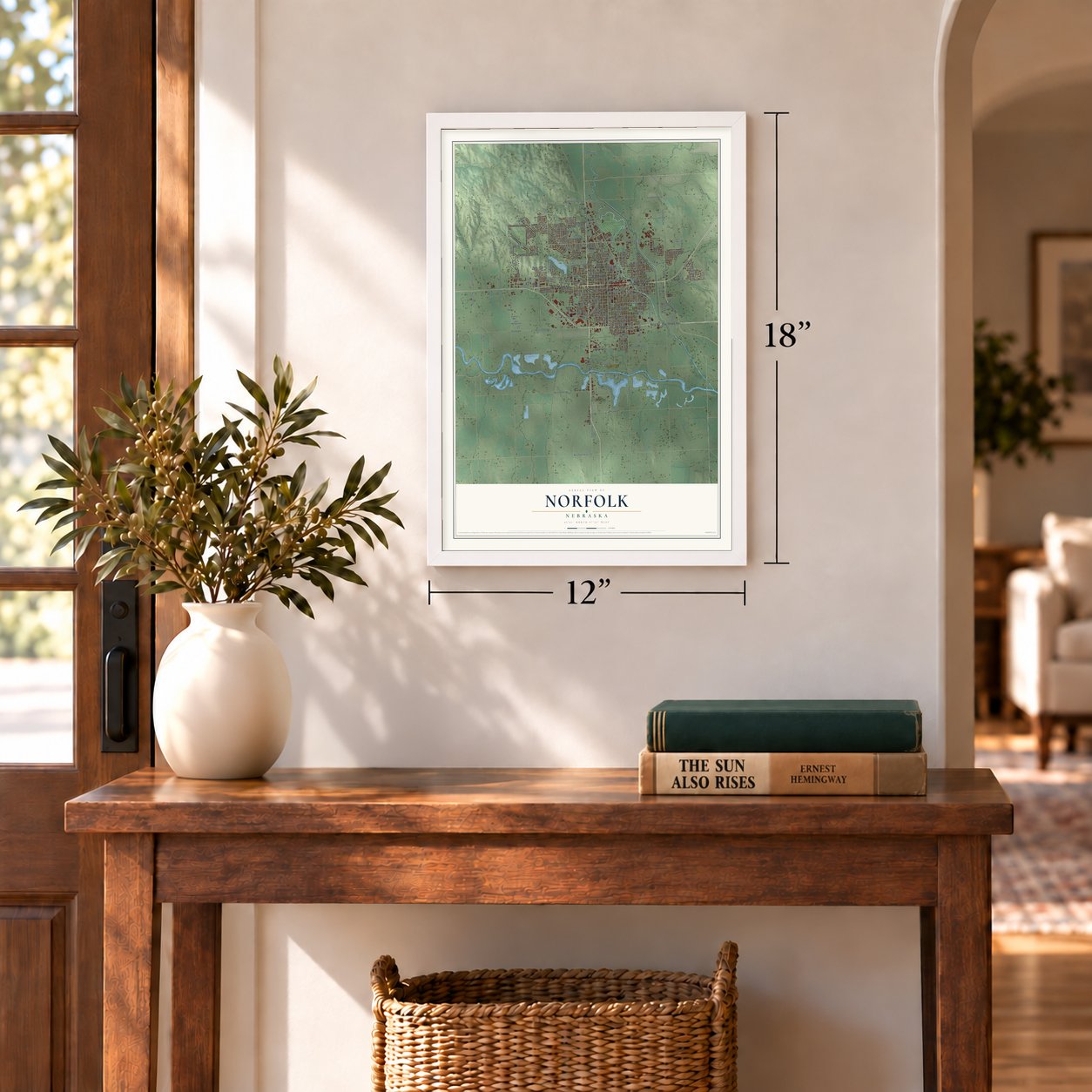
A new map of Norfolk, Nebraska, made in 2026 and printed to order on thick archival matte paper.
12" x 18" Archival Matte Print
A Map of Home. A Work of Art.
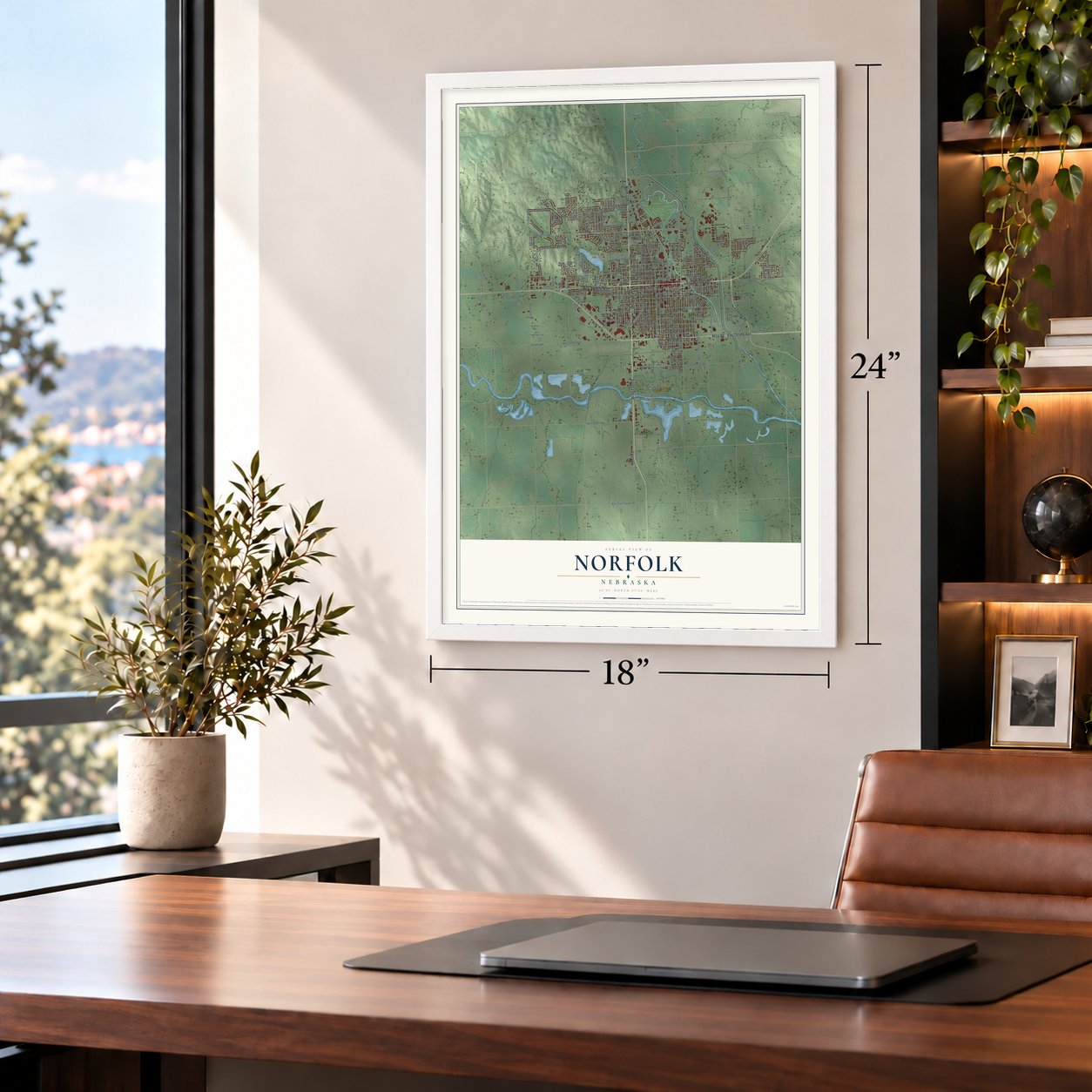
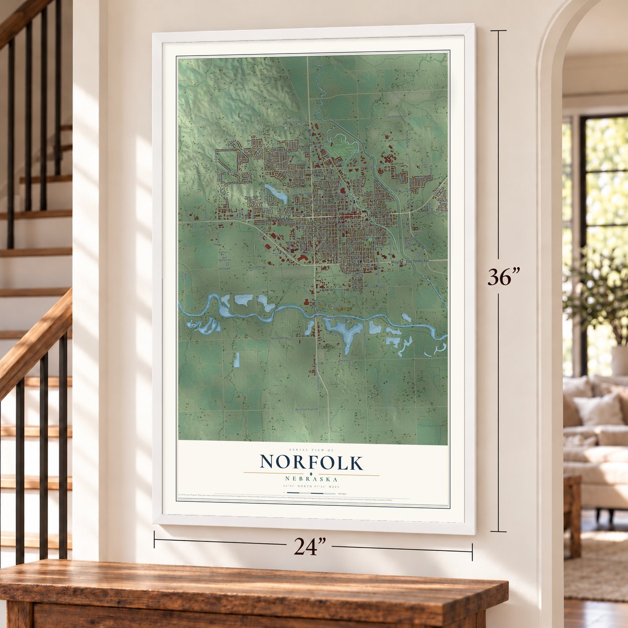
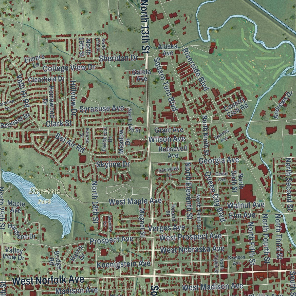
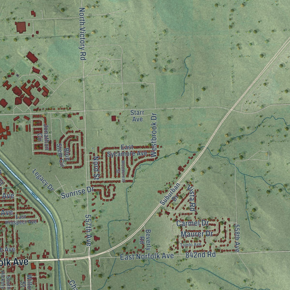
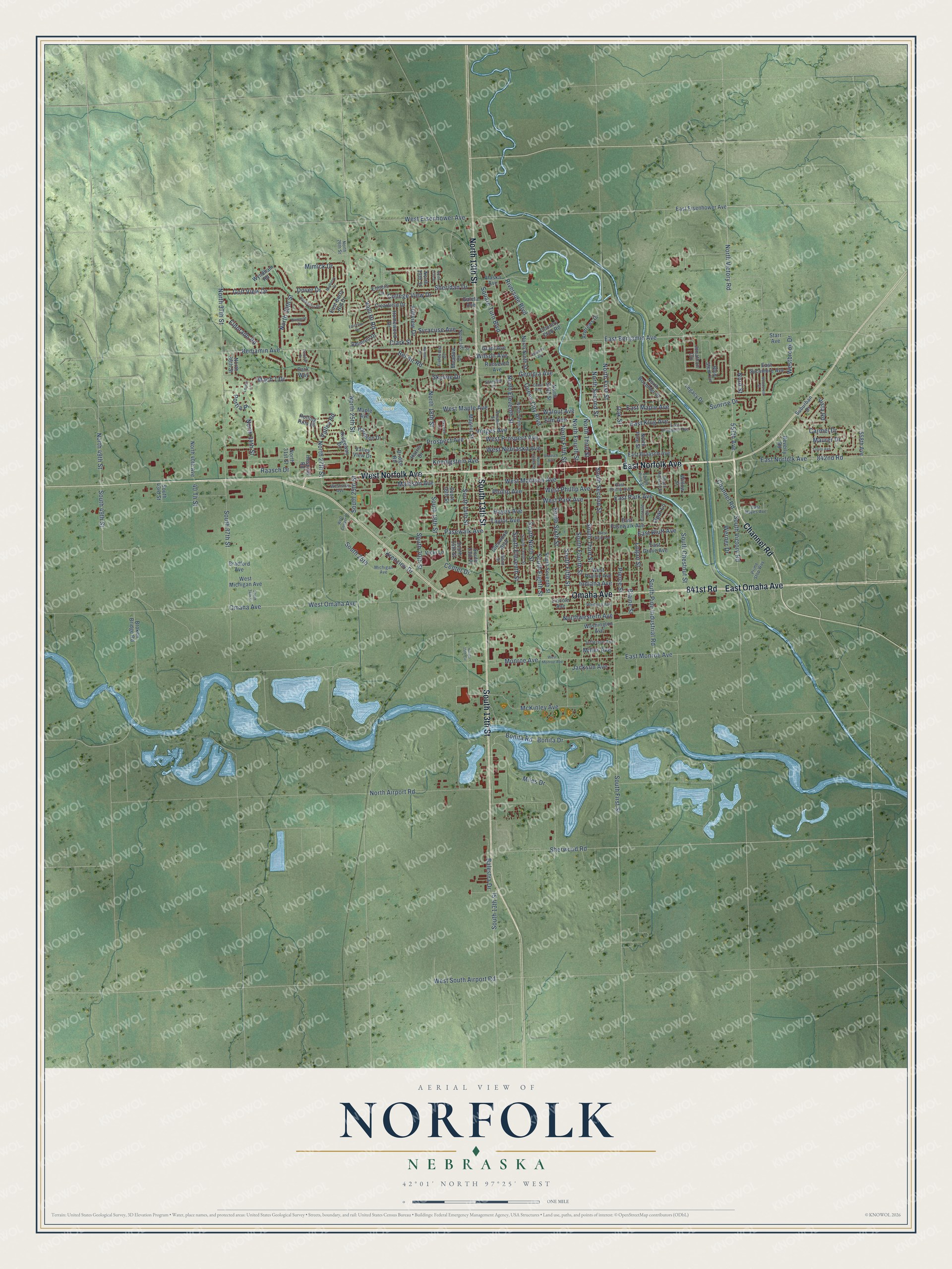
Explore Norfolk, Nebraska from a whole new perspective. Created using aerial imagery and detailed geographic data, this map captures Norfolk building by building, with labeled streets, familiar landmarks, and shaded topographical relief that highlights the natural contours of the landscape.
Combining modern data with the timeless character of a vintage atlas, this map is just as interesting up close as it is beautiful on the wall. Whether you grew up in Norfolk, spent memorable years there, or call it home today, this unique map is a great way to celebrate a place that means something to you. Zoom in on the preview to look for your street, and then order a print to put your memories on the wall.
Three ways to hang it
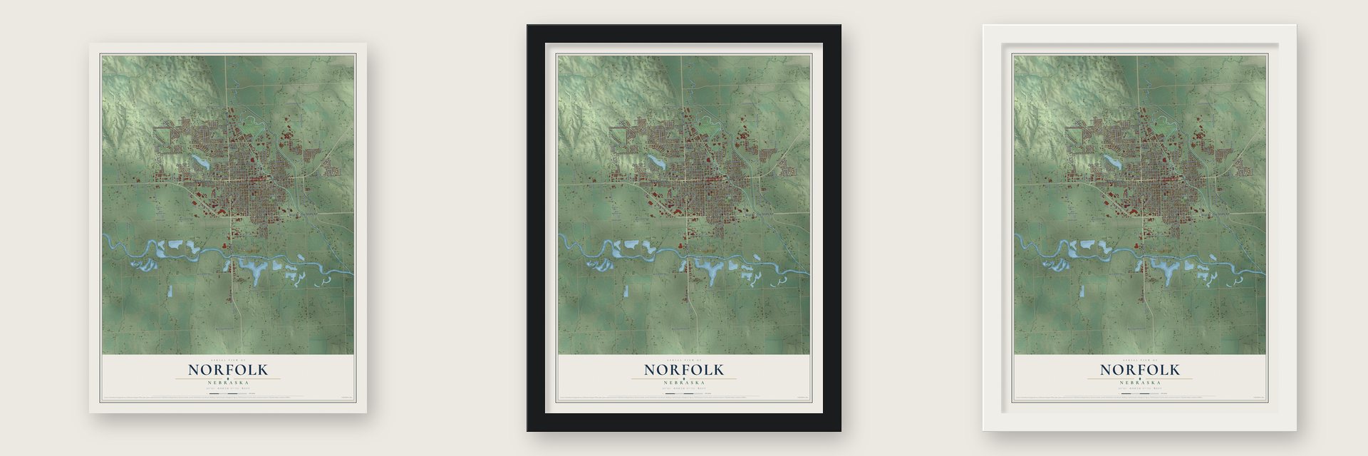
Unframed archival matte, a black wood frame or a white wood frame.
Up close
Geography Worth Displaying
This map was created using accurate cartographic data and authoritative geographic sources, including the U.S. Geological Survey and the Census Bureau. The map brings together terrain, waterways, roads, and building detail. The majority of the streets are labeled, houses are accurately depicted, and the topography is derived from government sources. Combining local data with carefully composed color and shading leads to this beautifully detailed Norfolk artwork for your wall.
Rather than simply showing street outlines, we’ve included as many of the street names as we could reasonably fit on the map while keeping their names legible. Zoom in on the high resolution preview to see exactly what’s on the map. We truly set out to create a statement piece for anyone who loves Norfolk. So whether it’s for you, or a gift for someone you love, we hope this map of Norfolk brings back fond memories.
Read the story behind this map of Norfolk, Nebraska from 2026.

About Norfolk, Nebraska
Norfolk is a city of 24,955 people in Madison County, where the North Fork meets the Elkhorn River. In late 1865 a German Lutheran settlement near Ixonia, Wisconsin, sent three scouts west to find good, cheap land to claim under the Homestead Act. They found West Point too crowded, kept following the Elkhorn upstream, and on September 15 chose the ground at the fork. On May 23, 1866, 124 settlers from 42 families set out in three wagon trains, and they arrived on July 15.
A second party from Wisconsin came in July 1867, and together the newcomers founded St. Paul's Lutheran, the first church in Madison County. That year the settlement became the county seat, but it lost the seat in a series of 1875 elections, when it had only 45 voters. Then the railroads came: the Fremont, Elkhorn and Missouri Valley in 1879, a Union Pacific branch from Columbus in 1880, and the Chicago, St. Paul, Minneapolis & Omaha in 1882. By 1886 Norfolk had 1,000 people and became a city of the second class, and in 1900 it counted 3,883.
“When it was time to send a petition to the post office department to have a post office established, the question of a name was brought up for consideration. Finally the name Nor’fork, a contraction of North Fork, was agreed upon, since the town was located on the north fork of the river.”
- Hallmark's start in 1908Joyce Hall started the Norfolk Post Card Company here in 1908. The business later moved to Kansas City, Missouri, and grew into Hallmark Cards.
- Johnny Carson's hometownJohnny Carson, born in Corning, Iowa, came to Norfolk when he was 8 and graduated from Norfolk High School. Thurl Ravenscroft, the voice of Tony the Tiger and the singer of "You're a Mean One, Mr. Grinch," was born here.
- Model rockets in 1954Orville Carlisle invented model rocketry in 1954, working out the idea in the basement of the shoe store he ran in Norfolk.
- On U.S. Highway 81Work began in the 1910s on the Meridian Highway, a straight north-south route across the country that ran through Norfolk. When the Meridian Bridge over the Missouri opened in 1924, the road could be driven all year, and in 1926 it became U.S. Highway 81.
- From flying school to airportA flying school opened here in 1928, and in 1942 the WPA started building a municipal airport on its field. After the war, Congressman Karl Stefan of Norfolk, who sat on the Congressional Air Policy Board, won more money for it, and passenger flights began in the early 1950s. The Karl Stefan Memorial Airport Administration Building joined the National Register in 2002.
Find your street
Names on the Norfolk map
Every name below is printed on this map. Look for your street, your school, the park where you played, or the pond down the road.
Places and landmarks1
- Skyview Park
Streets and roads213
- West Norfolk Avenue
- East Norfolk Avenue
- Channel Road
- South 13th Street
- 841st Road
- East Omaha Avenue
- Omaha Avenue
- North 13th Street
- 557th Avenue
- West Eisenhower Avenue
- North 49th Street
- South 49th Street
- North Victory Road
- South First Street
- South Eleventh Street
- 842nd Road
- Sherwood Road
- South 37th Street
- South 25th Street
- East Park Avenue
- West Park Avenue
- South 18th Street
- South 25th
- College View Drive
- Benjamin Avenue
- Bel Air Road
- North Second Street
- East Benjamin Avenue
- South Victory Road
- West Prospect Avenue
Show all 213 streets
- Prospect Avenue
- Madison Avenue
- North 25th Street
- Koenigstein Avenue
- South Fifth Street
- Bonita Drive
- Riverside Boulevard
- North First Street
- Pasewalk Avenue
- North 37th Street
- South Second Street
- South Fourth Street
- Bonita Road
- Phillip Avenue
- Queen City Boulevard
- Monroe Avenue
- Sheridan Drive
- South Third Street
- Elm Avenue
- Taylor Avenue
- North 18th Street
- West Maple Avenue
- Logan Street
- Valli Hi Road
- Dover Drive
- South Sixth Street
- West Madison Avenue
- South Eighth Street
- South Ninth Street
- West Omaha Avenue
- North Airport Road
- North Eleventh Street
- South Chestnut Street
- Blaine Street
- Verges Avenue
- Georgia Avenue
- East Maple Avenue
- North Third Street
- Skyline Drive
- North 27th Street
- Miles Drive
- Golf View Drive
- South 14th Street
- East Klug Avenue
- South Pine Industrial Road
- Pierce Street
- Hayes Avenue
- Clark Street
- North 30th Street
- Square Turn Boulevard
- West Nebraska Avenue
- Hillview Drive
- Eldorado Road
- West South Airport Road
- Center Drive
- Walnut Avenue
- West Phillip Avenue
- South 20th Street
- Westbrook Drive
- East Bluff Avenue
- Syracuse Avenue
- Sunrise Drive
- North 34th Street
- North Fourth Street
- Mach 1 Drive
- Carmel Drive
- Krenzien Drive
- East Monroe Avenue
- McKinley Avenue
- Indiana Avenue
- Balestra Drive
- North Fifth Street
- Northwestern Avenue
- Mimick Drive
- Jackson Avenue
- Raasch Drive
- Oak Street
- Werner Drive
- Wilson Avenue
- Vista Road
- Valley Road
- 40 Th Street
- Miller Avenue
- Maurer Drive
- Nord Street
- Portia Place
- Opal Lane
- East Eisenhower Avenue
- 558th Avenue
- West Michigan Avenue
- South Seventh Street
- North Boxelder Street
- Maple Avenue
- South 16th Street
- South 15th Street
- East Sycamore Avenue
- Clearfield Drive
- Homewood Drive
- East Grove Avenue
- Blue Stem Circle
- North Ninth Street
- Alaska Avenue
- North Sixth Street
- East Pasewalk Avenue
- Rolling Hills Drive
- North Pine Street
- West Prairie Avenue
- South 13th Place
- Elmers Lane
- East Braasch Avenue
- Valley View Drive
- Glenwood Boulevard
- North 19th Street
- North 40th Avenue
- Ridgeway Drive
- Hardison Drive
- Jonathon Circle
- East Berry Hill Drive
- Park Way
- Roosevelt Avenue
- North 31st Street
- Washington Avenue
- Broken Bridge Road
- Magnet Street
- Wyndham Road
- Country Club Road
- Andrews Drive
- Lincoln Avenue
- Belmont Drive
- Beverly Road
- Grant Avenue
- Hospital Road
- Galeta Avenue
- Bridge Road
- Legacy Drive
- Suburban Drive
- Vicki Lane
- North 36th Street
- Harris Drive
- Meadow Drive
- Bradford Avenue
- Starr Avenue
- South 43rd Street
- Willow Street
- South Hickory Street
- South Tenth Street
- South Pine Street
- North Tenth Street
- East Prospect Avenue
- Michigan Avenue
- North 14th Street
- North 26th Street
- East Phillip Avenue
- Westside Avenue
- Prime Stop Way
- Jefferson Avenue
- Roland Street
- Emerald Drive
- Whitney Avenue
- East Hayes Avenue
- Fieldcrest Drive
- Wood Street
- North 17th Street
- Braasch Avenue
- North Eighth Street
- West Bluff Avenue
- West Monroe Avenue
- Cedar Avenue
- Pinnacle Drive
- Fairview Drive
- Mulberry Drive
- Skyview Circle
- South 34th Street
- West Cooper Drive
- Hackberry Drive
- Woodcrest Street
- Isabelle Avenue
- Parkhill Drive
- Sunnydell Lane
- Kansas Street
- Tomlo Avenue
- South 15th Circle
- Lovely Lane
Names are listed as they appear on the printed map. Zoom into the product photos to find them.
The art of mapping a place
How This Map Was Made
Real places. Remarkable detail. Discover the layers that turn geographic data into a map of home.

The view from above
Aerial imagery reveals the character of the land: woodland, open fields, and the patterns of a place.

The shape of the land
Elevation data brings hills, valleys, and subtle changes in the landscape into view.

The details of home
Roads, waterways, and building footprints come together to make the map feel unmistakably local.

Geography becomes art
Considered color, shading, and typography bring the layers together in a map made for your wall.


Process illustrated with Mendon, Massachusetts. Aerial imagery: USDA NAIP. Terrain: USGS 3D Elevation Program. Map details and finished artwork: KNOWOL.
The Details
About This Print
Choose an archival matte print, or a black or white Ayous wood frame. The archival matte print is unframed.
Select your size and finish above to see the matching product image and price.
Materials & Craftsmanship
A contemporary map with the character of a classic atlas, printed on archival matte paper. Optional frames are made from Ayous wood.
Your printed map does not include the watermark shown in the full-map preview.
Shipping & Delivery
Free shipping within the United States. Every print is made to order in the USA.
Buying a gift? Add a note in your cart and we'll include it. We never put prices in the package.
Prints ship within 2 to 3 business days. Allow 7 to 10 days total from ordering for delivery. Timing may vary during holidays or periods of high order volume.
Read our shipping policy.
Returns and damaged prints
Each print is made to order. Change-of-mind refunds are not available after production.
If your print arrives damaged, misprinted or incorrect, contact support@knowol.com within 30 days of receiving it. Include your order number, photos and a description of the issue.
Read our full refund and replacement policy. For questions about your order, email support@knowol.com.
Find your town
Looking for another city?
Find a map of home in our Nebraska collection, or any town in the country.
Nearby
Maps of towns near Norfolk
Know someone from one of these towns? Their map makes a great gift.
 Woodland Park
, Nebraska
From $39.99See the map
 Hadar
Hadar, Nebraska
From $39.99See the map
 Hoskins
, Nebraska
From $39.99See the map
More maps nearby: Battle Creek, Stanton, Pierce, Madison and Meadow Grove.