
Search for another town


Free U.S. delivery 7 to 10 days after you order
Norman, Oklahoma Map Art
Building by building, with labeled streets and shaded relief.
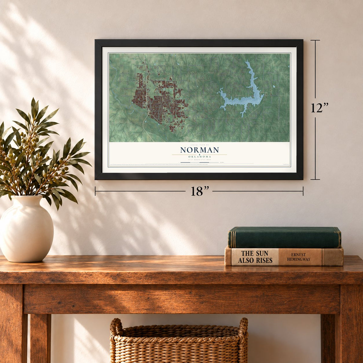
12" x 18" Archival Matte Print
A Map of Home. A Work of Art.
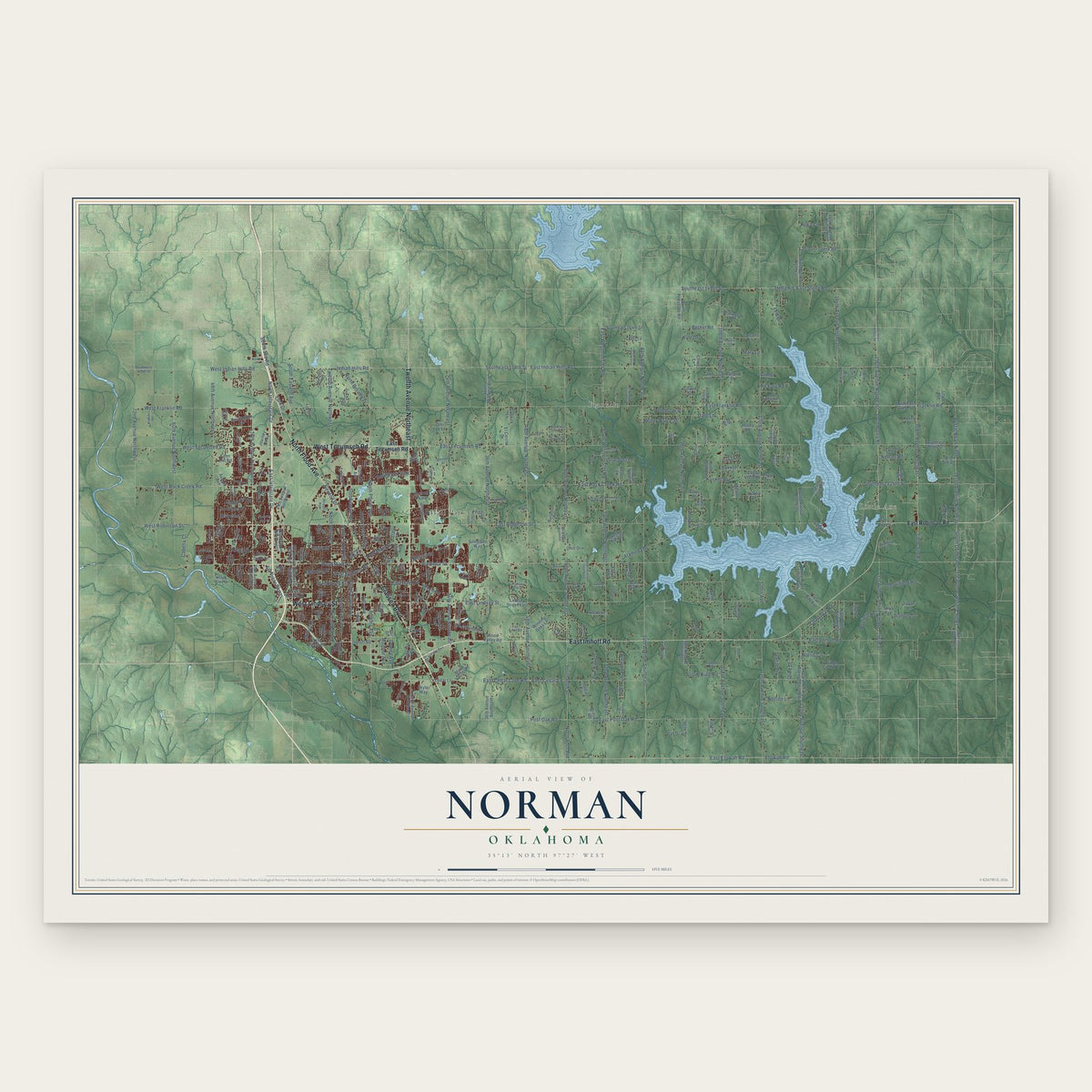
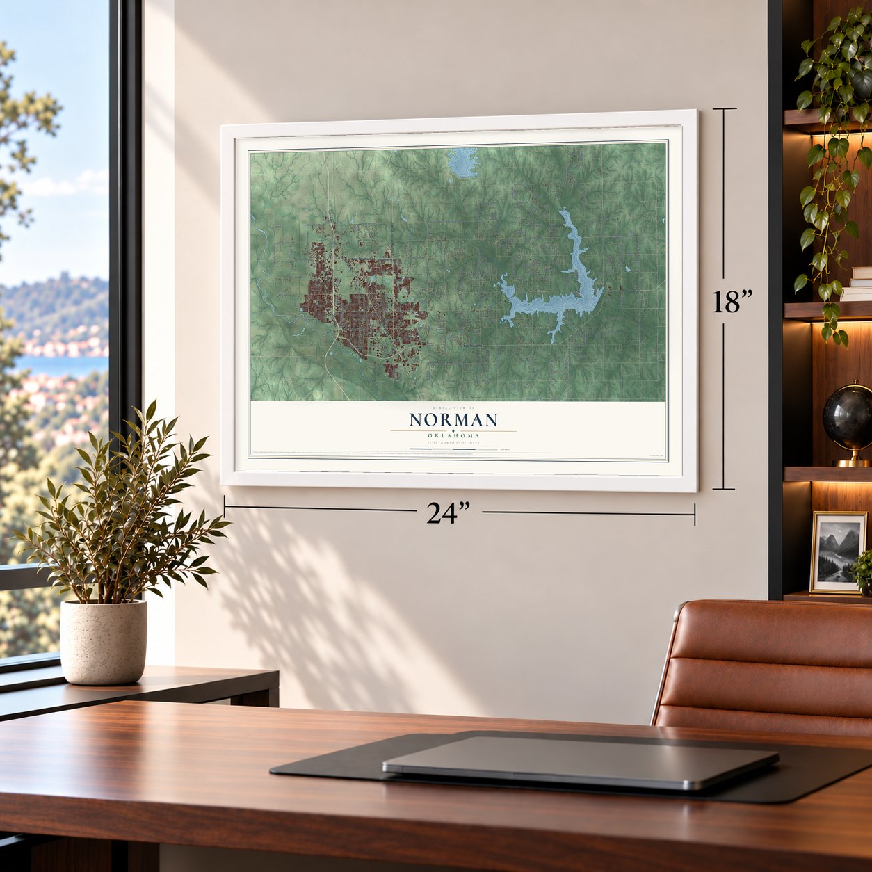
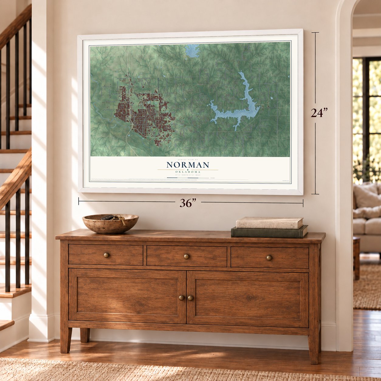
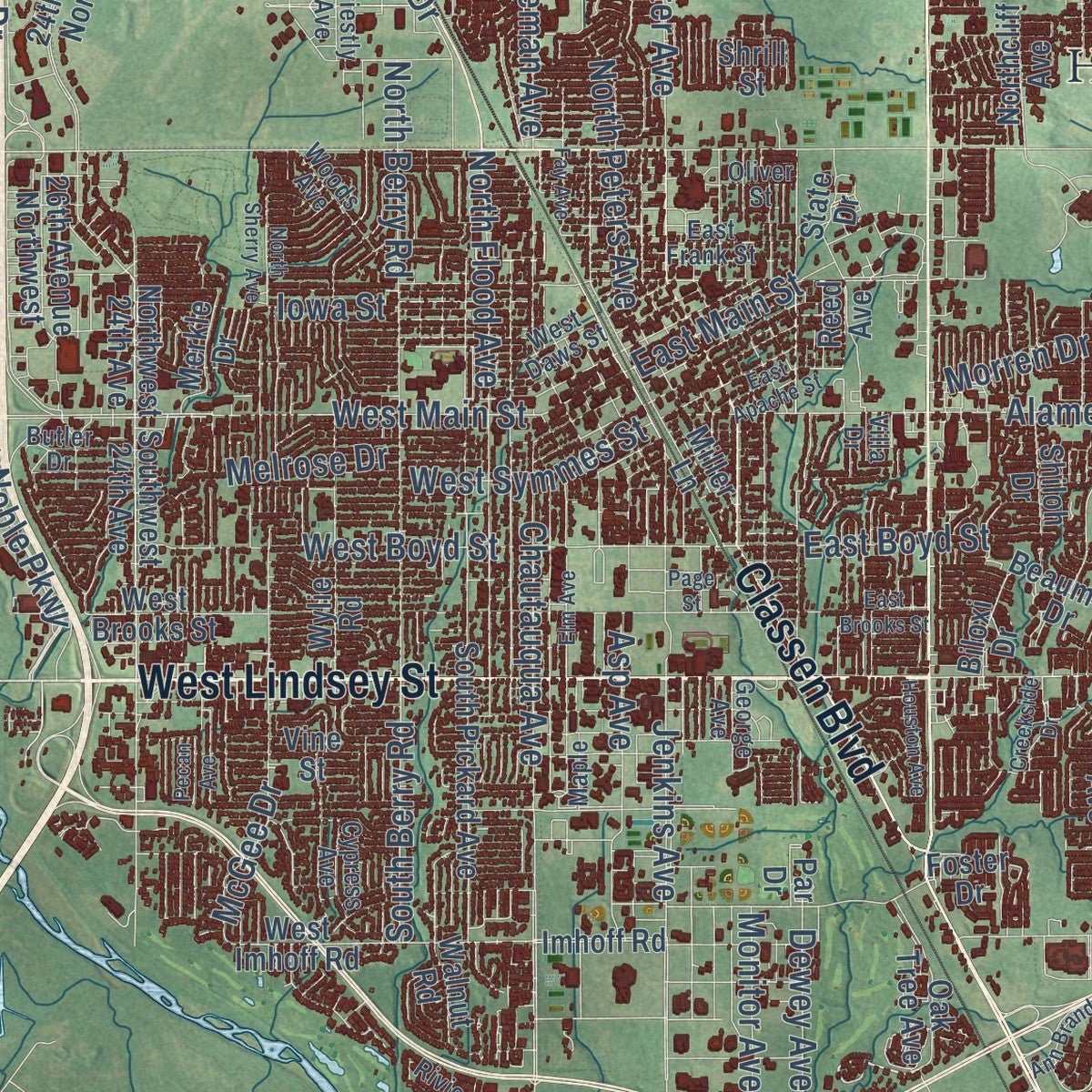
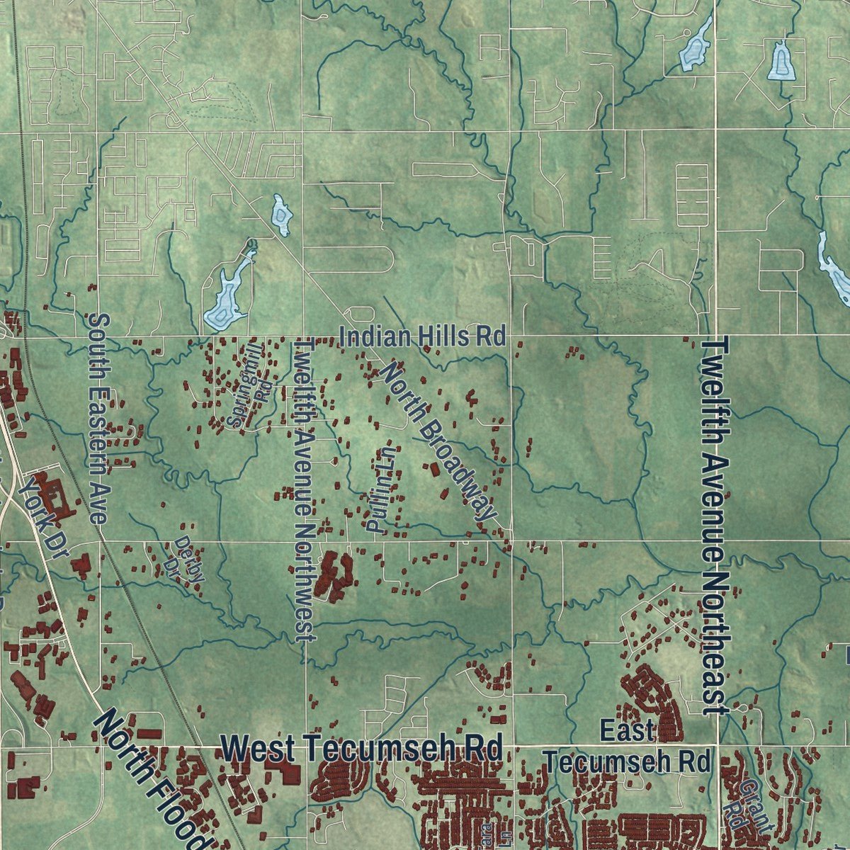
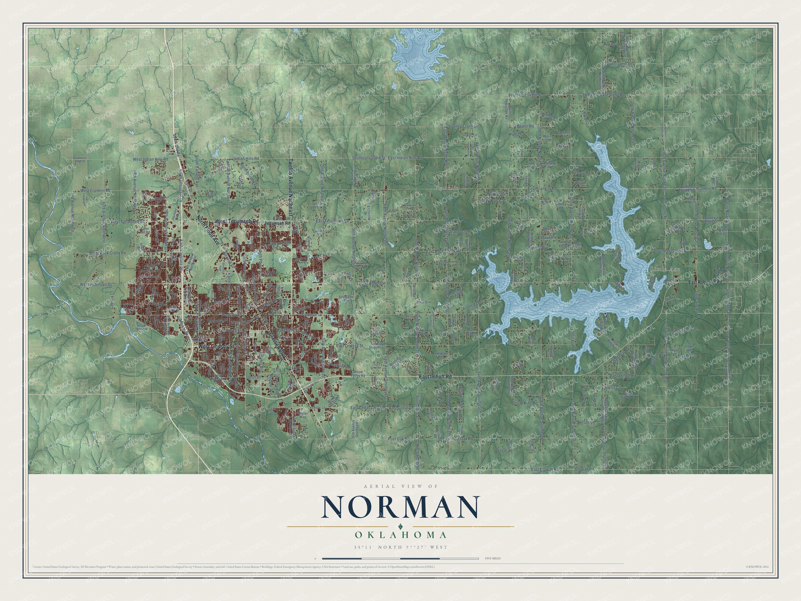
Explore Norman, Oklahoma from a whole new perspective. Created using aerial imagery and detailed geographic data, this map captures Norman building by building, with labeled streets, familiar landmarks, and shaded topographical relief that highlights the natural contours of the landscape.
Combining modern data with the timeless character of a vintage atlas, this map is just as interesting up close as it is beautiful on the wall. Whether you grew up in Norman, spent memorable years there, or call it home today, this unique map is a great way to celebrate a place that means something to you. Zoom in on the preview to look for your street, and then order a print to put your memories on the wall.
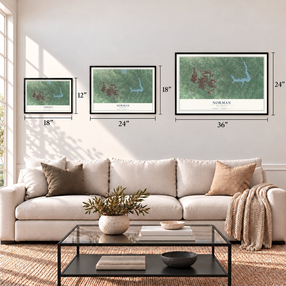
Three ways to hang it
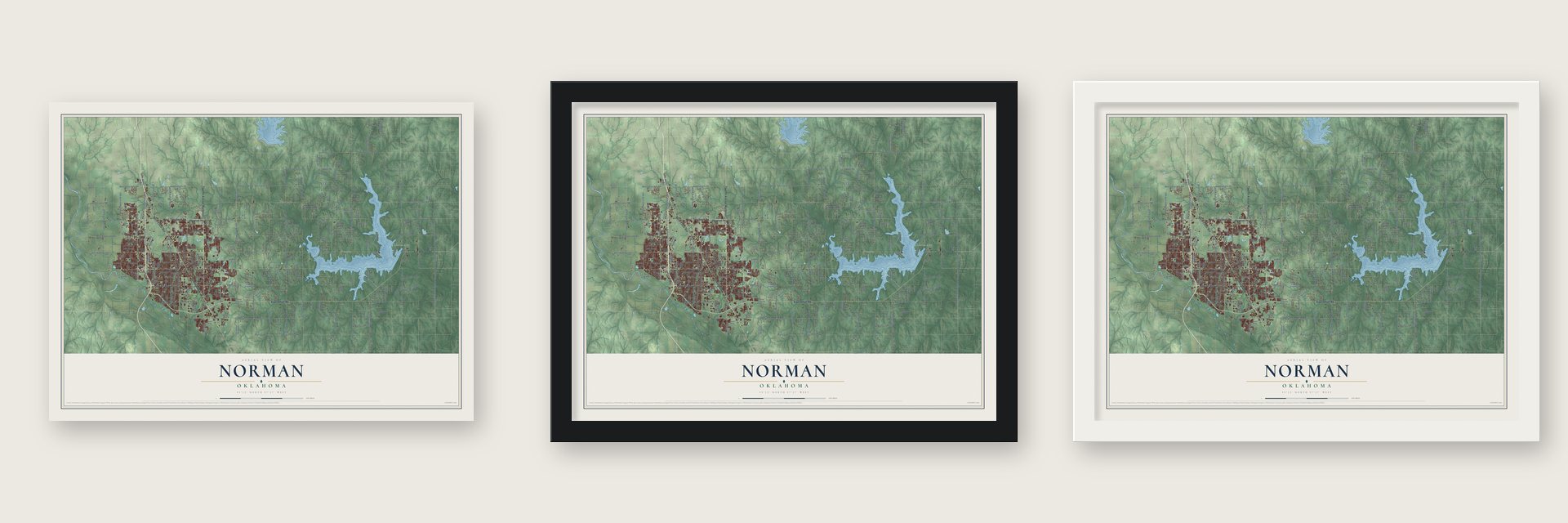
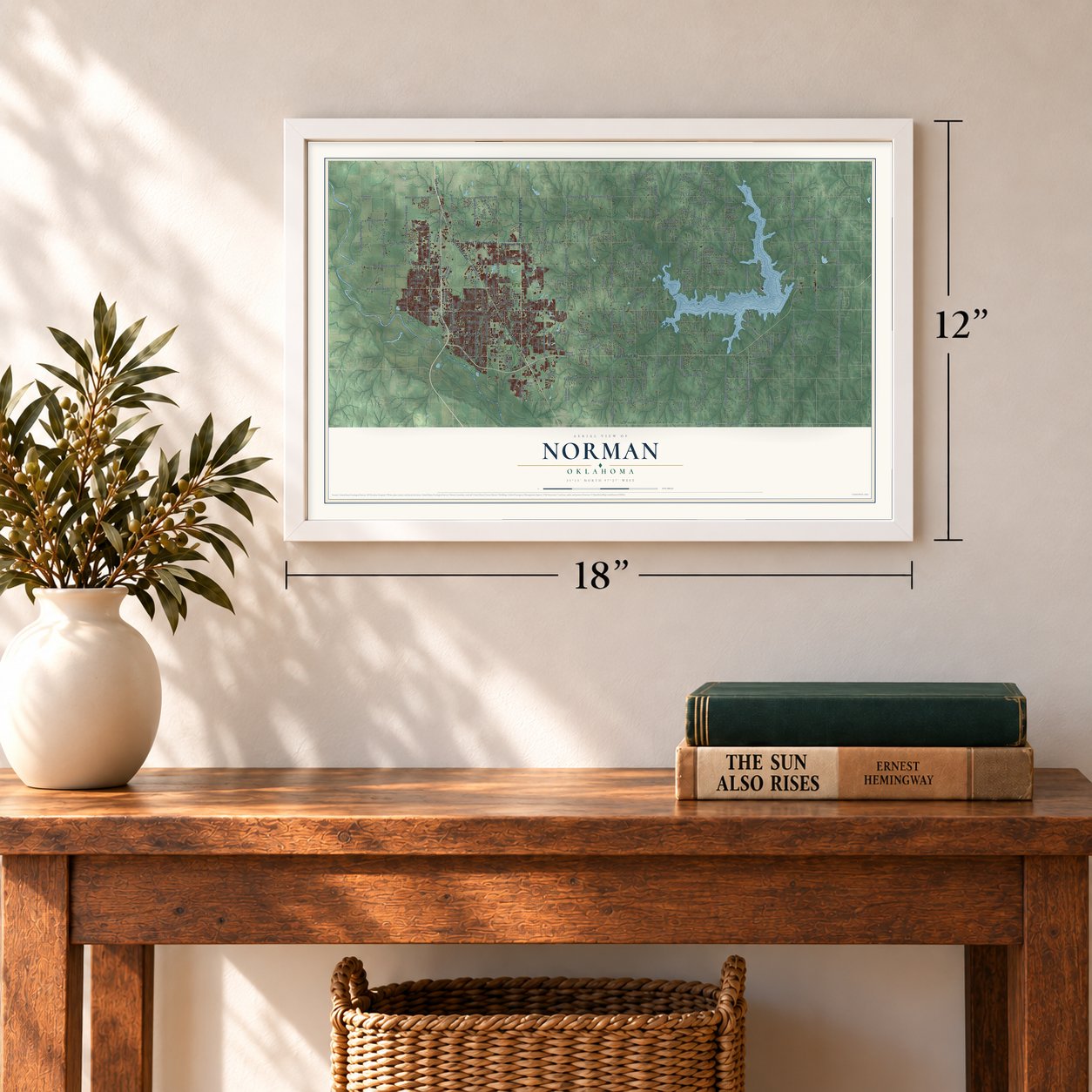
Unframed archival matte, a black wood frame or a white wood frame.
Up close
Geography Worth Displaying
This map was created using accurate cartographic data and authoritative geographic sources, including the U.S. Geological Survey and the Census Bureau. The map brings together terrain, waterways, roads, and building detail. The majority of the streets are labeled, houses are accurately depicted, and the topography is derived from government sources. Combining local data with carefully composed color and shading leads to this beautifully detailed Norman artwork for your wall.
Rather than simply showing street outlines, we’ve included as many of the street names as we could reasonably fit on the map while keeping their names legible. Zoom in on the high resolution preview to see exactly what’s on the map. We truly set out to create a statement piece for anyone who loves Norman. So whether it’s for you, or a gift for someone you love, we hope this map of Norman brings back fond memories.
Read the story behind this map of Norman, Oklahoma from 2026.
Find your street
Names on the Norman map
Every name below is printed on this map. Look for your street, your school, the park where you played, or the pond down the road.
Places and landmarks5
- Little Axe
- Denver
- Franklin
- Hall Park
- Little River State Park
Streets and roads339
- West Lindsey Street
- East Imhoff Road
- Classen Boulevard
- Twelfth Avenue Northeast
- North Flood Avenue
- West Tecumseh Road
- East Franklin Road
- Alameda Street
- North Interstate Drive
- East Cedar Lane Road
- East Etowah Road
- 156th Avenue Northeast
- 48th Avenue Northeast
- 84th Avenue Southeast
- Etowah Road
- Ed Noble Parkway
- 156th Avenue Southeast
- 180th Avenue Southeast
- East Indian Hills Road
- East Tecumseh Road
- East Rock Creek Road
- East Lindsey Street
- Southeast 179th Street
- East Post Oak Road
- East Robinson Street
- East Interstate Drive
- 108th Avenue Northeast
- South Dobbs Road
- 120th Avenue Northeast
- West Franklin Road
Show all 339 streets
- West Main Street
- 24th Avenue Northeast
- Alameda Drive
- West Robinson Street
- 48th Avenue Northwest
- 36th Avenue Northwest
- 72nd Avenue Northeast
- 36th Avenue Northeast
- 72nd Avenue Southeast
- West Rock Creek Road
- 60th Avenue Northeast
- West Indian Hills Road
- 60th Avenue Southeast
- 168th Avenue Northeast
- 60th Avenue Northwest
- 180th Avenue Northeast
- 84th Avenue Northeast
- 108th Avenue Southeast
- 144th Avenue Northeast
- Jenkins Avenue
- North Porter Avenue
- 24th Avenue Southeast
- South 60th Street
- Austin Road North
- 48th Avenue Southeast
- Chautauqua Avenue
- South Westminister Road
- 132nd Avenue Southeast
- Southeast 149th Street
- Twelfth Avenue Northwest
- Little Jim Road
- East Cedar Lane
- Stella Road
- 96th Avenue Northeast
- 120th Avenue Southeast
- Southeast 224th Street
- Post Oak Road
- Bethel Road
- 72nd Avenue Northwest
- East Boyd Street
- 156th Street
- South Berry Road
- West Boyd Street
- South Eastern Avenue
- East Westminister Road
- Newton Drive
- McGee Drive
- Indian Hills Road
- Franklin Road
- Asp Avenue
- Iowa Street
- North Berry Road
- East Main Street
- York Drive
- North Peters Avenue
- Dare Lane
- North Broadway
- Chaparral Road
- Stubbeman Avenue
- Old Oilfield Road
- East Stella Road
- Sequoyah Trail
- Lett Circle
- West Symmes Street
- 96th Street
- North 60th Avenue
- Nelson Lane
- Benny Bruce Street
- Astor Drive
- Day Drive
- Storm King Road
- Kunkel Avenue
- Cabella Court
- Melrose Drive
- Hickory Road
- Allspice Run
- Morren Drive
- Hayfield Road
- South Svc Road
- Dewey Avenue
- Stardust Lane
- Sexton Drive
- 120th Avenue
- Duke Drive
- Monitor Avenue
- Norris Circle
- Nelson Road
- Firefly Drive
- Quail Drive
- Roka Circle
- Mary Lane
- Kyle Drive
- Jet
- East Robinson Road
- South Peebly Road
- 36th Avenue Southeast
- Austin Road South
- Twelfth Avenue Southeast
- 36th Avenue Southwest
- Northwest 24th Avenue
- Cedar Lane
- Big Jim Circle
- 24th Avenue Northwest
- Southeast 164th Street
- 132nd Avenue Northeast
- Indian Meridian Avenue Southeast
- 96th Avenue Southeast
- South Pickard Avenue
- Southeast 209th Street
- West Brooks Street
- Southwest 24th Avenue
- Winding Oaks Lane
- Indian Point Road
- Indian Meridian Northeast
- 144th Avenue Southeast
- Southeast 194th Street
- Imhoff Road
- Wylie Road
- West Imhoff Road
- Walnut Road
- Beaumont Drive
- Oakhurst Avenue
- South Midwest Boulevard
- Lindsey Street East
- South Hiwassee Road
- East Deer Creek Road
- Torrans Lane
- Indian Point Circle
- Wheatland Drive
- Manor Hill Drive
- Wood Valley Road
- Juanita Lane
- Vine Street
- Hidden Hill Road
- Clear Bay Avenue
- 143rd Avenue Northeast
- Blue Ridge Drive
- Spring View Drive
- Isim Road
- Whitebrook Street
- Oak Tree Avenue
- Carrington Lane
- 26th Avenue Northwest
- Hoffman Drive
- Diamond Drive
- Central Parkway
- River Oaks Drive
- Black Locust Place
- State Drive
- Ballard Drive
- Don Ray Road
- Chloe Lane
- Mohawk Road
- Reed Avenue
- Northcliff Avenue
- Crickett Lane
- Bentwood Road
- Lola Road
- El Cerrito Drive
- Merkle Drive
- Pendleton Drive
- Parkside Road
- Journey Parkway
- Skyler Way
- Glad Lane
- Silverado Way
- Trailwood Drive
- Little Pond Road
- Briarcrest Drive
- 175th Avenue
- Dan Drive
- Spencer Circle
- Pullin Lane
- Hamden Avenue
- Fischer Drive
- Goertzen Drive
- Shiloh Drive
- Kasey Drive
- Ashton Avenue
- Gini Lee Lane
- Big Horn Road
- Grant Road
- Sailboat Road
- Hilltop Drive
- Little Axe Drive
- Bridge Creek Drive
- Estell Lane
- Dixon Street
- Cabin Road
- Angel Terrace
- Biloxi Drive
- Floyd Avenue
- Blue Jay Road
- Bains Lane
- Lago Vista Road
- Flora Drive
- Frontier Circle
- Miller Lane
- Ohio Drive
- Melody Lane
- Foster Drive
- Brittian Road
- Farm Hill Road
- Topaz Lane
- Gander Lane
- Onyx Avenue
- Bert Lane
- Darwin Street
- Baltic Avenue
- Jersey Road
- Aztec Drive
- Ash Lane
- Shrill Street
- Lyon Drive
- Par Drive
- RR Road
- Twin Acres Drive
- Little Gravel Road
- Eagle Cliff Drive
- Southern Shores Drive
- East Frank Street
- Northridge Road
- Clearwater Drive
- Kensal Rise Place
- Fox Croft Road
- West Daws Street
- Enterprise Drive
- Southwest 179th Street
- Sunvalley Drive
- Woods Avenue
- Summit Bend
- Springmill Road
- Goodman Lane
- Burlwood Road
- Trisha Lane
- Butler Drive
- Broce Drive
- Brown Lane
- Kiamichi Road
- Cherry Creek Drive
- Pudner Drive
- Cypress Avenue
- Willow Grove Drive
- Mystic Isle
- Maple
- Trail End
- George Avenue
- Priestly Avenue
- Omega Street
- Riviera Drive
- Oliver Street
- Derby Drive
- Villa Drive
- Southeast Peebly Road
- Elm Avenue
- East Brooks Street
- 79th Avenue Northeast
- North Sherry Avenue
- 66th Avenue Southeast
- Highland Hills Drive
- Ann Branden Boulevard
- Burning Tree
- Red Fern Lane
- Crooked Oak Drive
- Jackson Drive
- Queenston Avenue
- 80th Avenue Northeast
- 58th Avenue Northeast
- East Apache Street
- Creekside Drive
- Castlerock Road
- Fay Avenue
- 81st Avenue Northeast
- North Timberline Drive
- 90th Avenue Southeast
- 104th Avenue Southeast
- Shoreline Drive
- Annalane Drive
- Blue Creek Drive
- North Highland Drive
- Moonlight Drive
- Houston Avenue
- Junction Drive
- Misty Ridge Drive
- Little River Drive
- Coyote Trail
- Rhoades Drive
- North Floyd Cox Drive
- Bayland Drive
- Laramie Road
- Cardinal Lane
- Oakridge Drive
- Watkins Road
- Pheasant Run Road
- Lamp Post Road
- Grand View Avenue
- Perry Drive
- Big Bend Circle
- Forest Road
- Gauntlet Road
- Dalton Lane
- Market Place
- Gray Fox Drive
- Skyview Lane
- Page Street
- Pecan Avenue
- Bruehl Lane
- Tara Lane
- Lilac Lane
Names are listed as they appear on the printed map. Zoom into the product photos to find them.
Keep exploring Oklahoma
Norman is one of 887 Oklahoma towns we've mapped. Every dot on the map is a print of its own.
The search covers every state, Oklahoma first.
Near Norman
Order 2 or more town maps and save 10%. Shown in the size and finish you picked above, so they hang as a set.
- Noble 12" x 18" / Archival Matte Print $39.99
- Moore 12" x 18" / Archival Matte Print $39.99
- Slaughterville 12" x 18" / Archival Matte Print $39.99


More maps nearby: Goldsby, Etowah, Valley Brook, Pink and Newcastle.
The art of mapping a place
How This Map Was Made
Real places. Remarkable detail. Discover the layers that turn geographic data into a map of home.

The view from above
Aerial imagery reveals the character of the land: woodland, open fields, and the patterns of a place.

The shape of the land
Elevation data brings hills, valleys, and subtle changes in the landscape into view.

The details of home
Roads, waterways, and building footprints come together to make the map feel unmistakably local.

Geography becomes art
Considered color, shading, and typography bring the layers together in a map made for your wall.


Process illustrated with Mendon, Massachusetts. Aerial imagery: USDA NAIP. Terrain: USGS 3D Elevation Program. Map details and finished artwork: KNOWOL.
The Details
About This Print
Choose an archival matte print, or a black or white Ayous wood frame. The archival matte print is unframed.
Select your size and finish above to see the matching product image and price.
Materials & Craftsmanship
A contemporary map with the character of a classic atlas, printed on archival matte paper. Optional frames are made from Ayous wood.
Your printed map does not include the watermark shown in the full-map preview.
Shipping & Delivery
Free shipping within the United States. Every print is made to order in the USA.
Buying a gift? Add a note in your cart and we'll include it. We never put prices in the package.
Prints ship within 2 to 3 business days. Allow 7 to 10 days total from ordering for delivery. Timing may vary during holidays or periods of high order volume.
Read our shipping policy.
Returns and damaged prints
Each print is made to order. Change-of-mind refunds are not available after production.
If your print arrives damaged, misprinted or incorrect, contact support@knowol.com within 30 days of receiving it. Include your order number, photos and a description of the issue.
Read our full refund and replacement policy. For questions about your order, email support@knowol.com.