
Search for another town




Free U.S. delivery 7 to 10 days after you order
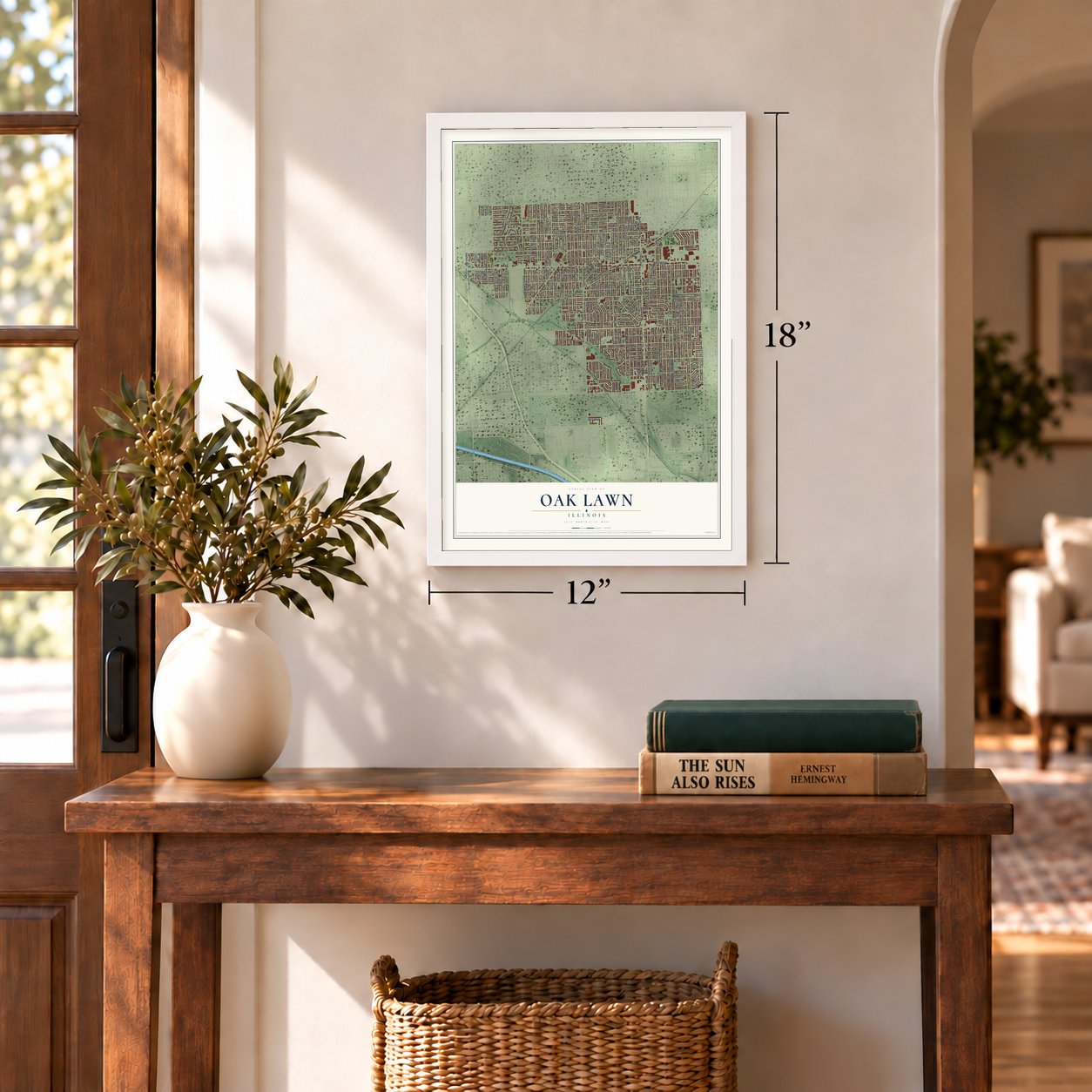
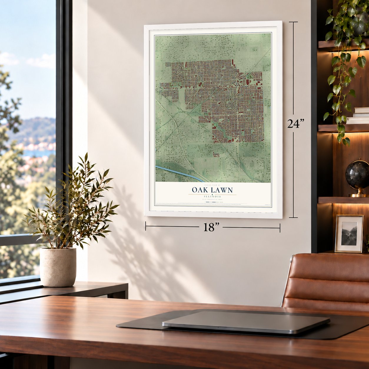
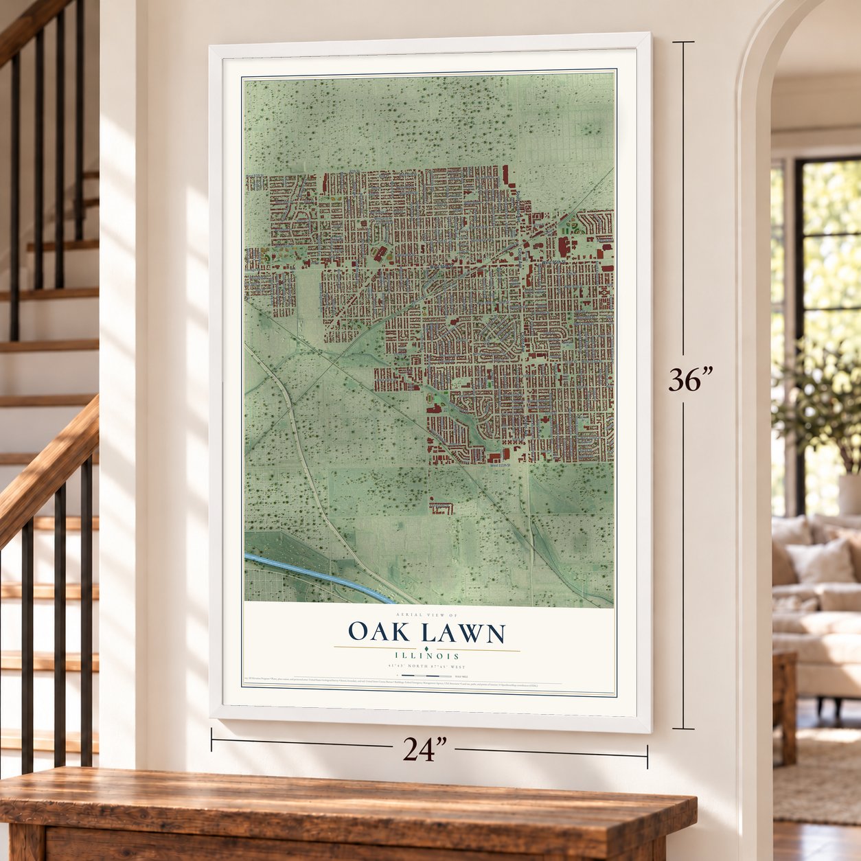
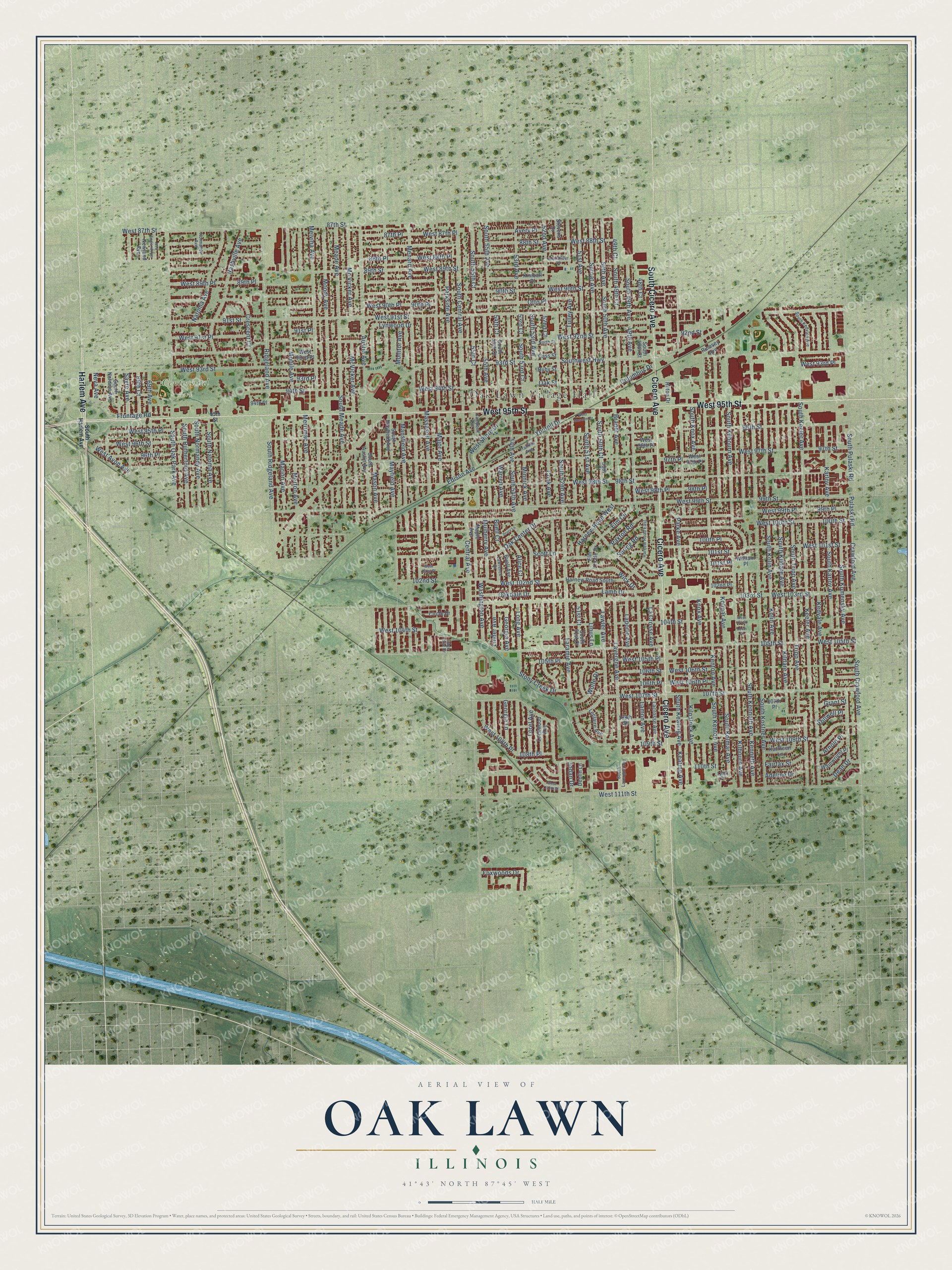
Oak Lawn, Illinois Map Art
A new map of Oak Lawn, Illinois, made in 2026 and printed to order on thick archival matte paper.
12" x 18" Archival Matte Print
A Map of Home. A Work of Art.
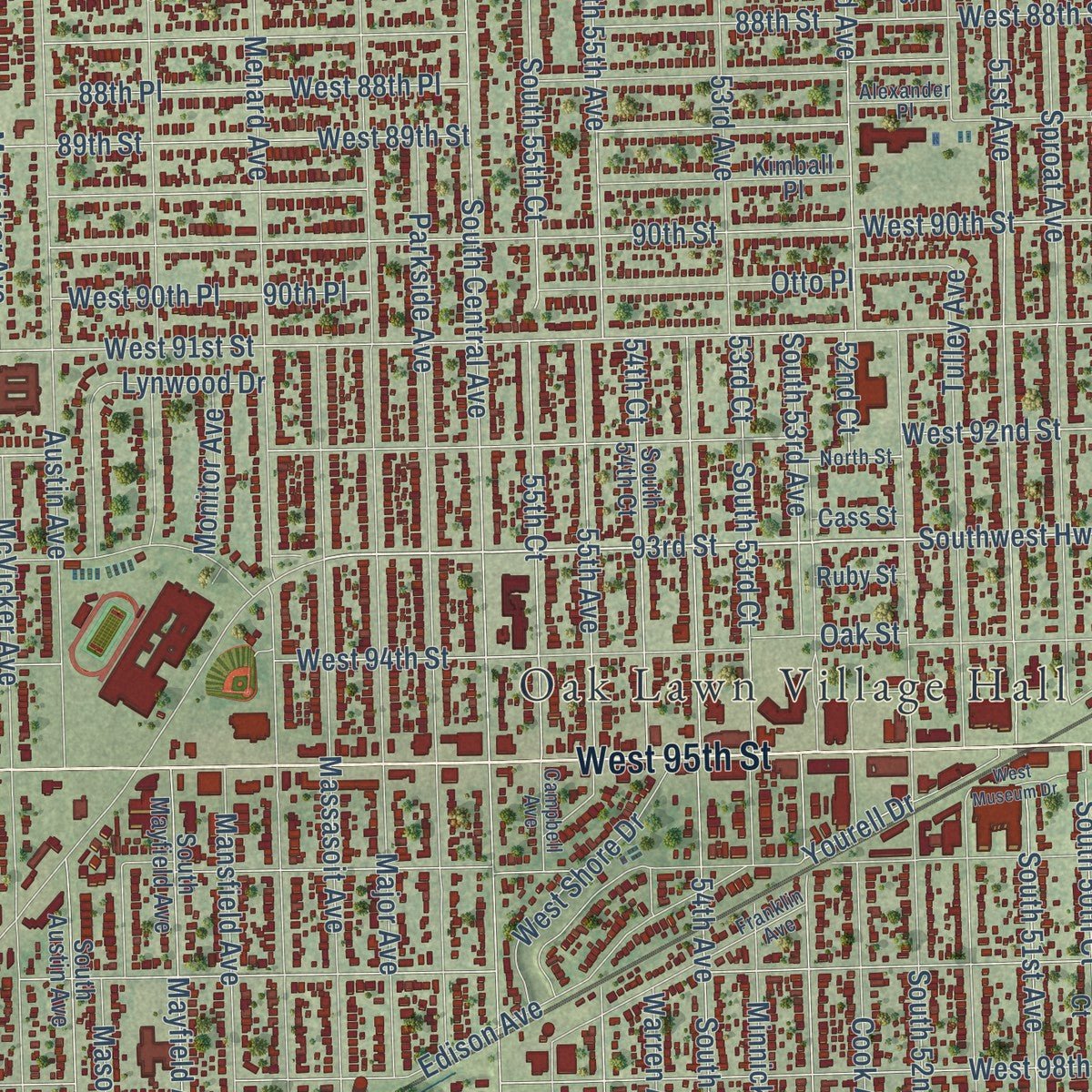
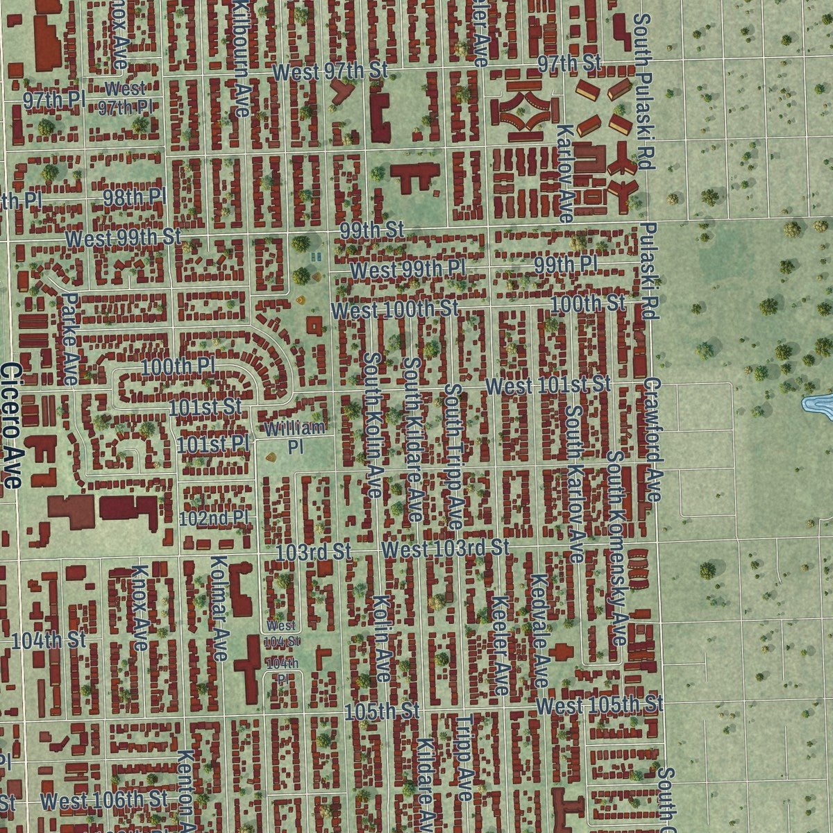
Explore Oak Lawn, Illinois from a whole new perspective. Created using aerial imagery and detailed geographic data, this map captures Oak Lawn building by building, with labeled streets, familiar landmarks, and shaded topographical relief that highlights the natural contours of the landscape.
Combining modern data with the timeless character of a vintage atlas, this map is just as interesting up close as it is beautiful on the wall. Whether you grew up in Oak Lawn, spent memorable years there, or call it home today, this unique map is a great way to celebrate a place that means something to you. Zoom in on the preview to look for your street, and then order a print to put your memories on the wall.
Three ways to hang it
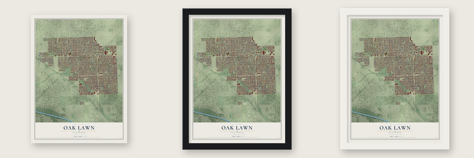
Unframed archival matte, a black wood frame or a white wood frame.
Up close
Geography Worth Displaying
This map was created using accurate cartographic data and authoritative geographic sources, including the U.S. Geological Survey and the Census Bureau. The map brings together terrain, waterways, roads, and building detail. The majority of the streets are labeled, houses are accurately depicted, and the topography is derived from government sources. Combining local data with carefully composed color and shading leads to this beautifully detailed Oak Lawn artwork for your wall.
Rather than simply showing street outlines, we’ve included as many of the street names as we could reasonably fit on the map while keeping their names legible. Zoom in on the high resolution preview to see exactly what’s on the map. We truly set out to create a statement piece for anyone who loves Oak Lawn. So whether it’s for you, or a gift for someone you love, we hope this map of Oak Lawn brings back fond memories.
Read the story behind this map of Oak Lawn, Illinois from 2026.

About Oak Lawn, Illinois
Oak Lawn is a village of 58,362 people in Cook County, right next to Chicago. In August 1835 James B. Campbell bought a stretch of land from Cicero to Central Avenue, between 95th and 103rd streets. He then lost a lawsuit to the Illinois State Bank, and by 1840 his property had gone to public auction. John Simpson, an important name in the village's early years, bought its northern half in 1842.
The earliest known name for the area was Black Oak Grove, later cut to Black Oak or Black Oaks. By 1859 Worth Township had paid to build Black Oak Grove Road, which is now 95th Street. A rail line reached the area in 1880, and by 1882 the depot, the post office and the settlement around them had all taken the name Oak Lawn. Farm families sold milk and produce in Chicago markets, and the village incorporated in 1909.
“The Post is named after Raymond H. Johnson and Leslie P. Phelps whose names were drawn from a hat which included the names of 23 young men from the Oak Lawn area who lost their lives in World War II.”
- Round-Up Days from 1949After World War II, veterans coming home bought houses with the G.I. Bill, and Oak Lawn grew fast. In 1949 the village started Round-Up Days, a Western-themed festival to promote itself. The first drew 25,000 people. In 1952 more than 100,000 came, Jack Brickhouse was master of ceremonies and WGN-TV televised the parade. By 1957 the festival had grown too large, so the village staged a final, scaled-down festival a year later.
- The tornado of 1967On April 21, 1967, an F4 tornado touched down in Palos Hills, then at the Starlite Drive-In on 95th Street, and crossed Oak Lawn with winds above 200 mph. It tossed cars and buses, split Oak Lawn Community High School in half and wrecked the Airway Trailer Park and roller rink. In 16 minutes it killed more than 30 people and damaged or destroyed roughly 900 buildings. Rebuilt, the village peaked at 63,500 people from 1973 to 1976.
- A library from 100 booksOak Lawn Public Library began in 1934 as a collection of one hundred books. The next year, President Franklin D. Roosevelt set up a new federal agency, the Works Progress Administration, to fund public projects nationwide. With help from a WPA grant, the village built a new library, and it opened in 1936.
- Oak Lawn LakeAround the time the post office opened in 1882, part of Stony Creek was widened to create Oak Lawn Lake, a place for recreation. Today the village keeps more than 300 acres of parks and open land, including the 38-acre Centennial Park.
Find your street
Names on the Oak Lawn map
Every name below is printed on this map. Look for your street, your school, the park where you played, or the pond down the road.
Places and landmarks2
- Oak Lawn Village Hall
- Centennial Park
Streets and roads270
- West 95th Street
- Cicero Avenue
- South Cicero Avenue
- Harlem Avenue
- South Kilbourn Avenue
- Kilpatrick Avenue
- 93rd Street
- Kilbourn Avenue
- Crawford Avenue
- Laramie Avenue
- 99th Street
- 107th Street
- Ridgeland Avenue
- Cook Avenue
- Lorel Avenue
- West Avon Avenue
- West 93rd Street
- Central Avenue
- South Central Avenue
- West 97th Street
- West 99th Street
- Southwest Highway
- West 91st Street
- 91st Street
- 87th Street
- West 87th Street
- West 98th Street
- South Keeler Avenue
- 98th Street
- 105th Street
Show all 270 streets
- West 105th Street
- 97th Street
- South Pulaski Road
- 103rd Street
- West 103rd Street
- West 92nd Street
- Kenton Avenue
- South Kenton Avenue
- South Kostner Avenue
- West 96th Street
- South Tripp Avenue
- 92nd Street
- West 111th Street
- 90th Street
- Keeler Avenue
- South 52nd Avenue
- West 107th Street
- Menard Avenue
- 96th Street
- Tripp Avenue
- 101st Street
- West 101st Street
- Major Avenue
- West 90th Street
- Kolmar Avenue
- South Kolmar Avenue
- 102nd Street
- Melvina Avenue
- 94th Street
- Austin Avenue
- Kenneth Avenue
- South Kenneth Avenue
- 100th Street
- West 100th Street
- 89th Street
- 88th Street
- West 88th Street
- Meade Avenue
- Mayfield Avenue
- South Ridgeland Avenue
- 53rd Avenue
- Pulaski Road
- South Crawford Avenue
- South Oak Park Avenue
- South 51st Avenue
- 51st Avenue
- McVicker Avenue
- Moody Avenue
- 109th Street
- Kolin Avenue
- South Kolin Avenue
- South Karlov Avenue
- South Komensky Avenue
- West 109th Street
- West 99th Place
- West 102nd Street
- Kildare Avenue
- South Kildare Avenue
- Tulley Avenue
- West 94th Street
- Parkside Avenue
- Massasoit Avenue
- 99th Place
- Oak Center Drive
- West 91st Place
- 55th Avenue
- South 55th Avenue
- West 89th Street
- Nashville Avenue
- 89th Place
- West 89th Place
- West 88th Place
- South 53rd Avenue
- Karlov Avenue
- South Keating Avenue
- 54th Avenue
- South 54th Avenue
- 49th Avenue
- South 49th Avenue
- 104th Street
- Kedvale Avenue
- Minnick Avenue
- West 105th Place
- 55th Court
- South 55th Court
- Mansfield Avenue
- Sproat Avenue
- Lavergne Avenue
- Merrimac Avenue
- 87th Place
- West 87th Place
- 50th Avenue
- South 50th Avenue
- 88th Place
- 108th Place
- West 108th Place
- Keating Avenue
- 105th Place
- Mobile Avenue
- South Meade Avenue
- Lawler Avenue
- Lamon Avenue
- 106th Street
- West 106th Street
- 49th Court
- South 49th Court
- Merton Avenue
- Knox Avenue
- Mason Avenue
- Long Avenue
- West 93rd Place
- 90th Place
- West 90th Place
- Marion Avenue
- La Crosse Avenue
- South Knox Avenue
- Washington Avenue
- 106th Place
- West 106th Place
- 110th Street
- 96th Place
- Natoma Avenue
- Laporte Avenue
- 54th Court
- 53rd Court
- South 53rd Court
- Brandt Avenue
- 98th Place
- West 98th Place
- Otto Place
- Frontage Road
- Edison Avenue
- 52nd Avenue
- Lamb Drive
- South 50th Court
- Mc Vicker Avenue
- South Normandy Avenue
- South Rutherford Avenue
- South Natoma Avenue
- Crescent Court
- Wick Drive
- Georgia Lane
- Elm Circle
- 100th Place
- Linder Avenue
- Lynwood Drive
- Sayre Avenue
- Oakdale Drive
- 91st Place
- West Shore Drive
- 97th Place
- 93rd Place
- West 104th Street
- Columbus Drive
- Harnew Road West
- Buell Court
- West 95th Place
- Mulberry Avenue
- Foxwoods Drive
- Paxton Road
- Avery Place
- Parke Avenue
- Stony Creek Drive
- Yourell Drive
- Wolfe Drive
- Linus Lane
- 51st Court
- 69th Avenue
- 69th Court
- Warren Avenue
- Fairfax Street
- Alice Court
- Adeline Drive
- Georgia Avenue
- 101st Place
- 48th Court
- Monitor Avenue
- Dean Drive
- Arnold Place
- Oak Street
- Spring Road
- Scott Lane
- Stillwell Place
- Grant Street
- Jodan Drive
- Neva Avenue
- 52nd Court
- Lacrosse Avenue
- Lockwood Avenue
- 108th Street
- West 96th Place
- South 54th Court
- South Mayfield Avenue
- South Austin Avenue
- 50th Court
- Buell Avenue
- Elm Circle Drive
- Leclaire Avenue
- West 97th Place
- Harnew Road South
- Maple Avenue
- Kimball Place
- South 51st Court
- South 48th Court
- Kathleen Lane
- West 92nd Place
- South Nordica Avenue
- Wainwright Place
- Deblin Lane
- Newland Avenue
- Circle Drive
- Rumsey Avenue
- Hilton Drive
- 107th Place
- Stevens Drive
- 102nd Place
- William Place
- Cass Street
- Ruby Street
- 94th Place
- South Harlem Avenue
- Alexander Place
- Franklin Avenue
- Harnew Road East
- South Kedvale Avenue
- South Lavergne Avenue
- Edge Lake Drive
- Lawrence Court
- Campbell Avenue
- Normandy Avenue
- North Street
- 110th Place
- 95th Street
- West 110th Street
- West 101st Place
- New England Avenue
- West Museum Drive
- 104th Place
- Drury Lane
- West 104 Street
Names are listed as they appear on the printed map. Zoom into the product photos to find them.
The art of mapping a place
How This Map Was Made
Real places. Remarkable detail. Discover the layers that turn geographic data into a map of home.

The view from above
Aerial imagery reveals the character of the land: woodland, open fields, and the patterns of a place.

The shape of the land
Elevation data brings hills, valleys, and subtle changes in the landscape into view.

The details of home
Roads, waterways, and building footprints come together to make the map feel unmistakably local.

Geography becomes art
Considered color, shading, and typography bring the layers together in a map made for your wall.


Process illustrated with Mendon, Massachusetts. Aerial imagery: USDA NAIP. Terrain: USGS 3D Elevation Program. Map details and finished artwork: KNOWOL.
The Details
About This Print
Choose an archival matte print, or a black or white Ayous wood frame. The archival matte print is unframed.
Select your size and finish above to see the matching product image and price.
Materials & Craftsmanship
A contemporary map with the character of a classic atlas, printed on archival matte paper. Optional frames are made from Ayous wood.
Your printed map does not include the watermark shown in the full-map preview.
Shipping & Delivery
Free shipping within the United States. Every print is made to order in the USA.
Buying a gift? Add a note in your cart and we'll include it. We never put prices in the package.
Prints ship within 2 to 3 business days. Allow 7 to 10 days total from ordering for delivery. Timing may vary during holidays or periods of high order volume.
Read our shipping policy.
Returns and damaged prints
Each print is made to order. Change-of-mind refunds are not available after production.
If your print arrives damaged, misprinted or incorrect, contact support@knowol.com within 30 days of receiving it. Include your order number, photos and a description of the issue.
Read our full refund and replacement policy. For questions about your order, email support@knowol.com.
Find your town
Looking for another city?
Find a map of home in our Illinois collection, or any town in the country.
Nearby
Maps of towns near Oak Lawn
Know someone from one of these towns? Their map makes a great gift.
 Chicago Ridge
, Illinois
From $39.99See the map
 Hometown
, Illinois
From $39.99See the map
 Burbank
, Illinois
From $39.99See the map
More maps nearby: Evergreen Park, Worth, Alsip, Bridgeview and Merrionette Park.