
Search for another town



Free U.S. delivery 7 to 10 days after you order
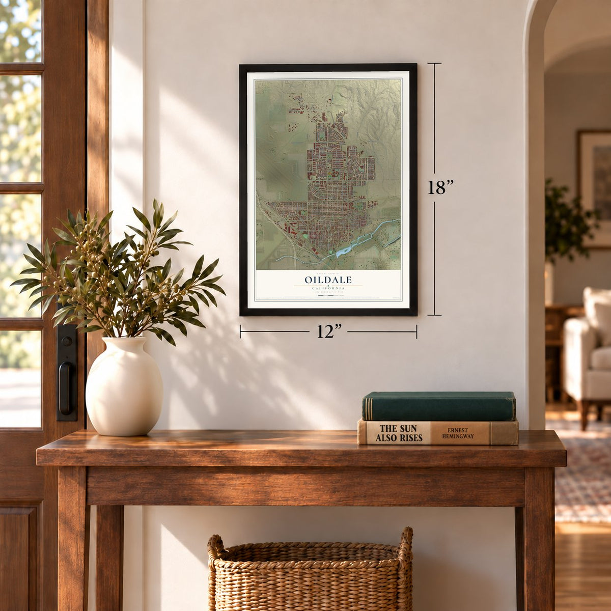
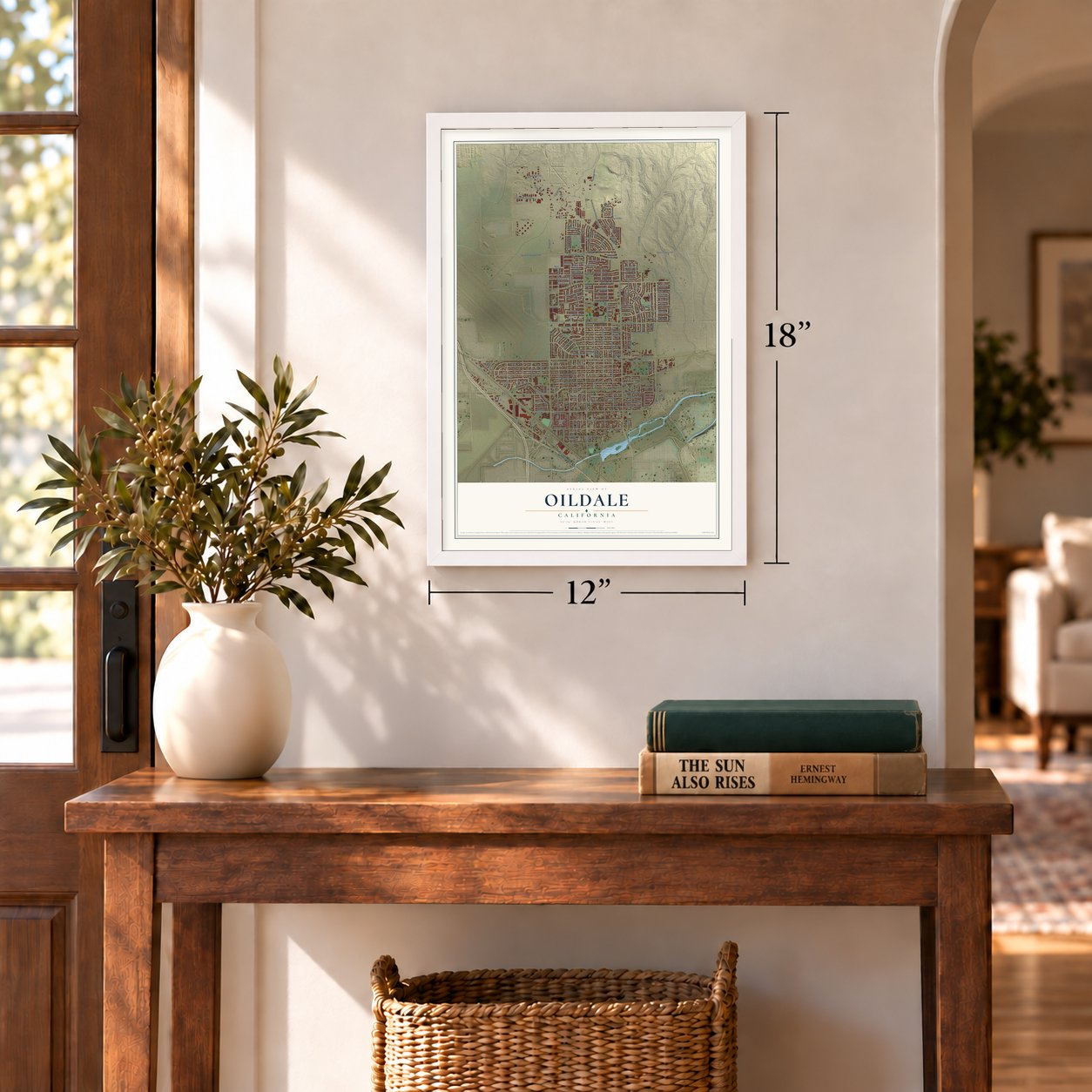
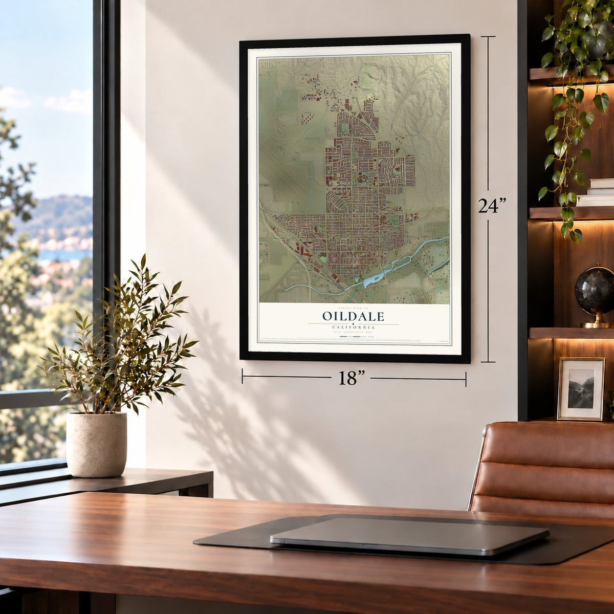
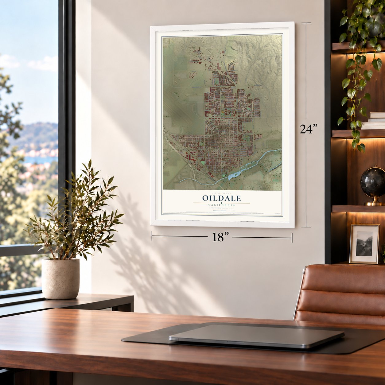
Oildale, California Map Art
Building by building, with labeled streets and shaded relief.
12" x 18" Archival Matte Print
A Map of Home. A Work of Art.
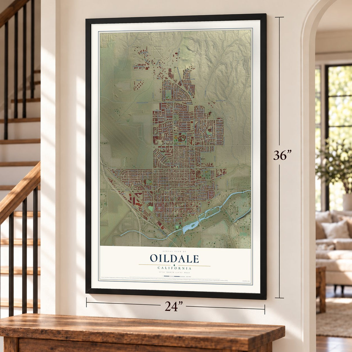
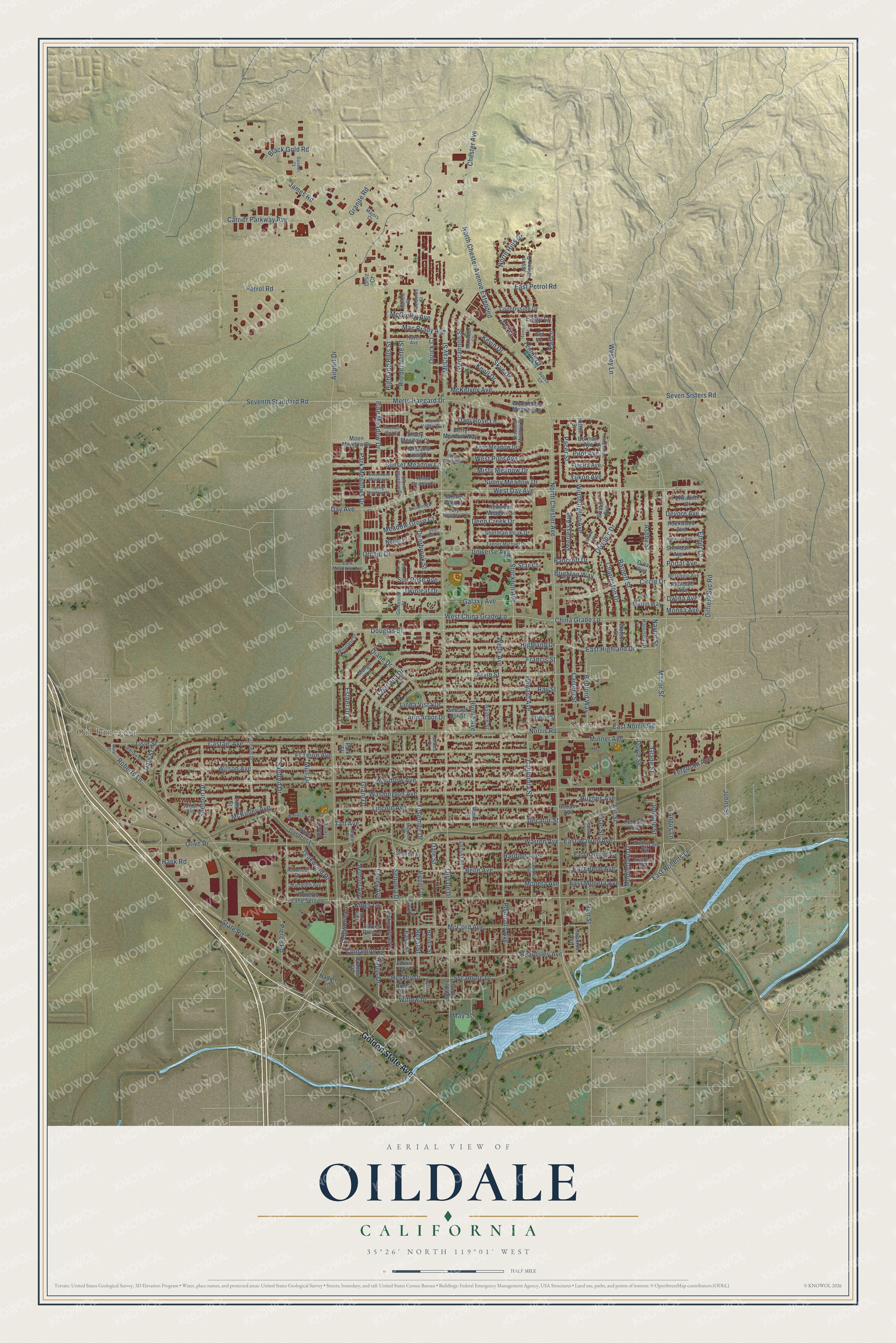
Explore Oildale, California from a whole new perspective. Created using aerial imagery and detailed geographic data, this map captures Oildale building by building, with labeled streets, familiar landmarks, and shaded topographical relief that highlights the natural contours of the landscape.
Combining modern data with the timeless character of a vintage atlas, this map is just as interesting up close as it is beautiful on the wall. Whether you grew up in Oildale, spent memorable years there, or call it home today, this unique map is a great way to celebrate a place that means something to you. Zoom in on the preview to look for your street, and then order a print to put your memories on the wall.
Three ways to hang it
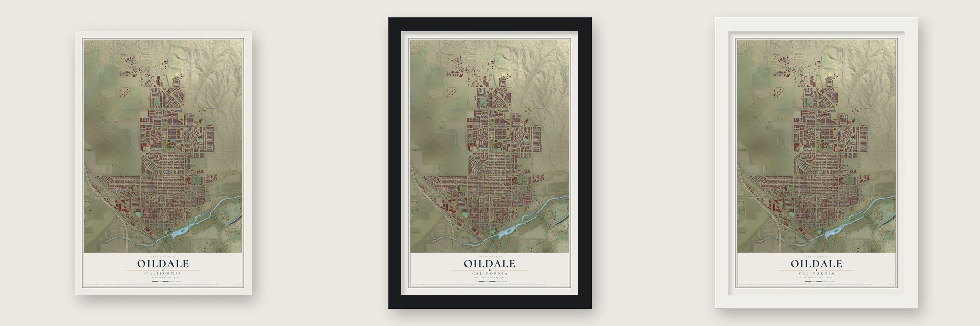
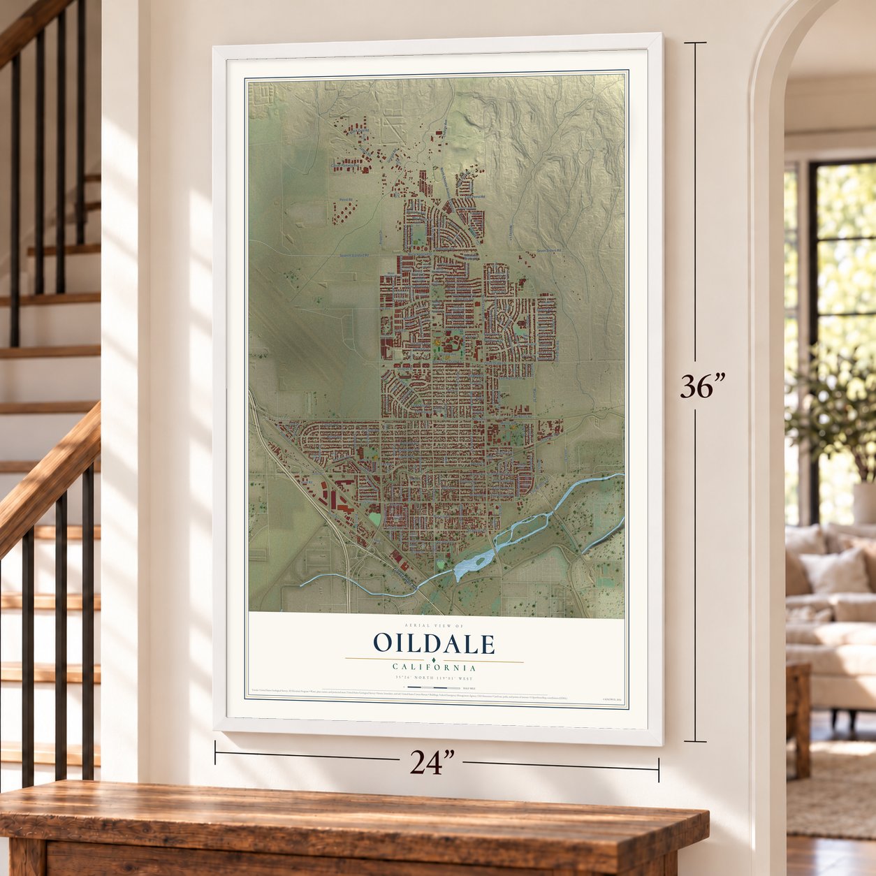
Unframed archival matte, a black wood frame or a white wood frame.
Up close
Geography Worth Displaying
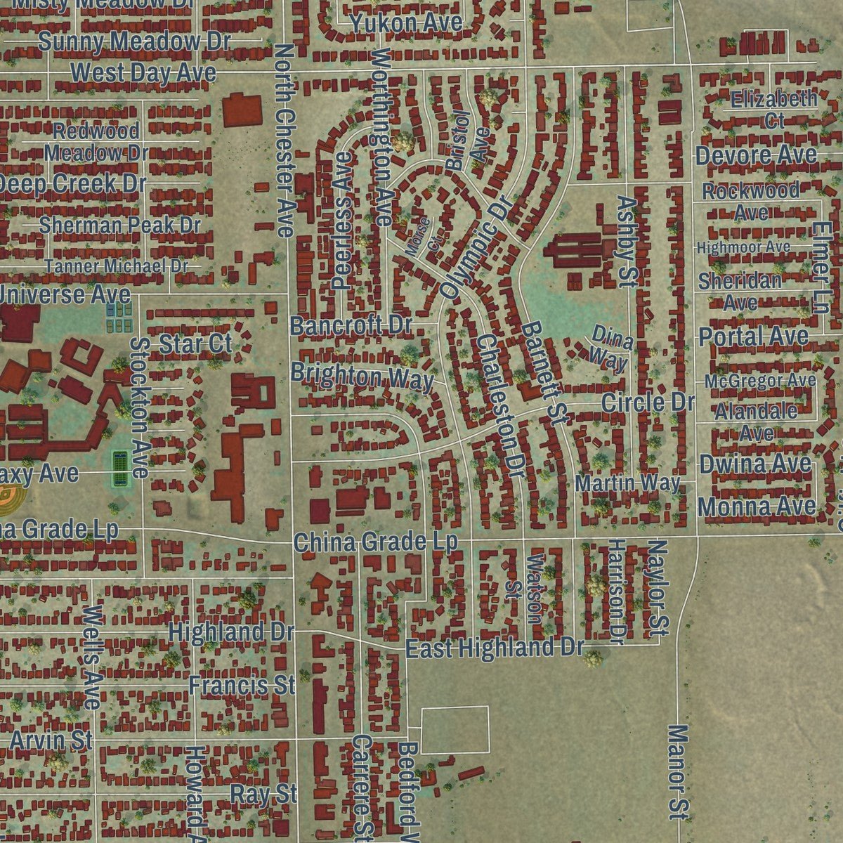
This map was created using accurate cartographic data and authoritative geographic sources, including the U.S. Geological Survey and the Census Bureau. The map brings together terrain, waterways, roads, and building detail. The majority of the streets are labeled, houses are accurately depicted, and the topography is derived from government sources. Combining local data with carefully composed color and shading leads to this beautifully detailed Oildale artwork for your wall.
Rather than simply showing street outlines, we’ve included as many of the street names as we could reasonably fit on the map while keeping their names legible. Zoom in on the high resolution preview to see exactly what’s on the map. We truly set out to create a statement piece for anyone who loves Oildale. So whether it’s for you, or a gift for someone you love, we hope this map of Oildale brings back fond memories.
Read the story behind this map of Oildale, California from 2026.

Find your street
Names on the Oildale map
Every name below is printed on this map. Look for your street, your school, the park where you played, or the pond down the road.
Places and landmarks2
- Oil Junction
- Seguro
Streets and roads247
- Golden State Avenue
- Wesley Lane
- North Chester Avenue
- Beardsley Avenue
- Petrol Road
- West China Grade Lp
- East Highland Drive
- Johnnie Street
- North Chester Avenue Extended
- East Warren Avenue
- Cinnamon Lane
- Dogwood Lane
- Kings Lane
- Yukon Avenue
- Roberts Lane
- Norris Road
- East Belle Avenue
- Sycamore Drive
- Airport Drive
- Manor Street
- McCray Street
- Wilson Avenue
- Seventh Standard Road
- El Tejon Avenue
- Woodrow Avenue
- Day Avenue
- West Day Avenue
- State Road
- James Road
- Washington Avenue
Show all 247 streets
- Merle Haggard Drive
- Castaic Avenue
- Sequoia Drive
- Francis Street
- Decatur Street
- Lincoln Avenue
- Douglas Street
- Oildale Drive
- Arvin Street
- Ferguson Avenue
- Olive Drive
- Belle Avenue
- Olympic Drive
- Minner Avenue
- Ray Street
- Hurrle Avenue
- Wells Avenue
- East Roberts Lane
- Oilfield Svc Road
- Bedford Way
- McCord Avenue
- Barnett Street
- Linda Vista Drive
- Pierce Road
- China Grade Lp
- Seven Sisters Road
- Charlana Drive
- Warren Avenue
- Sanford Drive
- Diane Drive
- Ann Arbor Drive
- Park Meadows Drive
- Granite Road
- Ashby Street
- Circle Drive
- Plymouth Avenue
- Highland Drive
- Universe Avenue
- East Norris Road
- Stockton Avenue
- Sunset Meadow Lane
- Yosemite Drive
- Twinleaf Drive
- Highland Hills Street
- Howard Avenue
- Carrier Parkway Avenue
- Angus Lane
- Harding Avenue
- Charleston Drive
- McKelvey Avenue
- Esther Drive
- California Street
- Willow Drive
- Grant Drive
- Johns Street
- Skye Drive
- Worthington Avenue
- Carrere Street
- Kevin Drive
- Galaxy Avenue
- Glencannon Street
- Sheldon Drive
- West Pilot Avenue
- East Petrol Road
- Devore Avenue
- Orchid Drive
- Meadow Grove Court
- Misty Meadow Drive
- Moneta Avenue
- Sunny Meadow Drive
- Huskey Drive
- Orrick Court
- North Hills Drive
- Teakwood Drive
- Pine Meadow Drive
- Peerless Avenue
- Rio del Norte Street
- East Moneta Avenue
- Deep Creek Drive
- Mac Brady Avenue
- May Street
- Mobiletown Drive
- Hughes Avenue
- Covey Avenue
- Pilot Avenue
- Lisle Street
- Lilac Street
- Hart Street
- Iris Street
- Knoll Drive
- Dani Rose Lane
- Sun Rose Avenue
- Black Gold Road
- Tennis Drive
- McKinley Avenue
- Eagle Lane
- Par Lane
- Doyle Street
- Deerbrook Street
- Chester Avenue
- Muir Drive
- Pacer Street
- Glade Street
- McGinley Avenue
- Brighton Way
- Harris Drive
- Bancroft Drive
- Portal Avenue
- Elmer Lane
- Hank Road
- Monna Avenue
- Dwina Avenue
- Tee Lane
- Dale Street
- Naylor Street
- Taft Avenue
- Easy Street
- Regal Street
- Date Street
- Star Court
- Hickorywood Lane
- Olive Gardens Lane
- American Circle
- South Oildale Drive
- Locust Street
- Belmont Avenue
- Higgins Drive
- Torrey Pine Lane
- Sherman Peak Drive
- Redwood Meadow Drive
- Countryside Drive
- Moon Meadow Drive
- East Harding Avenue
- Woodlands Meadow Court
- Fern Meadow Drive
- Berry Meadow Way
- Roberts Lane Service
- Pearson Avenue
- Meadow Rise Court
- Shady Meadow Court
- Sheridan Avenue
- Rockwood Avenue
- Borman Avenue
- Electra Avenue
- Alandale Avenue
- Martin Way
- Margo Lane
- Harrison Drive
- Watson Street
- Bristol Avenue
- Hopkins Avenue
- Bendix Street
- Justine Street
- Second Nor Street
- Haldon Street
- Smoke Tree Lane
- Elizabeth Court
- Set Lane
- Jason Glenn Drive
- Sharon Place
- Felton Street
- Nettle Place
- Nadine Lane
- Polk Street
- White Street
- Windy Gap Court
- Cooper Avenue
- Cramer Street
- Edwin Drive
- Hood Drive
- Ortiz Court
- Dina Way
- Park Street
- Central Avenue
- Floral Meadow Drive
- Tanner Michael Drive
- Scofield Drive
- Haven Avenue
- Woodstock Lane
- Timberline Street
- Mammoth Avenue
- Crescent Meadow Drive
- Sousa Lane
- Arthur Avenue
- Wingland Drive
- McGregor Avenue
- Redwood Drive
- Park Meadows Avenue
- Adrian Street
- Dry Meadow Lane
- Fern Valley Way
- McGinnis Street
- Snowridge Drive
- Freedom Way
- Goldenrod Street
- Yellow Meadow Court
- Rian Noelle Court
- Gusher Court
- McTavish Court
- Marlow Court
- Bryce Drive
- Majors Court
- Shasta Drive
- Wisteria Street
- Greenwood Meadow Lane
- Tennis Lane
- Highmoor Avenue
- Monache Drive
- McArthur Place
- Spring Meadows Court
- Mary Kay Lane
- Mountain Mist Court
- Quail Rock Avenue
- Violet Court
- Crystal Court
- Morse Court
- Ward Street
Names are listed as they appear on the printed map. Zoom into the product photos to find them.
About Oildale, California
Oildale is an unincorporated community of 36,135 people in Kern County, across the Kern River from Bakersfield. People once called the place Waits, and later North Side. Its founding came in 1909, when Samuel Dickinson split his land into lots for sale, and the first Oildale post office opened in 1916.
Three oil fields border the town. The Kern River Oil Field lies to the east and northeast, and at the end of 2006 it had 9,183 active wells. Only the Midway-Sunset Oil Field, with 11,145, had more in California. To the north is the large Kern Front Oil Field, while Fruitvale, a smaller field, lies southwest of Oildale.
“Multiple scores of oil field houses were moved into Oildale and many can still be seen on Decatur or Belle Streets and all through that general area.”
- Spy planes on Norris RoadMost of the first U-2 spy planes that later flew out of Groom Lake were built in Oildale. The work went on at a secret plant on Norris Road, just west of Meadows Field Airport, and from the outside it passed for a tire factory.
- Two country music legendsMerle Haggard and Buck Owens, both country music artists, are among the people who came from Oildale.
Keep exploring California
Oildale is one of 1,914 California towns we've mapped. Every dot on the map is a print of its own.
The search covers every state, California first.
Near Oildale
Order 2 or more town maps and save 10%. Shown in the size and finish you picked above, so they hang as a set.
- La Cresta 12" x 18" / Archival Matte Print $39.99
- East Bakersfield 12" x 18" / Archival Matte Print $39.99
- Goodmanville 12" x 18" / Archival Matte Print $39.99

More maps nearby: Rivergrove, Bakersfield, Hillcrest, Old Stine and Benton Park.
The art of mapping a place
How This Map Was Made
Real places. Remarkable detail. Discover the layers that turn geographic data into a map of home.

The view from above
Aerial imagery reveals the character of the land: woodland, open fields, and the patterns of a place.

The shape of the land
Elevation data brings hills, valleys, and subtle changes in the landscape into view.

The details of home
Roads, waterways, and building footprints come together to make the map feel unmistakably local.

Geography becomes art
Considered color, shading, and typography bring the layers together in a map made for your wall.


Process illustrated with Mendon, Massachusetts. Aerial imagery: USDA NAIP. Terrain: USGS 3D Elevation Program. Map details and finished artwork: KNOWOL.
The Details
About This Print
Choose an archival matte print, or a black or white Ayous wood frame. The archival matte print is unframed.
Select your size and finish above to see the matching product image and price.
Materials & Craftsmanship
A contemporary map with the character of a classic atlas, printed on archival matte paper. Optional frames are made from Ayous wood.
Your printed map does not include the watermark shown in the full-map preview.
Shipping & Delivery
Free shipping within the United States. Every print is made to order in the USA.
Buying a gift? Add a note in your cart and we'll include it. We never put prices in the package.
Prints ship within 2 to 3 business days. Allow 7 to 10 days total from ordering for delivery. Timing may vary during holidays or periods of high order volume.
Read our shipping policy.
Returns and damaged prints
Each print is made to order. Change-of-mind refunds are not available after production.
If your print arrives damaged, misprinted or incorrect, contact support@knowol.com within 30 days of receiving it. Include your order number, photos and a description of the issue.
Read our full refund and replacement policy. For questions about your order, email support@knowol.com.